The Apache Trail & Fish Creek Grade
Salt River Canyon & Tonto National Forest, Arizona • March 31, 2013 |
|||
|
The Apache Trail is the section of state highway AZ-88 that runs from Tortilla Flat east to the Roosevelt Dam, a distance of about 25 road miles. Along the way, this dirt road dips steeply into canyons and high onto bluffs overlooking the various lakes formed by the sequence of dams along the Salt River.
We drove this back in 2003, and I drove it myself in 2006, but then recently, my father sent me an article from a magazine about this very drive, and it got us thinking to drive it again. So we drove to Globe the day before, stayed the night in a hotel, and started our drive back home via the Apache Trail today, Easter Sunday of 2013.
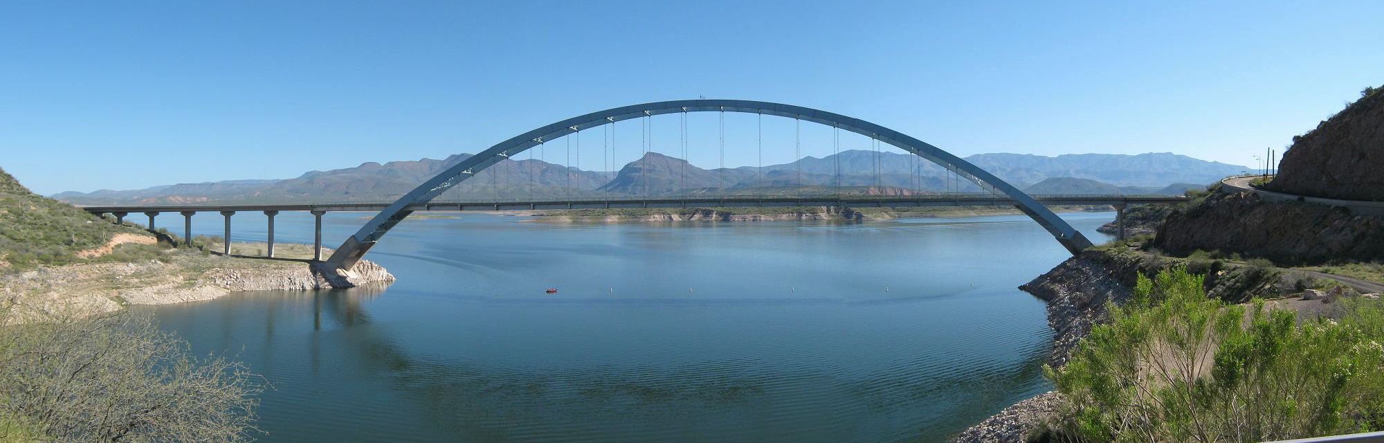
The weather was beautiful and clear. From Globe, we drove about 30 miles along AZ-188, fronting long stretches of Roosevelt Lake, before coming to the turn-off to AZ-88, the Apache Trail. We pulled in to a lot to read the informative signs and talke some photos of the area, including the single-arch span bridge that was built in 1988-90 and allows state route AZ-188 to continue north on its merry way.
Prior to this bridge, motorists had to drive on top the actual dam. In the photo below (left), the dam is seen. The older (pre-1996) dam has the rougher-looking concrete face, and the newer addition is the smoother concrete. You can even see some of the old road-bed, although they blasted out some of it when the dam was refurbished in the early 1990s.
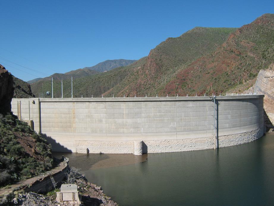 Roosevelt Dam
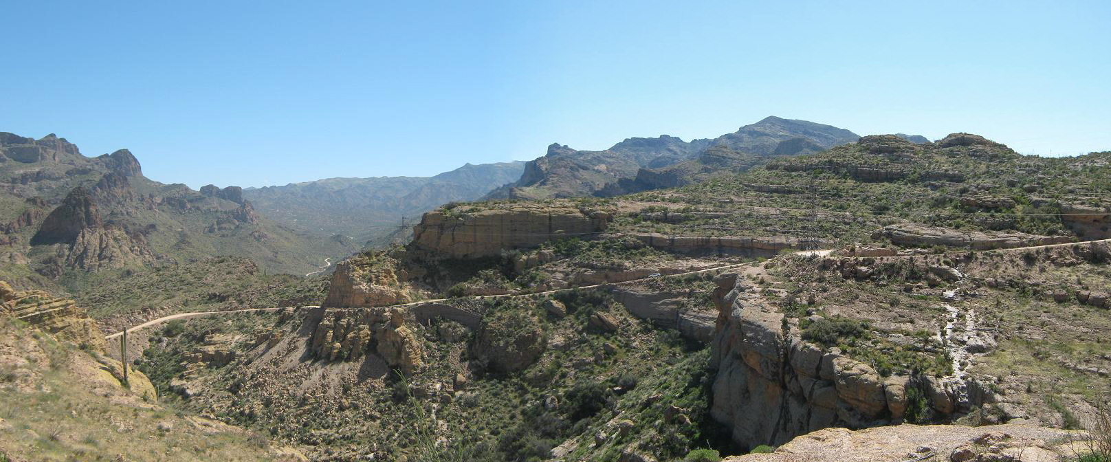
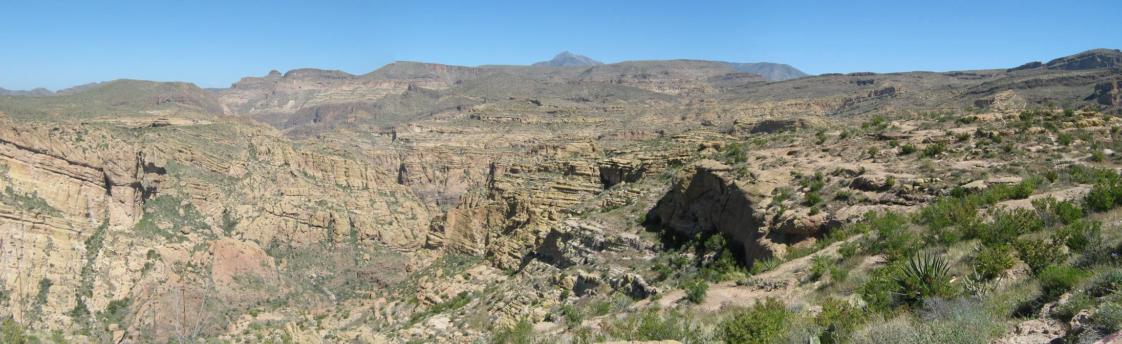
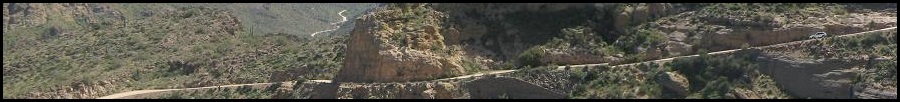
We drove west along the road, averaging 15 m.p.h. Every bend presented a beautiful vista, and we stopped often for photographs. Traffic was light on this end, but being a nice day and a holiday, a number of people had set up camp along the beaches of the lakes. The road was put in originally to allow workers access to the dam construction back in around 1911. It fronts the river, but for about 10 miles it veers from the river itself and aims for the Fish Creek Grade, a semi-"famous" steep grade cut into a cliff-face. Here, the road is barely one car-width wide, with cliffs above and below you, and featuring a 10% grade. Furthermore, there is no room for error, as one missed turn could be your last. We waited at the bottom as one caravan of cars came down, then we started up. Unfortunately, there's no way to know what kind of oncoming traffic to expect, and about half-way up, we had to pull aside in one precarious spot to allow about seven vehicles coming down to pass, all tightly clumped together and presumably all one large group. The Fish Creek Grade lasts about a mile, then makes a hard left and gains steeply some more to top out on the plateau. We pulled into a visitor's parking lot and vista, where I walked out and took some more photographs. By now, so close to the Phoenix side (and being a beautiful holiday weekend), there was a lot of traffic. A lot of people pulling boats and larger vehicles that really shouldn't be on this road (Note: the Fish Creek Grade has a couple points where overhangs limit the height of what can pass. A large RV cannot pass through here). We also noticed a lot of people pulling aside then making frantic u-turns. We theorize they had no idea what this road entails, and merely were following their car's GPS unit.
Finally back to pavement, we joined the dense caravan of cars as we slowly made our way back to Apache Junction and on home. Despite the traffic, we had a great day, and enjoyed our return visit very much.
| |||
|
(c) 2013, 2019 Scott Surgent. For entertainment purposes only. Keep your eyes on the road! |