The Mountains of Arizona
• www.surgent.net
|
| Adams Peak |
• Little Dragoon Mountains • Arizona State Trust Land • Cochise County |
|
Date: February 7, 2025
• Elevation: 5,846 feet
• Prominence: 1,066 feet
• Distance: 4.3 miles
• Time: 3 hours, 30 minutes
• Gain: 1,075 feet
• Conditions: Sunny and warm
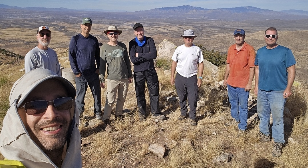
• Partners: Scott Peavy, Matthias Stender, Jay Dolan, Michael Berry, Adam Walker, Mike Williams, Brian Smith
Arizona
•
Main
•
AZ P1K
•
PB
•
LoJ
•
USGS BM Datasheet
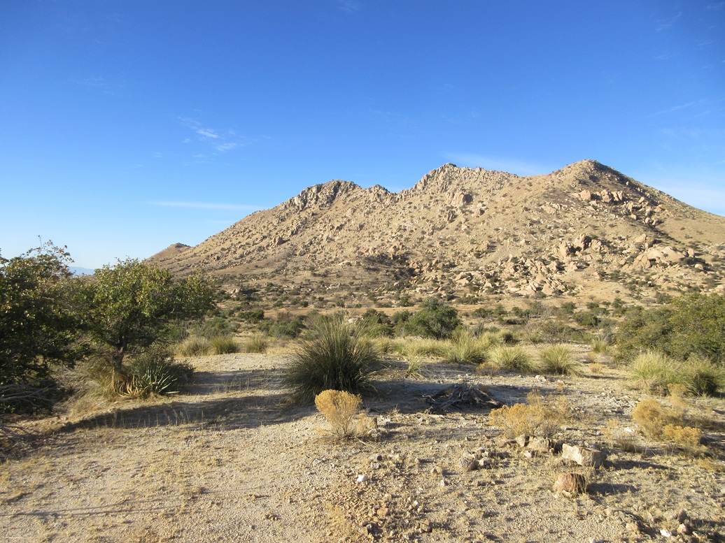
Adams Peak rises immediately northwest of Interstate-10, about fifteen miles northeast of Benson. It is a very rocky peak, part of the rocky Texas Canyon, where the interstate cuts through the Little Dragoon Mountains. The peak is split between Arizona State Trust land and BLM (public) land, but the surrounding property is private, meaning permission is necessary to approach the peak.
People have climbed this peak, and it appeared that the landowner is amenable to allowing access as long as certain reasonable conditions are met. I had not approached the landowner myself, but when an opportunity came up arranged by a fellow climber, I jumped at the opportunity to join in with the group.
The climb was arranged by Michael Berry, whom I had not seen since 2018. The group would number 8 of us. My usual partners, Matthias Stender and Scott Peavy, were here. Jay Dolan, whom I've met just once prior almost ten years ago, showed up. Adam Walker was here, I last saw him a couple years ago. Two climbers from Tucson, Mike Williams and Brian Smith, joined us as well. It was good to reconnect with everyone, and meet some for the first time.
The climb was set for Friday, February 7. I usually drive back to Bisbee from Tempe on Thursday nights after I finish teaching. However, it did not make sense for me to go all the way to Bisbee, then have to get up 5 hours later and come back toward Benson. Instead, I camped in the Coronado Forest northwest of Benson off Mescal Road. This saved me over a hundred extra miles of driving.
The camp went well. There is a meager campground just inside the forest boundary, and I rolled into a spot underneath some trees. With the moon up and clear skies, the moonlight gave the place a surreal appearance. I slept in the front seat of my car, too lazy to set up the cot. That, and seeing a skunk waddle by, suggested I stay inside.
I was up early, and drove about twenty miles to the Dragoon exit. I parked on the north side of the interstate, near the gate leading onto the Adams Ranch property. I was the first one here. In moments, a couple more cars rolled up, then the landowner lady. She asked if I was one of today's climbers. I introduced myself, and soon, those of us that were here got out to meet with her.
She opened the gate for us and took our waiver forms, plus noting our State Trust permit numbers. We got this all sorted out in about ten minutes. She was very friendly, and I appreciated her kindness to allow us access. After that, she drove off to her place. The rest of us, we drove in about a half mile and stuffed our cars onto any open spots we could find off the road.
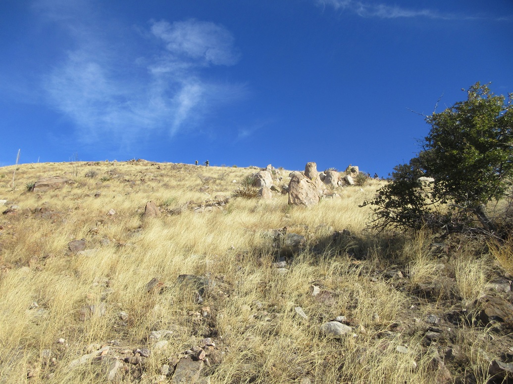
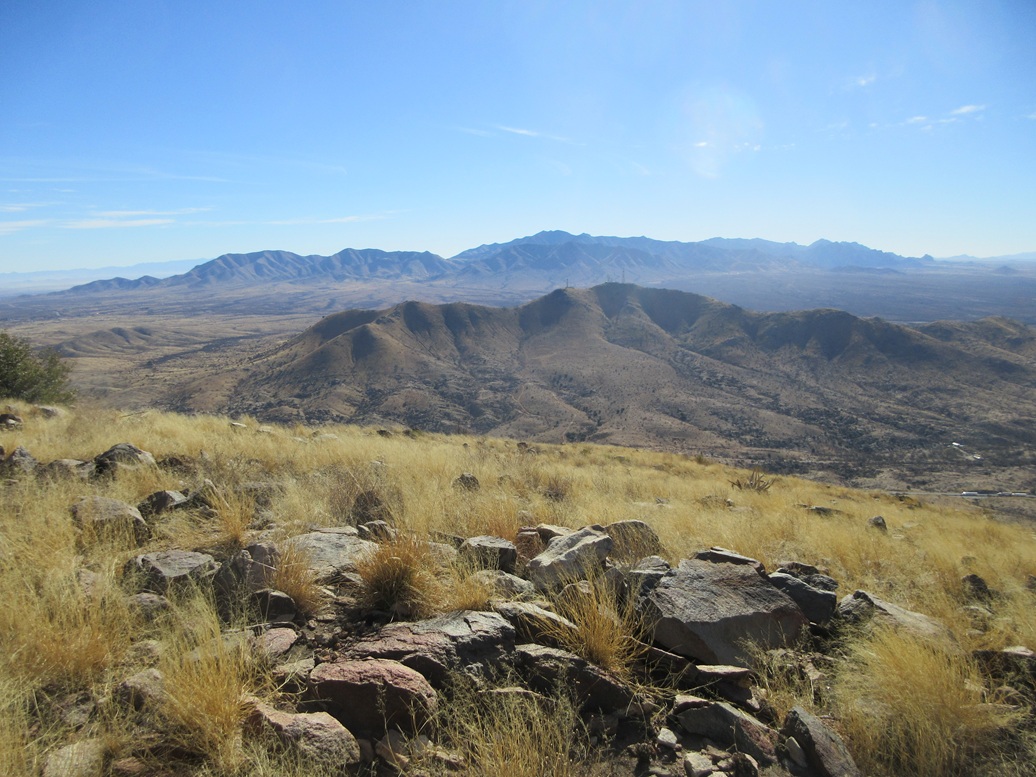
The peak rose directly west of our position. From this perspective, it was nothing but cliffs and rock formations. Approaching it directly looked foolish. Instead, we would walk past the peak and approach it from its southwest side, where the slopes appeared to be far more friendly and less rocky.
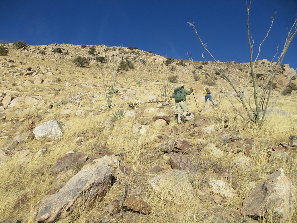
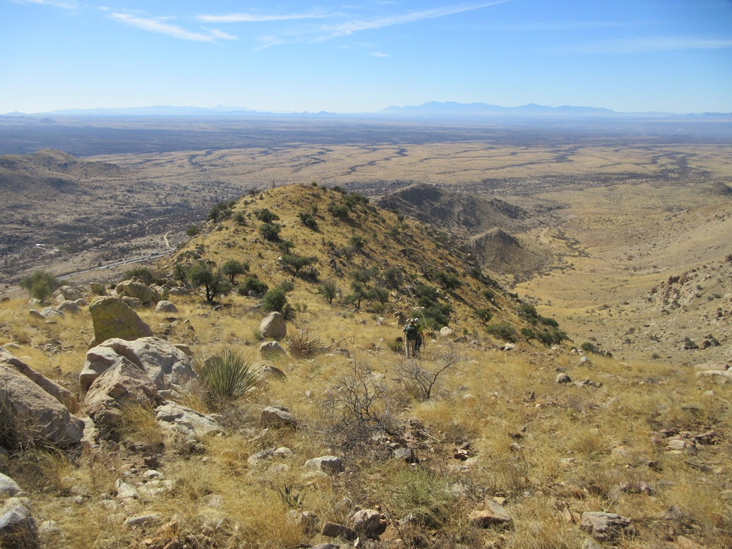
We started walking at roughly 9 a.m., following a very old track westbound into and out of arroyos. We were aiming for a saddle up ahead. The track ended about half way and the rest of the trek was through open country, mostly grassy and rocky slopes with a few scattered trees.
Adam and Matthias were ahead, but I was close behind, with Brian and Scott a minute or two behind me. They picked a line that went more up than over. This worked, and placed us on the main southwest ridge above the saddle, but it was loose in spots and we all agreed not to take this way down.
Now on the ridge, it was wide open, sloped steeply but easy to manage, and the terrain behaved. The rocks generally stayed in place and the grass was barely ankle high.
Adam and Matthias stayed up ahead, about fifty yards ahead of me. Brian was close by me, and Scott about fifty yards downhill. The others were lower down but within sight, so we knew they were doing okay. There was no rush and we went at paces that suited ourselves.
The slope led to a small hilltop where the grade flattened slightly, now a little more rockier. Another slope rose above, with a single tree at its highest point. I watched as Adam and Matthias disappeared above the skyline, but then I could see them sitting nearby, so this was the top, which was a relief. I was a couple minutes behind them. Adam said it was a 71-minute ascent for him. Thus, my up-time would be 73-74 minutes. Brian and Scott showed up within a minute or two, and within another ten minutes, everyone was on top the peak.
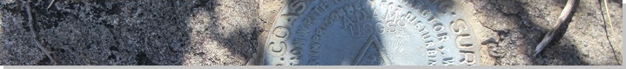
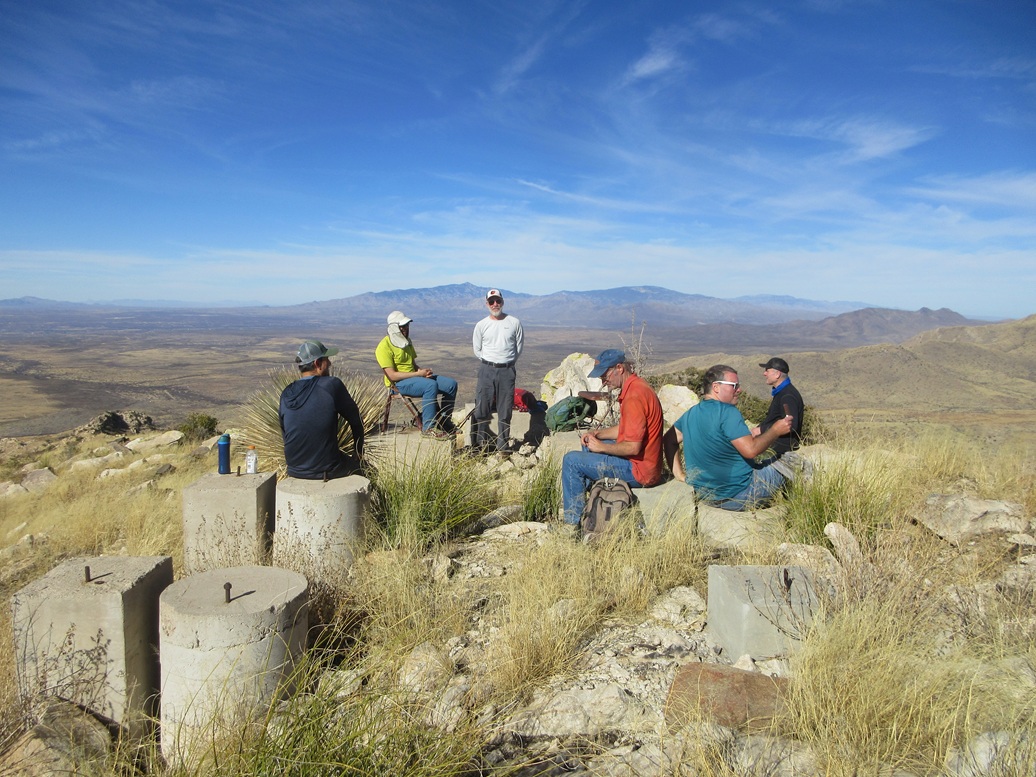
The top features a number of large concrete piers that were foundations of an old airway beacon tower (the Phoenix El Paso "T2" beacon). The benchmark datasheet describes the tower as being 50 feet high, and an overall height of 70 feet. This must have been quite an impressive tower back in its time.
The tower has long since been dismantled and removed. Only the concrete piers remain, plus an old metal door. And, curiously, two folding chairs, which Adam and Matthias set up on two of the piers. I found another pier and sat on it. There were enough concrete pads and piers for everyone to sit comfortably.
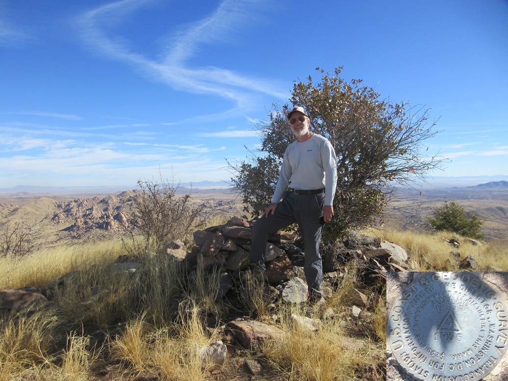
The highest point itself is near the aforementioned tree, a big rock cairn beside it. The benchmark lies on a rock flush to the ground beside the cairn. The day was beautiful, with temperatures in the 60s and a sunny, calm sky. Since there were so many nice places to sit, we all sat around for the better part of an hour on the summit, and told tales of heroism and bravery on our many other climbs.
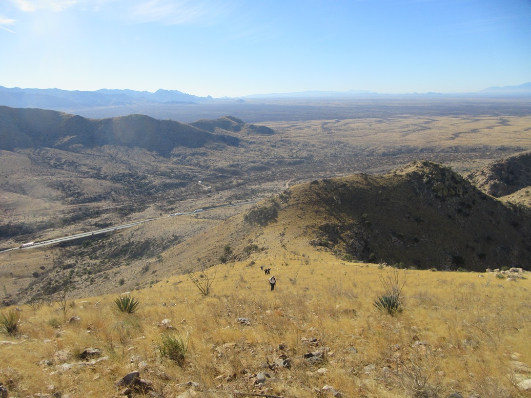
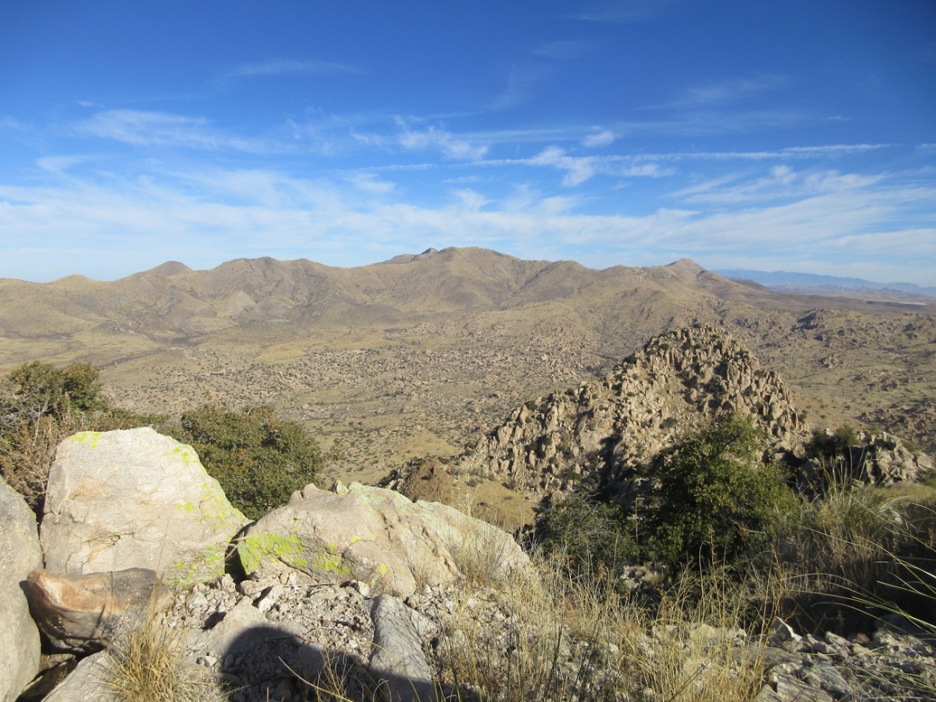
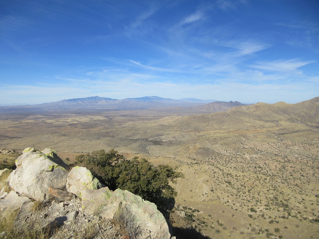
We were close enough to the interstate to see the vehicles and hear the trucks. To the north, we could see Rincon, Mica, Lemmon, Johnny Lyon, Mae West and Lime Peaks. To the south were the Dragoon Mountains. The Whetstone and Huachuca Mountains rose to the west and southwest. Even Cerro San Jose, the peak barely over the border in Mexico, was visible.
Despite all the sitting and talking, it was still not yet noon. People had various other plans, so slowly we started the downhill climb, agreeing to go at our own paces. Those who wanted to stay behind could if they wanted to. Adam and Matthias, the young bucks, were in the lead again, but I soon caught up to them and we hiked as a threesome down to the lower saddle. Scott, Jay and Michael were just a couple minutes behind. Mike and Brian stayed up top for a while longer.
At the lower saddle, we inched down the slope through large rocks and grass, using cattle paths in a few places. This segment was steep and sometimes sloppy, but it worked well, and we were soon back down onto the flats below the peak. The three of us hiked out together, and the next three were behind us just a few minutes. The outbound hike had taken just over an hour, the round trip covering a little over 4 miles.
We hung around some more at the cars, but then we all started to get moving. Matthias and I were going to hike another peak nearby, but I lost interest as I needed to get back home. I'd been gone from hom for three days now and really needed to get there and take care of things there.
I was very happy the hike went well and we had a good, solid team. Everyone was cool and we had a good time on the mountain. I most appreciate the work Michael did to set this up, and the graciousness of the landowner to allow us on.
|


|