
The Mountains of Arizona
• www.surgent.net
|
| Booth Hills Highpoint |
• Highpoint: Booth Hills • Sonoran Desert National Monument • Maricopa County |
|
Date: January 29, 2022
• Elevation: 2,216 feet
• Prominence: 656 feet
• Distance: 5.5 miles
• Time: 2 hours, 20 minutes
• Gain: 786 feet
• Conditions: Cool, breezy, sun with high clouds
Arizona
•
Main
•
PB
•
LoJ
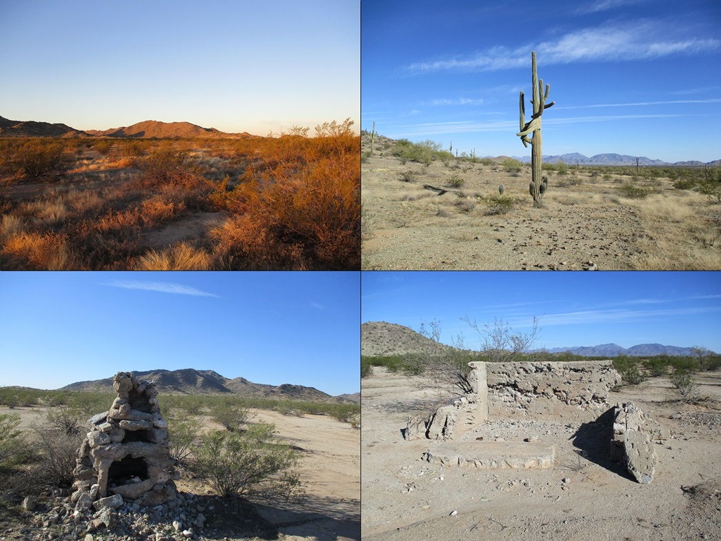
The Booth Hills lie south of state route AZ-238, south of the tiny town of Mobile. The small batch of hills lie barely inside the boundaries of the Sonoran Desert National Monument. I was in the area about ten days ago when I hiked Haley Hills Highpoint, which is about two miles to the east. I had planned to hike both on one long hike, but grew concerned hearing all the gunshots, the whole area evidently one giant ad-hoc shooting range. So I went home, and saved Booth Hills for a later date.
A couple days prior to today, Matthias proposed a peak or two in the Maricopa Mountains north of AZ-238, but he would not be available until noon. I suggested that I would get an early start, hike this peak, then meet him later closer to noon for whatever peaks he had cooked up.
Thus, I was up and on the road before dawn, stopping in Maricopa for snacks, then driving westbound on AZ-238 to 83rd Avenue, which isn't signed for westbound travelers. There's a standard black-on-yellow intersection sign, then moments later, the road itself. I had to signal and turn quickly, hoping the guy behind me was cool. This would be my first time crossing over the railroad tracks (which parallel AZ-238) into Mobile.
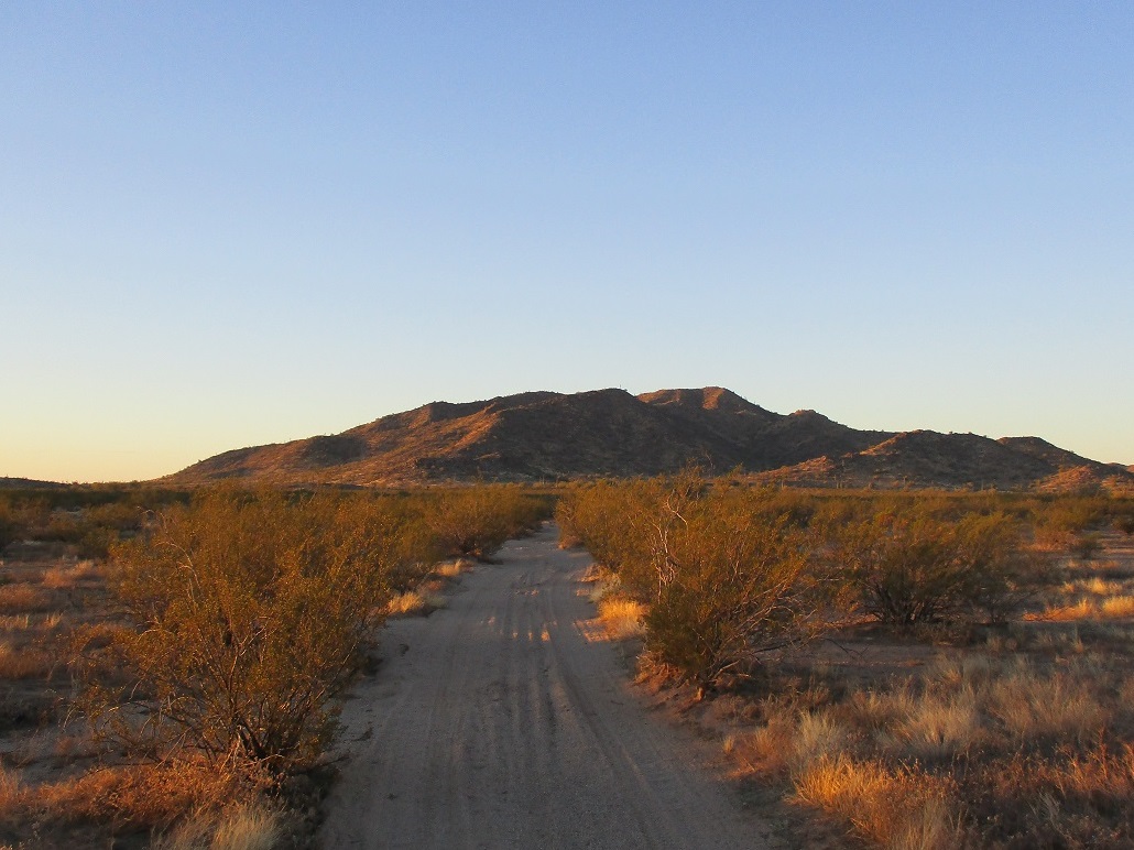
The road is paved for a mile and a quarter, more or less. There were scattered homes, some looking abandoned, some looking occupied. There was a batch of mailboxes in one place. I had no preconceptions about Mobile, and it was about what I expected. Pavement ends, and a decent hardpack road continues south for two more miles. The road then makes a soft dog-leg left, now heading slightly east of south. I drove in as far as was sensible. I drove past a small hill, and after carefully crossing a couple arroyos, parked beside a third one that I felt might be a bit sandy. But I was close, about two miles on a straight line to the peak.
I was walking at 7:45, the sun rising above the eastern horizon. It was clear and cool, temperatures in the high 40s. Up ahead, the Booth Hills lit up in a deep red color. I walked south along the road, then as the road petered out, on scanter tracks. I followed any track that went south. I was surprised how far the tracks went. There is a fence line to cross, but I found a section that was entirely open. So had some drivers, apparently. I walked the tracks until they finally gave out completely. I had covered almost two miles.
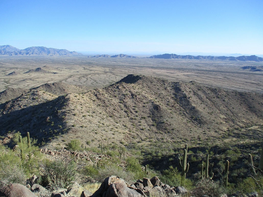
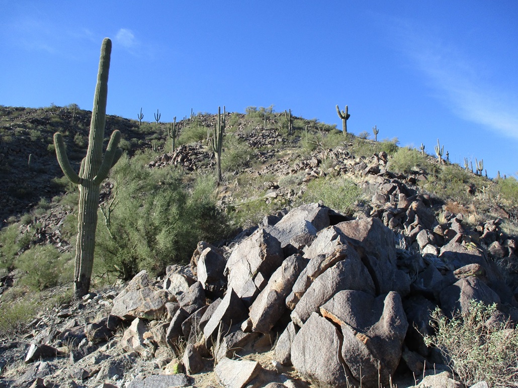
I was walking east of the small range, intending to get abeam of the saddle north of the highpoint, then walk in from there. However, I ended up walking a little farther than I planned, about a half-mile farther. This put me on the toe of the peak's main southeast ridge. Well, I had overshot my intended entrance canyon, but where I was looked good too. A typical slope of grass, rock and cactus, the gradient gentle.
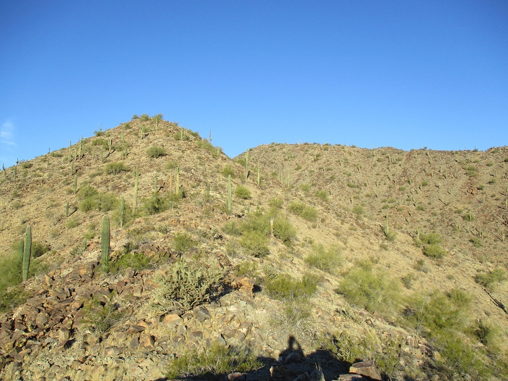
I hiked up hill until I met the ridge, then hiked more uphill, until I had a clear view of what was ahead. My ridge, so to speak, undulated up and down a little, then dropped about forty feet to a saddle. Up ahead, there was about a 200-foot gain. This went well, the rocks solid and the grade never too steep. Getting up this took about fifteen minutes.
This fed me onto the highest ridge, the highpoint up ahead, and two or three false summits between me and the highest point. The walk was easy, and only in one section, where I had to clamber up about 20 feet of heaped rock, did I need my hands.
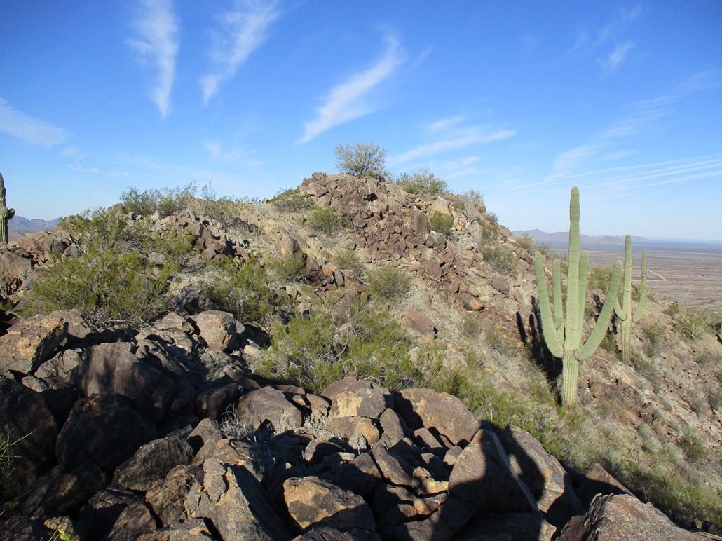
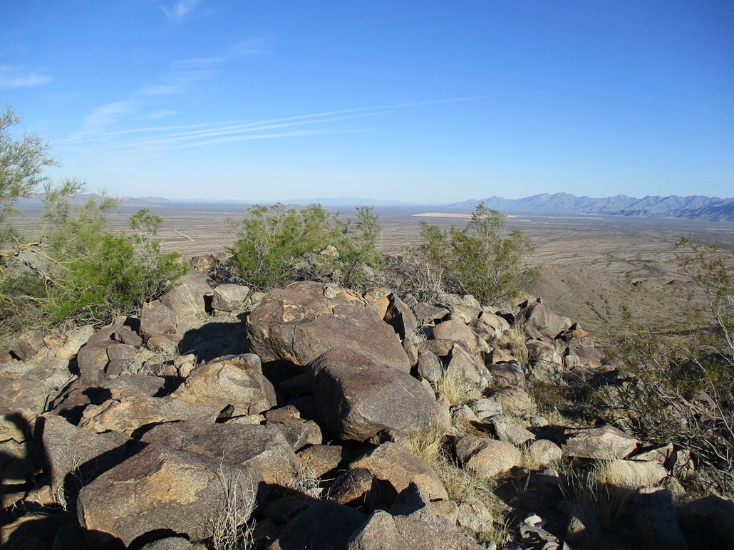
It was also about this time I noticed all the trash. At first, a soda can or water bottle. Or a discarded sweat shirt. The closer I got to the highpoint, the more crud on the ground. I kept an eye out for people but saw no one nor heard any commotion. I made the top and was pleased. The one-way hike took about 90 minutes and covered 3 miles, including my unintended detour.
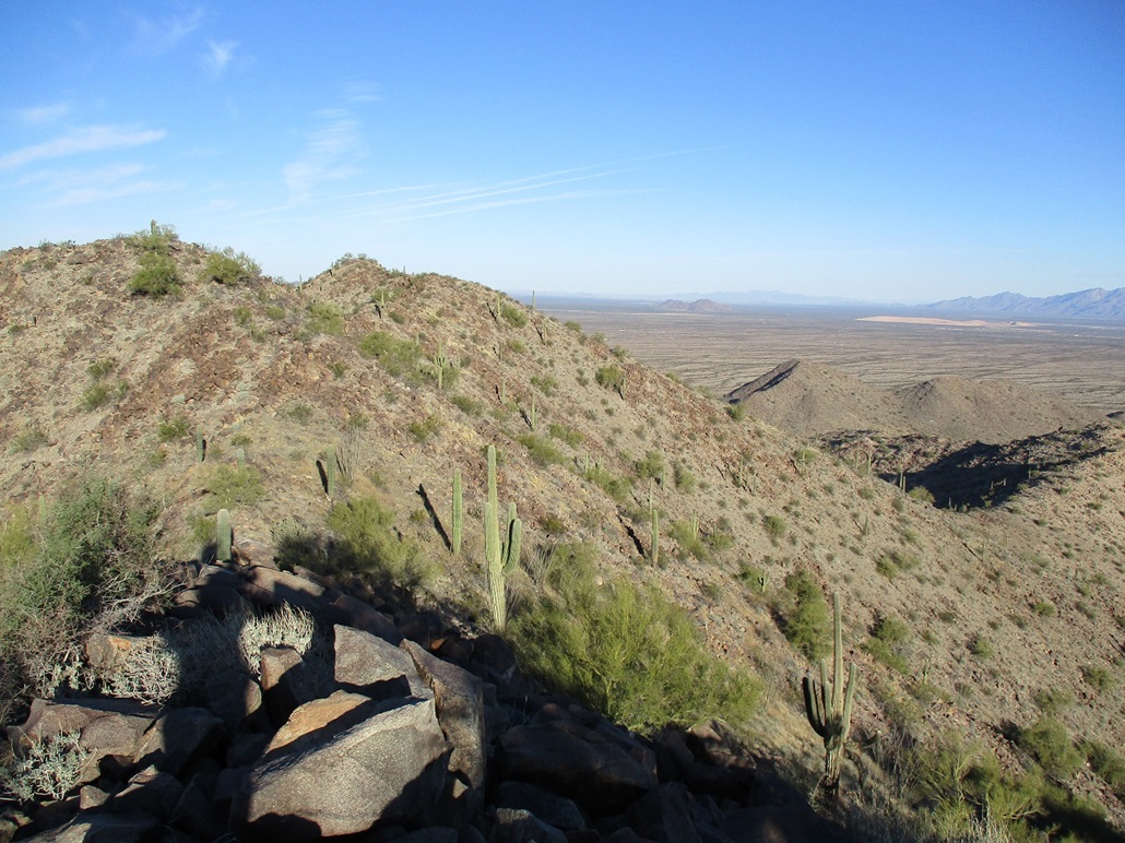
The top was cute, a small hump of rock of which about three big ones could have been the highest point. I tagged all three. I also studied the large stash of left-behind stuff on the peak: food wrappers, big water jugs, blankets, electronic odds and ends, and shoes. It's the shoes that fascinate me, as I've seen this before, shoes that have been discarded. I figure if they needed shoes to climb to here, they'll need them to climb back down. I would think shoes would be critical for border crossers and their sentries. What do I know.
I did not stop or pause on the summit. Even though it was dead quiet and I had neither seen nor heard not one iota of possible sentries up here, I still thought it wise to not linger. I stuck around just long enough to snap a few images and look around. Like on Haley Hills Highpoint, they seem to use these two hilltops for their lookout operations. Why these two hills, I have no idea. We're talking about a hundred miles from the border to here. Again, what do I know.
I dropped north off the summit, down a very rocky ridge that was steep, but it went nicely and revealed itself in fifty-foot segments. This put me a little below the saddle, the one I wanted to get to on the ascent. Now in the drainage, I walked within its sandy and bouldery channel, or up on its banks to avoid brush. Shortly, I was out of the drainage and back into the open desert. In retrospect, I think tacking on that extra distance worked well. The ascent ridge was a more enjoyable trek than the drainage. Truthfully, just about any ridge will work. They all look about equal in gradient, rocks and brush.
Now back onto the flats, I walked north toward my car. By now, pushing 10 a.m., it was pop-pop-pop-pop one after the other, then an occasional boom. The shooters were all here. I could see their trucks. They all took positions abutting the base of the hills, using the slopes as a backdrop. Me, I just stayed out on the flats. I was not concerned about catching a stray bullet. None of the shooter contingent were farther south than the fence I mentioned. Hiking south of the fence is pretty safe, I would say, in my sample size of one visit, authority.
I had parked in a small glade of palo verde and tamarisk beside an arroyo, knowing that my car would not be visible from the south. I hiked on the roads and even saw my bootprints. I took a turn somewhere and came upon some old ruins. A chimney and some concrete walls. I have not a clue what these date from or why they're here. Anyway, I was only off route by about twenty feet. I was soon back on the road and back to my car, the time 10:15. The hike took about two hours and thirty minutes, or so.
I drove out the roads and back to highway AZ-238. Matthias and I were to meet at noon at the parking lot for the main road that leads into the Maricopa Mountains. We were here about a month ago when we hiked Peak 2272, discovering the road to be open for vehicles now. I got to this lot in about fifteen minutes. It was not yet 11 a.m., the day was warm and comfortable. So I did the smart thing and leaned my front seat back and took a good solid 45-minute nap. That felt good! Soon, Matthias rolled up and we got rolling toward Peak 2391.
|

|