The Mountains of Arizona
www.surgent.net |
| Casner Mountain |
• Coconino Plateau • Mormon Mountain Volcanic Field • Coconino National Forest • Yavapai County |
|
Date: June 7, 2020
• Elevation: 6,836 feet
• Prominence: 676 feet
• Distance: 5.6 miles
• Time: 3 hours, 20 minutes
• Gain: 2,070 feet
• Conditions: Clear, pleasant and a little breezy
Arizona
•
Main
•
PB
•
LoJ
•
USGS BM Datasheet
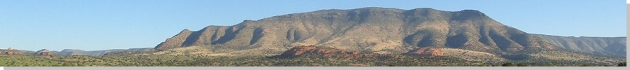
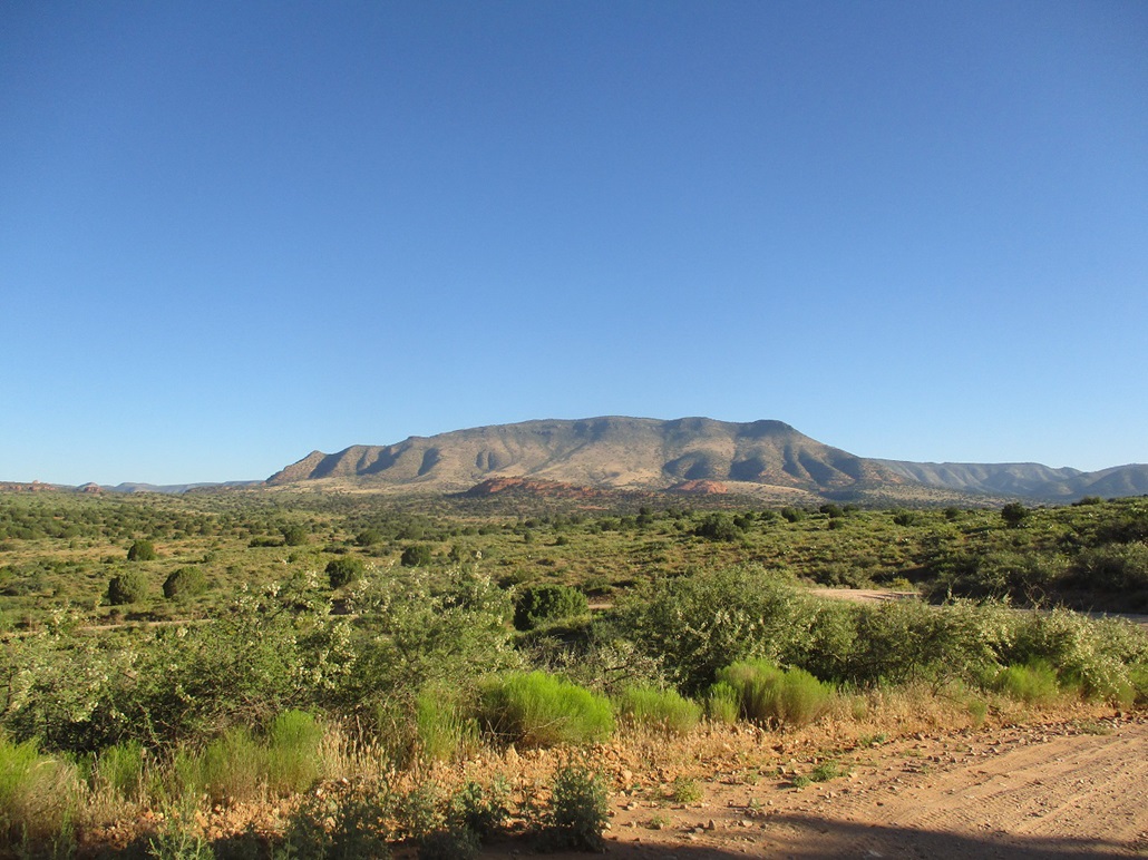
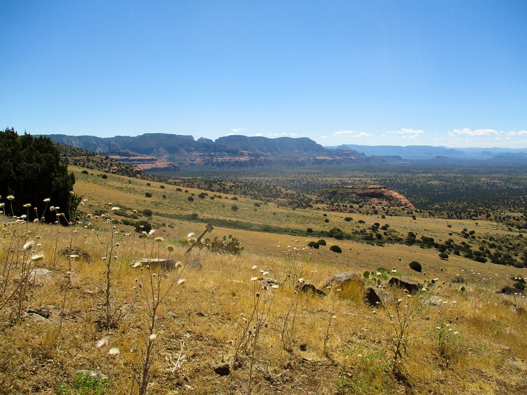
Casner Mountain is about 15 miles northwest of Sedona, a mesa-peak that was once part of the Colorado Plateau before erosion cut it off and left it a stand-alone mass. It lies north of Black Mountain, which I hiked in 2011. It also lies between two wilderness areas, the Red Rocks Secret Canyon Wilderness to the east and the Sycamore Canyon Wilderness to the west.
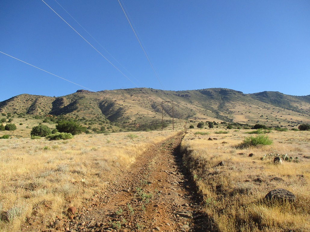
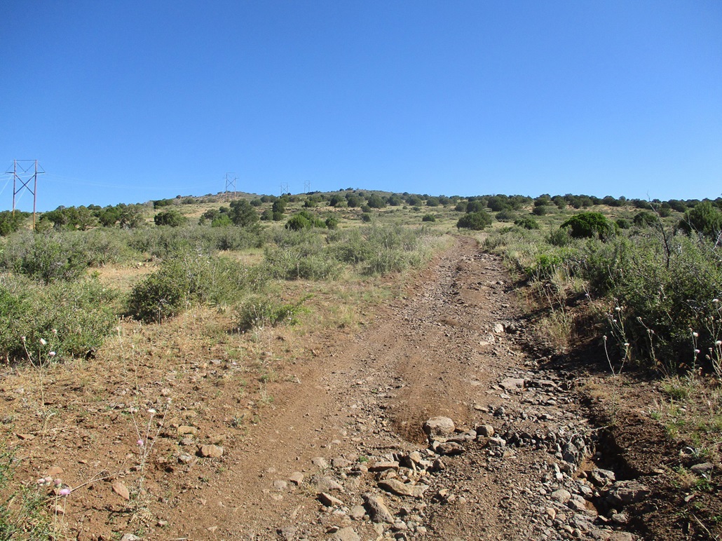
A set of powerlines run through here, up the south slope of the mountain and heading to probably Flagstaff. A service road is built parallel to the power lines and the wilderness boundaries are drawn so as to exclude the road. For most hikers, Casner Mountain is just a waypoint of a longer loop back-packing route that drops into the Sycamore Canyon Wilderness. For me, it was my destination. I wanted a hike with good elevation gain and as little off-trail (or off-road) as possible, this being snake season.
I left home early, 5 a.m., to beat the traffic. I went up AZ-87 above the Mogollon Rim, then took AZ-260 westbound, down into Camp Verde and into Cottonwood, about a 70-mile drive. I topped the gas in Cottonwood and got some drinks and snacks for the hike, and inquired about the Red Rocks Day Pass. They did not sell them at this location and apparently no one in Cottonwood does. More on this at the end.
I then followed AZ-89A a few miles toward Sedona, then eased onto Coconino Forest Road 525. I followed this road north a couple miles, then took FR-525C left at a fork just past a cattle grate. The sun was up by now and there were campers every hundred feet or so along the road. Not in those obscene 35-foot land yachts, but regular people in regular cars with regular tents. I stayed on 525C for about 8 more miles. The farther in I drove, the fewer the campers, although the road was never too bad.
The road comes to a Y-split, with 525C going downhill into Coffee Creek. There is a larger parking area at the right, but I chose not to park here. Instead, I drove 525C down into the canyon and up the other side, not more than a mile, to where the road went underneath the powerlines. I parked behind a pinon in a clearing a little to the west of the power lines. It was just past 7 a.m. when I killed the engine. I had driven 10.2 miles from the highway.
The road was a fine road for the 9 (or so) miles to that last Y-split. Most cars could handle it in dry conditions. It was gravelly at the start due to high usage, but I was able to motor along at 25-30 m.p.h. for long stretches. That last bit into Coffee Creek could stop a passenger vehicle, there being some rocks to deal with. Parking back at the Y-split would add about a half-mile hiking each way.
I simply followed the power-line road northbound. The road drops into a small canyon and comes to a gate. With a permit, 4-wheel drive vehicles are allowed past the gate. Hikers appear to be welcome any time. I did not see anyone here today.
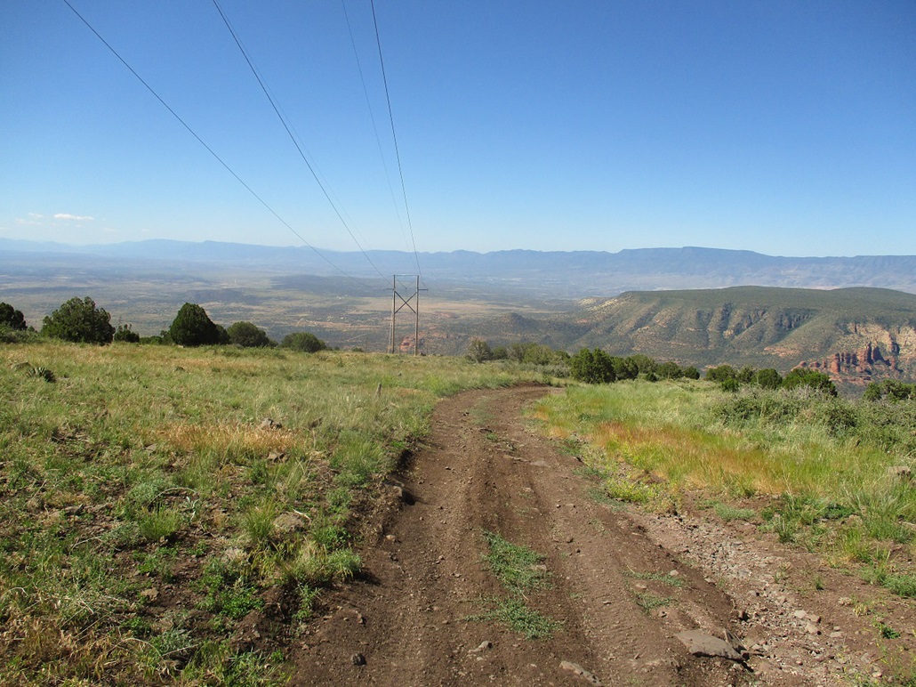
The road gains a sloping ridge and angles upward, covering about a half-mile, then starts up the steeper slopes of the mesa, where it makes about 8 long switchbacks to mitigate the gradient. Actually, I enjoyed the switchbacks. The roadbed was usually a little smoother than down below, which was full of loose rock and erosion channels. The weather was warming up but not too bad, into the mid 70s about now. The sun was bright and very intense, and there was no shade anywhere. In the sun, I could feel the warmth, but then a breeze would pick up and cool me off.
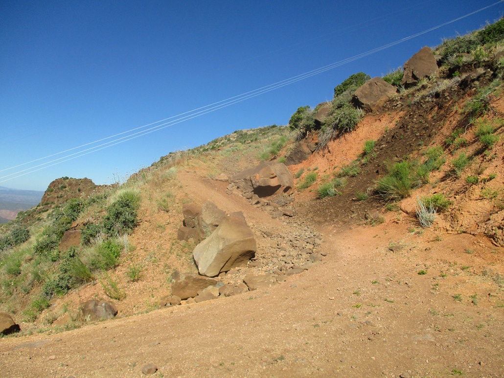
Toward the top, the road seems to be blocked by a large boulder that rolled off the slope above. The bypass is skinny and sloppy, and I tried to envision a Jeep easing past this barrier. It may be possible, but anything larger would have a real tough time getting past it. I took a photo that you can view in the left sidebar. Me, being awesomely fit and trim, got past it no problem.
I was soon above the steep switchbacks and on the southern edge of the plateau-top. The summit is a gentle hill, still about a half-mile away but easy to spot. The power line stanchions line up and run right past the top. I just kept to the road and was soon at the road's apex, just a few dozen feet from the top. The last bit off-road went well, keeping an eye out for snakes. I was on top at 9 a.m. sharp, a 1-hour, 45-minute hike covering about 2.8 miles with 2,070 feet of gain.
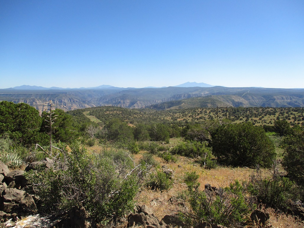
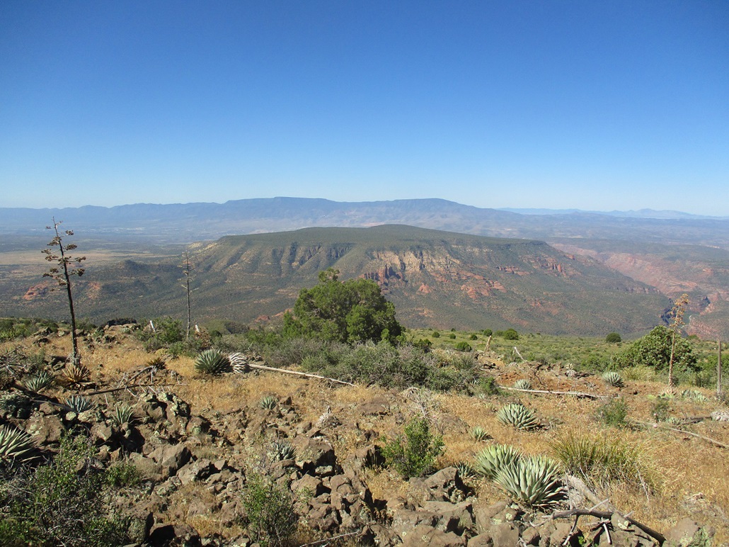
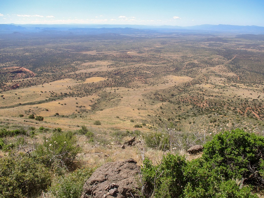
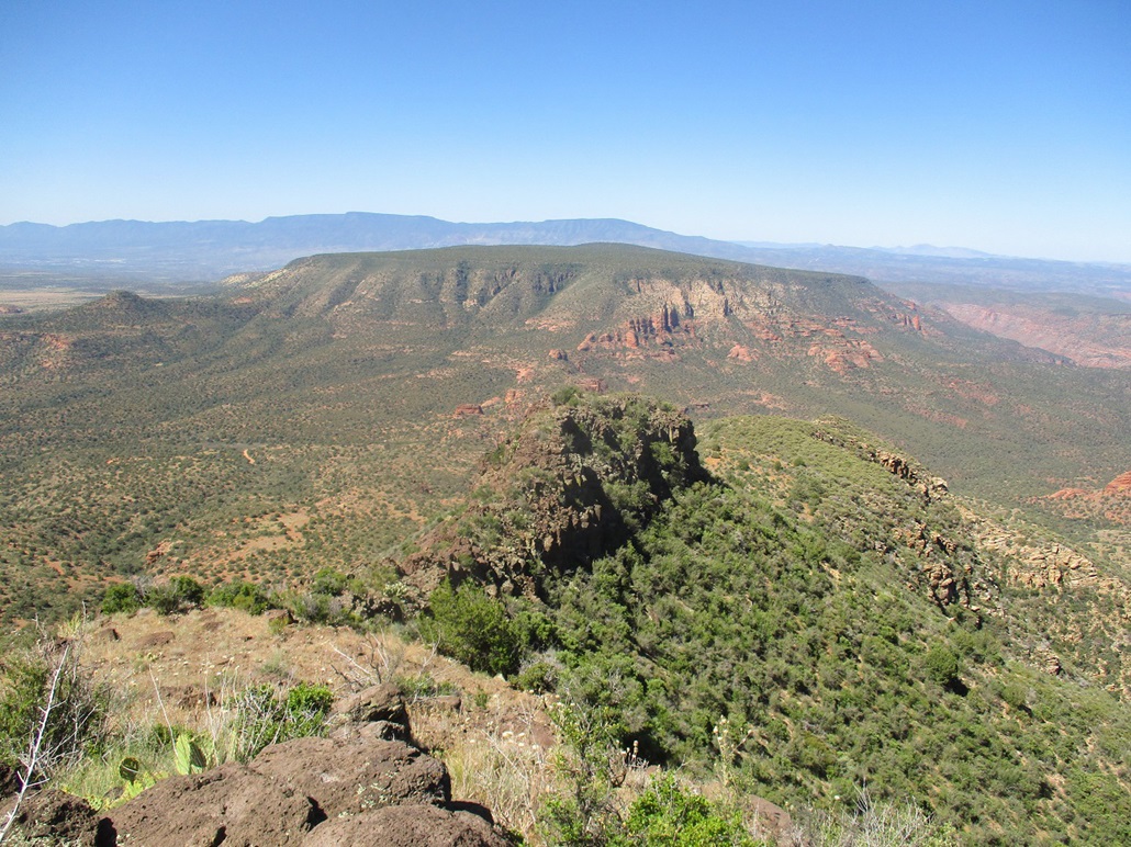
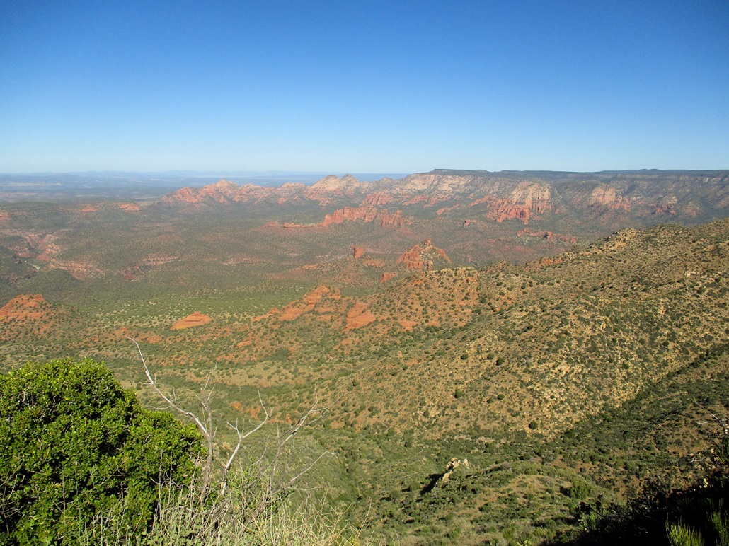
I took a break up here and enjoyed the views: the big volcanic peaks up on the Colorado Plateau to the north, and the surrounding ranges to the south such as the Black Hills with Mingus and Woodchute Peaks, and the rock formations in Sedona to the east. Unfortunately, the sun was still low enough that way that everything was in shadow or in glare. I spent about twenty minutes here. Up a couple thousand feet from where I started, it was noticeably cooler up here. Nice still, but when a breeze would come, it had a bite to it.
I started down, going slow, in no hurry and careful not to slip on the loose rocks. Once down below the lip of the plateau, I had better views of the surrounding canyons, mainly the Sycamore Canyon Wilderness to the west. The Sycamore Canyons are an astounding natural feature, a maze of steep-walled canyons that in 49 other states would be a National Park. I've explored just a small portion, more up toward Williams, but some people make it their life's goal just to hike within these canyons alone.
The hike down went well with no issues. I just had to watch my footing on the steeper parts with loose gravel. I was back to my car a little after 10:30 a.m., about an 80-minute egress hike. I was passed hy two guys on dirt bikes, but never saw another person otherwise. Back at the car, things were warming into the mid 80s, but it was still pleasant. I checked my windshield --- no citation. That was good. I changed into driving clothes and started the drive out. I was home a little after 1 p.m., a foot-long roast beef sandwich from Subway in my mitts, a treat to myself because I behaved well for the hike and drive.
Casner Mountain is a fine hike and an easy one, just following a road with very little off-road at the end. It was a conditioning hike for me. I had not yet put on over 2,000 feet on any hike yet this year, since I've mainly been hiking volcanic bumps up on the plateau, most of which are short hikes. I was a little lucky with the weather, as it is usually ten degrees warmer this time of year. But we had a few days of pleasant temperatures (low 90s in the deserts, 70s in Payson), so conditions were perfect today.
Red Rocks Pass: To hike anywhere in or near Sedona requires a Red Rocks pass, which are easy to get at most trailheads in town or at various gas stations, markets, hotels, and so on. But getting one means going into Sedona to get one, which I did not want to do. For one thing, it would add a lot of miles and a lot of traffic. Getting them online requires a week's advance notice so they can mail it to you.
I assumed naively that places in Camp Verde or Cottonwood would sell them, since it seems so logical, but none do. I called Circle-Ks, supermarkets, any place I could think of, but no one sells them. A lot of people, especially Arizonans here for the day, try to avoid Sedona proper if hiking in the area. Sedona is beautiful but absolutely jam-packed with people and cars on pleasant summer weekends. My wife and I, for example, never stay in Sedona. We always stay in Cottonwood if visiting the Sedona area.
Also, it appears that the Casner Mountain hike does not require one. I found an online map that shows the boundary of where the pass is required, and it seems to exclude the Casner area. But don't quote me on this. I could not find an explicit reference anywhere on the web whether a pass was needed here, or not. No signs along FR-525 or 525C said a pass was required. I took a small gamble in not having one, but I felt I also had a lot of plausible deniability if I got a citation. The truth is, if I could have got a pass in Cottonwood, I would have. For $5, I get peace of mind, and the $5 goes to help with costs to manage the area. It seems logical that most people visiting Camp Verde and Cottonwood probably are visiting areas around Sedona, so to make us have to go into Sedona to get a pass is absurd.
|


|