
The Mountains of Arizona
• www.surgent.net
|
| Governors Peak |
• Hieroglyphic Mountains • Hells Canyon Wilderness • Yavapai County |
|
Date: January 19, 2020
• Elevation: 3,260 feet
• Prominence: 600 feet
• Distance: 6 miles
• Time: 4 hours and 15 minutes
• Gain: 1,820 feet
• Conditions: Sunny, nicely warm in the sun, cool in the shade, no clouds
Arizona
•
Main
•
PB
•
LoJ
Governors Peak rises above the historic Castle Hot Springs Resort about five miles northwest of Lake Pleasant. I had not heard of the peak until I found a couple trip logs at the HikeArizona site, which has lately been a good resource for uncovering out-of-the-way peaks I would probably never notice otherwise. I was immediately interested, and set myself up to hike it this weekend.
From my home, I followed Loop-101 north and west onto northbound Interstate-17, exiting at the highway AZ-74/Carefree Highway exit. I went west about 10 miles to Castle Hot Springs Road. I was last here in November, hiking Francis Rogers Mountain. I went north on Castle Hot Springs Road for 5.6 miles to a T-junction, going left (still called Castle Hot Springs Road). The pavement ends after making the left turn. I continued generally northbound (the road wanders a bit) for 5.3 miles parking immediately past a cattle grate. I followed the direction from the HikeArizona site, although my miles were a little longer than what they report. The total one-way drive was just under 60 miles.
The dirt road segment was wide hardpack, a little bumpy, but smooth enough to where I could go 30 miles per hour with no trouble. Past the Casa Rosa Ranch (4 miles from the T-junction), the road drops into Castle Creek and runs concurrent with the creek-bottom for a mile. Here, the road is a little rockier, but still good road. The road gets graded regularly, but in wet weather, could be muddy or probably closed altogether.
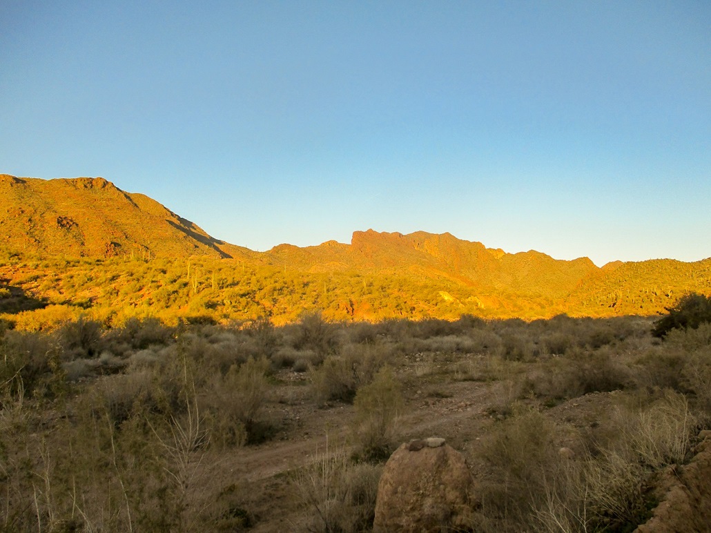
I parked at the small wide-spot past the cattle grate and started hiking at 7:57 a.m., the sun still low in the east and the air temperature about 45 degrees. The most challenging part of the hike comes first: finding a way down the embankment and hoping to find the trail again across the broad Castle Creek bottom. I was at about 1,860 feet elevation.
I walked up the road about 50 feet, then down the embankment about 5 feet where others had beaten in a path. In the river channel, I found "Trail" signs and cairns through the brush within the channel, then across the main channel on the opposite bank, a large cairn. There is no way to keep a trail within the channel as it would be wiped out every time water came through here. The channel is about 200 feet wide here. That cairn across the way was helpful.
At the cairn, there is a metal podium with a log-in register. One person had been here yesterday, and two people in the past week. Judging by the poo on the ground, people bring their horses here too. Two trails start here, I followed the right one. This trail switchbacks up the embankment about 60 vertical feet to top out on a flat bluff. A few yards in, the trail comes to a massive cairn, from which two trails split. Both trails have their own large cairns. I went right (studying the satellite images was critical so that I would not get lost). This trail is apparently called the Hermit Trail.
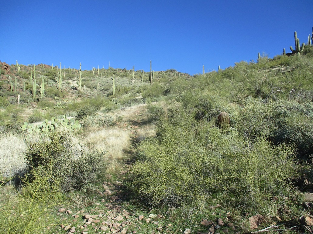
Large cairns marked the trail every few dozen feet. For the most part, the trail was distinct and easy to follow, but it would occasionally get thin in some rubbly sections, and the cairns were helpful. The trail bends slowly to the right, going right at one more Y-junction, trending slightly northwest. It meets and merges with a drainage, crossing it a few times. Here, the cairns are most helpful because the trail itself can be hard to glean when mingling with the drainage. There were a few unexpected sharp turns where it could have been easy to walk right past it, were it not for a 4-foot high cairn signifying otherwise.
This portion of the trail gains slowly and leniently, topping out on a small rise, elevation 2,220 feet, a 360-foot gain in about a mile. By now, the sun was up and the air temperature had shot up about 15 degrees. It was still comfortable, in the low 60s, but I had to shed a layer. For the first time in a month, I was actually sweating on a hike.
Past this first rise, the trail drops about 60 feet into a drainage, then gains up the opposite side, making long switchbacks and gaining about 380 feet to top out on a saddle, elevation 2,540 feet. I stopped here for a break, a little under two miles into the hike.
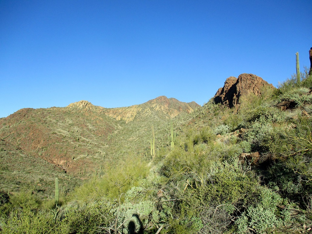
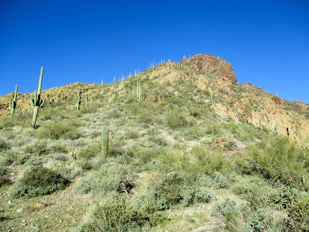
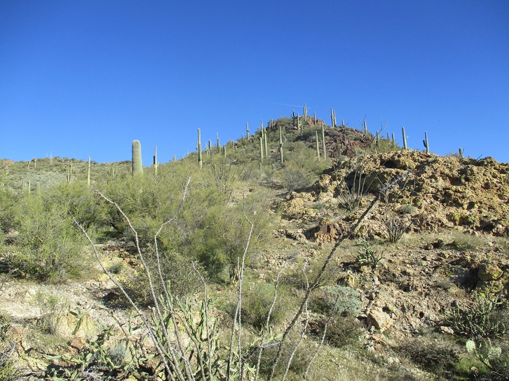
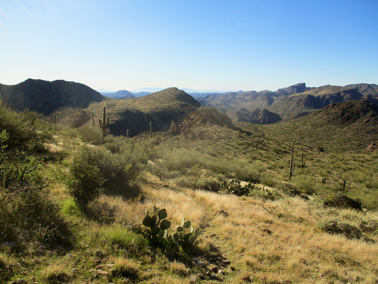
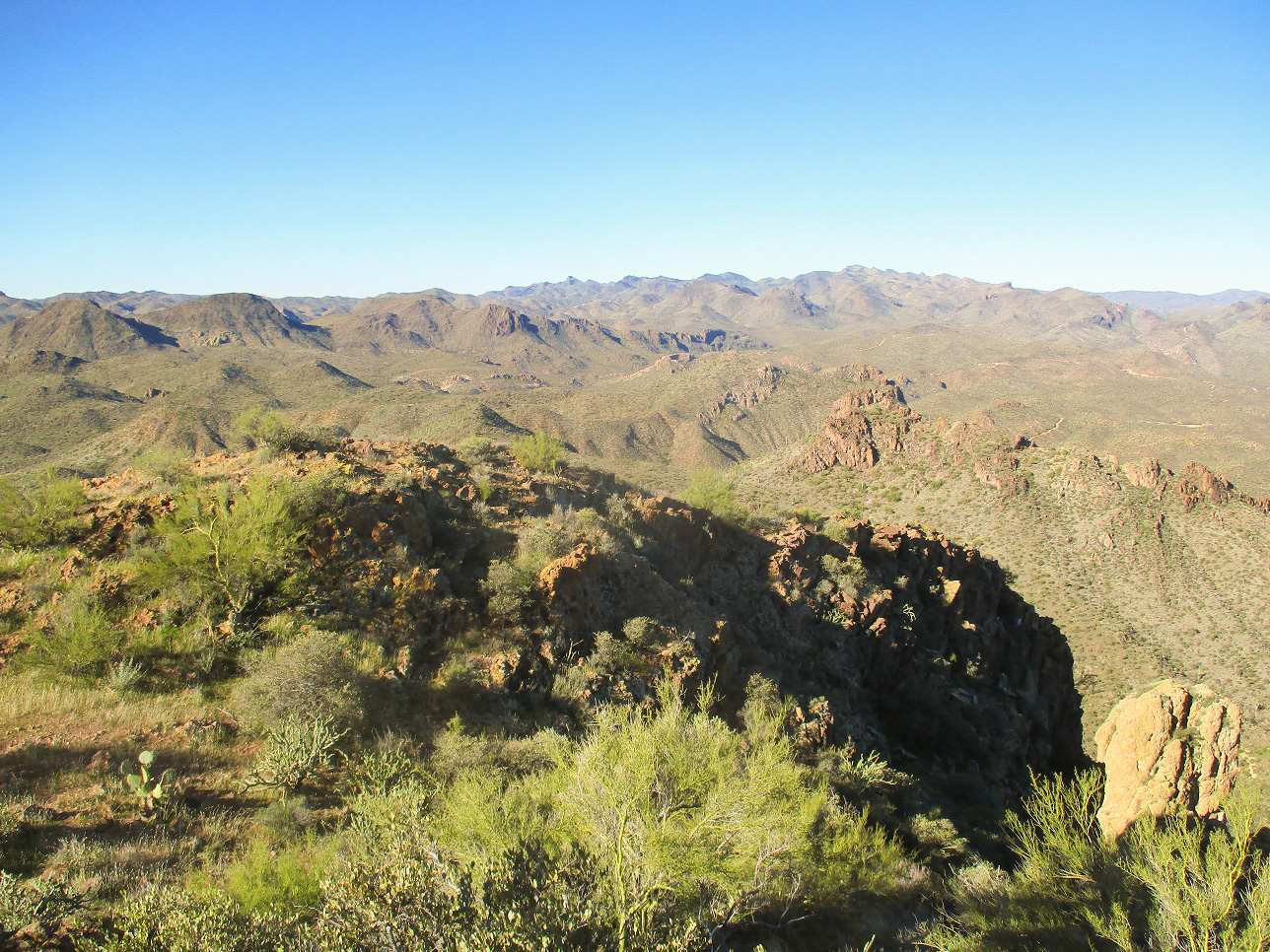
Up until now, Governors Peak was mostly out of view, hidden by foreground peaks and when not hidden, not obvious from a distance which bump in the skyline was the highest point. The main feature visible on the inward hike was Peak 2992, which rises southeast of Governors. Peak 2992 has a rocky crown and a vertical cliff face on its left (west) side. Now at the 2,540-foot saddle, I could see Governors Peak again and its surrounding lower peaks and bumps.
The trail drops 160 feet into Four Tanks Canyon (according to HikeArizona, this is now the Bell Trail). I was below Peak 2992, and about 900 feet below the summit of Governors Peak, a little under a mile to go.
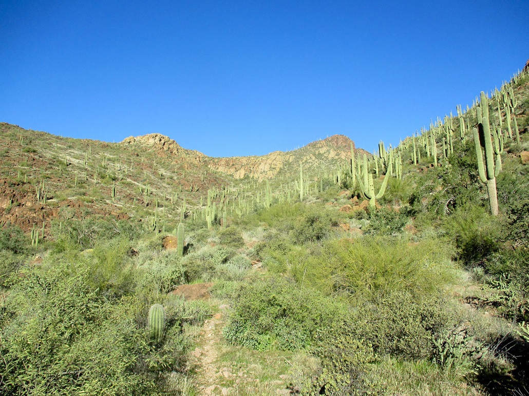
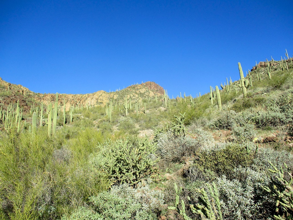
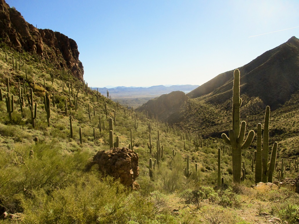
The trail loses distinction for long stretches within the canyon bottom. It crosses and intertwines with the various drainages. The rock cairns again were very helpful. I found myself hiking from one to the next, stopping often to eyeball the next one and hopefully the one after that. The brush closed in a little here but never too thickly. I could see where an April hike could be very brushy.
The route slowly works northbound up the drainage, aiming for the 2,800-foot saddle between Governors and Peak 2992. At some point, the route leaves the drainage and wiggles up steep rubbly slopes. Here, semblances of a trail can be seen again. Whenever in doubt, two or three beefy cairns re-assured me. The hiking here was steep and tiring, but easy, and I was quickly at the 2,800-foot saddle, taking another break next to ... wait for it ... a big cairn.
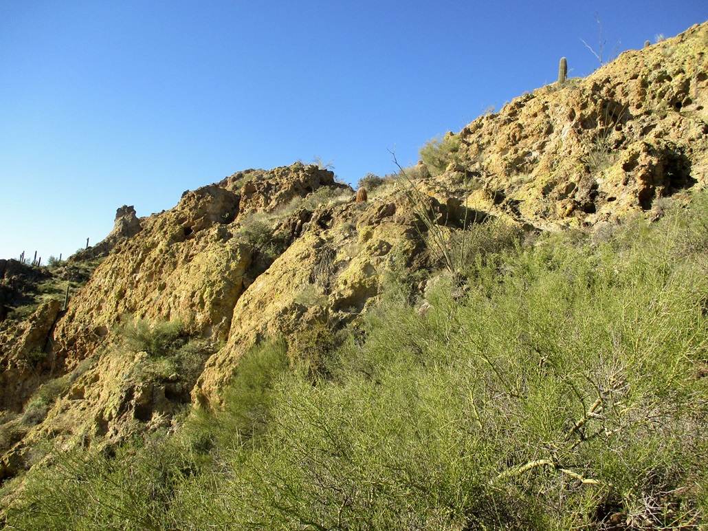
I studied the route from here. Up "top" was a rocky nubbin, a lower bump of the Governors Summit ridge line. Below it and to the left was a mix of rubbly slope, sections of thick vegetation, and a band of yellow-colored rock that looked like eroded tuff. After a drink and a rest, I started hiking again. I wasn't sure what I would do, but I would follow whatever route presented itself and hope for the best.
The cairned path goes up and bends to the left, traversing across the slope and aiming for this yellow rock band. Not until I was within feet of the rock itself did I see a lovely ramp, almost too good to be true. This ramp is about as easy as they come, and perfectly threads up a slope to the top of the rock band. I followed more cairns directly up slope, about another 40 feet of rock, to where it met with a gently-inclined slope, back on "regular" ground again. Surveyor's ribbons were tied to a few trees. The cairns stopped here.
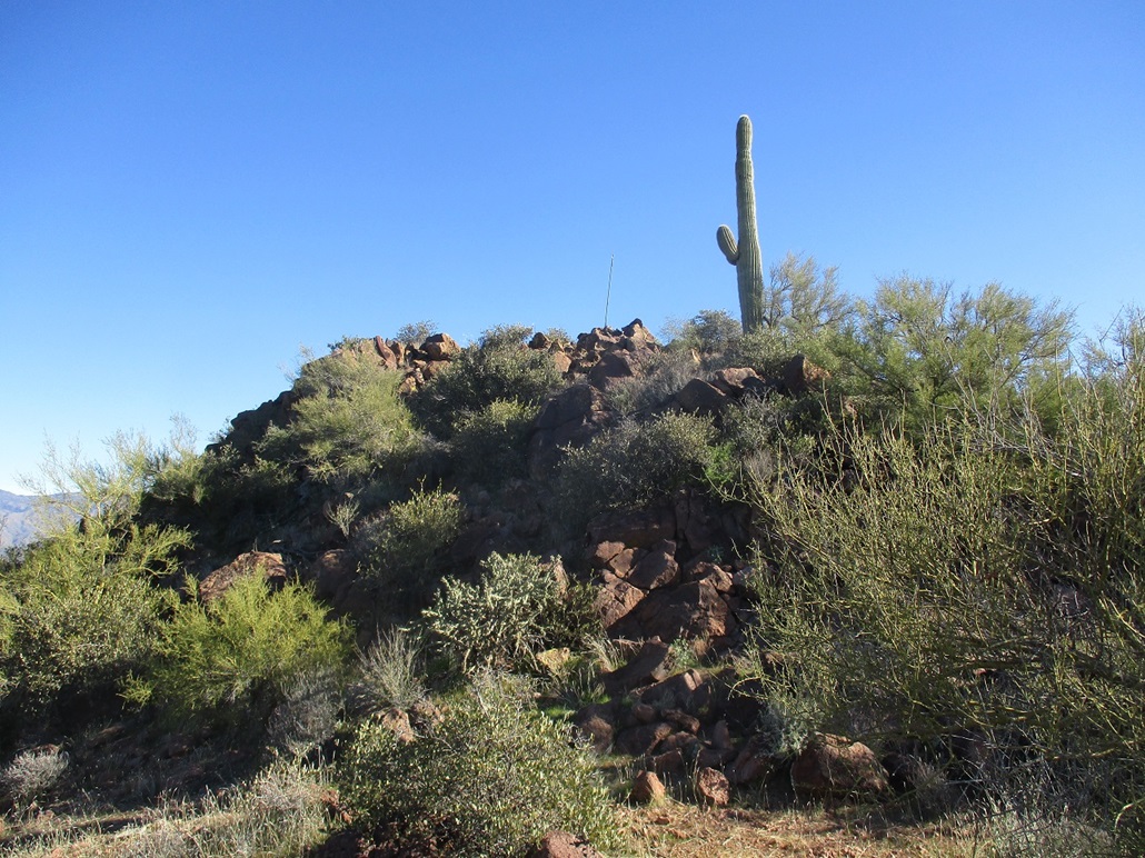
I found an open lane and followed it upward, on a direct line to the highpoint. It was a path for most of the way but when it would peter out, the underbrush was thin enough to find ways easily. I was on top of Governors Peak at 10:15 a.m., the top being a 20-foot rock pile with a thin pole being held upright by rocks.
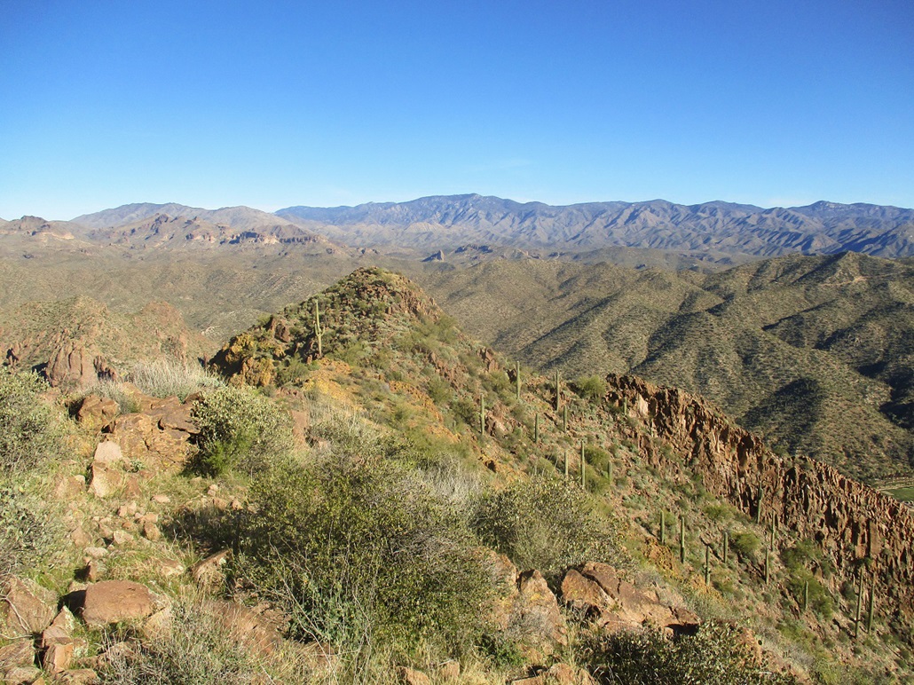
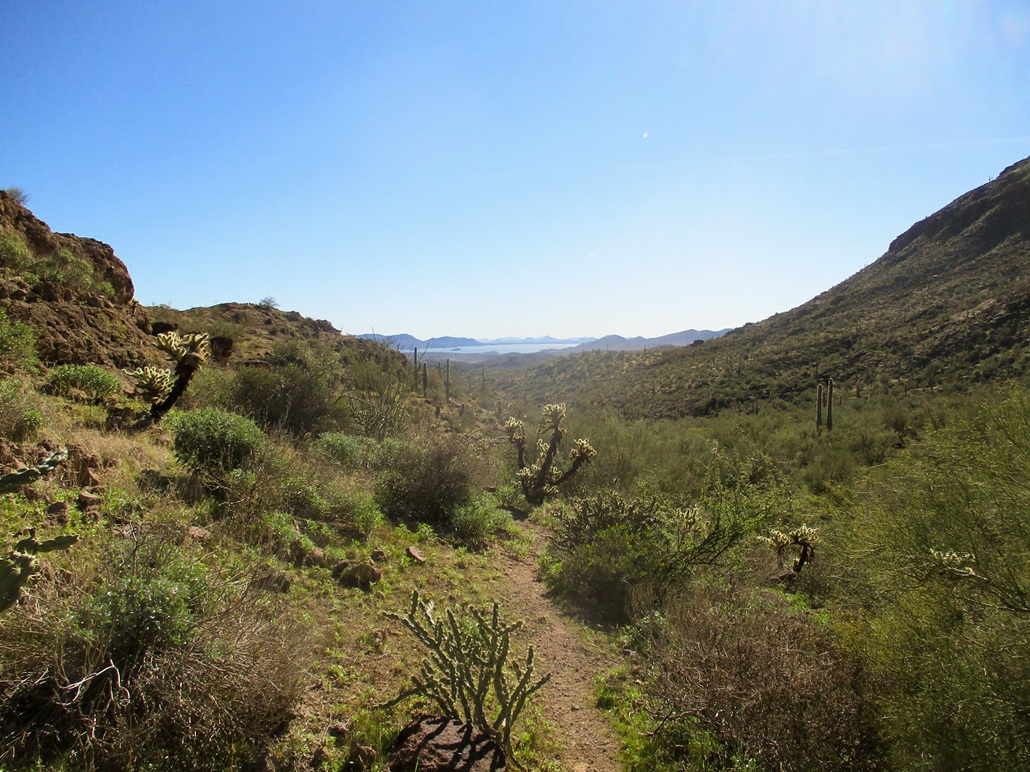
The views up here were fantastic. The day was sunny and clear, with no clouds or haze. I could see the multitude of peaks in the Hells Canyon Wilderness to the west, and the southern foothills of the Bradshaw Mountains to the north. To the southeast was Lake Pleasant, the sun glaring off the waters for the time being.
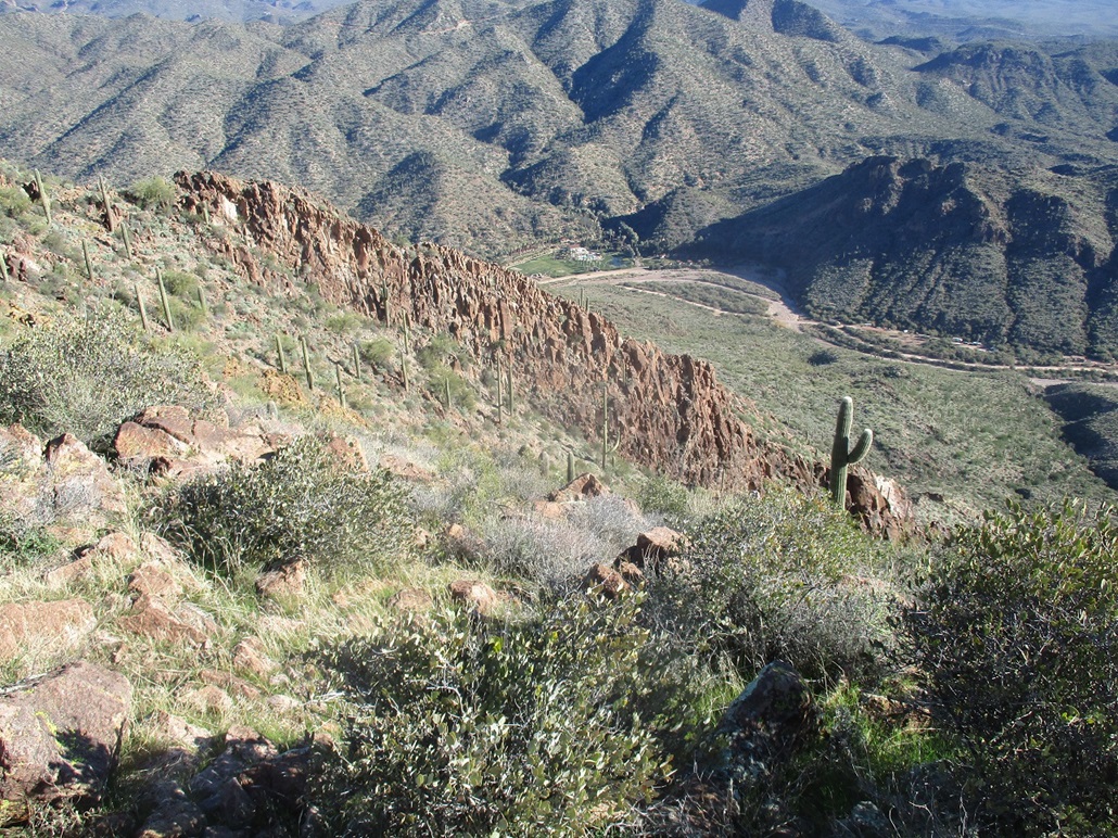
Looking down, I could see Castle Hot Spring resort. This is a fascinating piece of Arizona history. It was built in the late 1890s as a high-end resort and later as a rehabilitation center. Future President Kennedy spent time here recuperating after World War II. It was burned in a fire in 1976 and closed down, with no access, for the next 40+ years.
Castle Hot Springs Road is a 30-mile road that starts and ends at opposite ends of Highway 74. The road meanders through the Hieroglyphic, Buckhorn and Wickenburg Mountains, and when dry, is usually passable by most vehicles except for the weeniest of passenger cars. I was last up this far in 2002, when helping out with a triathlon race that ran through here. I think I was up here one other time in the 1990s. It was an odd sight to be rumbling through a tight canyon, then suddenly see these stately buildings just standing there, behind fencing to keep us out.
Looking down at the resort from my perch, it looked to be in good shape. Later, I looked it up and it has re-opened for business, after undergoing a massive renovation. It has been open since early 2019. This is good news, as it is a part of Arizona history and a shame to just wither away over time.
I spent about a half-hour up top. The weather was perfect: not too chilly, no breeze, and great views in all directions. The only negative was the noise of dirtbikes and sport vehicles driving up and down Castle Hot Springs Road, kicking up dust, their whines audible even up here. The register jar was jammed with papers and a mess. Someone had been up here about a month prior to me. It evidently gets climbed regularly.
For the hike down, I retraced my route exactly. It was easier going down, but even knowing the route, I still had to pay attention. I somehow walked "off route" more than once when the trail would make a sudden turn. Fortunately, I was only lost for a few seconds. I had to remind myself to watch out for cairns and the trail. As I neared my car, I could hear "pop-pop-pop-boooom" of various shooters in the creekbed. I hoped they were farther down than where I was. The hike out went quickly, taking just 90 minutes. It was just a little after noon, and I was very pleased how well it had gone. I was home about an hour later.
For a peak that I just "discovered" this past week, I was very impressed by the whole experience. The trail was solid and easy to follow (except when it wasn't), the cairns helped out too, the ramp was a gift from above, and the route was essentially blazed in some manner almost all the way up. The surrounding cliffs and ridges, plus the abundant foliage, combined to make this a pretty and enjoyable hike. I've been trying to learn about new areas to explore, and this one really paid off.
|


|