
The Mountains of Arizona
• www.surgent.net
|
| Green Valley Hills HP |
• Highpoint: Green Valley Hills • Tonto National Forest • Gila County |
|
Date: July 21, 2018
• Elevation: 6,222 feet
• Prominence: 582 feet
• Distance: 5.6 miles
• Time: 3 hours
• Gain: 1,460 feet
• Conditions: Humid and warm
Arizona
•
Main
•
PB
•
LoJ
We were in Payson for the weekend, getting out of the effing 115-degree heat down in the deserts that gets tiresome about now. We had no plan other than to eat, sleep and not be hot. I figured I better find a hike to do, to stave off any feelings of idleness that may arise. We arrived in Payson on Friday evening about 7:45 p.m., staying at the Motel-6 on the south end of town.
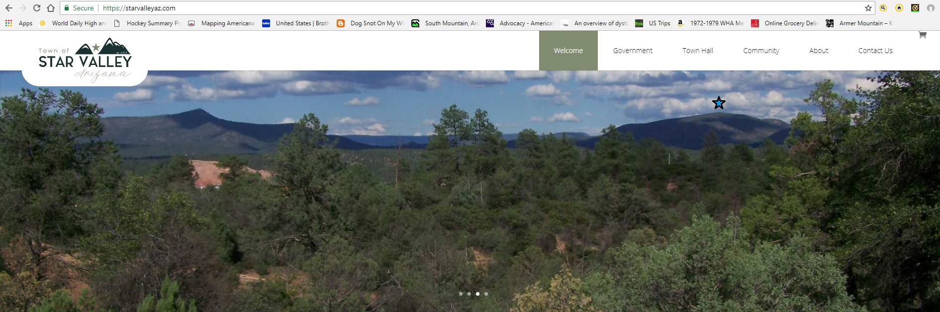
The Green Valley Hills rise east of Payson and Star Valley (Payson's suburb to the east), about 7 miles from the main part of town. Looking east, there's an obvious point along a band of cliffs. This is Diamond Point, along the Diamond Rim. Then angling to the right, the next set of hills one sees are the Green Valley Hills. State Route AZ-260 runs up between the hills. In fact, the Star Valley website has a splendid image of Diamond Point and the Green Valley Hills, which I copy below:
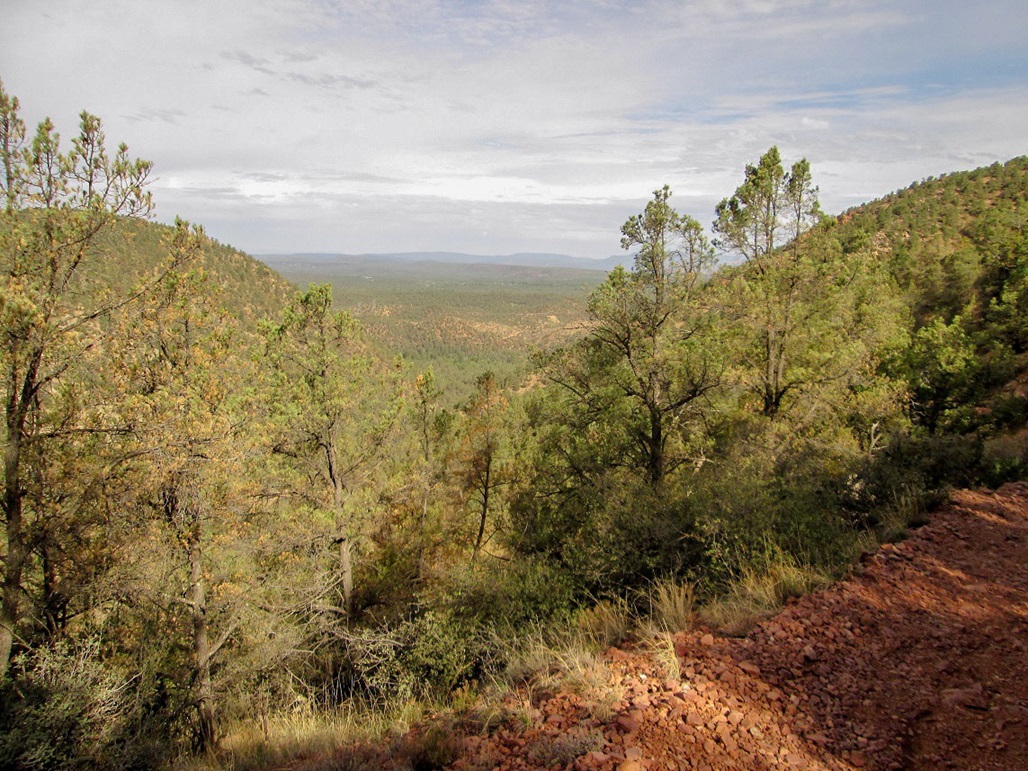
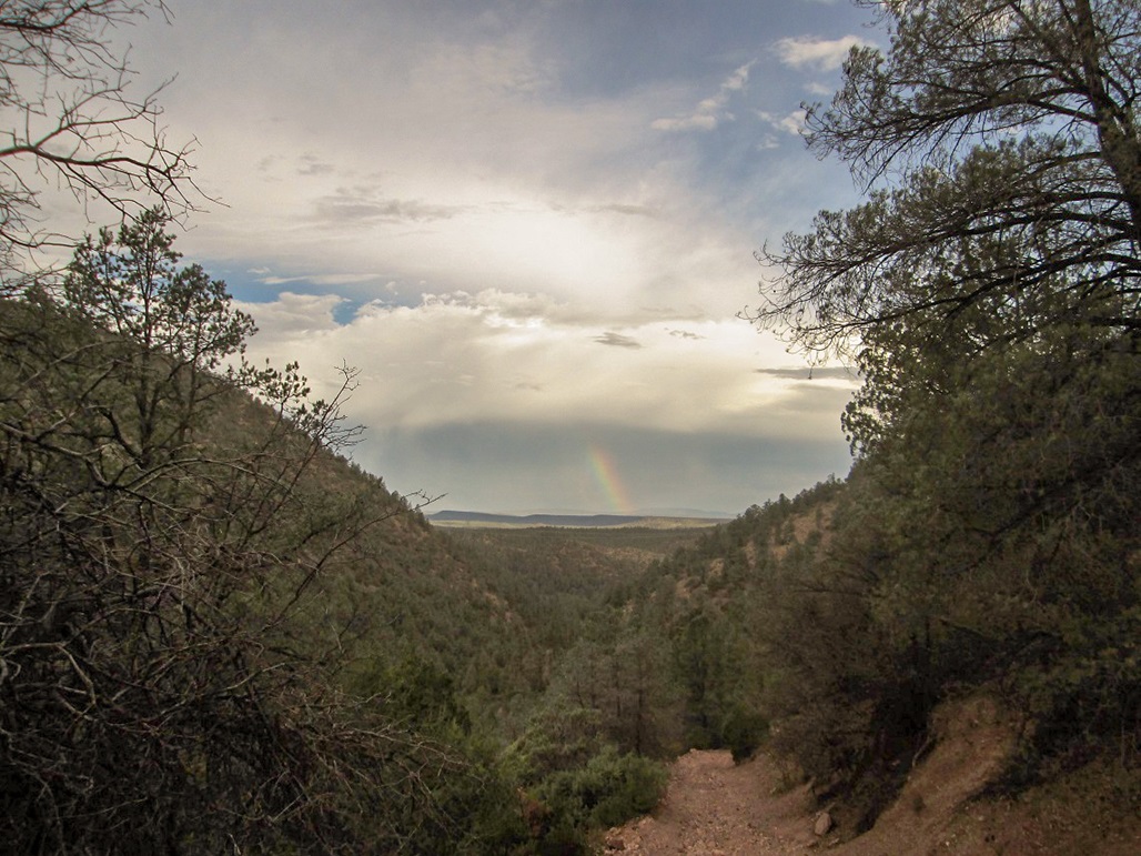
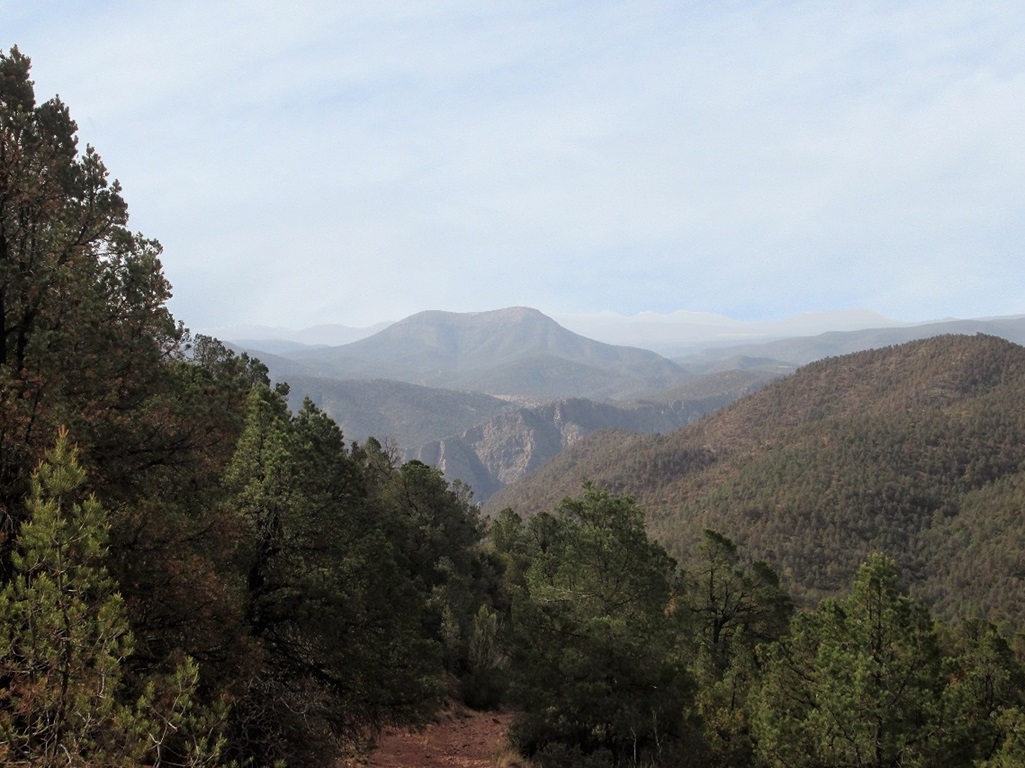
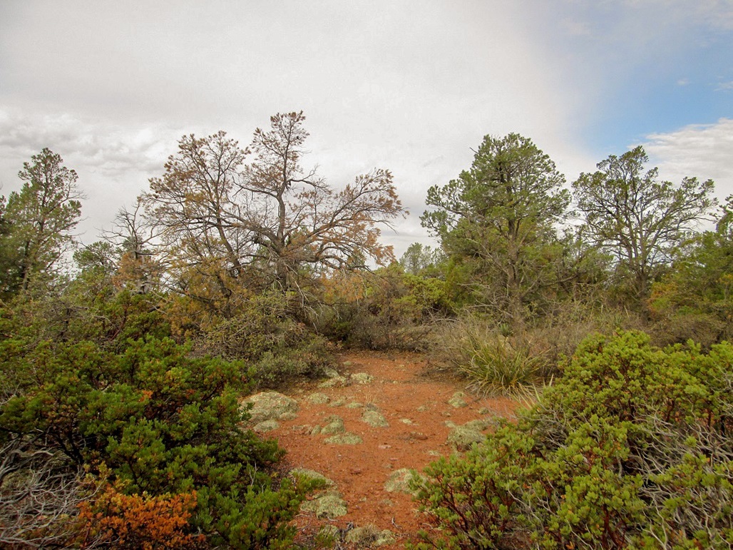
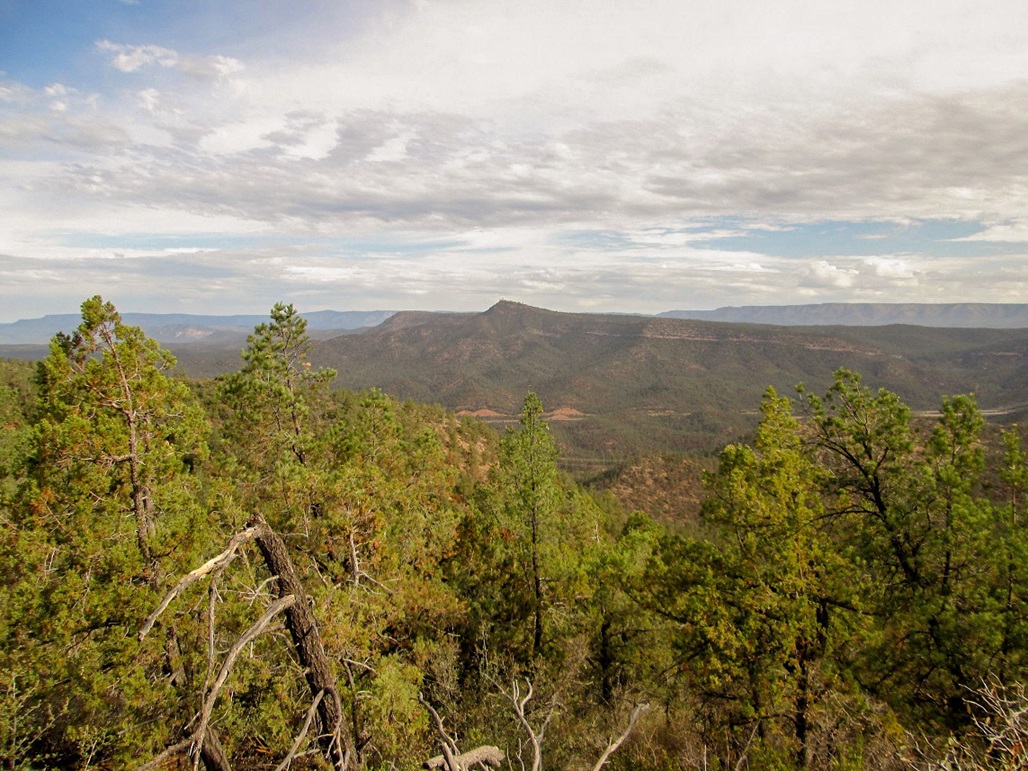
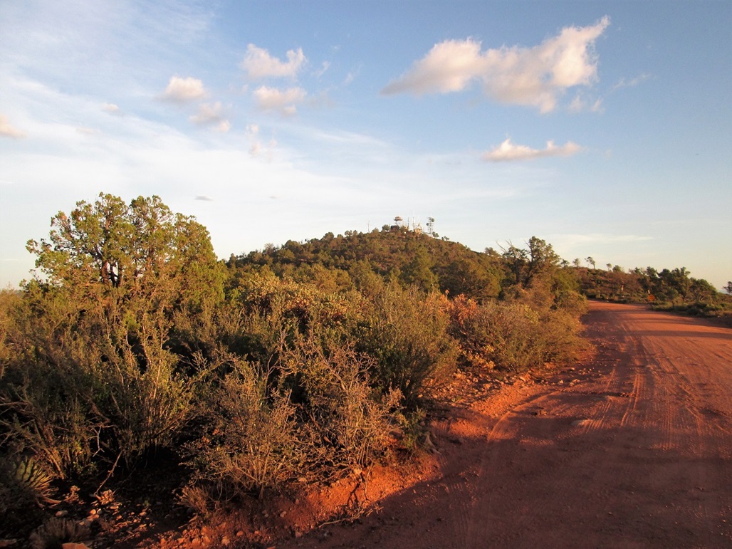
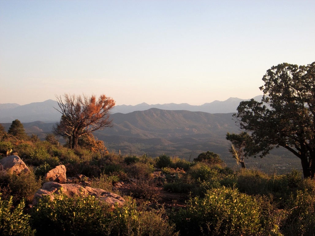
I planned to visit both peaks. There's a road to the top of Diamond Point, and technically, there's a road to the top of the highest point (which has no name) of the Green Valley Hills. This road is a nasty jeep track that would make an excellent hiking route, obviating the need to bushwhack. This time of year, with the warmth, bushwhacking of any sort is not wise, what with all the snakes and other bitey animals. The route to the top had the right blend of statistics and logistics: about 5.5 miles round trip, all road, and about 1,400 feet of gain. I'd get a good workout, too. Even though Payson is at 5,000 feet elevation, it still gets warm up here, highs in the low 90s. Also, the storms can be very active here, as the monsoon thunderstorms often build along the Mogollon Rim. When we arrived last night, there were cells in the area, some rain, and lightning. Thus, I wanted to be hiking as early as possible to avoid the heat and storms. I left the hotel about 5:30 a.m. and drove toward my destination. I missed the turnoff from AZ-260 and had to drive another two or three miles to find a cross-over to go back westbound (the turn off is between milepost 259 and 260, just before the highway splits from a single two-lane to a split four-lane). I got onto the desired Tonto National Forest road, and drove a mile to the Preacher Canyon Group Camping area. I parked near an old corral. There were people here but all was still. The sky was cloudy, muting the sun, the air was calm and warm, and very moist. The humidity would beat me up nearly the whole hike. I locked everything up and starting hiking at 6:10 a.m, temperature about 70 degrees. I crossed a drainage, on Forest Road 656. The road gains up the other side and bends west, gaining about 150 feet to a rock outcrop about a quarter-mile in. Then, the road drops about a hundred feet, most of it exposed bedrock covered in pea-sized gravel. Footing was slippery, for obvious reasons. I carefully scampered down this slope, then hung a left where the road seems to braid with the drainage for a short segment. At least it was bending in the direction I wanted to be going. The next mile was mostly level, going up and down easy slopes as the road merged, then split, then merged with the drainage bottom. In about a mile and a half, I had gained only a couple hundred feet and I was still slightly concerned I had missed a turnoff somewhere back there. Plus, it was humid. There was no breeze, the sky was gray and I was soaked. Finally, the road drops into the drainage then barges steeply uphill. This agreed with the map. I was growing weary of making no upward progress. Now I'd be making fantastic upward progress, the road pitched about a 15%-20% grade. It was rubbly and ugly, but at least it went up. I trudged up the road, stopping often to wipe away sweat with my soaked shirt sleeve. This portion gained about 500 feet in a half mile. Here, the road I was on (FR-656) ends at Forest Road 893, elevation 5,480 feet. I was about a mile below the top, about 750 vertical feet to go. I marched upward on FR-893, and where it makes a couple switchbacks, I had good views down into the valley I had come up, and out across the landscape, looking north toward the Mogollon Rim and south into the cliffs of the Hells Gate Wilderness. As for the hike, this segment wasn't as steep as before, but it was still a grind. But soon, I was on the top. I left the road and walked into the low forest to seek out a cairn or marker of any sort. I found a small cairn slightly offset from where I thought the highest point to be. Inside was a badly-decaying water bottle and ziploc bag containing a slip of paper placed here in 2001 by Dave Jurasevich, a well-known hiker and climber from California. I doubt I am the first to come here since then. The cairn was hidden in brush so maybe nobody had noticed it. There was nothing for me to sign in with, so I put everything back and re-assembled the small cairn. I did not stay too long. The weather was warm and still, with more sun than before. The scrubby trees blocked any views. I did not check my time, but I estimated a one hour and 45-minute ascent time. I started hiking down immediately. Now and then I would stop for photos, but mostly, I kept to the walking, maintaining a good pace with gravity helping me. I had to be careful on the steep rubbly roads. I never fell, but I came close a couple times. The downhike went better than I would have guessed. I actually moved quickly, exiting in just over an hour. I was back to my car at 9:10 a.m., an exactly 3-hour hike. I felt good, but was happy to peel off my sweat-soaked clothes and into something drier. I drove out and back into Payson, getting some coffee for my wife back at the hotel. For most of the next few hours, we relaxed, watched an old 1960s-era British movie on the telly, and played with a gorgeous golden retriever puppy owned by the Motel-6 owners, who would take her out every few hours to run around and pee. The little puppy was adorable, and plopped on her back for tummy rubs. I still wanted to go see Diamond Point, so we got in the car about 7 p.m., with about an hour of daylight. The weather was calm now, much warmer than yesterday. The usual thunderstorms were not building. Thus, we had good conditions for a quick drive to Diamond Point's top. The drive covered about 20 miles, and we were able to drive to a gate just below the top. We had wonderful views looking down into the valleys below. There were signs on the gate about authorized personnel only. I might have jogged up if I was on my own, but chose not to this time, plus it was really getting late, the sun near the horizon now. We walked around the area and snapped some photos, then drove back down into Payson as the sun set. We drove home the next day. I finally hiked Diamond Point in December 2020. |

|