
The Mountains of Arizona
• www.surgent.net
|
| Haley Hills Highpoint |
• Highpoint: Haley Hills • Hidden Valley • Maricopa County |
|
Date: January 18, 2022
• Elevation: 1,988 feet
• Prominence: 538 feet
• Distance: 1.6 miles
• Time: 65 minutes
• Gain: 528 feet
• Conditions: Cool, cloudy, some drizzle
Arizona
•
Main
•
PB
•
LoJ
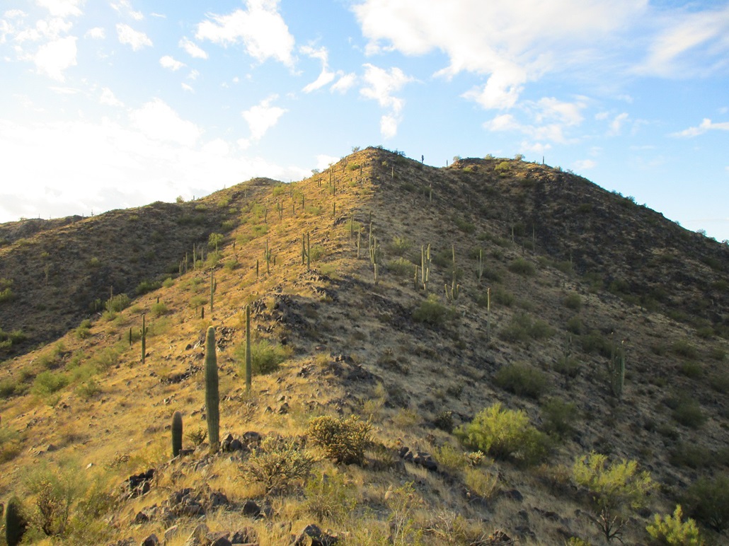
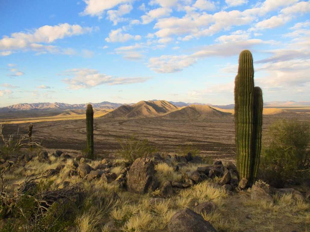
The Haley Hills are a small batch of desert hills west of Maricopa, south of state route AZ-238. There are four ranked peaks, the highest being the northwest-most peak at 1,988 feet. Most of the range is in Pinal County, but the highpoint hill lies barely inside Maricopa County.
I planned originally to visit the highpoints of both the Haley Hills and the Booth Hills, which are west about two miles. I would park somewhere near the Haley Hills, climb it, then strike off across two miles of desert plain toward the Booth Hills.
I was up early and on the road a little after 6 a.m., and in Maricopa a little before 7 a.m., the sun not yet risen. I wanted to time my arrival to the hills at dawn, so I killed time in a Walgreens parking lot, just sitting in the car, spacing. This took up fifteen minutes.
I drove west on AZ-238 a few miles to Rio Bravo Road, then south on that for about six miles. It bends slightly at first, then is now named Hidden Valley Road. I was last here in 2017 when I climbed the Palo Verde Mountains Highpoint. I went over a soft pass, then turned right (west) onto Fulcar Road. I drove it for about three miles. Out here, it's a few scattered homesteads, and Haley Hill Highpoint was up ahead, left of the road, plain as day. Pavement ends after two miles, but the sandy road thereafter was in decent shape. I drove it another mile to a corner, then south about a half mile to another side road, which I followed to its terminus, where I parked.
I was northwest of the summit, in a little desert cirque formed by two of the ridges. My car was out of sight of the main roads, not that there's much traffic out here to begin with. It was 7:45 when I pulled in. I changed and was ready to hike a few minutes later. It was cold for now, about 45°. The sun was up but behind the hills. I was in the shadows, the high ridges backlit by the sun.
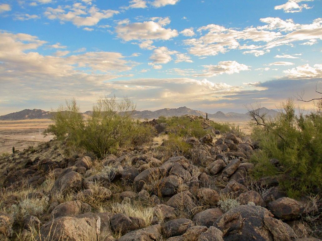
I aimed for a gentle slope up ahead, the grass about shin high, some rocks, not a lot of cactus except for the little things. And a few old blankets and backpacks, and random bottles and trash items. Clearly, this was the leftovers of a camp by the border crossers. I saw no people, and I stopped to look around but it was dead quiet. As far as trash goes, I've seen far worse. This particular camp I found was generally tidy except for the few items I mention. I am bewildered they get this far north. I assumed that all of them would have either got a ride, or been caught by the BeePee, before they get as far north as Interstate-8. Anyway, I was perplexed for about two minutes.
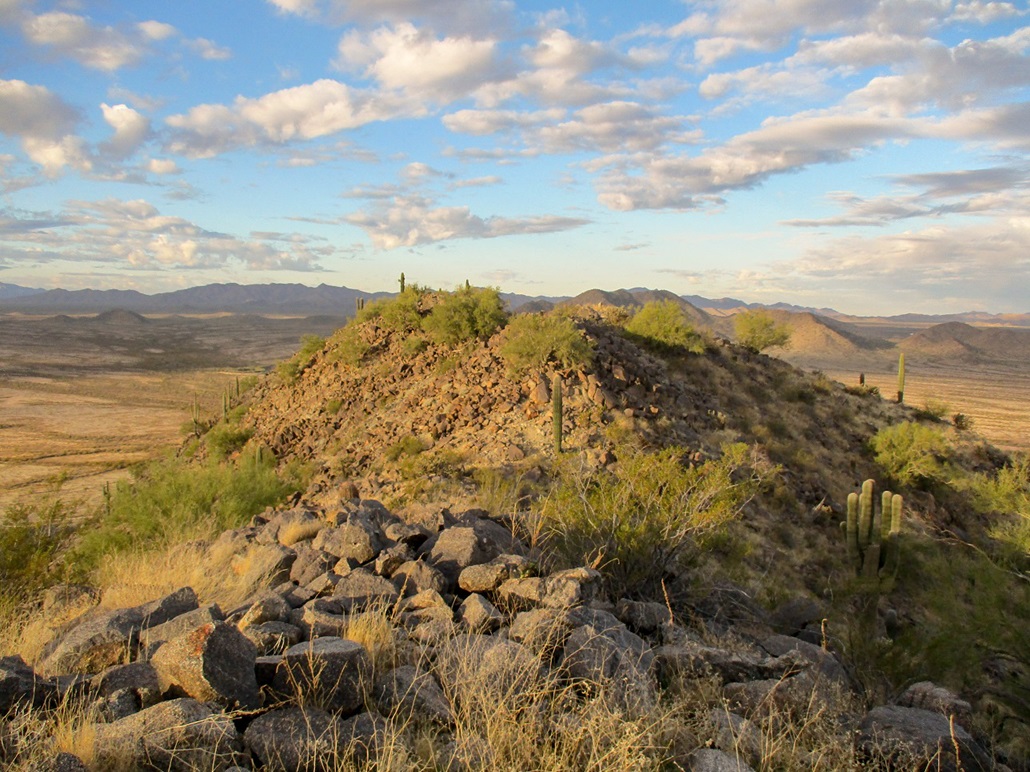
I was soon on the north ridge, and I followed it up to the top, which wasn't far. The slope was moderate but friendly, not too brushy, and the rocks piled up nicely. I achieved a rocky "summit", but looking over to my right, the rocks there looked higher by a couple feet. I walked down about 15 feet, then up the only "scramble" of the day, then boom, I was on the proper summit.
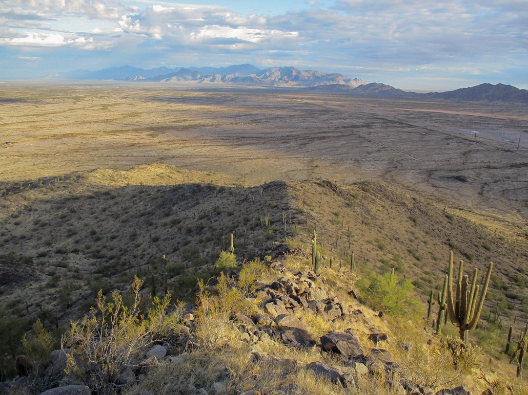
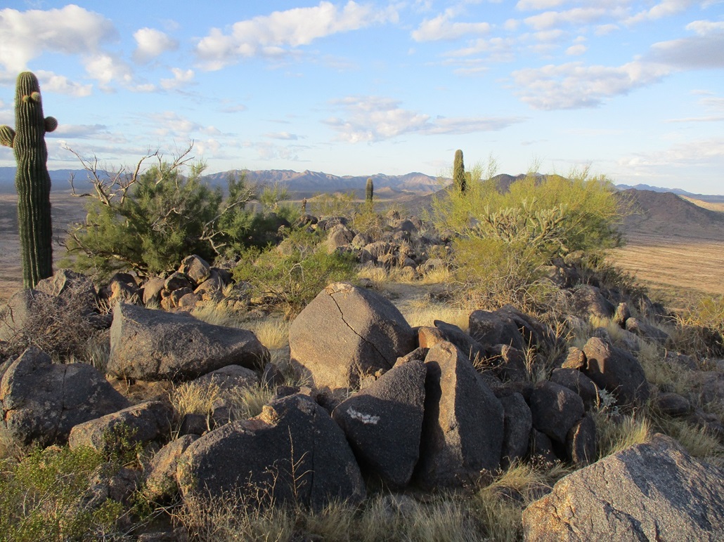
This summit was rocky but spread out with places to sit. I looked for a register, but found none. I did find empty bottles and other small items stashed in the rocks, likely from the border crossers. I stayed up here for ten minutes, some of it waiting for the sun to shine through to give me good lighting for images. I could also hear a lot of gunshots coming from the flats to the west.
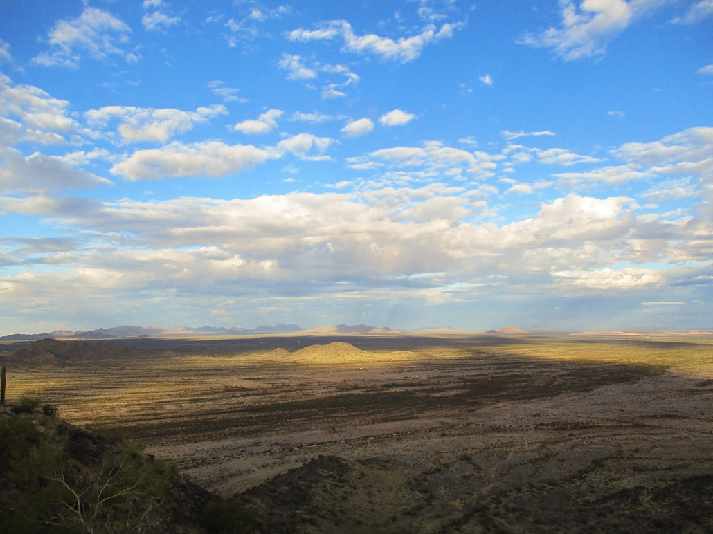
I headed down the exact same route and was back to my car, the total time about 90 minutes. It wasn't a long hike, but I enjoyed it. On the hike down, I heard nothing but pop-pop-pop sounds of small arms fire, evidently there being a shooting range west of me. Then I'd hear a boom and wonder what the hell they just blew up. I thought it wise to not take my chances to walk across those flats, so I canceled my hike to Booth Hills. I can approach those hills another way where theoretically I should be able to avoid the shooters.
I was happy to get this one hill-peak in the books. It was easy to get to, an easy slope to manage, brush not too bad, and scenic. I was home in an hour, another day of being barely useful ahead of me.
Update: I returned about ten days later to hike the Booth Hills Highpoint.
|


|