The Mountains of Arizona
www.surgent.net |
|
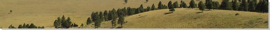
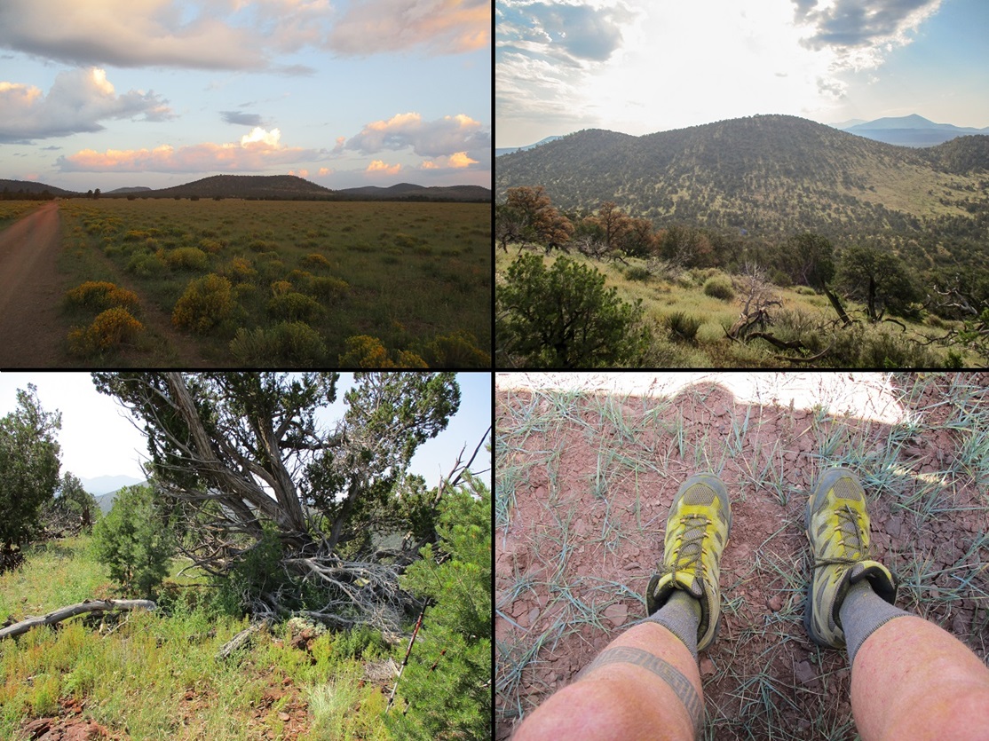
Hobble Mountain East & West Peaks I wanted out of the heat for a day, the state in a big heat wave, probably the last severe one for the Summer. I locked in on the Hobble Mountains, a small "range" about 30 miles northwest of Flagstaff. I also added on two nearby volcanic mounds for a potential four-peak afternoon. It would be warm up on the Coconino Plateau, but tolerably warm, in the 80s, not deadly warm like elsewhere. I left in the middle of the night, no traffic, and was in Flagstaff still before dawn. I actually bypassed Flagstaff and stopped in at the gas station in Bellemont, where I topped the tank and got some drinks and snacks. I then followed Interstate-40 to Parks, then Spring Valley Road (Kaibab FR-144) north about 15 miles to place me in the general area where the Hobbles and its nearby subsidiaries stood. The sun was just started to rise by now.
Date: September 10, 2021
• Elevation: 7,419 feet (East), 7,454 feet (West)
• Prominence: 459 feet (East), 534 feet (West)
• Distance: 2.75 miles
• Time: 1 hour & 45 minutes
• Gain: 1,160 feet
• Conditions: Morning clouds, warm and still
Arizona
•
Main
• East:
PB
•
LoJ
• West:
PB
•
LoJ
•
Interactive map
From the main forest "highway", FR-144, I eased westbound onto FR-736. As usual, ignore the numbers shown on the USFS topographical maps. Nothing matches, but the ArcGIS maps do show the current forest road numbers. I still wonder why the forest service maps are completely wrong in terms of the road numbers. It's not just a few errors. Virtually every secondary track is misnumbered on the maps. Maybe they were current when the maps were produced, the latest being 2016, but I can't fathom why every single road number would need to be changed. They don't make a lot of sense to begin with, so why change a bunch of arbitrary road numbers with a whole new set of arbitrary road numbers? Sorry, I had to rant.
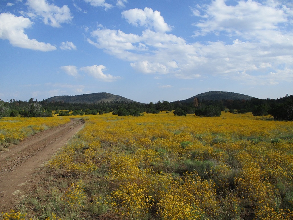
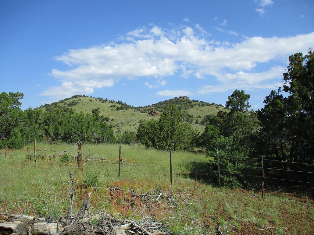
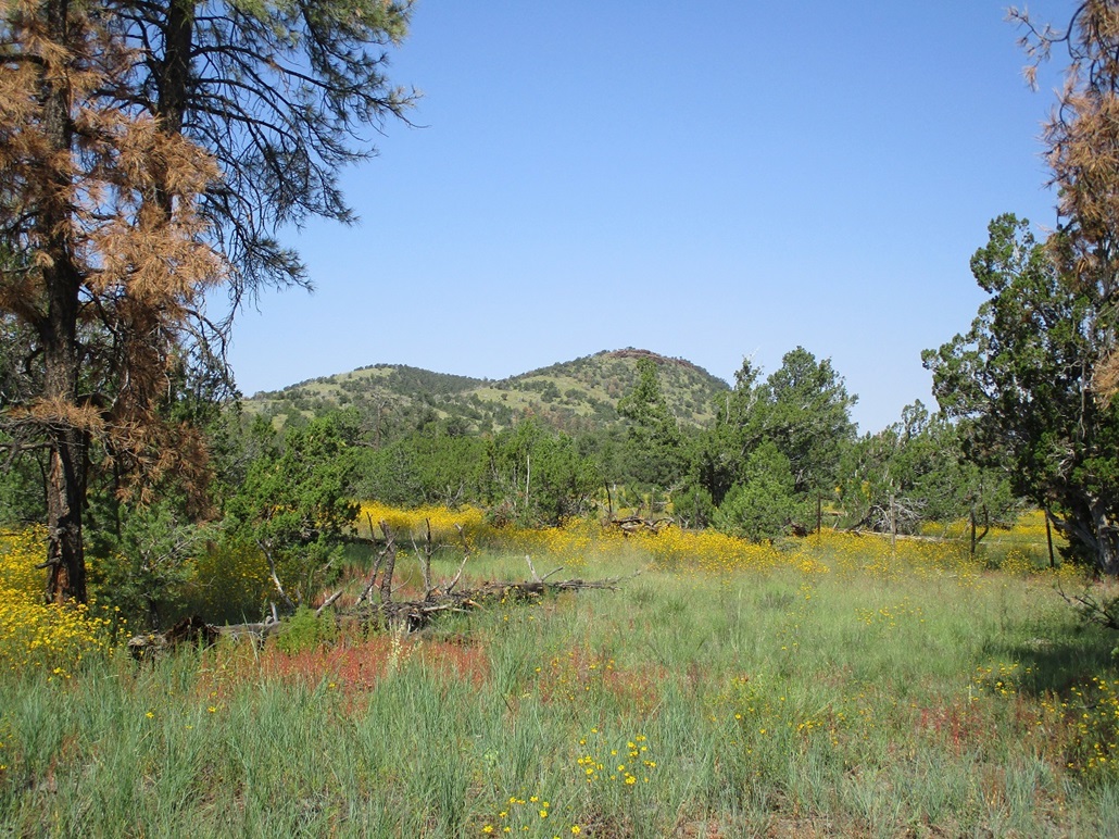
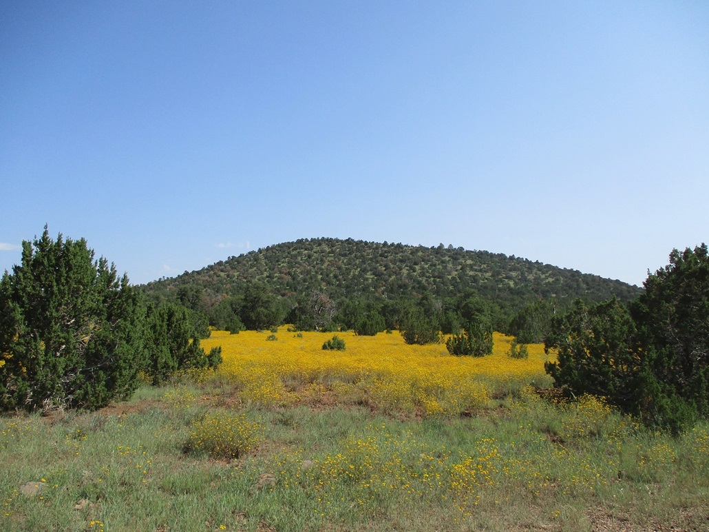
Kaibab FR-736 is narrower but in decent shape. It runs south of Potato Butte, which I hiked in June, and generally flat across open meadow. It seems to be prone to mudpitting, but it has been dry here for awhile so mud was not a problem at all. Up ahead was Sheep Hill. Behind and to the right were the Hobble Mountains and to the left, Buck Mountain. I drove in on FR-736 about four miles, to its junction with FR-118. I then followed FR-118 through an amazing profusion of yellow wildflowers, following the junctions as appearing on the map. I was able to ease in north about two more miles. I wanted to place myself somewhere south of the saddle that connects the two peaks.
The roads were manageable. FR-736 had a couple rocky stretches but nothing too bad. FR-118 was a little more narrow and haggard. There were a couple short rock segments, to where I had to inch through slowly. The main issue was high centers. I had to ride along the centers and the sideberms at times. Four-wheel drive is not needed when dry, but high clearance is. My Subaru Forester did fine.
I got to where the road passed south of the saddle, and was pleased (and surprised) to see a scanter track heading northbound, presumably to the saddle. I drove in about a hundred feet and parked in a cleared area. It was 6:45 a.m., still in the shadows because the peaks were right above me, cool but not chilly.
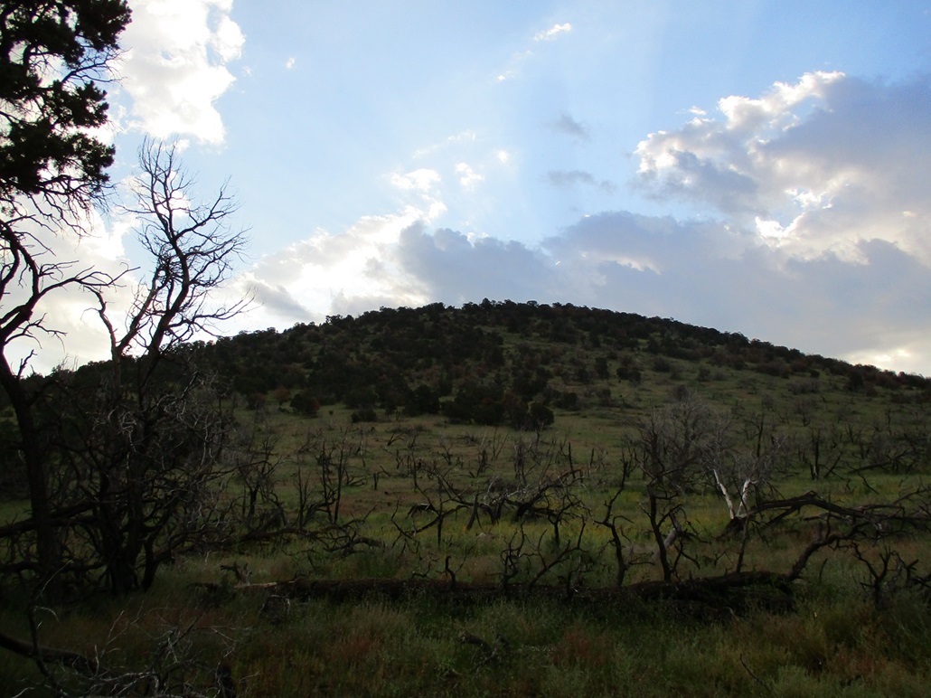
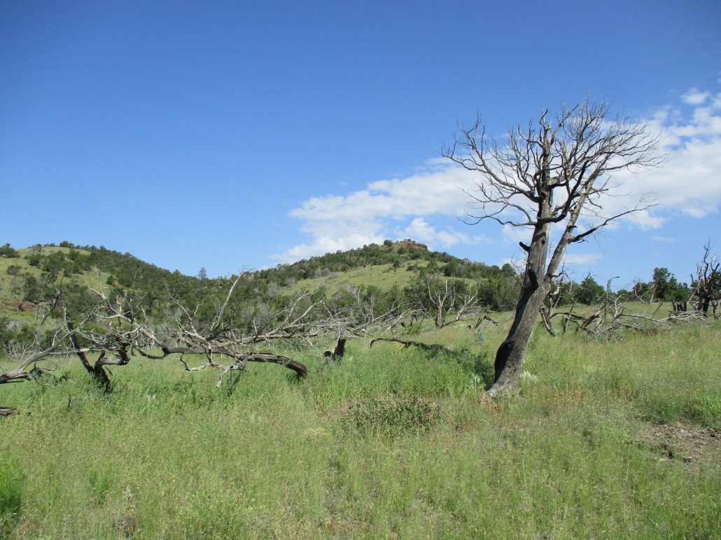
The track is just an ATV track. It quickly deteriorates into a messy rock-fest suitable just for an ATV. I walked it past a noticeable rock outcrop. The track then started angling upslope, while the natural drainage coming off the saddle crossed it here and stayed to my left. I would follow this drainage out, and in retrospect, deem it better than the track. But I had committed to the track. It went steeply uphill, then levelled off in a scraggly meadow, the result of an old fire. Burned snags still stood and others on their sides.
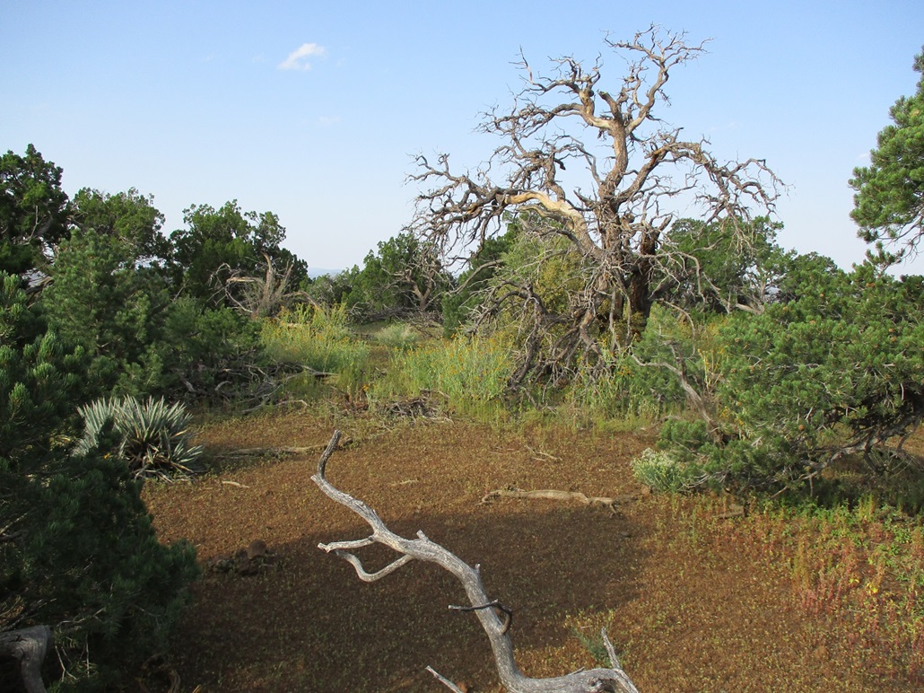
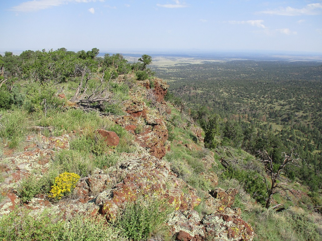
The track ends in this meadow. However, I was not far below the top of the East Peak. After the meadow, the terrain slopes upward and is brushy, low trees (no ponderosa here), deadfall, and a tremendous amount of low brush. Not the woody kind, but the flowery-stalky kind. It was dense, about knee high, and itchy. I wouldn't call it bushwhacking, but it was close. Even at this early hour, at this elevation and in the shade, I was already warm, and mildly concerned about snakes too. I did a lot of zig-zags to get around the barriers. The climb was short and I was soon on top.
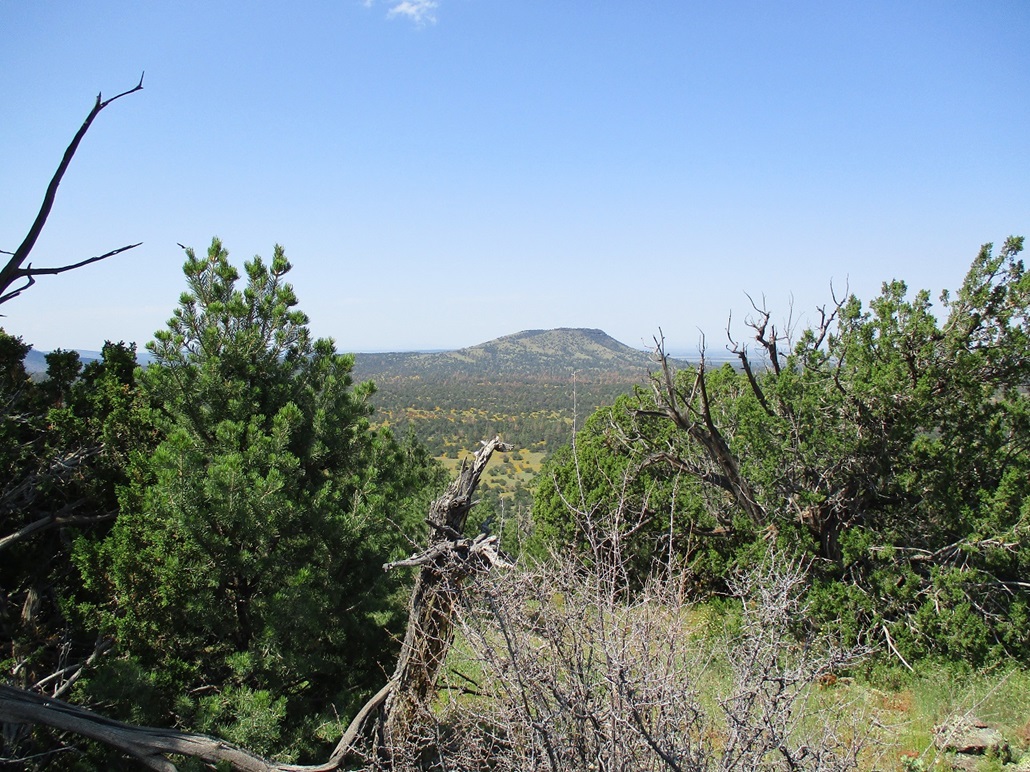
The summit was nothing special, but it was open with good views. It runs about 200 feet and any one of about a dozen large boulders could be the highest point. I tagged them all and saw nothing that would indicate past visitors --- no cairns, registers or evidence of markings. It was kind of homely. I did not stop. Instead, I started walking west, descending off the peak toward the saddle below. Up ahead was Wast Hobble, the highpoint of this tiny range. By now, the sun was starting to light things up and also spike the temperature a quick 5-10 degrees.
The hike up West Hobble went fine. It was the same as East Hobble, finding open lanes through the low trees, avoiding the downed logs, and skirting the big patches of low brush and flowering plants. From the saddle to the top covered a half mile and took me about 20 minutes.
The top here was a little more attractive. A tiny cairn signifies what somebody took to be the highest point. I walked the area to be sure. I did not see any bigger cairns, fire-rings, registers or signs of past visitors. After a few minutes, I descended off the summit a few feet and took a break in the shade of a tree, then started down. I played it safe and returned to the saddle, rather than bust directly downslope on an angle back to my car. The downhill went fast as I could fast-walk a lot of it. Back at the saddle, I followed the drainage out. Drainages can easily get choked with trees and rocks, but this one was clear and easy for about 95% of its length. I would suggest to follow this up instead of that ATV track, then tag both summits from the saddle as two separate hikes.
I was back to my car at 8:25, covering by my reckoning about 2.8 miles. This is a conservative figure because I do not account for the many zig-zags I needed to take. It was pleasant, the temperatures in the mid 70s. That's great normally, but at 8:30 a.m. at this elevation, that signifies a warm day ahead. Fortunately, my next objective, Buck Mountain, wasn't far away.
The west summit of Hobble Mountain was also my 500th ranked peak that I have climbed in Arizona. Here is my complete list.
Elevation: 7,412 feet
• Prominence: 492 feet
• Time: 1 hour & 15 minutes
• Distance: 2.5 miles
• Gain: 432 feet
• Conditions: Sunnier and warmer
PB
•
LoJ
Back on FR-736, I went west, then southwest, about a mile. The road drops then gains slightly, curving away from its original alignment. Here, the road was rough and I had to go slowly and carefully. I intended to top out at the road's apex and hike from there, figuring any elevation I can handle in the car is that much less I need to hike.
I parked along the old road alignment, which has signs every few hundred yards warning about buried gas lines in the area. I was about a mile on a straight line south-southeast of Buck Mountain. I was technically on its long southern ridge emanating off the west lobe of the summit, which is shaped like an inverted-U, the highpoont being on the east lobe. However, from where I parked, I could not see the top. The forest here was thick and the gradient so light that the trees simply blocked the views, and the peak wasn't high enough to rise above them from my viewpoint.
I started hiking into the trees, trying to keep going up, even though the grades were barely noticeable. This went on for about a half-mile, then I broke into the open and could see the peak up ahead. Suddenly I had a clear vision of where to go and what to do. Just as suddenly, I came upon a fence. This fence runs east-west and lies where Sections 1 and 12 border one another. It was a sturdy barb-wire fence with posts every few feet so that pressing down on the strands wouldn't work. The only way past it was to get low and shimmy under the lowest strand on my back.
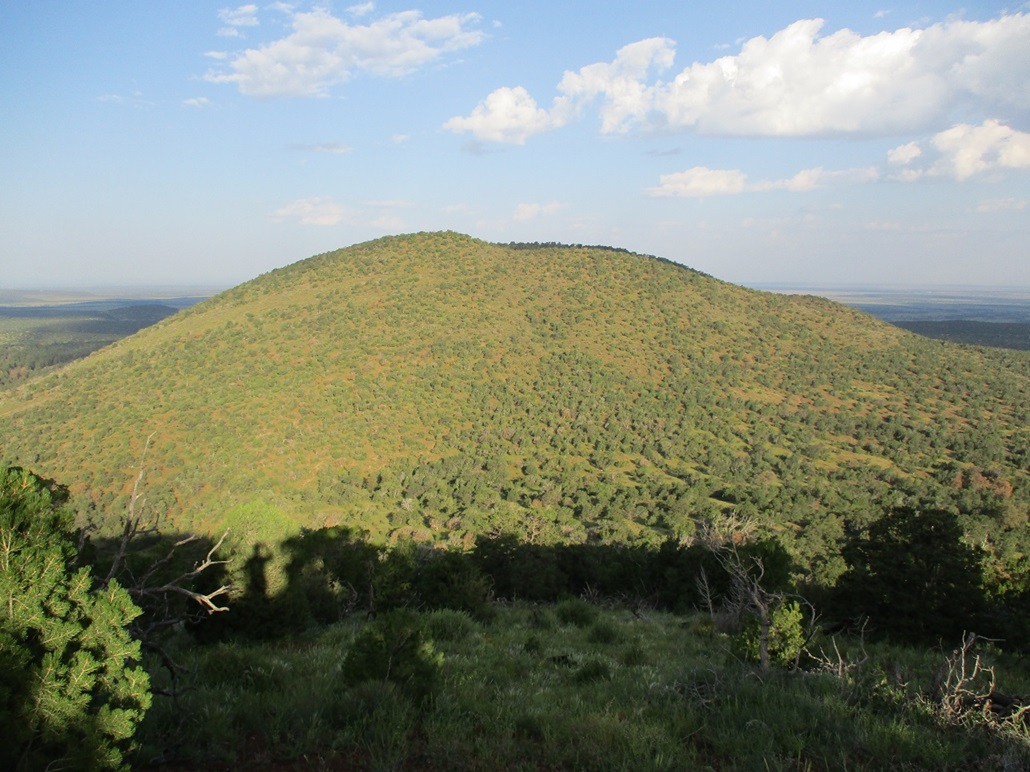
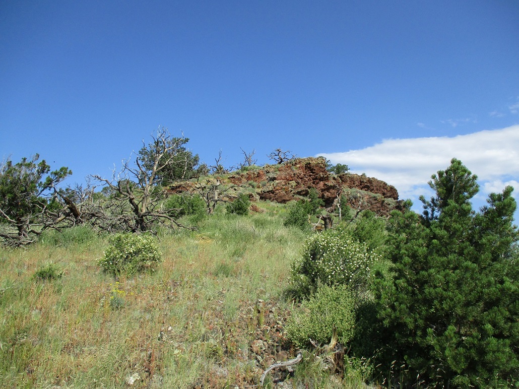
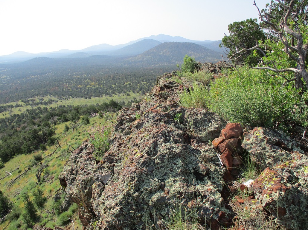
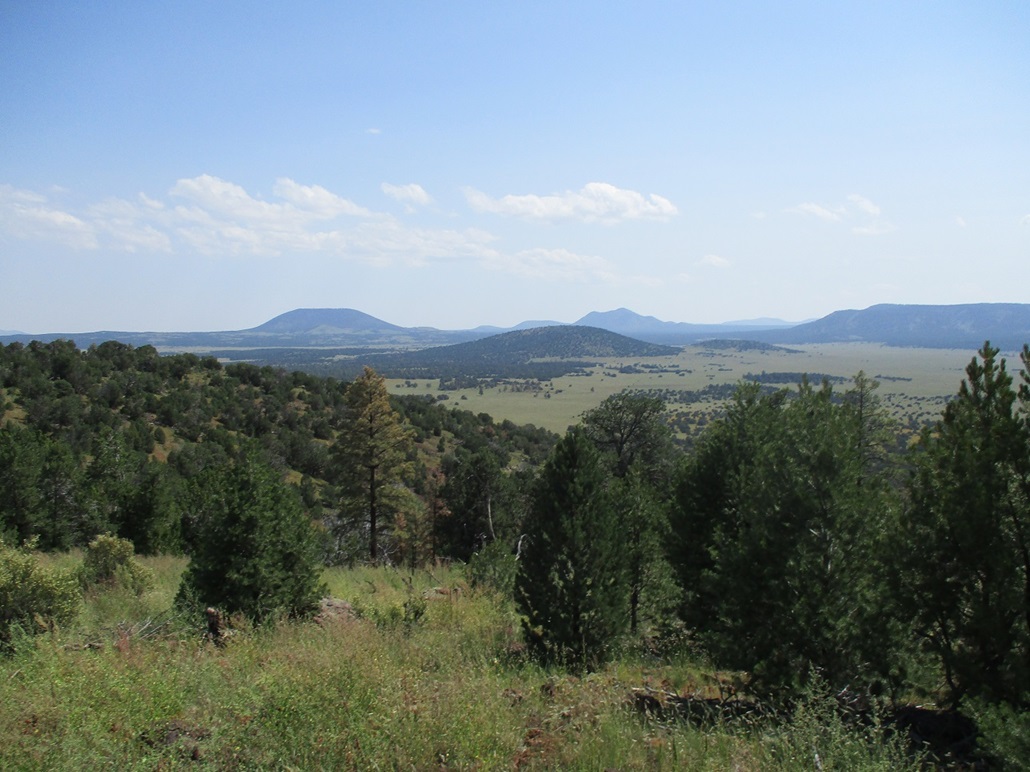
I was now more in the open. I was on the ridge that would lead me to the western lobe of the summit. So I cut across, going down a soft gully, then up the other side, to place me on the slopes below the east lobe, the peak's highpoint. Then I just walked up the consistent slope and soon was on top. The top features a rock band forming cliffs to the east. The last forty feet from my direction was through scattered rocks forming steps. The views up top were excellent, being literally on the cliff's edge (the drop was about sixty feet).
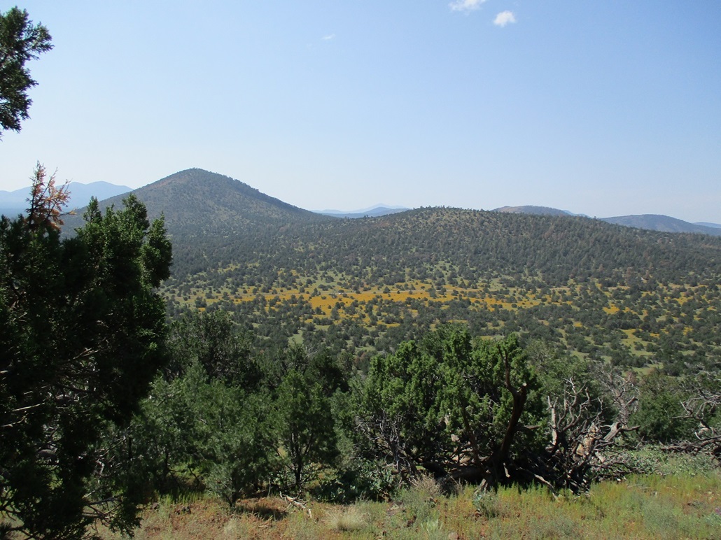
I found a register and signed in. Someone was here in May. I took a break too, and shot photos of the surrounding area including the Hobbles and of Sheep Hill, next on my agenda. I spent about ten minutes on the summit and enjoyed it very much.
Hiking down, I didn't exactly retrace my route. Instead, I kept to the ridge I was on and then once lower down, angled slightly southwest to at least point me in the right direction toward my car. I had to recross that fence, too. There was no chance of getting lost as I would hit the road no matter what. I did a better job than expecting as I came out to that old road alignment, about 150 feet east of where I parked. I could see my car up a ways near a post with the gas-line warning sign.
From where I parked to the top is a mile, going by the map, but taking into account all my wiggling and course corrections, I easily added on an extra quarter-mile each way. The hike took me 75 minutes, and in retrospect, proved to be my favorite of the four peaks. It has attractive slopes and rock formations, plus the cool cliff up top. I was not expecting much, but left feeling pleasantly surprised.
Elevation: 7,263 feet
• Prominence: 343 feet
• Time: 45 minutes
• Distance: 1.2 miles
• Gain: 360 feet
• Conditions: Sunny and very warm
PB
•
LoJ
Sheep Hill would be my last hike of the day. It was deliberate set up to be last: it would be the shortest hike with the smallest gain of the four summits. Plus, it was on my drive out. I parked at a cattle grate southwest of the peak, the time about 10:45 a.m.. I was tired by now and the day was warming, now into the low 80s.
I started walking across the initial flats, through a sea of yellow flowers. This was all very pretty but also very polleny, as I was kicking up a lot of yellow "dust" into the air and onto my clothes and body. When the slope started up in earnest, the flowers ended and now I was just on normal grassy slopes with trees and downfall to avoid. Like my previous climbs today, I did a lot of zigging and zagging to get around the barriers. The hike was short, as expected, and I was on top in about 20 minutes.
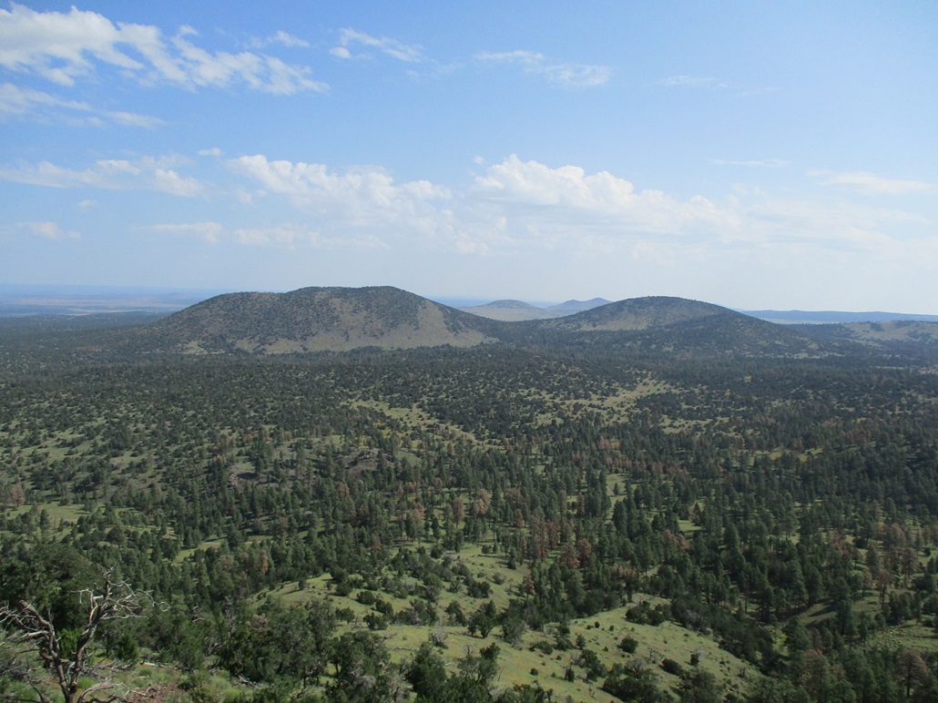
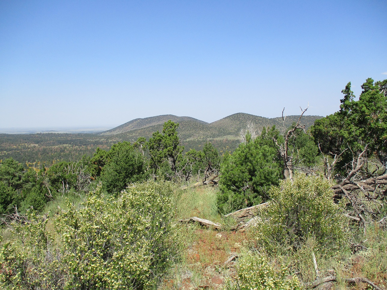
I found a register, placed here back in November 2020, and I was the second person to sign in. The first person left behind a couple small bottles of vodka. I left them alone for the next person. I don't know if vodka goes bad, but I wasn't interested to find out. The views were good, a little hazy in the far distances. I was able to snap images of the Hobbles and of Buck, plus peaks east. I stayed up top about 10 minutes, signing into the register and having a drink break.
The hike down went well too. I followed generally the same path, then waded again through the yellow flowers back to my car. I think they may be tickseeds, but am not sure. The flowers are small, about a half-inch in diameter and they clump tightly together. My shoes were caked in the pollen. I had been gone 45 minutes.
It was a little past noon now, and warmer. I had no more peaks on the agenda, so I drove out, following Spring Valley Road (FR-144) south back to Parks, catching Interstate-40 there. I went into Flagstaff and had a lunch at a Cafe Rio, then drove slowly down Lake Mary Road into Payson where I killed another hour at a Starbucks. Even in Payson, the heat was evident, into the mid 90s here. As I exited, my tire-pressure alert went on. My driver's-side rear tire was low --- again. The third time in six months now. I was fortunately near a Big-O Tire Shop and they were able to take it off and patch it. It had caught another nail. That damn tire is a nail magnet. This downtime added another 90 minutes to my day, but at least let the sun set so that temperatures cooled a little bit, all things being relative.
The three hikes cumulatively came to about 6.5 miles, with about 2,000 feet of gain. I was a little sunburned and covered in that pollen. I tried to clean off what I could at various restrooms, but my nose would remind me at times I didn't get it all.
|


|