The Mountains of Arizona
• www.surgent.net
|
| Horse Knoll |
• Mogollon Plateau • Coconino National Forest • Coconino County |
|
Date: July 2, 2022
• Elevation: 6,921 feet
• Prominence: 381 feet
• Distance: 9.8 miles
• Time: 5 hours
• Gain: 1,250 feet (gross)
• Conditions: Overcast, then clearing, warm and humid
• Teammate: Matthias Stender
• Prog-rock bands played: Hatfield & The North, Atoll, Kraan
Arizona
•
Main
•
PB
•
LoJ
Today's plan was to hike three hills that lie on a long sloping plateau west of Lake Mary Road, north of state route AZ-260 and northeast of Camp Verde. The three hills we were looking at were Horse Knoll, Oak Hill and Big Hill. However, very bad roads curtailed the plan down to one peak, Horse Knoll. But the hike turned out to be a dandy, covering nearly 10 miles in an area no one goes to, and getting a good workout in the process.
Matthias and I met at dawn at the Target on Shea Boulevard in Fountain Hills. He drove us up highway AZ-87 through Payson, up onto the Mogollon Plateau, past Clint's Well and onto Lake Mary Road, then the turn off onto Coconino Forest Road 81, a drive of about 110 miles. We went in on FR-81 past a number of "campers" in their humongous RVs, past a few mudpits in the road from recent rains, and past a couple cattle grates. Only a couple miles in, and the number of campers was zero. The road was decent, but then started to decline in quality.
The next few miles of road were very rough. Lots of rocks in the road, and a lot of erosion. Matthias bashed his vehicle slowly along the road. It eventually comes out to a power-line clearing. By now, we were debating whether this road was worth an extra five or six miles, which would have placed us roughly center to Oak and Big Hills to the west and Horse Knoll to the east. It looked like another tedious hour of driving, and the road didn't look any better.
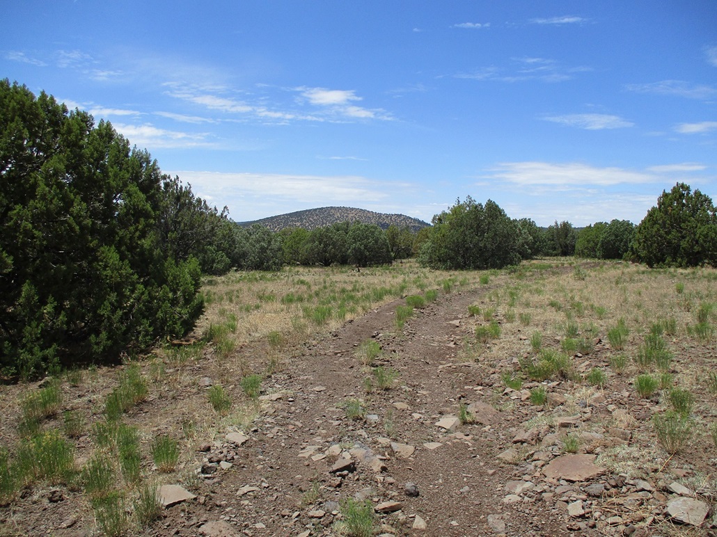
We chose instead to concentrate on Horse Knoll, and leave the other two hills for another time. Matthias drove into the piñon and juniper forest on the other side of the powerline clearing, then in another quarter mile, parking in a clearing. It was 8:30 by now. The day was warm and very overcast, the whole state in monsoon mode for now. We got things situated properly and started hiking at 8:50. We were about 3 miles on a direct line to Horse Knoll, which was not visible yet. But the roads meandered so we knew the walking mileage would be greater.
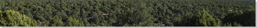
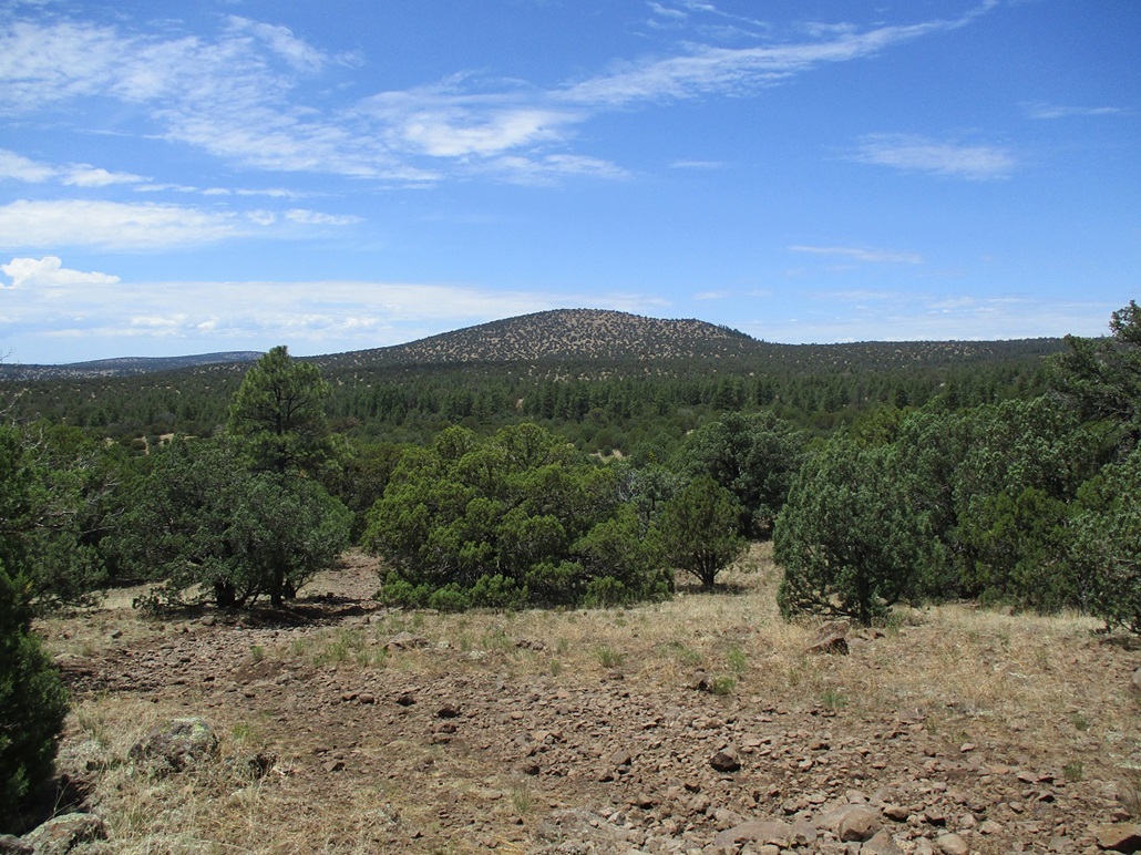
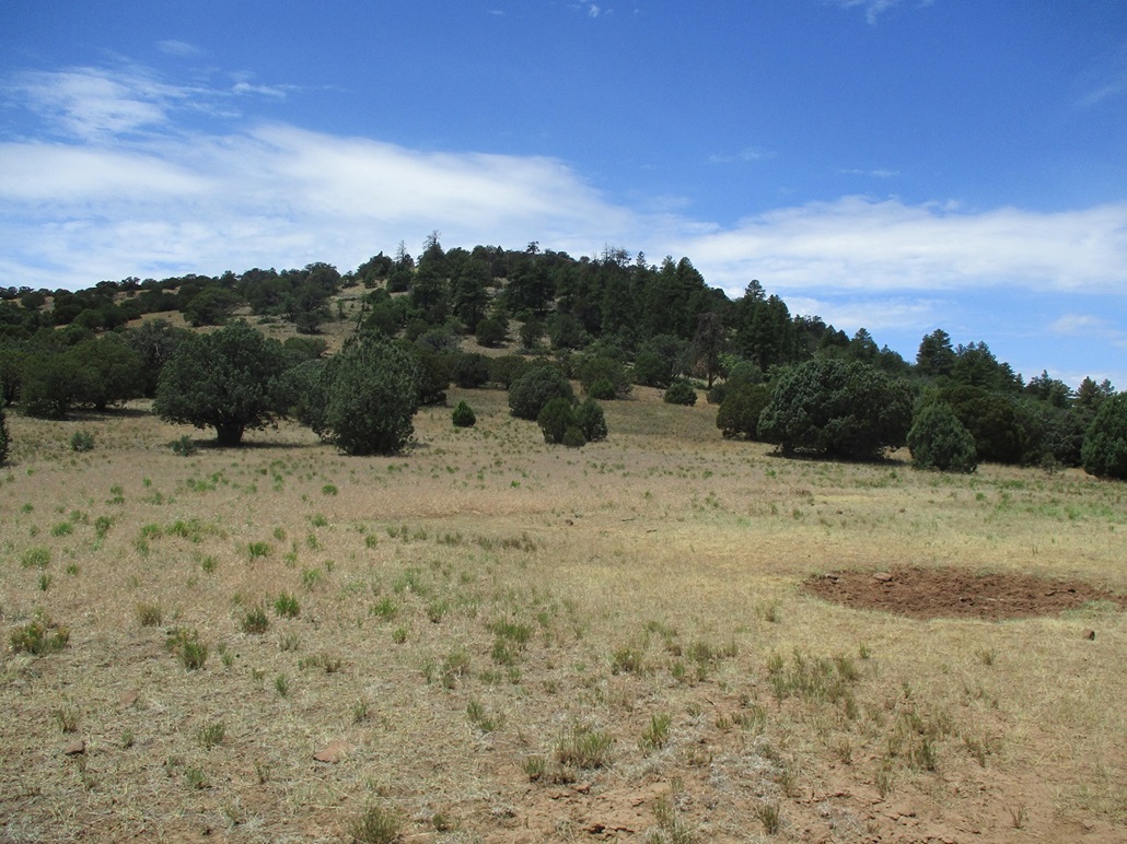
We followed the rough road westward. After about ten minutes, we rounded a bend and had our first view of Horse Knoll, a broad hill covered in piñon and juniper, but not thickly. We could see open areas too. The road drops over 500 feet in elevation in a couple miles, bottoming out near a big earthern tank, named Upper Tank, within Upper Tank Draw. We angled north and followed another track in that direction, situating ourselves northeast of Horse Knoll.
We left the road and started a mile-long cross-country trek toward Horse Knoll, its lower eastern bump visible for now, its highpoint still hidden. Our route kept the drop into the canyon minimal, about 50 feet. Then we started upslope, gentle at first and progressively steeper, but never uncomfortably steep. We were in more open terrain here, mostly scattered grass, rocks and cactus.
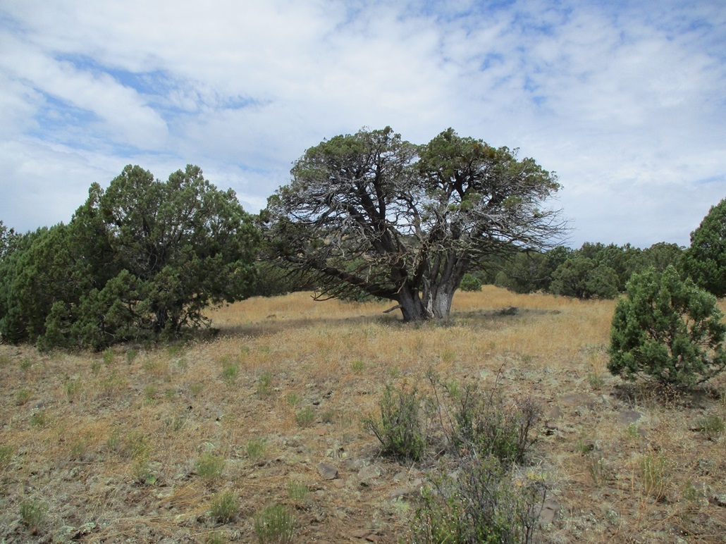
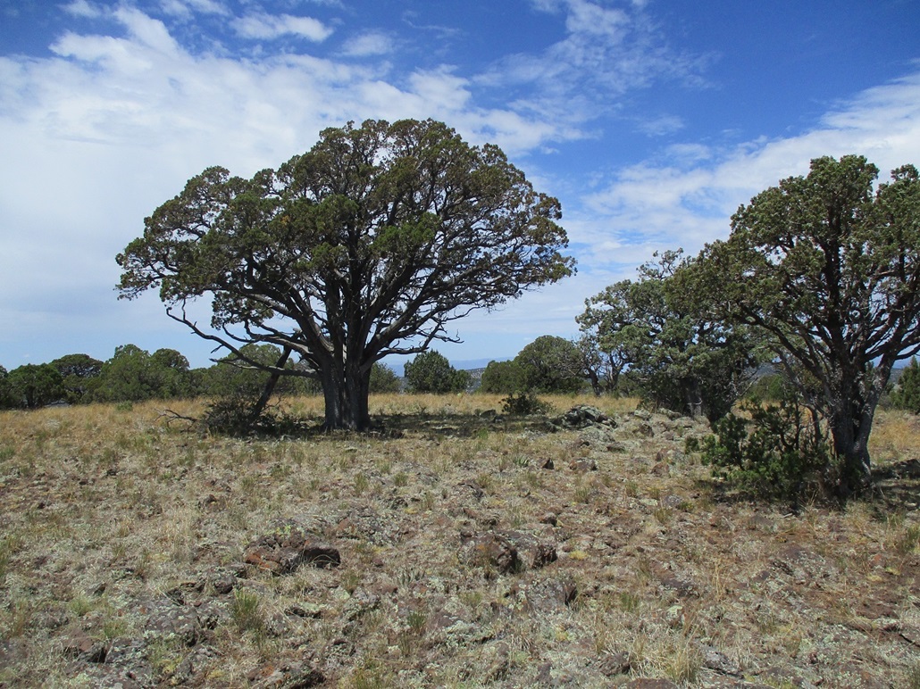
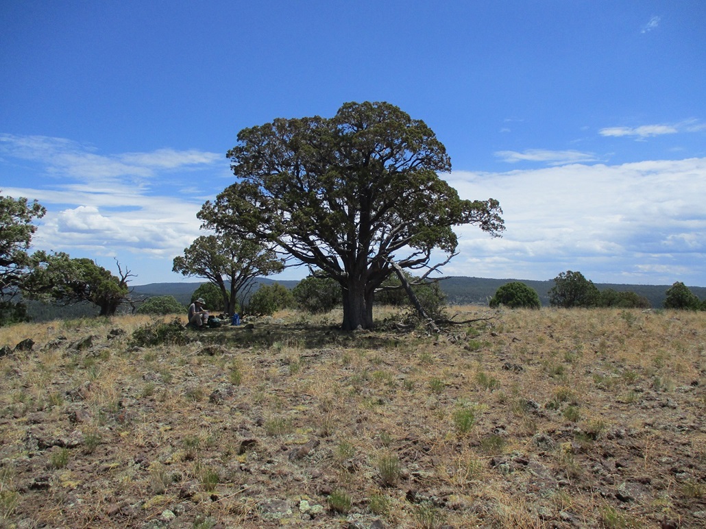
Now on the hill proper, the grade steepened, but it was short, and we were soon on the peak's crest. We followed it upward past a section of heavy brush (with paths through it). Then a little more uphill and we were on top of Horse Knoll. The summit is broad and flat, and at its presumptive highpoint, a stately juniper stands, no other trees in about a hundred-foot radius. Off to the side is a rock outcrop just a couple feet high, but probably the actual highest point. There was a register jar within a cairn on top of the rocks. Our one-way hike had covered 5.2 miles and had taken about 3 hours. The clouds had lifted and we had sunnier weather, but also much warmer temperatures and a lot of ambient humidity. This was great for photos, but not for comfort. There were lots of bugs including one that wanted in my ear real bad.
The register was placed here in 2018 and to our surprise, had about a half-dozen signatures, but no one we knew. I would have thought one of the obsessive peakbaggers we know would have been here (the logs at Peakbagger.com and Listsofjohn.com only list three or four ascents). For such a remote, unknown hilltop, it was surprising to see it has had other visitors, the most recent just 5 weeks earlier. It got us thinking there may be another way people come in to hike it. The roads in from Lake Mary Road were brutal and likely to keep visitation from that direction to a minimum.
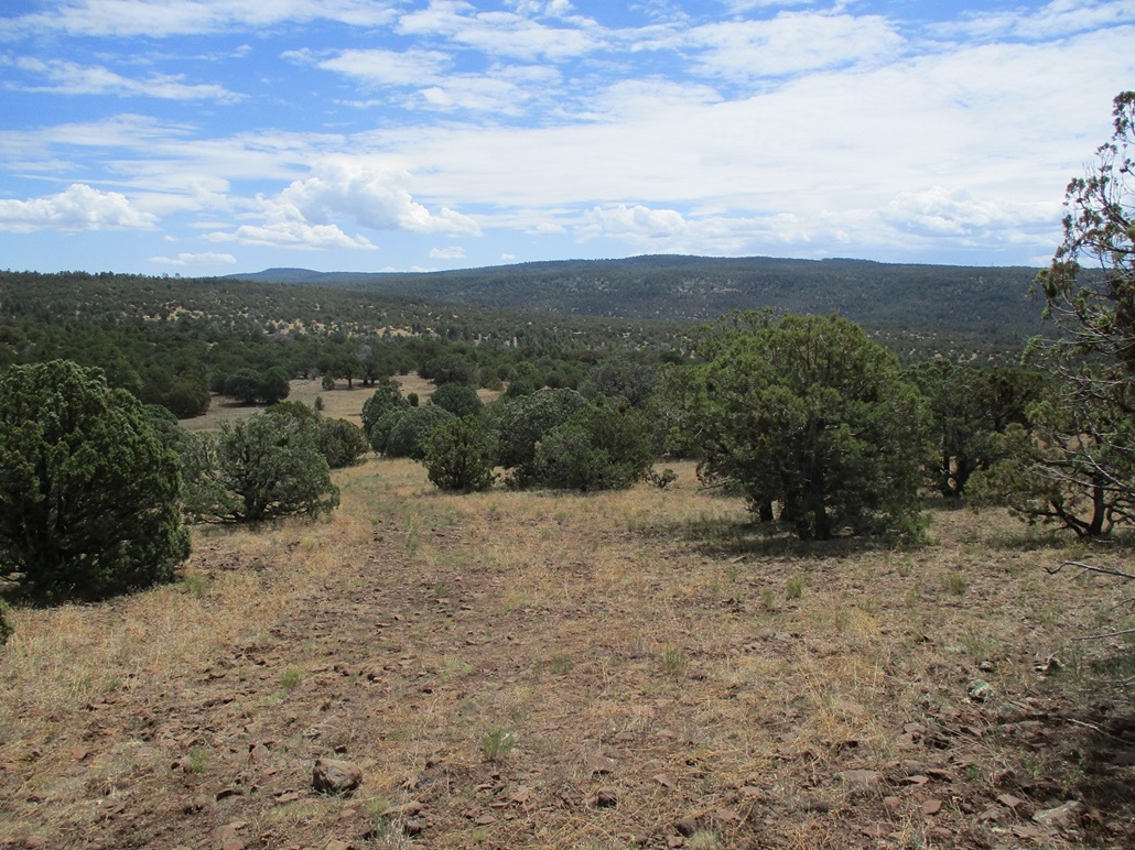
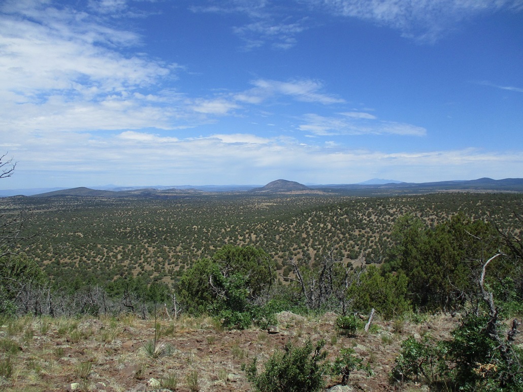
We spent about twenty minutes up top. There was a great view north of Apache Maid Peak and then Humphreys Peak on the distant horizon. The sky was blue, with passing puffy clouds, but nothing organized. To the east, where we had come from, a small thunderhead was developing. We heard one boom of thunder, but that was it. A half-hour later, that thunderhead seemed to fall apart. My knee did well. This was my first long hike since Chubb Mountain in February, and it was achy and a little tight, but not in pain, I had full movement, it felt strong, and I was pleased because whatever I did to it has been going on now for 6 months.
For the hike down, we descended on a northeast bearing, and then followed a different track dowhill, one that does not show on the Forest Service maps. We did not know where it went, but as long as it went generally east, that was fine by us. The track bent more south than east, and we eventually left it and started more cross-country trekking through thicker forest, more bigger trees. The grade goes downhill for awhile, comes to the creekbed of Upper Tank Draw, a little steeper here, then up the other side, another gentle uphill grade. We came out to Upper Tank mentioned earlier, back onto the road we had walked in on.
The hike out was tiring, but not difficult. It was rather hot by now, mid 80s, and humid. We had to regain those 500 feet, and that went slowly and tediously. But were were back to Matthias' vehicle at roughly 2 p.m.. I thought it was much later. It felt like it was much later. The egress hike was slightly shorter because we were on a more direct bearing, and the round trip covered 9.8 miles. Where we had parked was less than a hundred feet lower in elevation than Horse Knoll, but we had to drop and regain on the way in and the way out, putting our gross gain at over 1,200 feet, a good workout.
I was bushed. I had not hiked anything of any length since Chubb Mountain. My knee was sore but otherwise in fine shape. We got changed and packed and started the drive out, slowly bumping over the rocks back toward the campers and eventually onto Lake Mary Road. In Clint's Well, we stopped briefly because I wanted a coke and some chips. Clint's Well is not a town, it's just a gas station and minimart (and a tiny post office) at the junction of AZ-87 and Lake Mary Road. It sees a lot of pass-through traffic and there were scores of people and RVs. Today, it was very busy, with food trucks, lots of cars and people. There must have been over a hundred people in the area. Every other time I have ever stopped in (about 10 times total), it's usually just me, the cashier, and maybe one other person. Today was the first day of the three-day Independence Day holiday weekend, which probably explains the crowds.
The drive back to Fountain Hills went well, nothing to report on. The bands Matthias had on were all prog bands from the 1970s-1980s, from England, France and Germany, and as usual, bands I had never heard of before. It was good stuff, though.
As for those other peaks we wanted, we have to do more homework to find out how to access them. A western approach seems likeliest. Anything from Lake Mary Road likely has roads no better than the one we were on.
A few months later, we came back to hike up Big and Oak Hills, following roads in from the west out of Camp Verde.
|

|