The Mountains of Arizona
www.surgent.net |
|
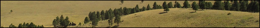
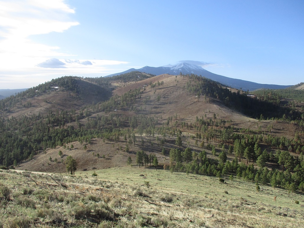
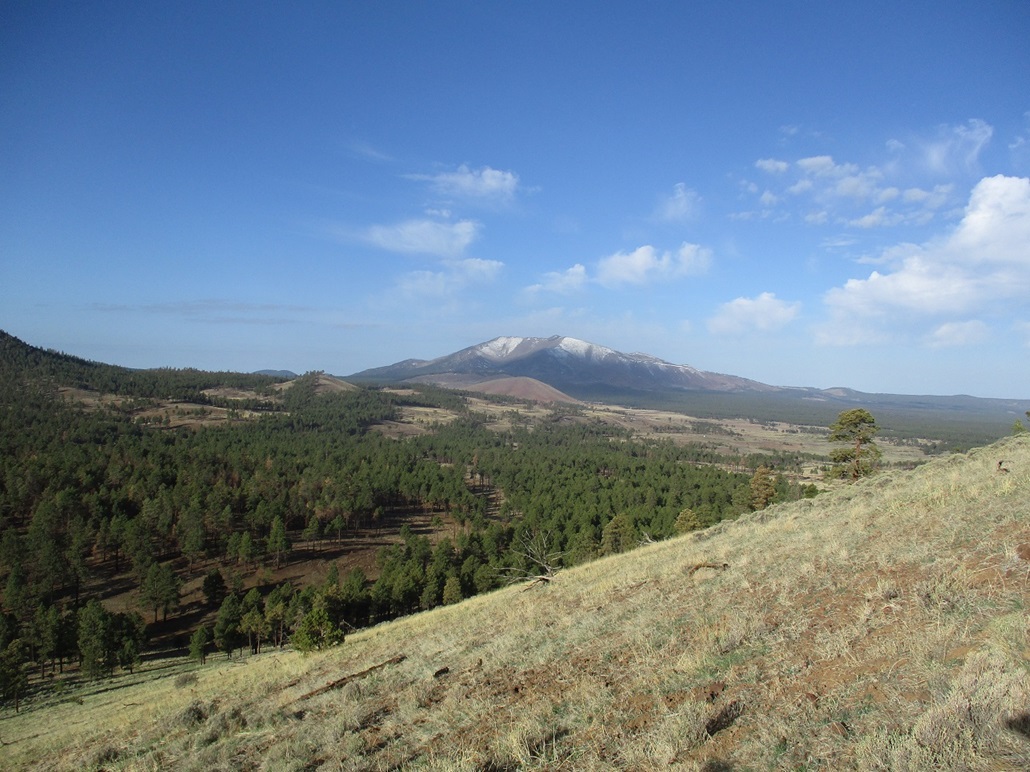
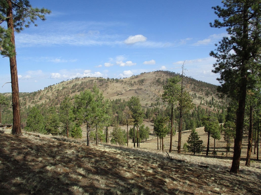
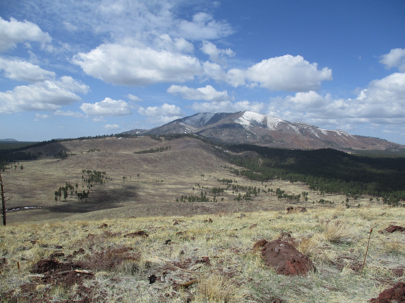
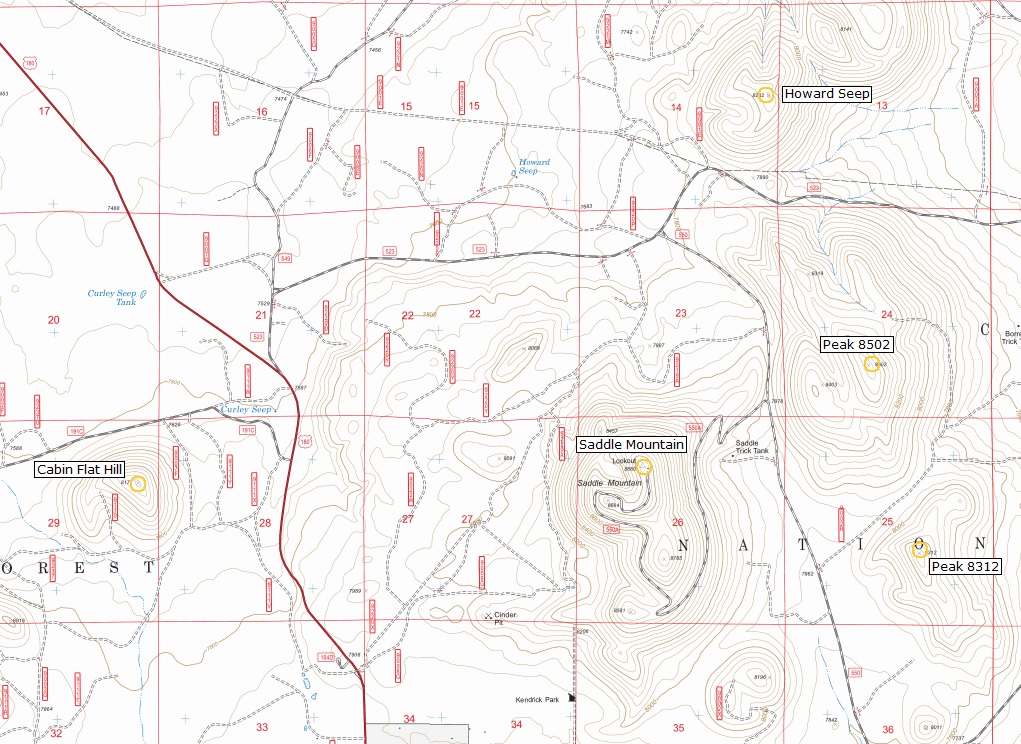
Howard Seep BM • Peak 8502 I had a day open for reasons I won't go into, so I got up very early and drove to the hills northwest of Flagstaff to hike four peaks, all surrounding Saddle Mountain, which I hiked in 2010. Three of the peaks --- Howard Seep Benchmak, Peaks 8502 and Peak 8312 --- lie on a line to the east of Saddle Mountain, while Cabin Flat Hill lies west of Saddle Mountain. None of the hikes looked long, and two of them had roads to follow. I was able to hike all four in about four hours total, including driving times between the peaks and other times when I was lollygagging. Each of the peaks offered tremendous views of the surrounding bigger summits such as Humphreys Peak and Kendrick Peak. The weather was a mix of clouds and blue skies, with a steady breeze throughout the morning. The hikes were short, but typical of these volcanic humps, would be steep and often with loose pumice and cinder slopes. I wouldn't be hiking very far today, but I'd be gaining almost 2,000 vertical feet over the course of the day.
Date: April 13, 2021
• Elevation: 8,282 feet
• Prominence: 422 feet
• Distance: 1 mile
• Time: 45 minutes
• Gain: 412 feet
• Conditions: Cool with a breeze, banks of clouds
Arizona
•
Main
•
PB
•
LoJ
•
Interactive map
I wanted an early start, so I left Payson at 4:15 a.m. and headed up the highways toward Flagstaff, traffic being very light. I had some excitement on Lake Mary Road, skidding to a stop when I saw a couple large elk in the road. I've driven this road a few times in the pre-dawn and there are always lots of elk and deer wandering about, so I was expecting them. I was driving slowly, about 50 m.p.h., but even then, I had to slam the brakes to keep from hitting these two. I saw two more group of elk afterwards. This all kept my adrenaline levels high and helped me stay alert as I drove into Flagstaff.
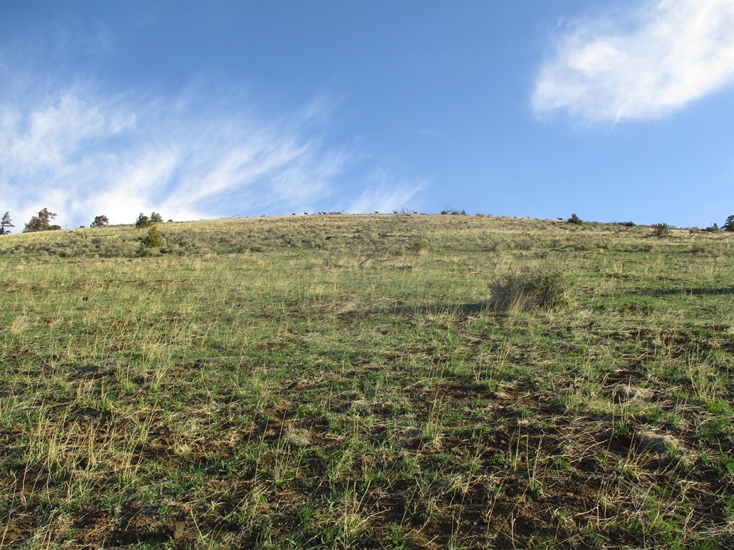
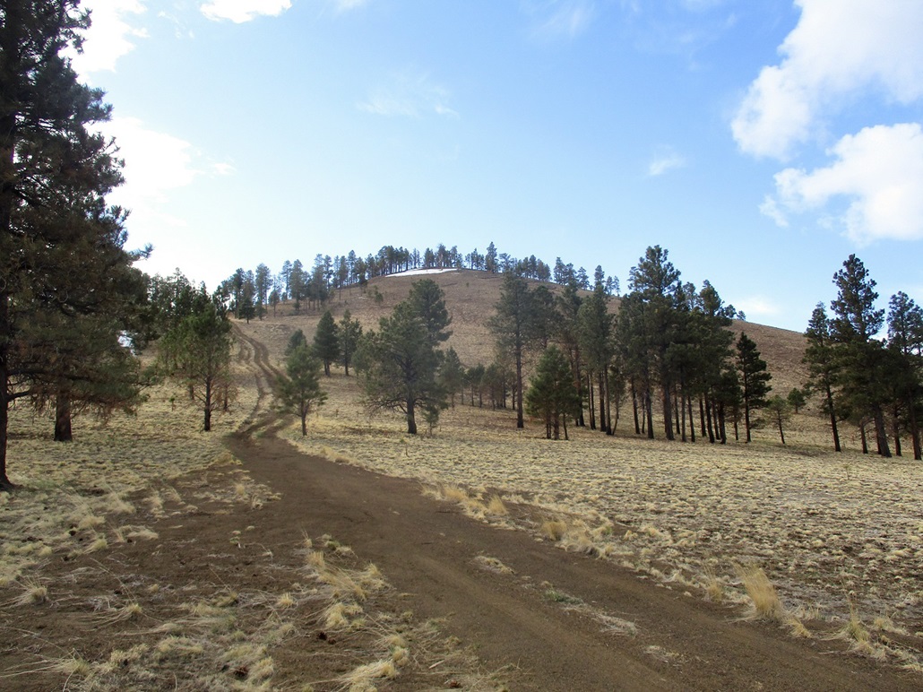
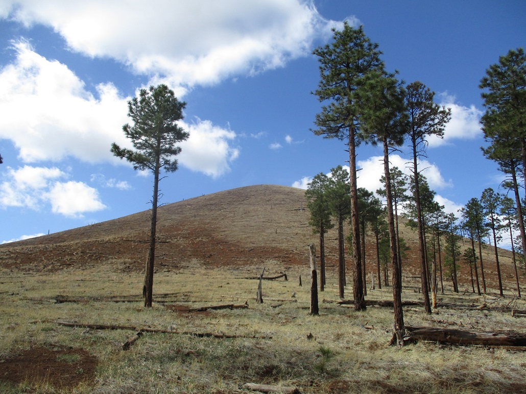
I stopped for snacks and drinks and proceeded northbound on US-180 past the ski areas, going about 25 miles to Forest Road 523, a little past a flat meadow called Kendrick Park. This whole area was hit hard by a big fire in 1996, and sections of dead trees, burned husks and downed logs still remain. I followed FR-523 eastbound about 4 miles, placing myself back into the trees that survived the fire. The road bends left toward Howard Seep Hill, then straightens again. I found a small pullout south of the peak and parked. It was 7:35 a.m. and cool, 39 degrees going by my car's thermometer. There was a bank of clouds hugging Humphreys Peak and surrounding hills. I had mostly sun above me but at times the clouds would move through, blocking the sun. The breeze was steady, about 10-20 miles per hour.
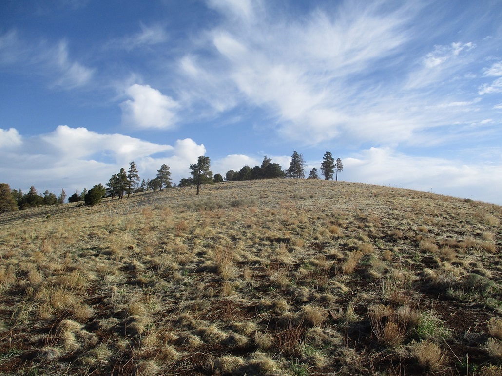
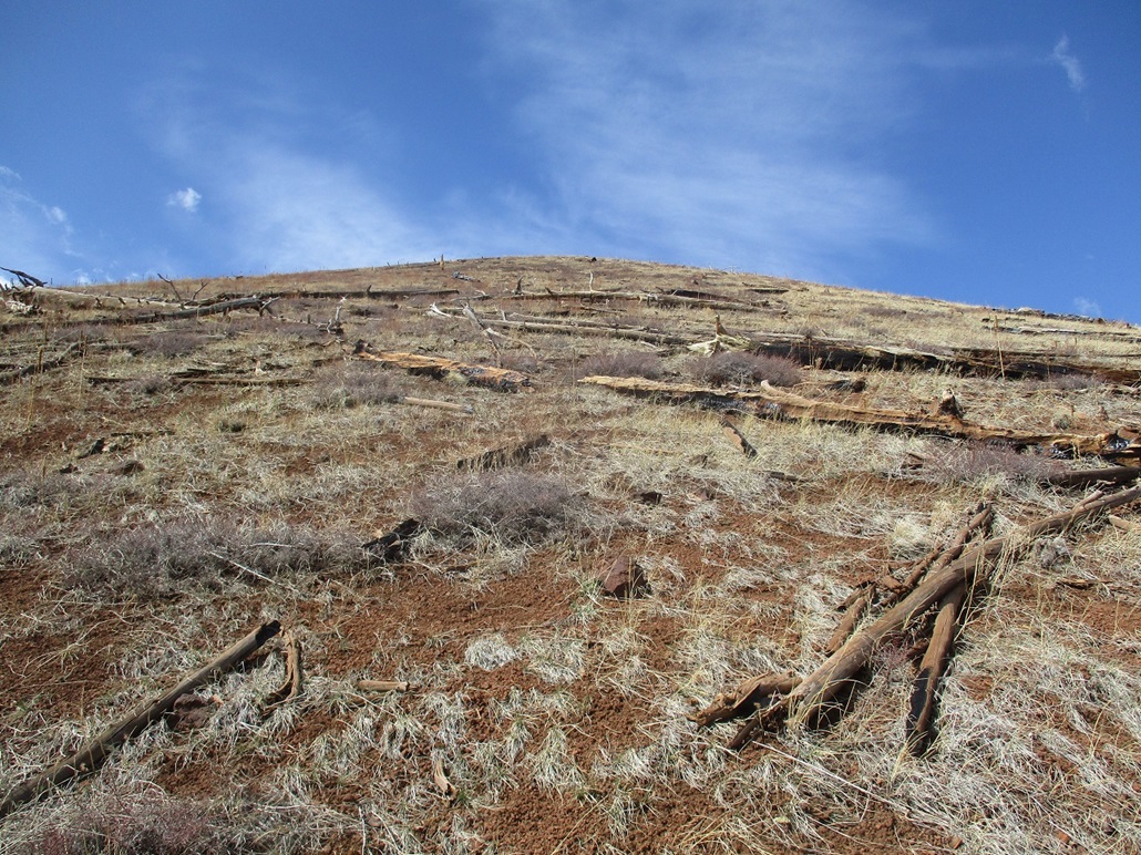
I walked through light forest until I was at the base of the bare south slope, then just started walking upward. Unlike last week's hikes over in the Cinder Hills, where the slopes were covered in pea-sized pellets that don't hold together well at all, the slopes here were composed of larger pumice stones that did "moosh" together reasonably well. The slopes were also covered in a low grass that also helped solidify the tread. I squeezed through a fenceline lower down, then continued straight uphill.
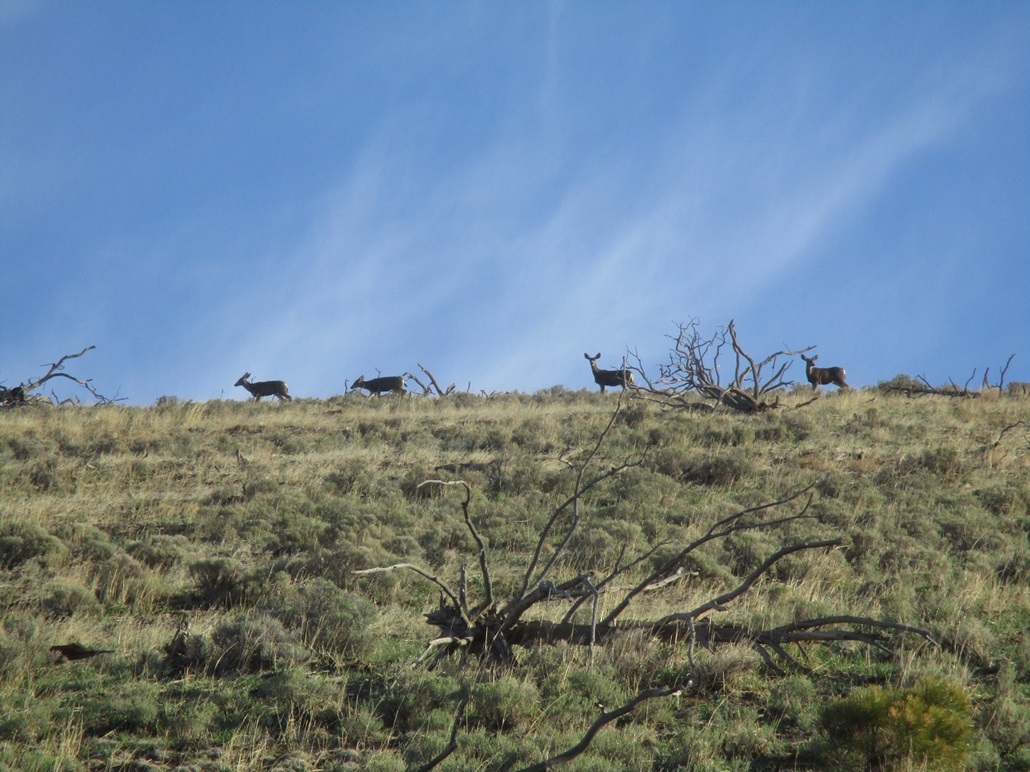
On the skyline I was treated to a sight of a large herd of deer, many stopping to look down at me. I was able to get a couple images of them, the photos coming out better than I was expecting. They slowly moved across, in no real hurry. They'd stop and look at me, then continue on their way. By the time I reached this ridge, they were long gone.
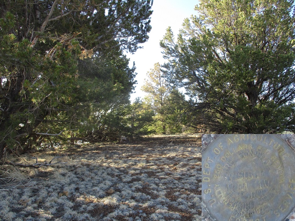
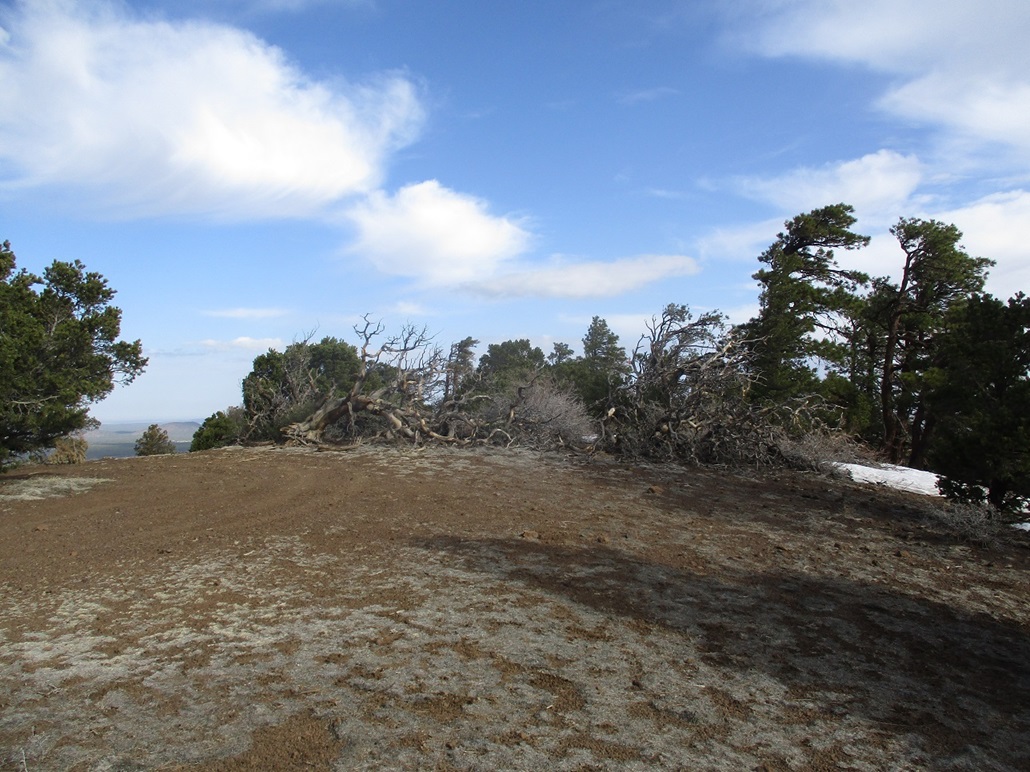
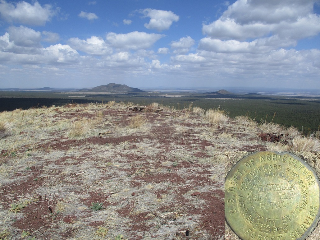
The summit was just a little farther on once I had reached the ridge. The slopes here were gentle and I made good time, arriving onto the flattish summit about 20 minutes after leaving my car. The top has a few good-sized trees, and the "Howard Seep" benchmark was cemented into a rock nearby one of the big trees. Up here, the breeze was steady and cooling, so I did not take a formal break. Instead, I wandered around the area looking for good vantages to take photos, then started down, retracing my steps almost exactly, including crossing the fence at the same place. I was back to my car quickly, the round trip taking about 45 minutes, covering a mile.
The views were fantastic. My next objective, Peak 8502, was just a mile to the south. In fact, its north slopes were mere feet from where I was parked. However, I opted to drive a little to place myself a little closer to the peak, plus another one I was planning to hike as well. I followed FR-523 briefly westbound to FR-550, then south on FR-550 about two miles past a saddle and down into a broad meadow, catching FR-9002 (marked on the map, not in the field). I found a spot in the trees roughly centered between Peak 8502 and its southerly neighbor, Peak 8312.
Elevation: 8,502 feet
• Prominence: 502 feet
• Distance: 1.4 miles
• Time: 1 hour
• Gain: 562 feet
• Conditions: Brisk wind, slightly warmer
PB
•
LoJ
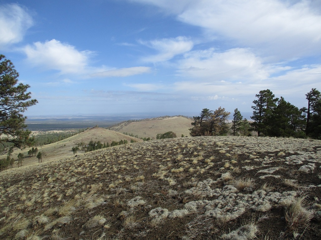
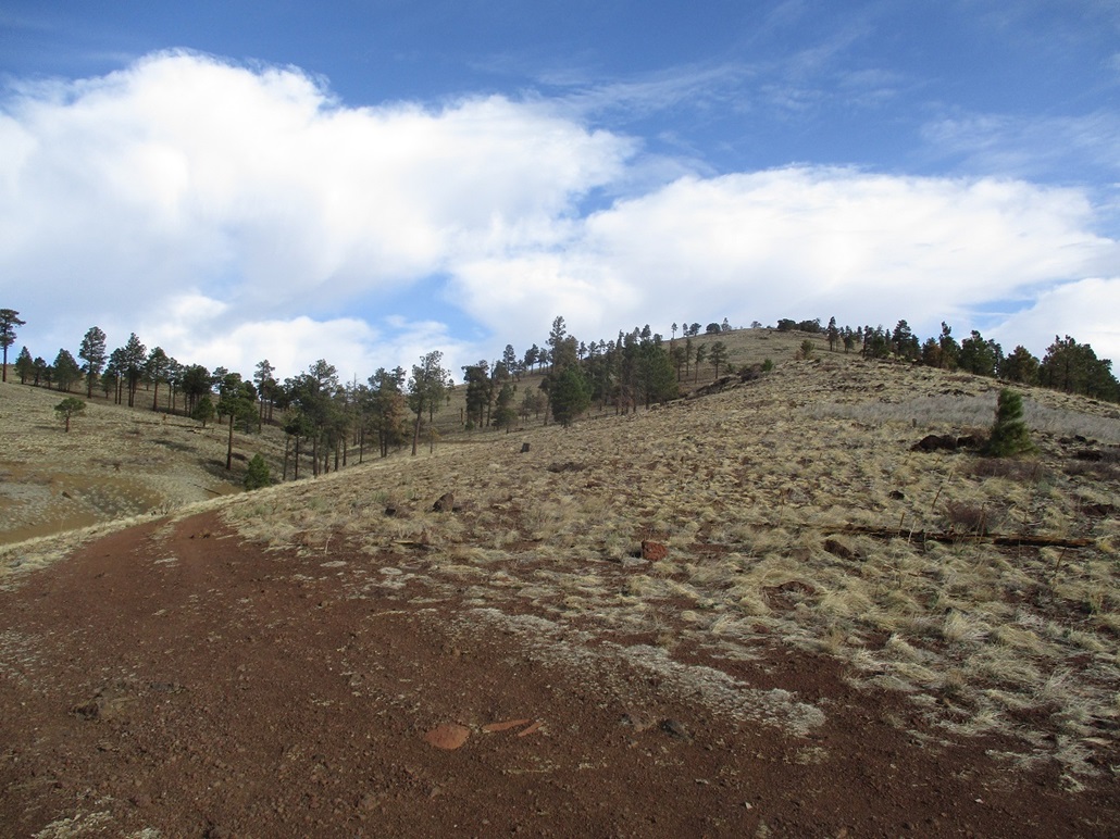
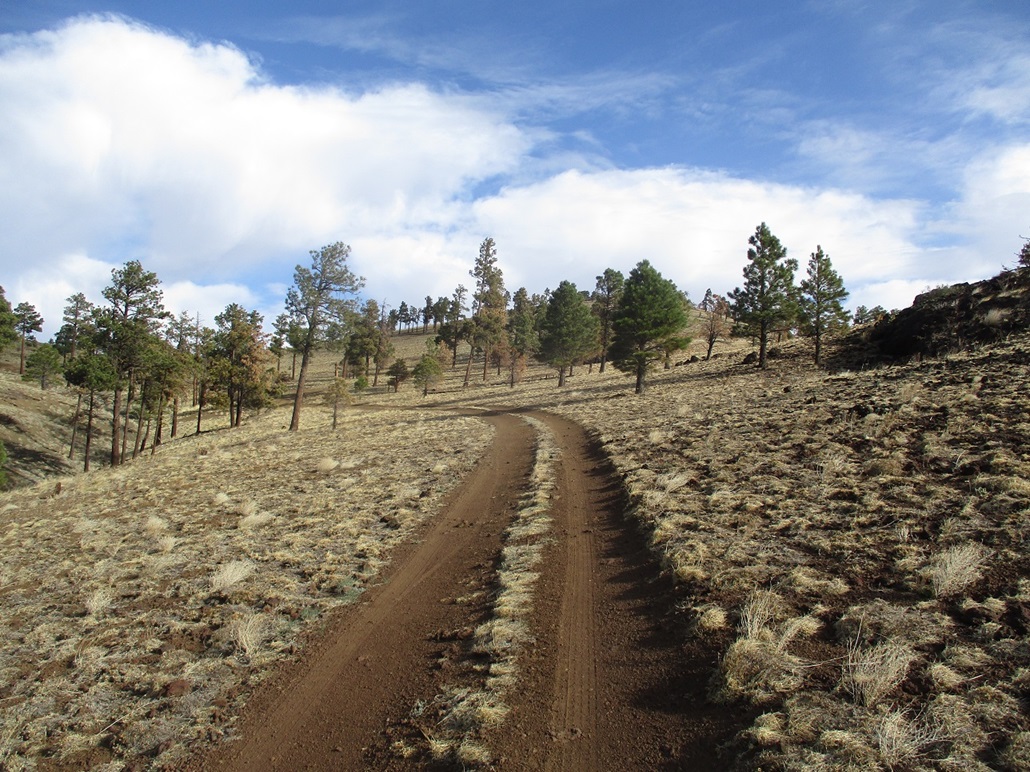
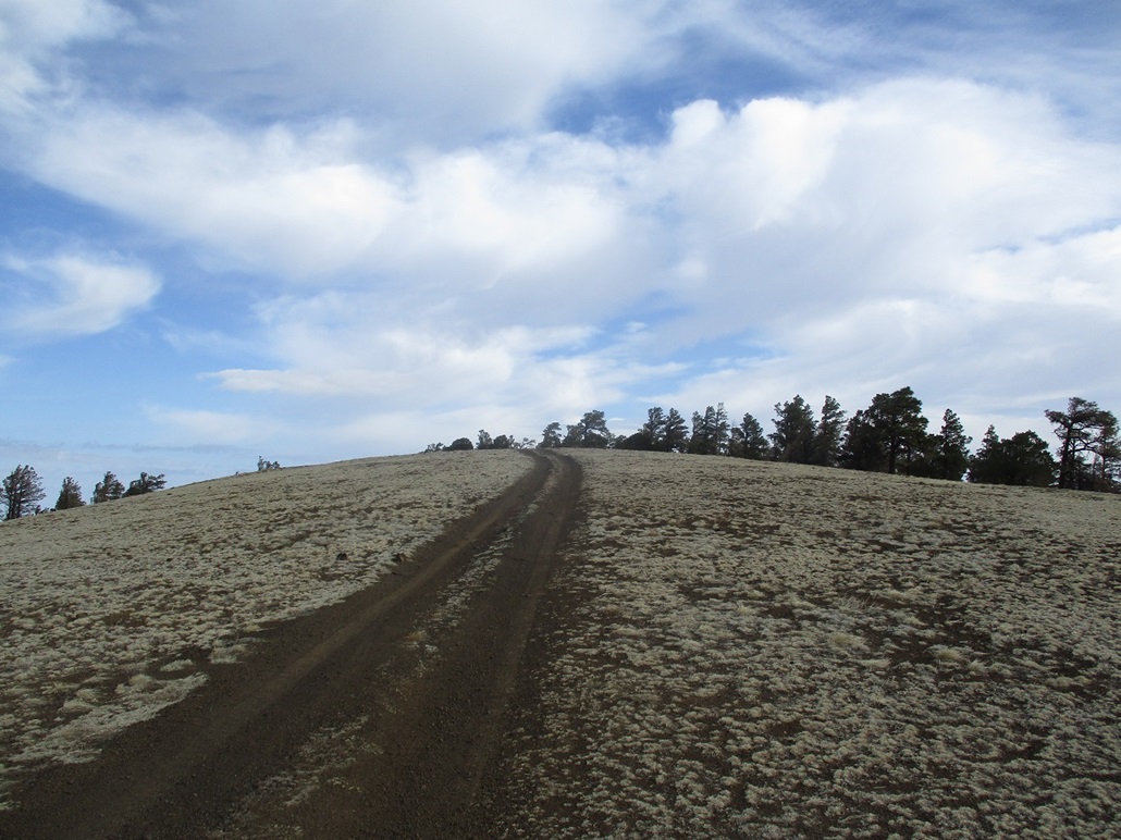
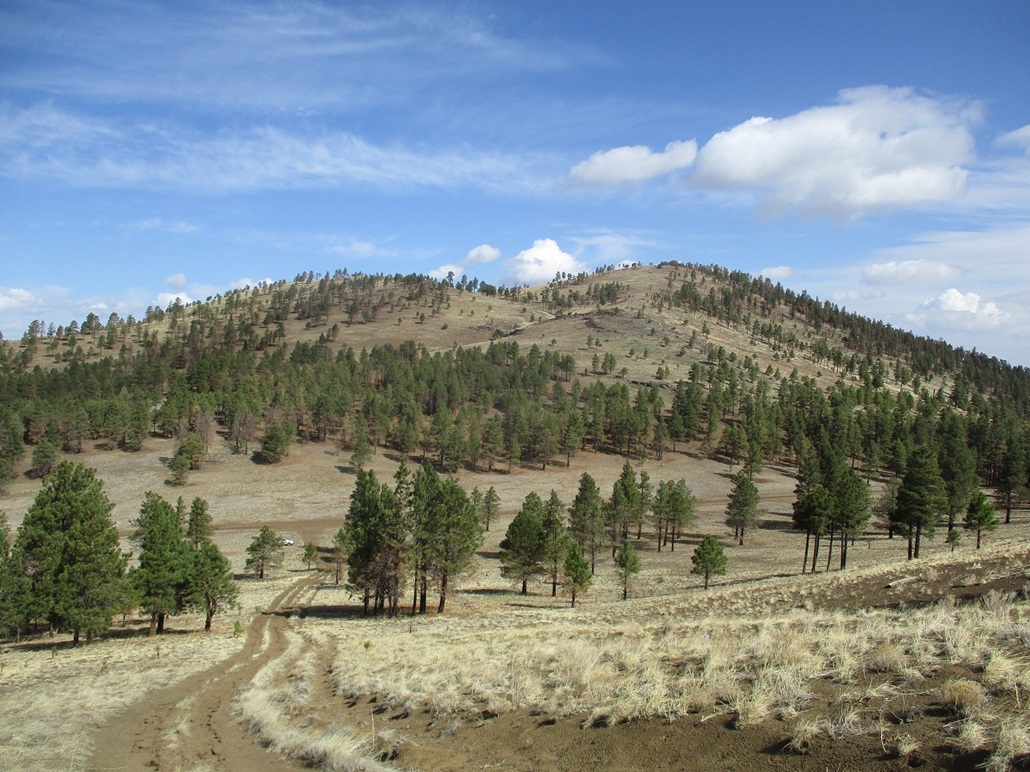
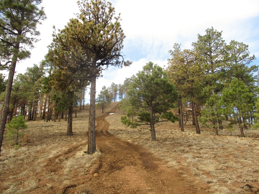
Forest Road 9002 was in better shape than I was expecting, and I was able to drive to the saddle connecting Peaks 8502 and 8312, parking in a small patch of forest, slightly east of the saddle's apex. I started hiking almost immediately, hiking uphill and trending right (east) back into the open. I could see the jeep track up ahead and I was soon on it. The track gets steep and the tread here was loose and rubbly, but I was soon on a ridge and above the steepest portion.
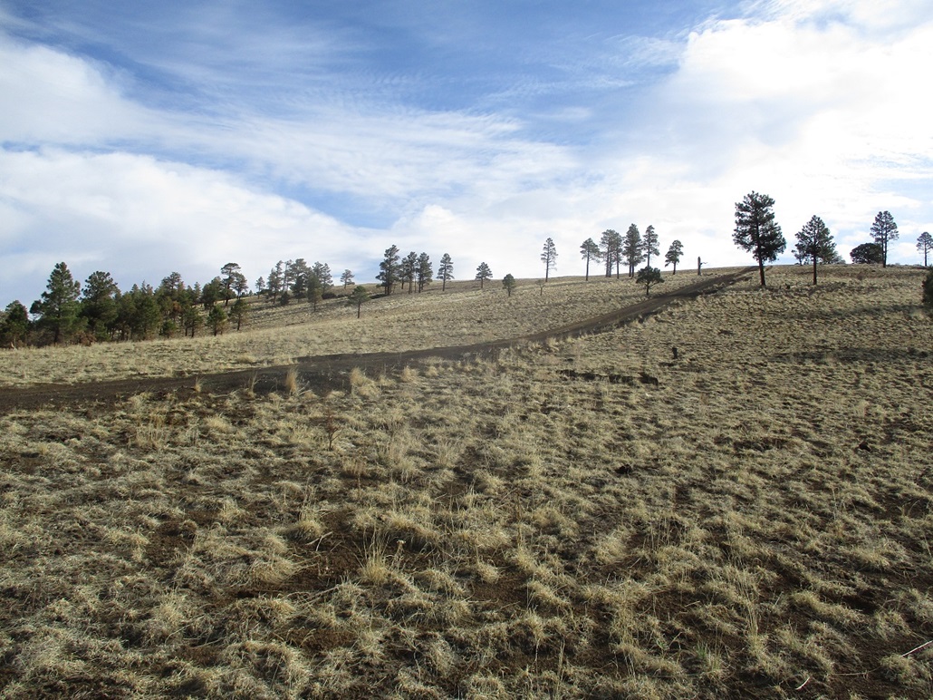
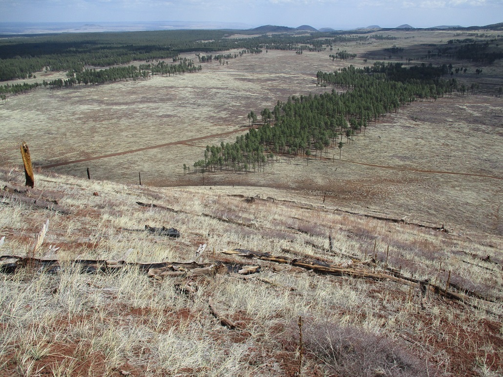
This track then curves north, then makes a hard-right up one more slope to attain the highest summit ridge. The highest points were up ahead, the road leading directly to the summit area. The hike itself was delightful, the road being in generally good shape and the trees not too thick, with great views the whole way up.
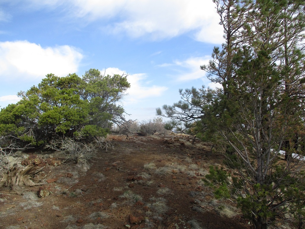
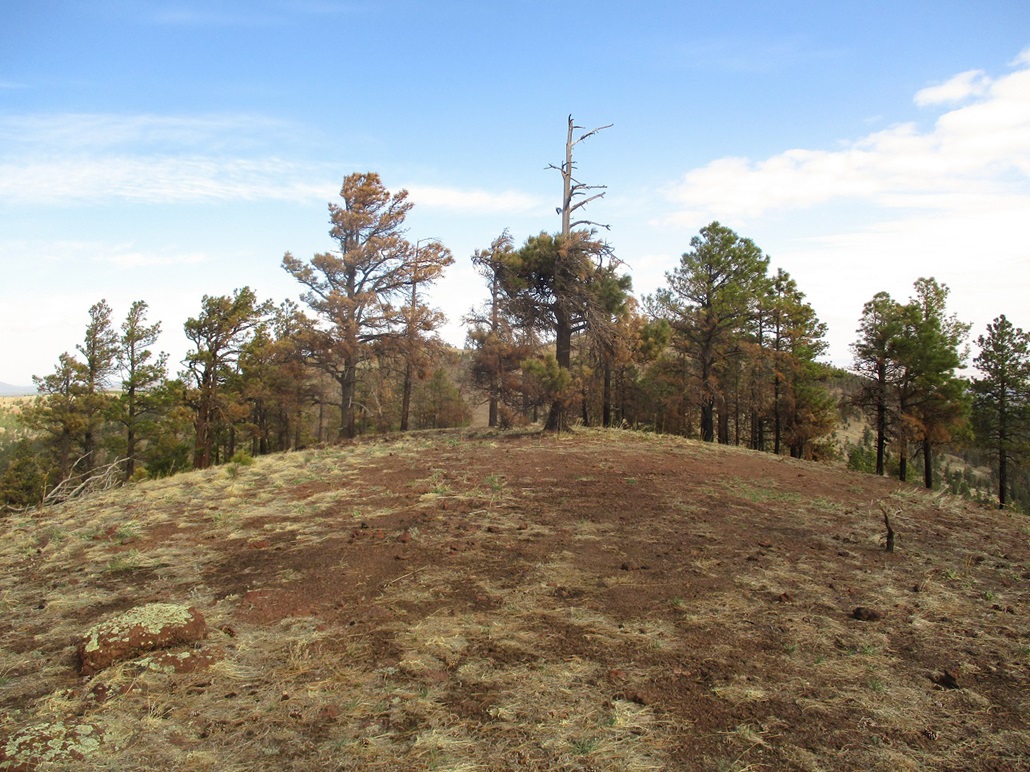
There are a couple bumps on the ridge that could be the highest point, so I tagged them. One area features a jumble of old logs and branches that looked like they've been moved to form a windbreak. The other area, and the likeliest highpoint, is about a hundred-foot walk north. The top here is rocky agglutinate, in parts forming small cliffs about 15 feet tall. I kicked and tagged any rock that looked highest.
I wanted to hike a little more north for better photos, so I descended down the rocks, the only time of the day that I needed my hands and butt to scoot down the rocks. It was easy, trivial scrambling. The agglutinate is very sharp, so I was careful not to get cuts or add tears to my shorts. I walked north a little more to snap photos of Howard Seep, then walked back and up those rocks, then hiked back to my car. The round trip took about an hour and covered 1.4 miles round trip.
Next up was Peak 8312, immediately to the south. Back at my car, I drove down FR-9002 just a couple hundred feet to place me at the start of the jeep track that goes to its summit.
Elevation: 8,312 feet
• Prominence: 372 feet
• Distance: 0.8 mile
• Time: 33 minutes
• Gain: 382 feet
• Conditions: Clouds and a breeze
PB
•
LoJ
I was already dressed and ready to go, so I started up the jeep track to a saddle, then a right turn (west) up steeply to the top. There was no mystery to this hike, no false summits or hidden ridges. I was up top in about 15 minutes.
The top is open and rounded. A line of low agglutinate rocks form the highpoint, one being the obvious highest, jutting above the ground about three feet. I stood atop it, then inspected the area. I snapped a few images. but unfortunately, right about now, the clouds had rolled in and muted the colors. The breeze was steady and the temperatures were still cool, low 50s by now. It was chilly and this was not the most amazing summit, so I got moving downward without much delay.
Going down, I avoided the track and went cross-country down the open grass slopes and the light forest. The footing was solid and I was able to descend almost all the way down to my car, only following the track the last few dozen feet. The sun had come out again and I stopped to take photos of the surrounding hills. The round trip hike covered about 0.8 mile and took me exactly 33 minutes. It looked easy and it was.
Elevation: 8,171 feet
• Prominence: 421 feet
• Distance: 0.8 mile
• Time: 40 minutes
• Gain: 531 feet
• Conditions: Sunnier and warmer but still breezy
LoJ
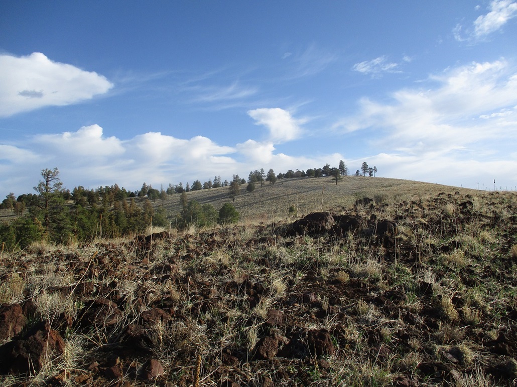
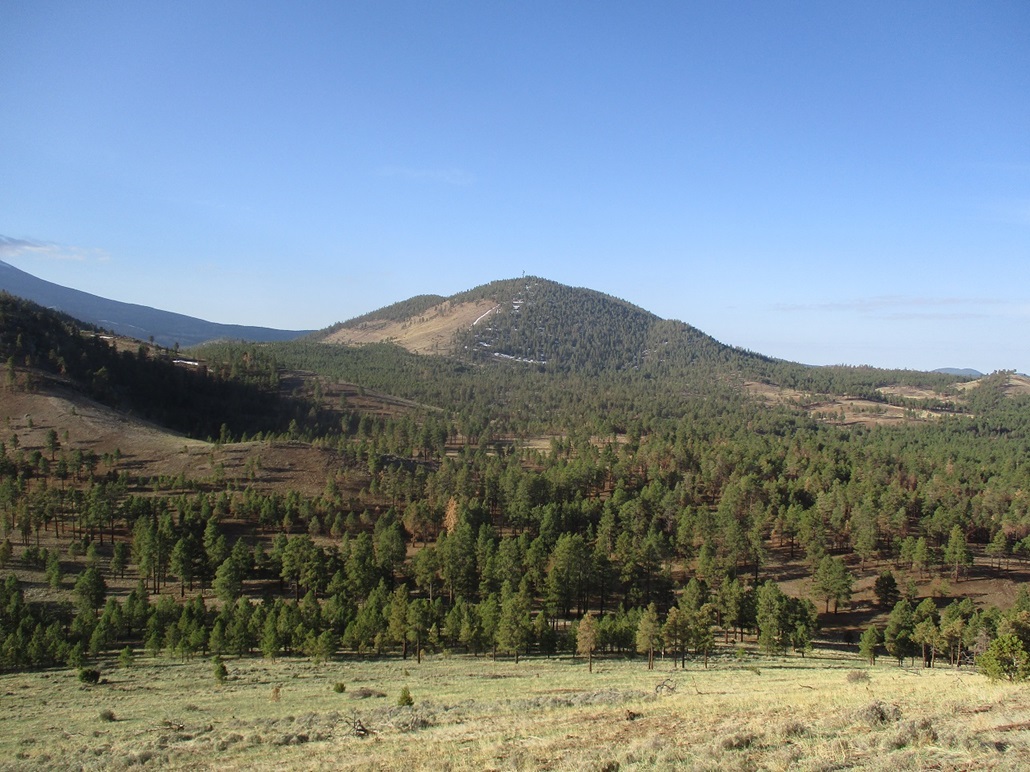
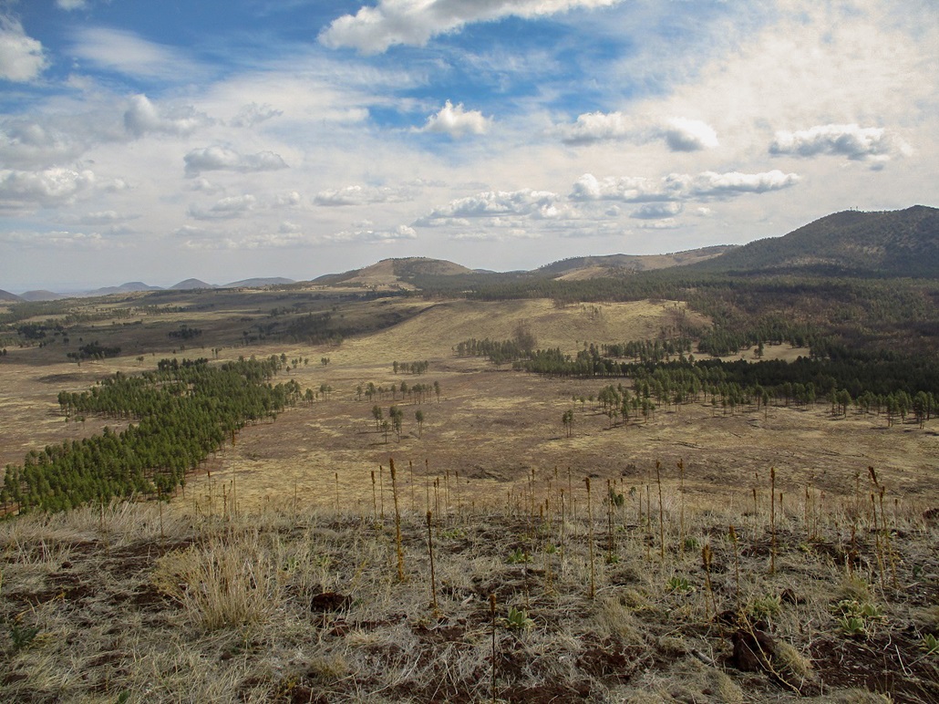
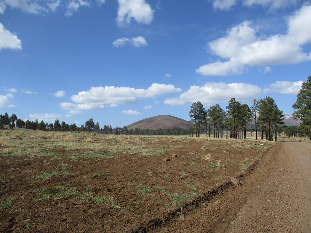
I drove back onto FR-523 and parked, just to get my stuff in order. Cabin Flat Hill copuld be seen from here, a bare hump of rock and grass, contrasting against the backdrop of the bigger Kendrick Peak rising behind it. I drove out to the highway, then found FR-191C and followed that about a half-mile to a lesser road going south, at the east base of the hill. I parked in the trees in a small clearing.
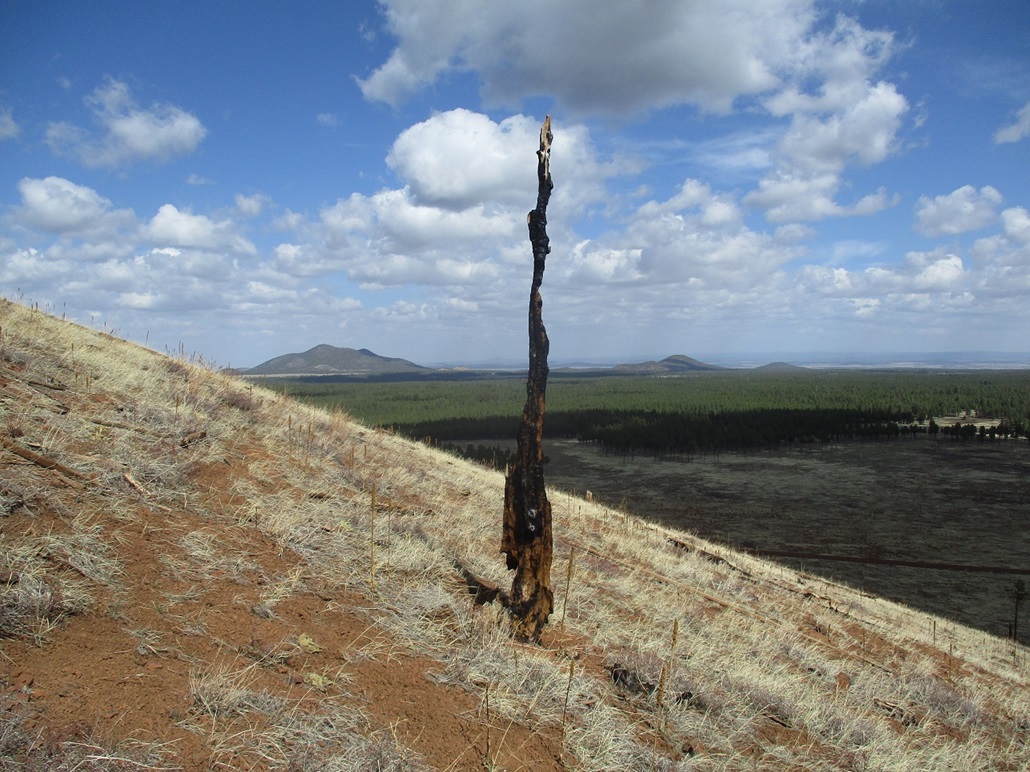
This hill evidently was covered, all or in part, by trees before the 1996 fire obliterated the area. The hill is completely bare of any living thing higher than my ankle, and looking down, a couple areas of meadow also look to be the work of the fire too. The trees I parked in evidently surviced the fire.
I walked uphill from my car, immediately on the east slopes of the hill. There are a few standing burned "sticks", and a number of downed trees. These days, just patchy grass covers the slopes. The uphill grind was easy but tiring, the biggest challenge doging the logs by stepping over them or finding ways around them. It was warm enough now to possibly bring out the snakes, but I saw none. I had more sun here, but still that steady breeze that never let up all morning.
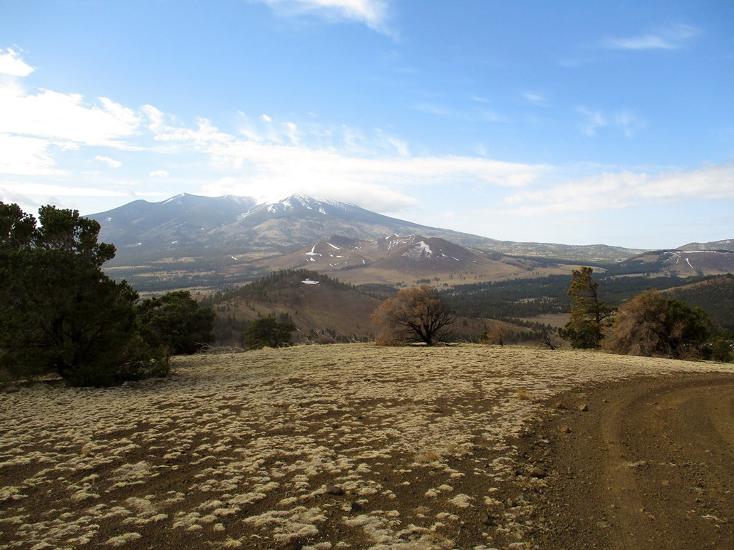
I was on top after about 20 minutes. The top was bare and unexciting, although the views were excellent. The big peaks, Humphreys and Kendick, dominate the views. Looking north, the forest and the hills in the far distance slowly gave way to mesas and plateaus, this being the edge of the Navajo Nation, plus (I think) part of the big Hashknife Ranch property. I was also surprised to find a benchmark up here, stamped "Curley Seep". Given that I had just hiked nearby Howard Seep, I wondered if there may be a Three Stooges connection here, or if it's just happenstance. Yes, I did look on the map to see if there were any Moe or Larry Seeps. I am not sure why this hill is not called Curley Seep, but the Cabin Flat name is evidently official.
For the hike down, I just retraced my general route. The footing was actually fairly good, not at all slippy or slidey. Nevertheless, I went slow and methodical, and was back to my car after another twenty minutes, a 40-minute round trip covering just under a mile.
The peak itself was nothing special, but I am glad I hiked it. The views up top were worth the effort and I doubt I'd be driving all the way back just for this hill. It was a peak of opportunity.
The time was just 10:40, almost exactly four hours after I started my first hike. I had climbed all four peaks in four hours and was surprised, given how old and slow I am. I put in about 4 miles total, but almost 2,000 feet of gain, and gave my calves and glutes another intensive workout.
Finishing early also allowed me to get home at a reasonable time. The drive back was fast and efficient, there being almost no cars on a Tuesday on Lake Mary Road or highway 87. I was home by 1 p.m. and was able to make like I was doing real work the rest of the day. These four peaks were worth the effort collectively. As singular destinations, they're probably not worth the hassle. If planning to hike Saddle Mountain, then any of these four surrounding hills make for a good second or third peak for the day. There is some excellent camping around the area, the fire damage notwithstanding. It is easy to find spots to pull off and camp within the trees. |


|