The Mountains of Arizona
www.surgent.net |
|
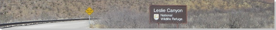
Leslie Benchmark • Peak 5508 The Leslie Canyon National Wildlife Refuge is a small (about 4 square miles) tract of land at the south end of the Swisshelm Mountains, where they merge in with the Pedregosa Mountains, all of this about 20 miles north of Douglas. I was here in January of last year, climbing a couple peaks in or alongside the refuge. I returned today, somewhat impromptu, to climb two more peaks, along a common ridge on the southwest aspect of the refuge. Earlier today, I had scratched myself up climbing Ajax Hill over in Tombstone. That took less than an hour, and the day was still young, not yet noon. From Tombstone, I drove Davis Road eastbound, which connects to US-191 in the community of McNeal. Davis Road continues another 9 miles and connects to Leslie Canyon Road. I followed that another couple miles up to Leslie Pass, where the road tops out before descending into theactual Leslie Canyon. This is some remote country out this way. It is on the way to nowhere except for a few ranch properties, and some of the Chiricahua Mountains. When I was here last year, I recall seeing no one and there being virtually no traffic on the road itself, perhaps a car an hour. I had not really itended to be here today, but because the day was so nice, and still just late morning, I pulled this hike out of my back pocket as my second hike of the day. I had been aware of it since my first visit — I had intended to climb these peaks on that visit as well — but had not worked up the momentum to actually come here. Today would be a perfect chance to come back.
Date: March 2, 2025
• Elevation: 5,384 feet
• Prominence: 328 feet
• Distance: 5.2 miles
• Time: 3 hours
• Gain: 1,250 feet (gross)
• Conditions: Sunny and pleasant, a steady breeze
Arizona
•
Main
•
PB
•
USGS BM Datasheet
There is no parking at the pass except for a tiny clearing that fits one car, and not very well. I backed in and angled myself so that I was off the main road. It was nearing noon when I stopped the engine. I was already dressed from my earlier hike, so I was on the move within minutes.
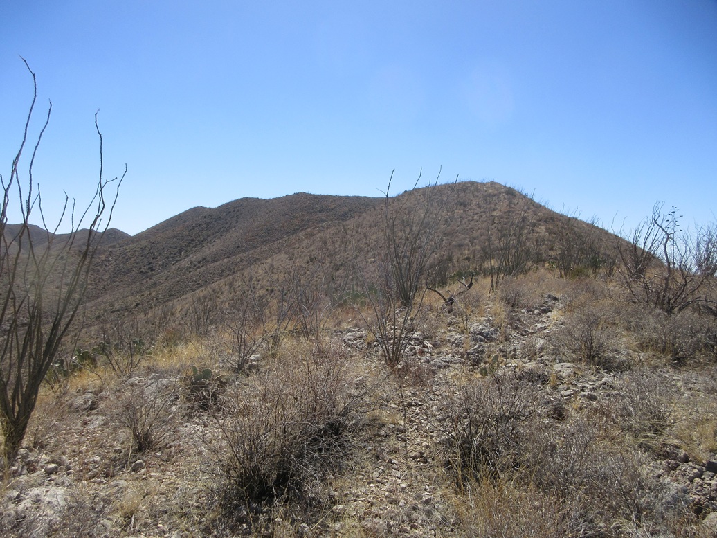
The hike would be along the high ridge of the mountain that hems in Leslie Canyon on its southwest. The first summit has "Leslie" benchmark, while Peak 5508 rises about another mile or so to the southeast (the ridge runs along a northwest-southeast axis).
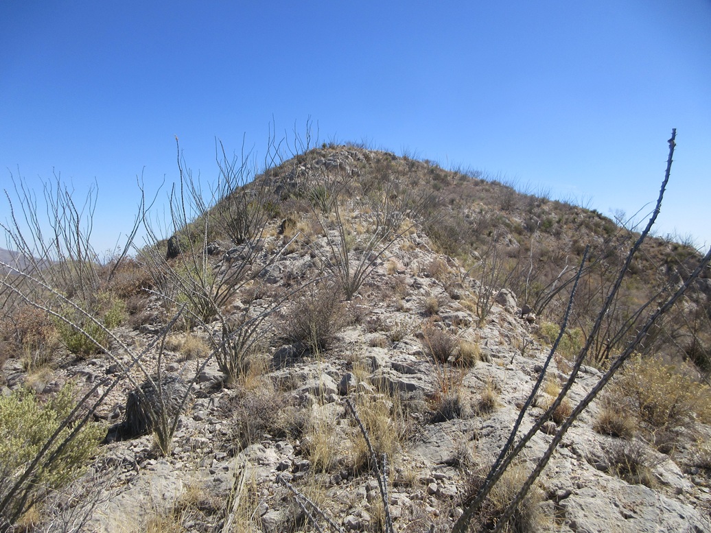
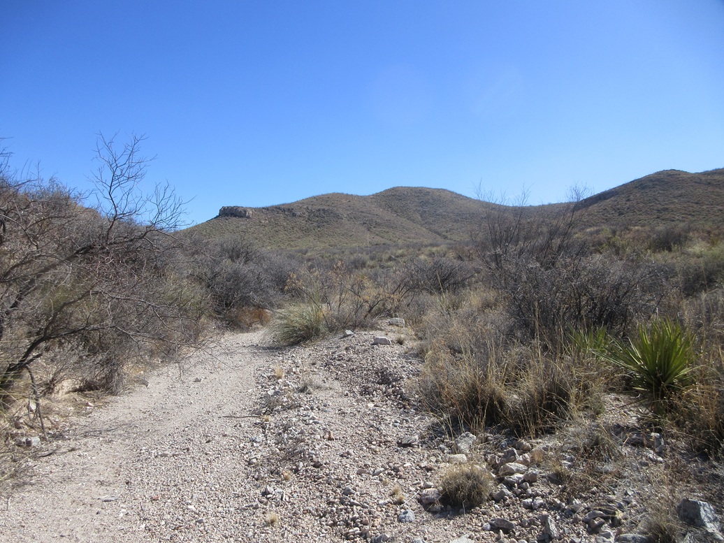
I started up the limestone slopes, the brush heavy but not too bad. I could usually follow lanes, and the slopes were pitched steeply but not severely. The limestone, as usual, was great when it was all in one piece, and loose when it was in rubble form.
I soon came to a fence, the boundary of the refuge. I squeezed under, and continued on my way. I generally stayed on the topmost ridge itself, but this was not always smart as the rocks would pile up and get cliffy in places. I scampered up and down a few nubbins, then up a steep slope and onto a higher ridge, this being the Leslie Benchmark ridge.
I found the benchmark, in a rock flush to the ground. This little ridge has a couple bumps and even the datasheet mentions higher land nearby. I stepped on each bump as it was on my way anyway. I snapped a couple images. So far, so good. I hadn't yet walked a mile.
Elevation: 5,508 feet
• Prominence: 328 feet
PB
•
LoJ
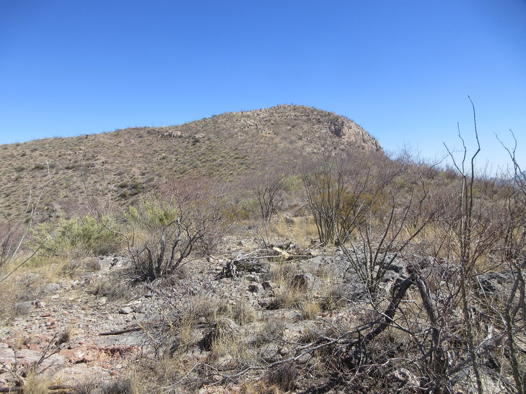
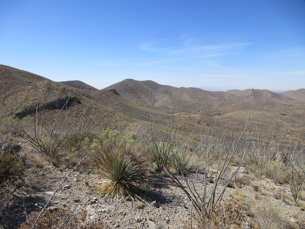
On this higher ridge, I could see Peak 5508 off in the distance about a mile, but with a number of peaklets on the ridge, meaning I'd be going up and down and up and down repeatedly. So I got busy walking.
The actual hiking was never more than Class 1 trudging, the main challenge being the slopes which could be steep and/or loose, and the brush, which sometimes closed in. Ocotillo grow heavy on the ridge and usually were the most troublesome. Along the way, I crossed a fence again. Looking at the map, the first fence I crossed earlier put me outside of the refuge, and this second fence put me back inside it.
After another hour, I was closing in on Peak 5508. I dropped to the last high saddle below it and walked up a slope to catch a higher ridge, which bent south and led right to the summit. This last ridge was narrow but safe, more exposed limestone and one of few times I needed my hands to ease through some of the rock.
Finally, after an hour since leaving the Benchmark peak, I was on top of Peak 5508. This is a rarely-visited peak. I know of just three people who have been here: Amy, Mark and Bob. There were no cairns or registers, nothing here to indicate someone's been here before. It had taken me an hour and 45 minutes to get here, coving a little over two miles. It felt longer, and I was tired.
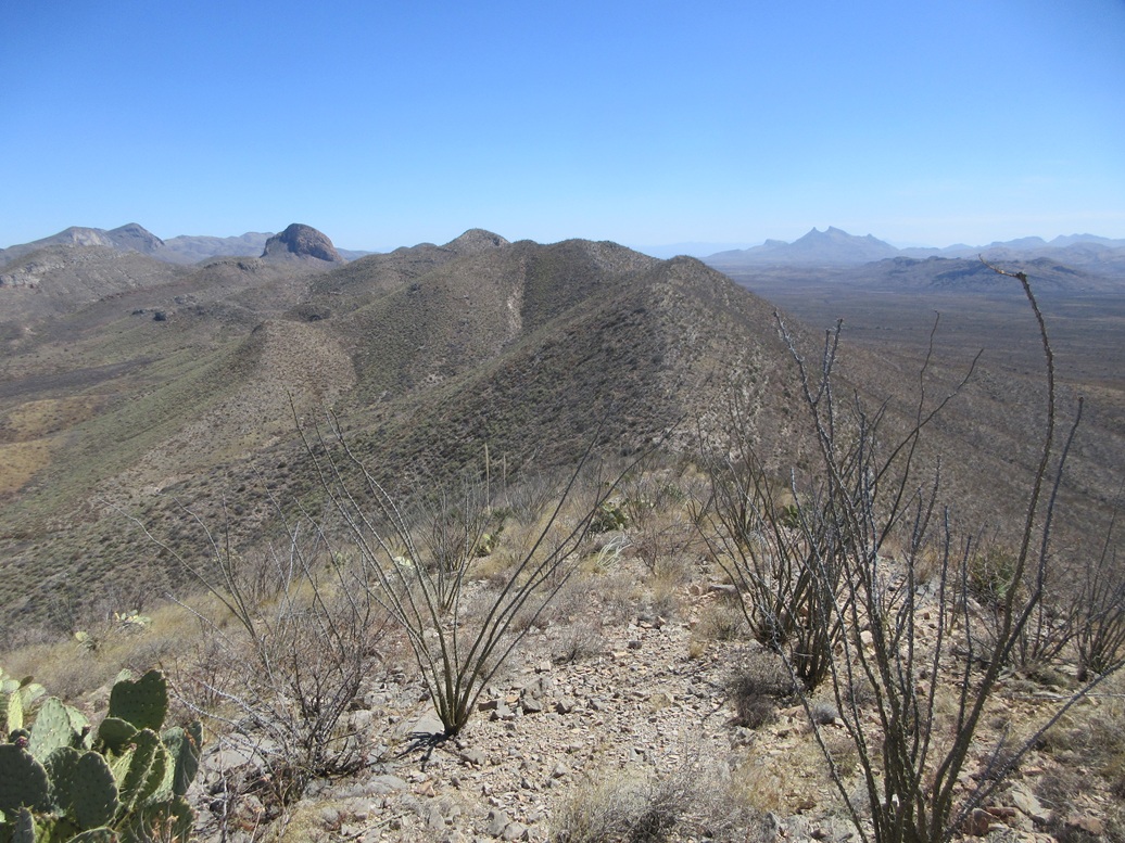
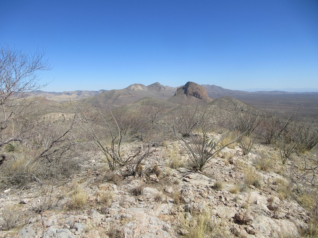
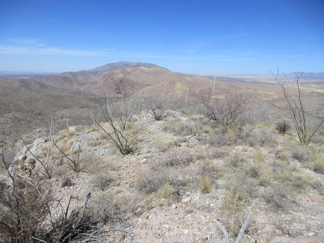
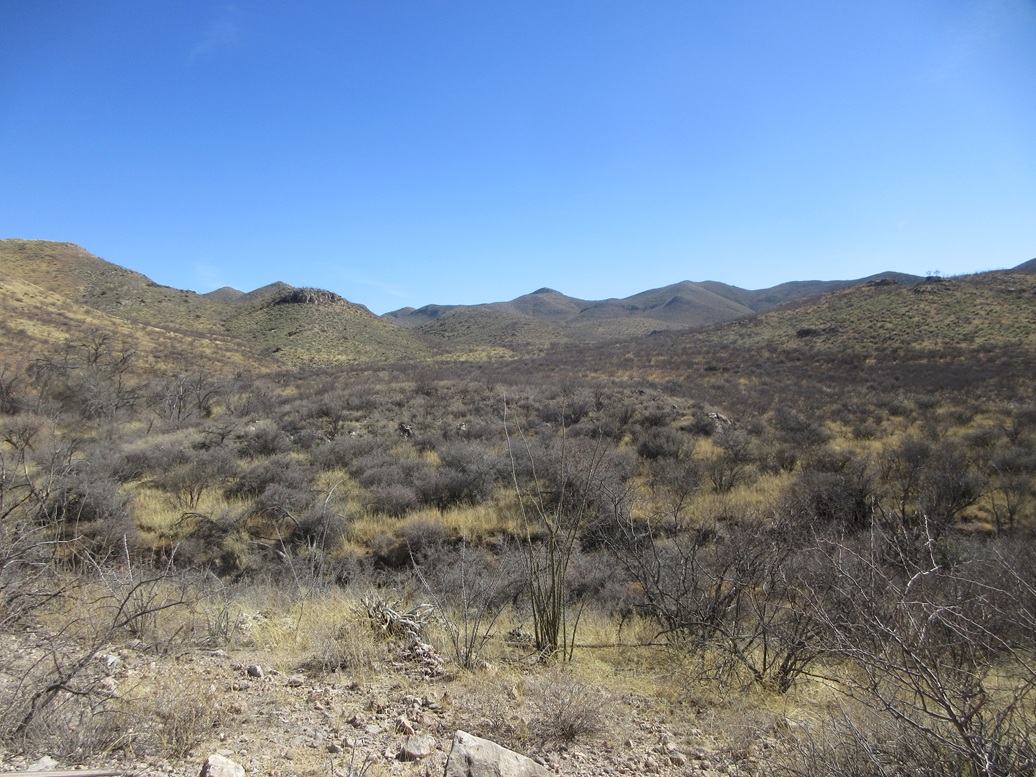
The views were excellent. I could see the southern Swisshelm Mountains, the refuge, the peaks to the east, the Chiricahuas to the northeast, desert to the south and west, and dusty haze in the far distance. I spent just a few minutes up here.
I was not eager to return via the ridge and all the ups and downs. Instead, I looked at the north-south ridge I had followed to the top at the very end, and it appeared to drop to the north, into Leslie Canyon and into the main drainage within the canyon, which looked wide and open. Thus, I decided to follow that down and hope for the best.
The initial downhill hike went very well, the slopes being open, solid and never too steep. I dropped about 400 feet quickly, then I came to a cliff. I had to backtrack uphill, then drop down a side slope. This was steep and rubbly, but safe. The brush closed in here too, now more mesquite and catclaw.
I was now in the lower arroyo system that feeds into the main drainage. As expected, it was very brushy at times, but short. I pushed through it and popped out into the wide open canyon bottom.
Now I just had to walk it a couple miles northbound until it met Leslie Canyon Road again. The walk went fast, but every ten minutes I would get stopped by brush or trees choking the canyon. I would clamber out of the drainage onto the slopes and get past these barriers.
This actually worked very well, and I was able to make good time. However, where it met the road, things got very brushy and rocky fast. I found no good spots to ascend out of the bottom, so I picked something and just gutted up the rocks and slope to get onto the actual road.
I was about a half mile from my car, so I walked the road up slope back to my car. This exit route was about a mile longer than my ascent route, but I saved almost a half hour in time, so I felt it was a fair trade. I was back to my car just shy of 3 p.m., a three-hour hike. A few vehicles had parked alongside the road, these apparing to be bicyclists. I waved as I drove out.
This hike was more tiring and took longer than I expected, but in retrospect, it wasn't a difficult hike. I am glad I returned to hike it, and I enjoyed the feeling of isolation and solitude being here imparts.
|


|