The Mountains of Arizona
• www.surgent.net
|
|
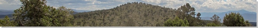
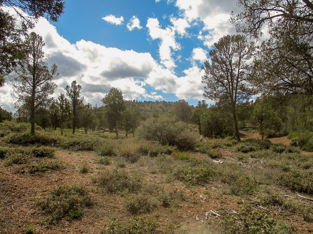
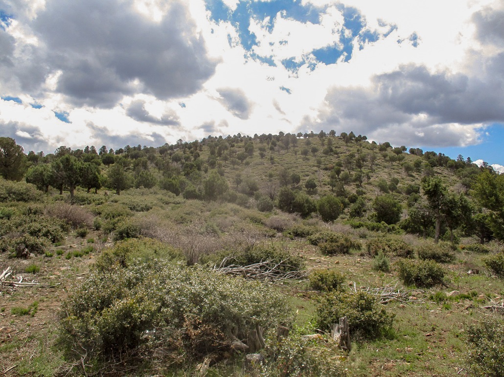
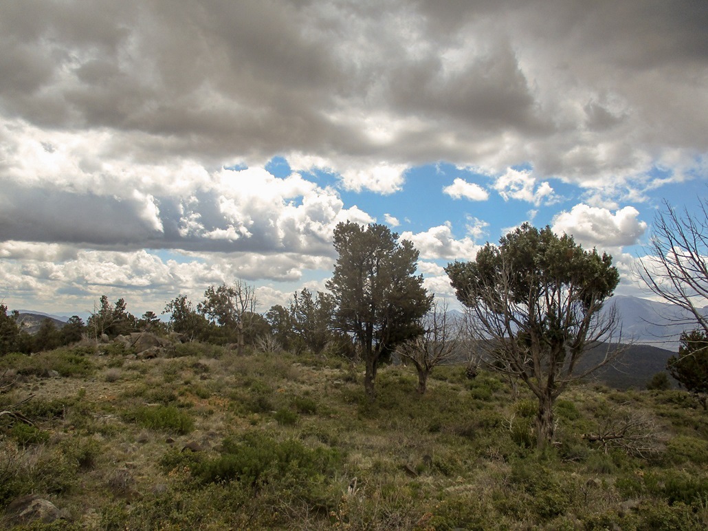
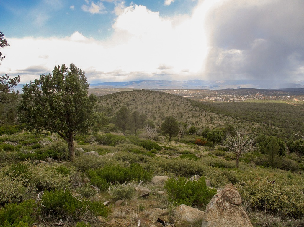
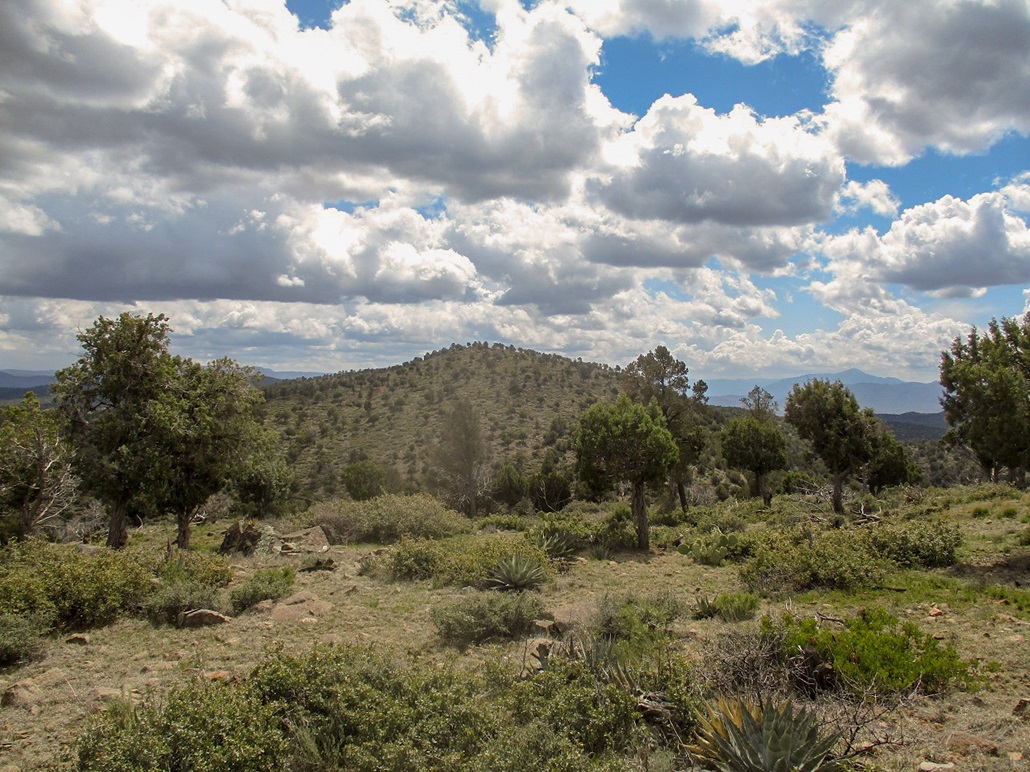
Peak 5343 • Peak 5301 These hills don't look like much at first. They rise just west of the Beeline highway across from the Mazatzal Casino. They are barely outside Payson city limits and are on the Tonto National Forest. Lousy Gulch lies below the hills to the west and is home, so to speak, to a number of old mining claims from the late 1800s. There was a short-lived boomtown in these hills and gulches called Marysville, but the town came and went within a decade, and today, almost nothing exists of the old ghost town. There are about four main hilltops. I was interested in the highest one, Peak 5343, and its neighbor to the north, Peak 5301. Both are visible from the Beeline highway as they lie less than a mile to the west. They are gently-rounded hills covered in pinon and juniper, and a lot of low-lying mountain oak. The trees are spaced out enough so that the views are pleasant and that navigation is straightforward. There is a meager trail system back here, part of the Payson Area Trail System (PATS). One online map source labels the trail that leads to the saddle between Peaks 5343 and 5301 as "Lousey Saddle Trail". To whatever extent these hills see foot traffic, the name seems to be in use, even if not spelled consistently the same way.
Date: March 27, 2020
• Elevation: 5,343 feet
• Prominence: 343 feet
• Distance: 2.5 miles total
• Time: 1 hour and 10 minutes total
• Gain: 360 feet
• Conditions: Very cold and cloudy with some sun, breezy, and one snow flurry
Arizona
•
Main
•
PB
•
LoJ
I was working at home once again. The day was cold and cloudy, a front moving through. There would be sunny segments, then cloudy and cold. At one point this morning, it snowed for about a half hour, although none of it stuck. By noon, I was growing antsy and wanted to get out for a short hike. These hills are close by, only three miles of driving.
The trailhead is at the end of the Green Valley Parkway, the street opposite the Mazatzal Casino at the last light in town, heading south. The Parkway does not go far, maybe a half mile. It ends at barricades near a storage yard and nearby a rodeo stadium. I was actually unaware of a trailhead here until I rolled in and saw the sign. There was a couple there walking their dog. Otherwise, I had the place to myself.
I went light, just my hiking pole and a drink, but no pack. The temperature outside was cold, in the 30s, with a breeze. It wasn't too bad except when I would catch a full breeze when the trees or the hills weren't acting as a deflector. I went southbound on a trail, which looks like an old ATV track, for a half mile. This segment was mostly level and not terribly interesting.
The track then merges with a Tonto Forest Road. I went west and up to the "Lousey" saddle, roughly another half mile. By now, the forest had opened up and I had some decent views. At the saddle, I went south again, following a footpath that weaves through the woody mountain oak. This got me to within about fifty vertical feet of the top. The path just peters out so I found my own way to the top.
The top is flat and there are two large rock outcrops that could be the highest points. I walked to the southern one first. Just beyond it was a tent. It was set up properly so someone was occupying it. It also looked kind of old. It's probably a forest bum. They're around town and frankly, if I was down on my luck, being a bum in a forest would be a better place than being in a city.
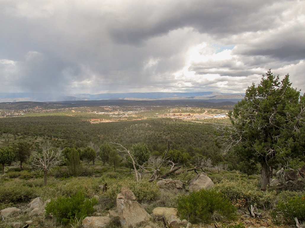
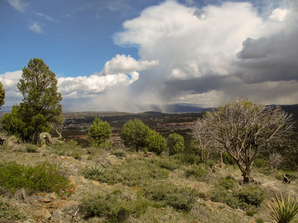
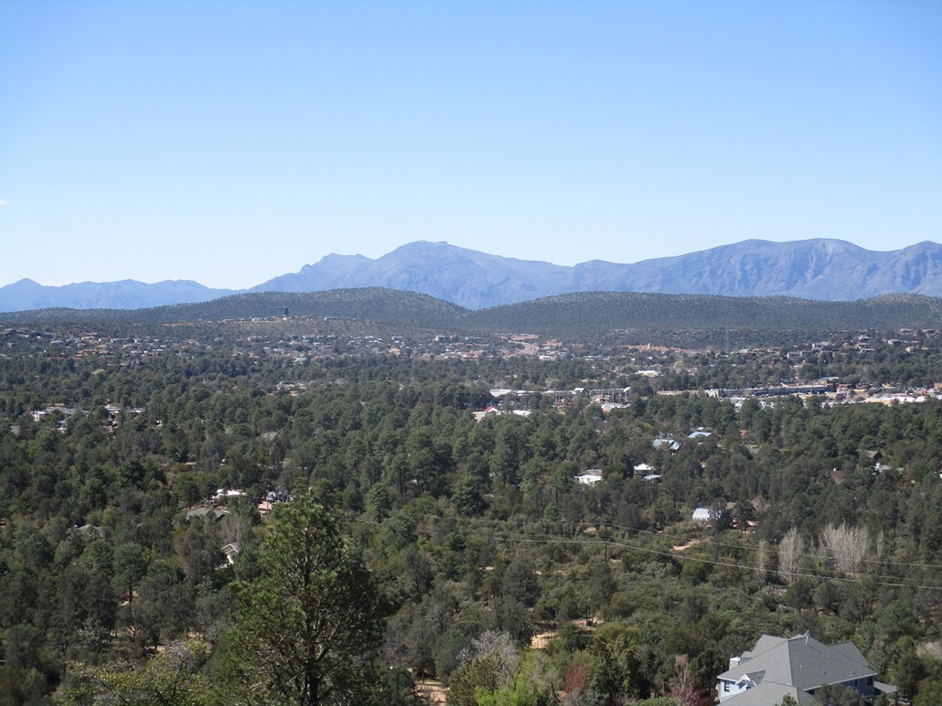
I retreated, not wanting to rouse whoever was there, and there being no reason to. I tagged the rock outcrop highpoints. The breeze up here was strong and I never stopped. As long as I kept moving, I felt good, and not too chilled. Looking northeast across Payson, there were places where the rain or snow was really dropping ... and other parts in bright sun.
I hiked back down, placing myself back to Lousey saddle.
Date: March 27, 2020
• Elevation: 5,301 feet
• Prominence: 181 feet
• Gain: 200 feet
• Conditions: Snow for about five minutes
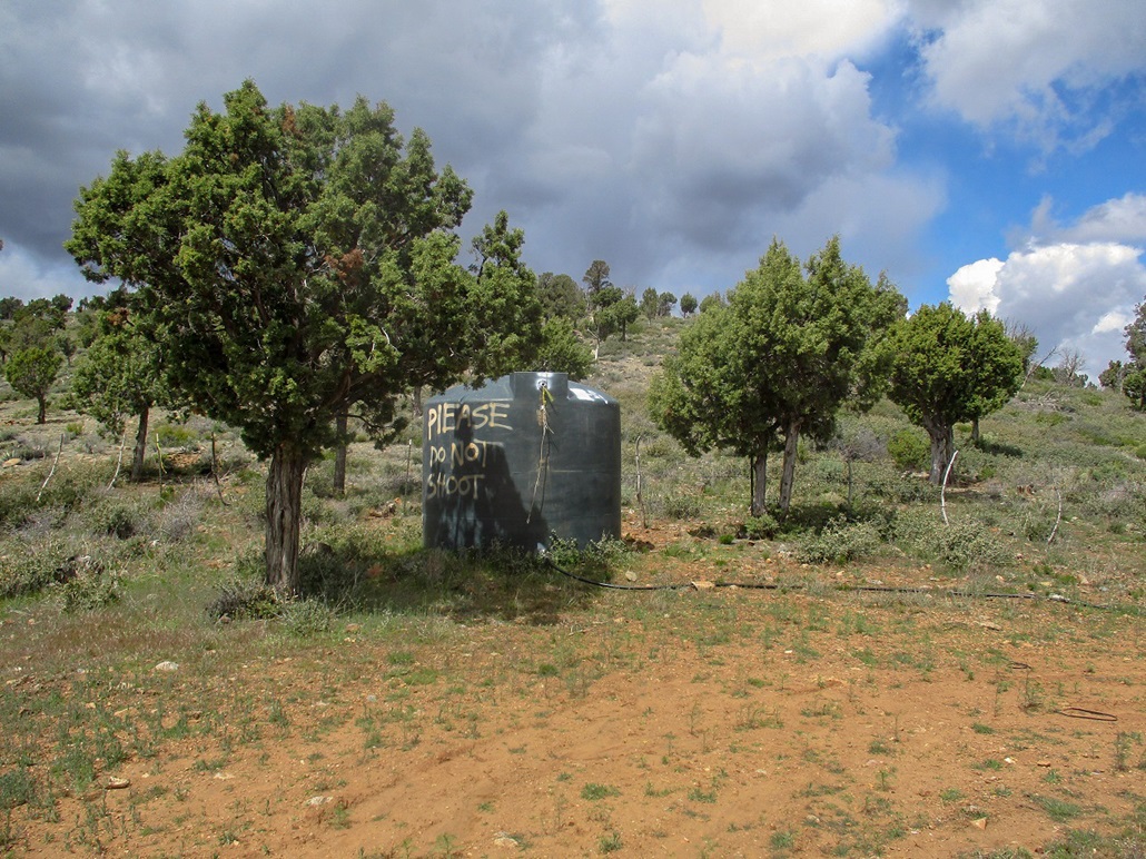
The saddle features a large water storage tank on which someone has spray-painted "Please do not shoot". Peak 5301 rises behind it, and I breached the barbed-wire fence at a weak spot, then ambled up a decent trail for most of the way. Like Peak 5343, the trees are spaced apart and it's easy to get a sense of the terrain. It was here that I got "dumped on", a soft snow flurry that lasted a few minutes. None of it stuck and I then had bright sun for the next twenty minutes.
I was on top quickly, the uphill hike covering a little less than a half mile. Its summit was also long and generally flat. I tagged whatever rocks looked highest, snapped a couple images, then started down. I did not stop here either.
I did not go back to Lousey Saddle. Instead, I went directly east down the slopes, where I would catch the first ATV trail. This went well, but I had about a hundred-foot stretch of thick trees to where I had to hunker in to barge through the branches. But it was short and soon I was back on the flats. I could see a light pole from the rodeo ground, so I walked toward it and met the ATV track along the way.
The hike out covered about three-quarters of a mile, partly due to my weaving to get through the trees. The overall hike covered 2.5 miles, give or take. I was out in a shade over an hour. Things had got a lot colder by now, much breezier and cloudy. I enjoyed the outing. It was prettier than I was expecting and probably worth a look when it is sunnier. I want to drive to the old ghost town site at some point, but am not sure if that's possible.
The disorganized storm seemed to develop so that for the latter part of the afternoon, it was very breezy and very cold, with no sun. But other than some benign snow flurries, there was little precipitation.
I am always curious where these places get their names and the best resources are the books by Barnes and by Granger. Barnes makes just a passing reference to the name, but with little insight where it came from. The obvious meanings are "lousy" as in not very good, or "lousy" as in lotsa lice. I did a google search and what few references I found suggested both could be valid. Be that as it may, I would not rate this as a lousy hike. Not an epic, but fun and fast.
|


|