
The Mountains of Arizona
• www.surgent.net
|
|
Ludden Mountain • West Thunderbird Peak I headed out from home on a whim, already late-morning, work tasks completed and not a whole lot to do. I set my sights on Ludden Mountain in north Phoenix, then added on a bump in the Thunderbird Mountains to make it a two-peak day.
Date: December 19, 2019
• Elevation: 2,197 feet
• Prominence: 697 feet
• Distance: 2.5 miles
• Time: 90 minutes
• Gain: 780 feet
• Conditions: Sunny and cool
Arizona
•
Main
•
PB
•
LoJ
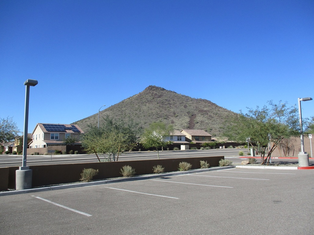
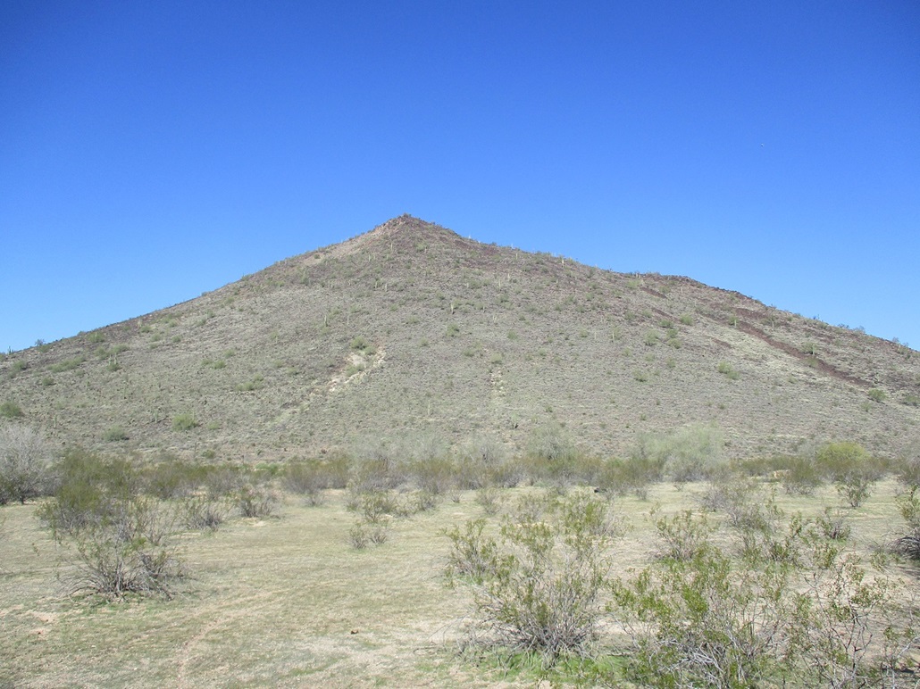
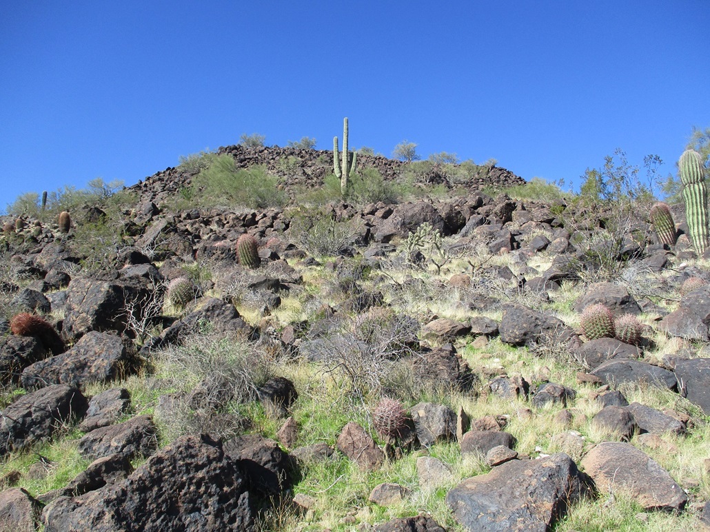
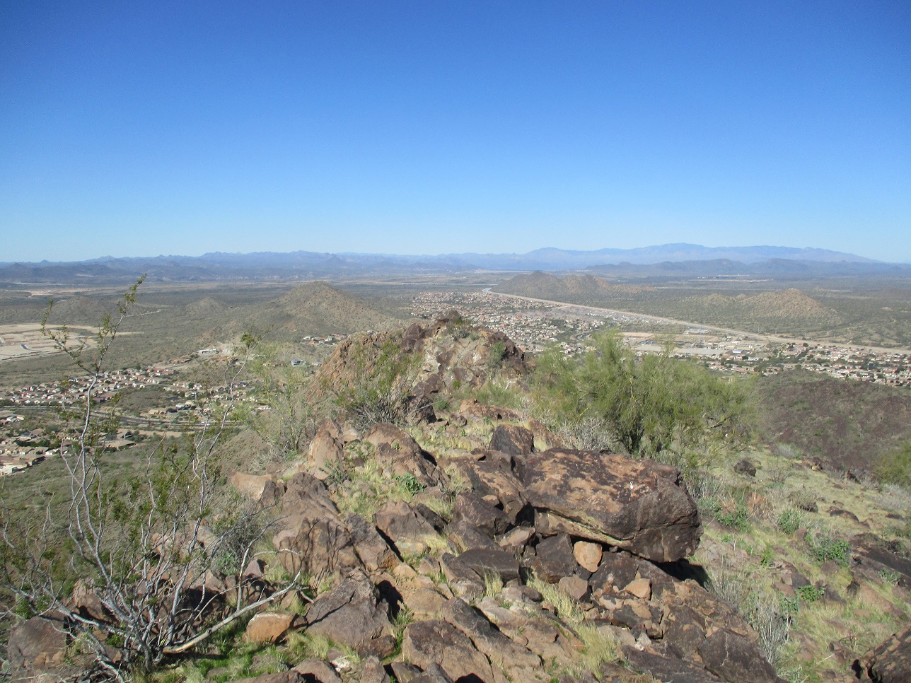
Ludden Mountain is an anvil-shaped peak in north Phoenix, north of Happy Valley Road and the north campus of Glendale Community College. It is volcanic, like other hills in the area, with slopes of bare volcanic rock and moderate brush. Homes suround the peak and there is no infrastructure for hiking it, other than an old road along its east base that serves as a walking and biking path for the locals.
The peak is named for Homer Charles Ludden, who lived from 1880 to 1958. According to the Arizona public archives website, he was a rancher, farmer, teacher, realtor, and for a few years in the 1920s, a state legislator. Ludden owned land in this area, and is the founder of what would become the City of Surprise, named for his birthplace, Surprise, Nebraska.
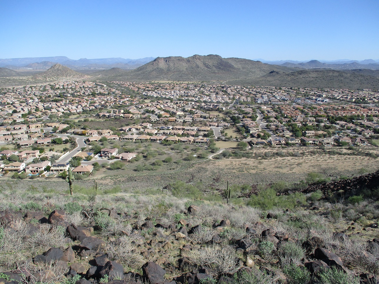
These days, Ludden Mountain is surrounded by civilization. It is inside the Phoenix city limits but near where Glendale and Peoria also meet. It is part of the Deem Hills, but for whatever reason just never developed into a recreational area, unlike the surrounding hills which all have some trails, ranging from meager to developed.
I decided to hike it on a whim. The day was cold but sunny and clear, and I was wrapping up some work tasks from home. By 10 a.m., I didn't want to stay inside anymore. So I hopped into the car and aimed for this peak, figuring now was as good a time as any to climb it. It is ironic that I tend to ignore the local peaks when looking for a hike, and I never have given Ludden Mountain much thought. I know it's there, but beyond that, never formulated a plan to hike it until now.
From my home in Scottsdale to the base of the peak is about 30 miles. The main challenge was to find a place to park and start the hike. I did not want to park along a residential street. There are no parks in the area with open parking. There are a few dirt areas but they're on the fringe. I chose to park at the CVS drug store at the corner of Happy Valley Road and 55th Avenue, southeast of the peak. I parked off to the side and hoped it was okay to leave my car there.
I went light, just my hiking poles and a couple bottles of water in my jacket pockets. I walked along Happy Valley Road to where the houses ended, then entered into an open area between the houses and the base of the peak. I walked up the aforementioned walking-biking path a little bit, looking for a good slope to start up. I was just a few dozen feet from the homes and every dog barked as I walked by. I was probably the highlight of their day.
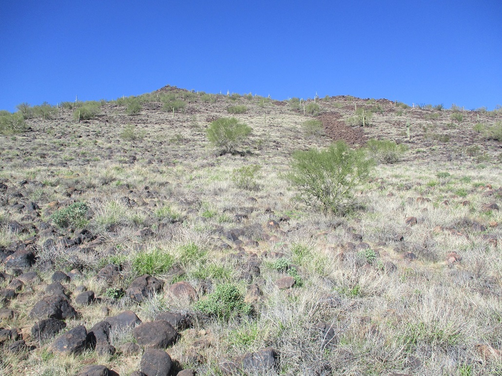
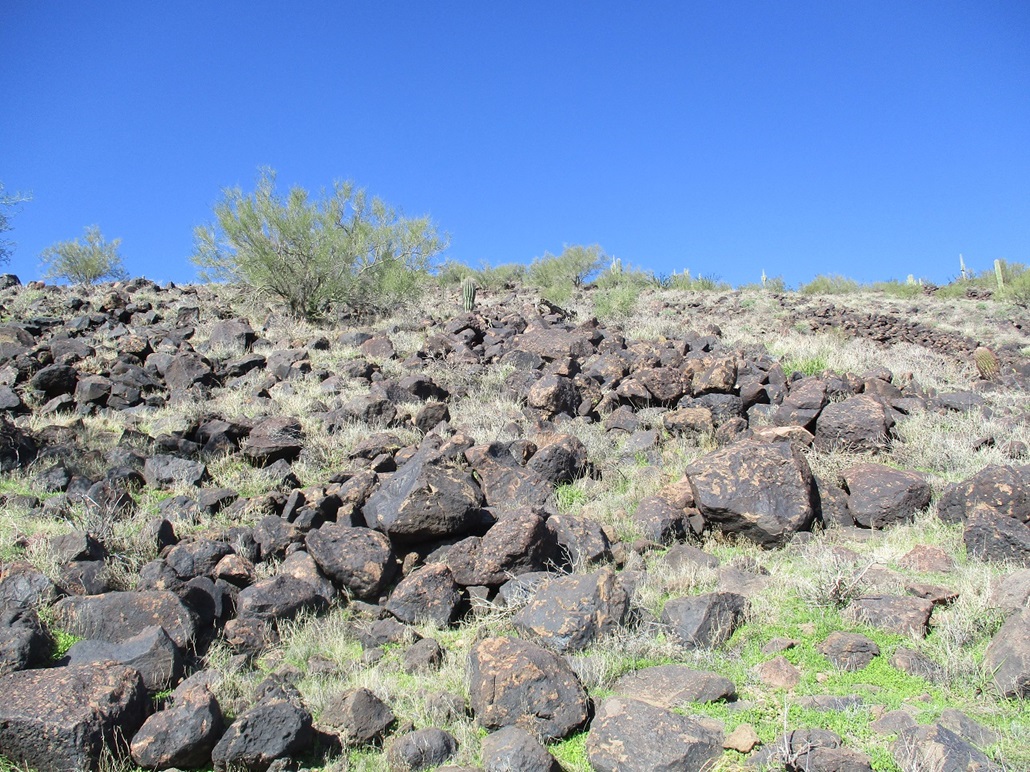
I started up the slope, sticking to the main southeast rib of the mountain mass. At first, the grade was easy and it laid back well. The rocks were small and firmly set, and the brush not too thick. I was able to scoot up quickly, gaining a couple-hundred feet in a matter of minutes.
Looking up, the slope steepened just slightly and got rockier, but the rocks were almost all solidly in place. The big black volcanic boulders piled up on one another to form steps and little cliffs, but the going was very straightforward. The last hundred vertical feet was just the rocks now, where I had to use hands in places, although I would not call it scrambling.
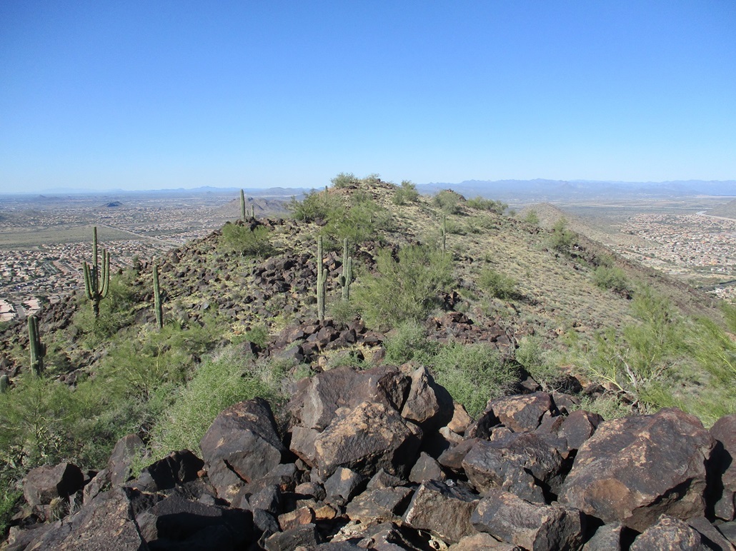
The slope soon leveled and I had just one more easy 40-foot gain to put me on the southern of the two summit highpoints. This southern summit was composed of the same large rocks, and here, they teetered and moved. I surmise the ones on the slope have had millions of years to do all the falling and slipping they're going to do, while these guys up top are still sometimes just loosely connected.
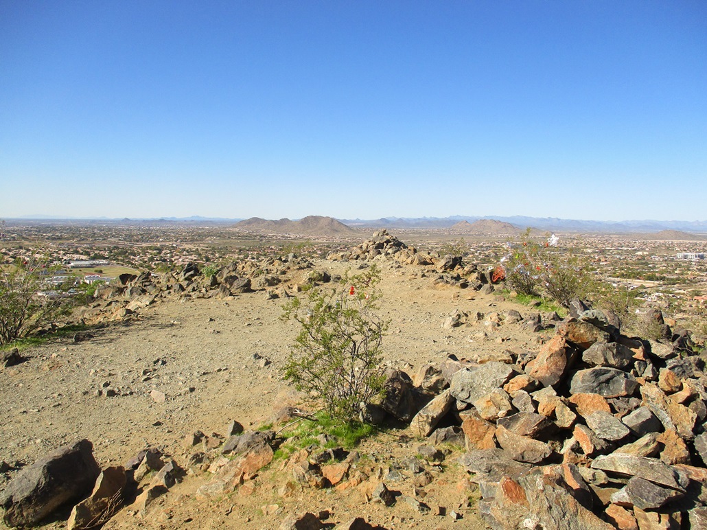
The southern summit was a dud. What few people that come up here have tagged some of the rocks in white paint. It wasn't horrible, just a few spots. I looked over to the north summit, which looked about equal in height to this southern summit. I scampered down off the rocks and down easy terrain to the saddle, then up to the north summit bump. This one was more open and not as rocky, although there were a few that could be the highest points. I found no register.
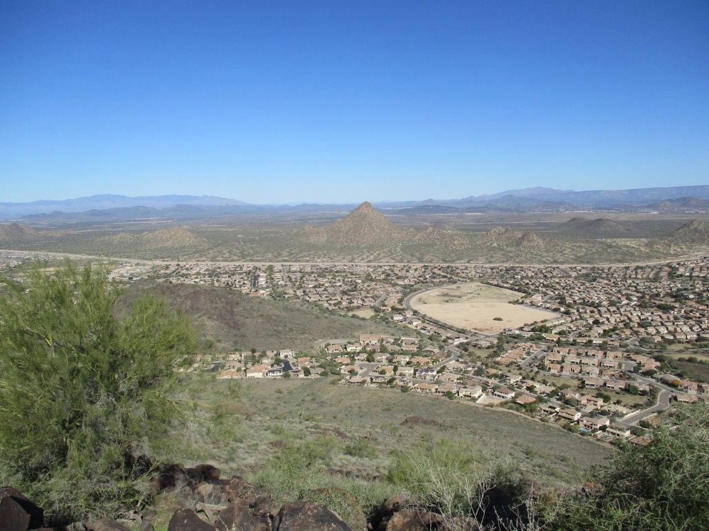
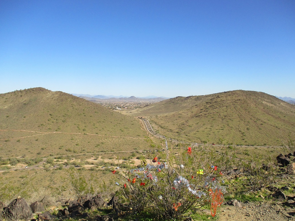
The one-way hike had taken me about 40 minutes and covered a mile. It went fast with no challenges at all, and I enjoyed it. The views were very good on this clear and dry afternoon, air temperature in the low 50s. I snapped some images, but did not linger much. Big Pyramid Peak stood to the north.
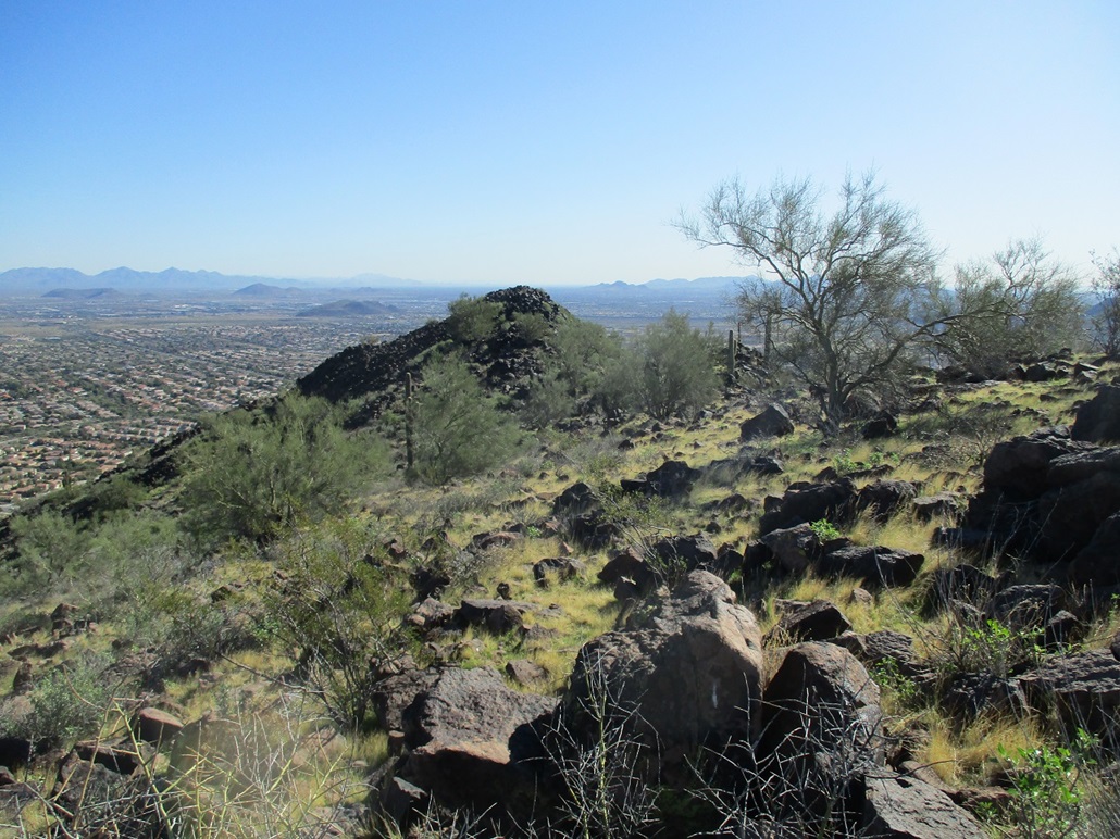
For the descent, I went directly off the north summit, going down the northeast-facing slopes which looked friendly, and they were. This worked extremely well, and I even found a path for about a third of the way. I was soon back to the walking-biking path, but a bit north of where I had started. This added some non-trivial distance to the hike out. I was back to my car, a total time gone of 90 minutes.
I had some vague concern that parking at the CVS was not entirely kosher. It was not crowded, but that's not why they have a CVS there. However, to my luck, a delivery truck had parked in such a way to hide me, yet leave an opening for me to get out. Nevertheless, I went into the CVS to get some drinks and some basic sundries, and they were very courteous to me.
So yeah, it's not an epic hike, but I am happy to have finally got off my butt to hike it. It's a nice-looking mountain and worth the 90 minutes it will take to hike it. It does not seem to get many hikers to the top, though. The HikeArizona site's last entry is from about three years ago. So I was very surprised when I got home to log it on Peakbagger.com that someone had been there this very day! Adam Walker had summitted earlier in the day and from a different approach. I emailed him to share stories and express my surprise, and he too was amused. We have not yet met but we have friends in common. We may meet a few weeks into January when a whole bunch of us are going to convene on the Cabeza Prieta for some scrambling.
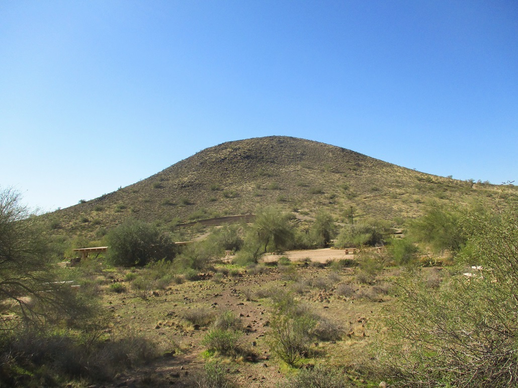
Since I was in the area, I drove a couple miles south and west to the Thunderbird Recreation Area, to hike the one remaining ranked summit in that little batch of hills, West Thunderbird Peak.
Elevation: 1,682 feet
• Prominence: 322 feet
• Distance: 1.5 miles
• Time: 40 minutes
• Gain: 340 feet
• Conditions: Sunny and cool, clear skies
PB
•
LoJ
This is the western hill of the small Thunderbird Conservation Park in Glandale. It has no official name, and the park map does not bother to call it anything. It is also the only remaining "ranked" summit I needed to hike in this batch of hills, but I would not drive this far (30 miles) just for this hill. I would preferably combine it with something else while in the area.
I finished hiking Ludden Mountain about 12:30 p.m.. From there, I drove just a couple miles to the main entrance to the Thunderbird Conservation Park at 59th Avenue. I parked and started hiking immediately. I carried just my hiking poles and a bottle of gatorade.
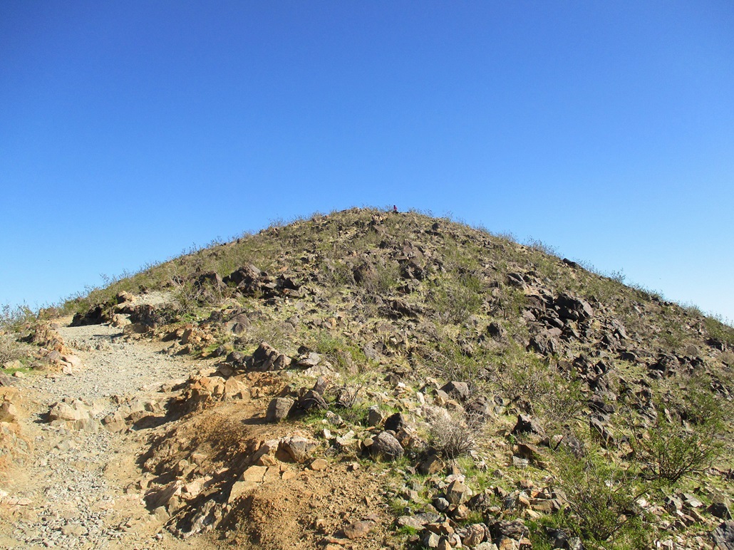
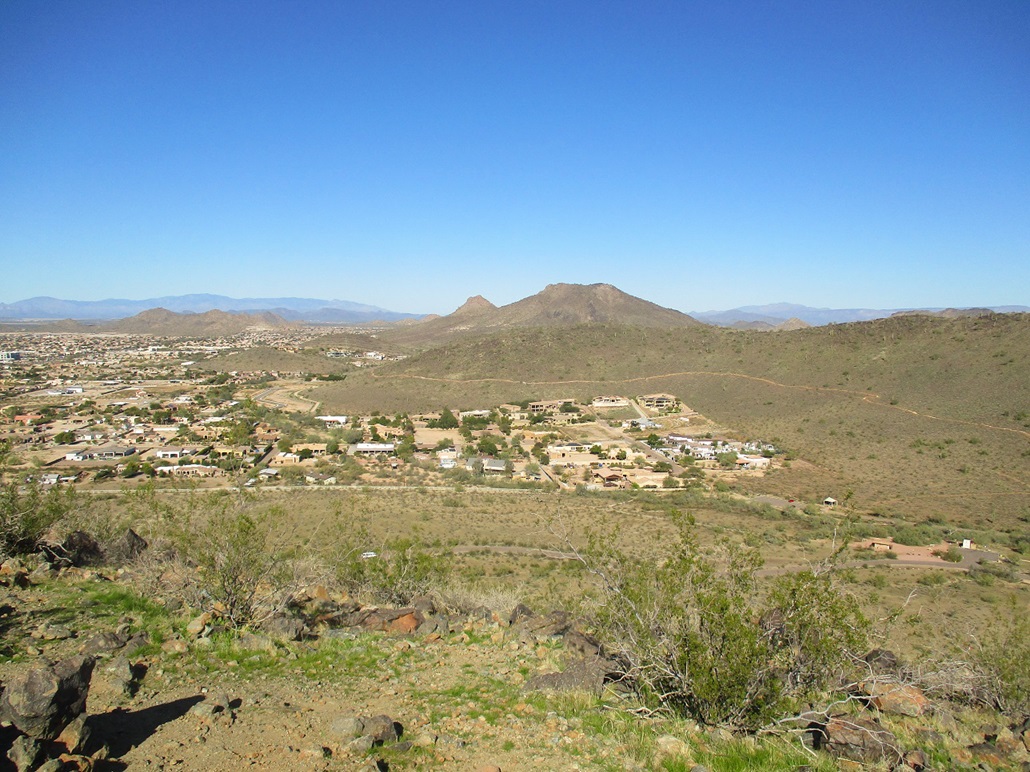
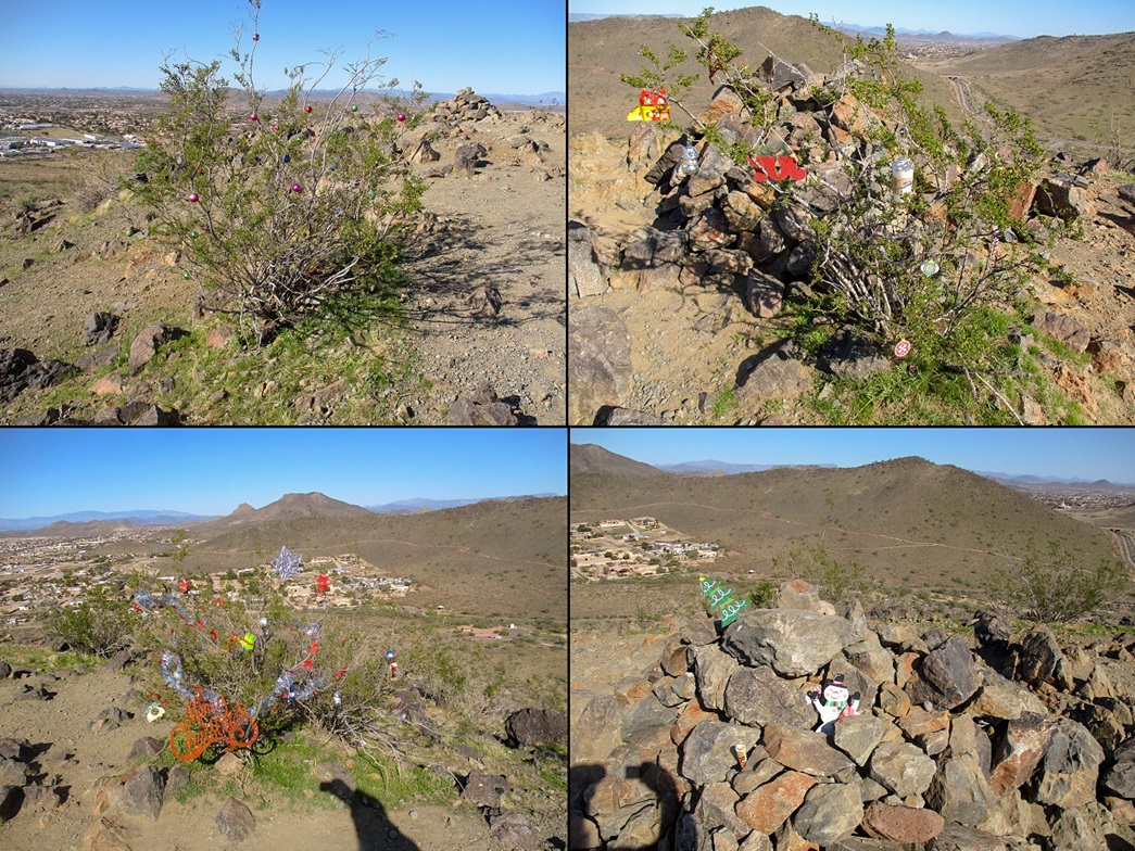
I walked past an amphitheater and followed the Sunrise Trail west as it curled around and headed east again, swtchbacking up the hill to the top. The one-way hike took about 20 minutes. Bushes up top, plus one of the cairns, were decorated in Christmas ornaments. I had views of the surrounding hills, homes and looking north, Ludden Mountain rising above the North Thunderbird hill. The trails weren't crowded but there was someone every couple hundred feet, so it wasn't too bad. One woman wearing a hands-free headset was on the phone talking loudly with someone about earaches and yellow teeth. Not that I tried to listen, but sometimes you don't have a choice.
I hiked back the way I came, gone just 40 minutes. From here, I just drove home, doing a few quick errands along the way. I am glad to hike this bump and get it into the record. I would not have come all this way just for this one bump, but it made a good second peak for the day, and on its own merits, is a good workout hike for those who live nearby.
|


|