
The Mountains of Arizona
• www.surgent.net
|
| Peak 2391 |
• Maricopa Mountains • Sonoran Desert National Monument • Maricopa County |
|
Date: January 29, 2022
• Elevation: 2,391 feet
• Prominence: 885 feet
• Distance: 4.1 miles
• Time: 3 hours, 15 minutes
• Gain: 925 feet
• Conditions: Sunny, some high clouds
• Teammate: Matthias Stender
• Prog rock bands played: Gong
Arizona
•
Main
•
PB
•
LoJ
After I hiked Booth Hills Highpoint earlier this morning, I drove about a dozen miles to The Boulders staging area, the main road that branches off AZ-238 and heads north into the Sonoran Desert National Monument. It was 10:30 a.m. now, and I was to meet Matthias at noon. I was beat from the morning's hike, so I laid my seat all the way back and took a 45-minute nap. A little before noon, Matthias rolled up, and we were on our way.
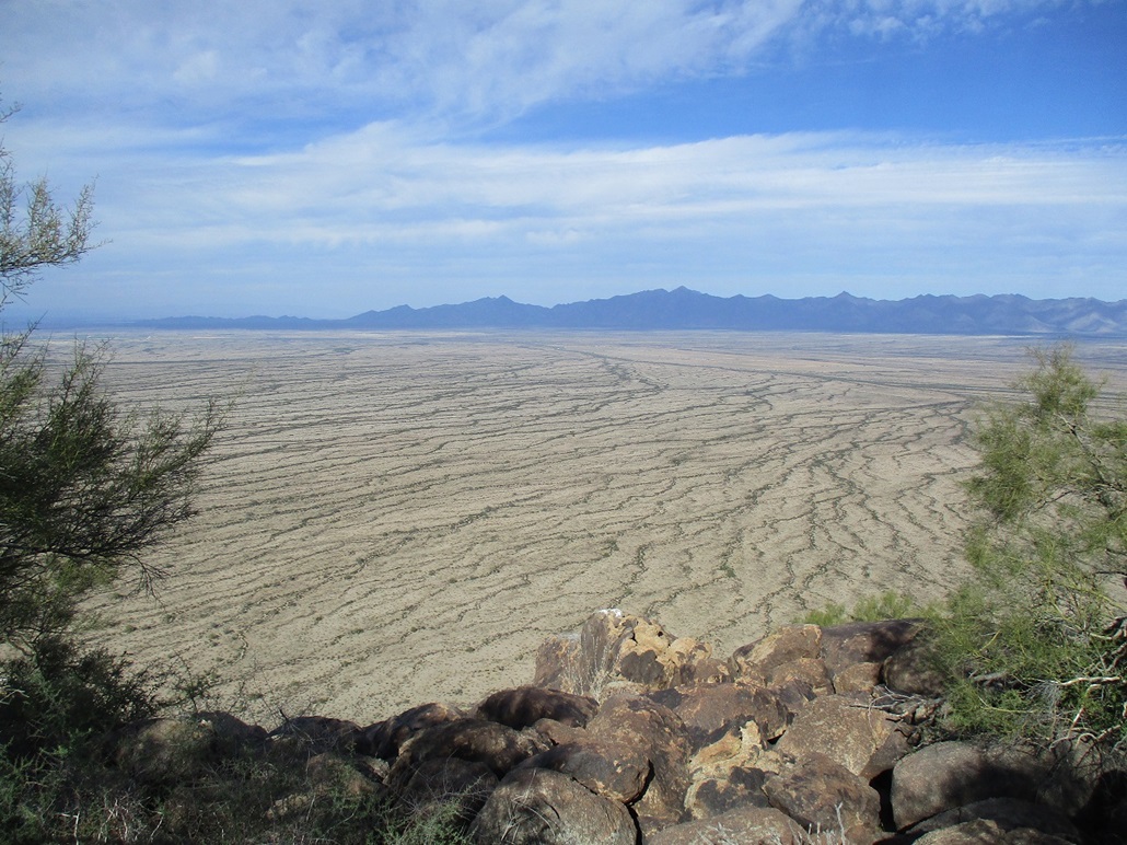
Our goal was an unnamed peak to the northwest of where we were now. It's either one five-mile long peak, or a range of smaller peaks. Technically, it's part of the Maricopa Mountains, and is within the Sonoran Desert National Monument. It rises all by itself, set apart from the rest of the range. This was Matthias' choosing. I was not sure what he had planned for us. I knew the name of the peak, "2391", but had not bothered to look it up on the map. I wanted to preserve the excitement and the mystery.
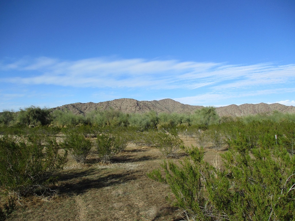
Matthias drove us onto the north-trending "main" road. It's a decent road, sandy in places, but it crosses every arroyo in the state because it goes against the grain of the land. Some of these arroyo crossings would be a little dicey in my Subaru. In his 4-Runner, it wasn't a problem, be we had to go slow. We drove past the junction where the Butterfield Stage Route goes east and west, then moments later, turned right onto another road, heading east. This road was in much better shape. We went a couple miles and parked near Conley Tank. We were now due south of Peak 2391, about a mile from its base.
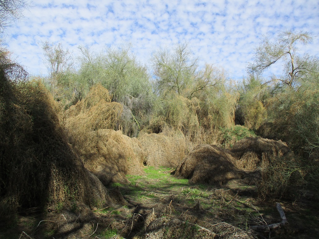
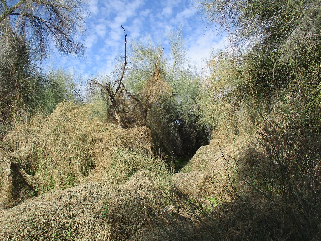
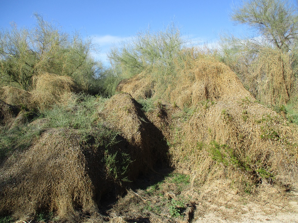
We started hiking a little before 1 p.m.. First up, we had to cross a main arroyo channel, choked thick with thorny plants and tamarisk. We found some openings, then were in the channel itself. Curiously, we came upon an odd scene, where all the trees and shrubs were covered over in this weird viney plant (ivy? kudzu?) that looked like a fishnet. It was thick and tangly, but with openings to pass through. It looked like something you'd see in Middle Earth, where Hobbits live, desert Hobbits that is.
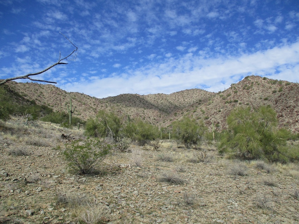
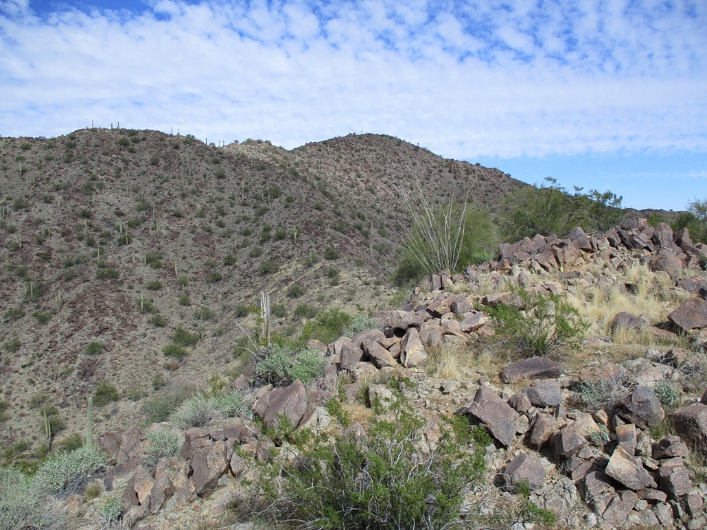
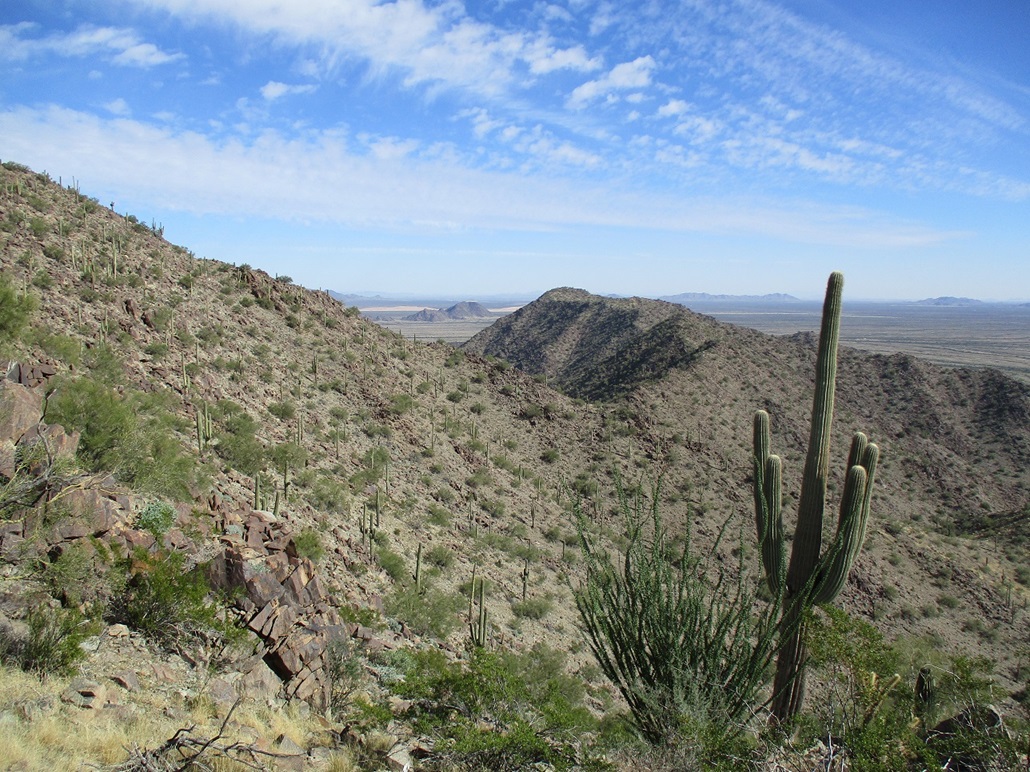
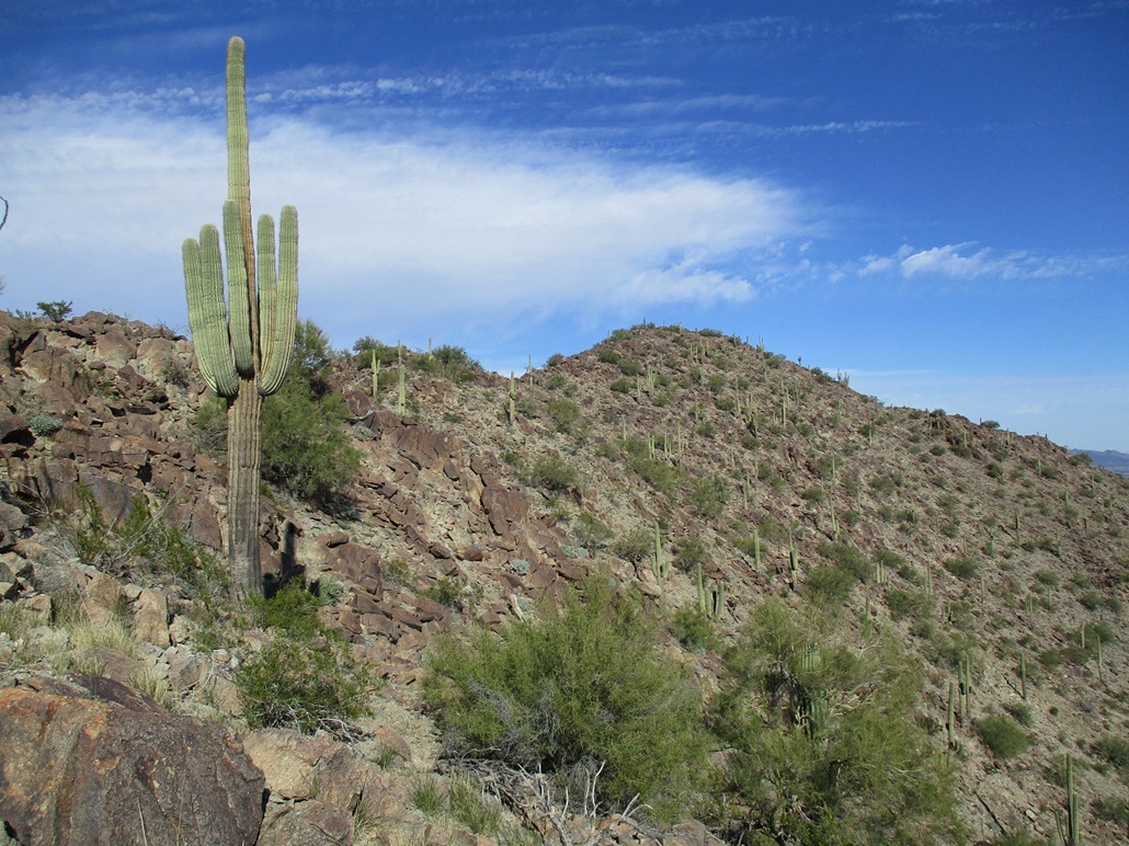
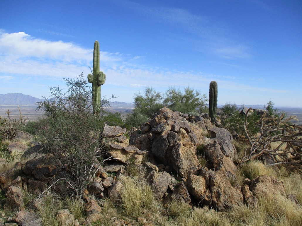
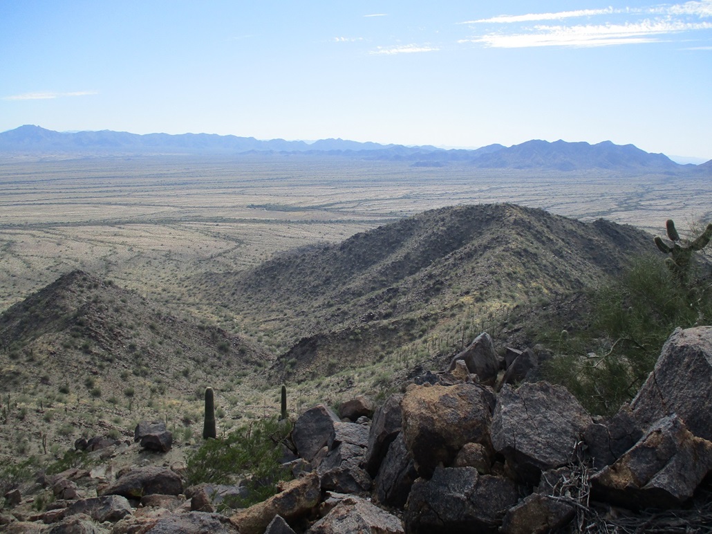
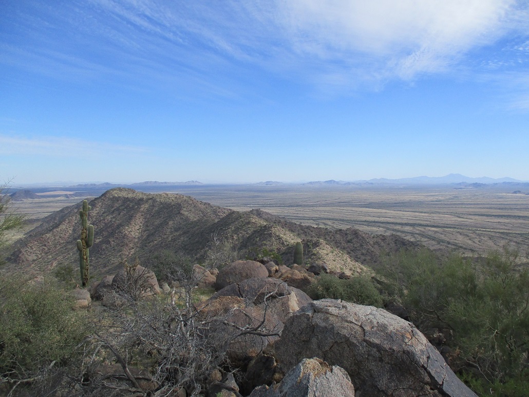
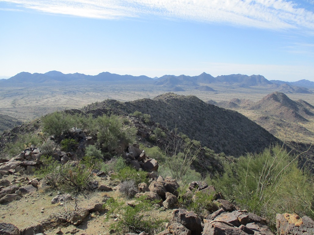
Once past the big arroyo, we trekked across the desert and were soon near the base of the mountains. Neither of us had much of a plan on how to tackle this peak. We'd figure it out on the fly. Directly ahead was a subridge, coming off the main crest to the south. It has a spot elevation of 2,118 feet. Around to the right, we entered into a canyon and got in maybe a quarter mile. The summit was above us and the slopes up to the ridges looked pretty good. We opted to ascend a rocky slope that would put us on that southern ridge, a little above its lower saddle. The hike up went well. The rocks were mostly granite boulders, solidly in place (except when they moved), and a little bit of scree toward the top. Once on the ridge, we took a break. It was windier up here, but pleasant, temperatures in the 60s. We then descended about 60 feet to the saddle, then up about 300 feet to catch the main ridge west of the summit. Again, the slopes were gentle and the rock barriers easy to bypass, with no scrambling necessary, maybe a hand here and there. Once on the ridge, we turned right and followed it up to the top, this segment going well too. The whole hike up had gone extremely efficiently. We encountered no bad loose slopes and no rock outcrops that would stop us. I didn't keep track, but the one-way hike took a little over an hour. The summit is fairly large, ringed by big rocks with a flat dirt platform within, and excellent sitting rocks. We found the register and signed in. The register was placed here in 1998 by the MacLeod/Lilley duo, and held just a few signatures up through 2008, then nothing until us, a span of almost 14 years. We theorize that once the main road into the Monument was closed about 2009, no one wanted to bother hiking about 8 or 9 miles each way to hike this peak. Now that the roads are open, this peak may see more visitors, relatively speaking (maybe one or two per year). We spent awhile on top. The conditions were calm and pleasant, the views excellent, and there was no reason to rush things. We were on a good schedule and we knew the downclimb would go well, too. After about a half hour, we got moving. As expected, the hike down and out was easy with no surprises. The only variation was at the lower saddle on the south ridge, we dropped into the drainage directly, and followed it out. It wasn't that brushy. We were back onto the flats, then one more time through that viney stuff. I'd never seen anything like it in Arizona. We were back to Matthias' vehicle about 4 p.m.. He wanted to do a nearby peak and I was game, but being 4 in the afternoon, we knew we wouldn't be coming out until after sunset. We felt this one peak was a worthy peak and were glad it worked out for us. Matthias dropped me off back at my car, we shook hands and he was on his way. I stuck around to change into more comfortable clothes. I stopped for my (now) usual Subway sub in Maricopa, and was back in Phoenix as the sun was setting. It was a good day in the desert, and I was pleased with today's haul. I recommend this peak. |


|