The Mountains of Arizona
• www.surgent.net
|
| Peak 3804 |
• McDowell Mountains • McDowell Sonoran Preserve • City of Scottsdale, Maricopa County |
|
Date: February 19, 2025
• Elevation: 3,804 feet
• Prominence: 504 feet
• Distance: 4.8 miles
• Time: 3 hours
• Gain: 1,675 feet
• Conditions: Pleasant, some high clouds
Arizona
•
Main
•
PB
•
LoJ
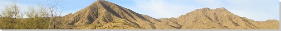
Peak 3804 rises at the southeast end of the McDowell Mountains in Scottsdale, near the Fountain Hills boundary. It is a big rounded dome, the highest peak in the range without a formal name. When viewed from the south, it is the right-most peak of a line of peaks with Thompson Peak (with the towers) to the west, Doubletop Peak in the middle, then Peak 3804.
I chose this peak for today because it was local and I had limited time as I had some meetings in the early afternoon on campus. I was also going to follow a path to the top, one I had not known about on my previous two attempts.
In early 2022, I intended to hike both Doubletop and Peak 3804, coming up from the west via the steep Thompson Peak access road. I got to the saddle between Thompson Peak and Doubletop just fine. I found a beaten path that went up toward Doubletop. The path steepened and faded into the long grass, which was wet with dew. The steepness and the wet grass made footing treacherous, so I backed down.
Then I felt a twinge in my right knee. Suddenly, it was weak if I put weight on it. It didn't hurt but I couldn't really do much with it other than walk carefully. I decided to back off altogether and hike out. On the trails, the weak knee wasn't a problem as long as I went slowly. I had strained a ligament and it would be weak for about the next six months as it slowly healed.
A couple years ago, I explored some trails from the newer Adero Trailhead. I was interested in West View Overlook (on the far east tip of the ridge, of course) and the Fountain Hills city highpoint, which lies on the slopes below Peak 3804. I thought maybe I could scamper up to the top this way, but then realized that wouldn't be very smart. It was very steep from this angle and not worth the hassle.
Then I learned about this route, following a rough path that goes all the way to the summit. Reports say it's a good trail almost the entire way. It was worth a look.
I camped the previous night in the rolling hills up by the Rolls OHV area about fifteen miles north on highway AZ-87. I was up early, and drove back down into Fountain Hills, getting onto Shea Boulevard, then Palisades Boulevard going north. I wanted Golden Eagle Boulevard (so many boulevards) but got temporarily fooled, going onto Eagle Ridge Drive. The similarity in names confused me.
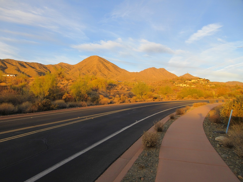
I righted myself and followed the correct roads to the small parking lot that serves as a trailhead and let-in to the McDowell Mountains Regional Park. I pulled in a little after 7 a.m., the first car here. The day was clear and sunny, with some thin high clouds to the east. It was cool for now but was expected to warm into the 70s.
I walked the sidewalks through this high-end development to the actual trailhead. They ask for a $2 fee, which you can pay by stuffing two $1 bills (or half a $4 bill) into an envelope, which in turn gets jammed into a slot where all the other envelopes containing $2 are stuffed into. Not sure how often these envelopes are collected.
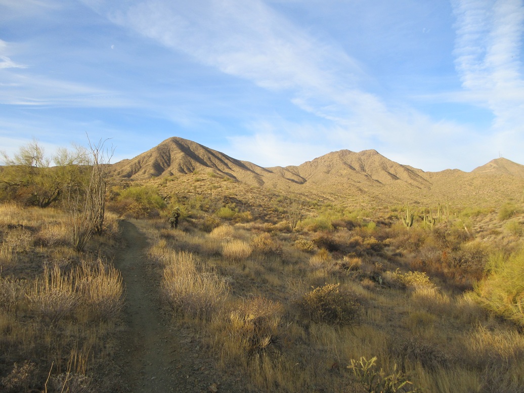
I was on the Dixie Mine Trail, which is an excellent trail that trends northwest and west toward the heart of the range. I followed it for about a mile, then turned left onto the Sonoran Trail, which went southwest, crossing into the Fountain Hills McDowell Mountains portion of the park.
The trail gained elevation and soon came to a split, the Lower Sonoran Trail going left and the Upper to the right. I stayed on the Upper Sonoran Trail, which steepened and switchbacked up a ridge. I kept on it until it got as high as it would go. This trail eventually connects to the trails by West View Overlook and the Adero Trailhead, but I wasn't going that far today.
The use trail to the summit picks up from here. It is not a maintained trail so it does not show up on maps, but I had some GPS traces to follow. I found what looked like a good path and followed it upward. It degenerated into a deer path, so I went with my instinct and angled upward to a higher ridge above me. Sure enough, once atop the ridge, I found the actual use trail.
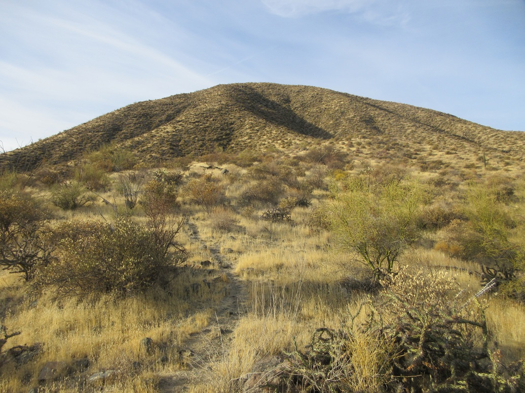
I followed the path upward. It would be a great path for a few dozen yards, then peter out in the grass, with three or four deer paths going in different directions. When unsure, I just stayed "high" and always re-found the trail.
The trail wasn't too bad, considering it's not maintained. The tread was usually solid and secure. I was fearing it would be a loose slope of gravel, which these unmaintained trails can be, but it was never like that.
Higher up, it steepened and worked up through some rocky heaps and barriers. There were no cliffs, but in a few spots I had to high-step and use my hands to hoist up a big step. Then the slope moderated nicely, and I could see the top up there, now about 400 feet above me.
I just kept to the trail, and it stayed steep but reasonable. There were a couple spots of loose gravel and other spots of heaped rocks, but surprisingly, it worked out very well. It was just a matter of trudging upwards until there was no more upwards to trudge. I was on top the peak after 90 minutes, in what I later determined to be a 2.8-mile hike with 1,670 feet of gain.
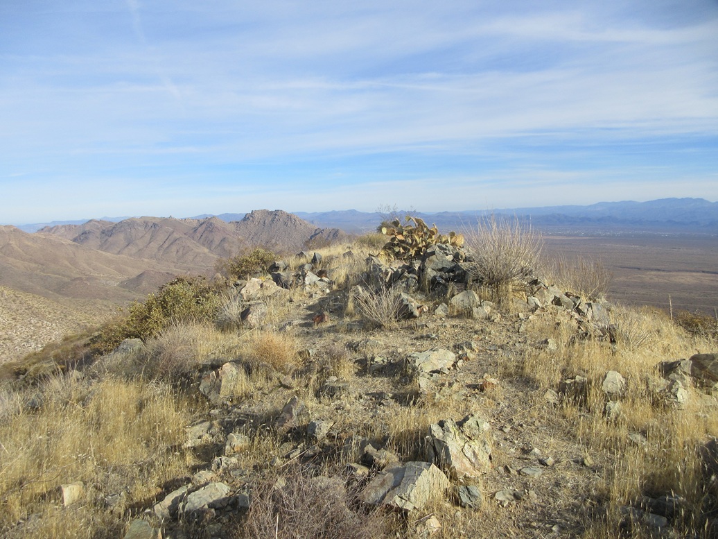
The top is narrow, about a hundred feet north to south and twenty feet wide. A rock cairn sits in the middle and is the highest point. I found a register placed there just a couple weeks ago and signed in. I also took time to relax and shoot some images. The high clouds blocked the sun just enough to cause extra glare and my images were not the greatest. I spent about ten minutes on top of the peak.
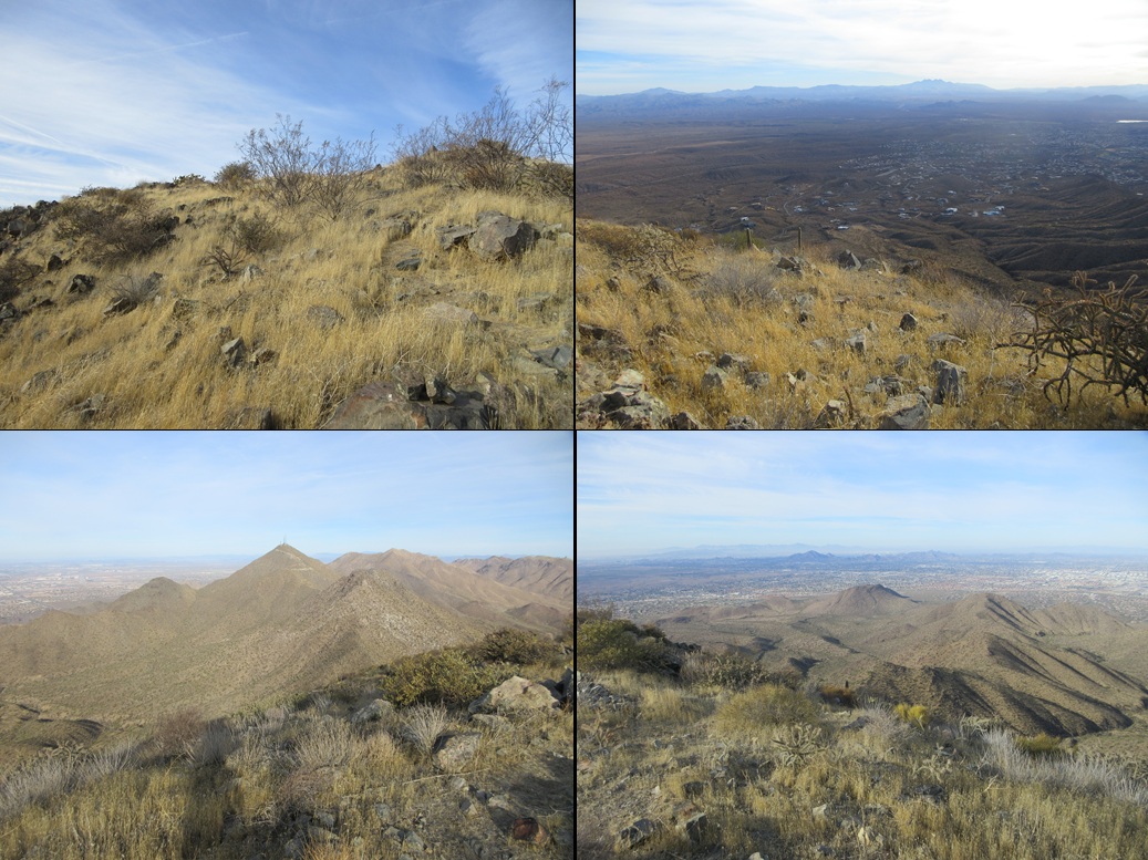
Views were as expected: a lot of houses everywhere, Scottsdale to the south and west, Phoenix farther west, Fountain Hills to the east. I had an excellent perch for the a full sweep of views, of mountains, desert and buildings. I was happy to be successful.
I looked over at Doubletop but decided not today. I did not have the time, and I also figured it still may be smarter to come in from the west, as I had tried in 2022. So I started the slow hike down.
Walking down the trail went well, albeit slow. I made sure my feet were solid and just looked at the dirt below me. In time, I was down off the use trail and back on the Upper Sonoran Trail. From up high, I could see the street layout. There is a water tank close by, so I aimed for it, walking some of the actual trails and also going cross-country until I was on the water tower access road. Judging by the many paths down low, lots of people access the hills from this road.
Technically, this was private, but I wasn't too concerned. A lovely mansion sits on a hill nearby but it appeared empty. I was now on East Coyote Way. I walked past a few more big homes, some still being built, most appearing for sale rather than occupied. The only people I saw were the workers.
I followed this road back to Mountain Parkway, which leads back to the parking lot. This exit route saved me about a mile and probably a half hour. As it was, it took me less than an hour to hike out back to my car.
From here, I drove into Tempe to my office and attended to grown-up things.
|


|