
The Mountains of Arizona
• www.surgent.net
|
| Peak 4449 |
• Poachie Range • Bureau of Land Management • Mohave County |
|
Date: December 10, 2021
• Elevation: 4,449 feet
• Prominence: 849 feet
• Distance: 5 miles
• Time: 2 hours
• Gain: 1,510 feet
• Conditions: Cool, high clouds and misty from recent rains
Arizona
•
Main
•
PB
•
LoJ
This peak is part of the Poachie Range, southwest of US-93 in Mohave County, about twenty miles south of Wikieup. Matthias and I were here in February 2020, climbing Greenwood Peak. This peak would have been a bonus peak for the afternoon, but we were too tired after hiking Greenwood, so we skipped it.
The peak has a service road that leads to its summit ridge for a tower that sits near the highpoint. The presence of the road is the only reason I (or we) even considered this peak. It's not important enough to deal with the brush, but with a road, suddenly it becomes a straight-forward hike and worth the effort to visit it.
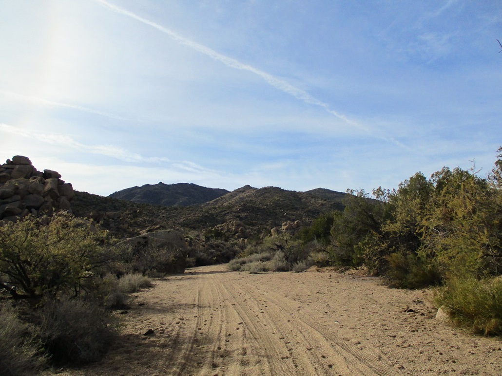
I was driving to Kingman and eventually to Nevada for a week-long visit with my father. I had the whole day to get to Kingman, so I stopped along the way to hike this peak. I would not drive all this way for this peak alone. From US-93 south of the Burro Creek bridge and camping area, I turned onto 17 Mile Road. I drove 4 miles on this good dirt road to a downed windmill alonside the road. A few feet before the windmill is a side road that leads to the top of Peak 4449.
I parked just a couple dozen feet off the main road, so I was not hidden, but the road's condition was a little too loose for my comfort level. I dressed casually, in shorts and a long-sleeve t-shirt, got my pack and poles, and started hiking. The day was cool and humid, the after-effects of a storm that passed through the previous day. It was sunny now, with high clouds, but moist.
Five minutes into my hike I come upon a lone cow standing in the road. It just stared at me at first, then slowly walked toward me. I moved off the road a little bit to see what it wanted to do. It was not interested in me. I watched as it slowly walked along the road. I did not see other cows or bulls.
Once back on the road, I walked quickly. The road drops into a wide drainage with a sandy bottom. I followed it for a couple hundred yards to where the road branches off again to my left (south). Hereafter, I would be hiking the road all the way up.
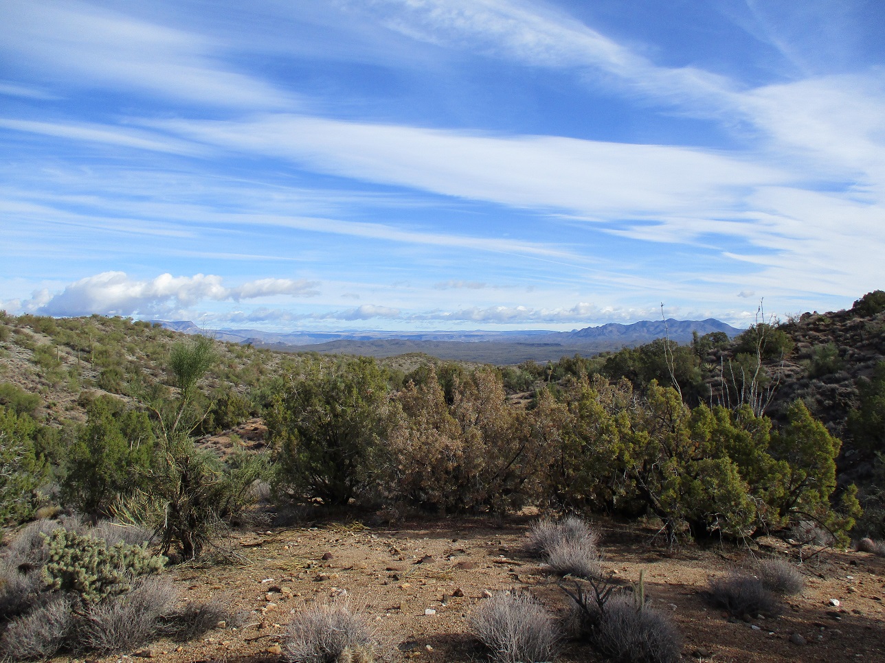
The road was actually in pretty good shape. A decent high clearance vehicle could get this far. It goes up one ridge, then cuts left, and comes to a gate. No vehicles can get past it without a key. I walked around it and continued walking.
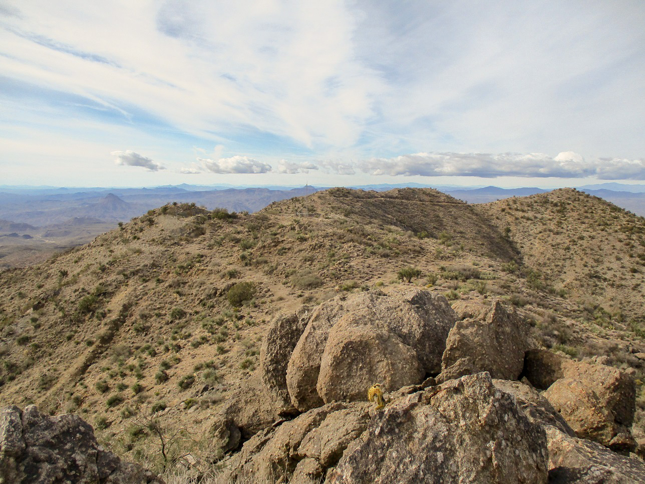
The road was never steep and I was able to walk the entire thing with no stops. Only at the very top, where the road splits (take the left), did the road's condition drop, now rockier and steeper. But I was now on the high ridge, having gained about 1,400 feet. The weather had not changed but it was cooler up here, plus breezier.
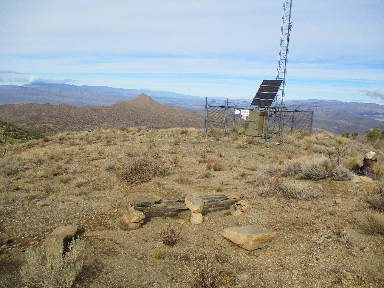
The road curls to the left and essentially ends at a very humble tower surrounded by a cyclone fence. Someone had built a bench out of rocks and wood planks, and to my amusement, there was a trash bin nearby, with actual trash in it, all being kept in by a large rock. This begat about 12 questions, but I won't bore you with them here.
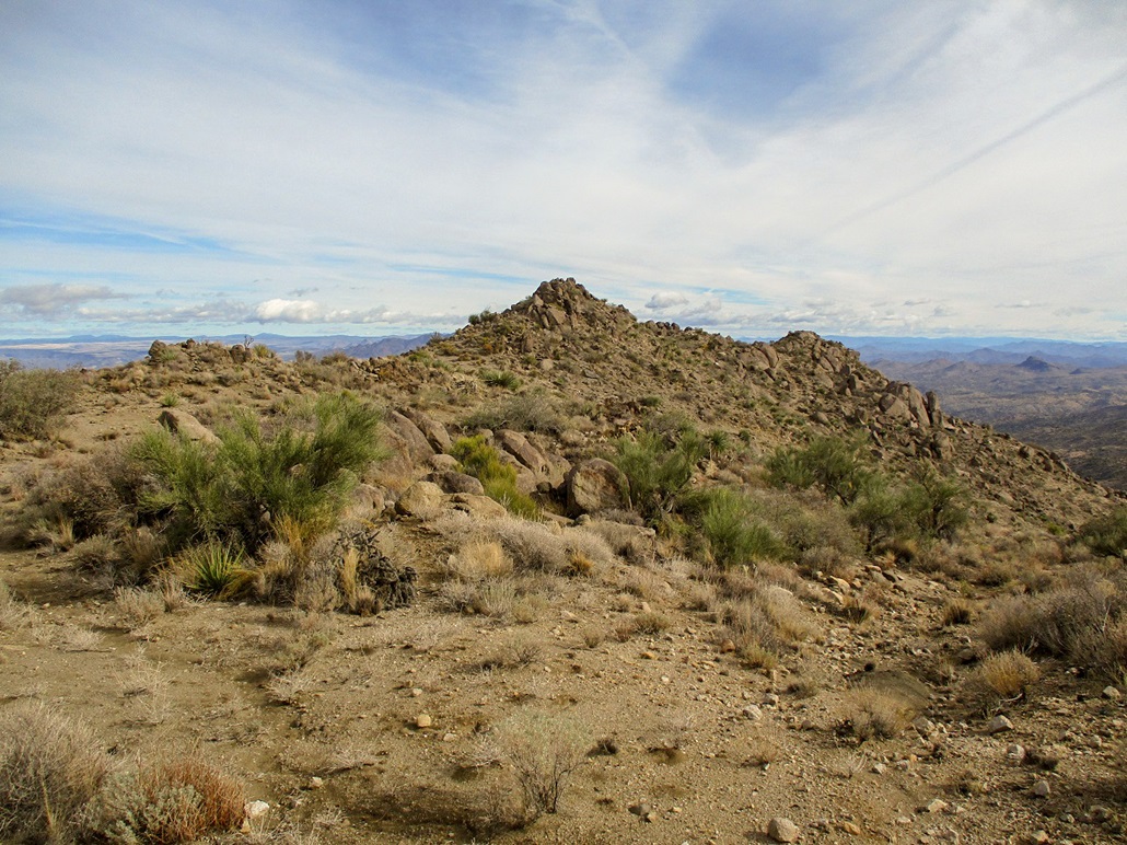
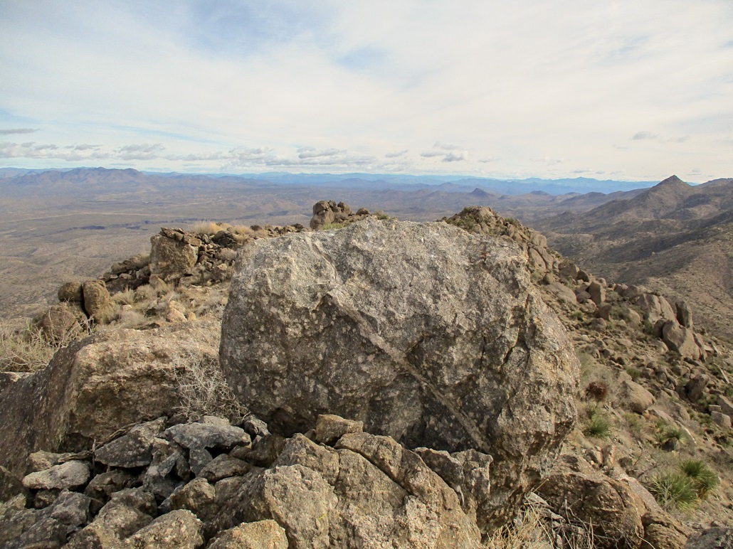
The highpoint is a pointed jumble of rocks about 300 feet to the east. I walked over easy terrain to get to the rocks, then up a couple easy steps and chutes to gain the highest point. I stopped briefly for photos, but took a longer break back at the tower and that odd bench. I did not sit on the bench. Whatever trash I generated, I took down with me.
The hike down was fantastic. Once down past the steeper slopes up high, I fast-walked, even jogged, much of the road to the bottom. It was smooth and mostly free of smaller rocks, and the tread itself was just soft enough so that I wouldn't slip. I was back to my car quickly. The one-way distance is about 2.5 miles. It took me an hour and fifteen minutes up, but just 40 minutes down. I'm just grateful no one saw me jogging.
I changed back into more confortable driving clothes, and returned to the highway, now aiming for Kingman. I spent the night there, then hiked Nutt Benchmark the next day.
This hike had gone well. It was a perfect way to break up the drive, and while I would not recommend it on its own merits, it is definitely something to look at if driving through the area.
|


|