
The Mountains of Arizona
• www.surgent.net
|
| Peak 4489 |
• Harquahala Mountains • Harquahala Mountains Wilderness • Maricopa County |
|
Date: October 15, 2016
• Elevation: 4,489 feet
• Prominence: 1,689 feet
• Distance: 6 miles
• Time: 6 hours
• Gain: 2,080 feet
• Conditions: Sunny and warm
• Teammates: Matthias Stender
Arizona
•
Main
•
AZ P1K
•
PB
•
LoJ
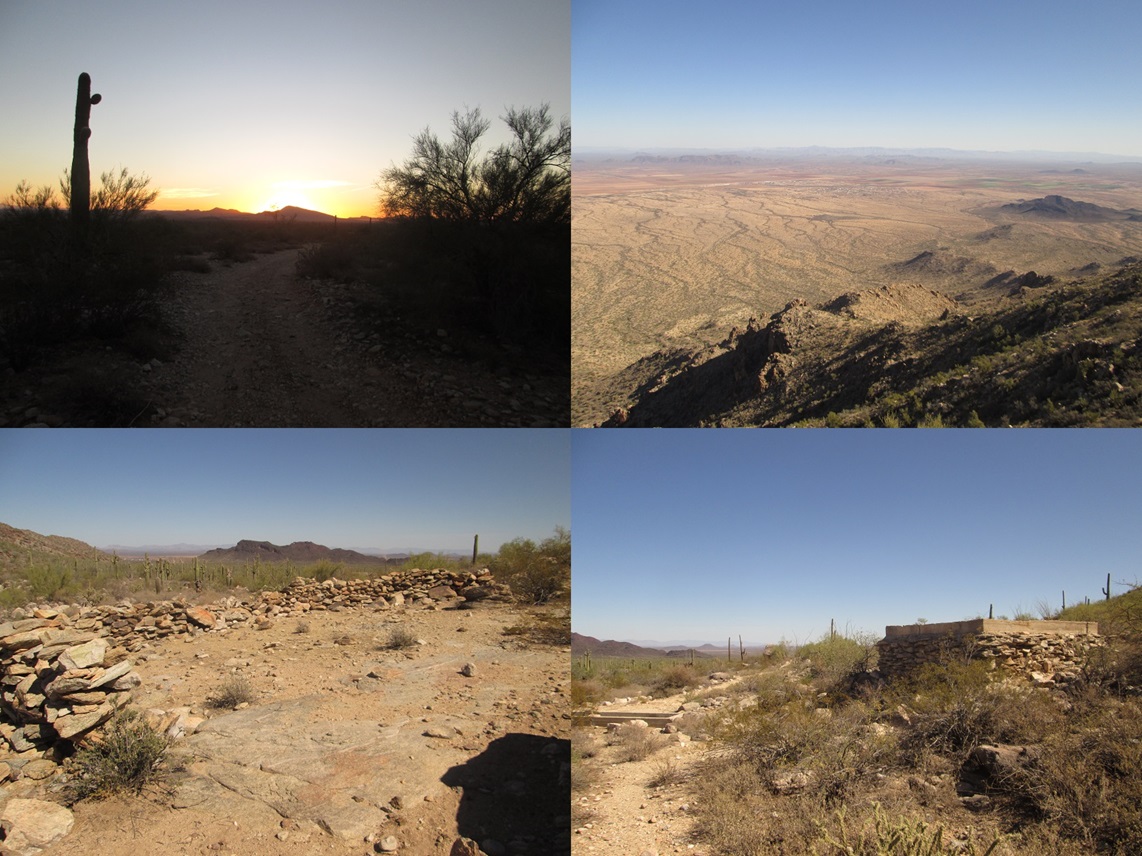
This peak lies at the northeast tip of the Harquahala Mountains, rising south of the town of Aguila in northwest Maricopa County. It has nearly 1,700 feet of prominence, but apparently no name. It just goes blandly by its elevation, 4,489 feet.
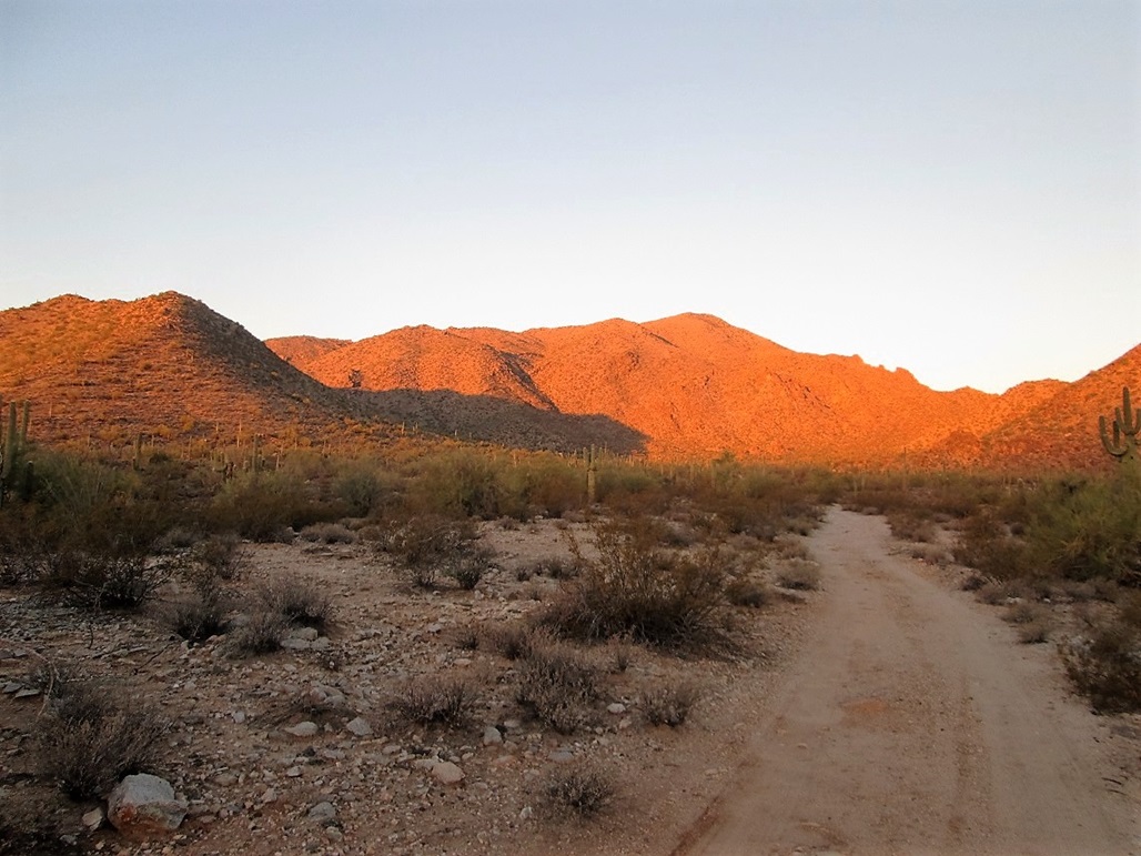
Matthias and I set out to hike this peak, me driving my new Subaru Forester. We met at the Denny s on the Carefree Highway near Interstate-17 at 5 a.m., then proceeded west through Wickenburg and into Aguila, about a sixty-mile drive. In Aguila, I followed Eagle Eye Road south about four miles to where it splits with Aguila Road. South of the split is a scant desert track marked by a BLM marker. The map shows the road only goes in about a mile, but I was conservative in my new Subaru Forester, only driving in about a quarter-mile to a gate. I parked off the road, the time 6:25 a.m.
The peak rises immediately west of Eagle Eye Road, and viewing it (and the topographic maps) suggests the climb is fairly straightforward. A mutual pal, Scott Kelley, climbed it a year ago and said it was fun and easy. The ridges and slopes trending east are all long and unbroken. Other than putting in the effort, it looked like your typical brushy, trail-less rocky desert summit that anyone could do.
We started walking at 6:35 a.m., still in shadow as the sun was rising behind us. We were at the end of the road in fifteen minutes. There is a stone foundation, a concrete water trough and a stone animal pen (?) from the olden days. Once near these old structures, the canyon opens, now trending south. By now the sun was up and we could now study the slopes, choosing a route to follow up.
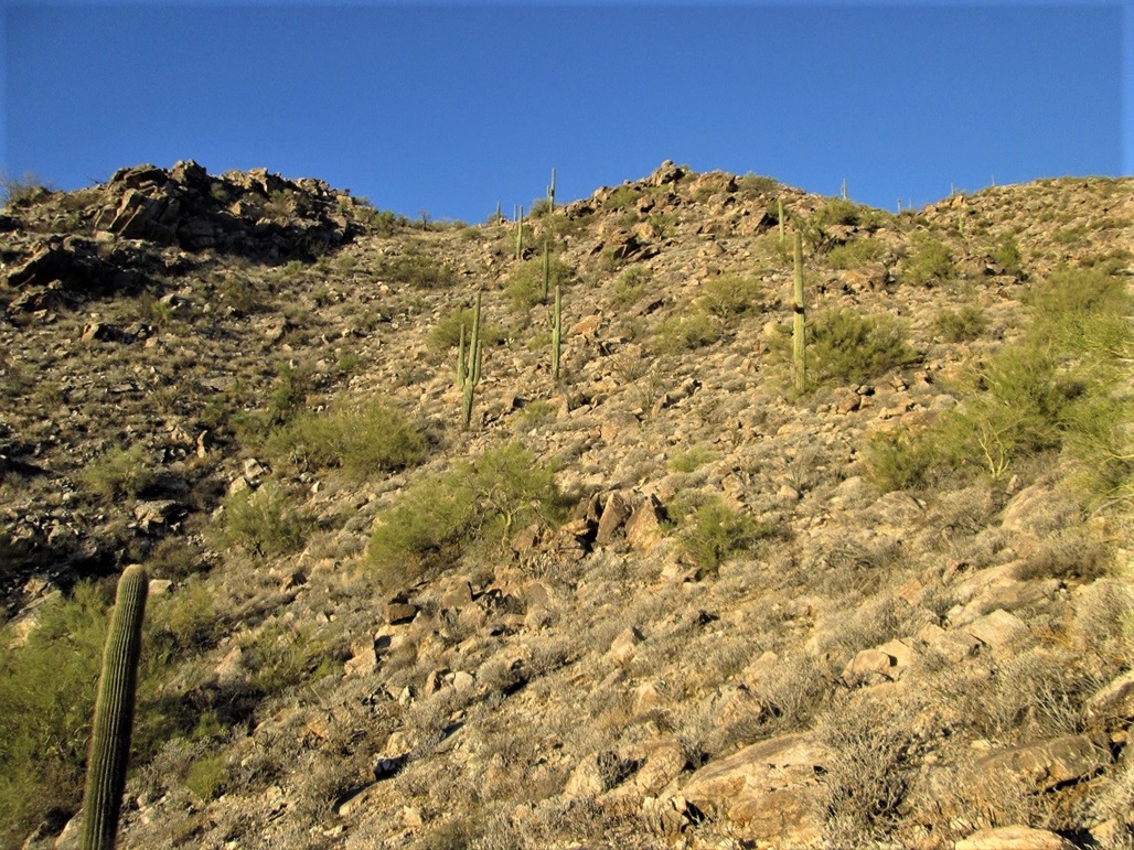
We angled a little to the left and both saw a ramp that looked friendly. We dropped into the drainage, then up the other side and aimed for this ramp. We followed whatever path looked easiest and quickly ascended this ramp to put us on top of the ridges, a gain of about 400 feet from the drainage below.
Now on the ridges, we assumed they all eventually should connect and lead to the top. Thus, we started hiking up our ridge, going from point to point. The gradient was lenient and the ground rocky but not too rocky, brushy but not too brushy. It was a little warm, the temperature in the 70s, but the day was clear and dry, with no clouds anywhere.
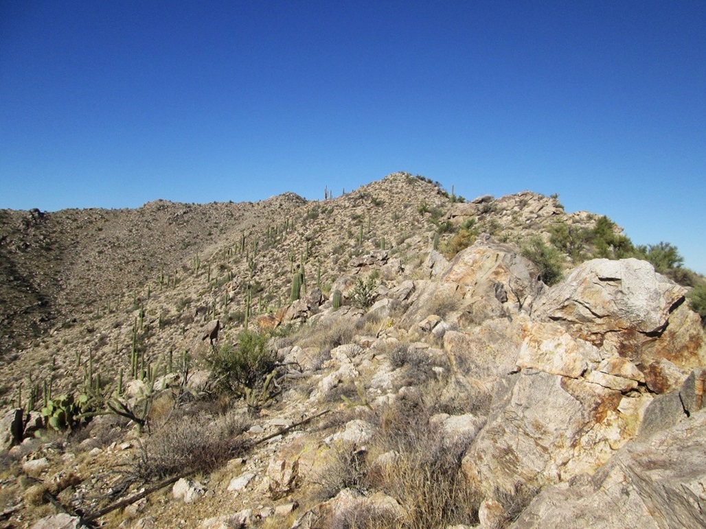
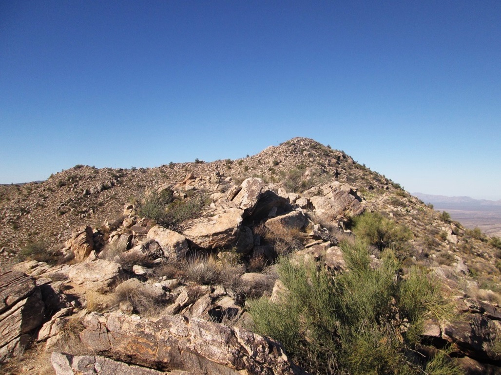
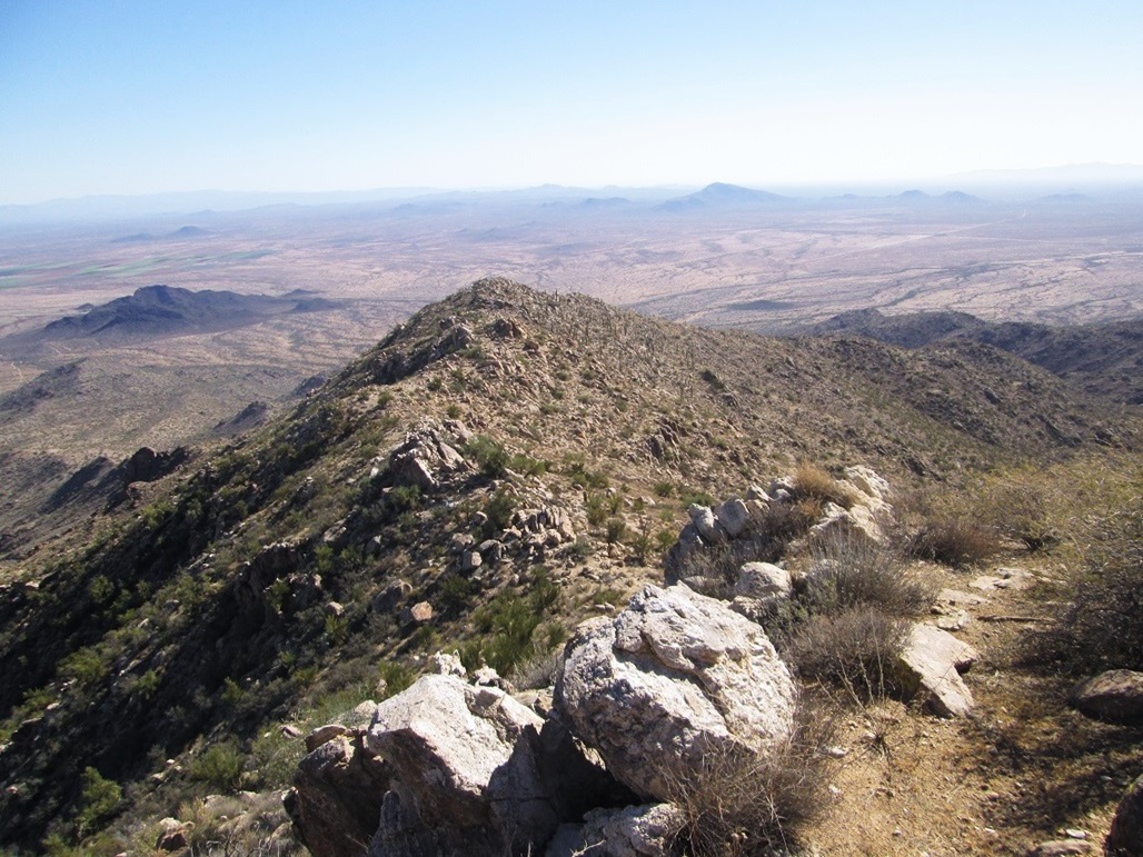
We followed ridges upward until we were on the main eastern ridge. We could see the main southern ridge, with the main subsummit, Peak 4425, which lies south of the objective. We used it as a gauge, because we often could not see the actual summit for stretches at a time.
Now on the main ridge, we hiked westward, the final couple-hundred feet rockier, but never requiring more than hands to balance as we moved up and down through the slabs. We were soon below the summit. We angled a little left, then turned right and walked up the final few dozen feet to top out on Peak 4489. Although we had moved at a steady pace, the one-way hike had taken us exactly three hours. We dropped the packs and sat on nearby rocks.
The register held just a few names going back to the 1990s, a running gag about "bowl games" interspersed with the signatures. Not many people climb this peak. Scott Kelley was the last, about 11 months ago. There would be years between signatures in the register. It s probable that Matthias and I were the only ones to climb it thus far into 2016.
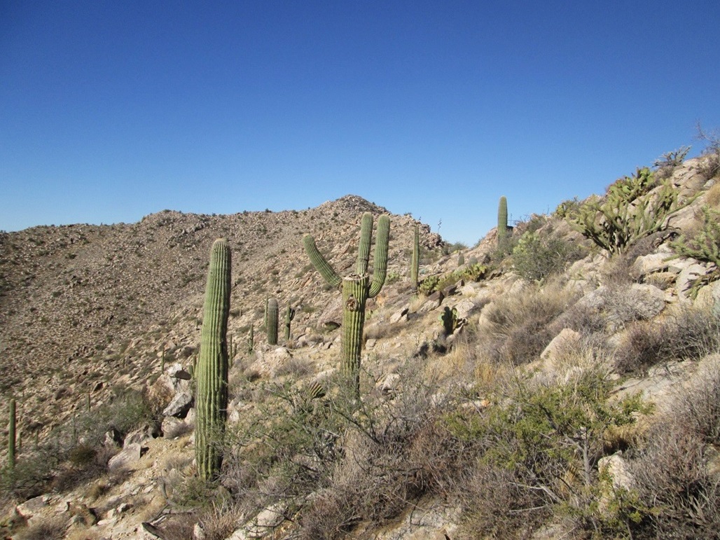
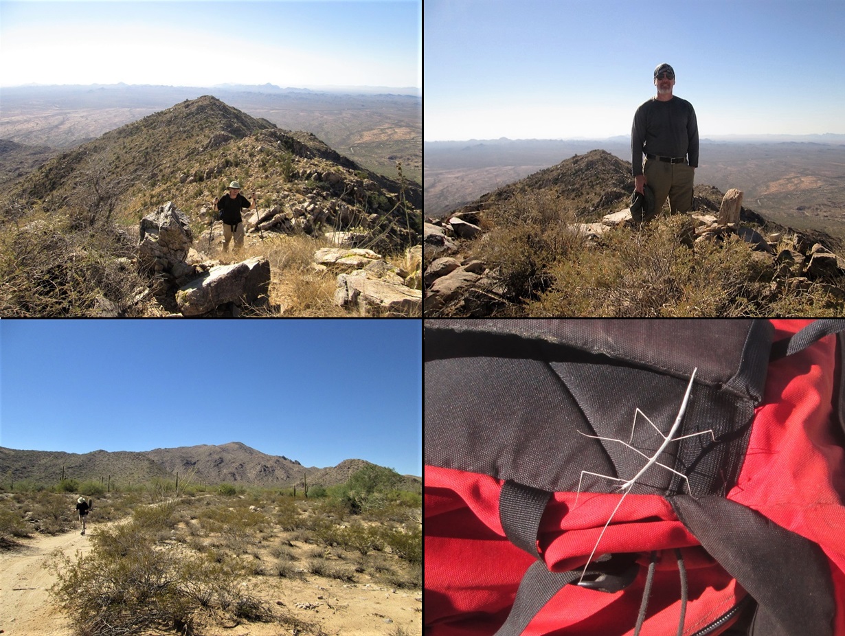
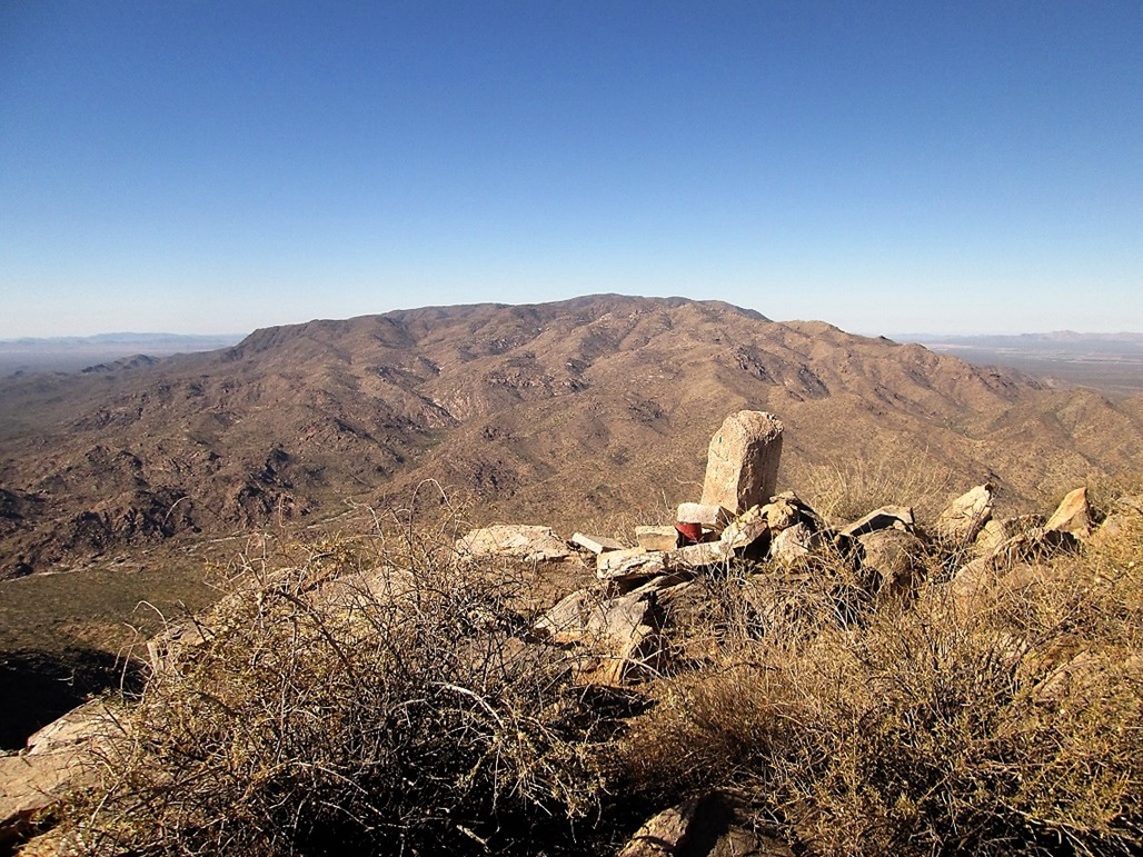
We spent about 30 minutes up here, shooting photos and trying to name the surrounding mountains. The close-by ones were easiest, but the day was clear and dry enough so that we could make out distant peaks, such as Woolsey Peak way down by Gila Bend, and Mount Hope way north on the O-RO Ranch. Naturally, if one can spy Mount Hope, then Mohon Peak should be nearby, and we were barely able to detect its unique silhouette. Looking west, we could stare down at nearly 1,700 feet of air, or look across at Harquahala Mountain, the range highpoint.
When we were going to get the packs back on, Matthias noticed a bizarre creature on his pack a walkingstick insect, or "phasmid". This was a first for me! I had never seen one in the wild. They really do look like sticks, and they move slowly, with long skinny legs. We took a couple images. We let it walk off, no intention to harm it.
For the hike down, we retraced our route, for the most part. We got down about halfway, but then trended a little farther south along another subridge until we were overlooking the main drainage from this morning. We knew we were not where we had ascended, so we decided to bust down the steeper slope. We were able to zig-zag down the slope into a sub-drainage. It was looser, brushier and steeper than our ascent ramp, but we were committed to it.
In the drainage, we clambered down the bare rocks. By now, the temperature was getting much warmer, probably about 85 or 90 degrees. But in the drainage, with the white granitic rocks, all the reflected energy made it feel ten degrees warmer. We got out of the drainage and cut across slopes, then some more in the main drainage, then finally, back to those stone structures.
From the structures, we walked the road back to my vehicle. It was warm and we were both a little bushed from the hike. Our navigation error added about a half-mile and a half-hour to our day, we estimated. Back to my vehicle, which was still there and untouched, we changed and got moving. The round trip had taken us six hours exactly.
We exited by driving southeast on Aguila Road. I wanted to scout Black Butte for a future hike. Twenty-three miles later, Aguila Road meets up with Vulture Mine Road. We followed that north into Wickenburg, got drinks, then drove back to the Denny s, arriving there about 3:30 p.m. We shook hands and went our separate ways.
The hike had been enjoyable but a tad warm. Maybe we should have waited a month, but I was itching to get back onto the desert summits and was happy Matthias was willing.
I find it hard to believe such a prominent mountain has no name. An "obvious" name might be Eagle Eye Peak or Aguila Peak. There is an Eagle Eye Peak and an Eagle Eye Mountain, two small rocky bluffs about three miles east of the peak, featuring a natural arch that suggests the profile of an eagle. But I guess no one ever got around to giving this bigger peak a name.
|


|