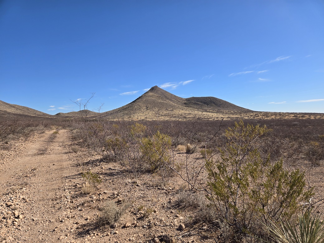
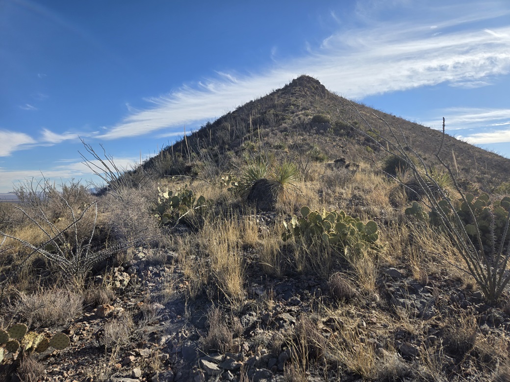
Peak 5487 is the southernmost peak of the Whetstone Mountains, rising about a mile north of state route AZ-82 about six miles west of the town of Whetstone. It has a nice triangular shape with a long ridge from the west and a pointed top.
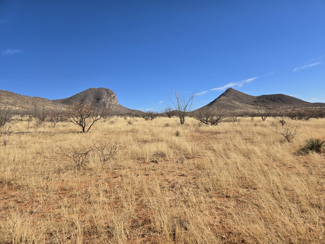
Two months ago, Matthias and I climbed Mescal Peak, the highest peak in this grouping of peaks. Mescal Peak rises about two miles to the northwest. This was my first time on this property. That hike gained me some knowledge of what access would be like for the other peaks here.
I was on my Tuesday Tempe drive, and whereas I normally hike a peak around Tucson to break up the drive, thought I would mix it up a little, and hike this peak instead. I chose it primarily because it looked short, something I could do in a couple hours.
The land here is a patchwork of State Trust, private and some random BLM inholdings. There is a gate along AZ-82 where one can park, a sign nearby the gate saying "Foot Traffic Welcome". In past visits to the area, I always see a few cars parked here. According to land-use maps, at the gate itself is private land, but a big State Trust section lies north of the gate. The peak I wanted is on private land. In cases like this, once past the initial fence, unless I see more fences with unequivocal "no trespassing" signage, I usually proceed until told I can't.
I was the first one here, arriving about 8:30 a.m.. The day was sunny and very mild. Being a Tuesday, I did not expect a lot of cars. I got properly dressed, locked the car, then discovered that the gate is locked and cannot be opened. Just then, a work truck pulls in and parks, but the driver never got out. I was hoping he'd open the gate.
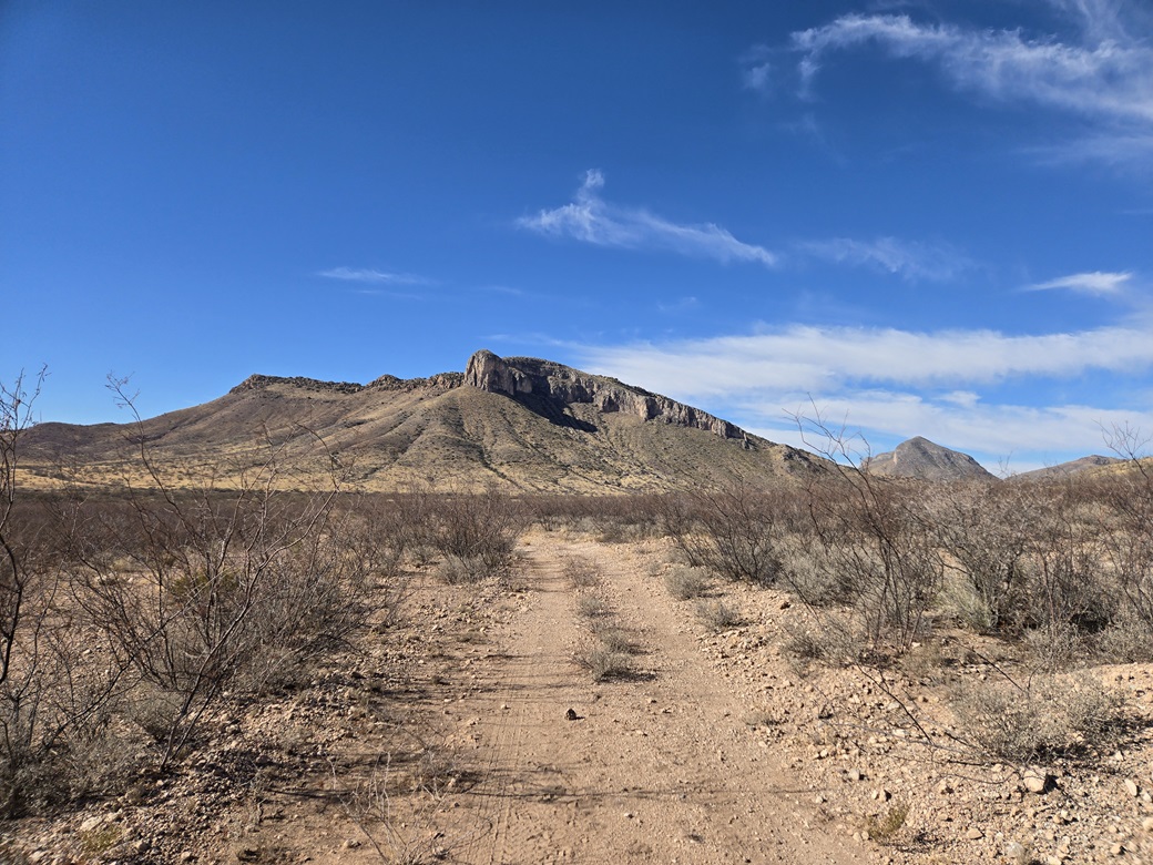
I found a spot to squeeze between two strands of barbed wire, and started walking northeast along a sandy ranch track. This track had many recent footprints and tire prints, so people come here often, that much is clear. The peak was about two miles distant.
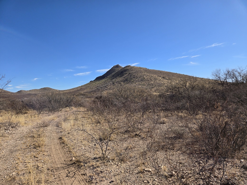
The walk along the ranch track went well, being mostly flat and sandy. I covered a mile and a half in about twenty minutes, the track dropping slightly into a draw with a clearing and some cattle items laying about. I stayed on the track as far as seemed sensible.
The peak from here was close by. Its lower slope was pitched gently and covered in grass, rocks and ocotillo. Behind this lower apron, the ridge narrowed and became much more rocky. I left the track and trudged up this lower slope, a gain of about 200 feet.
The ridge flattened here, but the spine became rockier, big exposed sections of limestone mixed in with chert. This "flat" segment ran about two hundred feet horizontally, gaining about 20 feet in that time. However, it was slow going. The rocks were jumbled and often loose, and any good place to step had a big ocotillo or prickly-pear growing on it.
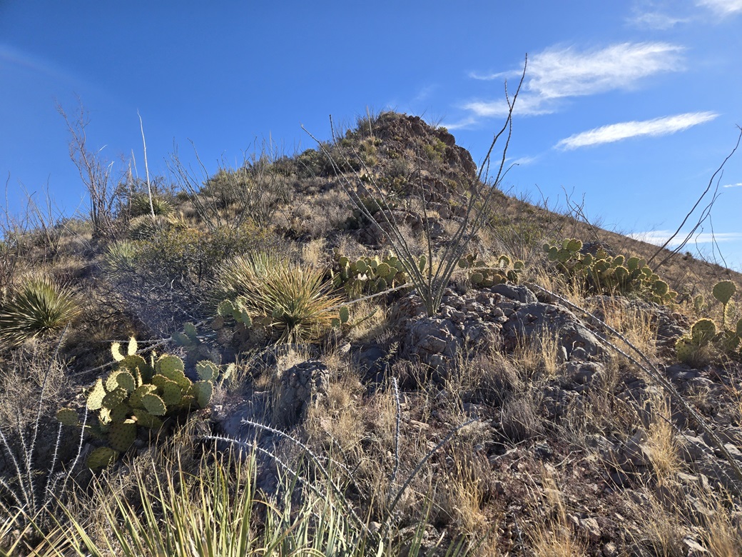
The grade started to steepen again. I generally stayed exactly on the ridge itself, going directly up and over the exposed rock. This worked generally well, the footing good when the rock was solidly in place. Sometimes I would angle to one side to drop below a particularly sloppy section of rock and brush.
The last fifty feet got a tad steeper, and one segment of rock was exposed enough to get my attention. I used my hands here and stepped carefully, with about a foot-wide catwalk for a few feet. A fall to either side would have meant a drop of about twenty feet. But this was over quickly. The last couple dozen feet were much gentler, and I was soon on top of Peak 5487.
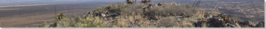
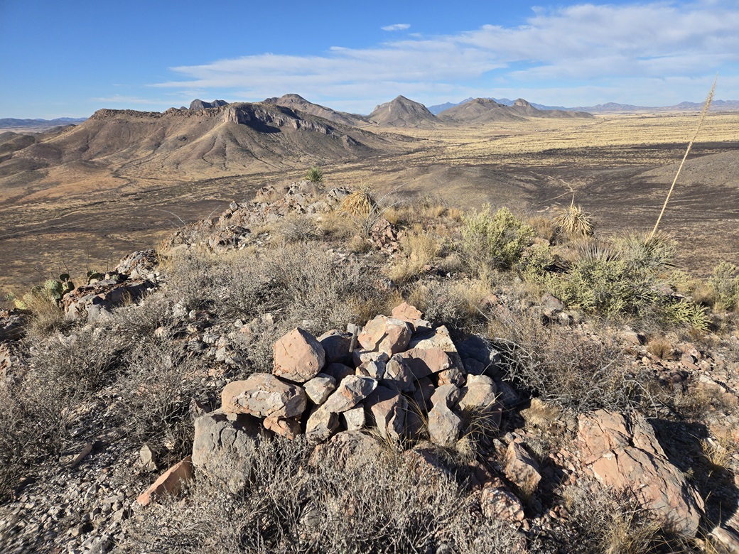
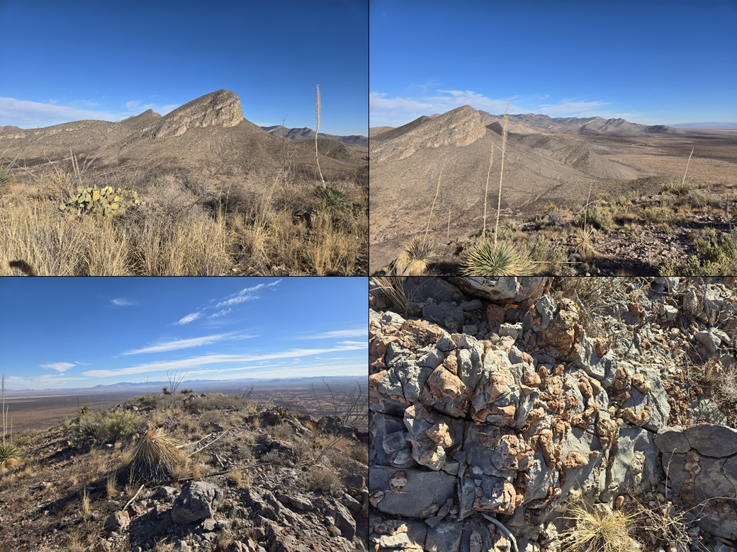
The one-way hike covered a couple miles and had taken barely over an hour. The top was open, with a rock pile at its center, but no cairn or register to be found. I snapped some photos and took a five-minute break. The day was clear and with low humidity. I had crisp views of the Whetstone peaks to the north, the Mustang peaks to the south, and the Santa Rita peaks looking west. To the east, the peaks that way were still in the morning's glare.
Going down, I found a bypass option for that narrow catwalk segment. This bypass was looser rock but not exposed. As I descended, that work truck was slowly making its way on the ranch tracks. It would stop for a while, then move onto the next place and stop. I timed my descent to avoid him.
The hike out took about an hour, and my total time gone was just over two hours. Back at my car, just one other vehicle had pulled in, but I did not see anyone else. This had been a fun and informative hike. There are a few more peaks back here I want to tag, and now I know how to get to them. I never saw any other fences or signs. Whoever owns this land, thank you for allowing access.
It was nearing 11 a.m., so I changed and drove myself into Tempe. The next day, I would tag a bunch of easy peaks in the Tonto Basin and up by Payson.