The Mountains of Arizona
• www.surgent.net
|
| Porcupine Mountain • Peak 6525 |
• Verde Rim, Yavapai Plateau • Cedar Bench Wilderness • Yavapai County |
|
Date: March 14, 2011
• Elevation: 6,525 feet
• Prominence: 1,365 feet
• Distance: 4 miles
• Time: 1 hour and 15 minutes
• Gain: 730 feet
• Conditions: Lovely weather, remnant snow on ground
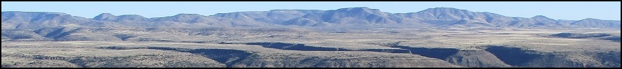
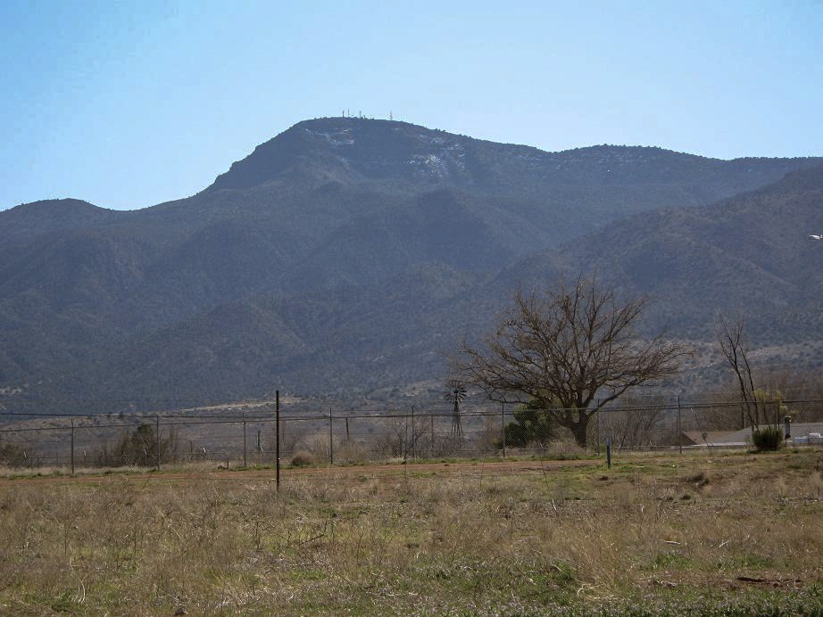
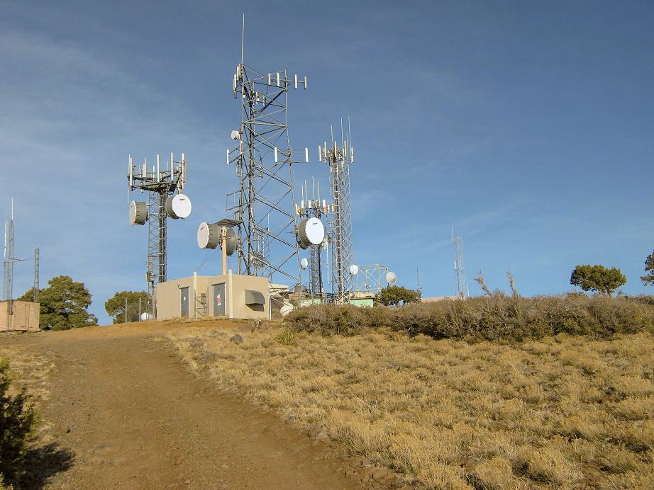
Peak 6525 is a dome-shaped summit on the Verde Rim in north-central Arizona, overlooking the town of Camp Verde. Its height and prominence means it gets the honor of hosting a batch of communications towers, so there is a road to the top. I was on a one-day driving tour of central Arizona, hiking two simple peaks, this being my second.
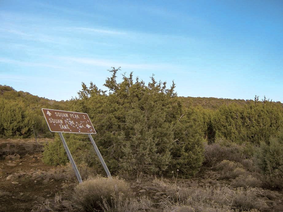
The peak is (and has been) known officially as Squaw Peak, but there is a push to get this named dropped and replaced with a more appropriate and less offensive name. The proposed name, Porcupine Mountain, comes from Das Zine Das Dahe, which means "Where The Porcupine Sits". The name is suggested by the Yavapai-Apache Nation, who historically lived in the area and still do. When the name change is official, I'll update this page to reflect it.
Update, September 2022: It is now officially Porcupine Mountain. Please see this USGS link for a full list.
Early today, I hiked Baker Butte, then followed AZ-260 into Camp Verde. I stopped at the Forest Service Ranger Station to inquire about the road to the top, but the ladies working there had no information. However, they gave me a free map. I could see snow patches on the north-facing slopes below the summit, but it had been dry for nearly two weeks now so I hoped the south side would be snow free and dry.
After stocking up in town, I drove southbound on Interstate-17 up the long grade to gain the "Yavapai Plateau", exiting at Exit 278, signed as Cherry Road, a main route to Prescott. However, I went east to where the pavement ended. Immediately, a sign mentioned the peak being 11 miles away. It was about 3:30 p.m. when I started the drive along FR-732. I assumed I would get about half-way in, then be forced to stop due to poor road conditions, set up a camp and then hike to the top the next day.
To my surprise, the road was good. It is deceptively smooth for the first two miles (enough to lull me into going faster than I should have). It achieves a highpoint, then starts a descent into a small village of private residences. I followed the signs and after about a mile had bypassed the homes. The road stayed in good shape as it followed a rocky streambed for about a mile, before the land opened again. About five miles in, the road makes one or two quick turns to bypass another private residence. Again, I followed the signs.
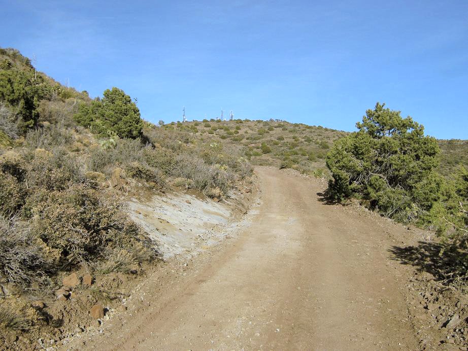
After this last residence, the road starts steeply up the hills. The ground looked muddy enough to suggest 4-wheel drive, but it wasn't too bad. Previous drivers had driven in while it was still wet, forming six-inch deep ruts. I was able to rumble another 3 miles to a junction with one road going hard-right to a tank, and the main road going soft-right to Peak 6525. The sign said the distance to the peak was two miles. The road had been rotten for the last mile or so, so I opted to park at this junction and walk the remainder. It was 4:30 p.m., and I was pleased I had driven in as far as I had.
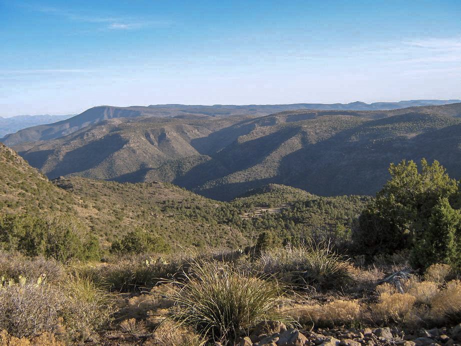
For the hike, I followed the road to the top. It got steep in spots, and the walk itself was very pleasant. Closer to the top I had to scare off some cattle milling in the road. The top itself, and all the towers, only becomes visible at a turn at the very end. The road makes a couple long switchbacks and then ends at the structures. I walked quickly, covering the one-way, two-mile trek in 45 minutes. With the sun low in the west, I had great views down into Camp Verde, and the spectacular canyons of the Verde River to the east. Mazatzal Peak, with all its snow, stood tall to the southeast. Looking farther north, Humphreys Peak and its surrounding peaks stood out on the Coconino Plateau. Even this little range I was in, which has no name as far as I know, was quite lovely, with rounded forested peaks of juniper, pinion and cactus, pocked in places with impressive cliffs and rocky formations.
I didn't stay long, maybe 10 minutes. There was no one up here, and the towers just stood there, keeping America connected. The highpoint seems to be a boulder beside the fencing surrounding one building. I found the benchmark by accident in another rock a few feet away. The walk out went quickly, once again highlighted by the cattle blocking the road. I was back to my truck in 30 minutes, a total time gone of 1 hour, 20 minutes. Combined with my Baker Butte hike from a couple hours ago, I had put in 7 miles and 1,400 feet of gain today, or about a typical "workout" hike.
I thought about camping here, but I didn't like that I was along the road, so I drove out to a nicer area closer to the interstate, but well-hidden in a copse of pinion. I had the place to myself for the night, and slept well in the back of my truck, with the overnight temperatures about 45 degrees, and a half-moon for half the night to light things up.
The next morning, I exited back to the highway, traveled south about 30 miles to the Bumble Bee exit, and followed that road road past the town of Bumble Bee to a camping area where Beth and I stayed a year ago. At the time, we had just had our beloved 14-year old kitty, Iaroslav (aka Iari, The Big Kitty, TBK), put down as he'd grown infirm and was suffering from some sort of nerve disease where he couldn't lift his head. We had driven to this spot and built a cairn out of rose quartz in an out-of-the-way spot in his honor. This was my first time back, and it took me almost 30 minutes to find this cairn, which we hid too well. But I found it, mostly undisturbed, and stood by it, and said hi to my old pal again. It was good to be here and reconnect.
|


|