The Mountains of Arizona
www.surgent.net |
|
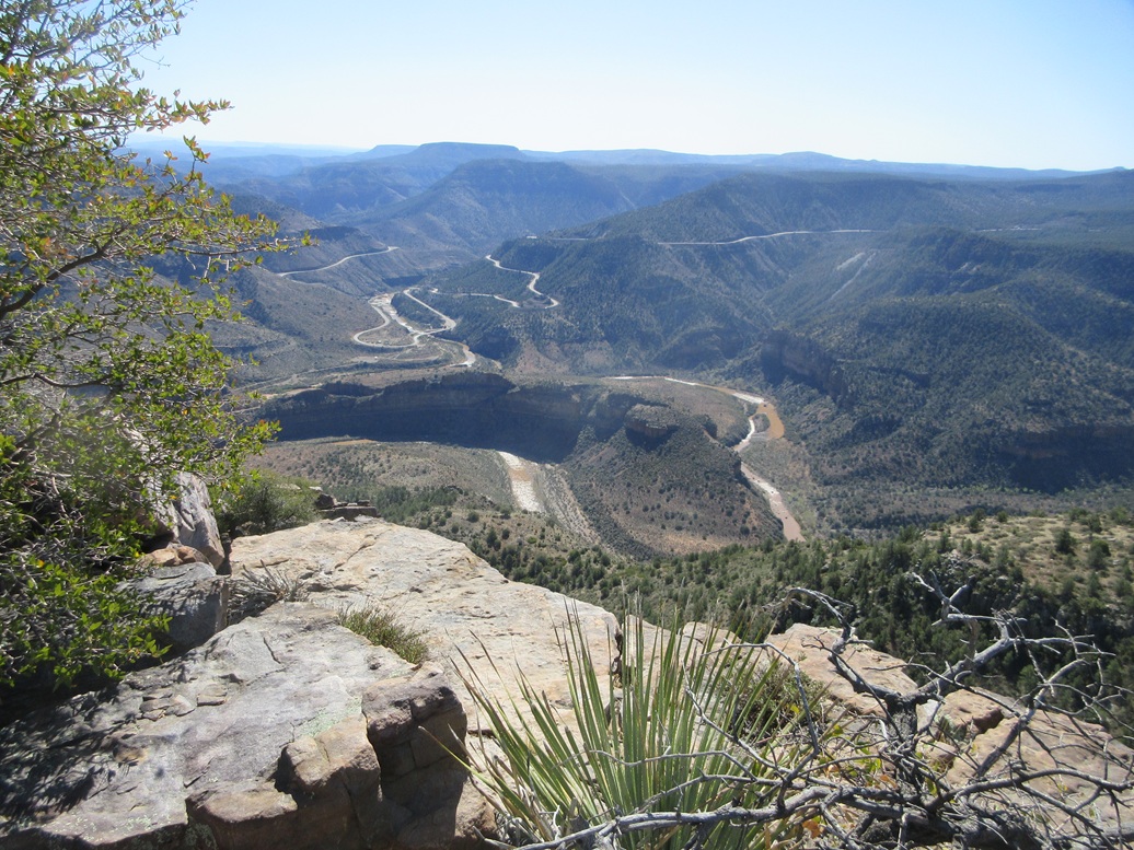
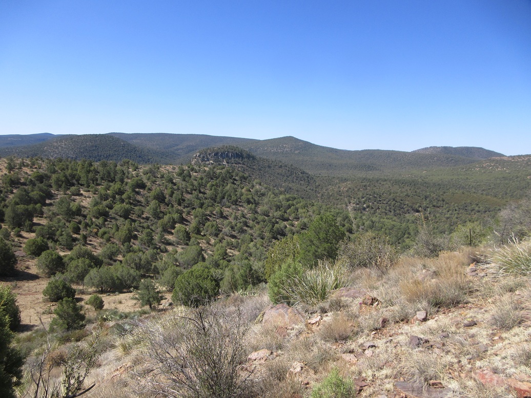
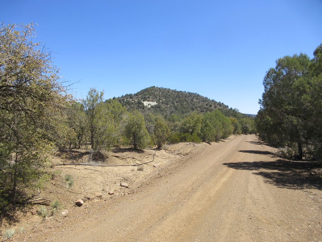
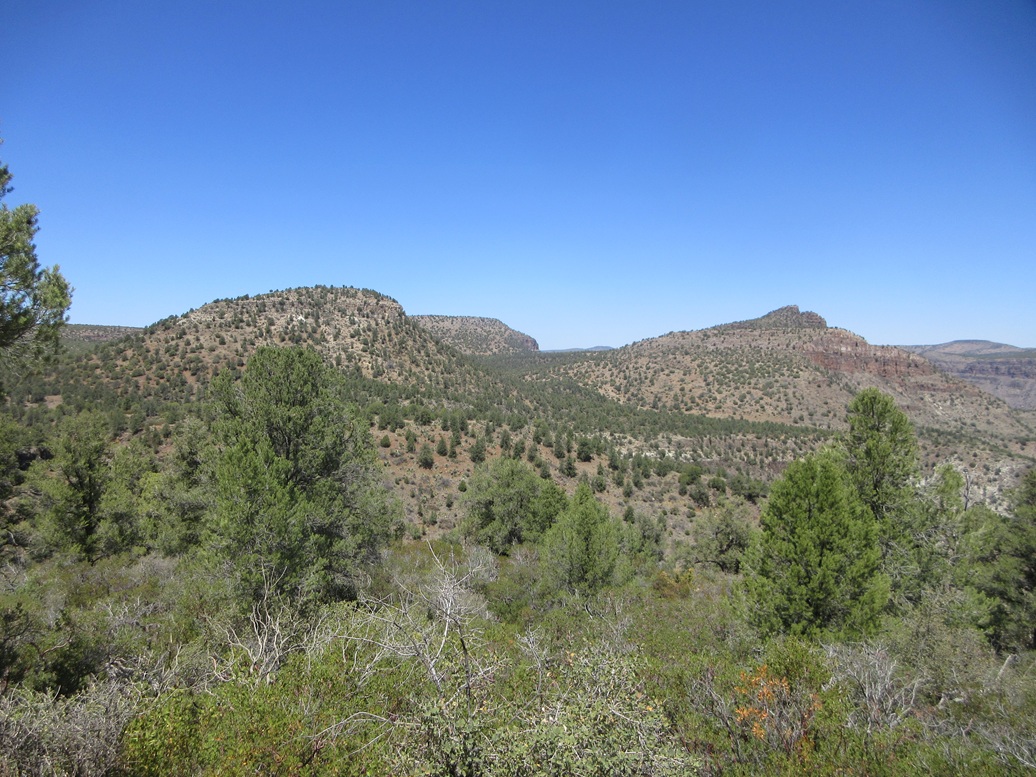
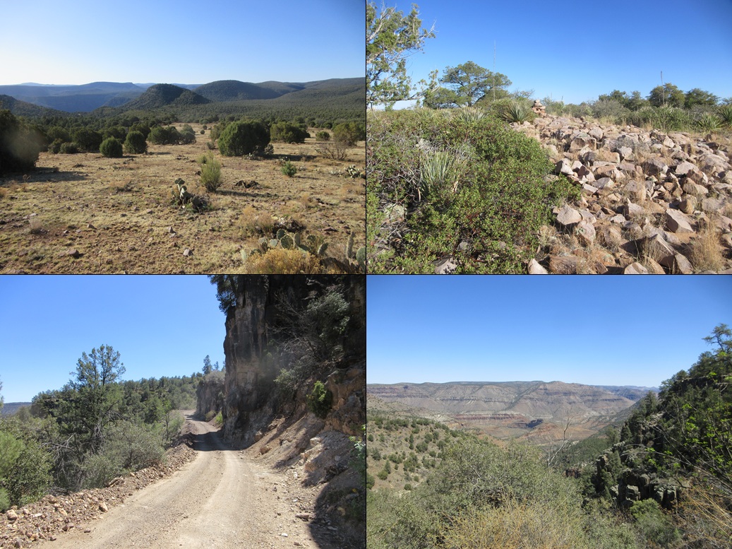
Regal Benchmark • Salt Benchmark • Phillips Mine Hill These three peaks lie directly along the south rim of the Salt River Gorge near Seneca, west of where highway US-60 crosses down into and out of the Salt River. The peaks have forested slopes coming up from the south, and where they abut the edge, sheer cliffs down into the gorge. The peaks rise about 2,000 feet above the river itself. The Salt River Gorge is one of Arizona's better-kept secrets. Were it not for the Grand Canyon hogging all the glory, this would easily be a National Park. The views and the landforms are astounding. Maybe this is a good thing. Few people come here and those that do invariably are just passing through on the US-60. The gorge cuts through some of Arizona's remotest territory. South of the gorge is the San Carlos Apache Reservation, and north is the White Mountains Apache Tribal Lands. This alone throttles casual visitation to near zero. The parts that are ostensibly public, such as these three peaks and the canyon to the west, are simply hard to get to. Roads are scant or nonexistent, and few trails exist. These three peaks lie close to one another with decent roads that should make access relatively uncomplicated. There is a small private inholding for the Canadian Mines tucked in between two of the peaks, but it appeared it would not be necessary to cross any of this posted land. The surrounding land is all on the Tonto National Forest. On my trips up and down the highway, either on my own or with my usual hiking pals, we have looked at these peaks and contemplated climbing them. What I found perplexing was that only one other person has ever logged ascents of these three peaks, that being Mark Nicholls back in 2006. Was there some reason no one else has been up here in all these years? Bad terrain? Cliffs? Mine owners with shotguns? This being the Wednesday between teaching (essentially, my "weekend"), and things warming up now in the lower elevations, I thought that conditions should be ideal to make a journey up this way. After class last night, I headed east into Globe, then up US-60 to the Jones Water campground. The highs in Phoenix were close to 100°, and in Globe, temperatures were still in the 80s. But once at Jones Water, elevation above 5,000 feet, the temperature had dropped into the 60s. This was my third time here at this humble campground. I even drove to the spot I had the first two times but it was taken, so I drove to the next one and grabbed it. It was past 9 p.m., so I had a dinner, then got myself situated in the passenger seat. The night was mild, with no clouds and a mostly full moon (a waxing gibbous that would be full in a couple days). I opened the car's interior skylight to let in the moonlight, and slept reasonably well. Temperatures were in the low 40s when I awoke the next morning at dawn. I was moving by 6:10 a.m.. Back on US-60, I drove north on it (technically, eastbound) another 15 miles or so, to the Seneca site (now being briefly on San Carlos Nation property), then on its roads west back onto the Tonto Forest, now on FR-473. I was here a year ago but only got in a mile or so, recalling the roads being good, if a little rough. FR-472 was a wild-card, because on the satellite images, it looked good, but it does cross below a cliff and I wasn't sure if my car would be up for it. I saw a cleared area near the rim and just before the cliffy segment, and that's what I aimed for. I rolled in a little before 7 a.m., the temperature now in the 30s, but the sun now rising to warm things up. According to my odometer, this was about 3 miles in from the highway. I got suited up and started walking at 7 sharp, temperature 32°, according to my car temper-o-meter.
Date: April 9, 2025 (22/32/452)
• Elevation: 5,427 feet
• Prominence: 427 feet
• Distance: 6.2 miles
• Time: 5 hours & 15 minutes whole hike
• Gain: 907 feet (gross)
• Conditions: Sunny and cold, then warming
Arizona
•
Main
•
PB
•
LoJ
•
USGS BM Datasheet
•
Mine information
I walked the road, snapping a couple images of the peaks tinted red in the early-morning light. The road is good, and it does drop in toward a crook in the cliff, dropping about a hundred feet. It gets narrow and hugs some cliffs very close, and I concluded the Subaru would have been fine on it. But I was already walking it and I did not have far to go anyway. I didn't feel like going back to my car.
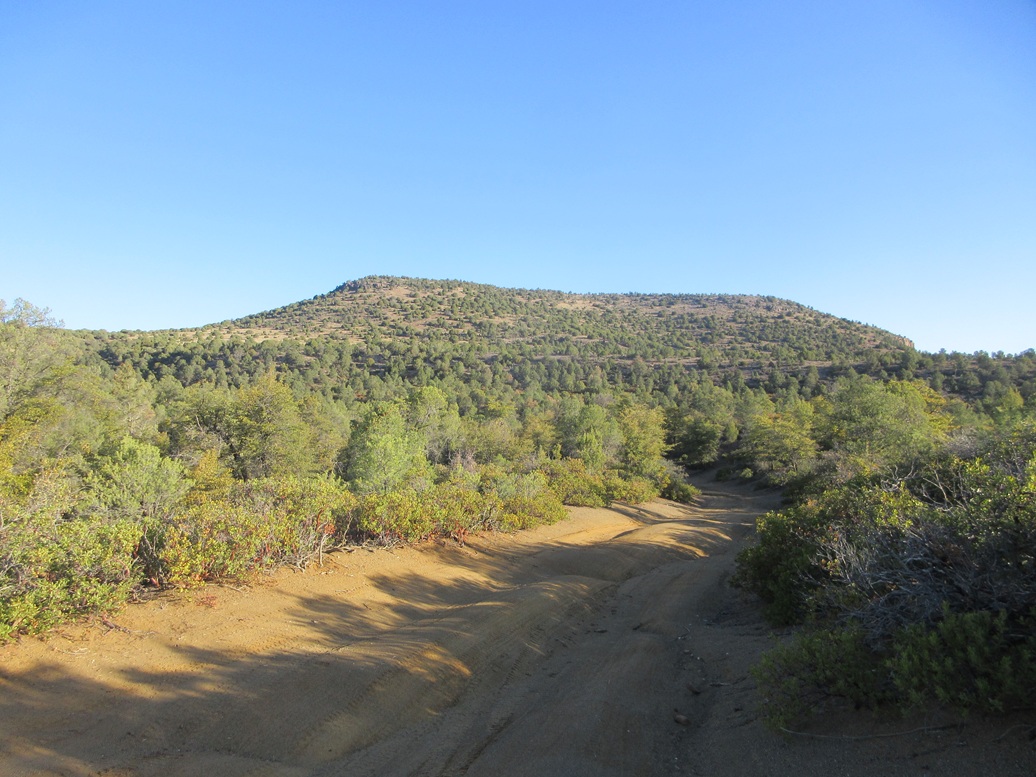
I stayed on the road, FR-473, for 1.4 miles, to where it meets with FR-382, which goes north. I could see the three peaks from here: Regal Benchmark Peak to the left, Salt Benchmark Peak to the straight-right, and Phillips Mine Hill to the closer-in-right. My plan was to hike them west to east, highest to lowest elevation. Thus, Regal Benchmark Peak became my first destination.
I walked north along FR-382, which is rougher, probably too much for the Subaru. Erosion is the main issue, with ruts, high centers and some cambering. A beefier vehicle would probably be fine but 4-wheel drive would be advisable.
About a mile later, I came upon a gate with a big "Stop" sign and a private property notice. This was the entrance to the Canadian Mines. I had looked them up beforehand and learned that this mine has not been active for decades. Nevertheless, it is still owned by someone, and apparently they still want to keep people out.
I stepped over the low fence anyway. Mainly, I was curious what lie ahead. Some fresh tire prints (about a week old) were on the road bed. I got in about another 300 feet, to a second sign, telling me to "Be careful" because "Your on video". I looked around for cameras but did not see any.
My usual rule is if the place looks kept up, then passing one barrier is kind-of okay, but not passing two. Since I did not need to access the peak this way, I turned around, not wanting to meet the owner or security people with bad grammar skills.
Back on the legal road, I found a track that angled northwest. This was evidently an actual road years and years ago, but has degraded into a wide track. An ATV might be okay on it, but not a regular vehicle. This track went in and up, into progressively denser tree cover. Of concern was the bear scat: fresh little piles and one about every fifty feet. It's April, they're stirring from hibernation and probably hungry and not in a cheery mood.
This track started to wane, and it appeared to aim for some tailings. I got close to it and saw it was a substantial mine adit. I was curious to go look in, but then figured this would be a perfect bear den, so I backed off. I retreated to where I found a game path steeply uphill, and went that way.
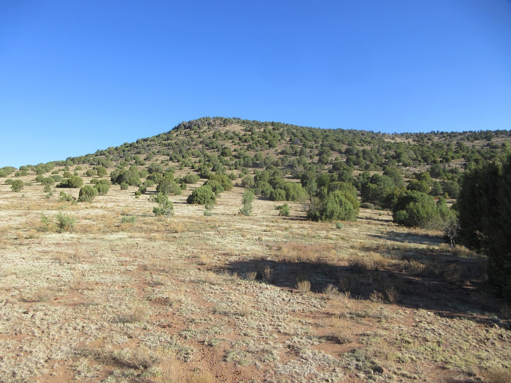
This worked well because the trees lessened and I had more open views of the peak, which was now just right in front of me. The slope was open with low grass, and dotted with piñon, juniper and smallish oaks.
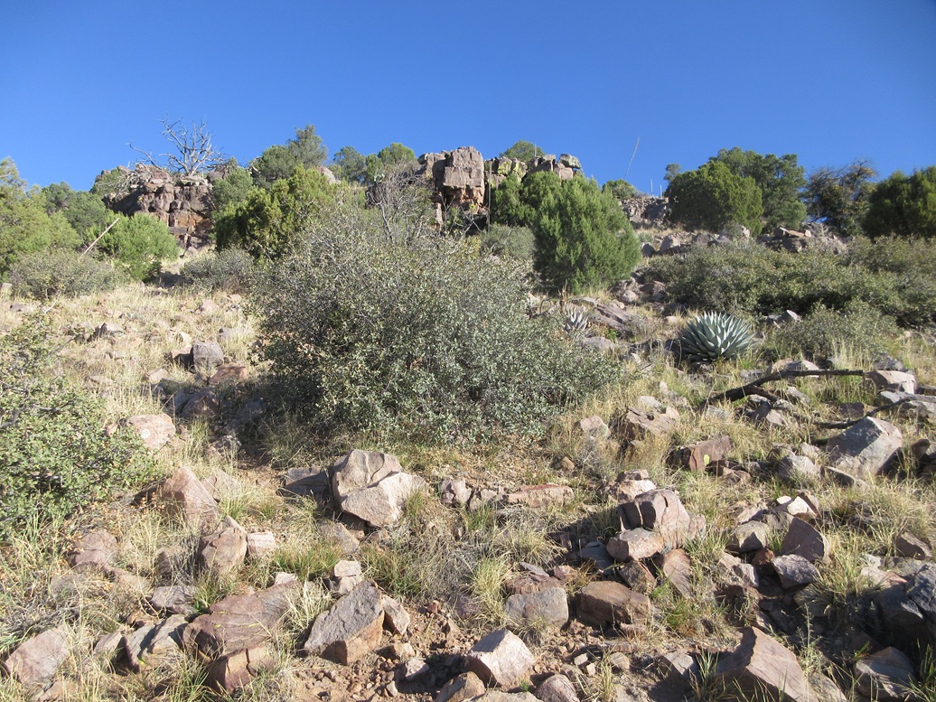
The grade was steep, then steeper, as it approaches some low cliffs. The ground became rockier, but I never needed hands. Even the cliffs could be bypassed easily. I was soon above them, essentially on top of the peak.
The top was covered in much denser trees and brush, including a lot of manzanita. I was able to find lanes but not always. I kept walking north and uphill. I came upon one large cairn randomly in the trees, probably a mine property boundary. Then moments later, came upon another one on a rocky clearing that looked like the top. I was excited... but sensed I still had more to go.
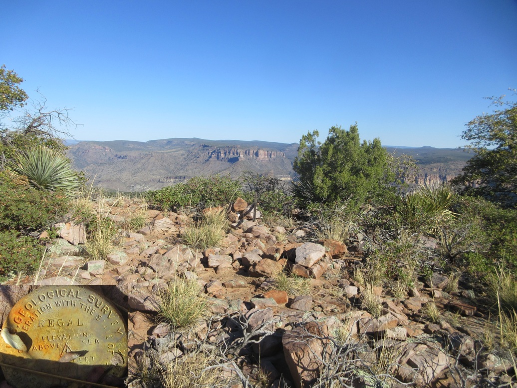
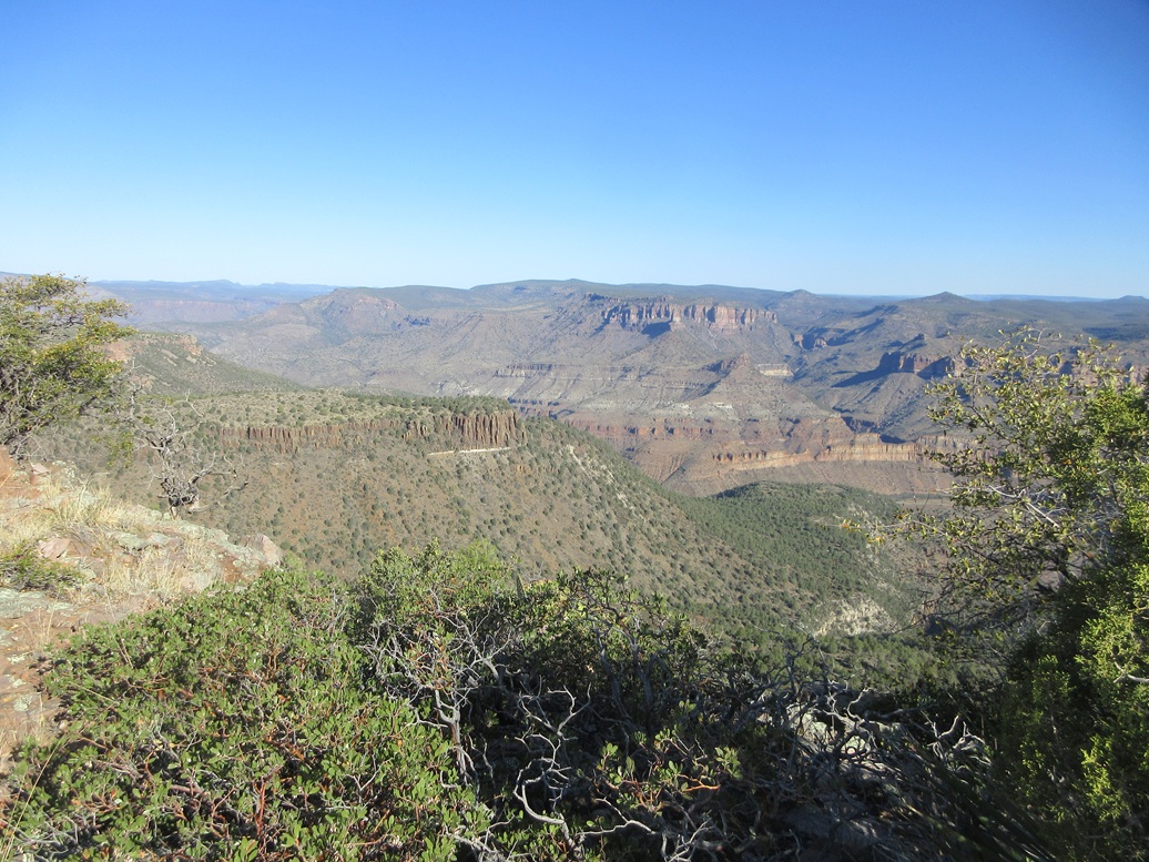
Sure enough, another fifty feet of pushing through the trees, I came upon the summit, another rocky clearing smack on the edge of the cliffs, with outstanding views down into the gorge and across to the opposite sides. It had taken me 75 minutes to get here, covering 3.1 miles.
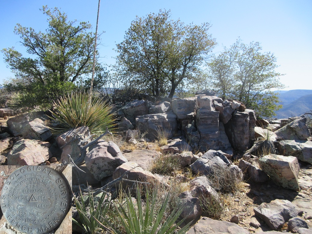
I found the "Regal" benchmark inside a small rock pile, the old height-of-light stick nearby. The USGS datasheet for the benchmark mentioned this hill being locally known as "72 Mesa". This was from the 1940s, and it does not appear on any maps. I love these old historic name references. This page is probably the first time in 80 years that "72 Mesa" has been mentioned. You're welcome.
The register was nearby, one of Mark's from when he was here in 2006. Surprisingly, there were two more signatures, two names I don't recognize, but no one in years until me. I uncovered the rocks a little to get the benchmark in the sun for an image, then reassembled the small cairn and took a break.
The day was warming, probably in the 50s now, a 20-degree increase. The views into the gorge were mesmerizing and I just sat there enjoying the solitude. I could occasionally hear a truck engine-braking on the highway. Otherwise, it was dead quiet.
After about ten minutes, I started down, following the same route out. I had ribboned a couple turns in the trees to ensure I stayed on course. I was back to the main road, FR-382, quickly.
Elevation: 5,287 feet
• Prominence: 527 feet
• Distance: 1.9 miles (side trip portion only)
• Gain: 610 feet
• Conditions: Warming but still nice
PB
•
LoJ
•
USGS BM Datasheet
Back on FR-382, I basically "crossed the road" and started on a track on the east side, trending slightly southeast away from my next peak, Salt Benchmark. I went in anyway. It was only a few dozen yards before I left it, hanging a left and starting into the woody underbrush.
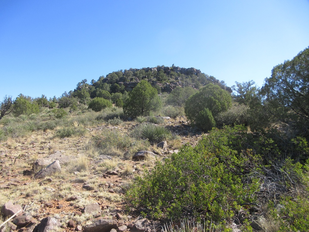
Salt Benchmark Peak looked potentially tough from below, a band of cliffs encircling the summit. Two ridges come off the peak, one to the west and one to the south. I had no particular preference, so I just went "in and up", unable to see very far within the trees for the moment.
As it was, I angled northward, to achieve the western ridge. Once on it, the trees lessened and I had more open views. The slope was steep but very manageable. The undergrowth was sometimes thick and a rock would roll occasionally, but getting up this slope went quickly.
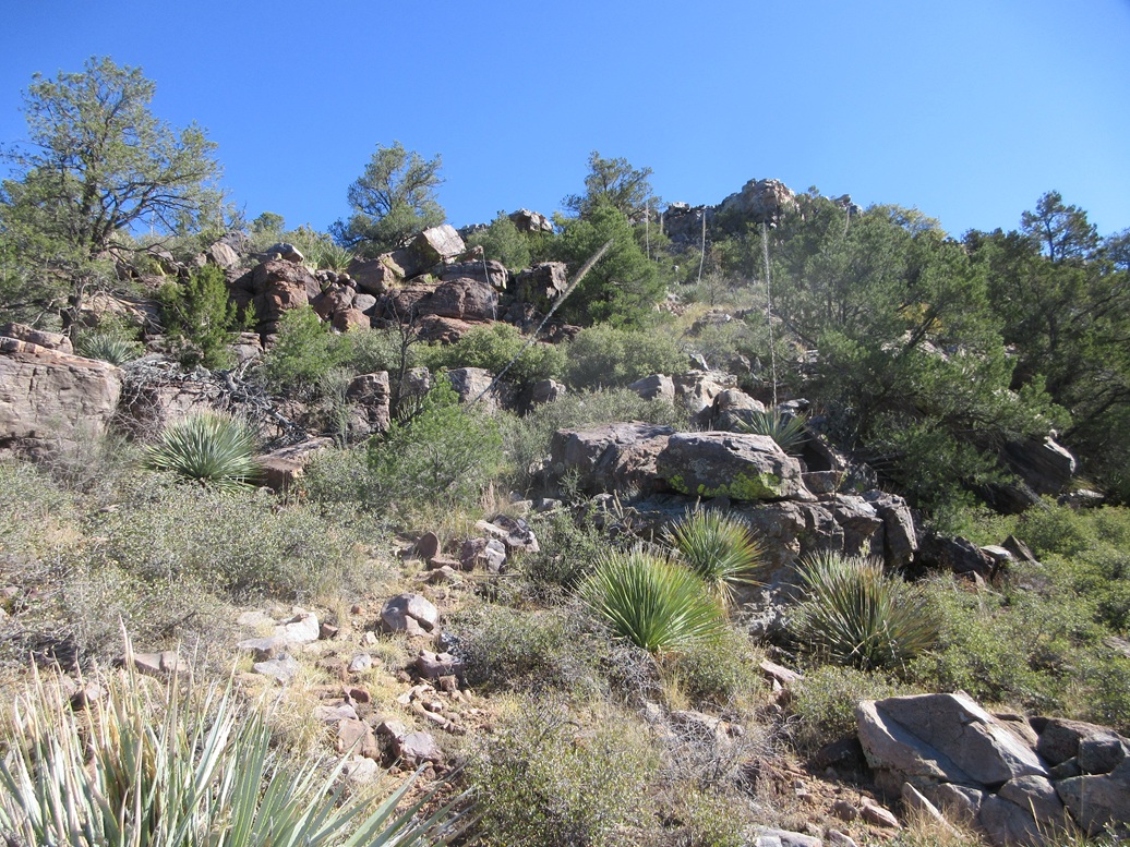
Once above the slope, I was now approaching the summit cliffs, now much closer to where I could study them. I was about a hundred feet below the top. The lowest cliffs looked more like heaps of rock. I was able to get up these by zig-zagging through chutes and open lanes and occasionally pushing through the brush. This got me up about 70 feet.
Now I was below the topmost cliffs, these sheer walls about 20-30 feet tall. It didn't look promising. I eased up some sloppy slopes and talus to get to the actual base, then started walking north along the west base of the cliffs.
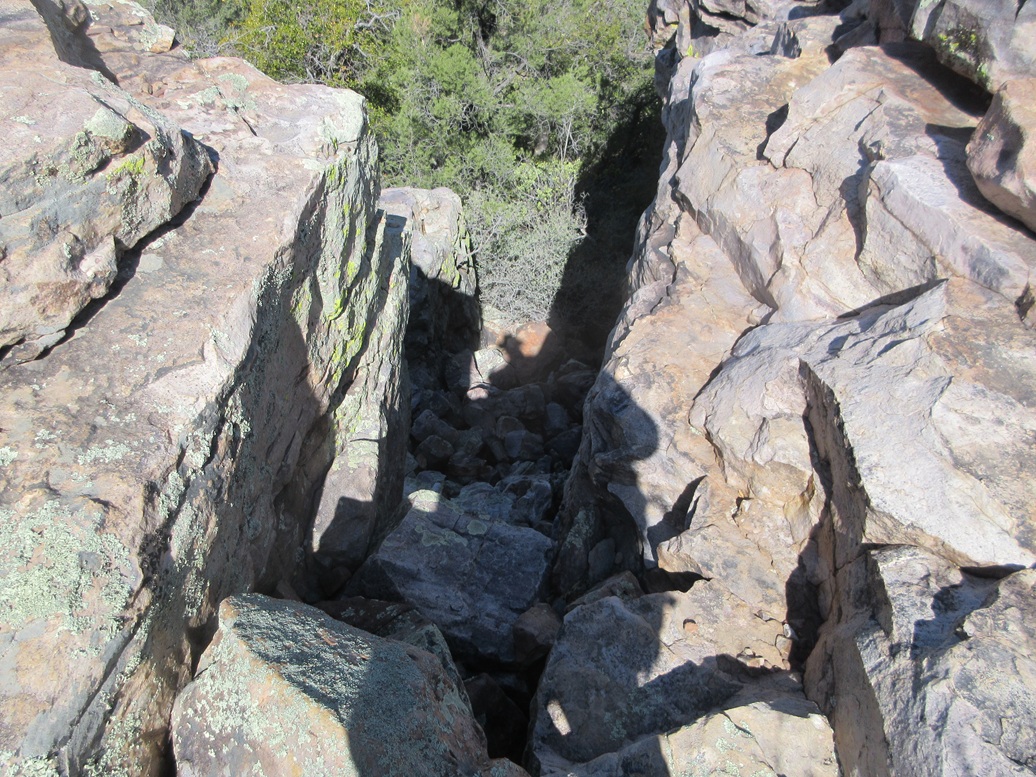
I found one weakness with a couple chutes but these looked tough, class-3/4 but possibly with good holds. I put this in my "maybe, if there are no better options" list. I eased more along the base, and soon was upon a steep slope of talus emanating from a chute.
Even though I was about ten feet from it, I could not see the chute until I rounded a bend and was literally within reach of it. The chute was about 18 inches in width. A chockstone was wedged in the chute about 5 feet above the topmost rock below. I sensed I was very close to the top so I studied this option.
It was too high to do a big step up, and I did not want to put outward weight on the chockstone for obvious reasons. That rock has likely been there a thousand years and it would be my luck to be the guy that yanks it out. The chute was too narrow for me to stem it.
So I faced outward. The rock beside the chockstone had a couple flat places to place my hands. I ditched my poles, and then hoisted myself up, like doing a reverse dip at the gym. I got high enough to set my butt on the chockstone. This allowed me to bring my legs up and butt-scootch up and back a couple more feet until I felt I had the room to actually turn around and stand.
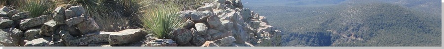
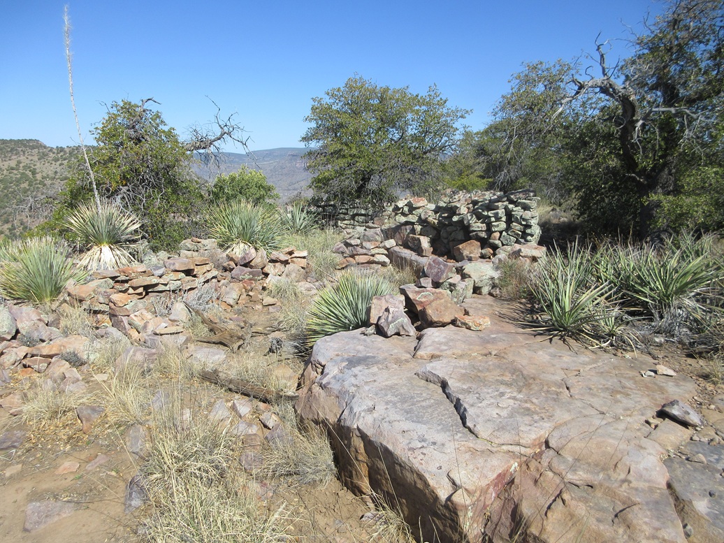
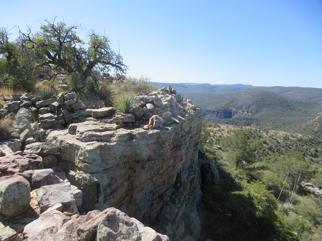
And by gum, I was on top! I was proud of myself for being so clever. Suddenly, I see walls, lots of them. The top is a series of flat rock platforms with numerous walls creating divisions, presumably old rooms from an Indian encampment from centuries ago. There were battlement walls around the edge of the rocks, too. It was surprising to see, and utterly fascinating. Some unexpected archaeology for me!
I walked around until I found the highest rock(s), and tagged them. The "Salt" benchmark was set flush into the rock nearby, but I could not locate a register. The views were amazing from here, too. I really was on the lip. Below me was about 200 feet of sheer cliff, then 1,800 more feet of slopes and cliffs to the river below.
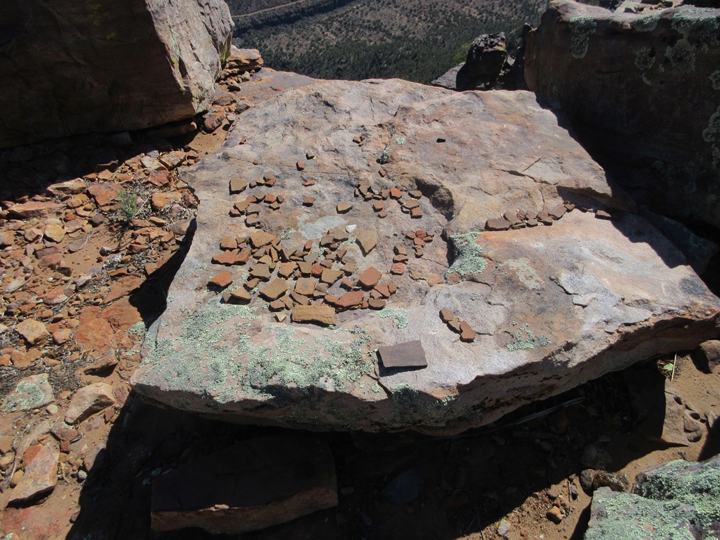
I walked the whole area, to see what else I would find. I found potsherds, piles of them, many dozens, if not hundreds, of them. Some had etchings on them. One was from 1970, a "Floyd Caddo" who signed himself in this way. Okay, so that establishes at least one ascent in the 1970s. I took images but left the sherds alone.
I thoroughly enjoyed this summit, walking around it like a little kid playing fort, to see what other neat things I would find or see. I never really stopped for a break. I was having too much fun. I was up here about ten minutes.
Going down, I situated myself into the chute and planned to reverse the moves. This was tricky. I was able to get the hands placed and to do a controlled dip downward, but that top rock below moved from under me. I was able to very carefully ease downward, mindful to not place all my weight on it at once. That top rock was moving as were a few more underneath it. These were large rocks and I was concerned I'd get a foot trapped or start a slide.
I was able to control my weight by getting onto all fours, and doing a crab-crawl for a few feet until I was sure the rocks wouldn't move. I don't think these top rocks were there by forces of nature. These appeared to be placed there by people. They were dreadfully loose and I recommend to be extremely careful here. A spotter would be useful.
This peak also sees almost no visitors. Mark Nicholls was here in 2006. A duo from HikeArizona was here about 2009. Mr Caddo was here in 1970. Wouldn't be surprised if that's it, then me, for the past 55 years. At one time in the ancient past, many Indians called this home. I bet they had ladders.
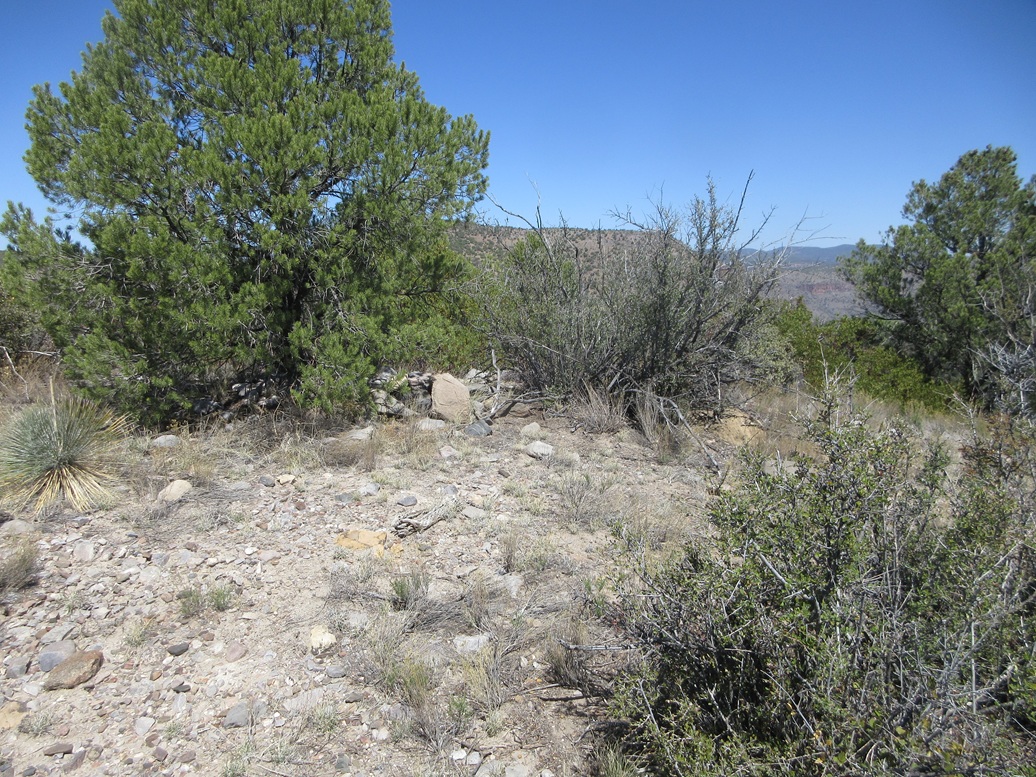
Going down, I took the south ridge down, needing to ease through some cliffs lower down, but these were not difficult at all. I then followed a nice open ridge and slope into the trees, with lanes almost the entire way. These led to some very old buildings near a spring, and soon, I was back on the track, which I followed out to FR-382.
The online distance calculator suggests about a mile each way, and it did not seem one way was faster or shorter. This side trip took me about 90 minutes, and it was now quite warm, into the mid-70s.
This was easily one of my most exhilirating climbs and I was absolutely delighted I was able to solve the riddle and get up onto the top rocks and then see all the neat walls and pottery sherds, as well as the wonderful views. I recommend any future visitors to pay attention to what I mentioned, and be respectful of the ruins up top. Look, but don't touch.
Elevation: 5,070 feet ✳
• Prominence: 310-320 feet ✳
• Distance: 1.2 miles (side trip portion only)
• Gain: 320 feet
• Conditions: Warmer now
PB
•
LoJ
•
Lidar
This next peak rises south of Salt Benchmark Peak. a big lump of rocks, dirt, trees and cliffs. The old Phillips Mine was located here, giving the peak its de-facto name.
Back on FR-382, I walked south a little ways, then found a track angling southeast, this road blocked by large rocks to prevent vehicles from proceeding. I walked it, trying to stay on it as there were branches and braids and it wasn't always obvious which way was the correct way. But it didn't matter that much. As long as it went in toward the peak, I figured that was good enough.
This track comes to a second rock barrier. Past it, it goes up a slope then to a Y-junction at the west base of the peak. I chose left, angling around the peak's north slopes. The track was almost completely gone and grown over, and the slopes above it were too steep, so I backtracked to the junction and took the right branch.
The track now curled around the peak's south slopes, up and slightly past the main Phillips Mine works, big slopes of white-colored rock tailings. The track ends slightly beyond the tailings. The slopes looked better from this side and allowed me a messy way up toward the top.
I just grunted up loose rock through the trees, making a right turn to go up more trees and rocky tiers. I ribboned my way for when I came back down. I made a left, now on the top ridge. I was soon on top the peak, and to its highest point on its eastern tip.
There was a cairn and register in the shade of a tree. It was a Nicholls register, and I was the second to sign in since he did in 2006. Views were okay but partially blocked by the trees. Actually, I was beat by now and it was very warm, pushing 80 degrees. I took a drink break but did not stick around. As much fun as the earlier two peaks had been, this one was a dud.
Going down, I followed my ribbons but missed the track anyway, backtracking a little bit before refinding it. From here, I just walked the track out to FR-382, then that back to FR-473, then back to my car. I arrived at 12:15, a five-hour and fifteen-minute hike covering a little over 9 miles.
I was beat and hot. I changed into shorts and a dry shirt, and got rolling. My car's temperature thing read in the low 80s outside. meaning a fifty degree change from this morning!
I drove into Globe and got a lunch at a Mexican place, and linked into a zoom meeting at school as an observer. I needed to kill some time anyway, as the highway wouldn't be open until 2 p.m.. Later, I would encamp at a cheap hotel in Scottsdale, temperature down here at an even 100°.
Today was a particularly pleasing day of hiking and peakbagging, doing so in some of the most spectacular countryside in the state, where it is guaranteed no one else will be. I was not expecting the ruins or such an interesting climb up Salt Benchmark, but it was surely the highlight of the day.
|


|