
The Mountains of Arizona
• www.surgent.net
|
| Saddle Mountain • Tonopah Area |
• Highpoint: Saddle Mountain (Range) • Bureau of Land Management • Maricopa County |
|
Date: May 9, 2015
• Elevation: 3,037 feet
• Prominence: 1,777 feet
• Distance: 3.3 miles
• Time: 3 hours and 15 minutes
• Gain: 1,580 feet
• Conditions: Clear with cool breezes
• Teammates: Scott Peavy
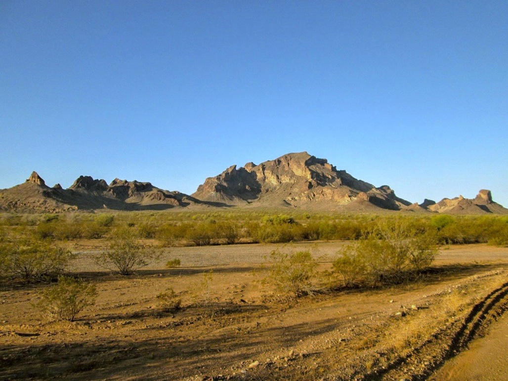
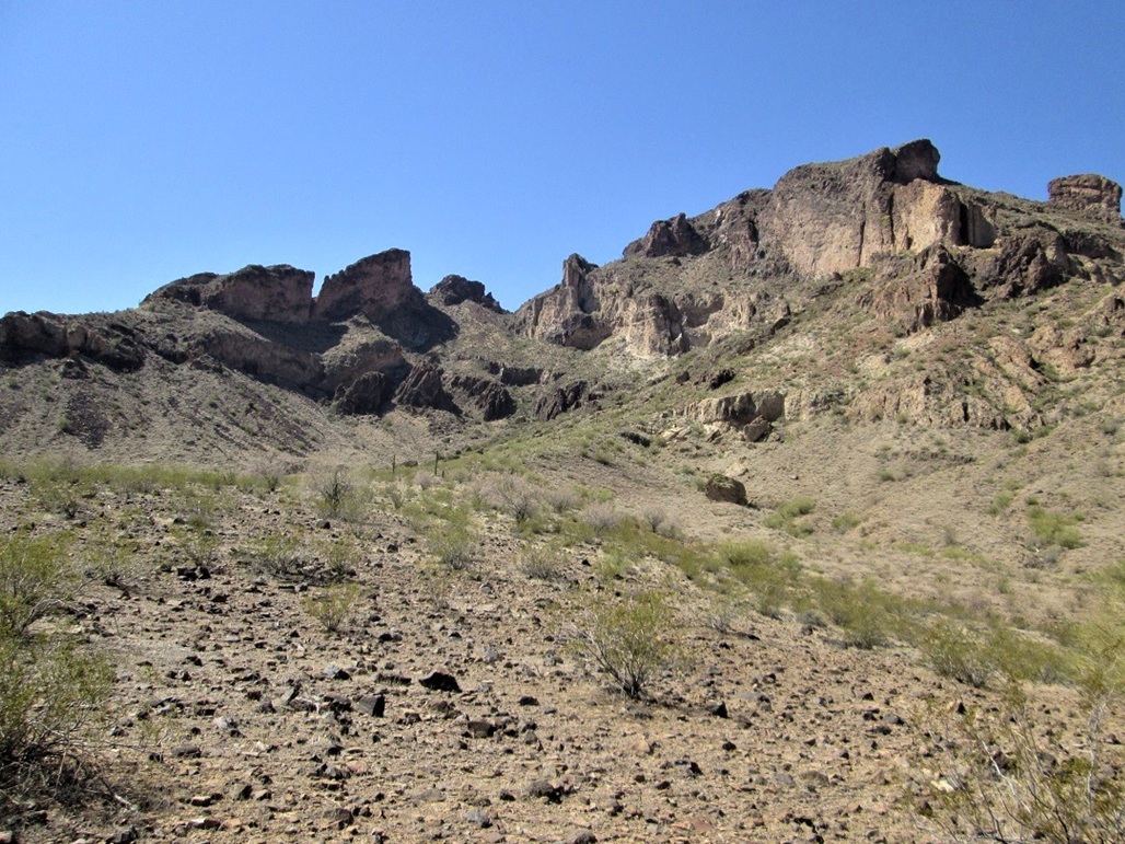
Saddle Mountain is 45 miles west of Phoenix in the town of Tonopah, south of Interstate-10. It is named for its obvious saddle shape, best seen from Interstate-10 from the west. The mountain is a "volcanic upthrust", composed of tuff and rhyolite and featuring an abundance of cliffs, spires, overhangs and other odd formations. It sits in the middle of a big patch of BLM land that is surrounded on all four sides by state and private lands. An aggregate of locals have formed into the Friends of Saddle Mountain. They help manage the area working in conjunction with the BLM.
Scott Peavy and I set out to hike this peak, taking advantage of a freak "cold" spell, with daytime highs expected to be in the 70s, instead of the high-90s that are typical for mid-May. We met one another at Litchfield Road, then Scott rode with me as I drove the remaining 30 miles to the mountain. We exited Interstate-10 at 411th Avenue in Tonopah, went south under three miles to Salome Highway, west about five miles to Courthouse Road, then west on Courthouse about 0.7 mile to a rough dirt track designated BLM-8211. There is a BLM signboard here, but no actual road marker. I drove south on this rocky road about a mile, past its junction with BLM-8212, and up onto an elevated mound of reddish-brown earth. There were hundreds of shotgun shells and shattered clay pigeons everywhere.
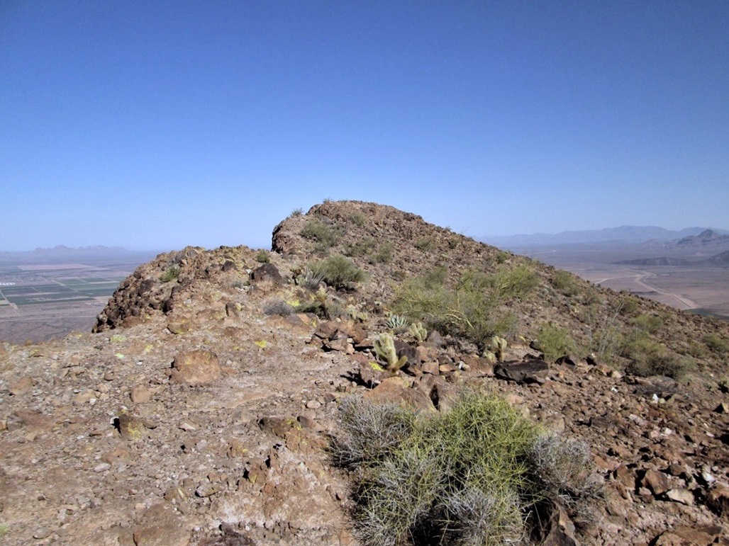
The mountain has a very striking profile from this vantage. The ridgeline is a series of rock fins, and there are cliffs everywhere. Up ahead on the ridge is a tiny saddle. This was our immediate destination. The actual summit was up and to the right, but we were so close to the base of the peak we could not see its top. We started hiking at 6:55 a.m., the weather nice with a cool breeze, temperatures in the 60s.
There is a decent trail all the way to the saddle, but finding it from where we parked was a little tricky. We dropped into a drainage about 20 feet, then found a couple cairns and immediately, found the trail. The trail ascended out of the drainage and soon came to a T-junction, a right going up and toward the saddle. We followed this trail upward.
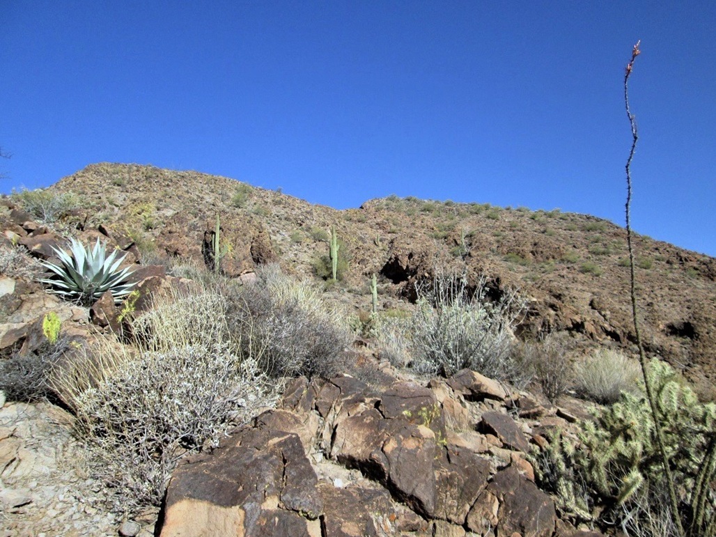
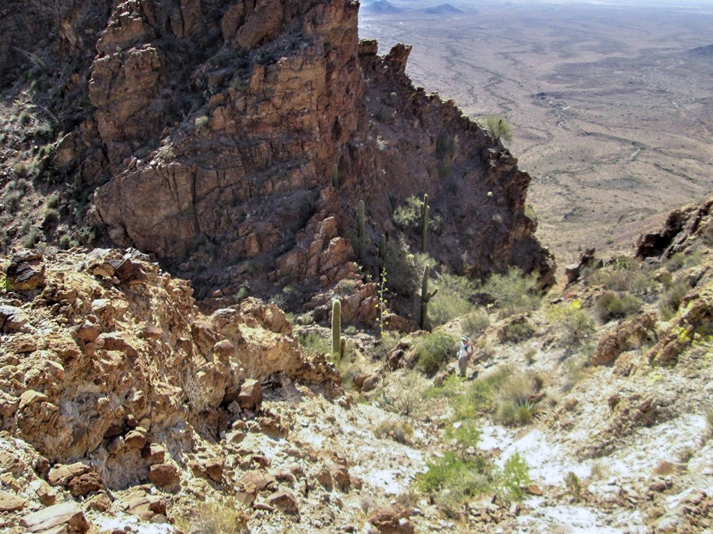
The trail is easy to follow and well constructed, but in a few spots it would get indistinct where it crossed rocky slopes or through brush. We stopped a couple times to make sure we hadn’t missed something or taken a wrong turn. Higher up, the trail switchbacks steeply through a scree field. We made excellent time, arriving to the saddle after one hour, gaining 1,200 feet in slightly over one mile. We took a break here. The saddle is tiny, about 15 feet separating the cliffs on either side.
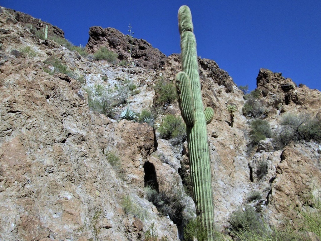
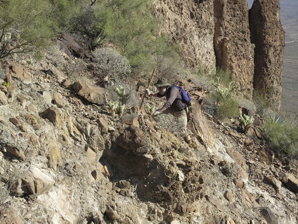
We needed to scale the slopes to the west. Looking up and slightly right, there is a gully and a big saguaro growing at its base (see photos in left sidebar). This saguaro serves as a visual marker for the descent, as well. We had a choice: to ascend the gully to its top, or to angle left about a third of the way up, and from there ascend an open slope of bare rock, which is also visible in the photo in the left sidebar. We ascended the open slope, which went well. It was steep but full of small ledges and holds. We gained about 40 feet, topping out on rockier and brushier slope. Scott was to my left, so I caught up with him, and we found the trail again, now much scanter than below. But at least it was a trail.
We followed this trail upward, still very steep, until it started to moderate. The trail aimed for a rock ahead of us on the skyline. Once high enough, we could look to our right and see the summit ridge. By now, the trail was essentially gone, but we had open views and the navigation from here on was trivial.
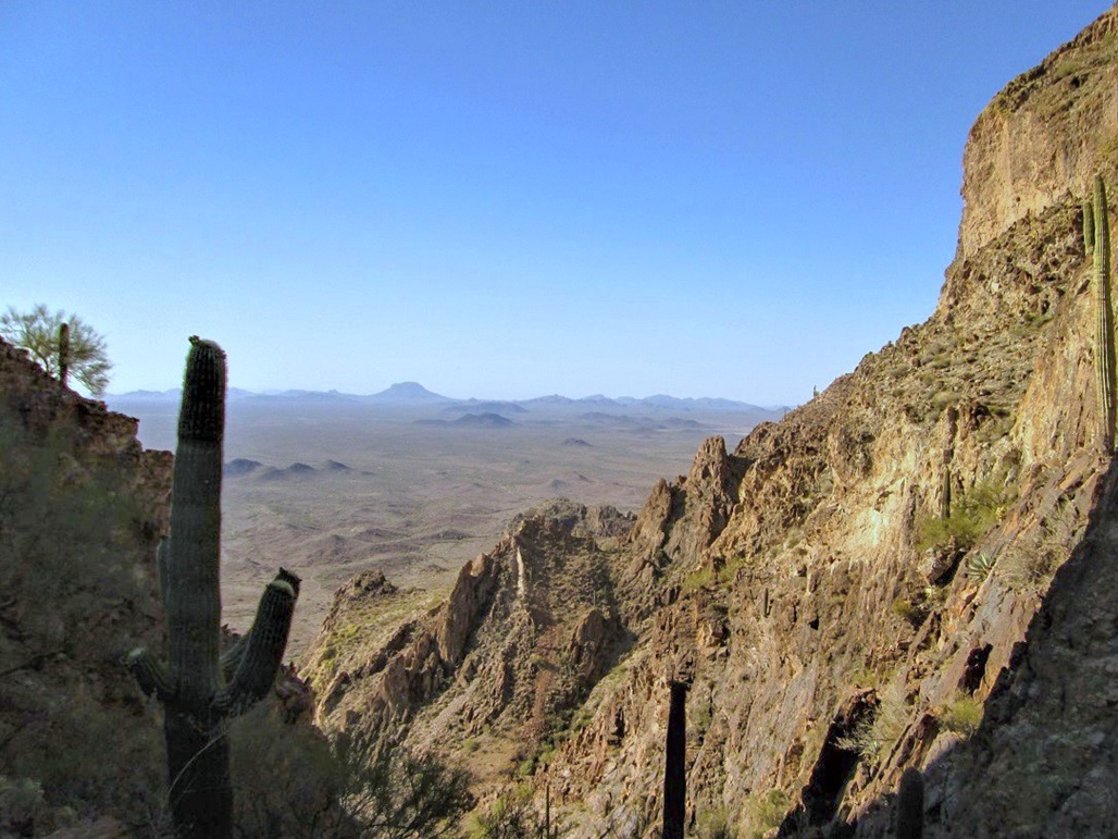
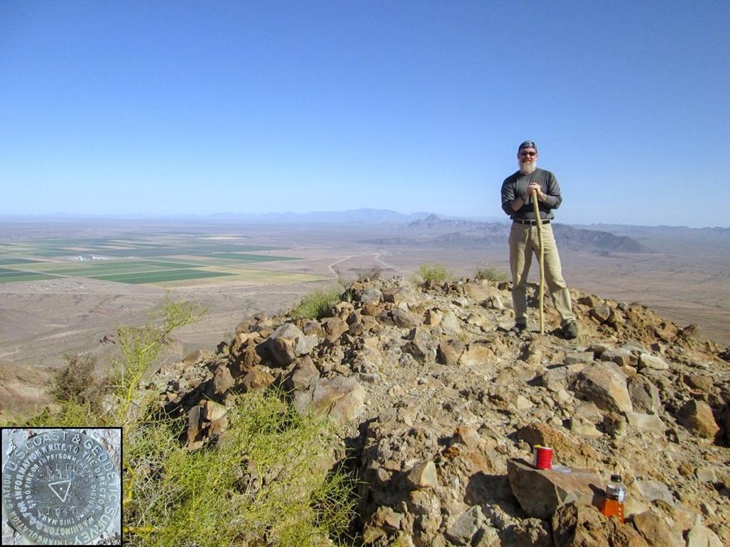
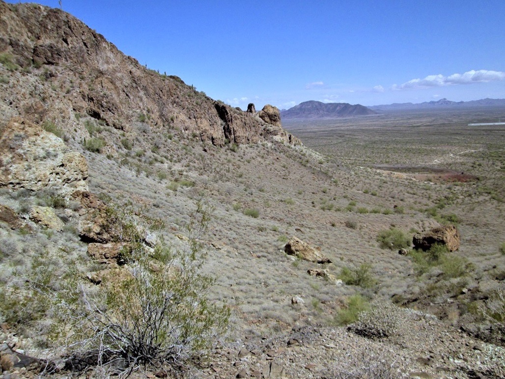
We worked our way up toward the main ridge, which overlook spectacular cliffs on the west side. We were careful to watch our footing near the edge. The views were amazing. The summit was about 150 feet higher and just a few hundred yards away. We ascended a slope, traversed around a couple bumps, and came upon the top, the time about 8:30, a 90-minute ascent. The climb had gone very well with no mishaps or troubles staying on route.
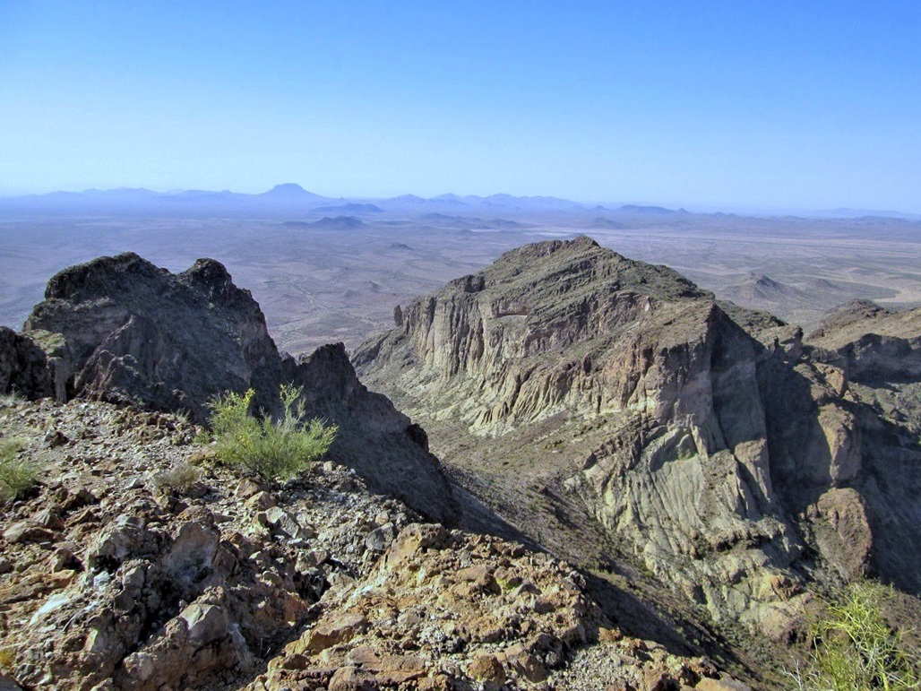
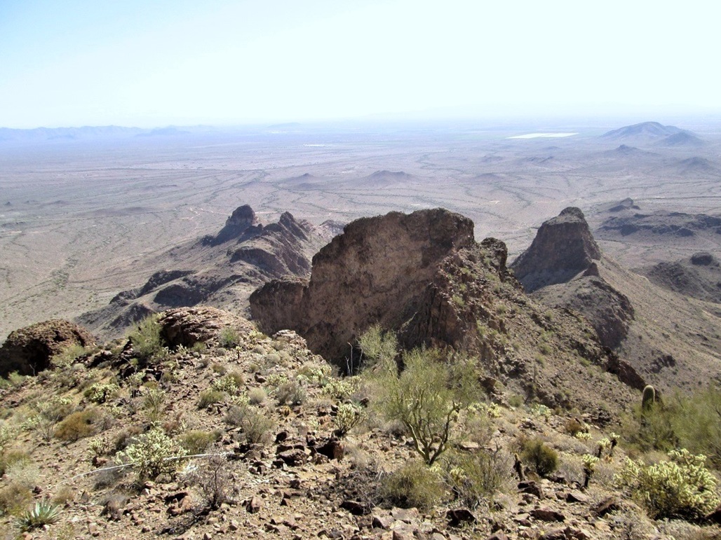
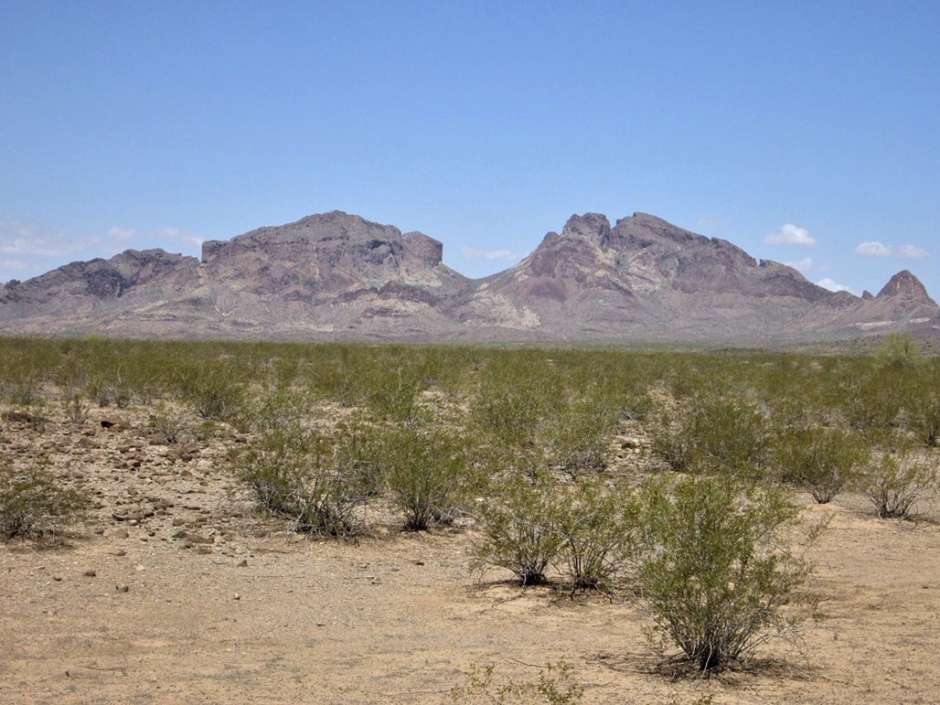
We stayed up top about 20 minutes. The day was clear and cloudless. Looking down, we had excellent views of the cliffs and formations of this "upthrust". The main summit of the western half of the range was visible close by. North, we could see Burnt Mountain, Big Horn Mountain and Harquahala Peak. To the west were the farm fields of the Harquahala Valley, then beyond that the Eagletail Mountains. To the south was the rounded dome of Woolsey Peak and the myriad of smaller peaks that surround it. To the east, we could see the volcanic hills that compose the Palo Verde Hills, plus some steam plumes from the nearby Palo Verde Nuclear Power Plant.
The whole time we were on the summit, a hawk was flying above us, screeching, sometimes flying low, clearly upset at us. Plus, the longer we lingered, the more bees started to appear. After a snack and photos, we started down. The hike down was easy, but we took it slow on the steep sections above the saddle. Instead of descending the open rock slope we had taken on the way up, we angled a little more and descended the chute, which was easy, and in retrospect, would probably have been an easier ascent route too.
Back at the saddle, we started the trek down to my truck. The descent hike took 80 minutes, and our accumulated time was three hours, fifteen minutes. We were pleased to be successful on this peak with no injuries, bee stings or snake bites, and fortunate that the weather was so pleasurable, the last nice weekend in the desert until November.
Saddle Mountain is a peakbagger's classic in this part of the state. The log went back about 15 years and seemed to see a few people each month, a few who climb it repeatedly and even some who bring their dogs. The small range is home to bighorn sheep (we did not see any) and may eventually become more of a destination as Tonopah grows, although that's probably way off in the future.
Since we had time to kill, I asked Scott if I could scout some roads to get close to the Palo Verde Hills, whose summit is also of interest to me. We took the long way around, going south on Wintersburg Road (directly by the Nuclear Plant), then west on Elliott Road to 415th Avenue, and up dirt roads to some power line roads. We were able to get close, and so we’ll be back to climb the Palo Verde Hills summit some point in the future. We exited, got back onto Interstate-10 and back to Litchfield Road, where I dropped Scott off at his car.
I had one more "highpoint" on the agenda. Read on:
Elevation: 1,083 feet • Distance: none • Time: 1 minute • Gain: none
City HPs of Maricopa County
Tolleson is a suburb covering about five square miles adjacent to Phoenix. Most people are vaguely aware of this city because it's the first city-limits sign one sees heading west out of Phoenix on Interstate-10. Within the city are zero hills. It is a completely flat town that slopes imperceptibly from the northeast to the southwest. Thus, its highpoint is at the northeast corner, where 83rd Avenue and McDowell Road intersect. The topographical maps are so out of date (1960s), they don't even show Interstate-10. Buildup for construction of the interstate would have altered the land so that higher land alongside the freeway may exist, but here, I was going strictly by the map.
I exited Interstate-10 at 83rd Avenue, then north a half-mile to McDowell Road, locating myself onto the Circle-K at the southwest corner, inside Tolleson. I needed a cold drink, Advil and gas. I parked, then walked to the corner. There’s a big rock (as in about a foot high) that I tagged. It was obviously placed there by the landscapers. I looked south and the land seemed to descend slightly, then ascend slightly toward the bridge over Interstate-10. Already feeling foolish, I did not bother to walk over and inspect that area. This was good enough.
I was able to get cold drinks and Advil, but the gas pump card reader kept fritzing out on me. I gave up, got back on the freeway and got gas closer to home.
|


|