The Mountains of Arizona
• www.surgent.net
|
| Sonoyta Mountain |
• Highpoint: Sonoyta Mountains • Organ Pipe Cactus National Monument • Pima County |
|
Date: January 16, 2016
• Elevation: 2,313 feet
• Prominence: 543 feet
• Distance: 3.6 miles
• Time: 2 hours and 15 minutes
• Gain: 650 feet
• Conditions: Cool with high clouds
• Teammates: Scott Peavy & Matthias Stender
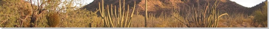
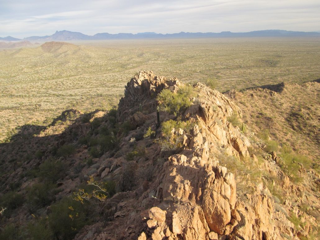
The Sonoyta Mountains are a small range of peaks in the Organ Pipe Cactus National Monument. The range's highpoint is an unnamed summit, elevation 2,313 feet, at the north end of the range. The rest of the range trends south and ends about a mile inside Mexico near the city of Sonoyta.
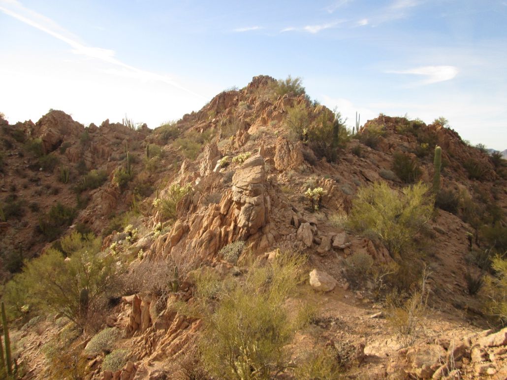
The Sonoyta Mountains are granitic, the ridges a series of heavily-fractured rock outcrops. The rock is brittle, breaking apart easily in one's hands. Even the big rocks on the upper outcrops seem to move easily. A handful of gold and silver mines were established in the range in the early 1900s, but none were big producers. Today, trails go to some of these old ruins. However, no trails go to the highpoint.
Scott Peavy, Matthias Stender and I were in Organ Pipe as part of Doug Kasian's list-completion hike up Peak 2306. We were part of that hike, which numbered about 15 people, plus more back at the cars, where we celebrated with cake and carbonated apple juice.
During the week before, we had discussed other possible peaks to hike while there, seeing that Peak 2306 is a quick hike. We knew we'd have just a half-day, so we agreed upon the Sonoyta Mountains. They were close, and looked like we could make the hike in just a couple hours.
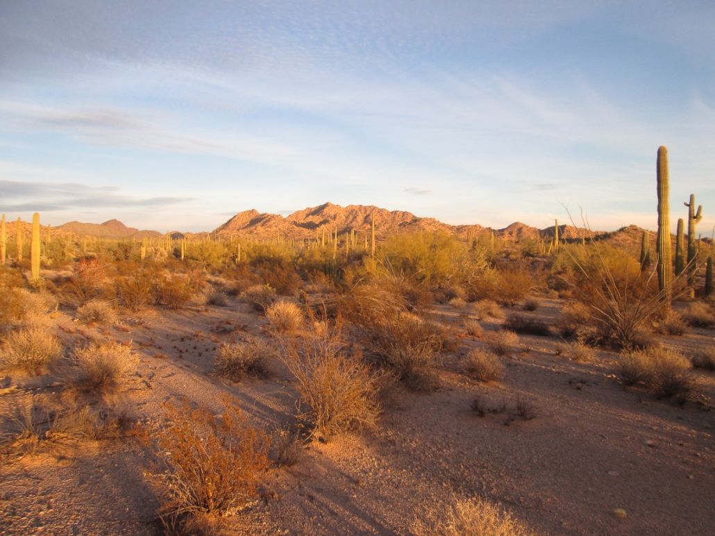
By 1:30 p.m., we said goodbye to everyone at Doug's party and exited back to Highway AZ-85, Scott driving. We went south on the highway to Puerto Blanco Road, then right (west) for about five miles to the Senita Basin Road. We followed this road north, then east, about four miles, parking in a turnaround at the trailhead. We started our hike at 2:45 p.m. The main summit mass was close by, less than a mile away. However, the hike wouldn't be as quick as the distances would suggest. The ridgelines were full of rock outcrops and little cliff bands.
The most logical route might be to aim southeast from the trailhead to a saddle west of the summit, then up a steep ridge to the top. But looking at that ridge, there was one big cliff. That could stop us, so we gambled a little and approached the summit more from the northeast.
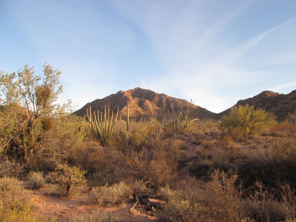
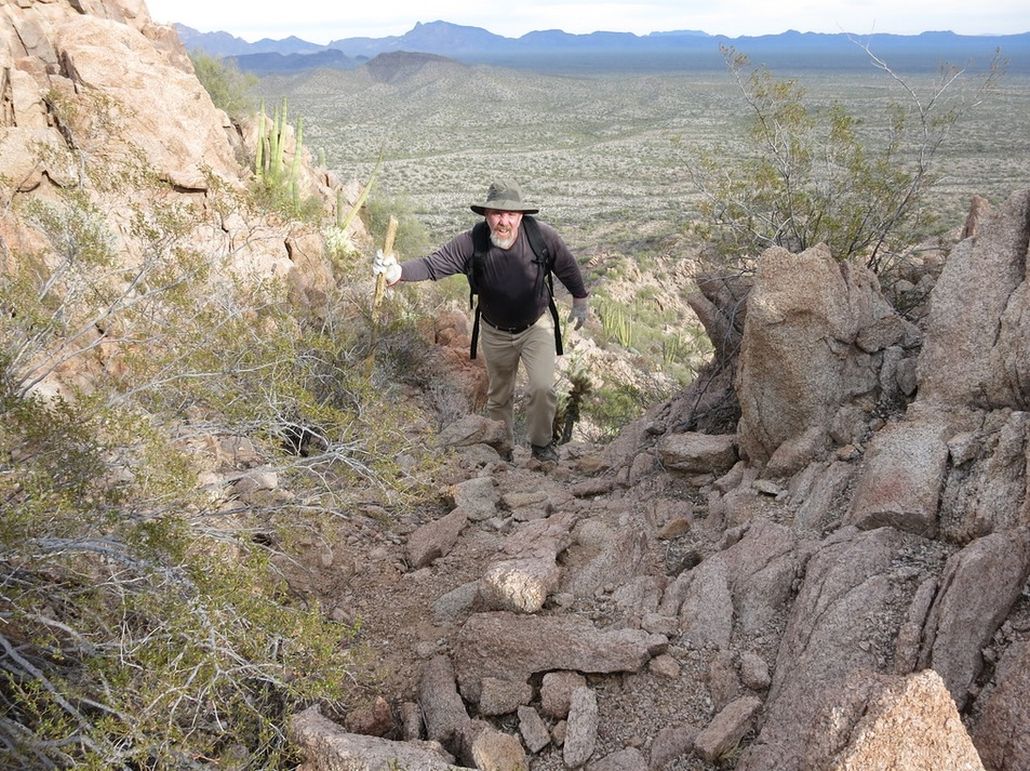
We followed the Senita Loop Trail about 0.7 mile east past a couple low foothills, then we started cross country and soon found ourselves aiming for a big ridge that came off the summit to the east. It looked nasty, but no nastier than the others. So far, the trail and off-trail segments of the hike had been going well. A couple vertical mine shafts were fenced closed.
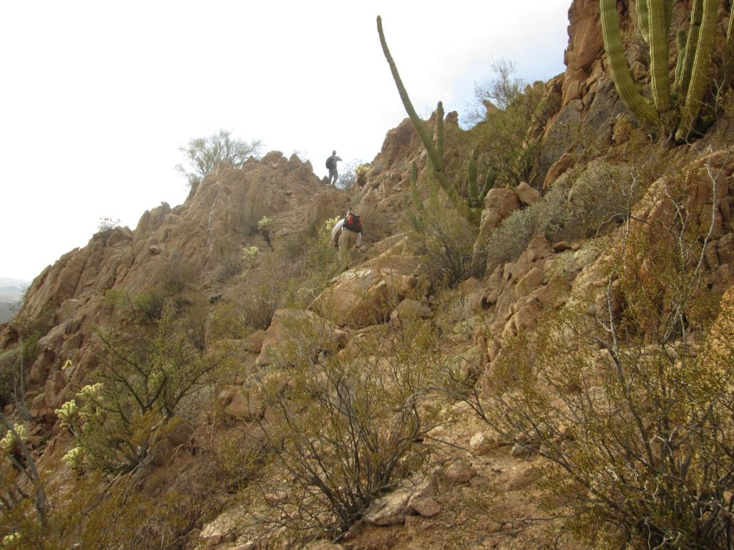
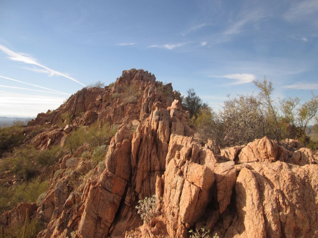
As we ascended higher, the footing became very loose. The slopes were essentially loose grains of sand. Sometimes, grabbing onto a rock for assistance would result in breaking off a little flake of the rock. We were able to brute-force our way up about 200 vertical feet of this, then we were on the ridge itself, where the footing was more solid.
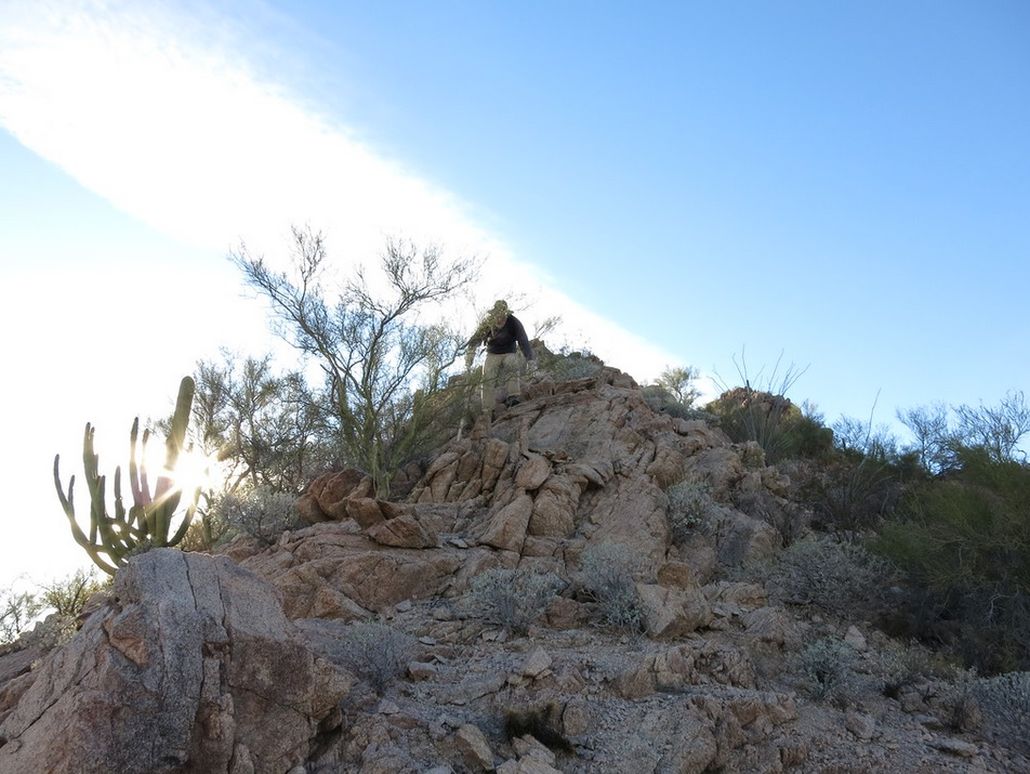
Looking up, we had a big outcrop above us about 30 feet. We went left of it across a loose slope, then into a notch which I thought might be at the summit. However, it was not, but the summit wasn't far away, perhaps 200 horizontal feet and 30 more feet upwards.
The ridges were rocky, but scooting around or over the outcrops was fairly easy. The sun came out from behind a cloud band and in the late afternoon, offered fantastic lighting for photographs. We were all on the summit shortly, where we spent about five minutes.
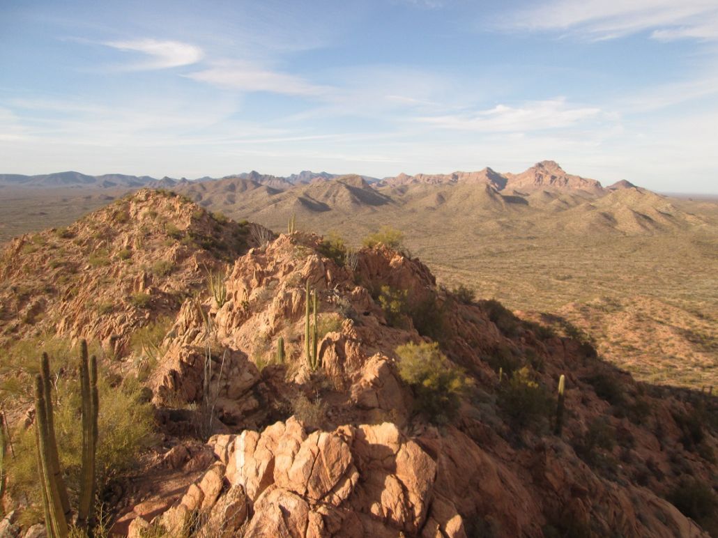
To the north we could see Peak 2306, and behind it, Pinkley Peak. Other visible peaks were Kino Peak, the Cipriano Hills (which I would hike tomorrow), Mount Ajo and Diaz Peak looking east, and Sierra Cucapa in Mexico. I snapped a few images, drank some water, then started down, going ahead of Scott and Matthias.
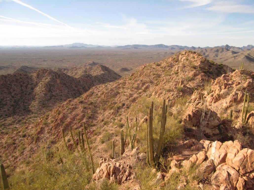
The downclimb went well but it was slow-going as we weaved through the rocks. Rather than deal with the loose crud in the gullies we had coming up, we stayed on this ridge as far as it would go. Soon, we were off the ridge. We hiked northeast and caught the trail, which we followed back to Scott's vehicle. We had been hiking for two hours and fifteen minutes.
We had good late-day sun for more photographs. We then drove back to the campground, where they dropped me off at my truck. I was going to stay another night while Scott and Matthias would return to the Phoenix area.
Our hike of Sonoyta Mountain covered about 3.6 miles and 600 feet of vertical gain. It was a challenging little peak, but not impossible. Combined with Peak 2306, we had put in about 7 miles today, just enough to be a good workout. I enjoyed both, and was pleased to visit this peak's summit. Not many people do, apparently.
The next day, I would hike in the Cipriano Hills and drive the Puerto Blanco Loop, before heading home.
|


|