The Mountains of Arizona
• www.surgent.net
|
| Steele Hills Highpoint |
• Highpoint: Steele Hills • Arizona State Trust Lands • Cochise County |
|
Date: February 23, 2025
• Elevation: 5,301 feet
• Prominence: 561 feet
• Distance: 9.8 miles
• Time: 4 hours
• Gain: 1,170 feet (gross)
• Conditions: Sunny and clear
Arizona
•
Main
•
PB
•
LoJ
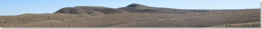
The Steele Hills are a low ridge of rounded hills rising north of Interstate-10 at the US-191 junction in Cochise County. They rise north of the Red Bird Hills, the two small hill-ranges lying in a straight line as though they were one band of hills.
The land north of the interstate is almost completely continguous State Trust land, and other than one narrow sliver of private land, the Steele Hills are entirely on State Trust land. Access would likely not be barred, but there appeared no obvious ways to approach the hills that would not require a lot of hiking miles.
I decided to try an approach from the northwest, off of Three Links Road west of Willcox. There were some lesser tracks branching south and east off this main road that could be walked to within a couple miles of the hills. Unless I got lucky with these minor tracks, I was expecting about ten miles of hiking, but most of it on these tracks.
I left Bisbee before dawn and drove to Willcox via Double Adobe, Elfrida and Kansas Settlement, the sun rising about when I was just south of Willcox. I went west on Business-10 to the Interstate, crossed over it to the north, now on Taylor Street, then a couple miles later, went left (west) onto Airport Road. The day was cold, temperatures into the 20s as I drove through the hinterlands.
Airport Road is paved and heads west, making a couple right-angle turns and passing by a small race track. Afterwards, it is unpaved but graded hardpack and somewhere here, changes its name to Three Links Road. I motored westbound a few more miles to a junction of roads, Muleshoe Road going north. The track I wanted was south of this intersection.
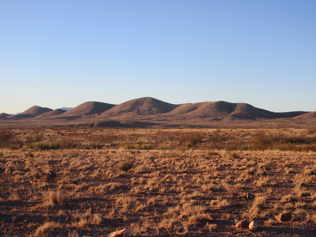
I didn't get very far in, maybe a quarter mile, just past some power lines. The tracks was in fine shape util it came to an arroyo. I got out to look. Big rocks and one bad erosion rut forced me to park early. It was 7:30 a.m. and sunny with no clouds. It was still cold but warming, now in the 40s. Steele Hills Highpoint could be seen off to the southeast, almost five miles distant.
I was walking at 7:40. I followed the track to a gate. There were no signs on the gate and it wasn't locked. Past the gate, I came to a cattle watering hole, and a sign from the Game and Fish not to camp here. There were no cattle here at the moment.
The track continues south and passed through another rutted arroyo. But past this, the track was actually in good shape. No big rocks, smooth tread, few ruts. Were it not for those two arroyos, the Subaru could have handled these roads with ease.
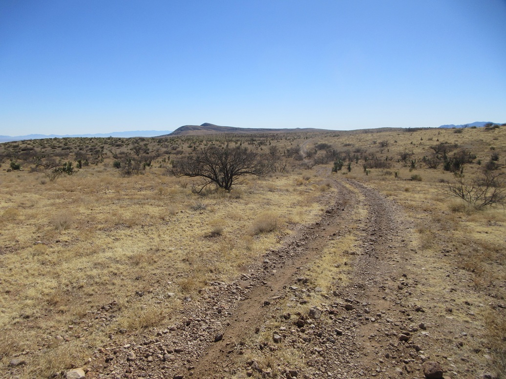
The track drops slightly then makes a long, gentle ascent to a hilltop up ahead, where another tracks veers southeast, this being a little over a mile in from where I parked. I followed this second track past another gate, and just stayed on it, going right at one junction, until I came upon a fence line.
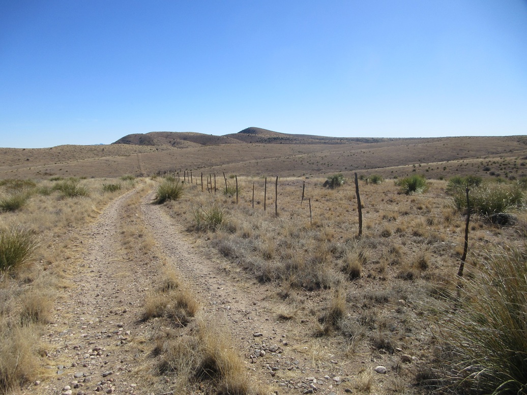
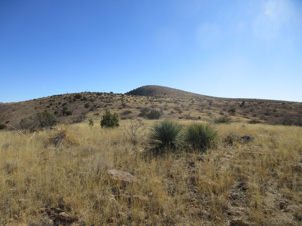
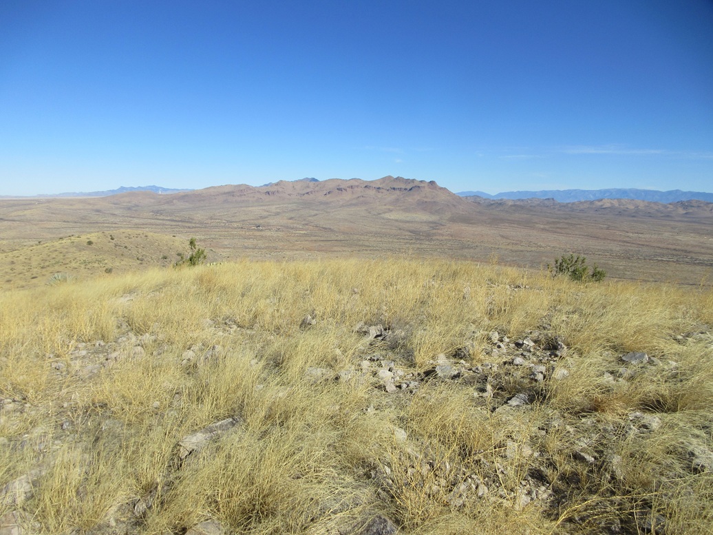
I followed the track to its end at a corner of two fences, 3.1 miles in. Although the track went up and down with the lay of the land, the elevation difference was never more than 50 feet over these three-plus miles. The terrain here is wide open, just low grass and brush, the essence of "high lonesome". I enjoyed the walk.
The hilltop could be seen poking above some foreground ridges, the summit a little under two miles away. I'd be walking cross-country from here on. I had been concerned the brush would be thick, woody, pointy and possibly snakey. To my relief, there was almost no brush, and the grass was mowed to an inch high by nature's lawnmowers, cattle. I could see some up on a bluff to the south.
I just had to find a way to the peak through the bluffs and draws. I generally aimed for the peak but would follow natural lanes and easy slopes as I found them. Nevertheless, I was obliged to drop into and out of a couple of drainages, losses of about 50-80 feet each time. I crossed the fourth fence of the day here, stepping over some loose wires.
Higher up, the grass became more abundant and taller, but also, I found better cow paths, which I followed as far as they would go. I was now on the peak's long western slope, which I followed upward to the top. The climbing was easy, the slope never more than slightly steep. And then suddenly, I was on top of the Steele Hills.
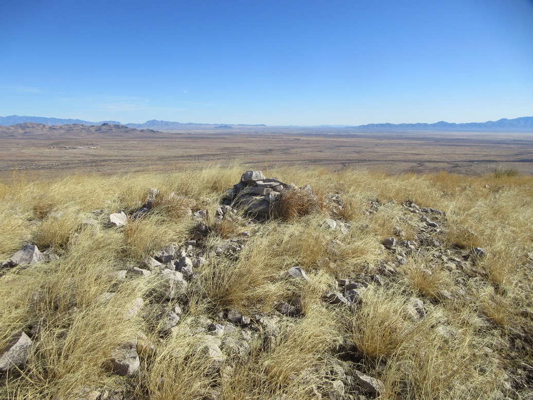
It had taken me two hours to get here, covering just under 5 miles one way. The top is rounded and bare, a simple cairn sitting dead center, and not much else. The sky was bright blue and dry, with details easily seen on mountains thirty miles away. I sat for a break and enjoyed the solitude. It wasn't completely quiet, though. The interstate is about three miles distant and I could hear the occasional truck.
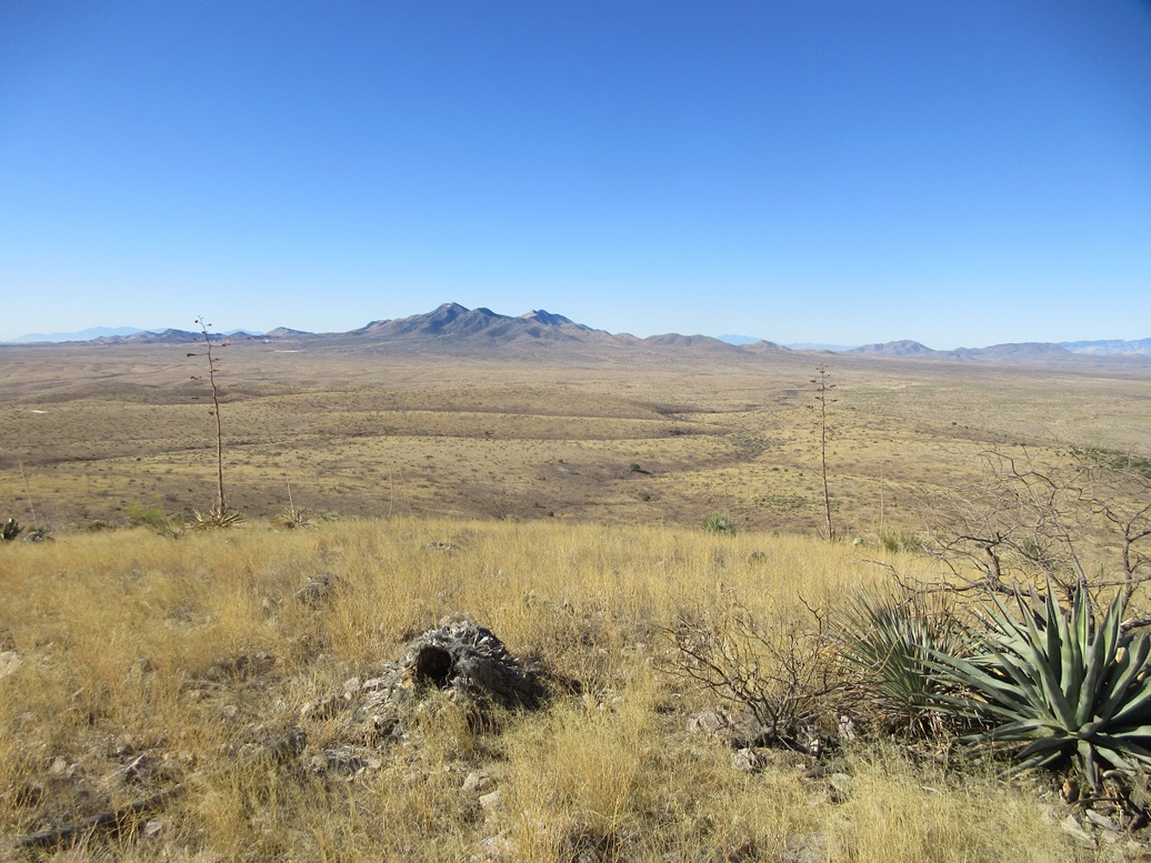
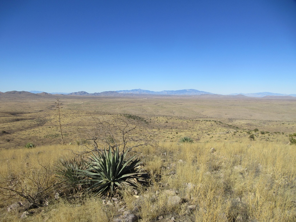
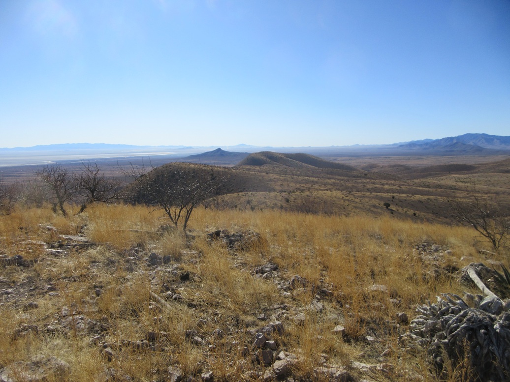
I had a lovely perch to view the surrounding peaks. To the north were the southern foothills of the Winchester Mountains. To the west in the distance was Rincon, Mica and Lemmon, and closer in, Johnny Lyon, the Little Dragoons and Kelsey Benchmark. To the south was the Dragoon Range and the Willcox Playa. To the east, looking into the sun, was the Dos Cabezas Range.
I found a register in the cairn and signed in. It sees a small but regular stream of visitors, mainly the Southern Arizona Hiking Club. I was the first visitor for 2025, and on average, probably sees one group every year or other year. I spent about 15 minutes on the summit, having a relaxing rest.
For the hike down, I followed my ascent route out, but not exactly. I followed what looked easy and friendly. Navigation was easy, as I could see where I needed to get back to the tracks from a distance, there being some beefy wooden fence posts nearby that were visible against the yellow grasses.
Once back on the road, I walked it out in one long push, no breaks, the egress hike taking a little under two hours. It had warmed by now, but still very pleasant, in the mid 60s. While some may think these road walks across open, vacant high desert rangeland is tedious, I like them. It allows me to get into a walking meditative state, and not needing to worry about every darn rock at each step.
Back at my car, I piled in and rested. Up on the main road were a couple trucks and toy haulers but I never saw anyone else. I had some ideas for a second hike, but after ten miles on this hike, wasn't sure I was up for any more. I drove out, back to Willcox, and decided I was tired and just wanted to get home.
I enjoyed this hike a lot. Access was not an issue, the road in was fine, and a beefier vehicle should be able to get farther in than I did. You get the feeling this area may only see a few people a year, when anyone who has any business being here is included. The Steele Hills also appear to have escaped being mined. None of the mine sites list any old digs. It seems no one in the past gave much thought to these hills either.
|

|