The Mountains of Arizona
www.surgent.net |
|
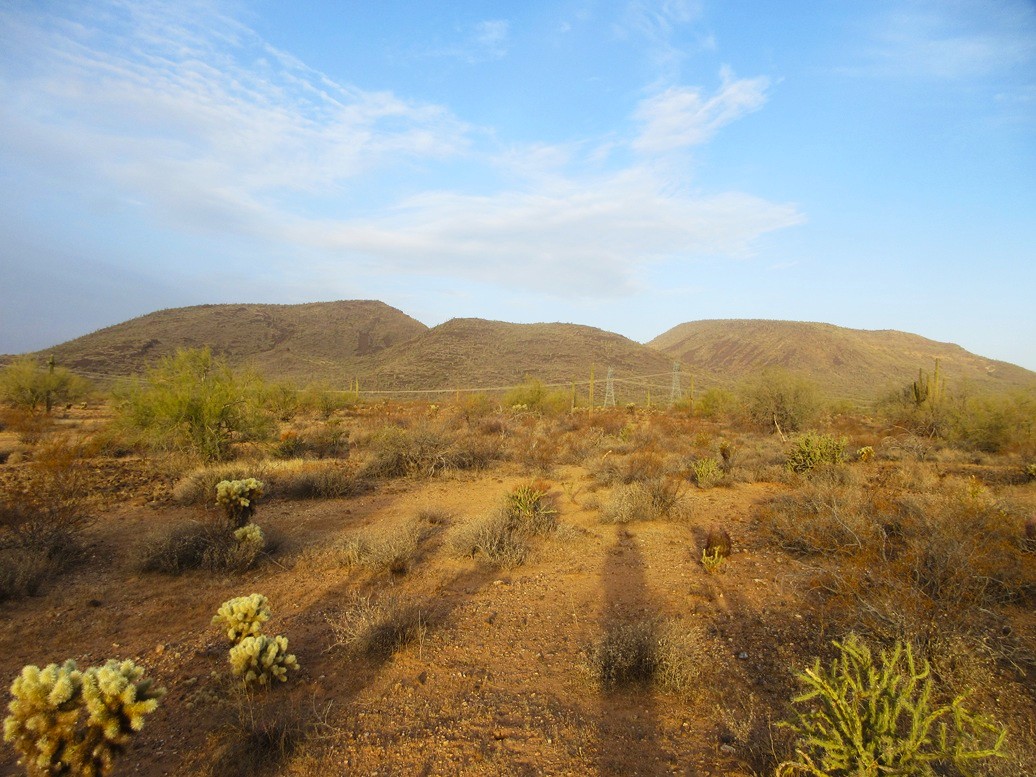
Peak 2747 • Sweat Peak • Peak 2740 These three peaks are volcanic summits in the hills east of Lake Pleasant and west of Interstate-17. I was mainly interested in Sweat Peak, which is an outside contender to be the Phoenix city highpoint if the city ever annexes the land it sits on (more on this below). The other two were nearby peaks that were chosen mainly to "clean up" this region. There is no convenient way to Sweat Peak, being set far back from the paved roads. Some dirt tracks get close but these tracks require a very strong 4-wheel drive vehicle. I would be obliged to walk the distances. I figured if I am going to put in the miles, I may as well tag some other nearby peaks. After teaching my class last night, I did a grocery run and hit the road. I was going to camp on the BLM land to the west of Lake Pleasant. I got onto the Loop-101 Freeway northbound. Where it bends west in north Phoenix, some guy raced past me and everyone else at a hundred miles-per-hour easily. Where was the DPS? Good question. More on this later. I merged onto the interstate and exited at New River Road, doubling back south on New River Road where it connects to state route AZ-74. I followed that to Castle Hot Springs Road and drove it in a few miles. It comes to a T-junction. I went left, now on a graded wide gravel road. I found a pull off that rose onto a soft hill then dropped slightly, so that I would be hidden from the road even though I was just a hundred feet from it. It was cloudy and overcast. It was a full moon, but its light was muted by the clouds, which was disappointing. The camp area was scraggly. People have used it as a camp since there are fire rings. There was some junk but not much. I set up my cot beside my car and had a meal in the front seat. About 11 p.m. I got under the covers on my cot. Unfortunately, this was a loud campsite. There was a car on the road every five minutes or so. Burros live in the area. I could hear their braying. One was kicking up something nearby, maybe bedding down for the night, but whatever he was doing, it went on for about a half hour. Coyotes also were in the area, howling. When the burros bray and the coyotes howl at the same time, it's not very harmonious. After a couple hours of being distracted, I gave up and slept in the front seat of my car. I was up at dawn, and on the road quickly. I drove back up New River Road to the Emery Henderson trailhead. I had been here once before, in January 2023 when I hiked Peak 2422. I rolled in about 7:20 a.m., the only one here. It was overcast and chilly, but not cold, in the high 40s for now. I was dressed and stiuated quickly, and started my hike at 7:40 a.m..
Date: February 12, 2025
• Elevation: 2,747 feet
• Prominence: 467 feet
• Distance: 13.8 miles (whole hike)
• Time: 7 hours, 10 minutes (whole hike)
• Gain: 990 feet
• Conditions: Cloudy and overcast, cool but not cold
Arizona
•
Main
•
PB
•
LoJ
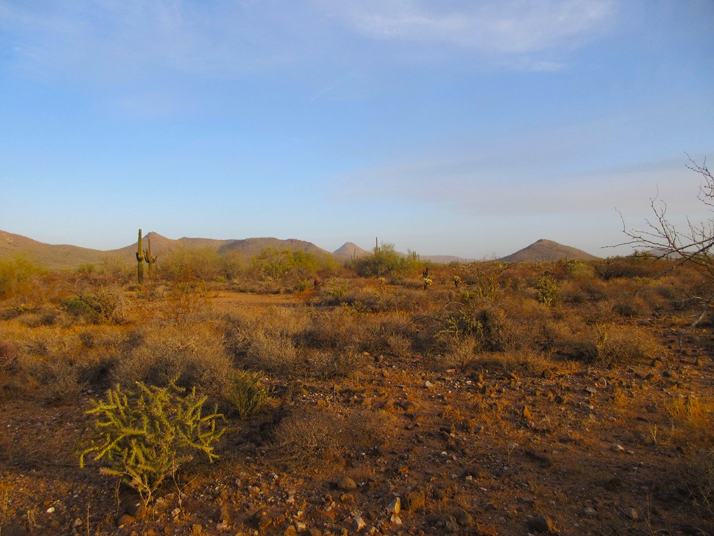
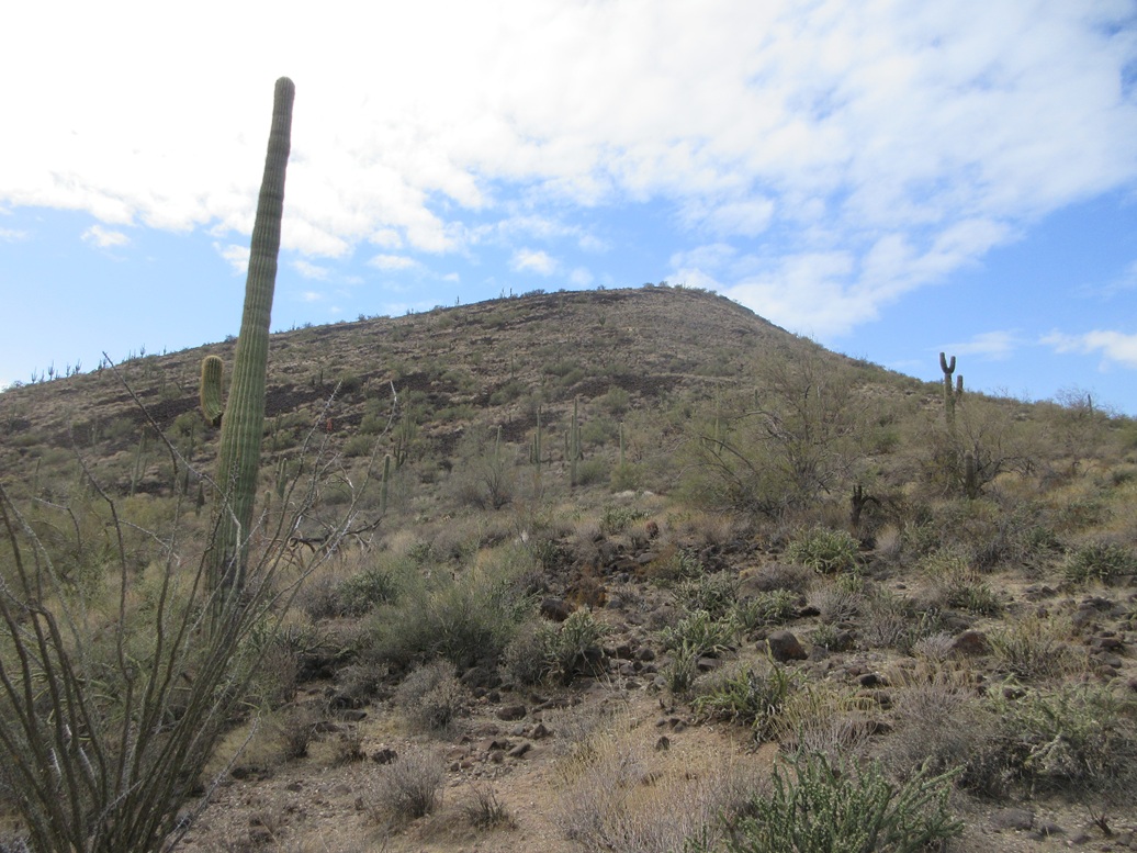
Peak 2747 rises about two miles west, and would be my first goal of the day. This peak rises south of Whiskey Spring Head, which I hiked back in 2015. At the time, the group I was with ignored this peak, and it stood as a lone outlier for me, not one I wanted to do all by itself.
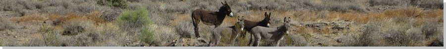
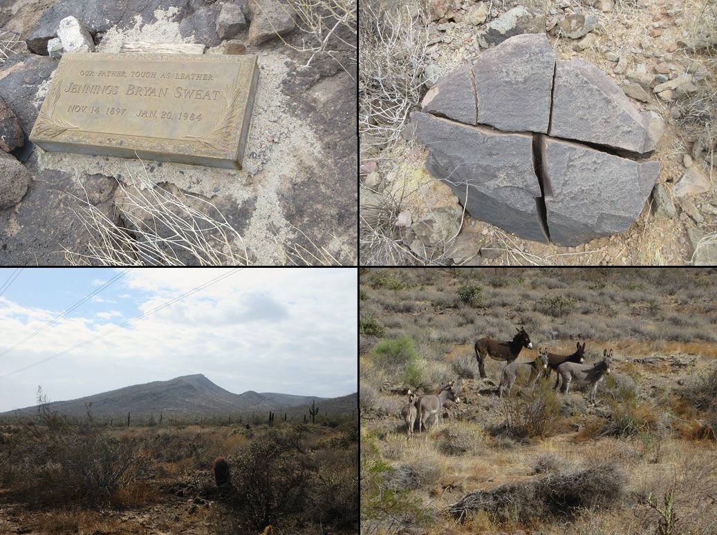
I started walking due west, ignoring the trails. The terrain was open and rocky but easy to pass through. It dropped into a few arroyos along the way, drops about ten to thirty feet each time. I also crossed a fence along the way. And I got my first glimpse of some burros. One snorted to get my attention, so I walked a wide arc around them.
Up ahead were some power lines, and after about a mile and a half of trekking, came to the road that runs underneath these lines. I turned right (north) and continued another 0.4 mile to a side road that branches in toward Whiskey Spring Head and Peak 2747.
I walked this road partway. It is very rocky and nasty and would need a Jeep. For walking, it was a chore because the rocks rolled and the tread was never smooth. I got to a point where I could see Peak 2747's main northeasterly ridge going up. To the right were cliffs, so it made sense for me to start from here rather than from the high saddle.
I started up a slope that narrowed into a ridge ... but not the one I wanted. I had to drop into a rocky ravine and up the other side. I found a spot to do this so that the drop and regain was minimal. Now I was on the correct ridge.
Then I just stepped upward, following a game path up the grassy slopes with pockets of palo verde and pencil cholla to ease through. The cliffs were just a few feet to my right.
After about twenty minutes, I was on top the peak. The climb had gone well. It was steep but not bad, the rocks generally stayed put, and the grass and pointy plants were not too troublesome.
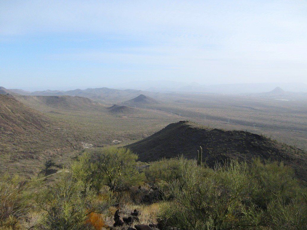
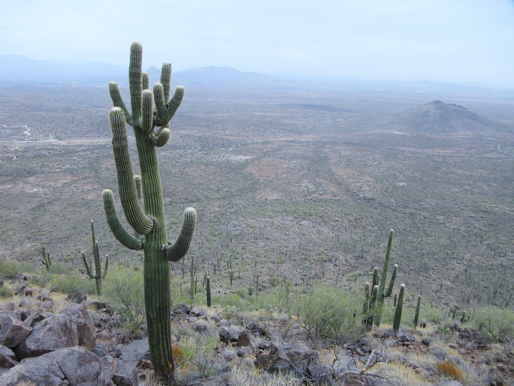
The summit is rocky and with good views, especially that of Lake Pleasant. Were it not so overcast, I would have snapped an image of it. I found a register in a cairn tucked against some rocks and signed in. Not many people have been here. I may have been the first to tag this peak in the 2020s.
I did not stick around. I had a short break to drink something, then started back down. The ridges get messy lower down and I had to ease through some rocky drainages again to get back on the road. Once on the road, I just walked it down back to the main power line road.
My mileages are conservative, but I came up with 1.4 miles from my car to the power line road, 0.4 mile to the turn-off, 1.5 miles to the summit, and 1.5 miles back down to the power line road, so 4.8 miles so far this morning. I had been hiking now just over two hours.
Elevation: 2,872 feet
• Prominence: 512 feet
• Gain: 1,000 feet
• Conditions: Still cloudy, some sun
PB
•
LoJ
Now back on the powerline road, I walked it north, Peak 2422 up ahead, and pointy Sweat Peak hidden for the moment. The powerline road has some very rough spots where it crosses some arroyos. Otherwise, it is smooth, but that does no good if a rough spot stops your car two miles back. I made good time on the walk. After a half hour, I was past Peak 2422, now Sweat Peak in my sights.
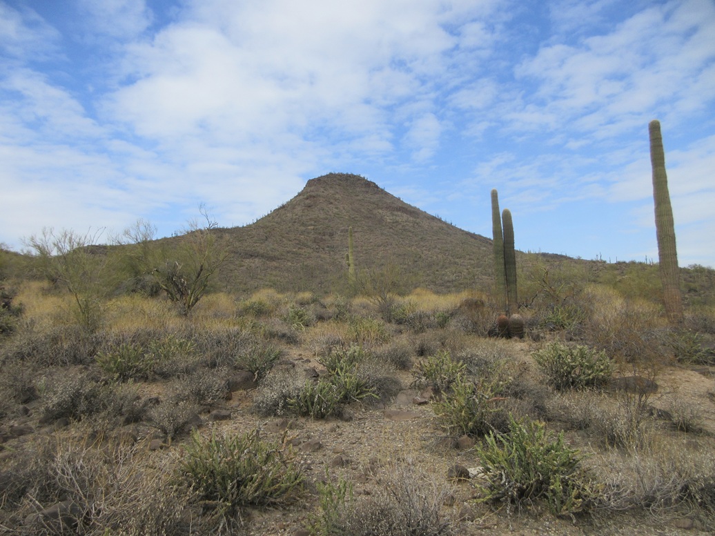
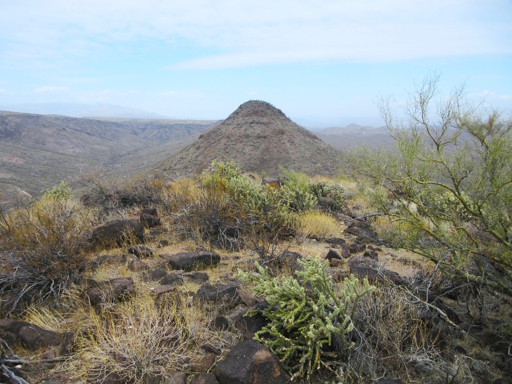
Sweat Peak has a very pointed summit, and it looked cliffy from all sides. It made sense, reading the map, to aim for its saddle south of the peak and north of Peak 2740, and hike both from their common saddle. But the ridge up to Sweat Peak looked particularly bad.
Instead, I just aimed for the peak in a general sense, and would make it up as I got closer. I walked cross country, within an arroyo, and along a lesser track, until I was on the peak's southeast slopes.
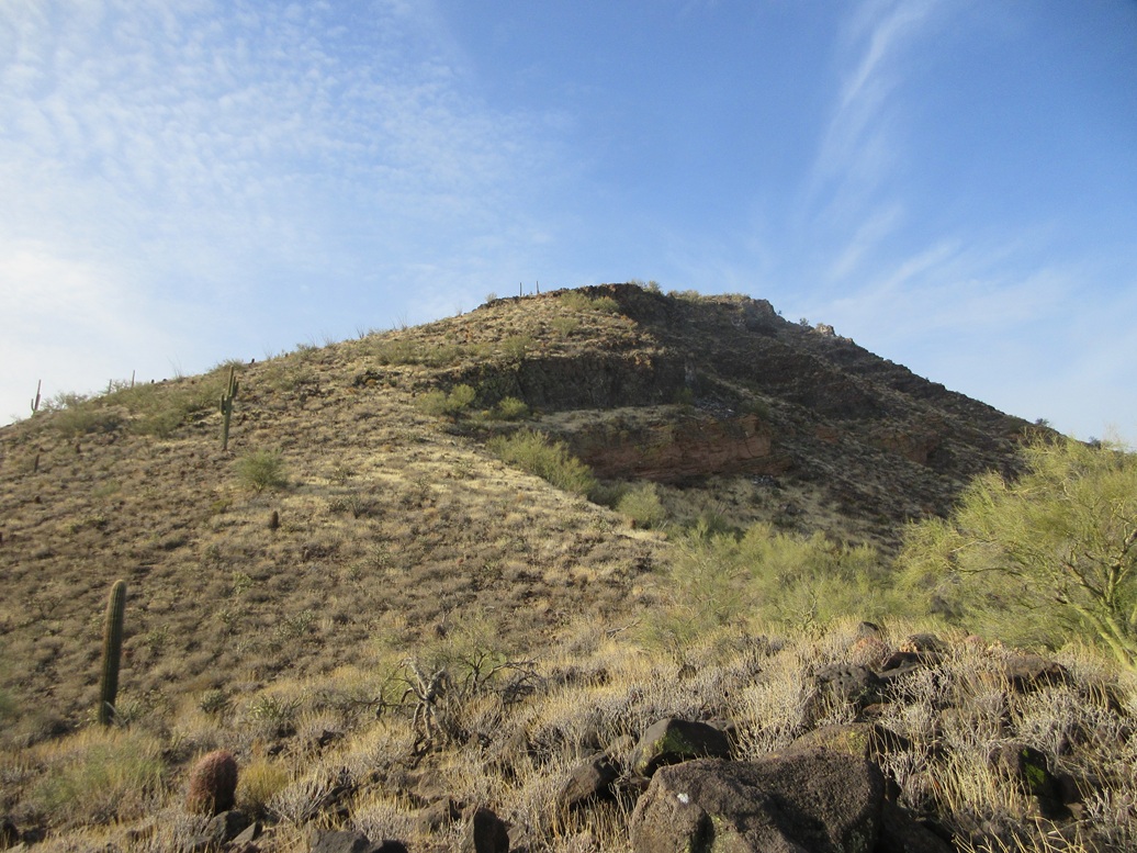
What looked impossibly steep from a distance was not as steep once closer, but the slopes were still very steep. The grade increased in increments, going from easy to moderate to steep to really steep.
The top 200 feet was about as steep as the slopes could be before the rocks all tumbled downward. I was on a slope where the rocks were smaller and laying atop a layer of loose scree and gravel. This was treacherous, so I angled over to an equally-steep slope but one composed of big basalt boulders.
This boulder slope was a little safer, but I was still careful to test each step. More than once, as in about a dozen times, I forced loose a large rock creating a small slide. This was not intentional, of course. I was moving very slowly and carefully here.
Up higher was a small cliff band. I hoped the rocks here would be more solidly in place. They were but barely. But by now, I was almost to the top. I had one more messy slope of large rocks to scamper up, using my hands in a couple spots. The summit was just a few yards above me. As I ascended, someone was shooting in the flats down below, then a loud boom, enough that I could feel it. I see a huge plume of smoke. What the hell were they shooting down there?
Finally, I was on top of Sweat Peak. The top features a very large cairn with a register buried deep within it. I was the first to sign in in many years, but I know people have been here recently. It is possible they did not see the register.
To the side is a plaque for Jennings Bryan Sweat, a local rancher who lived in the area from 1897 to 1984. I looked him up on the web afterwards and all I found was a copy of his obituary on a genealogy website. It did not reveal much about him. The peak is clearly named after him.
I was eager to get down, so I did not spend much time up here. I descended the same slope I had ascended, and it was damn loose, uncomfortably so. I went very slowly, baby-stepping down until I was onto less severe slope.
This slope is probably not the best slope, but it was the one I got to first. From a distance, the northeast slope looks possibly better, with a longer profile and no obvious cliff barriers. I would not recommend "my" slope.
My miles are as follows: from where I ended my Peak 2747 hike, I walked 1.6 miles on the road, then 1.5 miles to the top of Sweat Peak. I descended to a point about 0.7 miles from the top, so 3.8 miles for this segment, and 8.6 overall. It was now about 11 a.m.. The sun was starting to come out some more.
Sweat Peak is 6 feet higher than Whiskey Spring Head, which is the highest point within Phoenix city limits. Phoenix annexed a big swath of land up here a long time ago, for reasons I don't know. Sweat Peak lies less than a mile north of the northwestern-most corner of the city. It is possible that Phoenix might add more land. If so, Sweat Peak could find itself inside the city limits and would be the city's highest point. I doubt this will happen but there is an outside chance.
Elevation: 2,740 feet
• Prominence: 380 feet
• Gain: 580 feet
• Conditions: More sun and blue skies
PB
•
LoJ
Peak 2740 is the next peak south of Sweat Peak. It has a much more gentle profile and of the three peaks, would be the easiest by far. This was good, because I was getting fatigued by now and wanted no more epics.
I descended off Sweat Peak into the ridges and drainages below the saddle between the two peaks. I had no intention to go to the saddle. As it was, I dropped about a hundred feet below the saddle, but on slopes that looked very friendly.
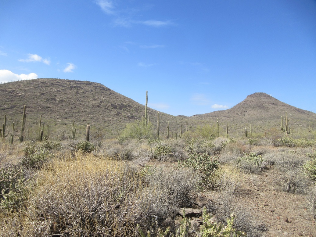
I started walking upward through the grass, palo verde and black boulders. There was much more pencil cholla here than on the other peaks for some reason. Fortunately, there was none of that bastard cholla that is more common and more painful.
I walked upward, bending right, and picking my way through big boulder piles all the way to the top, a one-way climb of about a half mile in about a half hour. And it was as easy as it looked.
The top is rocky as expected. I stepped on a few, and found a cairn abutting a rock partially hidden by a bush. It was by luck I found the cairn. The register was within it and I signed in, the first to sign in since 2012.
Views were getting better as the clouds were slowly drifting to the south. There were more blue skies to the north but the sun was still being muted by the hazy clouds. I snaped a couple images and had a snack.
Going down, I followed the slope a little more east than the way I had come up. The slope was fine, but one large rock slid out from under me. I slid with it, surfing it for about a foot. I was surprised how easily the damn thing slid and it reminded me not to take these rocks for granted, even on "nice" slopes.
I was down to the tracks, which I then followed out to the main powerline track. I thought about bending around Peak 2422 but decided to just follow the tracks out, essentially repeating the same route as I walked in. It would not be shorter in terms of distance but would save time as I could walk it quickly.
The walk out took about an hour and went without event. I saw some more burros, a bull, and a lot of bunnies. It had been a long day and I could feel it. I got back to my car at 2:50 p.m., a 7-hour, 10-minute day.
My miles are: from the lowpoint below Sweat Peak, a half mile to the top of Peak 2740, then 4.6 miles back to my car, for 5.3 miles for this segment, and 13.9 miles for the day. Not bad for an elderly man.
Naturally, I need to check my messages and email. No texts and just one or two emails but nothing specific for me. I like being invisible in this way. I drove back to town to my hotel in Scottsdale, rewarding myself with the chicken shawarma plate from the local Mediterranean food place in town that I like.
The drive went well, the usual traffic for mid-day in north Phoenix. So some guy in a big raised truck comes jetting through traffic, changing lanes and going about 90 where everyone else is about 65. So again, where the heck is Arizona DPS? I've been on this stretch often and it's always like this. They could have five officers write their own salaries in tickets alone with the amount of speeders that are up here. I got pulled over once a few years ago on this stretch for a busted taillight. No citation, just a warning, but it bothers me the amount of dangerous drivers up here.
There remains just two more ranked peaks, both on the Wild Burro Mesa, which is set even farther back than Sweat Peak. There is a track that gets close but it'll have to be walked. I'll be back but it may be awhile. I enjoyed today's hikes. It's not terribly scenic up here but the hiking was fun and efficient and I got three peaks out of it.
|


|