The Mountains of Arizona
• www.surgent.net
|
| Syenite Peak |
• Hieroglyphic Mountains • Highpoint: City of Peoria • Maricopa County |
|
Date: December 19, 2022
• Elevation: 2,783 feet
• Prominence: 623 feet
• Distance: 5 miles
• Time: 4 hours, 45 minutes
• Gain: 780 feet net, about 1,980 feet gross
• Conditions: Cool, sunny and clear
Arizona
•
Main
•
PB
•
LoJ
•
City HPs of Maricopa County
•
USGS BM Datasheet
This peak lies north of state route AZ-74, about fifteen miles west of the Interstate-17 interchange. It is part of the Hieroglyphic Mountains, which roughly encompass the hills and peaks west of Lake Pleasant and up to the Yavapai County Line. It's not developed out this way except for the Quintero Golf Course. Lake Pleasant lies about seven miles east, and the City of Peoria has annexed this area into its domain. The peak is the highest point in Peoria city limits.
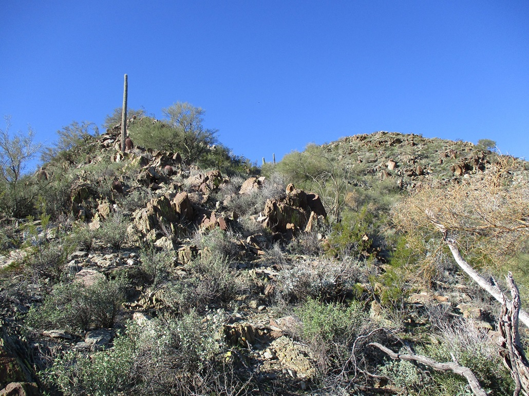
The peak has no name, so it goes by its benchmark, Syenite 2, or simply as "Syenite Peak" to the three or four people in the world to whom this matters. Syenite is a type of granitic rock, but that's as much as I know and that's because I looked it up. I wouldn't be able to identify it in the field. The hills here are granitic, that much I can tell. There are outcrops of rock formed into thin layers that flake into narrow slate-like fragments. Quartz rocks lie on the ground everywhere.
I studied the satellite images of this peak beforehand and two things become clear: (1) there is a trail/track network within these hills that could mitigate hiking time and navigation; and (2) the whole area in off of AZ-74 seem to be popular with shooters. There are obvious shooting areas that are easily seen even on a satellite image. Thus, I planned my hike to be when the shooters would be least likely to be there, Monday morning. I was on the road at 6:20 a.m., and at the Carefree Highway/AZ-74 exit about an hour later. I stopped for snacks, then proceeded west on AZ-74 to milepost 14, where a track branches north in toward the hills.
This track was in good shape. I had satellite images of the roads so I could follow where I was going. I didn't drive far, about a mile, going north toward a large turn-around that abuts the southern hills. I was the only one here. It was cold and sunny, but not too cold, in the 40s. I started hiking at 8:00 a.m. exactly.
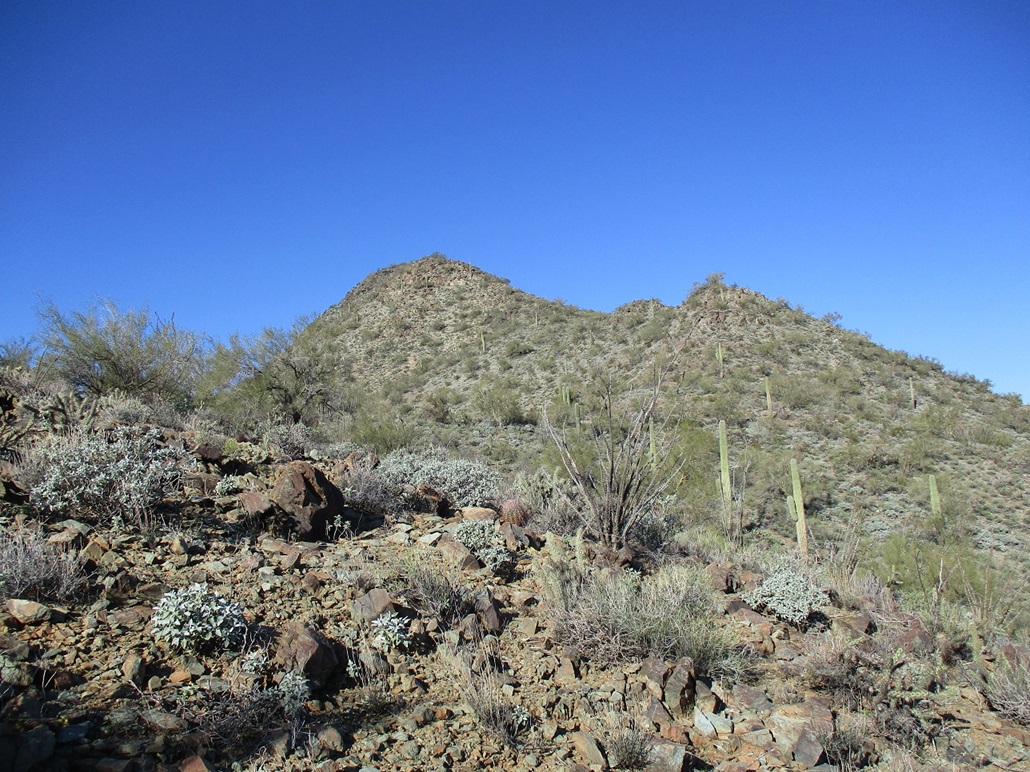
I was able to locate the trail with some detective work. It leads north toward a low pass up ahead. The quality of this trail varied. It was steep and haggard in spots, smooth in other places. Down low, there was too much gravelly rock to see what kind of people/animals/contraptions use it. Higher up, where there were patches of looser dirt, tire tracks suggested mountain bikes or dirtbikes. I did not see any bootprints.
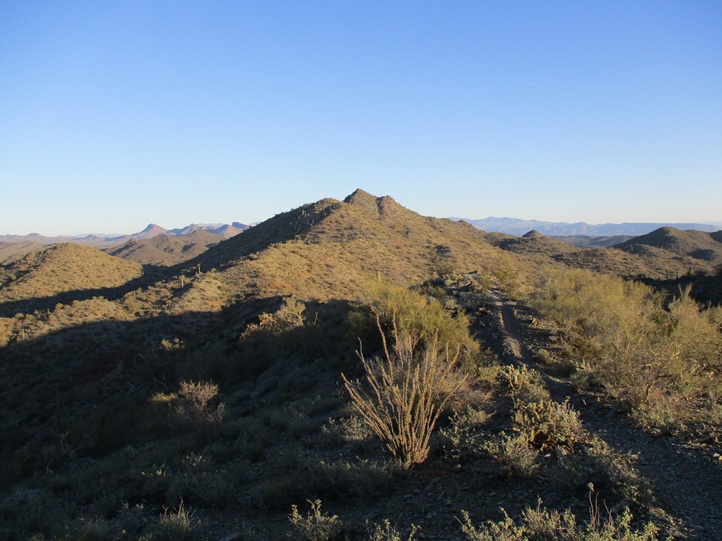
At the pass, the track makes a right (east), then gains steeply uphill about 120 feet to top out on a hilltop, elevation 2,420 feet, the highest the track achieves. It then drops steeply to the north, losing all that elevation, to a saddle. Up high, I had fine views of the peak. As I descended, the peak was hidden by foreground ridges. The track drops even more, wiggles in and out with the ridges coming off the crest, and gains again to about 2,300 feet, slightly southeast of the summit, which I still couldn't see from where I stood.
Here, I left the track and started uphill through a light forest of palo verde, ocotillo, saguaro, creosote, barrel cactus and low brush. It was never very thick and I could move freely. I was now on the main southerly ridge emanating off the peak. I had to go up and down a few intervening bumps. From a short distance away, this approach didn't look promising. I kept going forward and upward until I knew I could not proceed. I got up about a hundred feet from the highest saddle, but the steepness soon stopped me. The rock outcrops became more cliffy, the tread more loose with that shaley-scree, and looking up, it didn't look any better. So I called it, turned around and retraced my route back to where I had originally left the track.
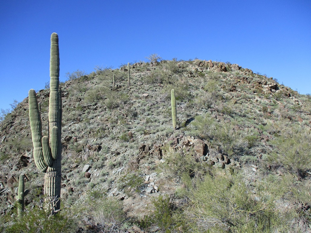
I was feeling kind of bummed, thinking I had come this far for nothing. But in reality, I had not hiked very far up to this point, not even two miles. It was still early, and walking the track a little more, I studied the peak's main easterly ridge, which had a much-less severe slope. It looked very promising. To the east of the summit is a lower whitish-colored subpeak that would serve as a navigation reference, and probably be the crux of the climb, even from looking afar.
I continued on the track, losing a lot more elevation, to a point where I felt it right to descend off trail into a drainage, my intention to catch this eastern ridge, which was one ridge over from where I was. But the drainage between me and that ridge was cut deeply, walls about 25 feet high. So I had to descend downhill parallel to this drainage until I could find a spot to ease into this drainage and then out of on the other side. This added a little distance, but not much.
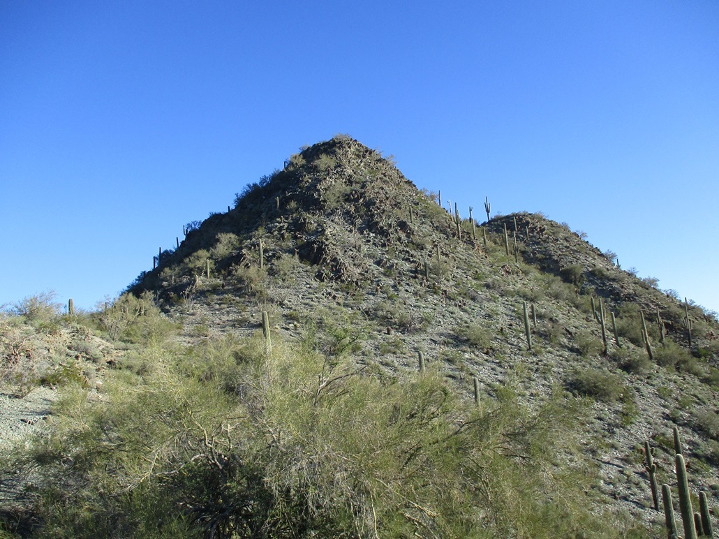
I now proceeded uphill, gaining onto the lower slopes of the eastern ridge. The whitish subpeak was highest, for now blocking the view of the summit. Two lower rocky outcrops lie along the ridge as well, but even from down low, I could tell this was a much more promising route. The slopes lay back well and there were no obvious cliffs. It was just a matter of hiking uphill and weaving through the rock outcrops. In time, I was below the slope up to the whitish subpeak, and I also now had a view of the highpoint summit itself.
The climb up this subpeak went slow, and as I expected, was the crux. It is essentially a heap of granite boulders and outcrops. Most of it was solid but not always. It steepened to where I had to use hands and be clever at times. The actual scrambling was not difficult. It was awkward and brushy, and sometimes with enough exposure to get the heart racing. A few spots I had to move with extra care. But this was short, perhaps 75 vertical feet. I was now on the highest saddle below the summit.
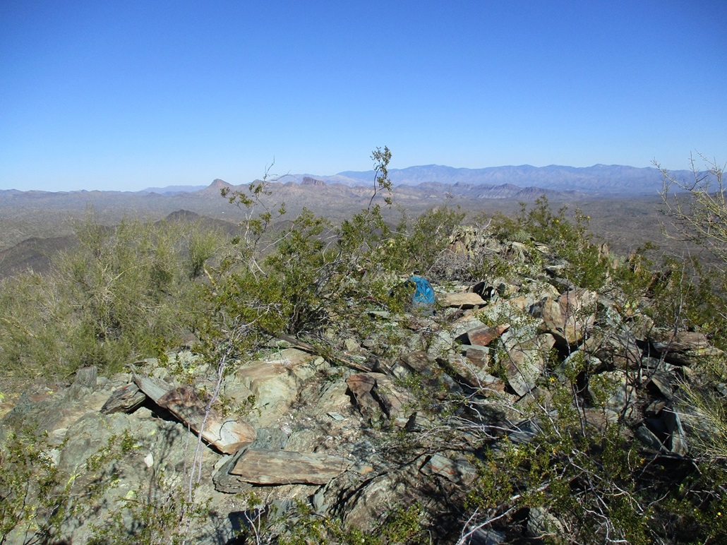
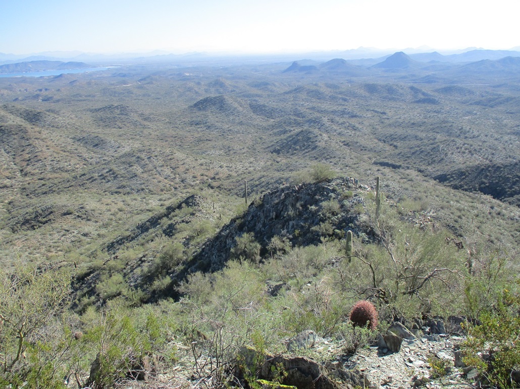
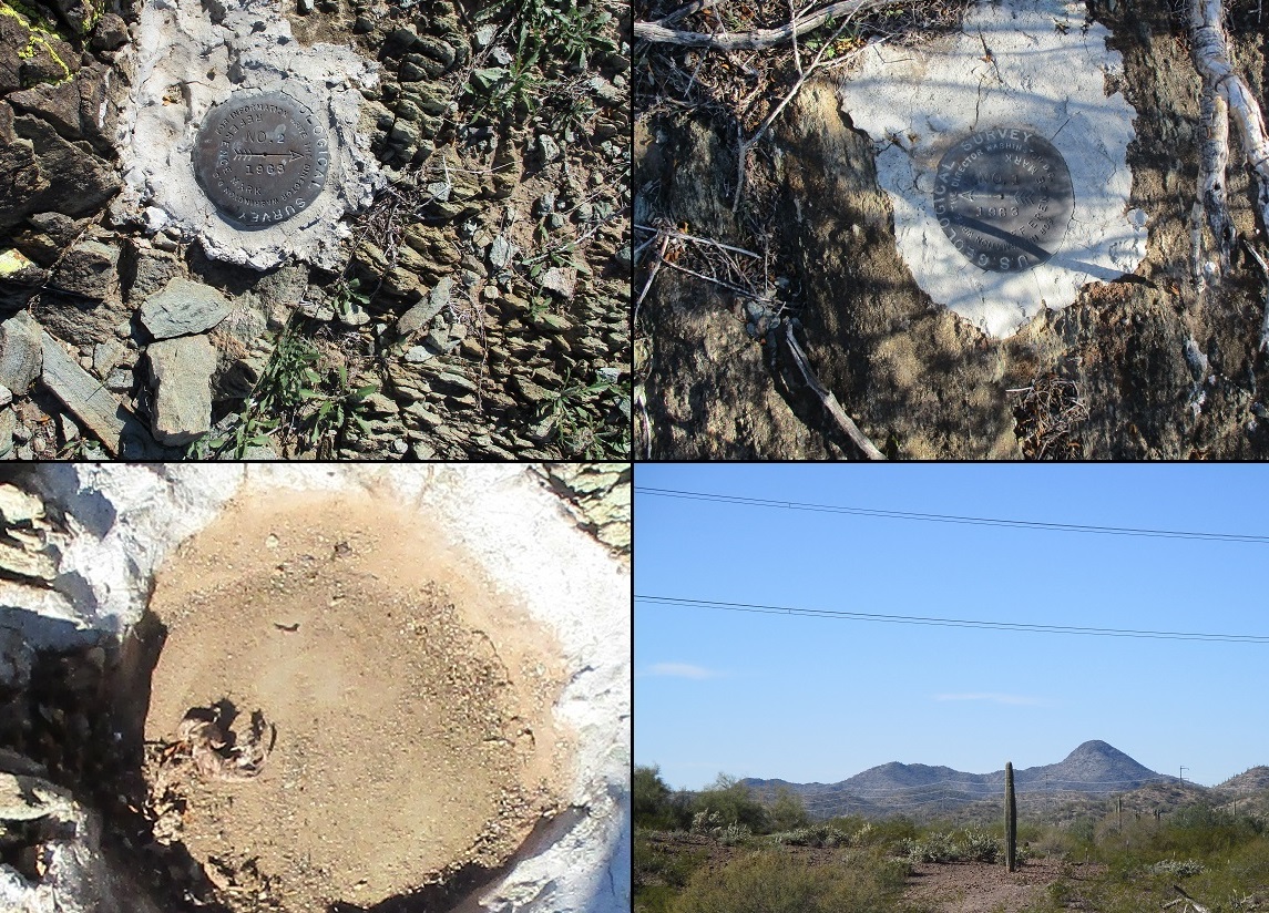
The remaining uphill hike went very quickly, this being possibly the easiest part of the hike. I was on top of Syenite, a little after 11 a.m.. The top is a narrow perch about 30 feet end to end, maybe 10 feet wide, a little brushy but with decent sitting rocks. I stopped to have a drink and look around. I found the two Reference Marks immediately, but the actual benchmark seemed to be gone, all that remained a hole of concrete and dirt. I took photos, and was a little let down that the benchmark was not there. Curses to those treasure hunters, I thought at that moment. The register went back 20 years and held just a few names: Moore, Packard, Scouras, then a fellow from HikeArizona in 2016 (more on him later), then me. Was I really the first visitor here in 6 years? It's possible I was. I stayed up top about ten minutes. The best views were north, at the heart of the Hieroglyphic Mountains.
I descended the same way, taking those steep rocks slowly, then once down onto the gentler slopes, moved more quickly (for me, that is). I was soon back onto the tracks, which I followed out to my car. These tracks, I should mention, were at times wide and smooth, and other times extremely eroded and full of loose crud. And they went up and down, up and down, far more than necessary if this was a trail designed for hiking. Thus, I ended up adding quite a lot of extra elevation gain over the course of the hike.
Back at the car, I didn't change or anything. I was a little surprised that no one had showed up. I assumed that there'd be a few shooters, but it was vacant and silent. There were some trucks and toy-haulers parked up near the highway but I didn't see anyone on the tracks. They were probably sticking to the more substantial roads.
I was very pleased with my success on Syenite and felt extra happy that I was able to make it to the summit after being denied on my first attempt from the south. I am glad I took the time to check for routes "around back", which in this instance, worked splendidly. It was a quarter to 1 p.m., and I had been hiking for just under 5 hours. Although the distance covered was about 5 miles (I honestly have no idea given all the zigs and zags I did), I likely put in over 2,000 feet of elevation when all the gains are added up. I was tired!
I had a back-up peak in mind, a ranked hill north of Saddleback Peak about 5 miles east. When I rolled in, I discovered that this whole area has been developed into a shooting range, this one for rifles only. There was no one here, but signs emphatically made it clear not to enter the exclusion zones. So I didn't. I gave up immediately on this hilltop as it was not that important to me. It would be my luck to try to sneak in a hike just as eight guys with rifles show up.
Later that evening, I googled "Syenite" to learn more about the rock and the I see a trip report and photo-set from a guy named MountainMatt at HikeArizona. He was the last guy to sign in the register back in 2016. He had images of the two Reference Marks and of the benchmark, where he said he had to clear away a lot of dust and dirt to see it. Hmm, I thought it was simply gone. So I look at my photo of it, zoom in, and by gum, I could make out a couple letters! It was there. I just didn't take the extra time to clean it up. Bah. So I am happy I saw it and even got an image of it, but a little annoyed at myself for not looking a little harder. I am not sure why it is cited as "Syenite 2". It would imply there was a "Syenite 1" (or likely just "Syenite") some time in the past. The datasheets don't shed any light on this.
The drive back to Tempe went well, nothing to report on. I was back to my place around 3 p.m..
|

|