The Mountains of Arizona
• www.surgent.net
|
| Wild Burro Mesa |
• Agua Fria River Canyon • Lake Pleasant Hills • Maricopa County |
|
Date: March 5, 2025
• Elevation: 2,997 feet
• Prominence: 737 feet
• Distance: 11.5 miles
• Time: 5 hours, 20 minutes
• Gain:
• Conditions: Sunny, high clouds, cool but warming later
Arizona
•
Main
•
PB
•
LoJ
•
USGS BM Datasheet
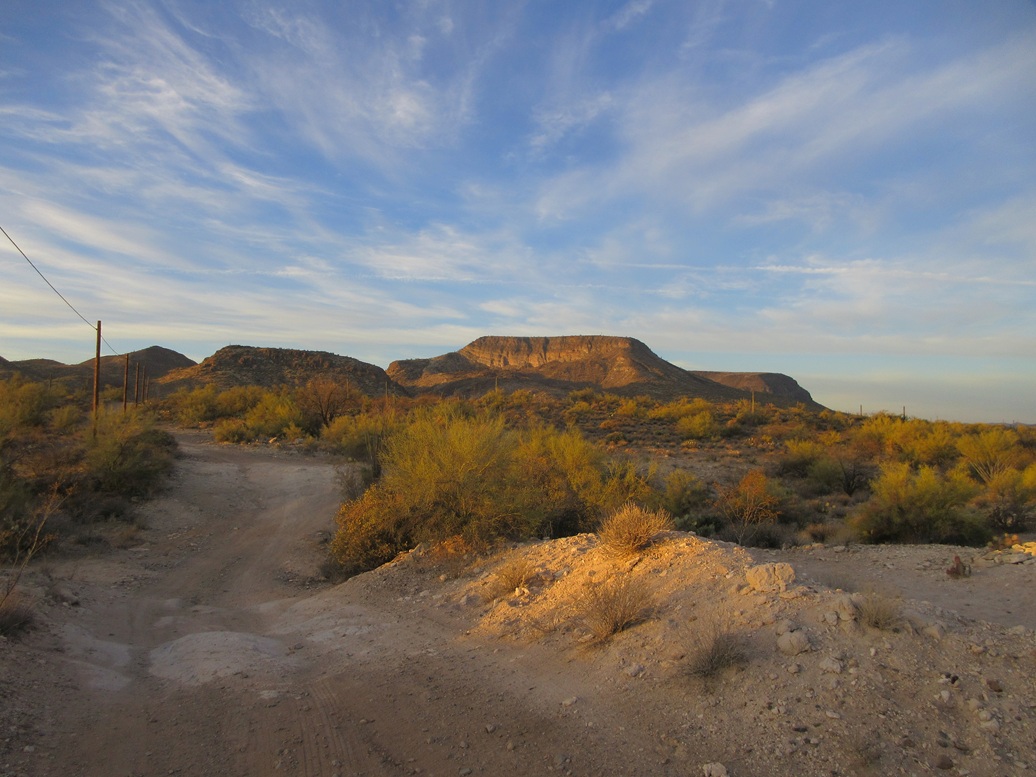
Wild Burro Mesa rises in far north Maricopa County, abutting the Agua Fria River north of Lake Pleasant. Its summit is the highest point of this band of hills, which I refer to as the Lake Pleasant Hills. These are the hills west of Interstate-17, east of the Agua Fria River and Lake Pleasant, and north of state route AZ-74. Some maps consider these to be part of the Bradshaw Mountains, but I feel the Agua Fria River should be that range's southeastern boundary.
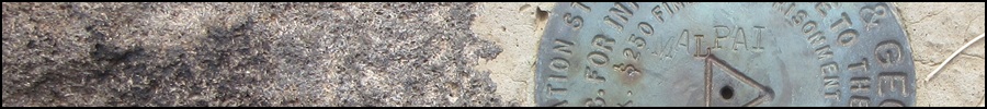
There are two ranked summits on Wild Burro Mesa: the highpoint, elevation 2,997 feet and marked by the "Malpai" Benchmark, and a northern unnamed peak, elevation 2,730 feet. Two weeks ago, I was here on a long dayhike, tagging three ranked peaks including Sweat Peak. This got me thinking about Wild Burro Mesa. The mesa rises north and west of Sweat Peak.
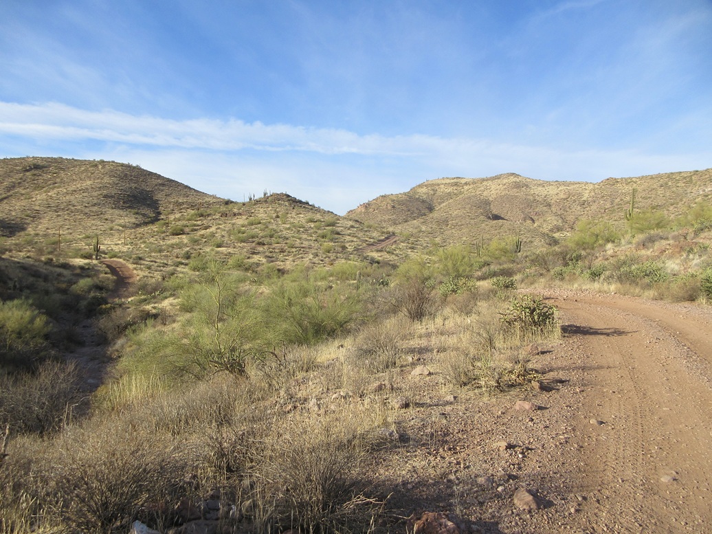
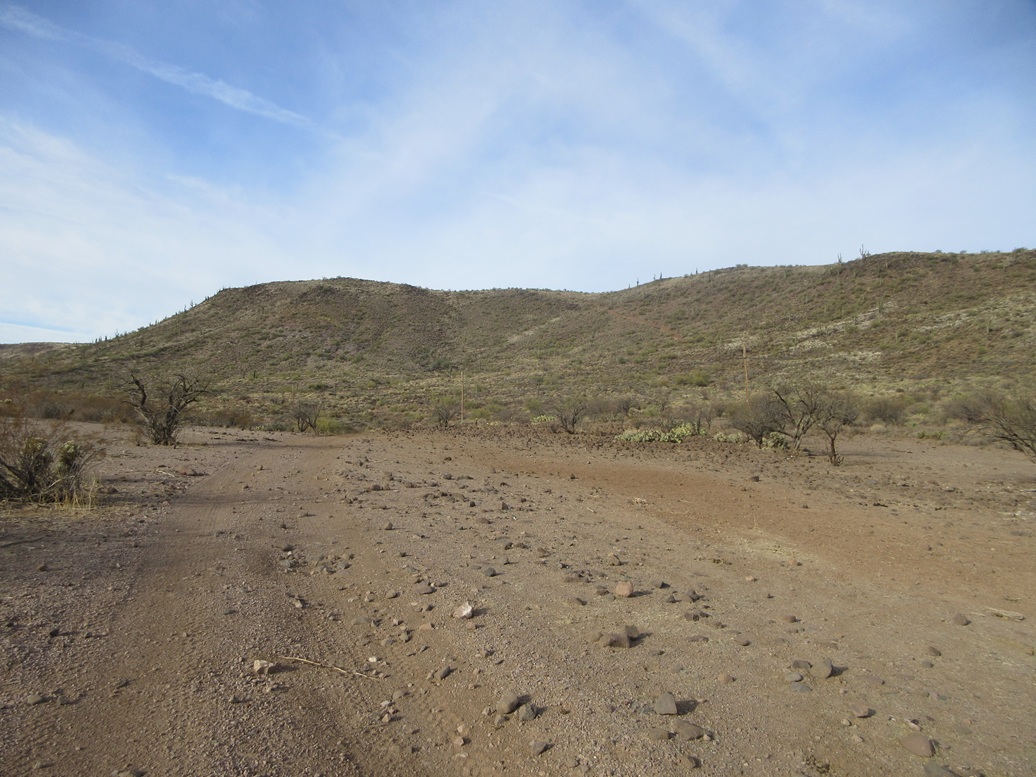
Access back into these hills is not easy. The roads back here are awful. They are unmaintained, rocky, heavily eroded and sometimes ridiculously steep. Only a fully articulated Jeep with a skilled driver might handle some of these roads. For hiking, they are tolerable, but not the best, due to the loose rock and the steepness.
Studying the maps, I saw a possible way up to Wild Burro Mesa, coming in from the north. The older topographic maps show a few of the roads but not all. The newer maps show more of the tracks, and the satellite images also showed some tracks not represented on the maps. In particular, there is a track that gains onto the top of Wild Burro Mesa. It stops short of the highpoint by over a mile, but getting on top of the mesa via this road would be a huge help.
I decided to come back while the weather was cool. Being March, it'll start warming fast. The last couple of weeks had been warmer than normal, with highs in the 80s, but this week, some storms blew through north of us, but dropped temperatures into the 50s for the daytime highs. It was now or never (or "now or November"). My plan was to climb both peaks.
I taught my class at ASU on Tuesday night, got groceries and headed north on the Loop-101 freeway to Interstate-17, then that north about twenty miles to the Table Mesa exit. I camped here in November and knew the roads to follow, even in the dark.
From the exit, I got onto a frontage road going northbound, on the west side of the freeway. As soon as I made the turn, a couple of wild burros were standing in the road. They jogged away. I drove in slowly, making a left onto one main road and driving in about a mile, parking in the first big cleared area I came to that was not being used by anyone else.
It was a little past 9 p.m.. My "area" was trashy, even in the dark. It is obviously a shooting area, this whole region being very popular with the shooters. I parked alongside a fire ring between two palo verde trees, about fifty feet from the main road.
I had a dinner in my car's front seat and listened to the burros bray and some jokers off in the distance shooting. Those guys shot for another couple of hours, and while not that loud, I didn't think it was good style to be shooting in the dark. Some burros were close by and would make a ruckus. The road was quiet, just a couple cars came by during the night.
The new moon was a couple days ago, so the moon was just a couple days into its waxing crescent stage. It was already up but low in the west, and would set within a couple hours. The night sky was starry, but there was a slight high cloudy haze that sometimes occluded the stars. Overnight lows were in the 40s. I slept reasonably well.
I was up before dawn. With the sun rising, I could get a better view of my area. The amount of trash everywhere was unreal. It was more than spent shells and casings and targets, it included boxes, food wrappers, furniture items and plastic everywhere. Some guy rolled into the area to begin his day of shooting, and I got a move on.
I drove not far, about a mile, to a road opposite a mine. This road goes south and parallels some power lines. This would be the road I would follow into the hills that should get me close to Wild Burro Mesa. I got suited up and my backpack on and started walking at 7:20 a.m..
I had hoped to drive in on this road, even a little bit, but I was stopped by a rocky arroyo crossing about fifty feet in. I parked on another nearby road where I could be farther in and not alongside the main road. Walking the road went well at first, but then about five minutes later, I came to the first heinous ravine crossing. The road dropped about thirty feet. It was rocky, steep and badly degraded.
The road then continued south and about five minutes later, dropped again into a ravine. It gained steeply up the opposite side, the road just etched directly into the rock, the barest amount of gravel covering it, at about a 35% gradient. I was able to walk it up and continue on. After a couple more bends and turns, the road then starts to gain elevation, going up a ridge, gaining about 450 feet.
I was able to save some time by sidehilling past the highpoint, to where the road dropped down. I re-met the road on its descent, hit a lowpoint, then up about 40 feet to another apex. Then a 200-foot drop into the main canyon. Here, the road was just abysmal. It was steep, 30% grade or higher, with loose gravel for its tread. I didn't chance it. I walked the berms and other "natural" slopes beside the road, where footing was more reliable.
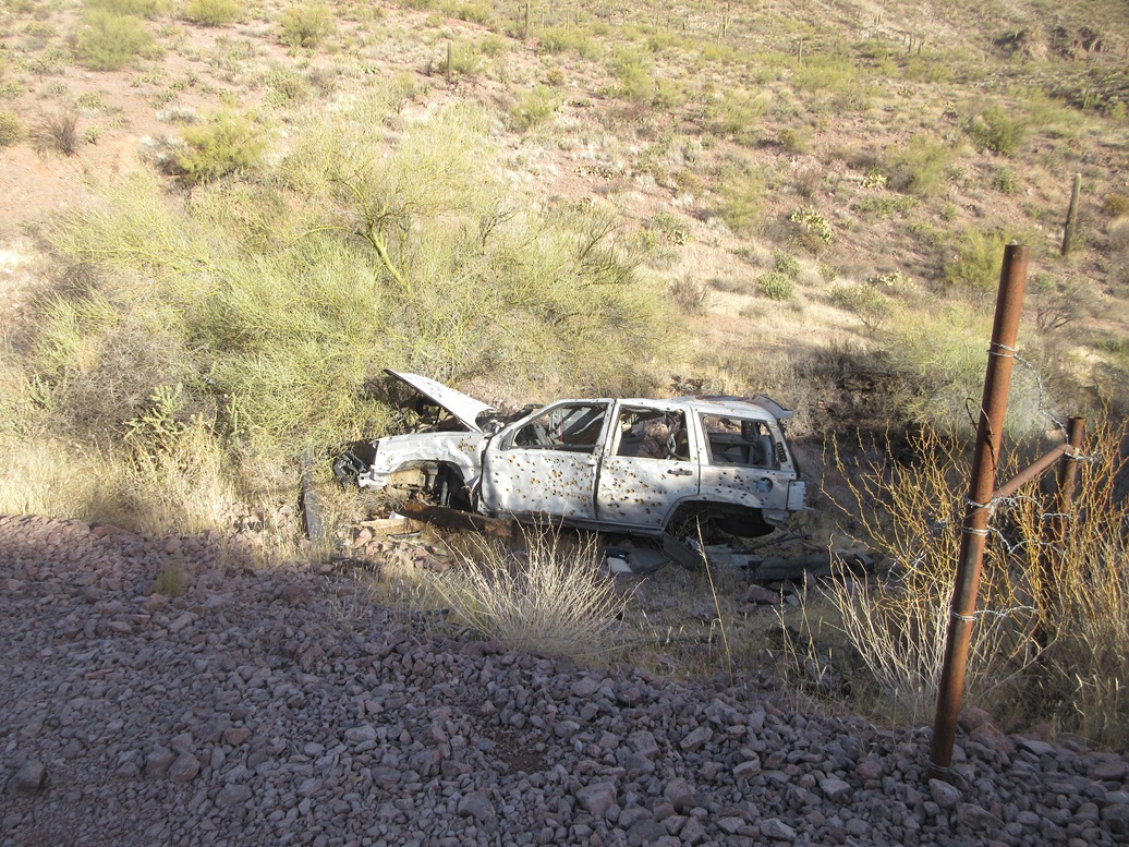
The road then wanders through the canyon bottom for a little under a mile, passing underneath the North Peak of the mesa. The road then picked up some elevation, then dropped again, near the "WC" printed on the older topographic maps. At the base of this drop was an abandoned vehicle, a small SUV from about 25 years ago it looked like, judging by the parts not shot full of holes. I wonder how it got here and why.
The road continued south, now gaining elevation again. I made a right at one Y-junction, and nother a few minutes later. By now, I was below the east walls of Wild Burro Mesa, and I could see the magical track that would take me to the top.
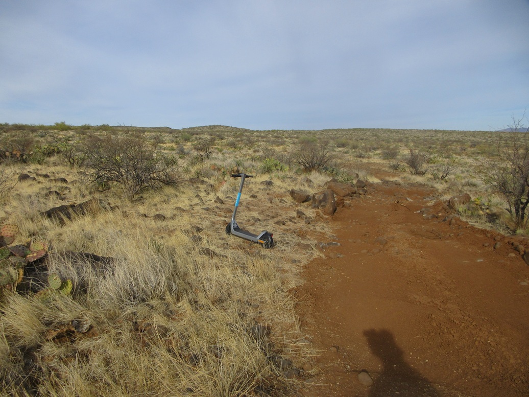
I got onto this track, which was steep, rocky, rutted and loose. I marched up the track and onto the sloping mesa top, and followed this road to its end, at a dry tank. This must have been a very important tank to justify putting in a track to get up the mesa. I had hiked 4 miles by now and for 2 hours. I took my first break on a convenient rock nearby the tank. The weather was cool, in the 50s, with more clouds than earlier.
I had one amusing discovery: one of those electric scooters was parked up here, so I took a photo of it. How and why it got up here, I don't know. It was just parked like normal, upright, still looking like it might work.
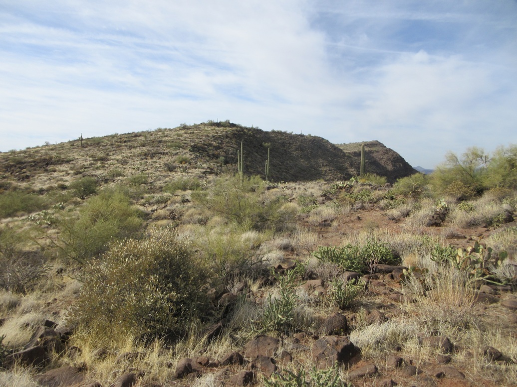
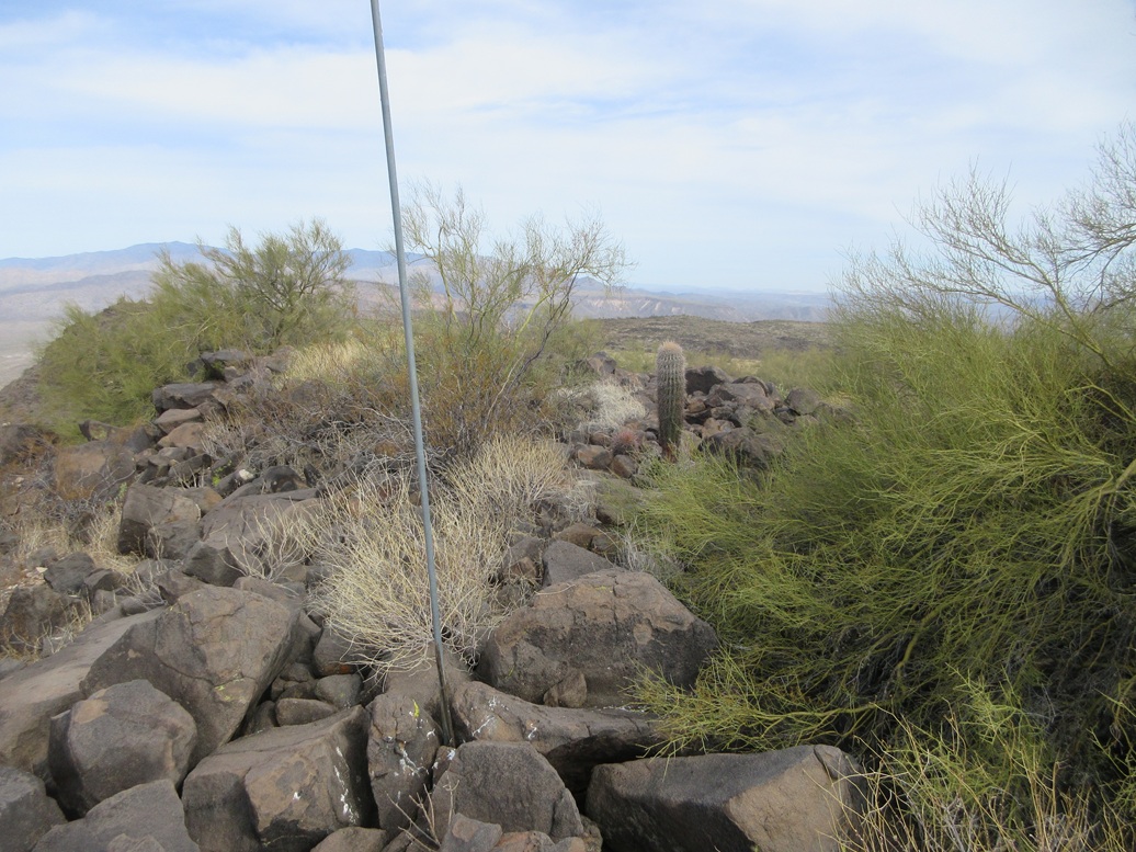
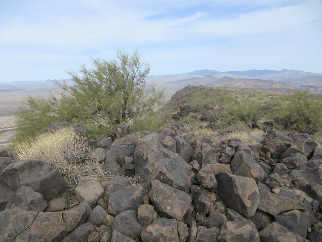
The highpoint was visible over a mile distant to the southwest, a very gentle rise on the mesa's southern tip. The mesa itself was covered in large back volcanic boulders with moderate brush in between, what the old-timers called "malpai" land, or badlands. I think it's a good term that has fallen out of use. There was no more track to follow, so I walked on and amid the boulders.
I walked west to a rise, the dropped about forty feet to a saddle, then up another rise, now on the mesa's big southern lobe where the highpoint is located. The walking varied: sometimes I could make good time hopping from rock to rock, an other times the rocks and brush closed in forcing me to step carefully. It was a little chilly for snakes but I still kept an eye out for them.
The grades were extremely lenient, almost imperceptible. The summit could be seen from a long distance away, but I never seemed to get there ... until I finally did. The last few dozen feet was over and on more heaped boulders. Finally, three hours and almost six miles later, I was on top of Wild Burro Mesa.
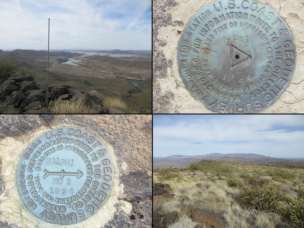
I came to a witness marker first, a boulder nearby being the highest point of the mesa. The main benchmark was close by, flush on a rock about two feet lower than the witness mark. A metal pole still stood, and some wires were still present, because I almost tripped on one. With the clouds, views weren't the best, but I snapped a few photos anyway.
I went back to the witness marker rock and found the register beside it. I sat and took a break, and signed myself in. It was placed by Bob Moore in 2004. Amy was here three years ago, then a group of three last year (hunters?). Then me. I was the first to sign on page 2 of the notebook. Not many people come here. Many of the big names ignore this peak.
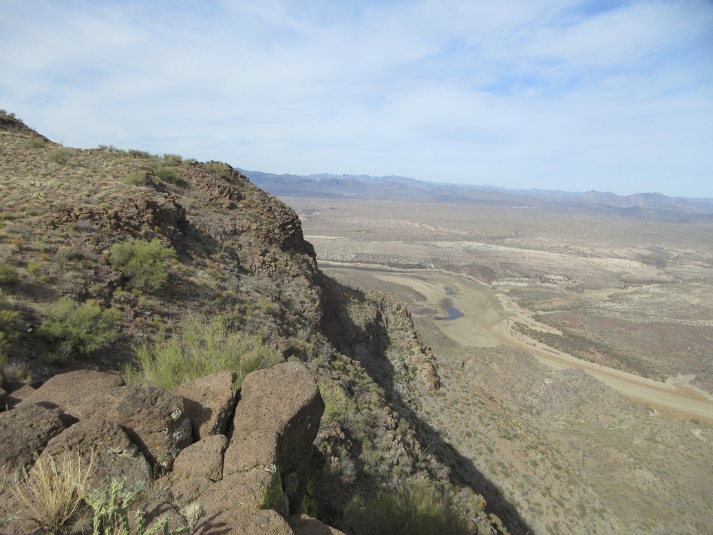
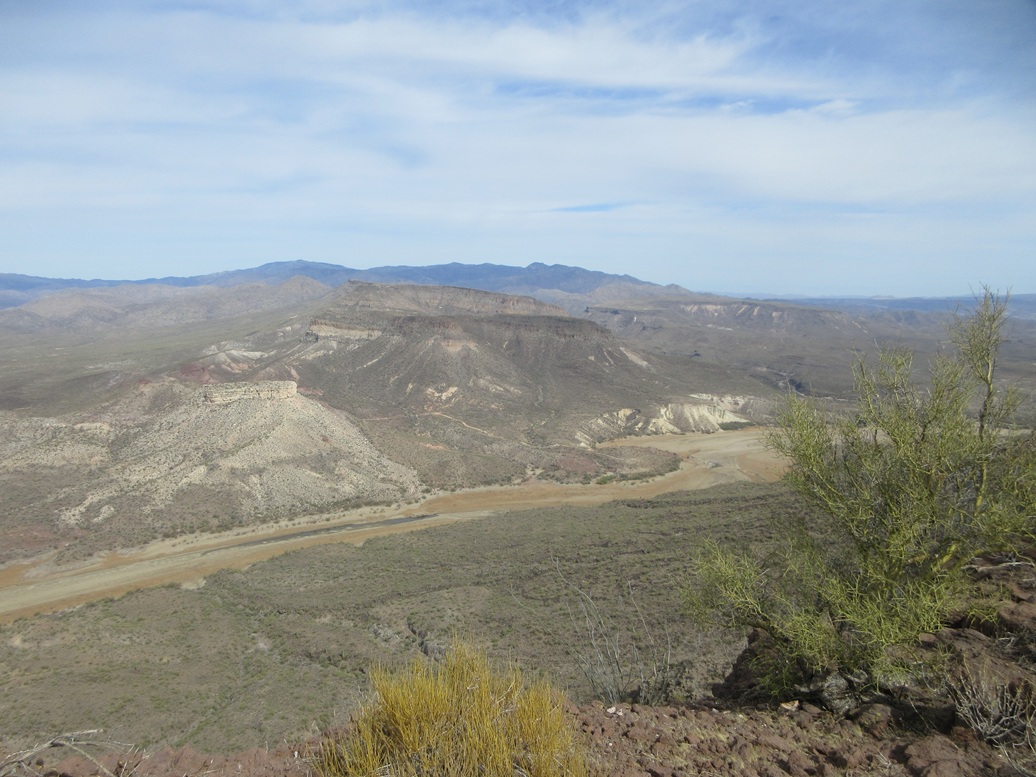
I especially enjoyed the views looking down the cliffs into the Agua Fria River, which was mostly dry on top but with some trickles and pools. I wish it was sunnier with bluer skies, but I also realized the clouds helped mute the sun and keep things cooler. By now, it was in the low 60s.
For the walk out, I followed my ascent route, kind of sort of. I followed lanes as I found them, and at one point got off on a wrong bearing before realizing my error. I corrected my track and was back to the tank, where I could brainlessly follow the road out.
Now it was a question of did I want to climb that north peak still. I was tired by now, and the inbound hike had taken longer than I was expecting. I decided to skip it. I followed the track downhill off the mesa and started the long march out.
The uphills I had to regain were not welcome, as I was tired by now and these were some loose, nasty roads. I walked on the berms whenever possible, and slowly made my way out, the shooters now in full force making pops and pows and the occasional booms. I was back to my car at a quarter of 1 p.m., a round trip hike of almost five and a half hours. I was tired. I was relieved to be out and pleased to bag the big prize, and not at all disappointed to skip the northern peak. That one I will save for a later day.
I changed into some looser-fitting clothes and started the slow drive out. I could feel my body melt into the car seat as I drove. I drove back to campus and walked my stinky self to my office where I did productive things for a couple hours. I had a hotel in Chandler set up, with a barbeque place nearby. I rewarded myself with the combo plate and, frankly, didn't sleep too well. My body was aching, but also, some kids were screwing around in the hall at 2 a.m.. Little ones too, judging by their voices. Whatever.
I am happy to finally check Wild Burro Mesa off my list. This just leaves that northern peak for me to do, and that will "clean up" that area for me. I don't mind putting that one off for a few more months. I enjoyed the overall experience, but the nasty roads and the trashiness of the area was a turn off.
|


|