
The Mountains of California
• www.surgent.net
|
| Lassen Peak |
• Highpoint: Lassen Volcanic National Park • Southern Cascade Mountains • Highpoint: Shasta County |
 Lassen Peak summit
|
Date: July 15, 2004
• Elevation: 10,457 feet
• Prominence: 5,229 feet
• Distance: 5 miles
• Time: 4 hours
• Gain: 2,000 feet
• Conditions: Clear and windy
California
•
Main
•
PB
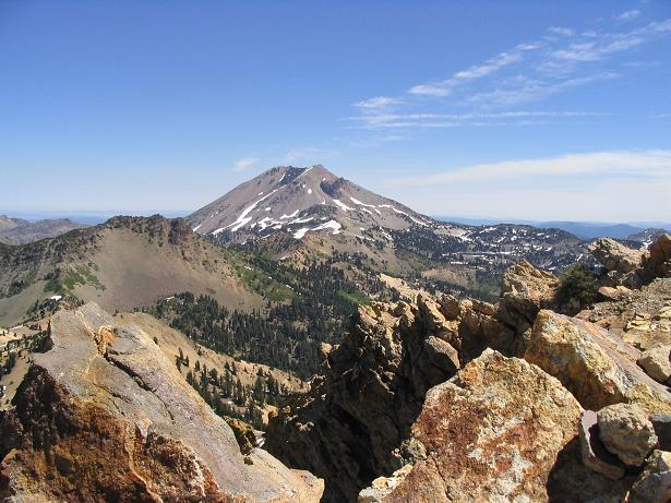
Lassen Peak is a well-known volcano in northern California, the southernmost of the Cascade Volcanoes that run north into Washington state. Lassen Peak erupted in 1916 and is dormant for now. It is always emitting steam and will likely erupt again in the future. When not erupting, an excellent trail leads all the way to the top. The peak and surrounding lands are enclosed within the Lassen Volcanic National Park.
We were starting a two-week vacation that would take us as far north as Washington and British Columbia, and include a couple days at the National Highpointers Convention in Puyallup, Washington. We had landed yesterday in Reno, stocked up on supplies, and drove to Lassen Volcanic National Park, arriving about 4 p.m. and scoring a nice camping space. We spent the remainder of the day enjoying the scenery and cool temperatures.
We awoke the next day and drove a few miles to the Lassen Peak trailhead, arriving to the large parking area around 8:15 a.m. The lot can hold easily 100 vehicles, but as we rolled in there were five cars already there. We got dressed and got our stuff in order, and in about 15 minutes we were on the route.
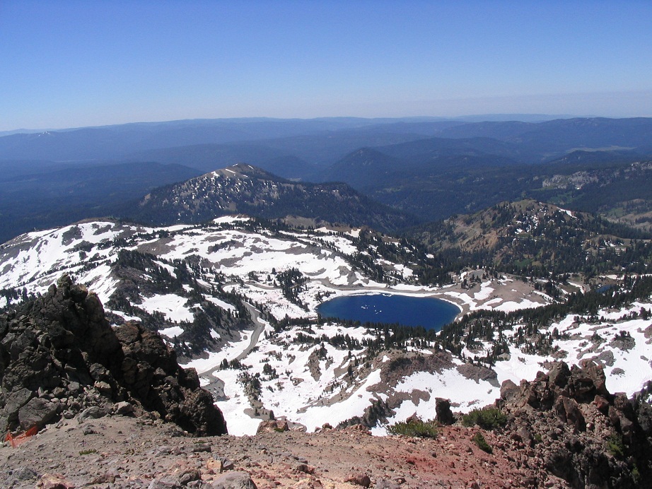
The trail starts as a wide road, then switchbacks once, gains moderately, enters a thin stand of pine, then contours east for a short ways, gaining at a moderate grade. There was a surprising amount of snow still on the ground down low. We were told (and read) that mid-July is often the start of the hiking season for Lassen Peak, since it takes that long for the snows to melt. In fact, around Helen Lake nearby, the ground was mostly snow with occasional open patches, and the lake itself still was iced over in places. In any case, our progress was not hampered at all by the snow. Only in a few spots on the trail did we have to cross it, and often, we just walked around the drifts. Shortly, the trail made a sharp left turn and we could now see the summit for the first time since the parking lot.
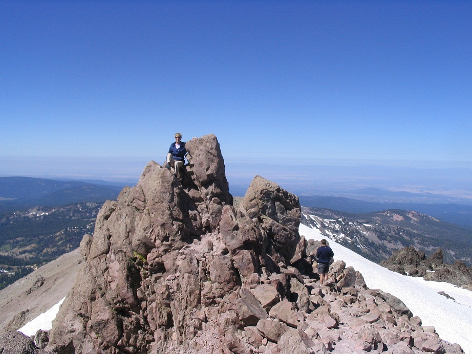
From here the trail switchbacks up a sharp southeast-trending ridge. The trees reduced to occasional stands of krumholz and eventually, to nothing. The trail is well maintained, never steep, but never flat either. We had to contend with extremely strong winds on the exposed ridge. They were sustained 25-30 mph for minutes at a time and gusts over 50, which sometimes forced us to walk in a squatting position or to sit out the gusts behind the rocks. The trail eventually comes to a large rocky promontory about a half-mile below the summit. Afterwards the route's gradient lessens and shortly, brings one to the "top", a flattish, gently rounded hump, not far from the true top. We rested here, the wind having graciously died down for us.
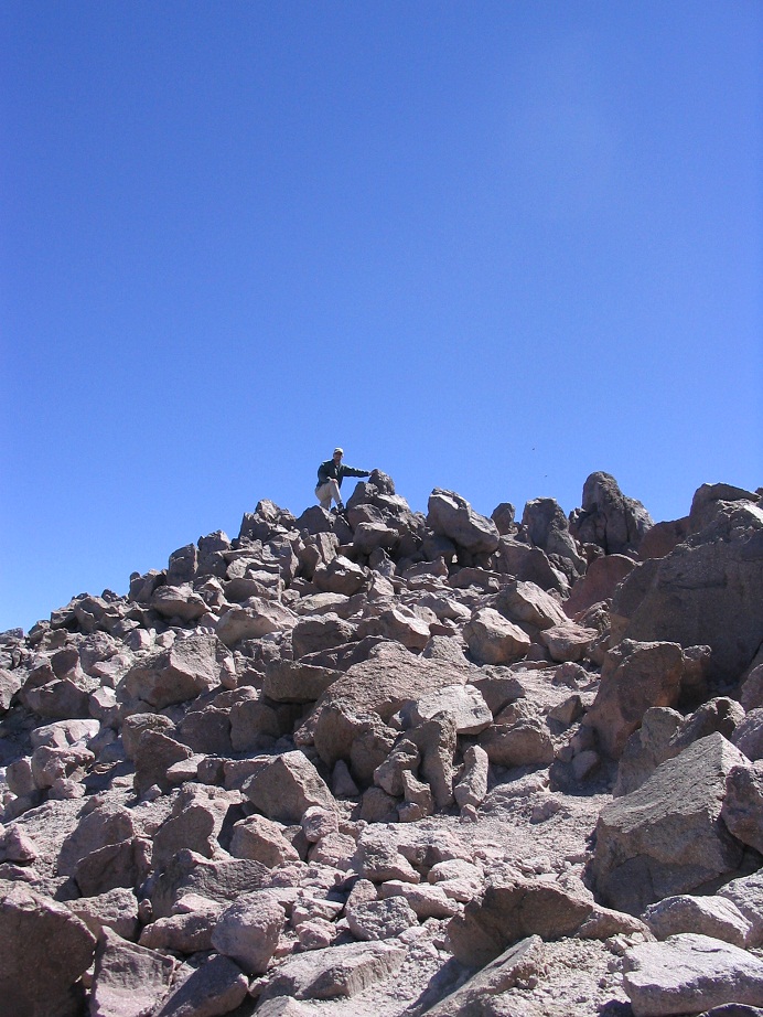
The true summit is a little ways to the north. We walked across a snowfield, down into a small depression, then up loose slopes toward the rocks that vie for summit honors. The presumed summit features a small building, I think used to monitor the activity within the volcano. Another spire of rocks nearby looked nearly as high so we checked it out, too. The views are positively stunning in all directions, especially with today's clear and dry conditions. We stayed up top for 20 minutes before starting the trek down. Back at the lower sub-summit, we stopped to chat with people hiking upwards, although we noted a lot of people get to this lower hump and go no farther.
We made good time on the descent, stopping occasionally to snap photos. On our descent, we passed over a hundred people coming up. There were lots of families, including one where the littlest hiker, a girl of about 4, was slowly making her way up without assistance from mom or dad. She was real cute: 4 years old, climbing a Cascade peak, all by herself.
In time we made it to our car, a round trip of just under 4 hours for the five-mile hike. The parking lot was jam-packed by now. It's reasonable to guess that hundreds of people hike this peak in a day. The trail is in good shape and the views are stupendous. We returned to our campsite, then drove to the Manzanita Visitor's Center to shower and get some food. Then, back to camp for some relaxing and preparation for the next day's hike of Brokeoff Mountain.
|

|