The Mountains of Arizona
www.surgent.net |
|
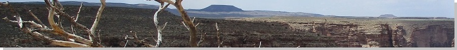
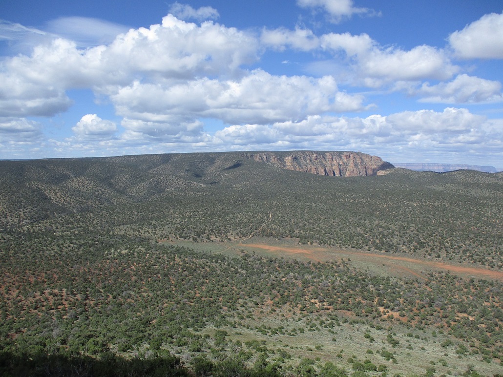
Cedar Mountain • Navajo Point Benchmark Cedar Mountain lies on a plateau at the east end of the Grand Canyon. This plateau is bounded on the east by the Little Colorado River Gorge, and on the west by the Colorado River and the actual Grand Canyon. The two rivers meet below the north tip of this plateau called Solitude Point. It is at this confluence of the Little Colorado with the Colorado that the "Grand Canyon" traditionally begins. Anything to the north and east is merely just "Really Nice Canyon". This particular plateau has no name I am aware of. It lies partly within the Grand Canyon National Park and partly within the Navajo Nation. The peak itself lies within the National Park. This plateau lies east of Desert View, near the eastern entrance of the National Park and the first main nexus point for visitors to the Canyon. Desert View is well-known for its stone observation tower, and is a prime spot to view into the canyon looking upstream at the Colorado River. Desert View lies about a thousand feet higher in elevation than the lower plateau on which Cedar Mountain stands. I've been aware of Cedar Mountain for years. My wife and I have been through this part of the Grand Canyon before. The peak sits by itself, a lone flat-topped mesa surrounded by flatter (in a relative sense) plateau country. A Jeep road descends off the Desert View promontory, losing a thousand feet of elevation, to place one's self below Cedar Mountain. The logistics amused me, requiring one to drop elevation first to climb a peak (which is common in the Grand Canyon). I've kept putting this off for years, though. I finally got a fire built and lit under my butt to go climb the darn thing.
Date: May 5, 2023
• Elevation: 7,061 feet
• Prominence: 571 feet
• Distance: 9 miles
• Time: 4 hours, 20 minutes
• Gain: 640 feet from the lowpoint
• Conditions: Sunny with puffy clouds and strong winds
Arizona
•
Main
•
PB
•
LoJ
It had not been a good week for me in town. I came down with a bad reaction to a medication I was taking and had to cease that medication cold turkey. So I had to deal with this reaction, which while I won't go into details, possibly meant systemic infection. So I went to the doctor yesterday (the 4th) to have it looked at and blood drawn. I wouldn't know for another day or two the results. And there was the normal stressors of the day job. Basically, I wanted off this ride and the sooner the better, so that's when the idea of climbing this peak came into my mind. I didn't debate the details. I basically got things planned in my head and after my last zoom meeting of the day, bailed. I drove to Flagstaff and got a cheap hotel room for the night.
The next morning (today), I was up before dawn and driving northbound on US-89 toward Cameron, then on AZ-64 west toward the Grand Canyon, about a hundred-mile drive from my hotel. Today being a friday I was uncertain how busy it would be, but when I rolled up to the entrance, it was unmanned and no one was in line. I paid for a pass, then drove a tiny bit toward the Desert View area. I made a couple right turns, passing through a small residential area used by the park employees, then continued a little farther on a decent dirt road. I drove in about a half mile and parked in a good pullout. This was the road that drops off the Desert View promontory down toward Cedar Mountain.
I knew the road would start to drop fast so I parked when I had the chance. I got dressed properly and started walking at 7:05 a.m.. It was a cool day, sunny with some puffy clouds and a steady breeze, temperatures for now in the high 40s. So yeah, I was wondering if I have a systemic infection. I felt fine now, but maybe it could come on fast, massive organ failure, that kind of thing. Well, here I am, I'm hiking in the Grand Canyon and having fun. If I keel over now, so be it. I'd be on or near a road so hauling my body out should be easy. Truthfully, I wasn't too concerned, but it was on my mind.
The hike down the road is easy, in that it's just following a road downhill for about three miles. The road is in rough shape, with bad erosion in spots, but for walking, was easy. The road would get near the edge of the canyon rim and I could look down into the vast voids of the canyon and stare at the beauty of it all. I don't get vertigo often, but looking into the Grand Canyon sometimes induces that in me. The scale is astounding.
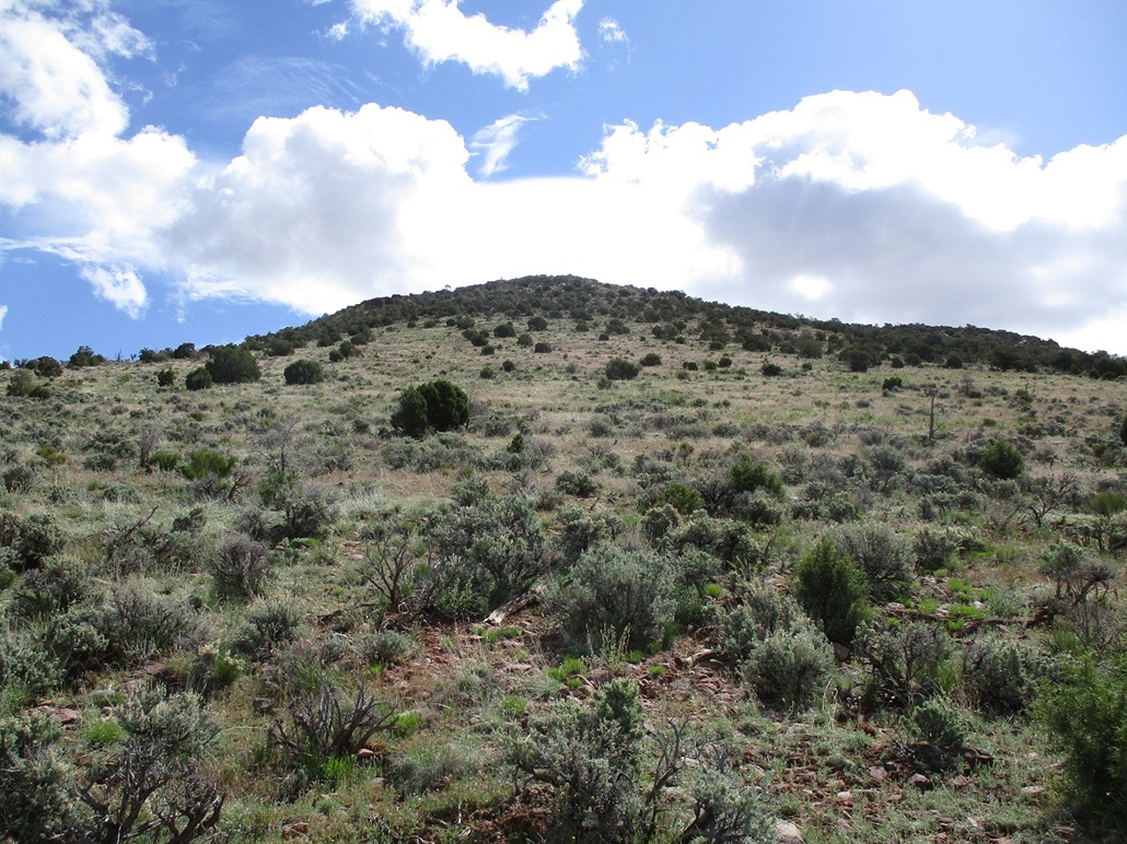
In about three miles, I had dropped down to a lowpoint, where the road splits in a meadow west of Cedar Mountain. The map has a spot elevation of 6,414 feet at this split. On the hike down, I had good views of Cedar Mountain, which is a mesa with steep sides all around, from a distance looking intimidatingly steep to climb. But as I got closer, it becomes clear real fast that a climb of Cedar Mountain won't be as bad as it looked from afar. Ways become evident and the steepness of the slopes not so severe when viewed closer in.
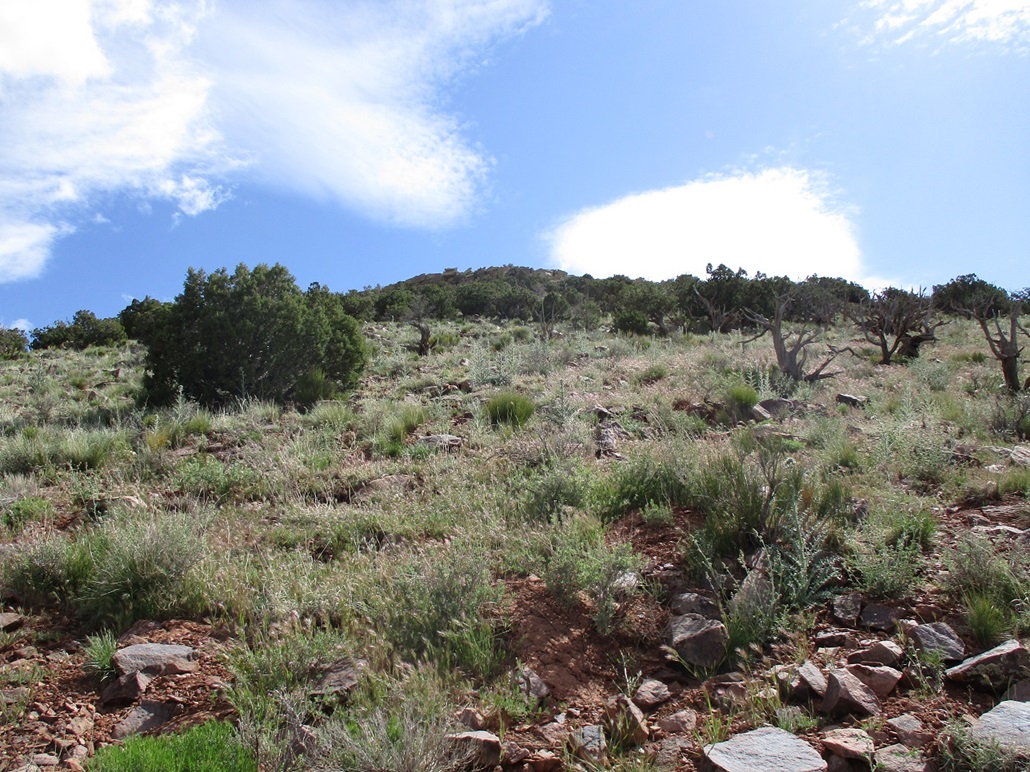
I struck out across the meadow, then into the trees, then back onto open meadow as it started to merge uphill with the lower slopes of the mountain. The grade was steep but not severe, and the footing solid the entire way up. The cliffs that surround the top show signs of weakness the closer one gets. About fifty feet below the top, the rocks start in earnest, and these tend to be solidly in place, offering good footing. I scampered over a few rocks and up one very easy chute and I was on top! I wouldn't even rate the scrambling Class-2. Maybe 1+.
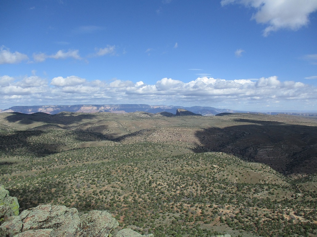
Now to actually find the top. On these flat mesa tops, the summit can be difficult to discern. Here, the mesa slopes away from the west to the east, so the highpoint is somewhere on or near the west rim. I went left and hiked north along this west rim, tagging and kicking any possible highest rocks while looking for any hint of past visitors such as a cairn or register. I hiked for a few hundred yards north until I was on the north rim of the peak, now looking due north across the plateau and its various smaller canyons and hills. I then hiked back along the rim to where I had first come up.
Just to be sure, I repeated what I did, but went in a little bit into the trees, in case the highpoint was some pile of rocks within the trees. But I saw nothing like that. I ended up hiking back to the northern rim, then back again to my starting point. I felt that the summit is a ledge of white rocks in which a rock has been placed into the crook of a dead stump. It occurred to me that the Grand Canyon people may send someone here to take down any cairns and registers, but perhaps this rock in the crook is a way of saying "here's the summit". That's my guess.
I sat down for a little bit to rest and enjoy the solitude and scenery. Up high, the breeze was heavier, but not overly uncomfortable. Puffy clouds were scooting through fast, sometimes creating dark shadows. It wasn't much warmer either, maybe mid 50s now. The views are tremendous. To the northwest is a ramp-like promontory called Comanche Point, which sticks out over the cliff edge like a diving board overlooking the Grand Canyon. I could see the tower atop Desert View. I could not see into the Grand Canyon from here but could see its cliff walls on the opposite side. I was happy to be here and happy to see these sights.
I started the egress, carefully poking my way down the slope back to the meadow, then the long walk up the road back to my car. I moved slowly and in no hurry, stopping often. I took another long break on a rock at the Canyon's rim. The uphill hike was a little tedious because it was a case of there always being just a little more up, or one more bend, that kind of thing. I was back to my car at 11:25 a.m., a 4-hour and 20-minute round trip hike.
Going by the statistics found on some other pages such as the HikeArizona and Summitpost pages, my round trip covered about 9 miles, give or take, depending on exactly where I parked. It was a 1,010-foot drop to the lowpoint, then a 640-foot gain to the summit from the lowpoint, then, of course, the 1,010-foot regain hike back to my car. I felt fine! No systemic infections yet, as far as I know. I changed into more comfortable clothes, then drove to the main Desert View parking area. But then I realized I had left something behind back where I had parked so I drove back to get that thing. There were two heavy-duty trucks coming up that road I was on. I pulled aside for them to pass. I got my thing, then returned back to the parking area and parked... then those two trucks park beside me. I talked to the guys. They said the road in and up was "nasty" and "epic". I had not seen them nor had they seen me, but it was good to get some feedback on the roads from people who drove it.
While sitting in my car, my phone rang and it was a nurse from my doctor's office saying that the blood panel showed no systemic infections to worry about, which was good. I spent a little more time relaxing in my car.
Elevation: 7,498 feet
• Prominence: 478 feet
• Distance: 0.5 mile
• Time: 15 minutes
• Gain: 1,010 feet (see notes that follow)
• Conditions: Smokey over the canyon!
PB
•
LoJ
•
USGS BM Datasheet
Desert View sits at the top of a long sloping plateau that comes up to and ends at the rim of the Grand Canyon. Its highest point is marked by the "Navajo Point Benchmark". From my car, I walked into the low trees toward the rim, found a trail, and within minutes, had come upon the "highpoint" and the benchmark, an easy second peak for the day. I was right on the rim's edge and looked out and across the Grand Canyon. There was a lot of smoke coming from a big fire to the west. The day was hazy and overall, it wasn't the best day for views, but even a bad day of views at the Grand Canyon is still amazing.
I got to thinking how I want to count the stats for my hikes. I got clever and decided to reckon everything from that 6,414-foot lowpoint. Thus, my climb of Cesar Mountain covered just a mile with 640 feet of gain from that lowpoint, and then my "climb" of Navajo Point Benchmark began from that low point and thus, I can count that 1,010 feet of gain as part of this climb. Heck, I want the credit for all that effort!
I spent the next couple of hours walking around and amid the buildings of the Desert View area. There were people around but not too many. It was chilly. Some people were properly attired, others, thinking it's always hot in Arizona, were underdressed and clearly not comfortable in the heavy cool breeze. I enjoyed the views, of course. It was a treat to look back down from the viewpoint and see Cedar Mountain below me off to the east. I had a lunch at the cafe and generally took it slow, now with no agenda whatsoever. Here are some of my images of the Desert View area.
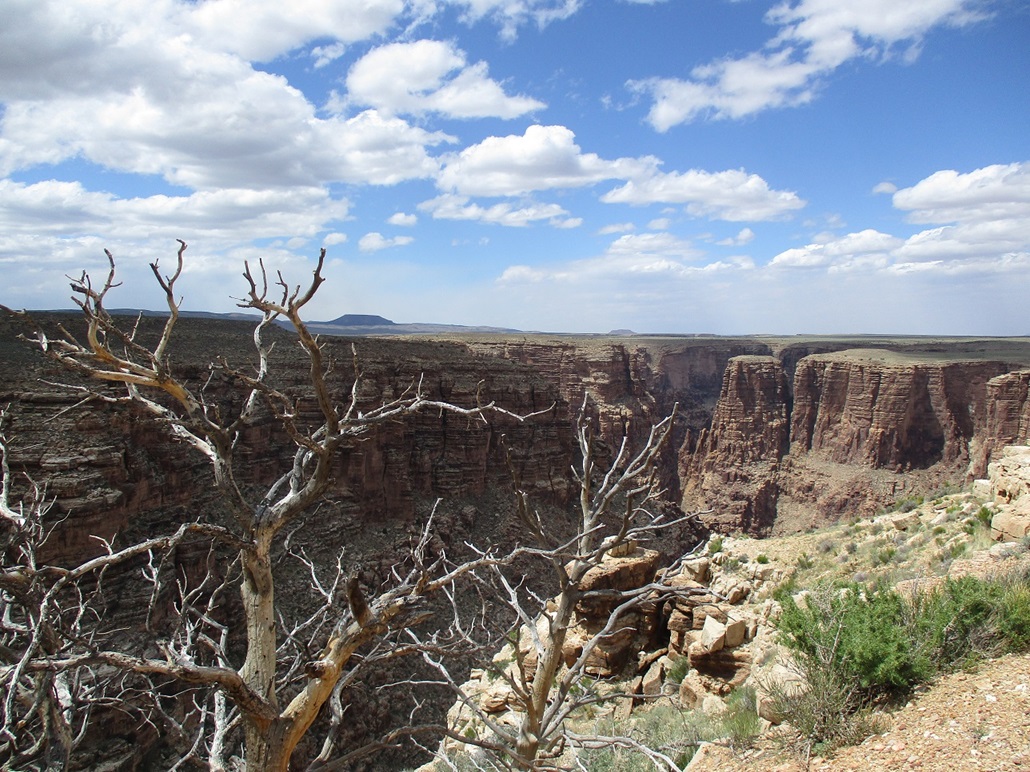
I finally got rolling, a general plan to be back somewhere in the Flagstaff area tonight. I left the park and drove eastward along AZ-64, now back on the Navajo Nation. Then suddenly, I see a little blue "Scenic Pullout" sign and pull into it. I parked at the small lot and walked along an old road toward the Little Colorado River Gorge. This was really cool! The gorge is a thousand feet deep and is much more compact than the Grand Canyon. It's Navajo run, which means no infrastructure but also no extra frills. You're on your own out here, which is nice. I spent the better part of an hour here, much of waiting for the shadows to move along so I could get that one awesome photograph. My images of this visit are here.
Back on the highway, I proceeded southbound toward Flagstaff, with time for one more peak. I had maps for a batch of peaks north of Humphreys Peak and ended up hiking Colton Crater before taking a hotel room for the night in Flagstaff.
|


|