This Copper Mountain rises east of the community of Mayer, along state route AZ-69 between Interstate-17 and Prescott. It lies in a patchwork of State Trust and BLM lands. To the southeast is part of the Black Canyon Trail system, and to the north there appears to be an active mining operation, although small in size.
I was here a month ago, intending to hike it and a few other anonymous ranked bumps in the area. However, my attempt was stopped immediately as I could not cross the swollen Big Bug Creek to access the roads beyond it that lead to the peak. Instead, I hiked Hickey Mountain up north by Jerome.
So a month later, today, me and the gang (Peavy, Matthias) are hiking a few peaks up north by Williams. The weather starts to get cloudy and stormy up there, forcing us to cancel our last couple of peaks and start heading back to Phoenix. Naturally, we wonder what peaks we could tag on the drive back. I mention this one and immediately everyone seems interested. It took a couple hours to drive down from Williams through the outer suburbs of Prescott to get to Mayer.
The Big Bug Creek crossing was as dry as a bone today! I expected a little trickle, but it was completely dry. Matthias crossed it easily, then drive up a half mile to a hard right at a junction marked by a "U Cross" ranch sign. We went right on this road and followed it generally eastward for a couple miles. The road gains the lower slopes of Copper Mountain and gets a little narrower. We came to a new green gate, mentioned by John McCafferty in his Peakbagger report. He parked here, but we passed through and drove onward, up to a saddle immediately west of the peak.
McCafferty mentioned that the road does not require 4-wheel drive, and for the most part, it is a very good road. It appears to be maintained so trucks can access the mine to the north. It had clearly been bladed within the past few weeks. However, it does get narrow and steep toward the end, and a strong vehicle with decent clearance would be advisable. In my Subaru, I probably would have parked back at the gate, and that would not have added much distance anyway, not even an extra mile round trip.
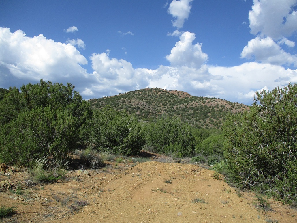
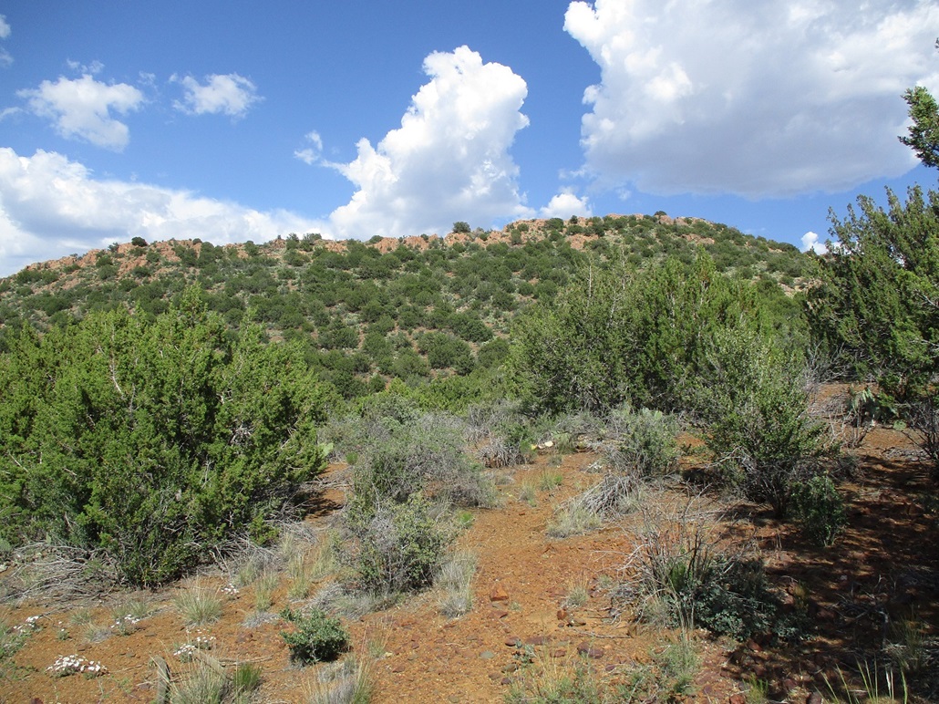
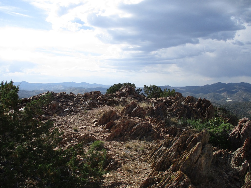
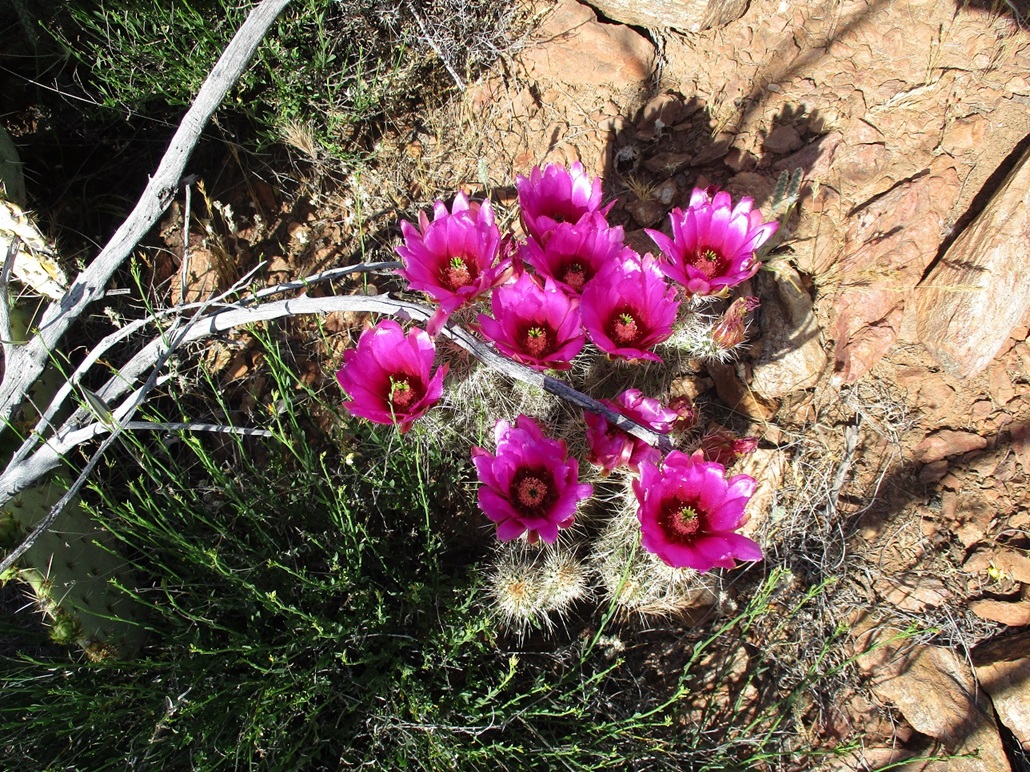
The peak was right there, just a quarter-mile away to the east, a ridge-shaped profile with a rocky crown and covered in brush and cactus. We started the hike at 4 p.m. in sunny and warm conditions, temperature about 80 degrees. We took the direct route, aiming for the summit directly. The terrain was steep but manageable. The slopes are covered in prickly-pear cactus and small trees. The pretty magenta flowers of the hedgehog cactus were blooming. In my opinion, the various cactus species produce the prettiest flowers.
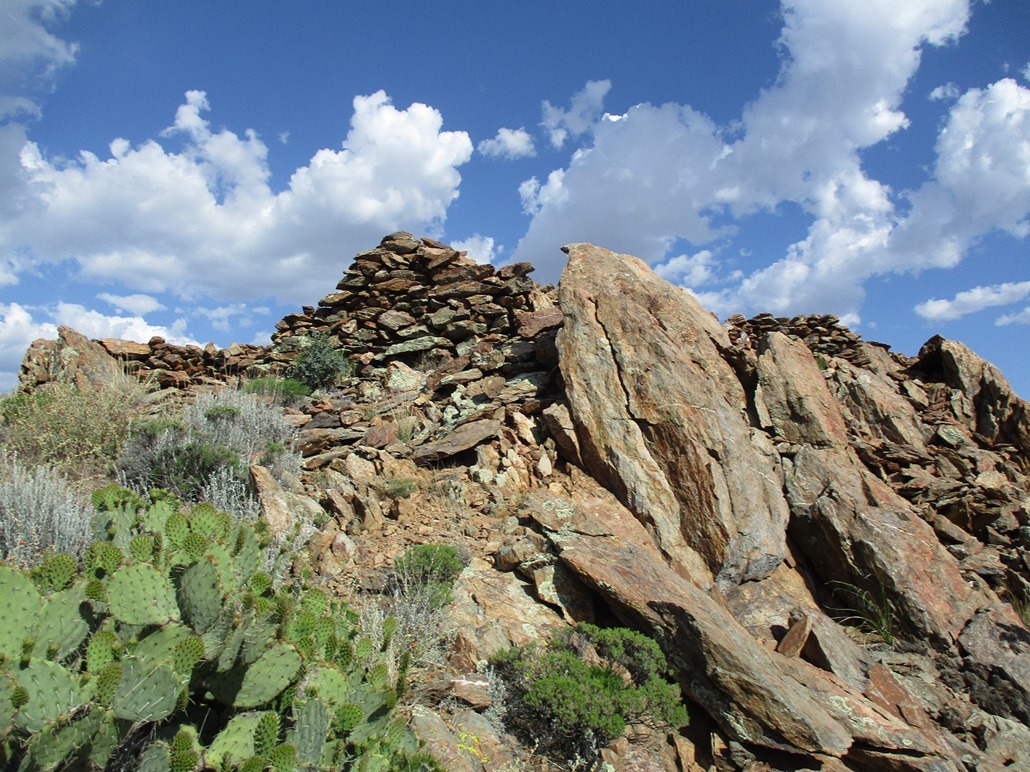
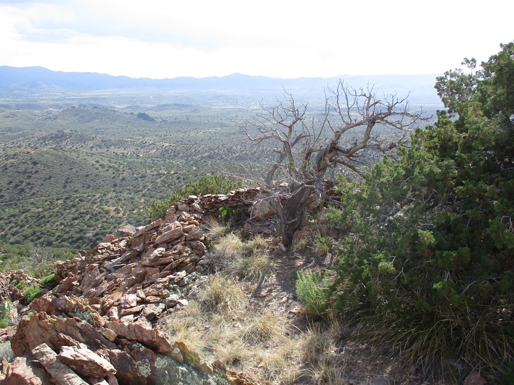
We gained the top within 15 minutes after starting, surprised to discover rock walls surrounding much of the summit area, obviously the work of the indians from the past. This wasn't any fancy structure with living quarters. The walls generally ran a couple feet high and likely were more for defensive and scouting positions. But still, these were unexpected and we were happy to have this little surprise up here.
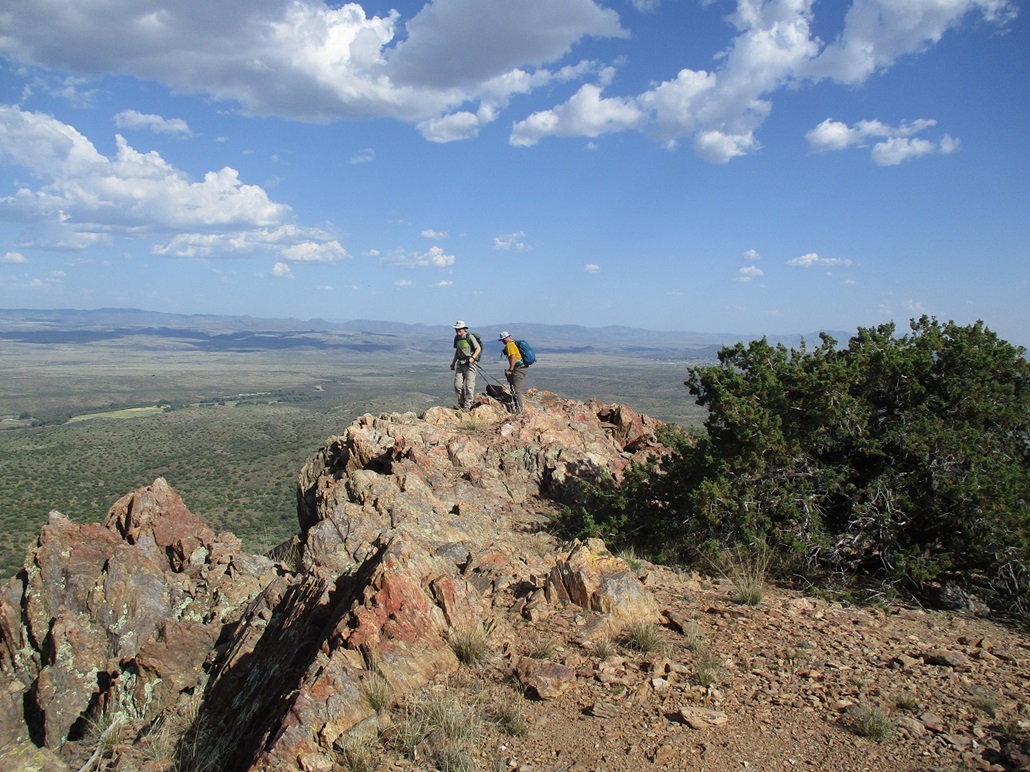
We stepped on and tagged any "natural" rocks that were likely highpoint contenders. Anything under a rock wall obviously did not get tagged. The views were good, but those pesky clouds were also starting to build around us now. It seems we could not escape the storms today. But they did not amass into anything threatening.
We hiked down the same way, the round trip taking less than an hour. Back at Matthias' vehicle, we changed and got rolling, getting gas down in town and rolling back into Phoenix an hour later, well into sunset by now. It had been a really good day: four peaks and a little epic weather while at it. This last peak was a nice consolation after being weathered off our other peaks, and I am glad we got to do it as a group. It was good to hike with the homies again, bagging peaks and outrunning storms.
Me, I called in an order for the four-taco special at El Jefe's in Tempe, picking it up along the way. Aside from the much-needed vitamin T, I also replenished my vitamin H (for their habañero salsa). A man my age needs these nutrients to stay young and active.