The Mountains of Arizona
www.surgent.net |
|
Diamond Butte • Apache Butte Diamond Butte and Apache Butte are two broad and heavily forested mountaintops in the White Mountains of Eastern Arizona. They rise side by side, Apache Butte northwest of Diamond Butte. Diamond Butte happens to be the state's 11th-highest ranked peak by elevation, which is partly why we chose these peaks for today's outing, as the state is in the middle of a very intense heatwave, and anything below 8,000 feet in elevation would be too hot. Yesterday, the high in Phoenix was 117 degrees. I was out of my place at 4:20 a.m. this morning, and my car's outside-temperature-ometer read 96 degrees ... and it felt like it, too. It was stifling even at this early hour. When I rolled into the Walmart parking lot off the Signal Butte exit in east Mesa where we were to meet, it was still reading about 92-94 degrees. Soon, Matthias and Scott pulled in, we got our gear loaded into Matthias' vehicle, and we were off at 5 a.m. on the nose.
Date: July 16, 2023
• Elevation: 10,624 feet
• Prominence: 384 feet
• Distance: 4.6 miles
• Time: 4 hours and 30 minutes
• Gain: 1,820 feet (gross)
• Conditions: Sunny and warm, lots of bugs of all kinds
• Teammates: Scott Peavy, Matthias Stender
Arizona
•
Main
•
PB
•
LoJ
•
Interactive map
We followed US-60 into Globe, where we stopped for snacks and to top the gas. Then we stayed on US-60 northeast, into and out of the Salt River Gorge, until we arrived to Carrizo Station a little after 7 a.m., just a single Sinclair Gas Station-Mini Mart at the junction of US-60 and AZ-73, about 35 miles north of the Gorge. Here, we got some more basic supplies, and also our recreational day passes, as we were now on, and would be on, the White Mountain Apache Nation for the day. The lady asked us if we were birders. We didn't confirm nor deny. In fact, when we walked out afterwards, we saw three or four birds. Our day was off to a good start.
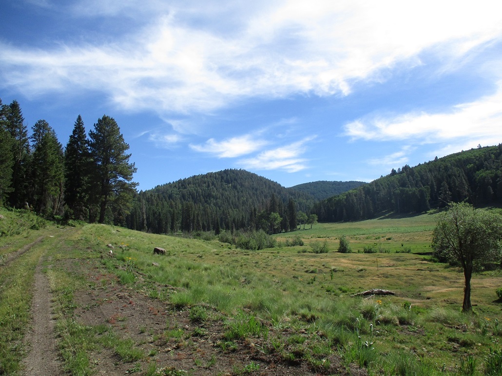
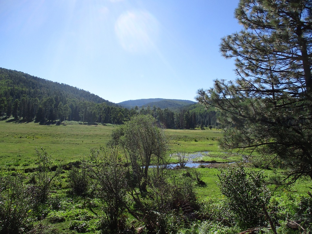
We continued eastbound on AZ-73 for another 20 miles or so, to the town of Canyon Day. Here, the main highway swings north toward Whiteriver and Hon Dah. But we exited onto Indian Route 46, at the historic Fort Apache. We followed IR-46 a few miles through the scattered homes, paralleling the East Fork of the White River. The road then meets IR-55 at a T-junction, which we followed east, still paralleling the river. The pavement ends at a Y-junction, where IR-55 goes right. We stayed straight, now on IR-30. The drive was scenic, with big green and leafy trees lining the road, and in some places, cliffs that come right up to the road.
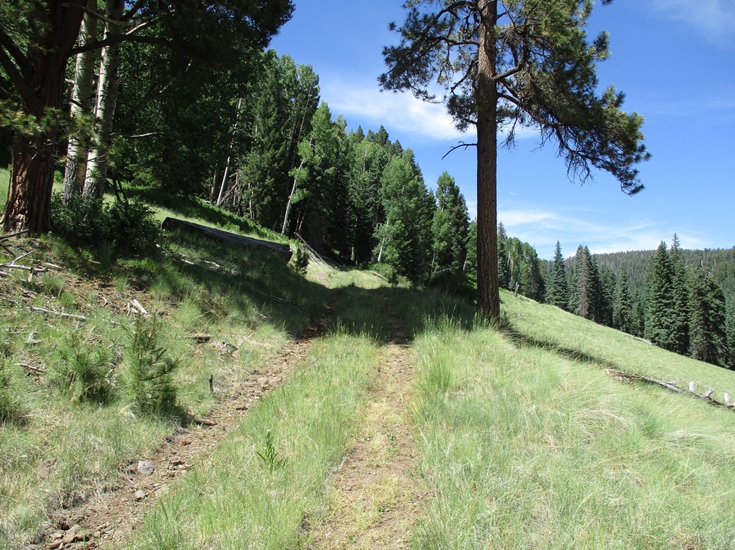
We stayed on IR-30, which is a wide hard-pack dirt road that is suitable for most vehicles in dry conditions. This road starts gaining steeply into the higher mountains, now into much denser forest with ponderosa and other pines, sometimes broken up by an open meadow. The road then comes to Kinney Junction, as named on the maps. We went right (I am not sure if it was still named IR-30 after this point). The road was a little choppy in a couple spots, what looked like some water damage from a probable storm from a few days ago. Finally, we turned onto a much scanter track, marked "40" by a small sign. This road heads east and roughly parallels Diamond Creek.
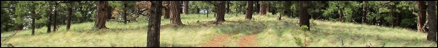
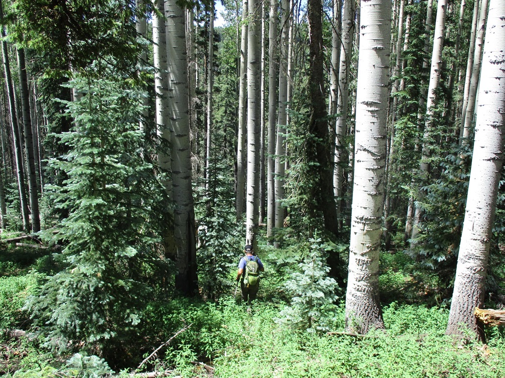
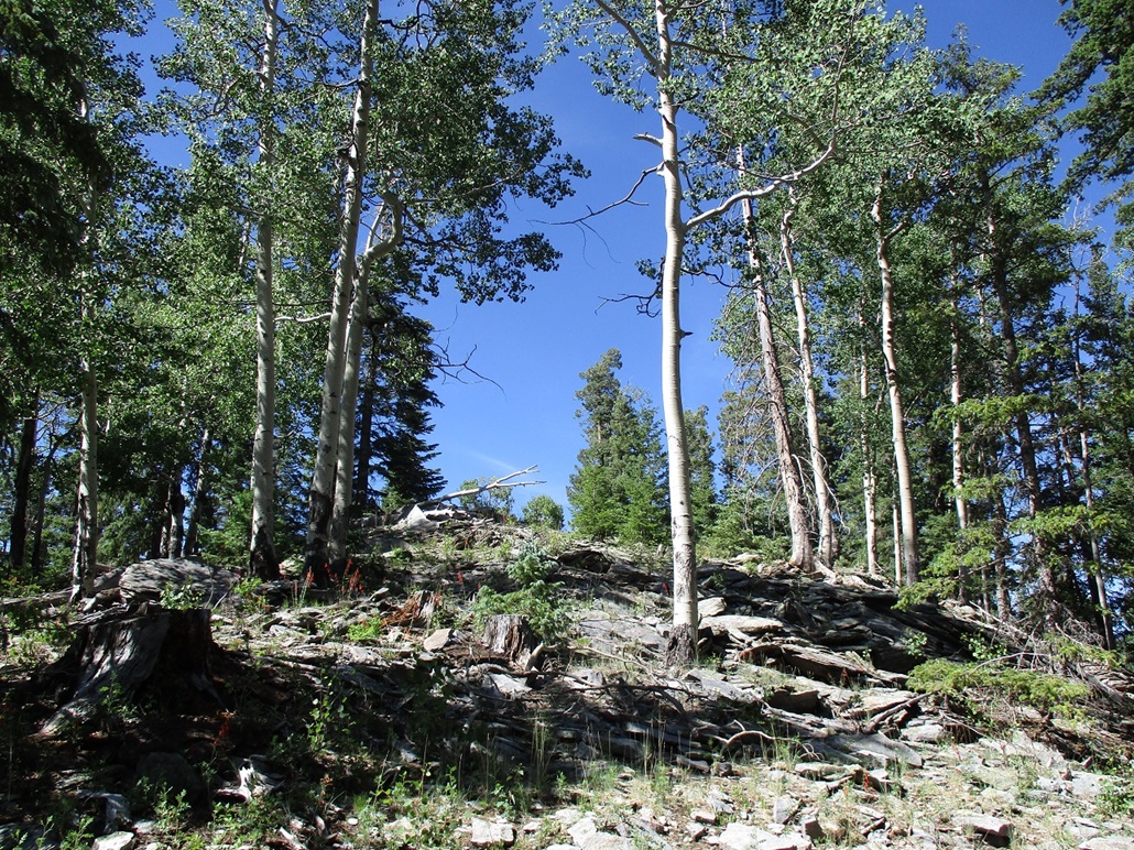
This lesser road is marginal, but it worked. It was much narrower and often just a two-track with vegetation growing between the tracks, including baby pines. Surprisingly, other than being narrow and bumpier, it was a good road ... but only in dry conditions. It does not looked to be maintained nor regularly travelled. We were able to get in about another five or six miles, to nearly the end of a track that runs south of Apache Butte overlooking Diamond Creek, east of the Beaver Dams (as named on the map). It was about 8:30 a.m. when we parked, already very warm and very, very buggy. Big black flies, bees, gnats, anything with wings and the ability to suck blood was coming after us. But, it was very pretty here. We were deep into the forests and canyons, probably a place that might see ten people all year. We were at roughly 9,300 feet elevation.
My road analysis: The main routes are good roads, with just a few spots where water had caused some minor damage and exposed rocks. Just about any vehicle would be fine on it, although cars with no clearance may have trouble where the rocks got exposed. Little route "40" would require something with better clearance and some power. It could be driven by a Subaru, moving slowly and carefully. The road make a hard right near the "North" of the North Fork of the Diamond Creek west of Apache Butte. This is as far as I would be comfortable to take my Subaru. From this point, the road was a little narrower, a little rockier, and a little steeper to where something more robust would be advisable. Four-wheel drive would not be mandatory, but it would be nice to have.
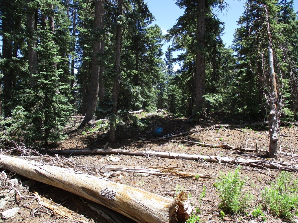
Now dressed for battle, we started our hike. We could not see much, except for a lot of trees. This is a case where we really couldn't see the forest because of the trees. We dropped about 125 feet down a slope, coming to Diamond Creek, which was flowing. We found a log to use as a bridge to get across the creek, about 8 feet wide where we crossed. We then crossed through a little stretch of bog and smaller feeder creeks, until on the slopes on the other side.
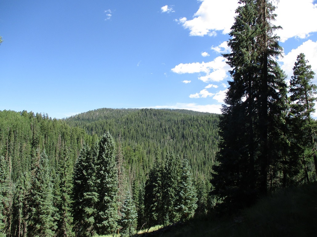
We then just started trudging uphill in the trees. There was no path to follow, as we just went wherever it looked most open. There were sections of low brush and downed trees, but almost always an open lane to follow if we looked hard enough. We gained about 500 feet, coming upon an old road, elevation about 9,600 feet. This was the steepest part of the hike. The road appeared to be a logging road, which ran level with the contour, and not helpful to us. In our case, it made better sense just to keep aiming uphill on a direct route, rather than spend more time and mileage on a level road. And the shade of the trees was welcome. In the sun, the heat (and bugs) was uncomfortable.
We walked uphill to a small nubbin on the ridge, spot elevation 9,811 feet. We dropped about 50 feet down its other side, and continued upward. The gradient here was much less steep. While still very heavily forested, we had lanes to follow about 80% of the time, so we moved efficiently. We crossed another road along the way. We would cross about a half dozen such roads before making the summit. The roads were usually a good excuse to stop for a water break. We then came to Point 10,155, another small hill-nubbin on the ridge, this one with about 80 feet of prominence.
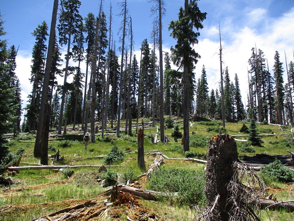
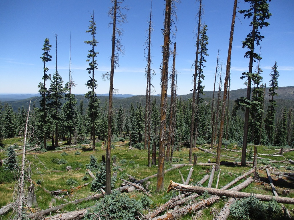
From here to the top was a little under a mile. We trended more south than east, and the final hundred vertical feet was more in the open, the first time on the hike we could see farther than a hundred feet. We were on top Diamond Butte about two hours after starting. We found what we felt was the highest point and dropped our packs and poles to rest and relax. We could not locate a register. Only two other climbers have been here going by the online sites, and given the remoteness, we may very well have been numbers 3, 4 and 5 overall. A random logger or hunter may also have been up here in the past.
We stayed up here about twenty minutes. Long-distance views are blocked by the trees, although we had some decent open views looking northwest where we could see McKays Peak in the distance. We also inspected a few other bumps to be sure we had not missed a higher point. We left feeling pretty sure we were at the right place. The bugs were getting bothersome, so we started down.
The hike down went well. We followed the GPS track religiously because using visual navigation would be impossible, and it would be easy to wander down a wrong ridge into much steeper, nastier terrain. We just had to be careful around the downed logs and loose slopes. I took a spill when I tripped on a twig. Otherwise, I stayed upright. We were back to Matthias' vehicle at 2 p.m..
We were all pleased to be successful on this peak, being our main objective for the day. It felt good to get one of the highest-elevation summits in the state and one that sees almost no one ever. Even most of the hard-core peakbaggers skip this one. I was beat. The warm day and the strenuous trudging through the trees and steep slopes had worn me out. But Apache Butte was standing right there above us, we had to climb it! After a fifteen minute break, we got started with our second hike.
Elevation: 9,773 feet
• Prominence: 383 feet
• Distance: 1.2 miles
• Time: 1 hour
• Gain: 480 feet
• Conditions: Warm and sunny
PB
•
LoJ
We started walking up the road, gaining about a hundred feet, until we were below the summit on a direct gradient line (i.e., perpendicular to the trail). When it felt right, we left the road and started walking up the slope.
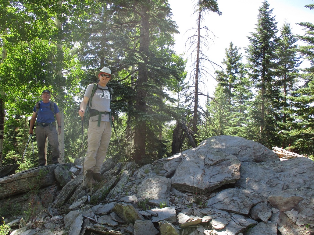
The forest was thick but open enough with lanes and options to avoid (most) deadfall. The grade was mildly steep at first, then very steep for a short segment, then suddenly, not steep at all. The rocky summit knob was visible up ahead. Within about twenty minutes after starting, we were on top, a 480-foot gain in a little over a half mile.
The rocks were perfect for sitting and even laying back a little. The trees provided shade while we had some views, mainly north and east, looking at the big Tiger Butte Ridge about a mile distant. Matthias had beaten us two old guys by a few minutes and had found a register placed in a nook by Andy Martin. We three then signed in. Only us three, Andy, and Bob Packard, have been here, according to Lists of John and Peakbagger. But long-ago visitors here had etched in their dates and initials in nearby Aspen trees, which preserve the etchings. Perhaps the occasional hunter. Someone was here back in 1978, for example.
After the arduous hike up and down Diamond Butte, then the short but arduous hike to here, sitting on these summit rocks was relaxing, and being in the shade helped. I could feel my muscles melt into the rocks. I probably could have fell asleep right there. As summits go, this was a nice one.
We hiked down the same way, and were back to the car a little after 3 p.m.. Now, I was super-officially tired. We got things changed and packed and started the drive back onto the better roads and eventually back to Phoenix. The drive was eventless except for a single-vehicle mishap on the steep grades into the Salt River Gorge. Some guy had lost control of his truck and got his front end partially over the guard rail. Police was on scene and an ambulance was coming (we could see them from the other side of the gorge). The guy was darn lucky he didn't go completely off the edge as that would have been a long drop and probably fatal.
We got back to the Walmart at 8 p.m., the end of a very long day, but a productive one. Diamond Butte was our primary objective and all of us really wanted a 10er. Despite the sun having set within the last hour, it was still about 110 degrees here. We got our things separated, shook hand and went our separate ways. It's always good to hike with the guys. I got the chicken shawarma plate from a nearby Greek/Mediterranean place.
Apache Butte has two summits, the east peak at 9,773 feet elevation, according to the map, and the west peak at 9,769 feet elevation, about a half mile away. We did not visit this western point, feeling no need to.
However, I checked on the Lidar website and the "digital elevation model" for this region shows a spot elevation of 9,773 feet on the east summit, and 9,776 feet on the west summit. But this is based on older "1/3 arcsecond" data which rasterizes down to just 10 meters (30 feet, roughly) on the ground. I suspect, but cannot prove, that some of this digitalization is just taking the raw data and running a form of regression on it to produce a continuous model by which intervening elevation values are merely interploated, rather than being based on a direct measurement.
We could have solved this problem by tagging both summits. In the meantime, I am of the opinion not to take this Lidar data as gospel yet, and wait for the better 1-meter datasets. In the meantime of the meantime, we even discussed going back to tag the western point because there are a couple other peaks nearby we didn't get to today that we wanted to, that we could combine with a hike of the western peak.
(According to the usgs.gov sites, there is no plan in the near future to either map or release the 1-m Lidar data for the Apache Nation, nor that of the Navajo and Hopi Nations up north. A lot of Western Arizona also lacks the 1-m data. Thus, this may not be resolved for a long while.)
|


|