The Mountains of Arizona
www.surgent.net |
|
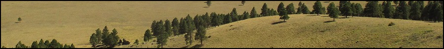
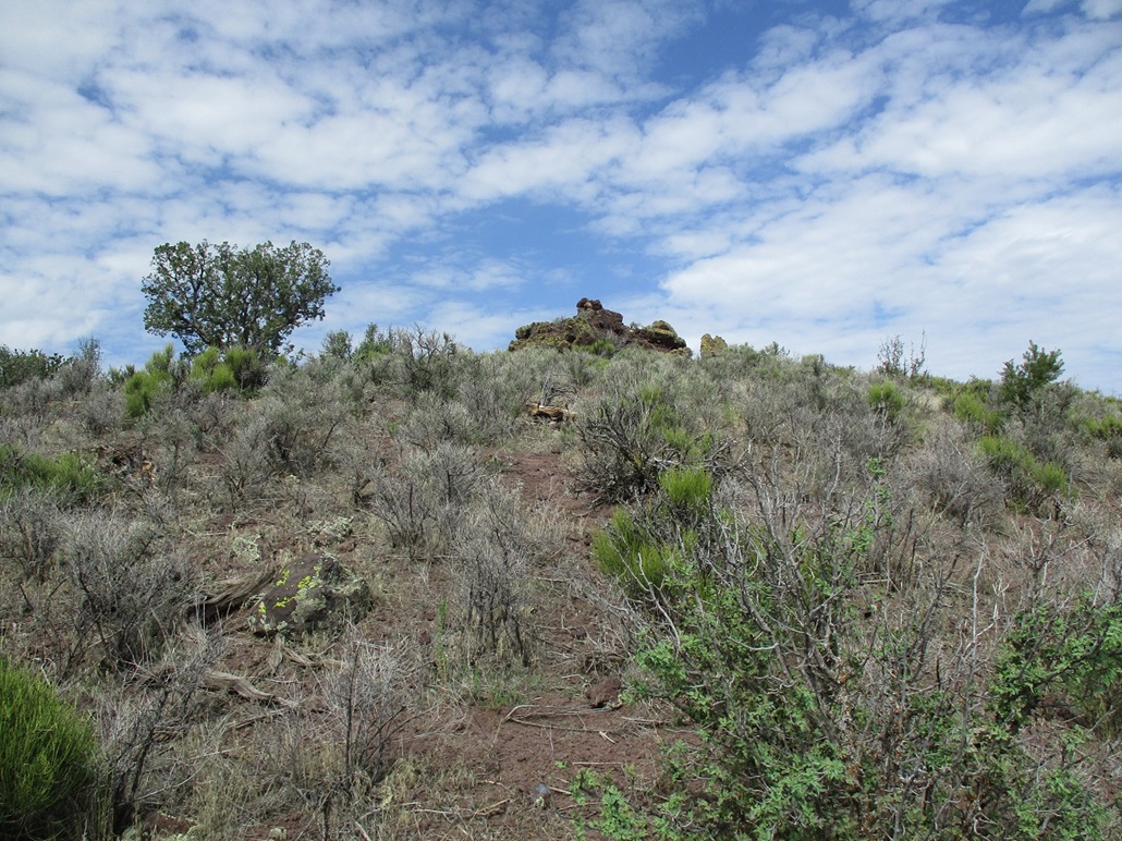
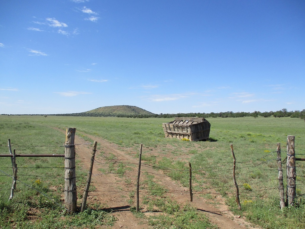
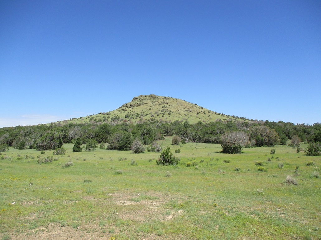
West Dog Knob • North Dog Knob The Dog Knobs are three, maybe four, possibly two, volcanic hills located almost 40 miles northwest of Flagstaff on the Colorado Plateau. The grouping lies on the northern fringe of the volcanic field, the last of the hills as one heads north and west before the land flattens out in those directions. The Grand Canyon lies about 30 miles north. Big Red Butte rises above the flat terrain roughly 15 miles northwest, but it is considered to be its own thing, not part of the volcanic field (it is not a volcano nor the result of an eruption). I was here in June, when I hiked Double Top, which also served as a scouting mission to explore the roads and access conditions for a future trip to the area. Matthias and I were discussing some hiking ideas and we landed on the Dog Knobs. It's still generally warm everywhere in the state, and we could expect highs pushing 90 degrees even at 6,000 feet elevation. But we also figured the Dog Knob hills should involve short hikes if we could drive close to each. Matthias' 4-runner vehicle would be most helpful to manage these roads. The Dog Knobs lie on the CO-Bar Ranch, part of the Babbitt Ranch empire. The CO-Bar takes up the big open space north of the Kaibab and Coconino National Forests (and the volcanic field), and south of the Grand Canyon National Park. One needs a free permit to access the property, which can be obtained at the Arizona Game and Fish website. The nomenclature of the grouping is uncertain and largely the opinion on who is reading the map. ListsofJohn calls the west one by its elevation, 6856, the north one he calls "West" and the east one "East". The name "Dog Knobs" on the map is written at an angle between these two peaks, which if taken super-literally, would result in one being west and one being east. However, there are three hills all nearly identical in height, prominence and appearance, lying in a triangle. I call Peak 6856 the West Dog Knob, the north one North Dog Knob (the one LoJ calles the West one), and the eastern one East Dog Knob. My opinion is that these three are clearly a single collective. The smaller Double Top could be considered part of the grouping. If so, it could be the South Dog Knob. We were finished with the Dog Knobs by noonish. This placed me at 599 ranked peaks climbed in Arizona. I was particularly eager to get number 600 today if possible. We decided upon Aspen Hill, which is located south of Williams in the Kaibab Forest.
Date: September 3, 2022
• Elevation: 6,856 feet
• Prominence: 396 feet
• Distance: 1.5 mile
• Time: 45 minutes
• Gain: 428 feet
• Conditions: High clouds, pleasant
• Teammate: Matthias Stender
• Prog-rock bands played: ELP, Agusa, Missus Beastly, Soft Machine, King Crimson, Tony Levin & Bill Bruford Upper Extremities
Arizona
•
Main
•
LoJ
•
Interactive map
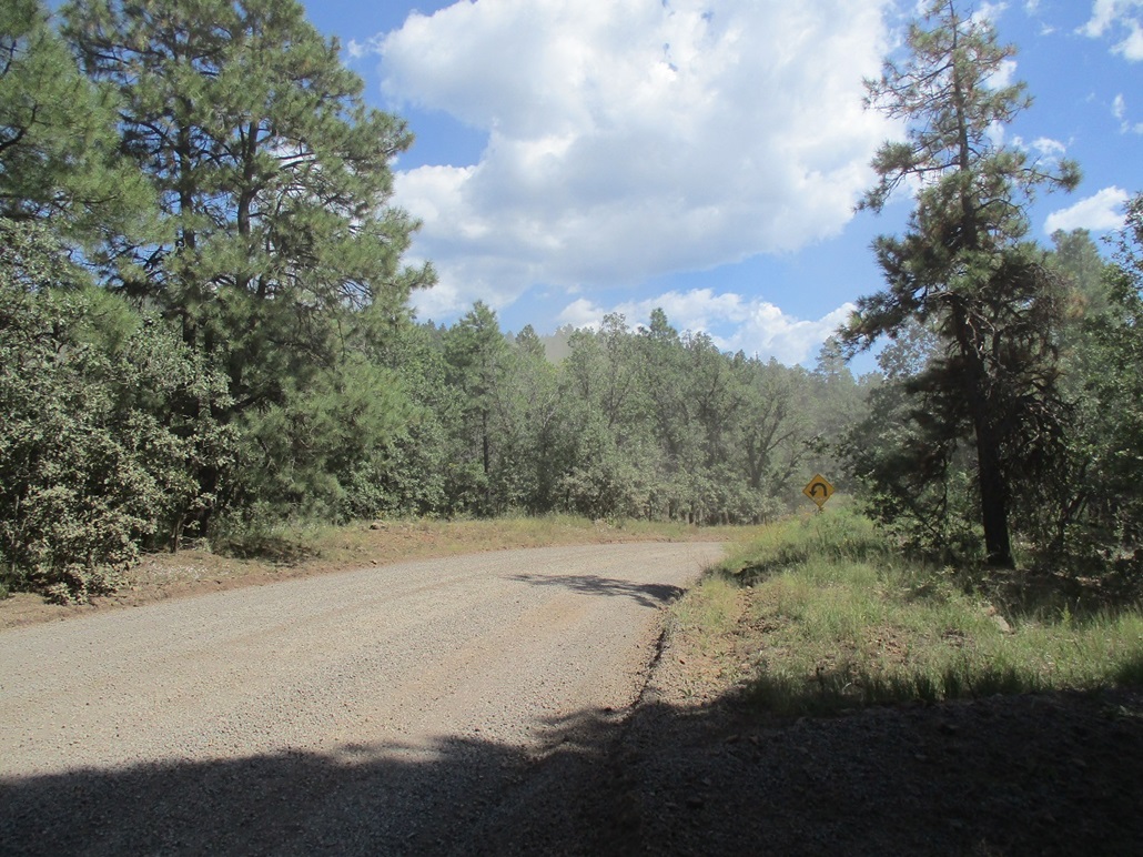
Matthias piked me up from the Denny's parking lot on the Carefree Highway at Interstate-17. We drove into Flagstaff, then up US-180 to the access road off the highway that leads north about a mile to a fence, the north boundary of the Kaibab National Forest and the south boundary of the CO-Bar Ranch. From here (and a gate along the way), we drove about two miles to place ourselves east of the West Peak, the time roughly 8 a.m..
The sky was cloudy, mostly high clouds, no puffy pre-storm clouds. It was drier than normal. The clouds muted the light for photos, but helped knock down the temperature a few degrees. Knowing it would be a warm day, any mitigation of the temperature would be welcome. We parked in the open, got properly suited up and our stuff together, then started our walk toward the West Peak.
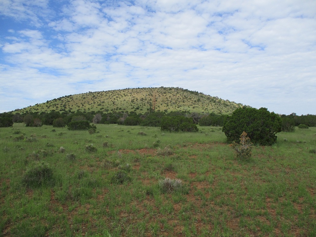
It wasn't a long walk, just three-quarters of a mile. We walked through scattered piñon and juniper, then onto the open slopes. There was evidence of a very old road here, just a straight shot up the slope, looking like something an idiot in a Jeep would do for grins, and not for any practical purpose. It was overgrown now, but heavily eroded forming deep erosion ruts. We walked beside them, on the firmer slope. The slopes consist of pebble-sized volcanic rock, low grass and more piñon and juniper, but not thick at all. We were on top 22 minutes after starting.
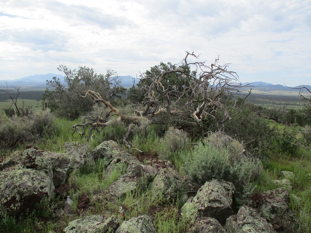
The top features a small clump of rocks and the branches of an old juniper now on its side. We found a register, but few people had signed in, less than a dozen over 15 years. The conditions were pleasant, but the sun was behind the clouds so I did not take many images and only include the summit shot as proof I was actually here, not carousing in a saloon somewhere.
We did not spend long. I was starting to get allergies, my snot factory kicking into high gear. I was sneezing one after the other. If I kept moving, it seemed to help. We hiked down and were back to Matthias' car, a round trip of about 45 minutes. This was easy as we expected. The North Dog Knob was next, about another mile or two up the road.
Elevation: 6,832 feet
• Prominence: 392 feet
• Distance: 0.8 mile
• Time: 45 minutes
• Gain: 372 feet
• Conditions: Still nice
PB
•
LoJ
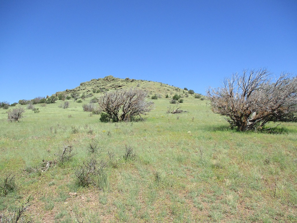
It took about 15 minutes to drive the track north with a jog east to place us directly east of the North Peak. We parked off the road, looked up and started walking. This hike also did not take long. We angled slightly left (barely southwest) for what looked like a better slope, then once on it, busted up to the top, another short hike that took about 20 minutes.
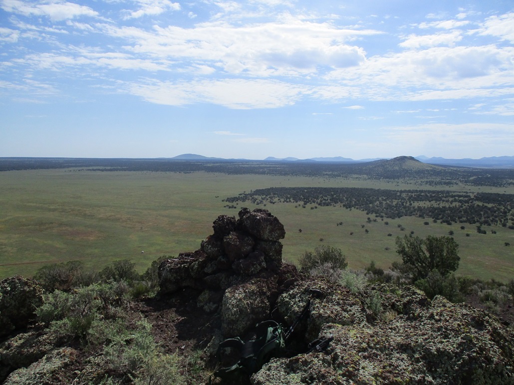
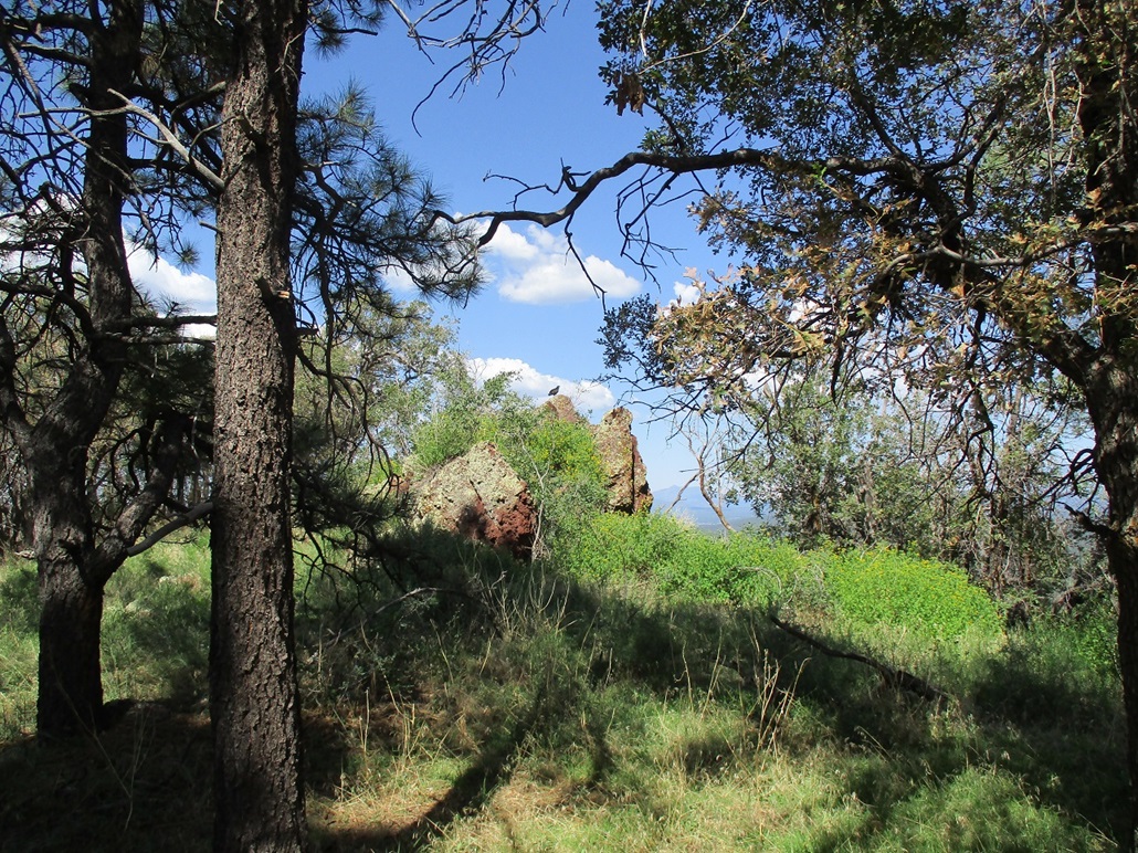
This summit was more interesting than the first. It has a rock outcrop acting like a prow of a ship. The rocks were pumice, even the big ones felt like they only weighed maybe 20 pounds. There was a cairn and what looked like a void where a register would be, but no register was found. It likely was removed. We stuck around for a little bit. The sun was out now and offered a chance at more photographs.
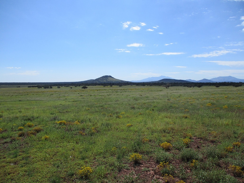
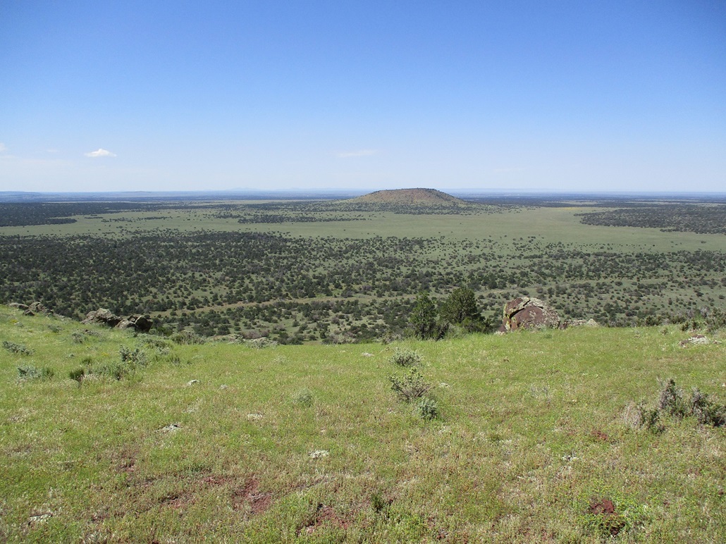
To the west, north and east, there was nothing but high-plateau flatness except for Red Butte and a few low mounds that barely qualify as hills. It's all Coconino Plateau rangeland hereafter. Looking far to the north we could see the cliffs of the North Rim of the Grand Canyon jutting above the flatness of the forests abutting the South Rim. The sky was a little hazy from the earlier clouds, so the farthest peaks were barely discernible or completely hazed out. Nevertheless, we had fine views of the many mounds and peaks on the volcanic field looking south.
After ten minutes on top, and about 30 sneezes by the author, we started down and were back to the car quickly.
Elevation: 6,942 feet
• Prominence: 402 feet
• Distance: 1 mile
• Time: 45 minutes
• Gain: 439 feet
• Conditions: Clearer, still nice
LoJ
We had to backtrack a bit, then get onto another track that aimed for Johnny Tank, which lies in the middle of the range equidistant from the three Dog Knobs. Five tracks converge here, and we spent a few minutes figuring out the fencing and the gates, but we solved the riddle and found the track we wanted.
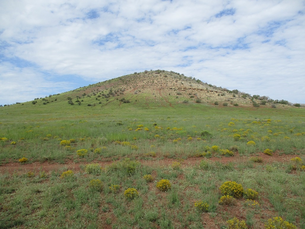
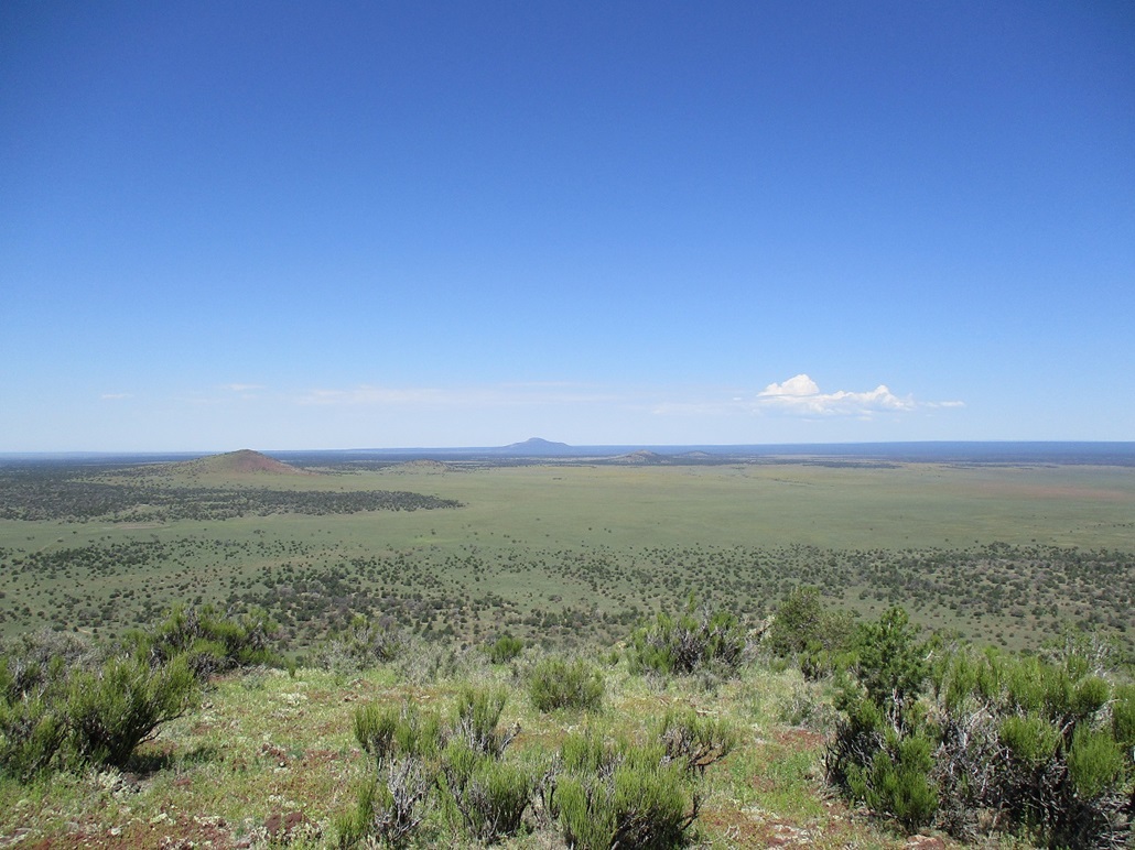
We proceeded southeast toward the East Peak. It has some impressive west-facing cliffs, so climbing it from the west was not an option. Matthias got his vehicle in about another mile or two until we were south of the peak, amid lower hills. From this vantage, we could see a lovely grass slope that fed to the top, bypassing the cliffs.
It was warmer by now, but still pleasant, perhaps low 80s. The earlier clouds had long since disappeared, but they had kept the temperatures down for a few hours. We started uphill, another hike almost identical in distance, time and gain to the summit. Somewhat surprisingly, the top is not amid the rocks but on a gentle rise with low brush set apart from the rocks. There was a cairn, the rocks arranged to leave a void for a register, but again, no register was found.
The views up here were fantastic. The sun was out and the light was perfect for photos. We both agreed this was the prettiest of the three Dog Knob hills. The summer rains had covered the slopes and surrounding meadows in green grass. We had a breeze which felt good. Me, I continued to sneeze heavily. I have not had such bad allergies for a long time. As long as I kept moving, it seemed to tamp down the sneezing.
We hiked back to Matthias' car, the round trip taking about 45 minutes, same as the first two. It was slightly past noon and we were done with the morning's main objectives. These three hikes had gone well and were a lot of fun. They were easy and quick, and a fine way (and area) to spend a morning. We now rumbled out back to the highway.
Elevation: 7,640 feet
• Prominence: 400 feet
• Distance: 1.3 mile
• Time: 45 minutes
• Gain: 400 feet
• Conditions: Hot, buggy and snotty
PB
•
LoJ
We discussed another peak to climb, especially, if successful, would give me 600 ranked peaks climbed within Arizona. We bandied about ideas and landed upon Aspen Hill, which is close to Williams and close to a forest track so that hiking it would (should) go quickly.
We continued northwest on US-180 to Valle, then south on AZ-64 into Williams. We topped the gas and I purchased two Claritins to hopefully battle my allergies. The streets were jam-packed in Williams, this being the Labor Day holiday, which made things more jam-packed than usual. We eased through the cars and people and got onto Perkinsville Road for a couple miles, then Kaibab FR-140, which angles east. Aspen Hill rises about two miles farther in, directly above the road
This forest road is a wide gravel hardpack which makes it a "boulevard", and it was full of people in cars, ATVs and hauling campers. It was as busy as a city street would be, and the amount of dust was unreal. There were dozens of camps set up on both sides of the road. For a peaceful weekend out in the forest, this was not the place to find it. It looked and sounded like camping hell, but I suppose people like the noise, dust and fumes you get in the city when they camp.
We parked in a small pullout beside the road near the hill, and immediately got moving. We were about a thousand feet higher in elevation and in heavy ponderosa forest cover, but it was hot now, in the low 90s. We walked uphill to a fence and carefully stepped over the barbed wire, and continued uphill. We could hear engine noise from the road, even though it was hidden by now by the trees.
About halfway up, the forest thickens, with dense gambel oak forcing us to go around or through its narrow lanes. Then we came upon another fence (presumably the continuation of the same fence we crossed below). We chose not to pass this fence but instead follow it, and only pass if absolutely necessary. It turned out not to be necessary, as the fence led uphill toward the small summit ridge.
This had not been a terribly exciting hill to climb, but as we neared the top, we saw that its summit was an impressive rock outcrop, and there was a turkey vulture sitting atop the highest rock. He was using it as a perch to scout for food. We moved at our usual pace and he alighted, leaving the top for us. We clambered up a rock slope to tag this top rock. Matthias found a regsiter but it had been damaged by water. We supplied a new pencil and some paper, but the next visitor should bring a sturdier container. The rock outcrop was quite impressive. On its opposite side (relative to how we approached it), there's a 40-foot cliff down to the ground below.
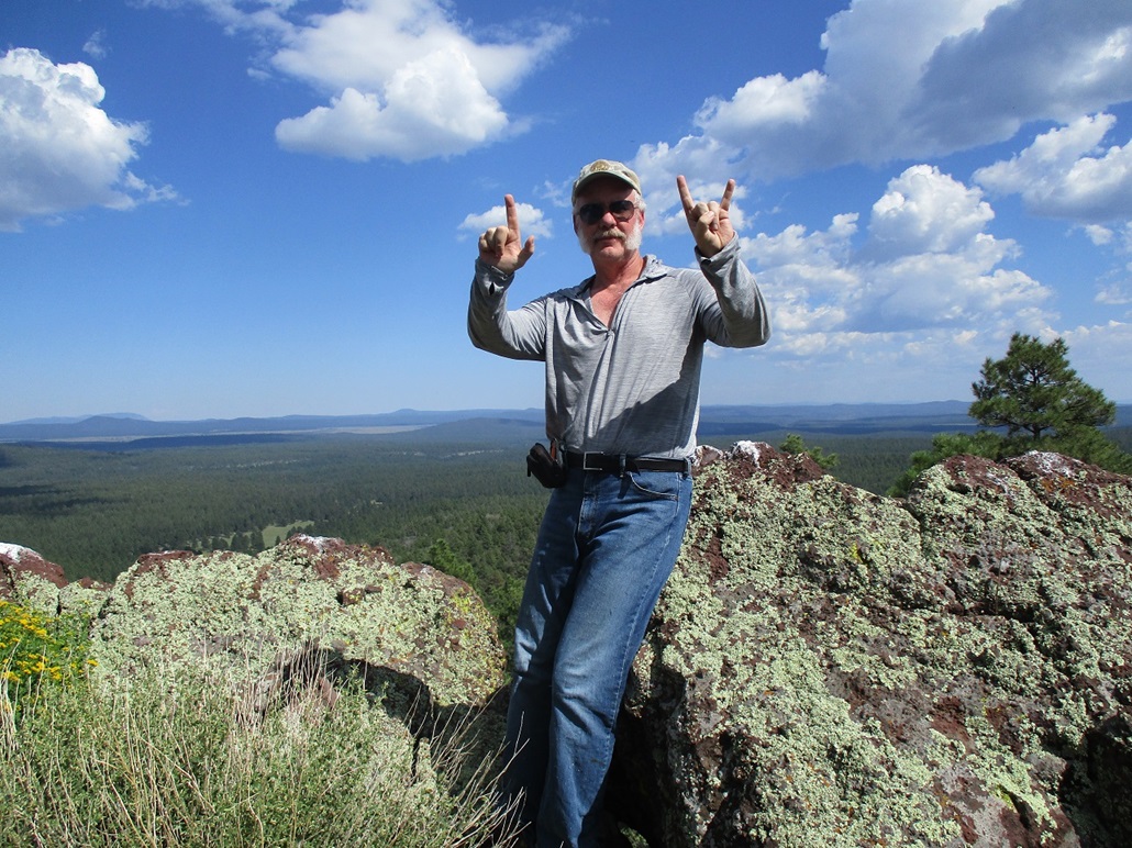
This was an unexpectedly pretty ending to the hike. The view here was outstanding. Davenport Hill was the biggest hill nearby, but we could also see dozens of other hills looking in that direction, including mighty Humphreys Peak. I was pleased now to make it to the 600 Club. In Latin, sexcenti. In Roman Numerals, 600 is DC, but when I tried to form "DC" using my fingers, I did not have much luck. So I went with the binary representation, 1001011000, or 512 (29) + 64 (26) + 16 (24) + 8 (23), using my fingers. Binary is read right-to-left, and I had it correct from my view, but it appears backwards (as 0001101001) in the photo. Still, how many people ever have formed the number 600 in binary using their fingers on a summit? Adam Helman would have been proud of me.
The hike down went well and we were back to Matthias' vehicle, this round trip covering about an hour. We were done and just wanted to get moving. The amount of off-roaders, vehicles and RVs rumbling by on this road never ceased. Once back on Perkinsville Road andheading south, the madness slowly mitigated to where after a certain point, there was no one.
We followed Perkinsville Road down off the plateau, then Drake Road west past the big Drake Cement plant, catching US-89 into Prescott, then the usual route back to Phoenix. It was close to 6 p.m. when he dropped me back off at my vehicle at the Denny's. We said our goodbyes and went our separate ways. It had been a productive day.
Matthias' 4-runner was nice to have on the roads amid the Dog Knobs. I had driven to Double Top back in June. The roads are rough but not impossible, generally flat but with fist-sized rocks and some uneven tread. I might have been able to get the Forester in to each peak had I gone slowly and carefully. There were a couple mud patches and sections with a high center. A bigger vehicle with ample high clearance is strongly suggested. It is hunting season (archery) but we only saw one guy in a truck in camo, and no one else. During archery season, there usually aren't that many hunters to begin with, and those that are out tend to be more careful and easier to work with. We also saw a group of off-roaders when we were on top of the East knob, and that was it, no one else. No one from the ranch ever asked us for our permit, but we had one anyway since it's free and the right thing to do. My thanks to Matthias for driving, and picking a good selection of prog bands for listening.
|


|