The Mountains of Arizona
• www.surgent.net
|
| Dry Lake Hills • Peaks 8843 & 8747 |
• Dry Lake Hills - S. F. Peaks • Coconino National Forest • Coconino County |
|
Date: May 9, 2021
• Elevation: 8,843 & 8,747 feet
• Prominence: 424 & 367 feet
• Distance: 7 miles
• Time: 3 hours
• Gain: 1,070 feet
• Conditions: Blue skies at first, then windier and cloudier
Arizona
•
Main
•
PB (Peak 8843)
•
LoJ (Peak 8843)
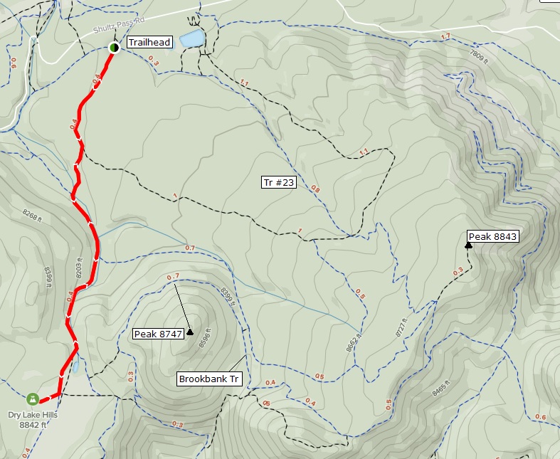
The Dry Lake Hills are a lava dome (so the signs say) lying southeast of Humphreys Peak. Mount Elden is the highest point of these hills. Today's objective were two ranked hilltops that lie northwest of Mount Elden (and thus, invisible from Flagstaff) and accessible from Schultz Pass. Many trails spread out here, most groomed for mountain bikers although foot-hikers are welcome. I would see about a half-and-half mix of both.
I left Payson around 7 a.m. and rolled into Flagstaff about 8:30, then went through town and up US-180 a few miles to catch Schultz Pass Road. I followed this good forest road about 8 miles to Schultz Pass itself, elevation about 8,060 feet. I arrived about 9 a.m., the second car in the parking lot. It was sunny with puffy clouds and a slight breeze, temperature about 60 degrees.
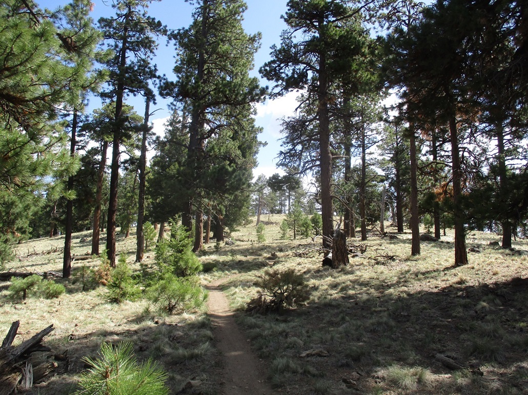
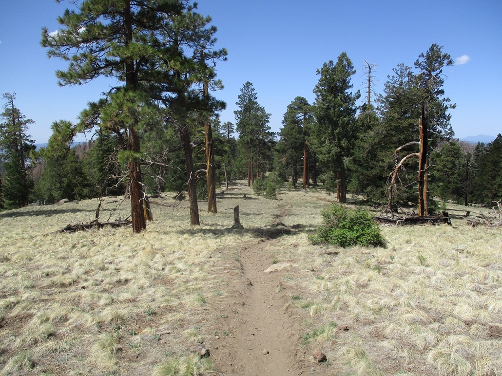
Three trails emanate from this parking lot, and they all meet one another eventually. I followed Trail #23 which heads southeast, aiming for Peak 8843 about two miles ahead. The trail was wide and smooth, full of recent mountain bike tire prints. For hiking, it was lovely as there were no rocks or uneven tread to worry about. I made good time, a little winded due to being suddenly 3,000 feet higher than home. But I was soon in a good breathing rhythm.
I passed one family (mom, dad, two small kids and a dog) early on. Then I was passed by two joggers, then about ten minutes later, a group of six joggers. They were all making the old slow guy who was walking look really bad, but I still smiled and was courteous. The hike went well and within a half hour, I was at the ridge containing Peak 8843. The group of joggers had convened here with a couple mountain bikers. They all took off as I appeared.
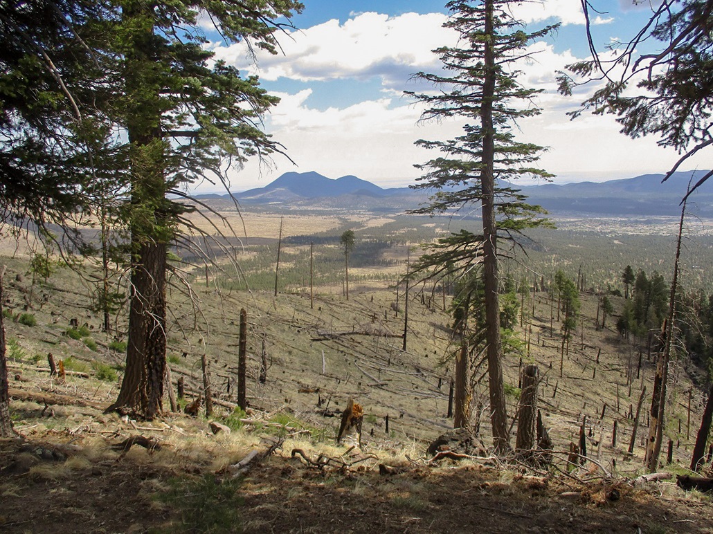
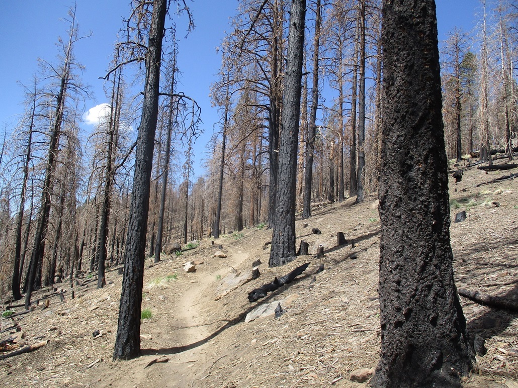
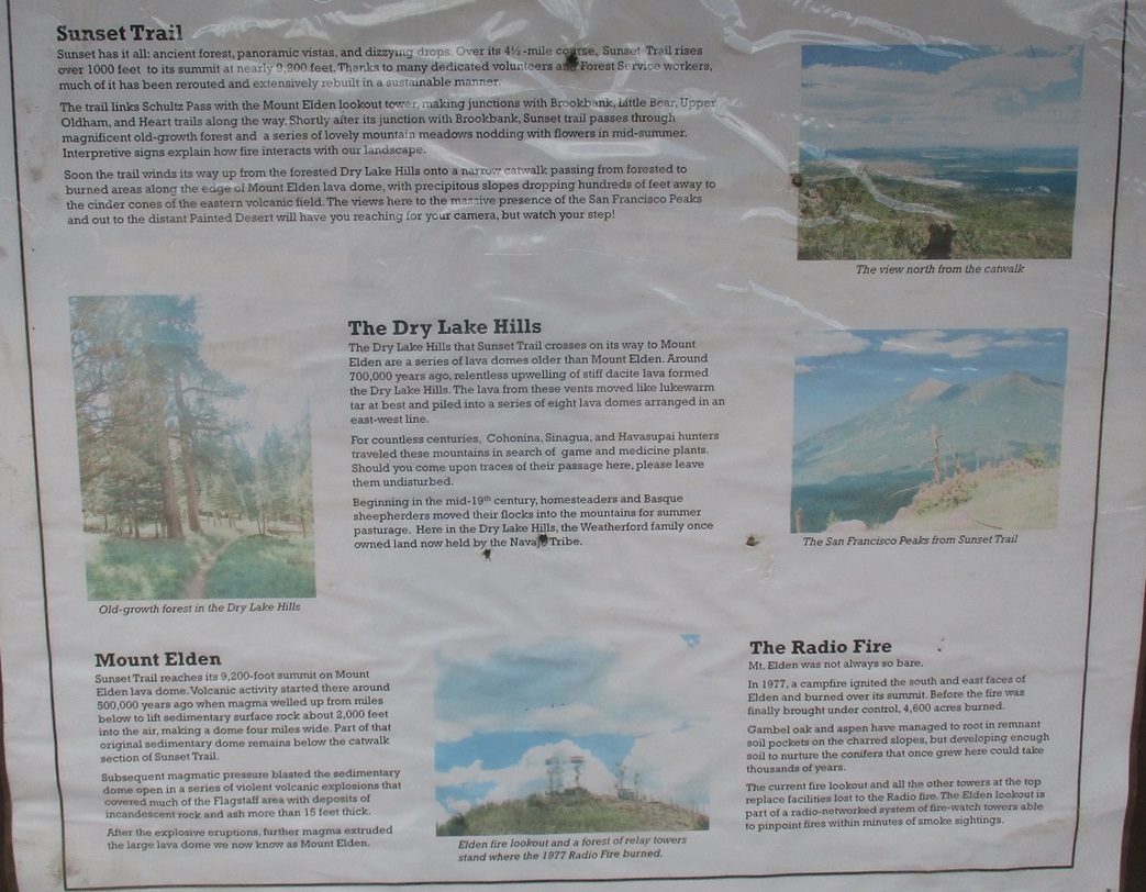
The trail map shows no trail to the summit, but there is a pretty good trail that goes to the top. I followed it and soon was at the top, a hump of ground with a few rocks and trees to the side. The forest here was healthy ponderosa, spread out so as not to be crowded. However, looking east toward O'Leary Peak, the eastern slopes were charred husks, some standing but most fallen over. This was from the Schultz Fire of 2010. It still looks new, like the fire was last month.
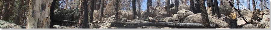
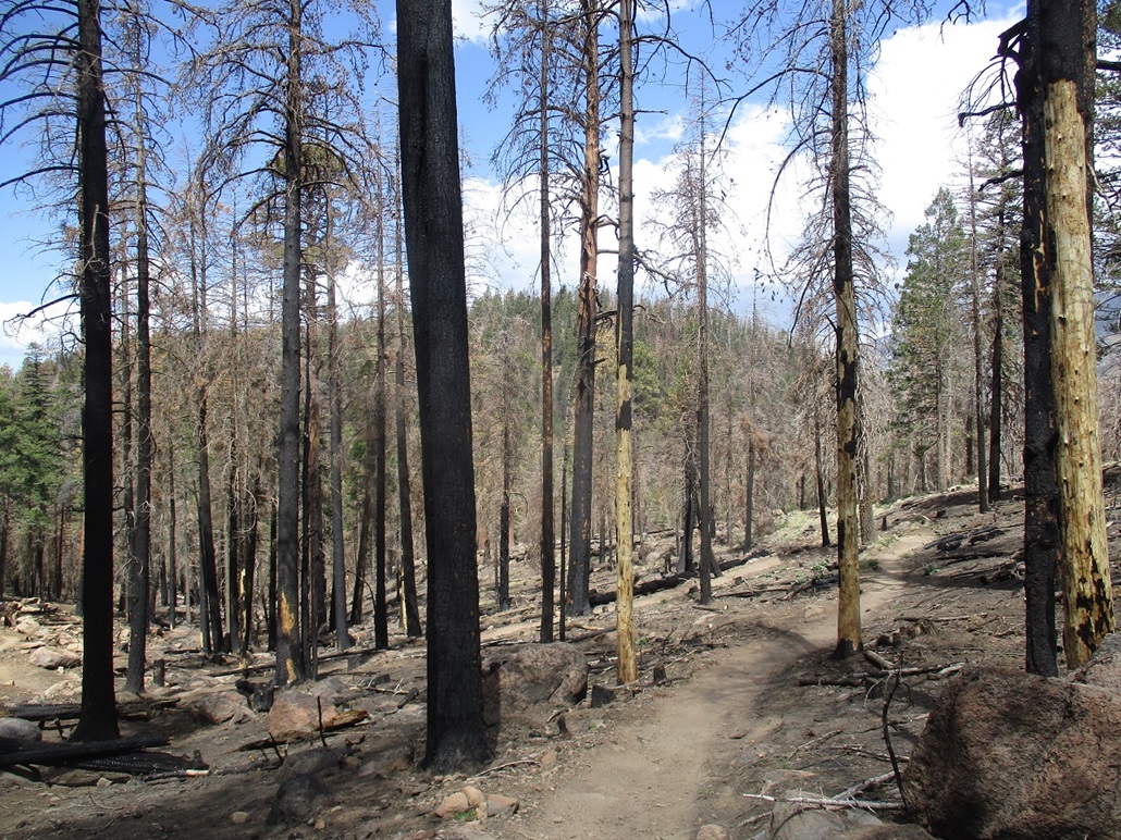
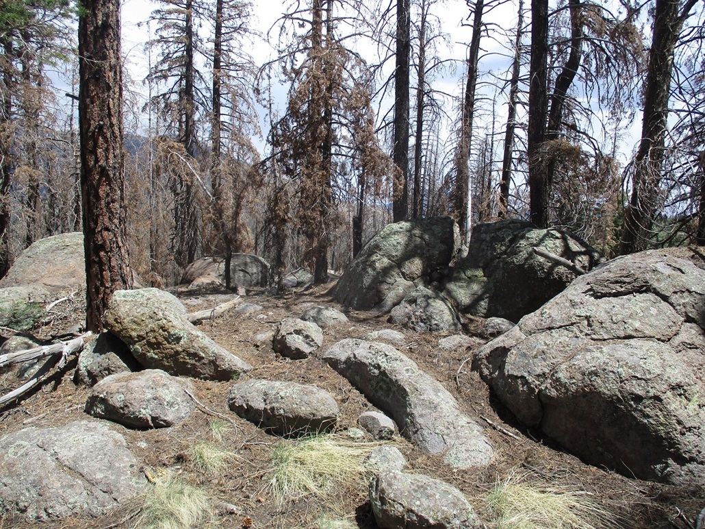
I spent just a few minutes up here looking around. The best views were to the east, but Little Mount Elden was just across the way to the south, but more forested. I walked back down the unofficial tral back to the official trails. I had a couple options of trails to follow and chose to stay on Trail 23, which drops off the ridge to the southwest, losing about a hundred feet. It then connects to the Brookbank Trail, which I now followed, heading southwest then west. Suddenly, I was in a forest of dead trees, black and brown from a massive fire. The only two big fires here in recent years were the Schultz Fire of 2010, and the Radio Fire of 1977. The Schultz Fire map seemd to show the fire was more north of here, so this may be from the 44-year old Radio Fire. If so, the fire looks like it happened recently. You just don't get a sense of time looking at a burnt forest. Something that happened 10 or 20 or 44 years ago looks the same.
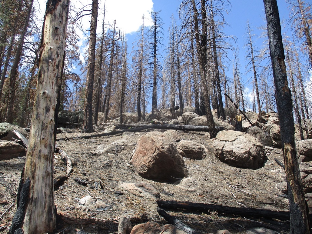
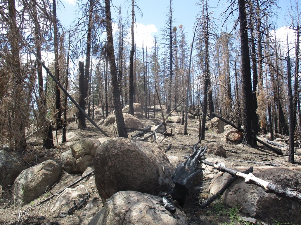
Trail 23 (the Sunset Trail, I think it was called) meets with the Brookbank Trail, with the Sunset going downhill and the Brookbank gaining at a lenient grade, aiming for a saddle up ahead. At the saddle, I passed another low hill, dropped down off the northwest slopes and soon had a view of the second hilltop on the agenda, Peak 8747. It had a little growth that survived the fires, the green contrasting with the browns and blacks. I stayed on the Brookbank Trail until it curled around Peak 8747 on its north. I did not expect any beaten paths to the top and would have to bust my own way up, so I looked for a spot that looked least messiest.
I left the trail and started uphill, the grade steep but manageable. Soon, I was in the rocks, mostly outcrops to where I could stay on the dirt and twigs and weave my way through the boulders. The rocks grew more abundant and I had to do a few easy scrambles. I achieved the summit ridge (I thought it was the summit itself at first). Once here, the true top was not far away, maybe 50 feet higher. I was on top quickly, tagging the highest boulders to ensure an official completion. Like Peak 8843, I did not stay long. I looked for a register but found none. I walked back down the slope following the same general route and was soon back on the Brookbank Trail.
I followed The Brookbank westerly, then a few smaller connectors down to a forest road near a small stock tank. The map shown on this page was taken from the AllTrails site and is accurate and was very helpful to ensure I wasn't following something I shouldn't. Now on the road, I walked downhill and met with another family (mom, dad, two small kids and a dog). Was this the same family I saw earlier? It wasn't. What are the odds of seeing two families like this? I bet something like 1.4 to 1. I was back to my car shortly, the time about noon. By now, there were about 10 cars in the lot and a handful of mountain bikers getting geared up to go on their rides. I took my time changing. The hike covered 7 miles (going by figures at the trailhead and on online sites) and took me 3 hours. The winds had picked up to a steady breeze and the clouds had moved in, but the temperature stayed mild, maybe 70 at the warmest.
I drove into Flagstaff to do some "shopping" for my wife. I wanted a little adventure for the drive home so I followed Thompson-Winona Road east out of town, then Leupp Road past the old cinder cones and onto the Navajo Nation through Leupp, then down to Interstate-40 and into Winslow. I enjoy this drive and never rush it. I then followed AZ-87 out of Winslow back to Payson. There was zero traffic until after Clints Well. Then I started encountering trailers and other slow-pokes. The last 20 miles I followed a white SUV-wagon that drove very slowly and drifted. A sure drunk. This is common up here on a Sunday. There are no passing lanes for quite a distance so I just stayed back and hoped this driver wouldn't kill someone. I was home by 4.
|

|