The Mountains of Arizona
www.surgent.net |
|
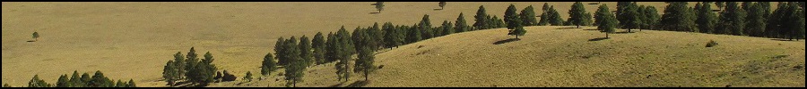
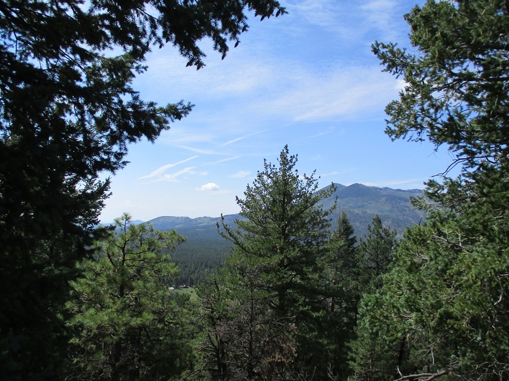
White Horse Hills North Peak (Peak 8842) Matthias and I teamed up to climb four volcanic peaks on the San Francisco Volcanic Field, three of them grouped together at the east base of Kendrick Peak, and the fourth being a summit in the White Horse Hills that neither of us had yet to tag. For me, it would "clean up" this region, being the only remaining ranked summits I had yet to climb. We met at 5 a.m. at the Denny's near the Carefree Highway and Interstate-17, and he drove us up to the high country. We were in Flagstaff early enough so that there was no traffic. For music, he had on an interesting German progressive rock band whose name I don't recall. First on our agenda was Peak 8842, or "White Horse Hills North Peak".
Date: August 14, 2021
• Elevation: 8,842 feet
• Prominence: 502 feet
• Distance: 4 miles
• Time: 2 hours & 15 minutes
• Gain: 1,238 feet (gross)
• Conditions: Cool and humid with misty skies
Arizona
•
Main
•
PB
•
LoJ
•
Interactive map
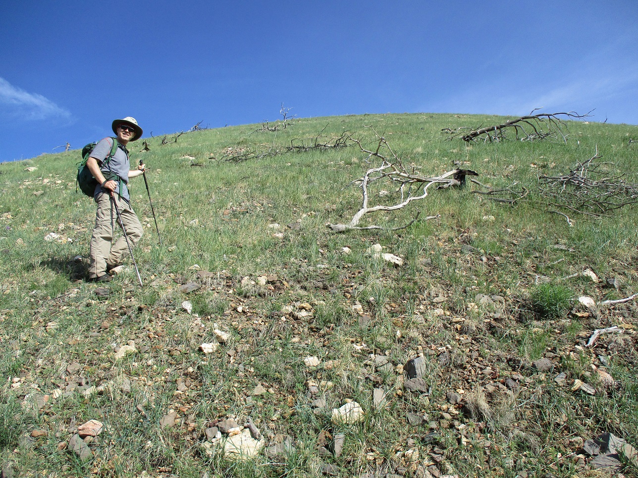
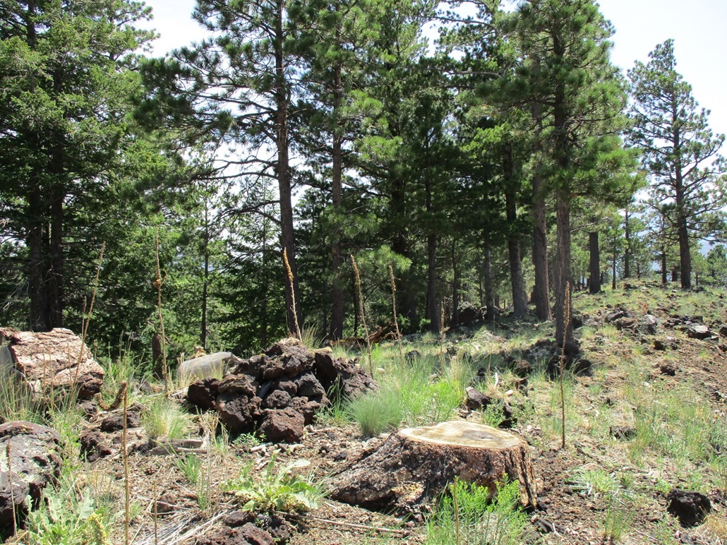
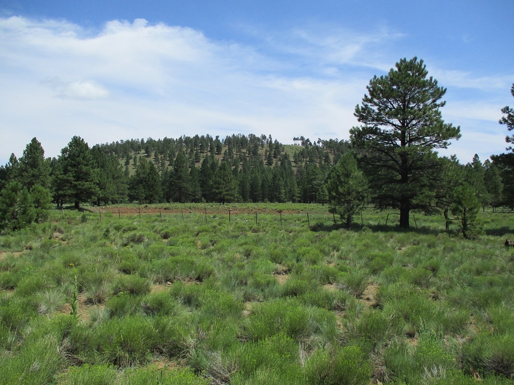
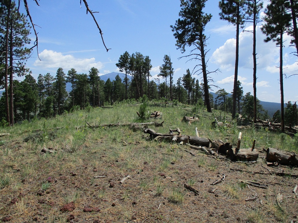
Peak 8842 lies north of the White Horse Hills highpoint, which I hiked back in May 2015. Today, we would concentrate on Peak 8842. We followed Forest Roads 151 and 418 in about 4 miles from US-180, parking in a pullout near the old jeep road that goes north into the hills. We arrived about 7:45 a.m., the day sunny and cool for now, but humid. The roads were wet from recent rains but not muddy.
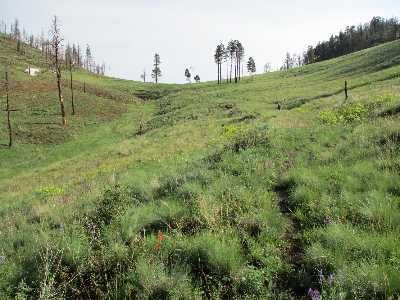
We walked up this old jeep road north. It is completely undrivable now, only suitable for hiking. In 2015, the ground here was a little less vegetated, a little more tan and yellow. With the recent rains, the grasses here grew in abundance, with lots of wildflowers. Any hint of the old road was covered over by the grasses (and logs). Compare my photos from 2015 to the ones here and see the difference. We walked northbound about three-quarters of a mile to a pass, elevation 8,750 feet, east of the highpoint summit, a gain of about 250 feet.
Next, we dropped down the north side, losing 450 feet, then coming to a distinct trail, which cuts east-west across the slopes of these hills. We stayed on the trail, heading west, now with Peak 8842 in view. We hiked until we were at another saddle, elevation 8,330 feet, below Peak 8842.
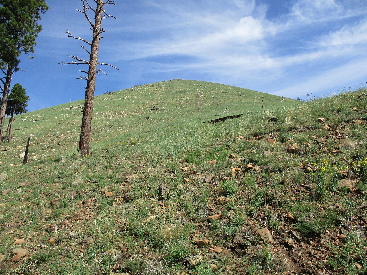
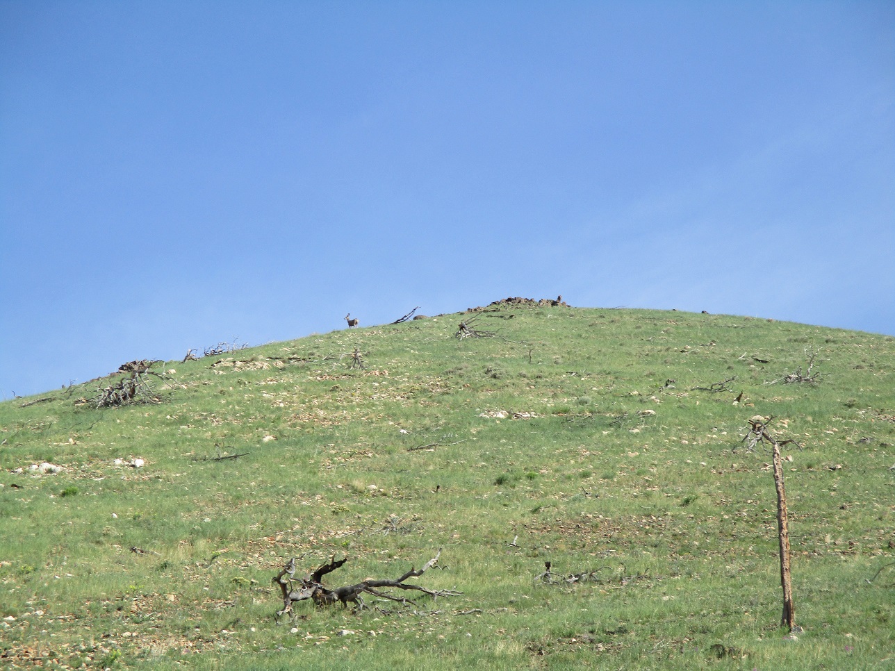
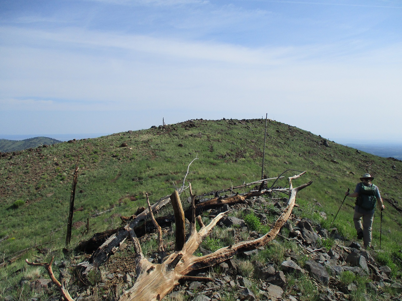
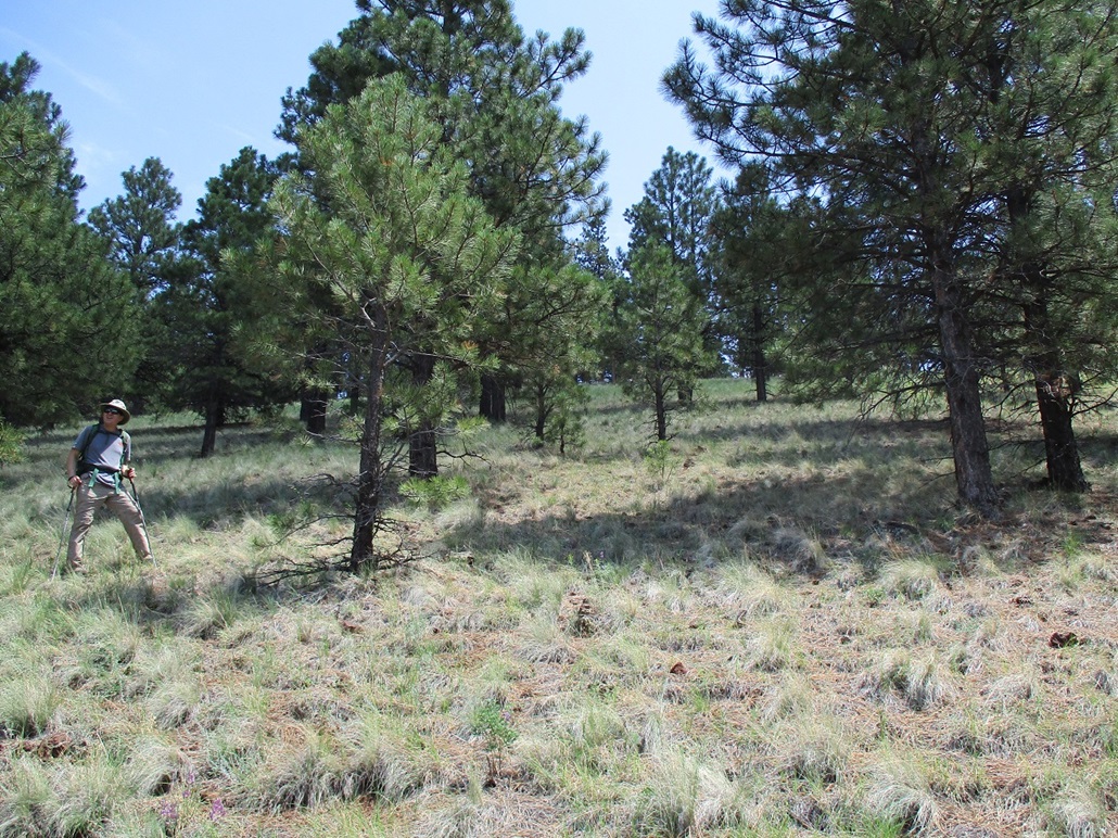
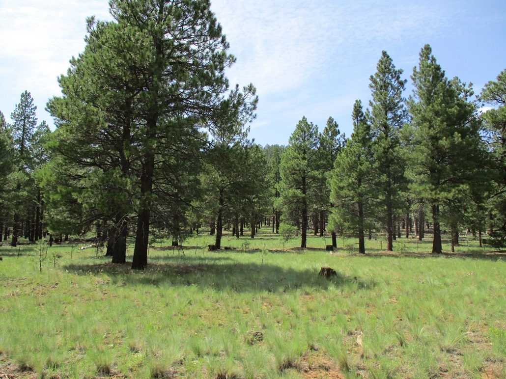
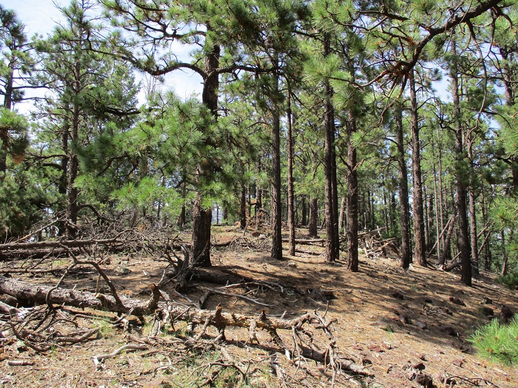
The slopes of Peak 8842 are open, just a few trees and mostly down low. We hiked up these slopes, which were steep but manageable. Up top was a deer, which I was able to capture in a photo. Five hundred vertical feet later, we were at the south knob of the summit ridge. Here, Matthias saw a little fawn. It scampered off toward its mom, we presume. I did not see the fawn.
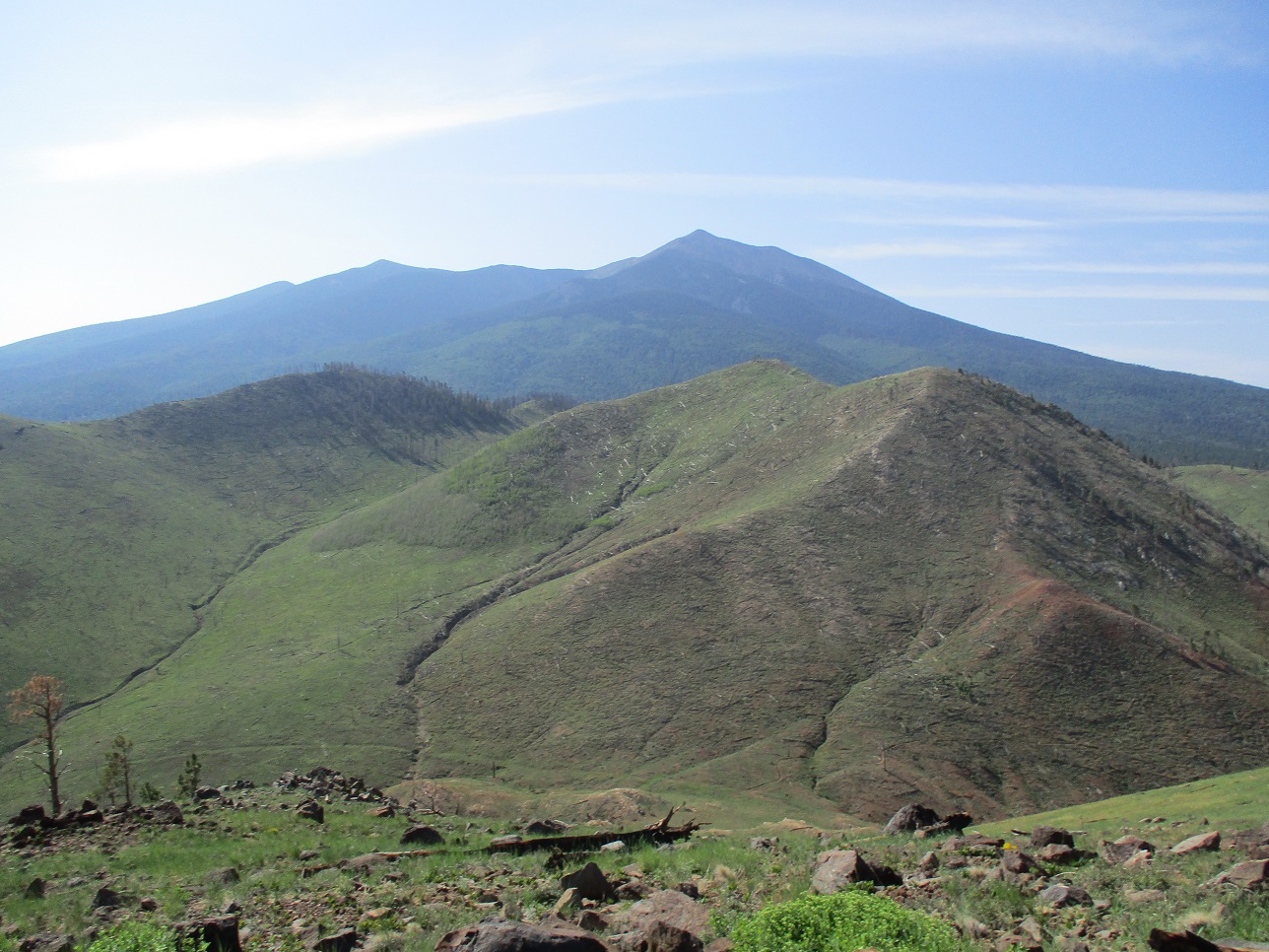
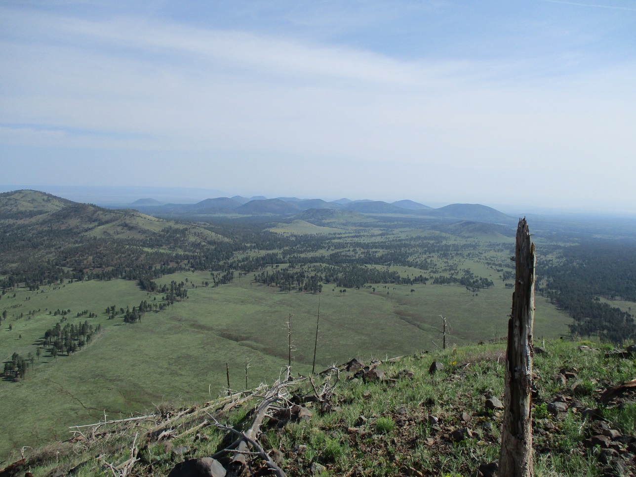
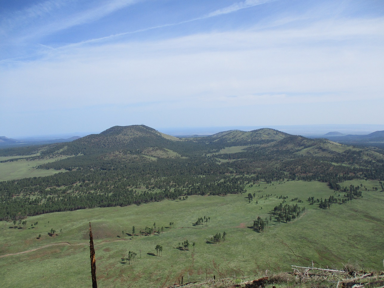
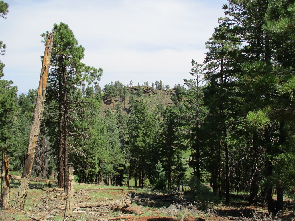
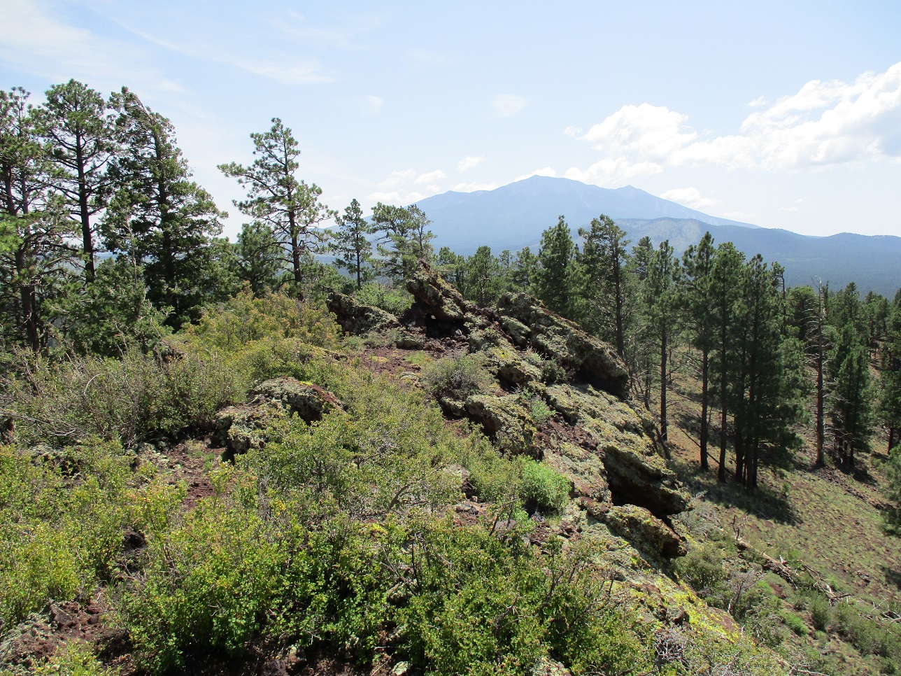
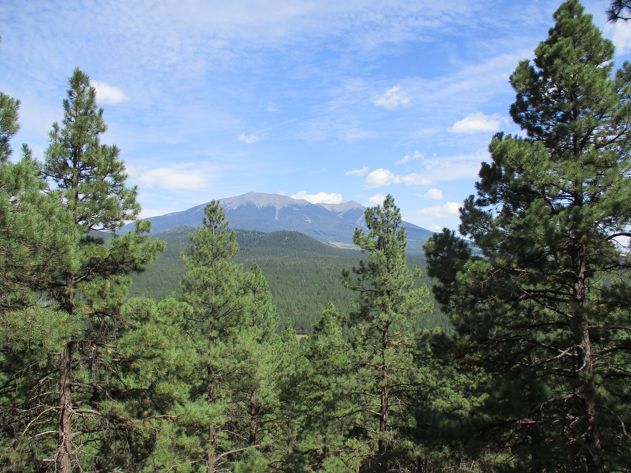
The highpoint was just a few more feet to the north. The top is open and covered in low rock piles. We tagged anything that looked highest, and took a ten-minute break up top. The views up here were tremendous, with peaks in all directions, including giant Humphreys Peak immediately nearby to the south. The temperatures were still cool and pleasant, but the moisture in the air gave the air a blue-hazy effect. The one-way hike had taken us about an hour, covering two miles.
We hiked down the same way, then followed that nifty trail a ways until we had to regain those 450 feet. The trail was in great shape and looked too smooth to be a game path. It definitely is a human-made trail, and possibly a mountain-biker's trail, but I could not find any confirmation of that. The Arizona Trail runs a couple miles to the west. We were back to Matthias' vehicle a little after 10 a.m., a two-hour and twenty-minute hike. This would be our longest hike and with the most gain of the day, so it was nice to get this one finished first, while temperatures were still cool.
The hike to Peak 8842 -- White Horse Hills North Peak -- went very well and we both agreed it was a prettier summit with better views than the highpoint. For people looking for a more traditional approach that does not involve a drop and regain of 450 feet, a north approach off of FR-514, following FR-9219M, would get one to the path we mentioned, then proceed as we did.
Elevation: 8,466 feet
• Prominence: 306 feet
• Distance: 1.6 miles
• Time: 55 minutes
• Gain: 417 feet (gross)
• Conditions: Sunnier, warmer
PB
•
LoJ
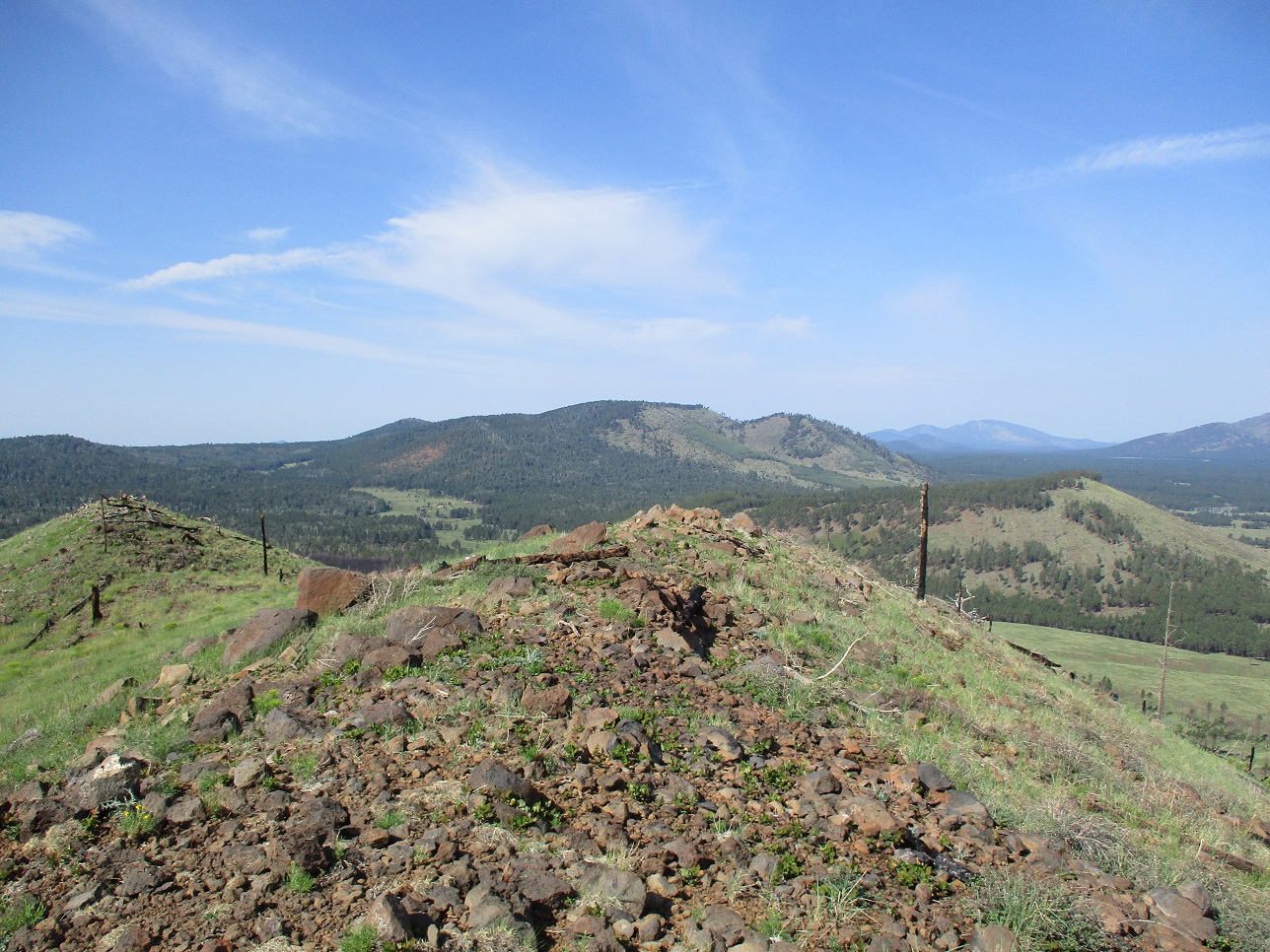
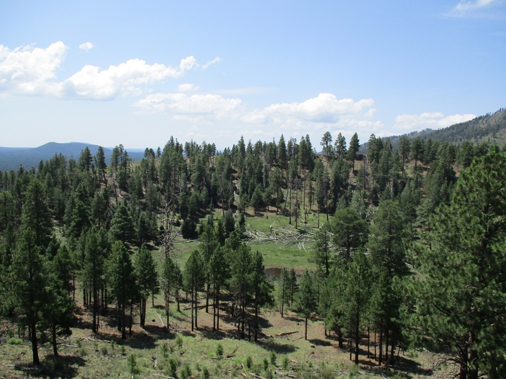
Next up was Crater Lake Peak, which abuts Kendrick Peak on its east flank. We got on US-180 south briefly, then onto FR-760 about four miles to FR-9009D. This last road decreased in quality slowly, but Matthias pushed forward, getting to where it makes a hard right turn, becoming FR-9009V, a spur to the southeast rim of the small peak.
We walked this last road uphill to its end. We then walked up the southwest lobe of the crater rim, a gain of about 80 feet. The top was flat, but a couple rocks and cairns were good candidates for a possible highest point. Looking across the small crater, the northeast lobe of the rim appeared to be higher. Thus, we continued our walk and would circumnavigate the whole rim. It wasn't too long, so why not.
At the lowpoint between the two lobes on the rim's northwest portion, we came to a small cabin, a grill and a good-looking hammock rigged up between two trees. There were a few "posted" signs about this being private property. We did not see anyone, though. We were soon past this private property bit.
We hiked up the northeast lobe and toward the topmost rocks, big agglutinates that jut above the ground by about 15 feet. We climbed one, inspected it, and immediately saw where the highest point was, then walked to that rock and gave it a good tag. Looking across the crater, the southwest lobe looked lower slightly, further evidence the northeast lobe is the highest point.
We were soon back to the road. We followed it back down to the car, a round trip of about an hour. This peak was better than we expected, with a tiny amount of scrambling and a chance to walk around a whole crater rim. We even saw tiny Crater Lake itself, measuring about 20 feet in diameter.
Driving out and toward our next peak, we saw a sign for the Kendrick Boys Ranch, which may explain that small private property segment we passed through.
Elevation: 8,274 feet (Per LIDAR)
• Prominence: 293 feet (per LIDAR)
• Distance: 1.4 miles
• Time: 1 hour
• Gain: 359 feet (gross)
• Conditions: Warm
PB
•
LoJ
Horseshoe Hill lies about a mile east of Crater Lake Peak and west of Cabin Flat Hill. From Crater Lake Peak, we got back on FR-760 and followed it about a mile northbound, where it cust between Horseshoe and Crater Lake. The plan was to get onto a scant side road marked FR-9237D on the map. Matthias wanted to drive this road as far as feasible, and then some, to the top if possible. But we only got in about a hundred feet. The road simply ends in a turn-around and the rest of the way is fenced off.
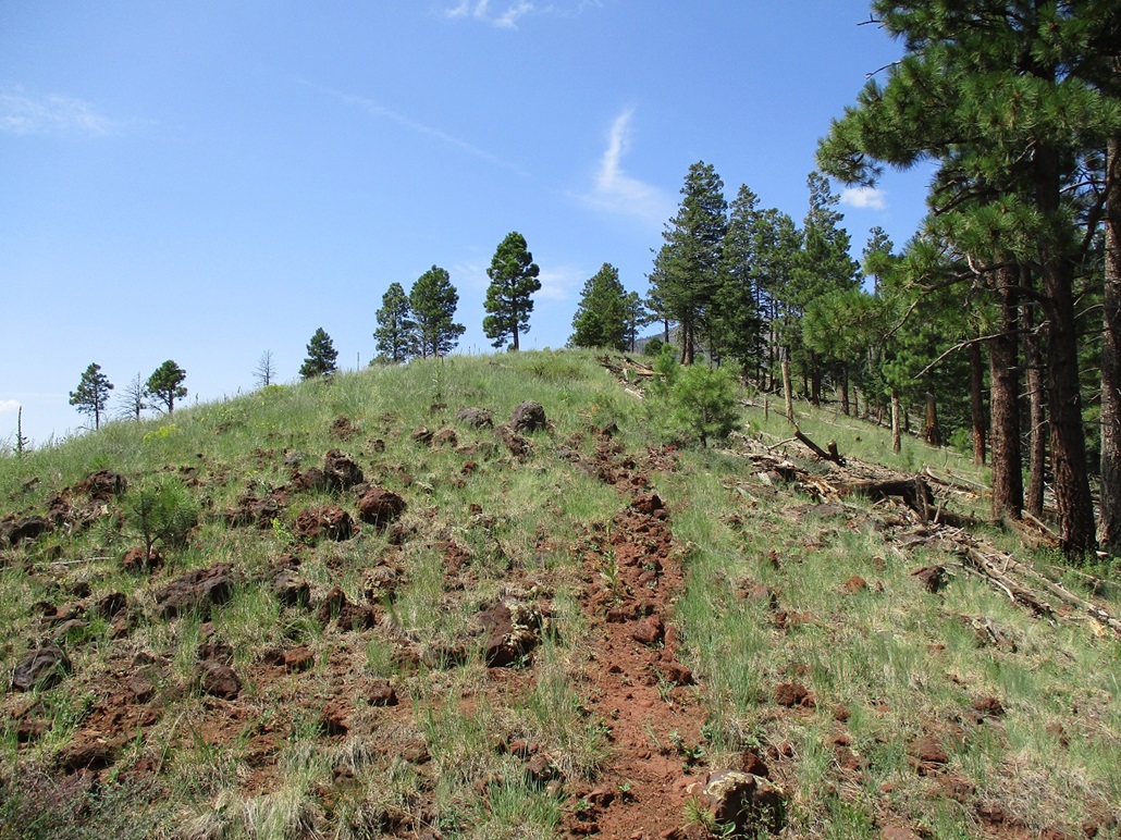
Fortunately the hike is not long or complicated. We scooted under the fence, then just aimed east and slowly walked up the grassy slopes to the top. It was warm now, so I stopped often in the shade to cool off. We were on top quickly, about 20 minutes after starting.
The top ridge has two areas of 8,260 feet, with the north one marked as 8,269 feet, the presumptive highpoint. We walked to it and tagged the top rocks. Looking south, we could see the southern possible highpoint area. We walked to it, covering the distance in just a few minutes. It was not possible to sight very well between the two high areas, but my instinct tells me the north area is higher.
We walked back to some shade at a lowpoint along the ridge and took our first long break of the day, spending about 20 minutes sitting in the shade, snacking and drinking, and enjoying the area. We were doing fine on time and there was no need to rush things. The hike back took about 20 minutes too. From here, we backtracked out alongFR-760 to the main highway and on to our fourth peak for the day.
This hill has about a 50-50 chance of being a ranked summit. Its clean prominence is 289 feet with 20-foot intervals. The defining col is in the meadow between Horseshoe and Crater Lake and perhaps with enough drop to make the peak ranked. It would be hard to locate the exact point by visual alone. Update Using the LIDAR data, the elevation and prominence are now adjusted and noted above.
Elevation: 8,450 feet (8,452 says ArcGIS)
• Prominence: 430 feet
• Distance: 1 mile
• Time: 1 hour
• Gain: 438 feet
• Conditions: Warm & Sunny but with a breeze
PB
•
LoJ
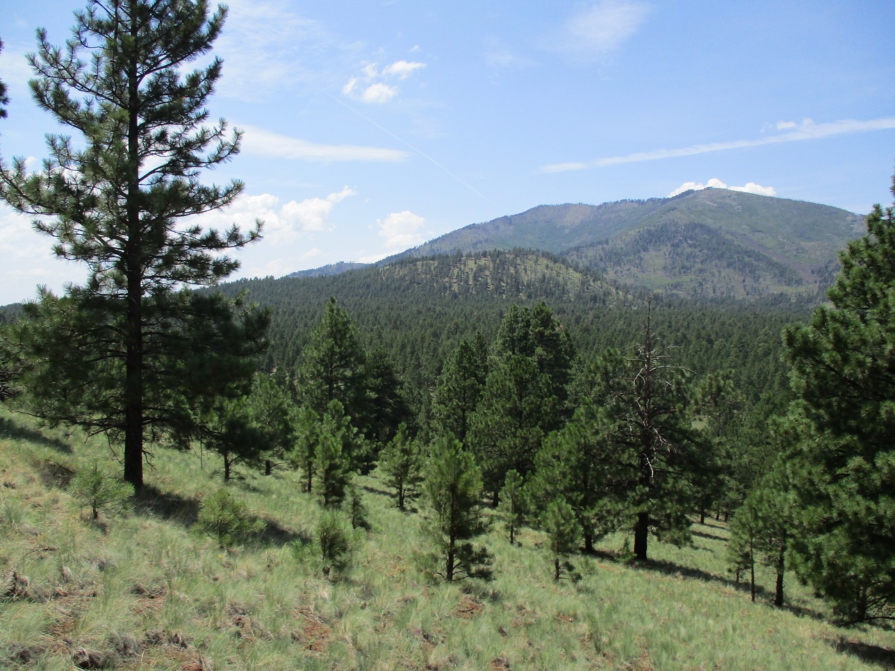
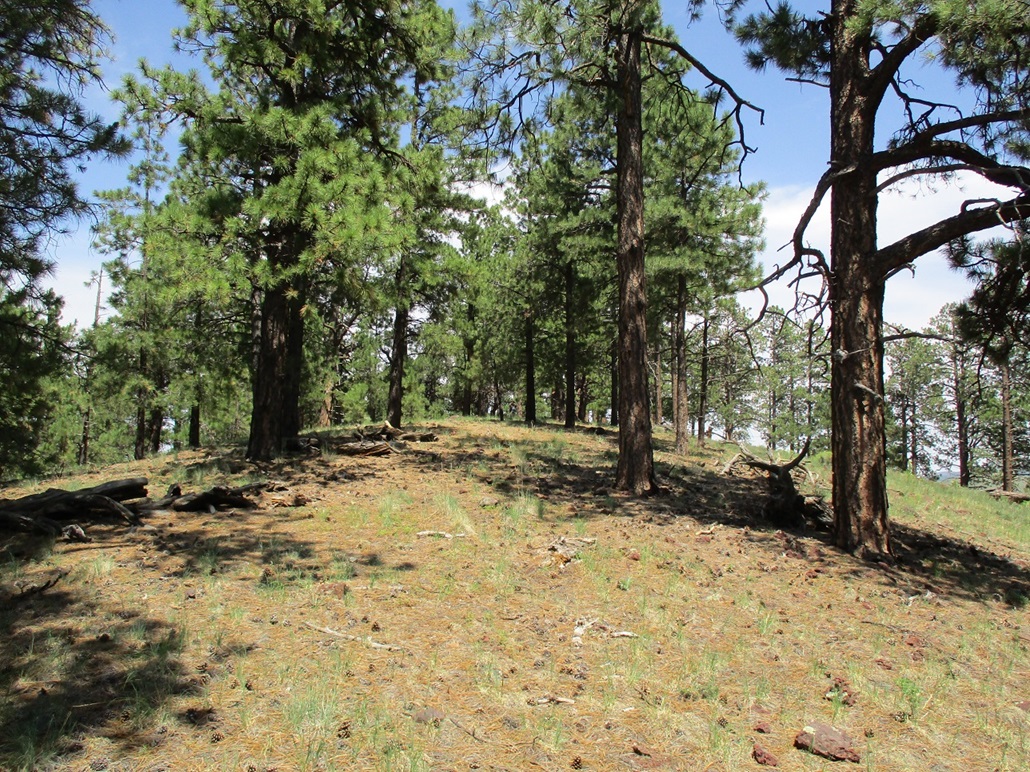
This unnamed peak lies alongside US-180, slightly south and across the highway from the Nordic Cross-Country Ski Center. The peak is forested on all sides with no particular side being a best side to ascend this bump. There is private property on the north side, so that shuts out any approaches from that direction. We pulled into an unmarked road east of the peak and after driving it briefly, returned to the entry area and parked.
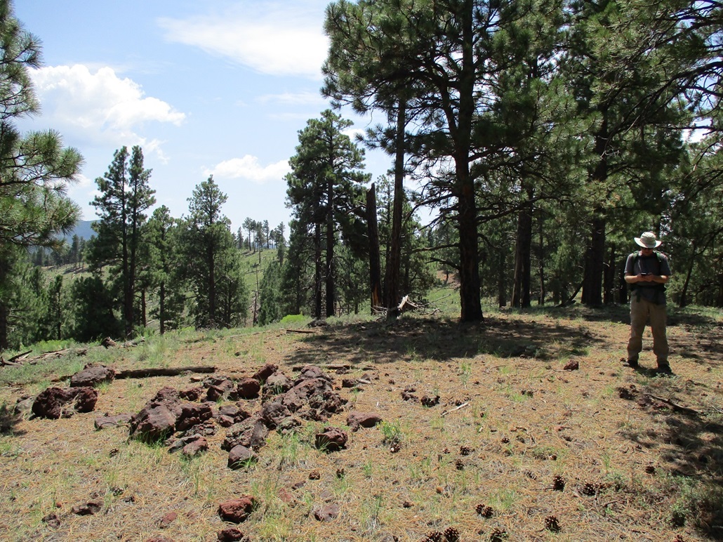
We crossed over a barbed-wire fence early, then trudged uphill through the thick forest. Toward the top, the ground is rockier. We angled right and achieved the ridge, and soon, were on the summit, which was wooded but with some nice views west toward Kendrick Peak. The one-way hike covered a half mile and took about 25 minutes. It was not an exciting peak, nothing too memorable.
We spent about 10 minutes at the top, resting, then started down. Following generally the same line down as up, we were back to Matthias' car quickly, the round trip taking slightly under an hour. It was not a difficult hike, but not one I would put at the top of any list. For me, it "completed" all the ranked summits that lie within 5 miles of US-180, from Flagstaff up to about Slate Mountain. I was pleased with that.
It was about 3 p.m., and we were done with peaks for today, getting four more for our records. Cumulatively, we had hiked about 8 miles with about 2,500 feet of overall elevation gain. It was warm now and I was pretty beat.
We got moving back south. On the car's music player was a new album by Soft Machine, apparently their first new album in almost 40 years. Those guys must be in their 70s by now. They're still doing good for a bunch of old guys! A couple hours later we were at the Carefree Highway exit, where Matthias dropped me off to my car. Thanks again to Matthias for driving.
I did not bother with the freeways, instead I took the slower routes via Carefree Highway and Scottsdale Road, in no hurry to actually get to my place. I arrived back about 6 p.m..
|


|