The Mountains of Arizona
www.surgent.net |
|
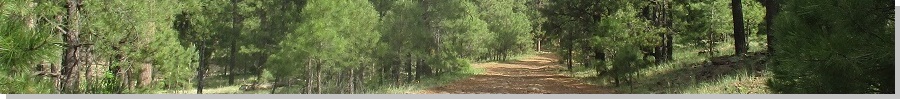
Mount Francis • Bean Peaks West I had a half-day open and was growing restless for any sort of hiking. The weather throughout the state has been very wet with powerful thunderstorms everywhere, a much wetter monsoon than usual. Nowhere was safe. Any of the high-elevation locales like Flagstaff, Show Low, the White Mountains, the Santa Catalinas, and so on, were getting hit hard. And it's still way too hot to be doing any serious hiking in the lower deserts. I saw that Prescott looked like it may have a spell (as in 12 hours) of promising weather on Monday, and since I had no pressing concerns that couldn't wait until later in the day, I took advantage of this opportunity to get out of town for a half day and hike a couple peaks. I don't get to Prescott often, so there are many peaks I can choose from. I opted for Mount Francis, which rises high to the southwest of town, with communications towers atop its summit, and nearby Bean Peaks West summit, the higher of the two Bean Peaks. Neither hike was too complicated — both followed trails or ATV tracks and both looked to be doable in a morning The two peaks lie about 4 miles from one another, but Mount Francis is considered to be a part of the Sierra Prieta, the range west of Prescott, and the Bean Peaks part of the Bradshaw Mountains, the range east and south of Prescott.
Date: August 22, 2022
• Elevation: 7,110 feet
• Prominence: 470 feet
• Distance: 3.5 miles
• Time: 2 hours
• Gain: 770 feet
• Conditions: Clear skies, cool but warming
Arizona
•
Main
•
PB
•
LoJ
I was on the road at 4:30 a.m., traffic surprisingly heavy for such an early hour. But I could still motor at 70 m.p.h. without too much trouble. I got onto northbound Interstate-17 and, after 30 years and over 200 times going up the steep grade from Black Canyon City onto the higher plateau, finally had it. What a craphole of a freeway this is, badly planned and outdated. It's steep for an interstate, 6-7% grade. I, like many others, try to build a head of steam on the lower flatter segment before the incline, and every g-d time, there's a massive truck with its hazards on poking upward at 15 miles per hour. So there goes my efforts to use momentum to my advantage. Then it becomes a free-for-all for passing trucks and trying to jockey for position with other drivers, then, like clockwork, a truck decides it wants to pass another truck, and gets into the passing lane at 20 miles per hour. This clogs things up more. Then, when things open up, to get back up to speed, I have to press the accelerator hard, straining my engine. And this is at about 5:15 in the morning. Effing Interstate-17, the worst stupidest interstate in the country. I hate it I hate it I hate it.
A few miles farther on, I exited at Cordes Lakes and got gas at a Chevron, plus snacks for the day. I then proceeded into Prescott on AZ-69. Being early, most of the traffic lights were green so I was able to get into Prescott relatively quickly. I drove through town and onto Copper Basin Road, which gains into the hills, with lovely homes along the way. By now, it was just me and maybe one other driver. The sun was up by now but it was pleasantly chilly, in the high 50s. There were no clouds in the sky for the time being. This helped my spirits.
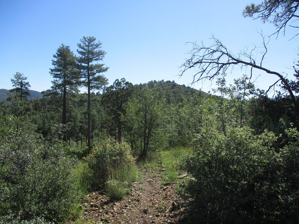
The pavement ends near the Prescott National Forest boundary. The road here is wide all-weather hardpack, but with the recent heavy rains, it showed some effects with low potholes and some erosion channels. It had no effect on me except make the drive slightly bumpy. Shortly, I pulled into the Aspen Trailhead, the time slightly before 6 a.m.. I was the fifth car here. I got properly attired, got my pack together, locked things up and started walking. The Aspen Trail (#48) starts across the road and is well signed.
The initial segment drops at a gentle grade, paralleling Aspen Creek, which was flowing today. Not that I have a lot of experience with Aspen Creek, but given all the recent rains, it "sounded" like it was flowing strongly. The trail drops to a small ford. I crossed it, following the trail as it doubled back, then made a right turn. Soon, there was a trail split. I had detailed maps with me and expected this. I took the right branch, signed FR-737 (this being an old road).
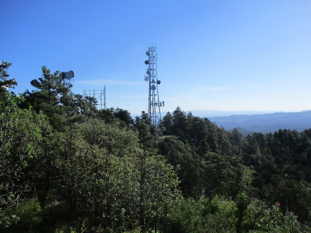
This segment gained steeply and was a little haggard in spots. It crossed the creek one more time, but up here, the creek was more of a brook, which was easily forded. I kept to this route, which would gainly steeply in parts. There was another trail split and I went right again. (The topographic maps do not show the trails and are essentially useless. But the OpenStreetMap site show these roads and trails and were most helpful to stay on course.) I could see the towers atop Mount Francis up ahead.
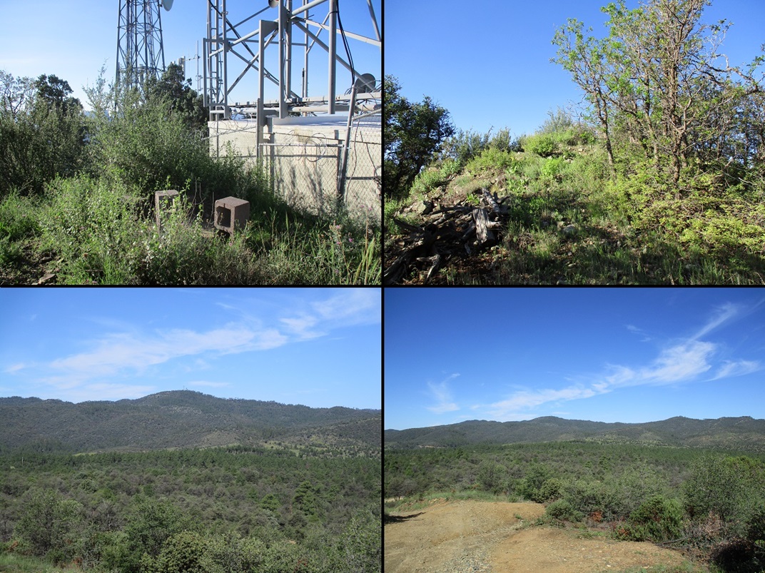
The trail makes one last steep push and achieves a saddle southeast of the summit. The towers were about another 75 feet higher. I went off trail here, which worked well, but near the lowest of the towers (and fencing), had to deal with heavy thornbrush, thorns a solid half inch long, and sharp. I moved slowly, got bit a few times, and was soon past it. I achieved the highpoint (so I thought) and stood on it. It lies between two buildings, the fencing about 6 feet apart.
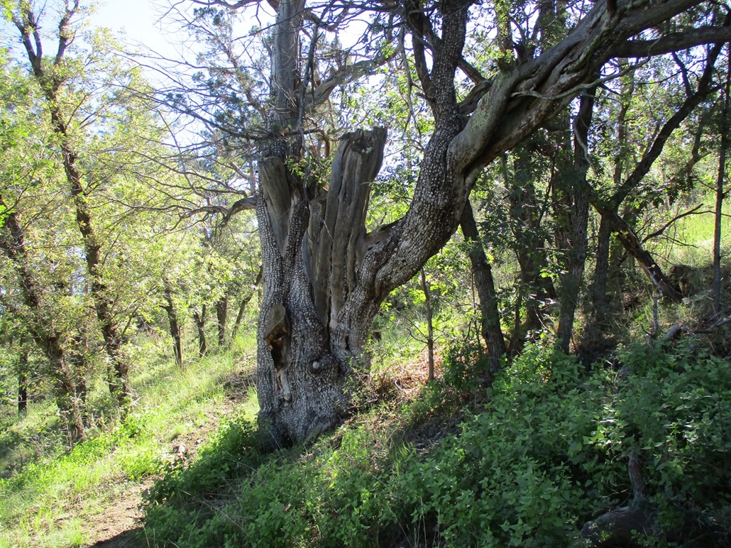
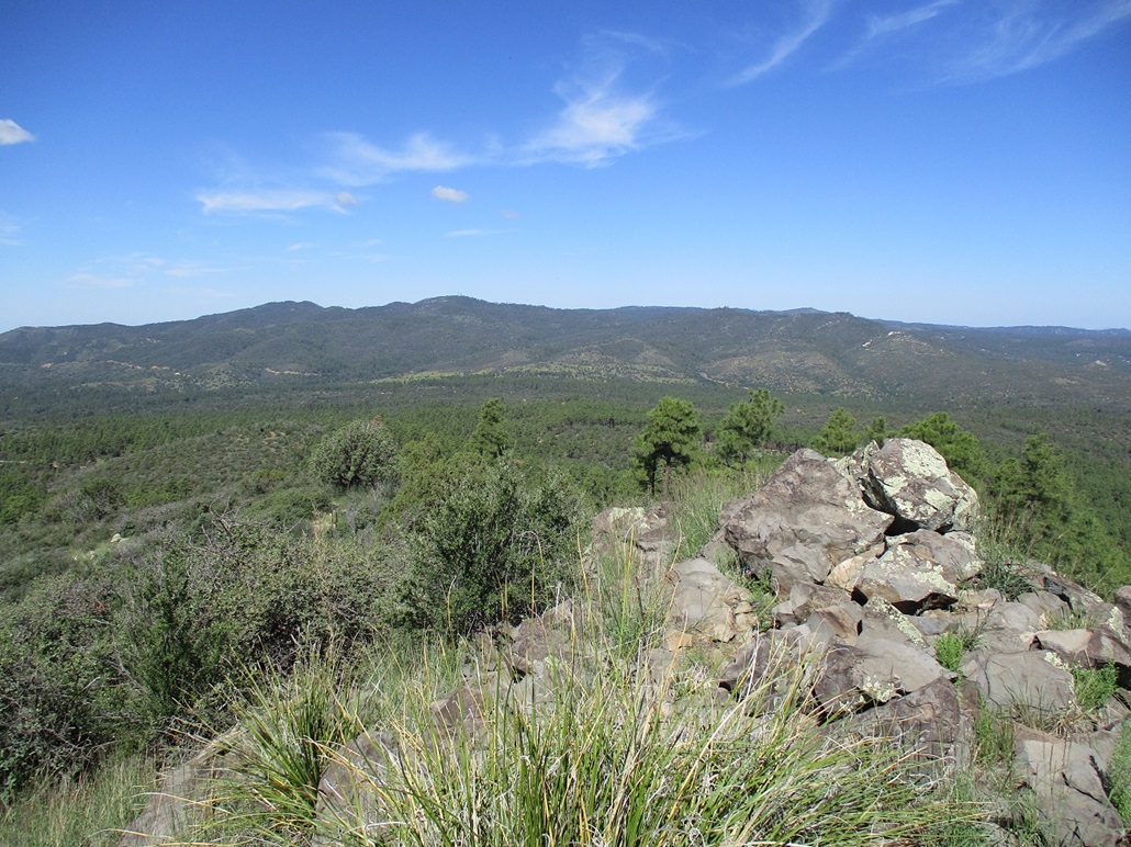
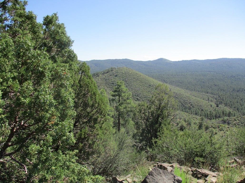
I then walked around until I came upon the service road. Up ahead, it was evident there was higher ground. I walked the road briefly, then up onto the bank and along a ridge to the actual highpoint, atop a mound of rocks and light brush. The register held about ten names going back a year, including a couple people I know, and a visitor from 2 days ago. It had taken me a little over an hour to get here, covering 1.75 miles (by my reckoning) with over 700 feet of gain. It wasn't a bad summit. In spots nearby, there were opportunities for good photographs of surrounding peaks and forest.
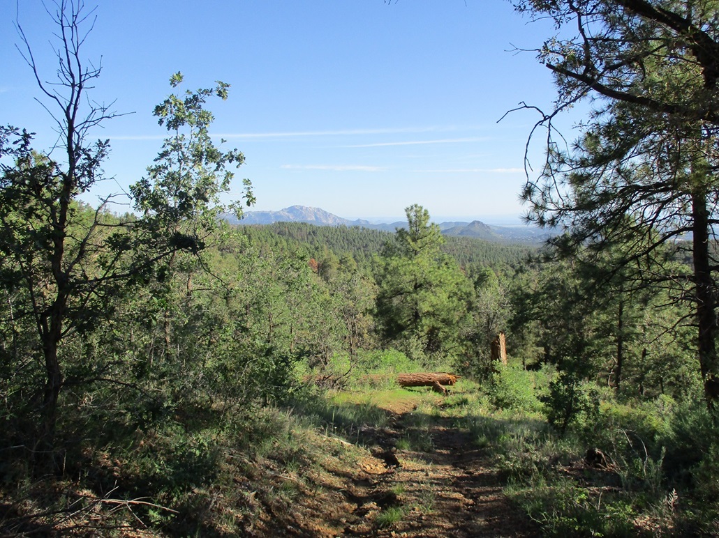
For the descent, I considered taking the service road down, but it would probably add on an extra mile, so I went with my ascent route. I moved carefully again through that heavy thornybrush, and was back onto the trail. Going down, and now with the sun high enough for better photography, enjoyed the views and snapped a handful of images. I could see a good part of Prescott intermixed with the trees, plus the big peaks like Granite Mountain and Thumb Butte, plus shadowy hulks way off in the distance, Bill Williams Peak most likely.
I was down in under an hour, the round trip taking close to 2 hours. I felt good and energized. The hike had gone well and got my legs and butt some conditioning. I'm still rehabbing my right knee, which is about 98% healed, but it still gets weak at times. It was tight when I egressed, but not painful. I also had a slight strain in my back, which didn't hobble me. I sound like an old man. Wait, I am an old man.
Back at my car, I drove down into town and aimed for Bean Peak, next on the agenda. Bean Peak is exactly east of Mount Francis, four miles distant. I was not expecting much on this hike, seeing it as a tag-and-bag summit to pad my totals.
Elevation: 6,500 feet
• Prominence: 340 feet
• Distance: 2 miles
• Time: 90 minutes
• Gain: 460 feet
• Conditions: Trippy
PB
•
LoJ
From AZ-89 south of Prescott, I got onto the paved road (FR-63) signed for Ponderosa Park, a small village within the forest. Slightly under a mile later, I turned east onto FR-64, a standard dirt road with a few camping spots alongside it. I didn't drive far, about a half mile. The road was rough in spots and I had to take a couple segments slowly. I parked at its junction with another track coming in from the north. It was about 9:30 a.m., sun higher up and warming into the 70s.
I started walking up FR-64, which got steep and ugly fast, which made my decision to park where I did a smart one. I hiked up one steep section, then heard an engine. Two guys in an old Chevy truck (looked like a 1970s model) with beefy tires were slowly coming up. They passed me by. I was soon above the steep portion and then came upon the two guys again, now parked and getting outfitted in their camo, bows, arrows and all sorts of things strapped to their bodies. We said hi, I pointed where I was going, and they were going another way. This was good to know. It's bow-and-arrow deer season right now.
I followed FR-64 as it bent south. I was looking for a lesser track that continued east. I found it, but not being confident it was the right one, I walked a little more south and saw nothing else encouraging, so I hiked back to the track and started in. It turned out to be a good trail, an ATV track that is now way too narrow to be driven on by an ATV. It is strictly a hiking path these days.
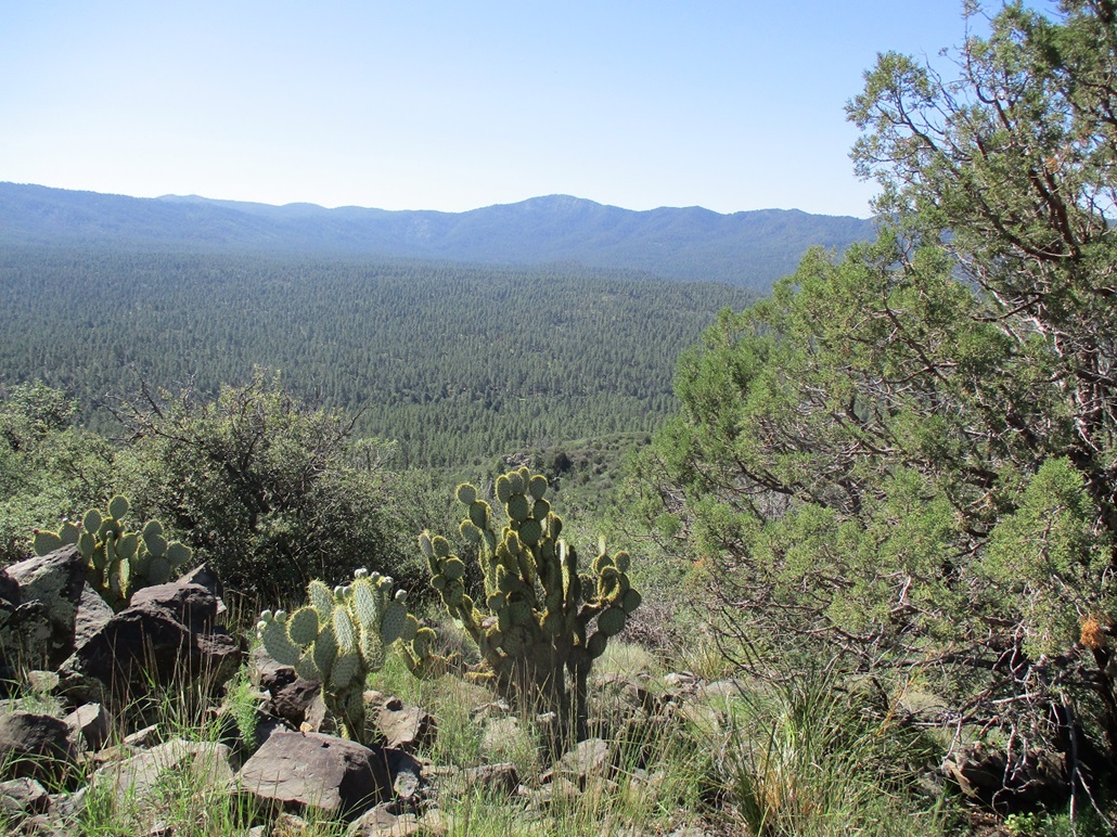
On the satellite images online, I knew the existence of this path, but it appeared to skirt the Bean Peaks to the north. My plan was to stay on it as long as it continued to head east and uphill. I assumed I would have to do some off-trail bushwhacking, but the path kept going up, and to my surprise, went to the top! In fact, it ended at the base of a pile of rocks about 15 feet high. This was unexpected. I was expecting a forested hump, not a cool open rock outcrop. I walked up an easy ramp and was on top the summit, with fantastic views in all directions.
I took a longer break to rest and have some Gatorade, plus snap more photos. To the east were Spruce Mountain, Mount Union, Mount Tritle and Maverick Butte (looking left to right). To the west was Mount Francis. To the north I could see Bill Williams Peak, and barely make out Humphreys Peak. The day was lovely and clear. The only clouds were way to the north, already surrounding Bill Williams and Humphreys.
Hiking down, all was dandy, then I caught my right foot on a twig. Then my left foot caught the same twig and suddenly, I was pitching forward into the brush. I was able to get my feet untangled and stay upright, but it was close. I was fortunate to have a little open space to run into to use up my momentum. And at that very moment, the two guys I spoke with earlier came walking up. They asked if I was okay. I said I was, the only thing I hurt was my pride. I pretended I meant to stumble, but they were smarter than to believe me. They were real cool.
I was back to my car quickly. This hike wasn't long, about 1.6 miles round trip, taking 90 minutes. It was close to 11 a.m. now, and I decided I got what I came for and felt I should head home to do some work, if there was some for me to do. I took the scenic route down the grade into Yarnell, where I stopped to walk the small park/memorial for the Granite Mountain Hotshot crew that were killed in 2013 in the Yarnell Fire. My last time here, the park was closed. This time, it was open and I walked it briefly to pay my respects.
From here, I followed AZ-89 down the Yarnell Grade, then into Wickenburg, across highway AZ-74 and then Interstate-17, the suckiest interstate that ever sucked, to Loop-101 and home, arriving at 1:30 p.m.. I showered, did laundry and yes, had some tasks waiting for me to complete. I felt useful.
Today went well. I was happy to get out for the day, and had no real delays or obstructions the entire time. It was a good-medicine day.
Last night, I looked up an old lady-friend of mine to see what she was up to these days. We have not emailed one another in many years. I wasn't planning to contact her, I just wanted to see if she was okay. We dated back in the 1990s and our split was amicable, and we stayed in slight contact over the years (she moved back to Ohio). Well, the first link was her obituary. What a kick in the gut. She passed back in December. I had no idea until now. She was a fine woman and one I respected and loved very much. I am saddened by her passing and have only good memories. She came into my life exactly at the moment I needed someone like her to come into my life, and I'll be forever grateful.
Give your loved ones a hug right now, and if they're not local, a quick text, email or phone call to tell them you love them.
|


|