
The Mountains of Arizona
www.surgent.net |
|
Peak 3303 • Peak 3344 These two peaks rise in the Hieroglyphic Mountains, a grouping of peaks between Wickenburg and Lake Pleasant, north of highway AZ-74 and south of the Maricopa-Yavapai county line. Neither peak has a name, and it appears the whole area is the domain of dirt-bikers, as numerous trails criss-cross the desert and the hills. The land is about half State Trust and half Bureau of Land Management. The second peak's summit lies barely inside a square of private land centered around a couple mines. Today was Wednesday, my middle-of-the-week weekend date between teaching. I had plans to hike a couple peaks in Yavapai County but the weather was being fickle. Like last week, storms were a possibility in the higher elevations. Also like last week (when I climbed some peaks west of Wickenburg), I played it safe and picked these two for today's hike. They were lower in elevation, but highs were expected to reach only 90°. I was out my hotel door at 4:30 a.m. and followed the routes north and west toward Wickenburg. Near the west end of highway AZ-74, I turned north onto Castle Hot Springs Road, which is paved for two miles, then wide graded dirt for the rest. I went in about 6 miles total. It was still mostly dark, the peaks in shadow for now. Conveniently, I found a cleared parking area just off the road on an elevated bluff, due west of the closer peak, Peak 3303. This would make it easy for me to see my car as I hiked out. It was about 6:15 a.m. when I rolled to a stop and got myself dressed and situated. I planned to hike both peaks in one long loop. Peak 3303 rises about a mile and a half east, and Peak 3344 another mile-plus east of that. The terrain was such that I would be forced to wiggle with the hills, arroyos and bluffs, adding distance. The morning was pleasant, in the low 70s and no breeze. It was cloudy but did not feel too humid. The clouds were heavier to the east, blocking the sun for about the first hour as it rose, which helped mitigate the heat.
Date: September 23, 2026
• Elevation: 3,303 feet
• Prominence: 345 feet
• Distance: 7.7 miles (entire hike)
• Time: 3 hours, 50 minutes (entire hike)
• Gain: 700 feet
• Conditions: Barely cool with high clouds
Arizona
•
Main
•
PB
•
LoJ
From my car, I had to drop 60 feet immediately, down an embankment into a broad arroyo. Then once in the arroyo, figure out a way across it. I would hike up one hill and down its other side, or hike along it. The arroyo could be brushy in places, but I usually found openings and lanes.
Once past the arroyo, I was now on elevated desert terrain with a slight upward slope. The lower foothills of Peak 3303 came fast, I was abeam of them after about twenty minutes. Peak 3303 was still back there another mile. I could see its mass, but not its summit. It was still dark even though the sun was up by now.
I made no effort to find tracks, but I ended up finding them anyway and would follow one if it went where I wanted. When I was close to Peak 3303's base, I left the track I was on and busted upslope over easy sloping terrain. Then I found another track higher up, so I followed it.
It seemed to go where I wanted, toward the summit, which was now visible. The track helped me keep a quick pace, and when I was below it, I left the track and hiked through rocks and grass to the summit, which was a 20-foot tall pile of rocks.
Fortunately, it was easy to just carefully walk up these blocks, and I was soon on top of Peak 3303, the summit a very small and pointy place. I snapped a couple images and signed into the register. It was still shadowy for now, about 75° but no breeze. Peak 3344 rose in the near distance, backlit by the muted sun.
It had taken about an hour exactly to get here, in what came out to 2.2 miles. Up high, I could study the terrain below and see numerous tracks. I may as well follow them if they help. One appeared to go down the peak's east slopes. From the summit, I eased downslope back to the track, then resumed following it eastbound.
The track did as I hoped. It was a dirt-bike track, often eroded with a foot-deep divot in its middle, covered in loose gravel over a hard base. Footing could be downright treacherous in places. In some segments, I walked in the brush and rocks beside the track, which offered safer footing.
In about twenty minutes I had dropped about 700 feet, now in another broad arroyo system that separates the two peaks. At some point I hit a lowpoint, where my climb of...
Elevation: 3,344 feet
• Prominence: 414 feet
• Gain: 810 feet
• Conditions: Sunnier, warming up fast
PB
•
LoJ
...Peak 3344 officially begins. I weaved through the sandy bases of the arroyo, guessing in a couple spots when to leave it. I busted up one slope, then saw a track about a hundred feet over, so I walked to it.
This track wasted no times going uphill. It was another dirt-bike track, and not in good shape. It had divots, and could be very loose in places. But it was faster than busting through the brush directly. I stayed on the track until I was northwest of the summit. Looking up, I could see a slope and some rocks at the top. I knew that wasn't the summit, but it was close. The track hereafter looked terrible anyway.
This steep slope gained about 250 feet to those rocks. It was steep but hikable, lots of large embedded rocks to step on. Brush was moderate and grass not too high. I aimed for a lowpoint to the right as I looked up. Once on the ridge, I found ... another track. So I followed it.
This track went steeply uphill, paralleling the rocks. I gained about another 150 feet, weaving left and right through the rocks, until I was on Peak 3344's summit. From Peak 3303, it had taken me another hour, almost on the dot.
This summit was a little more roomy with good views. Looking south and east I could see the mines down below. It was still cloudy that way. North and east I had more blue skies and sunlight, the sun just starting to rise above the clouds. I took a break here to drink something and relax. It was still tolerably cool, now in the high 70s. With the sun up, it would warm fast.
Going down, I followed that upper track to where I had met it at the base of the rocks. Rather than retrace my route, I followed this track. It went steeply downhill and did drop me into the arroyo. This looked more like a footpath. I can't fathom a dirtbike up this high but then again, I'm sure there are some who try.
Now I was in the drainge, about three-plus miles from my car. I did not want to retrace my inbound route because that meant essentially reclimbing Peak 3303. Instead, I would do a big sweeping end-run south around the peaks, staying low in the desert terrain.
I picked a spot at started out of the arroyo and heading west. It was warm now, in the 80s. As long as it stayed about this warm, this shouldn't be a problem. I started walking westbound for my car.
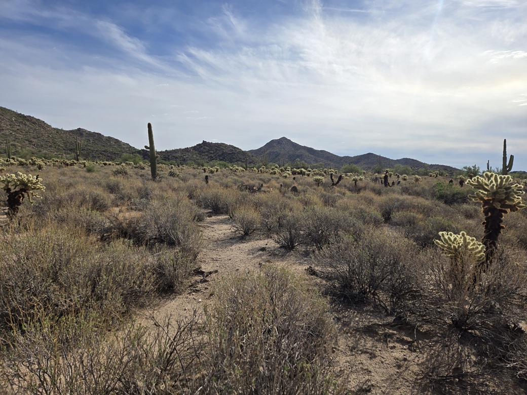
The terrain was very friendly. It was mostly open with spaced brush, lots of creosote, grass, palo verde, cholla, other cactus, saguaro, brittlebrush, but always with lanes to follow.
Sweeping around the peaks meant I'd be crossing arroyo braids, which I did often, but most were very gentle, maybe a four-foot drop into and out of. When on the flatter terrain, I made very good time. Once or twice I had to drop twenty or so feet into a larger one then back out of onto more open desert.
I basically hugged the base of the hills, and yes, it started to get very warm. The last half was more difficult as I was slowing down a little. I had two pints of liquids on me and I was feeling good, for now.
Finally, after about an hour of this trekking, I surmounted a rise and could see my car glinting on that bluff about a half mile away. I just aimed for it, and followed any opening or track that I came to. At the base of that embankment, I drank the rest of my liquids, then wobbled up that 60 feet back to my car, the time about 10 a.m. sharp.
The hike covered 7.7 miles and took three hours and fifty minutes. It was not difficult at all, but the heat by now was noticeable. I changed into dry clothes and drank some more liquids. When I started the car, it read 90° outside. That's just warm enough to make things a little rough. Ten degrees cooler and this would have been cake.
I drove back out to the highway and in one push, back to my hotel in Scottsdale. It was close to noon now, warm but not too hot (mid 90s). I showered and then took a 90-minute nap.
These two peaks went well and I enjoyed the hike. The tracks help and sometimes hinder. The land is easy to manage and at no time did I scramble or get into sketchy terrain. I never saw any dirt-bikers. It was just me today, and a band of javelina I spooked. When cooler, this would be a fun and pleasant hike.
|




|