The Mountains of Arizona
www.surgent.net |
| House Mountain |
• Red Rocks of Sedona • Coconino National Forest • Yavapai County |
|
Date: April 11, 2020
• Elevation: 5,127 feet
• Prominence: 927 feet
• Distance: 9.8 miles
• Time: 4 hours
• Gain: 1,330 feet
• Conditions: Mostly sunny and pleasant but with some clouds too
Arizona
•
Main
•
PB
•
LoJ
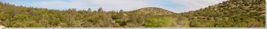
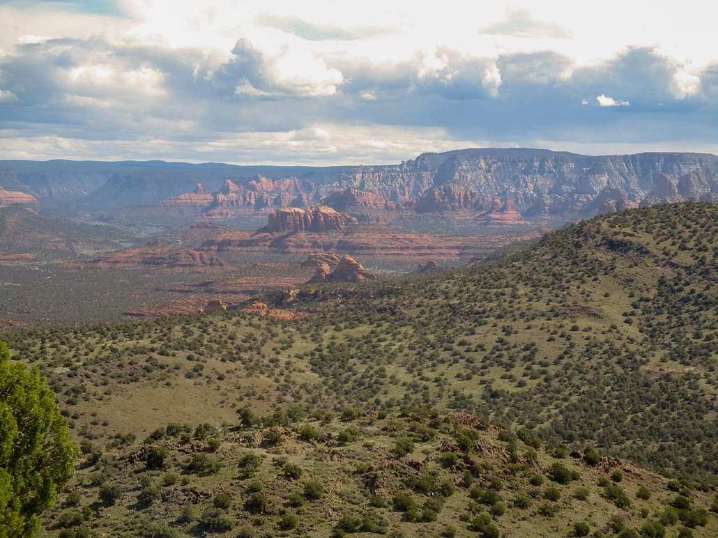
House Mountain is an interesting mountain, a shield volcano that rises south of the famous spires and cliffs of Sedona and north of Camp Verde. The Colorado Plateau has inexorably been receding northward by fractions of an inch per year, erosion thus forming the famous Red Rocks, whereas the basaltic caprock of what we know today as House Mountain has kept this mountain generally free from erosion. There was a time millions of years ago when the plateau included this landform. Now, the plateau's rim lies about 25 miles north, and House Mountain kind of sits by itself.
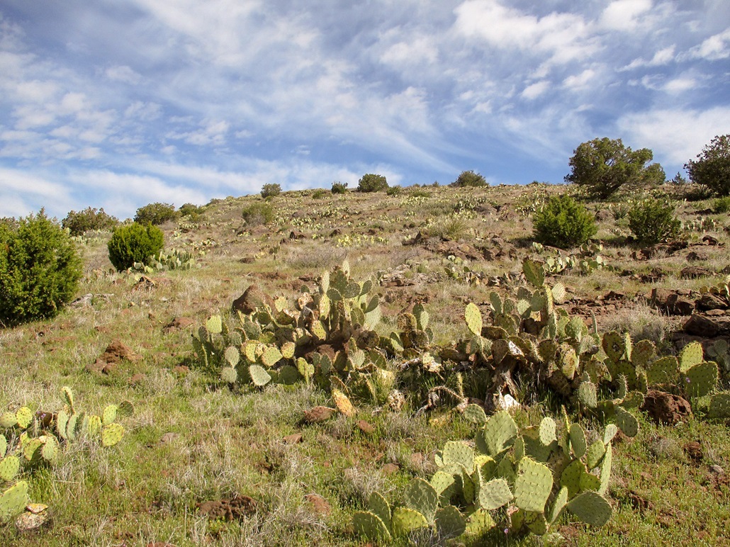
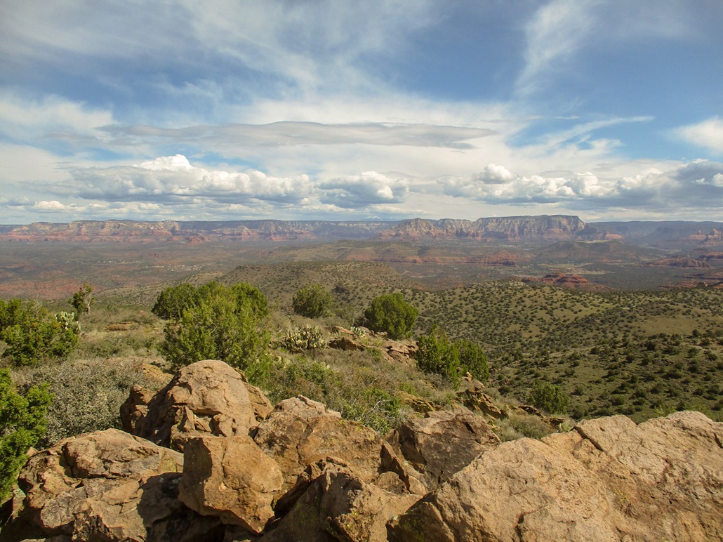
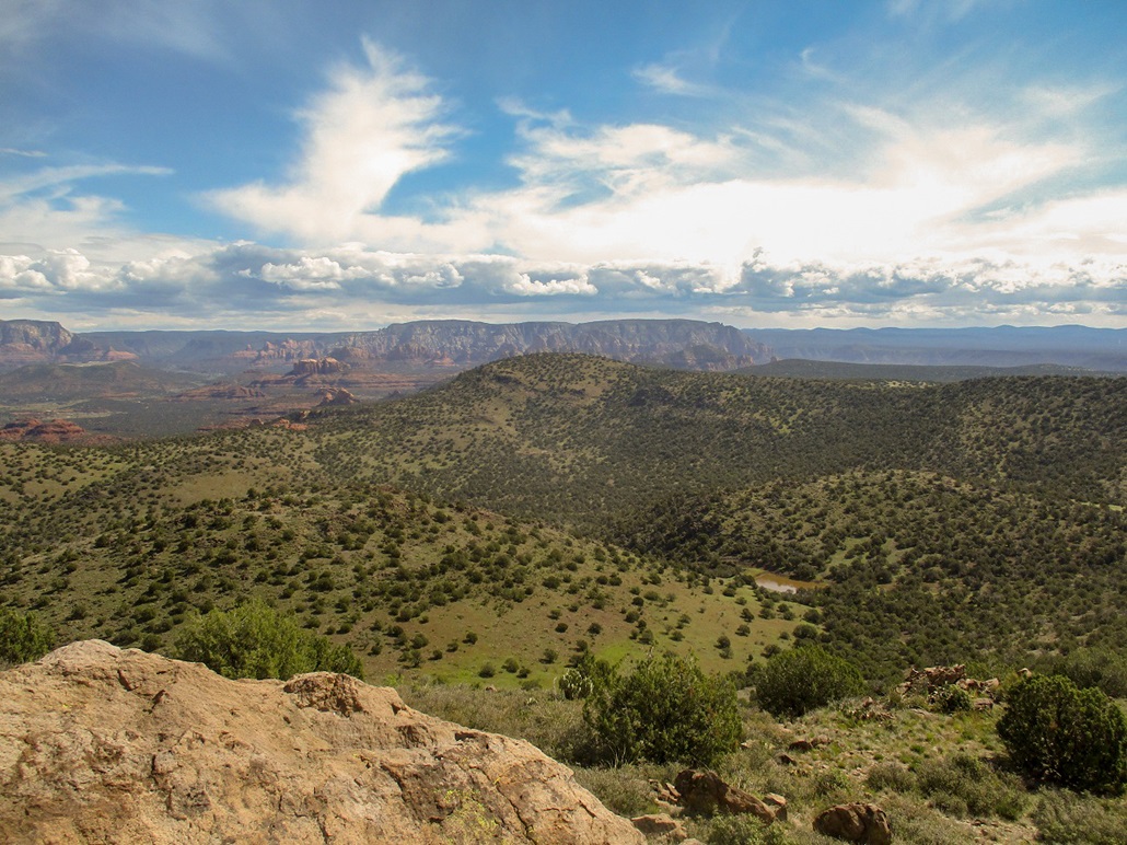
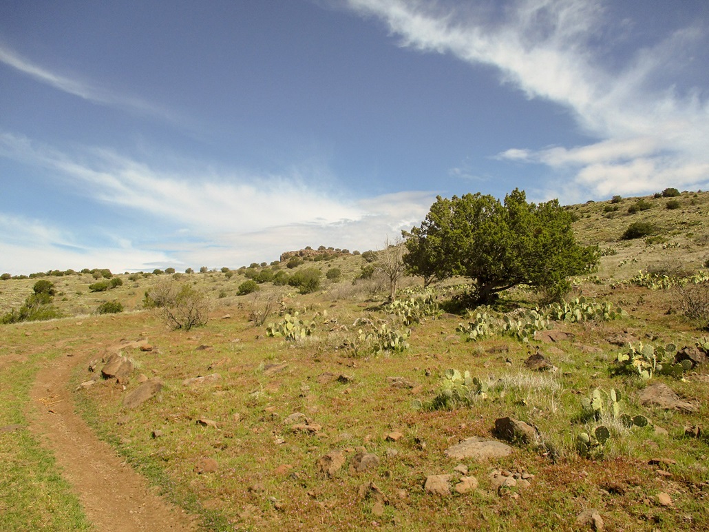
Like most shield volcanos, the mass is more broad than tall, and circular in a very general sense. From up close it does not look like a mountain at all, but more like a long ridge of hills. Canyons radiate outward from the central highland. The summit lies on the west of what is presumably the crater. The canyons are heavily forested as is the crater, whereas the highlands are more open and grassy, with pinon and juniper woodland and abundant prickly-pear cactus.
I've known about this peak for awhile, but usually forget about it when planning an outing, as Camp Verde is not usually on my hot list. However, this weekend, I suddenly remembered it. First, the weather was active throughout the state, with rain in the higher elevations, cold and cloudy around Payson and Globe, but supposedly just "sunny with clouds" in Camp Verde/Sedona. Second, I know it would likely be vacant since anyone coming this way to hike will head to Sedona, where "social distancing" is impossible to do. Third, I really wanted no part of a bushwhack after enduring a few in the past couple weeks. I wanted a long walk on road over gentle gradients. If you've read my site long enough, you know that if you say "shield volcano" to me, you need not say more. This would do nicely.
I left Payson early, driving up AZ-87 up onto the Mormon Plateau above the Mogollon Rim. It was cloudy and cool, but calm, temperatures in the 30s. I merged onto AZ-260 heading west toward Camp Verde, dropping about 2,500 feet. It was warmer down here and much sunnier, the clouds seemingly sticking to the plateaus for now. I got onto Interstate-17 briefly, then exited onto westbound Cornville Road, then onto northbound Beaverhead Flats Road, House Mountain now visible to my left.
I then eased onto Coconino Forest Road 9952, heading northwest. The road is uneven and prone to ruts when wet. I drove in about three-quarters of a mile, parking in a great spot at 3,800 feet elevation, just before the road drops into a drainage emanating from the canyon up ahead. I got myself situated and locked the car, starting my trek at 7:45 a.m.. The sky was clear but with high clouds, temperature about 50 degrees.
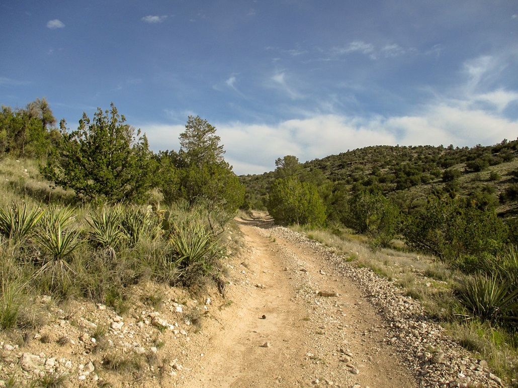
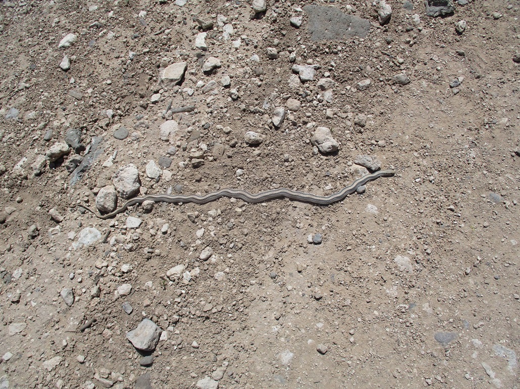
I simply followed the road northwest and north, into the canyons and up onto the highlands. Down low, the terrain is high-desert, with scrubbier plants. Once in the canyons, the forest thickens but never includes anything particularly tall, mostly junipers. The road was in fine shape for walking, and a motivated driver with a stock truck or SUV could probably get into the lower canyon, perhaps another mile from where I parked. There were fresh prints, probably from yesterday.
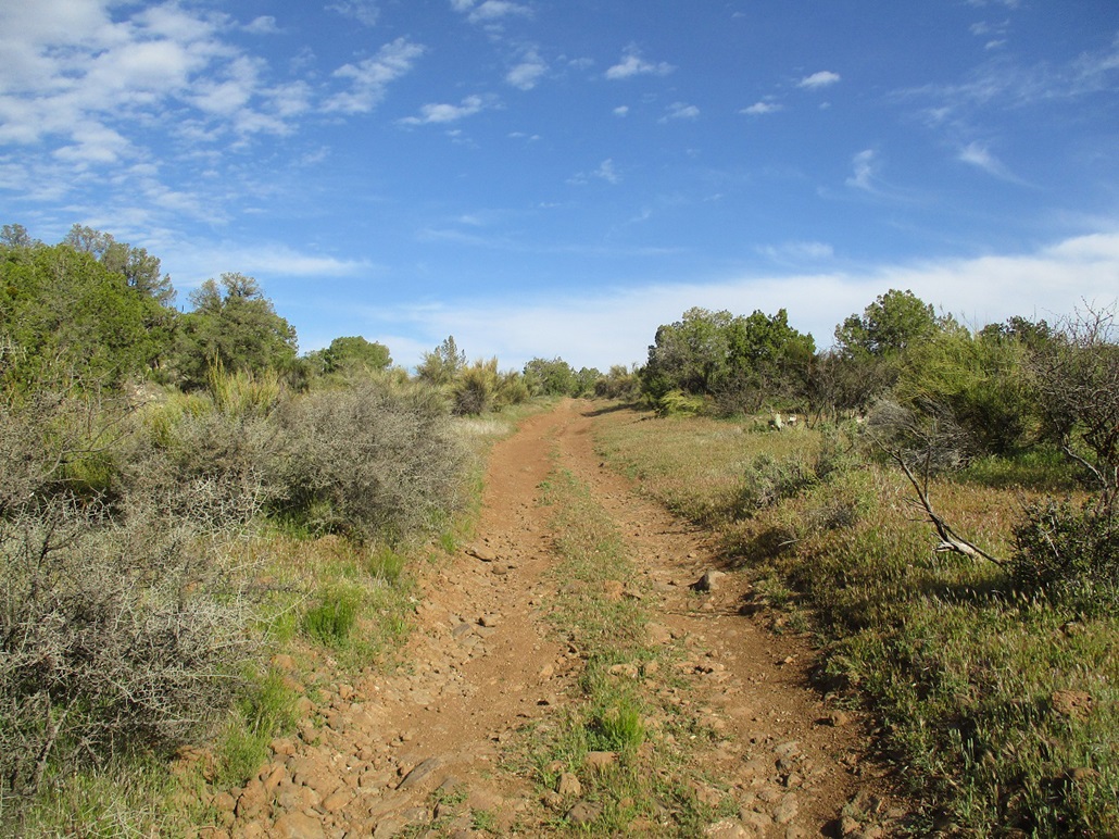
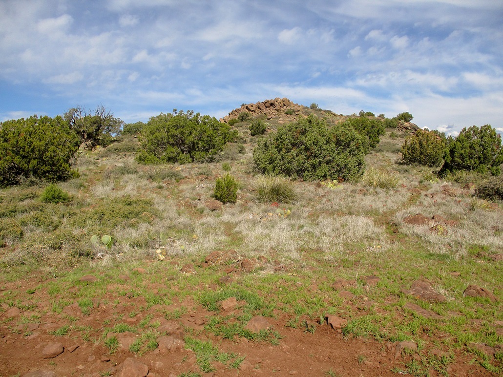
About two miles in, the road makes an aggressive upward push, the only steep portion of the whole hike. It gains about 400 feet in a half mile. The road is rocky and uneven and would require a more suitable vehicle such as a Polaris or Jeep to get past. For hiking, it was fine. Once on top this steep portion, the scenery suddenly changes flavor, with darker (persumably basaltic) rock, more grasses and wildflowers, and more pines, along with the junipers. The next half-mile was mostly level, the uphill barely noticeable.
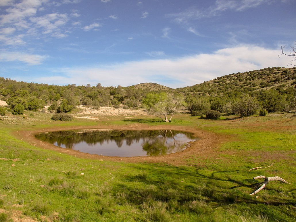
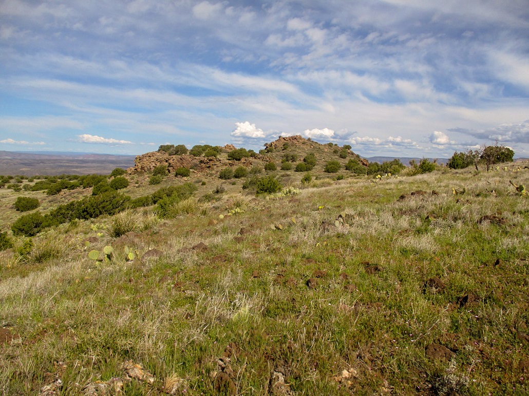
The road then achieves a small rise, then drops into a bowl, where the "House Mountain Trick Tank" is located. There is an earthen tank full of water for the cows, a metal tank on a hill nearby, and a corral near the metal tank. I had my first views of the summit hump, but not of the summit itself just yet. I was about three miles in. I took a break here, taking advantage of a few good sitting rocks.
Moving again, the road bends west slightly and meets another road. Now heading north again (and still marked as FR-9952), the road starts another uphill grade, bends east, then north again, now aiming for a saddle just east of the summit ridge. I kept walking until I was essentially below the east slopes. I left the main track and started walking on FR-9952C, which bends south then turns north again to the summit. By now, the sky was less cloudy and much more sunny, with comfortable temperatures in the 60s.
I walked this spur a little ways but grew impatient. The slopes above me were so gentle, I could not resist. I walked up and aimed slightly northwest, hiking through the low grass and cactus, plus lots of rocks. It was easy going, but the rocks wanted to roll every step, so I moved carefully. In time, I surmounted the slope slightly offset from the southeast summit hump, and finally saw the rocky summit up ahead. I was soon back on the road, where it ends in a small clearing with a fire ring.
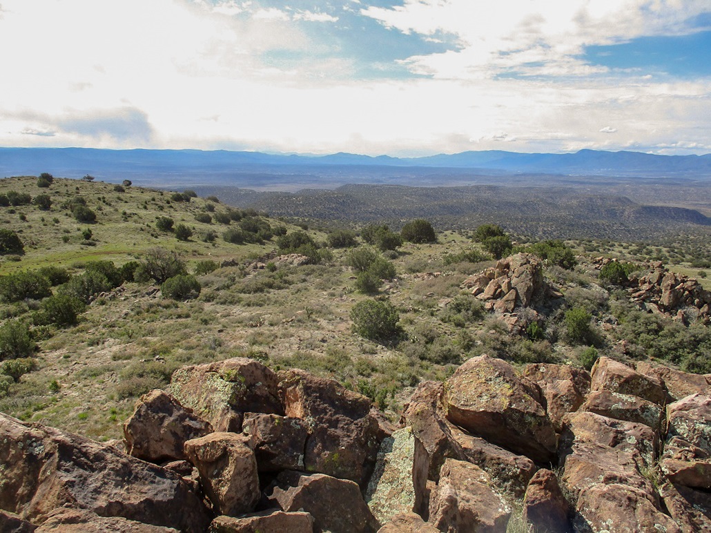
I then followed tracks up another 60 feet, gaining the summit rocks. The last dozen feet was up the jumble of rocks, tagging the two or three that looked highest. I then took a break nearby. It had taken me exactly two hours (give or take five minutes) to get here. The weather was holding up and it was cool, a little breezy, but sunny above. The thicker storm clouds were still on the plateaus north, east and southwest of me.
I looked for a register but found nothing. A few people had scratched their names into the rocks. I could make out one from 1976. I also looked for a benchmark, since the map shows a triangle at the summit, indicating a possible marker. I found nothing at the top. The views from up here, not surprisingly, were amazing, especially looking down into the Red Rocks surrounding Sedona. In all directions I had great views. I spent about 20 minutes up top, snapping images and also inspecting two other rock outcrops for any possible markers. I found two rocks with suspiciously-round holes in them which may indicate a marker that was once dug out.
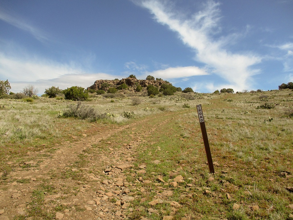
Hiking down, I kept to the road, which according to a marker down low, says it's not a road. Whatever it was, I hiked down on it, and stayed on it until it merged back onto the main track. In retrospect, I probably should have stayed on the road, as I cut off negligible distance going cross-country, but probably not any time doing so.
Once back on FR-9952, I just walked and walked and walked. Back at the earthen tank, a Polaris quad came running up from the south on the other road, the first people I'd seen all day. Then a little later, I met a couple hiking. They were just going as far as the junction near the tank. They were the only other people I saw all day. I was back to my car at 11:50, a four-hour hike overall, the outbound hike taking about an hour and forty five minutes.
I changed into looser clothing and drove out, back to Beaverhead Flats Road. I followed this road north to AZ-169, which fed me back to Interstate-17. The day was still young and I was interested in exploring the Mormon Plateau and maybe hike another short bump on the way home. If not, the drive would be fun. I went north in Interstate-17 about 8 miles, then exited at Stoneman Lake Road, then followed that east, gaining a thousand feet onto the west edge of the Mormon Plateau (essentially the plateau southeast of Flagstaff, north of Payson, a sub-plateau of the Colorado Plateau).
The clouds were much thicker up here, darker and more ominous, and the temperatures falling fast, into the 30s again. It was apparent I would not be hiking any more, but I still wanted to enjoy the drive. The pavement on Stoneman Lake Road ends at a T-junction. The next eight miles gains another thousand feet, circling around Stoneman Lake itself, then feeds out to Lake Mary Road, which is paved. I could see low clouds, virga and actual rain, and it did drizzle a little on me. I was concerned the road may get slick, but it was fine, and I was able to get to Lake Mary Road, where, ironically, it was actually sunny!
I then proceed southbound, where Lake Mary Road meets highway AZ-87. Conditions were stable, a little more cloudy, then sprinkly, then drizzly ... then little flurries of snow, just the soft wafting kind that melts on impact. My car's thing that tells temperature said it was about 35 degrees outside. I got to AZ-87 in good shape. I was thinking no problem, just a little weather is all.
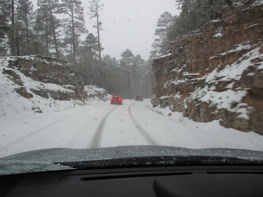
It was much darker here, much more gloomy. I got in behind a line of cars, and the highway gains elevation here, about 400 feet to top out about 7,600 feet. There was fresh snow on the ground, but still just a light layer. Then bam, within a space of 200 feet, things went south fast. What was just a light sprinkle of snow turned into a full-on localized blizzard. The stuff was collecting on the roads, on the hillsides and on the cars. My wipers could not move fast enough to keep it off!
We all slowed to a crawl, about 10 miles per hour. I was in a clump of cars, the third in line behind a blue SUV and a red hatchback-sedan of some sort. Behind me was a guy pulling a trailer, behind him was another 3 or 4 cars. The blue SUV was mashing in a path into the snow on the road, and we would do our best to stay in that path. At first this worked fine, but soon, it wasn't working so well. The mashed snow was slick and icy, and traction was spotty.
We all came to a slow stop on a slight downhill. On the uphill lanes, a small truck was stopped, his hazards on. He could not gain traction to go up the hill. He would spin his tires and just yaw a little, which was no doubt terrifying for him. At worst he would have slid into a ditch, not off a cliff. But still, that is not a good feeling. Another vehicle had pulled beside him to help him. He was in our lane so we could not move.
In stopping, I had a few seconds of concern, when I could feel my car still sliding ever so slowly downward! I was about twenty feet behind the red car, and I finally "stopped"... to where I wasn't sliding. We waited a few minutes to see what would happen. Meanwhile, the snow is barrelling down heavily. Finally, that other car eased past the small truck, back into his own lane. We then eased past the poor guy. Frankly, as long as he did not move, he was safe.
I turned on the "X-mode" for the first time in the car, a Subaru Forester. This essentially treats each wheel independently and is similar to driving in 4-wheel drive low. We crept along at 5 m.p.h., which was just fine, and I had good traction, not once spinning or yawing. I could feel the car's energy in the tires. It felt reassuring. Truthfully, I was rather concerned we might be stuck here for a few hours too!
Our clutch of cars moved forward slowly for another three or four miles, which at our speeds meant about another fifteen or twenty minutes. I was studying my driving partners. The blue SUV had trouble keeping to a lane but given how snowy it was, it was forgiveable. The red hatchback wandered everywhere, not staying in the mashed tire tracks, often cutting into on-coming traffic. His behavior was bizarre. The guy behind me kept his distance and I got the impression he knew exactly what he was doing.
We finally dropped some elevation to where the snow eased into rain and the snow on the ground was not as thick. This was just before the AZ-87/260 junction. The red car immediately swerved past the blue SUV and passed him, almost running into oncoming traffic. He then took off in a blaze ... only to get caught behind another car up ahead. What a horse's ass. I eventually lost sight of that turkey.
For the drive down off the rim into Payson, I was behind that blue SUV the whole way. All of us had lots of snow on our cars, falling off in big clumps. The blue SUV never could stay centered. He'd drift into oncoming traffic a few feet, then back, then ride the center-yellow with his left tires. He'd speed up then slow. I stayed behind him a good distance, not tailing him and no real chance to pass him. It occurred to me he may have been drunk. There were lots of people camping up on the plateau and probably drinking as well. I followed this guy all the way into Payson where he pulled into the Home Depot on the north end of town. He took so long to make a simple right turn that yes, I was convinced he was probably drunk. That was a reassuring thought.
I was home not long after. In Payson, we just had low clouds and cool temperatures but no rain or snow. I was home about 2:30, and spent the rest of the day relaxing and napping. The drive through the snow was far more than I was ever expecting! I need to gain experience as I now live up in the higher elevations. Still, it was quite a ride. I was pleased how well the car handled it in its X-mode.
I looked online, and yes, the highway was eventually closed. I hope that poor guy was able to get moved somewhere safe. The snowy portion covered just a span of five or six miles, a highly-localized storm cell. But that's all it takes. Once it dumps like that, it can stop you in your tracks.
|

|