The Mountains of Arizona
• www.surgent.net
|
| Cerro Hueco |
• Springerville Volcanic Field • Arizona State Trust Land • Apache County |
|
Date: May 28, 2023
• Elevation: 7,358 feet
• Prominence: 467 feet
• Distance: 5 miles
• Time: 2 hours
• Gain: 680 feet (gross)
• Conditions: Sunny and warm
• Wildlife: Rattlesnake
Arizona
•
Main
•
PB
•
LoJ
•
Interactive map
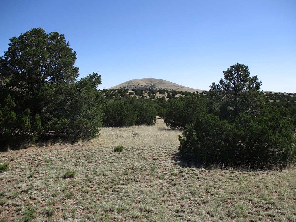
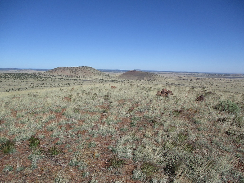
Cerro Hueco is a mound formed by volcanism, one of many such peaks found on the Springerville Volcanic Field in eastern Arizona. Almost all of the peaks on this large volcanic field were formed by individual single-event (monogenetic) eruptions, leaving behind symmetric cinder cones all roughly of the same size and shape. However, there are exceptions. For example, the Coyote Hills, which rise north of Springerville, is a shield volcano, formed by multiple magma flows creating a peak with an extremely broad profile. What looks like "hills" is just one very spread-out volcano.
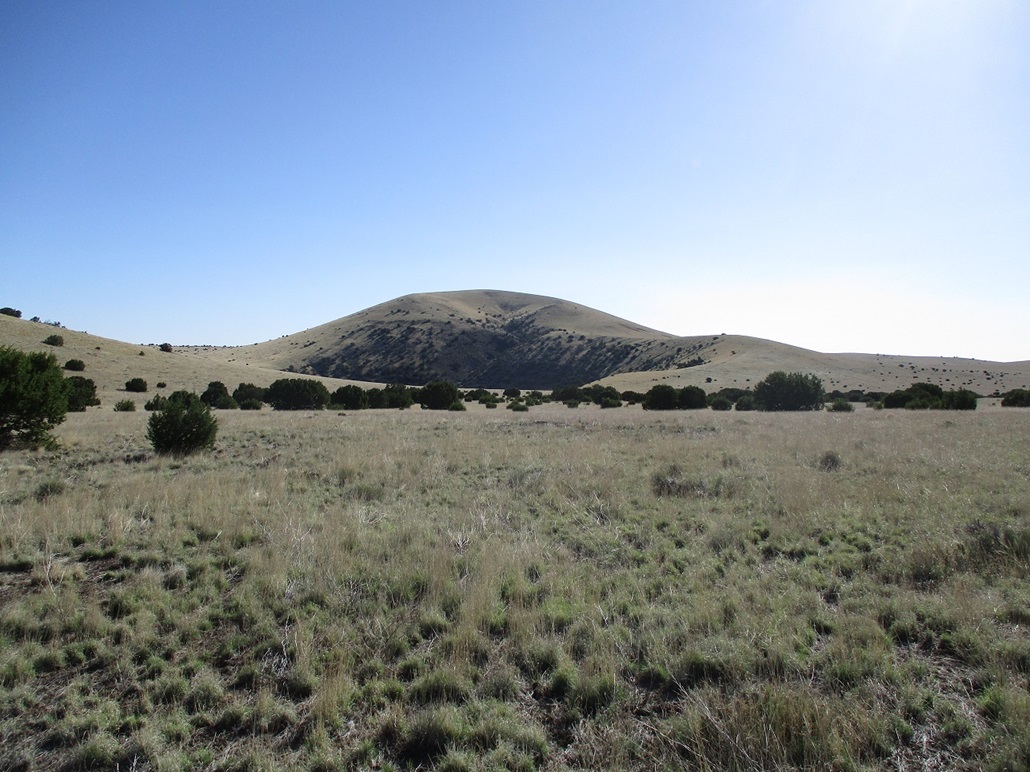
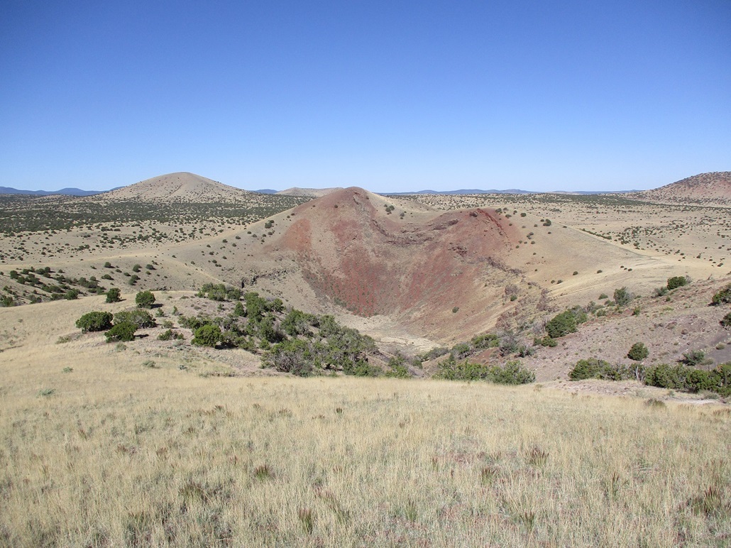
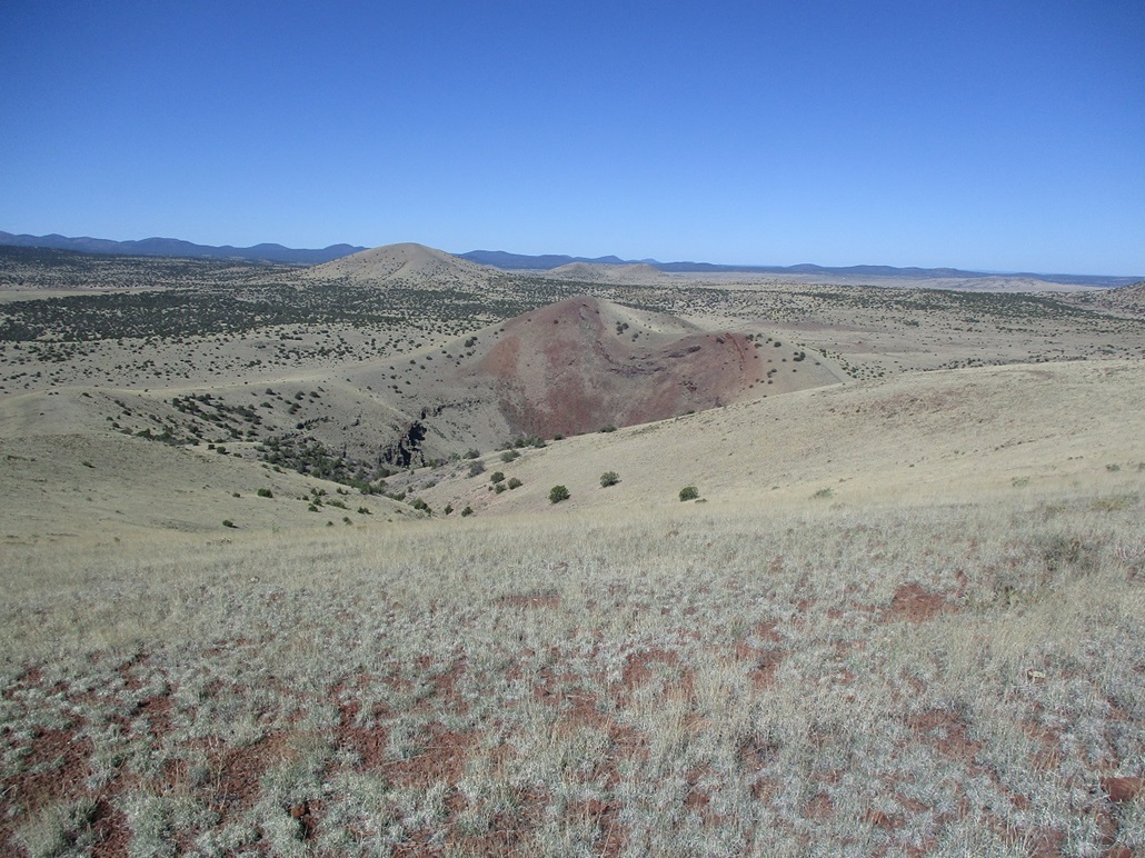
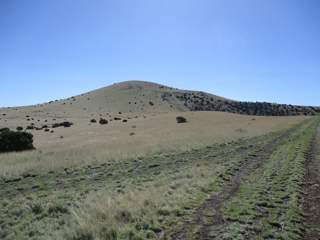
Then there's Cerro Hueco, which was formed by a maar event, where underground water got into contact with magma. This caused an explosion, leaving behind a crater. The stuff that was exploded upward fell and formed into two hills: Cerro Hueco, the biggest and highest of the two hills, and a lower hill on the opposite side of the crater. The crater itself is about a quarter-mile in length and almost 400 feet deep. It is literally a hole in the ground, "hueco" is the Spanish word for hole (or gap, or other synonymous words).
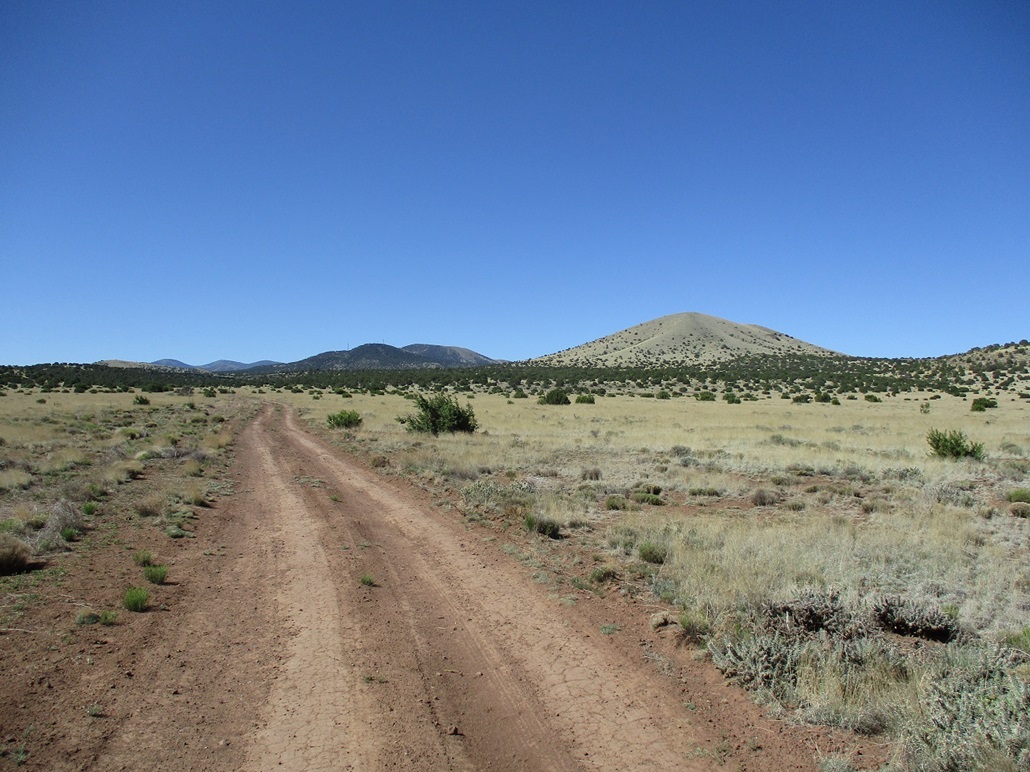
The peak and its accompanying crater lie about four miles north of highway US-60 between Show Low and Springerville. It is on the northern fringe of the volcanic field, as the land flattens heading north, this being a lot of undeveloped rangeland and ranch properties. The land is State Trust, meaning one needs a permit to get on (I have mine). It is leased to ranchers who run cattle on it, and not particularly attractive for general recreation. Thus, no one ever comes here, unless they make an effort to come here.
For me, the hole is interesting enough to make the effort to get here. Maar craters in Arizona are relatively uncommon, and I think this would be my second one I've ever visited within the state, Rattlesnake Crater being the first. I was on a three-day vacation to the high country, staying two nights in Springerville and tagging as many summits as I could. Cerro Hueco was one specifically on my to-do agenda, and I had it placed toward the end of my long weekend.
It's warming now, with temperatures at these elevations in the 80s during the day, which means the snakes are active. I left my hotel in Springerville early this morning and didn't have to drive far, maybe 20 miles along US-60, to the gate alongside the highway that leads onto the State Trust lands. I opened it, passed through, closed it, and started driving north. The peak could be seen, but not the hole yet, of course.
Roads on the trust lands are always a gamble. On the satellite they looked "okay". Now on the road, it was chunky and bumpy, but it went. No big rocks or barriers. I went left at a Y-split, this road now heading northwest, then more northerly. The road was not the best here, a few stretches of rocks and uneven tread. And cattle, who stand in the road and watch me, wondering what I'll do next. I just drove slowly and let them run away... in the road. Eventually, they all moved to the side. The road improved a little afterwards. I got in about three miles, coming to a lip where the road drops about 150 feet down a slope. This stretch was too haggard for me to trust my Forester on it. I wasn't far from the peak, just two miles on a direct line. So I pulled to the side, got properly attired, and started walking at 7:20 a.m., the day sunny and clear, temperature about 60 degrees.
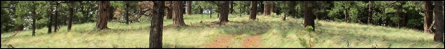
I walked down the road. A larger vehicle with beefier tires would be fine on it, 4-wheel drive probably not needed but nice to have. I got in maybe a half mile, then left the road and started a long bee-line toward the peak. The terrain was spotty piñon and juniper, and low grass with plenty of dirt spaces in between, and the usual low cactus. The sun was bright and warming things quickly. I was mindful of snakes.
I got up and over one very gentle hill, then aimed for a fence that parallels the hole. I found a spot to step over it, then started walking along the crater's rim, heading northeast toward the closest ridge of the peak. The crater itself looks pretty cool, with random cliffs and rubbly slopes. I had no desire to climb down into it. Viewing it was enjoyable enough.
Even though the grass was low and I could see my feet and the ground most of the time, it was still quite a shock to almost step on a rattlesnake. He was stretched out, sunning himself. It was a diamondback, about 18 inches long, reddish with the diamond motif. It wasn't coiled, and it hunkered backward when it saw me, probably just as surprised as I was. Me, I was already four feet in the air, ballet-stepping to get past it and make sure there weren't more nearby. There's nothing like a rattlesnake to motivate me to jump. I could dunk as well as Dr. J. if I played on a court full of rattlesnakes.
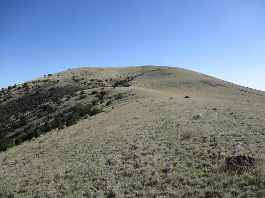
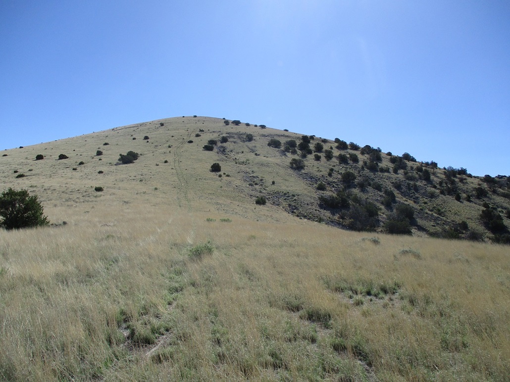
I wasn't going to let one snake ruin the hike for me. But I was super vigilant from here on out. I baby-stepped the entire way and scanned the ground for snakes. I did not see any more, but they're out there. I probably walked by ten more who were just a few feet to one side for me to notice. The climb to the top is along a very gentle and consistent slope, the top being bare except for a rock cairn. There was no register. I snapped a few images and looked into the crater, although the better views were from slightly down off the summit rather than from the summit itself. I didn't really stop. There was nothing to sit on, nothing to sign in on, and I wanted to keep moving.
I descended off the opposite ridge. The plan had been to walk around the rim entirely, climbing that lower hill on the opposite side in the process. However, I wanted to get myself back on open tracks as soon as possible and there just happened to be one nearby the northern perimeter of the crater. The descent went fine, being steep and rubbly in spots. I saw no more snakes and was relieved to be back on a track.
This worked out just fine. It added about a mile to my hike, but it was all wide road, where any snake should be easier to spot. I enjoyed the solitude and the views. There are a few more peaks back here I want to tag some day. I actually had plans to hike up Peak 7502 to the west. It's a more traditional conical mound, but covered in grass, and today, in snakes probably. Oh well, no big loss. I was pleased to climb Cerro Hueco and stare into the hueco. For the walk out, I had to regain the 150 feet I had lost when I had to descend the road coming in. The round trip hike covered about 5 miles and took me 2 hours.
Since I had a day still open, I chose to head south and tackle some more peaks that way, about a thousand feet higher in elevation where there should be more forest to mitigate the sun, and fewer snakes to mitigate the paranoia about snakes. The story picks up with a climb up Wolf Mountain.
|

|