|
|
|
Date: September 29, 2018
• Elevation: 1,380 feet
• Prominence: 520 feet
• Distance: 2.5 miles
• Time: 1 hour and 45 minutes
• Gain: 800 feet
• Conditions: Clear and warm, but not bad
Arizona
•
Main
•
PB
•
LoJ
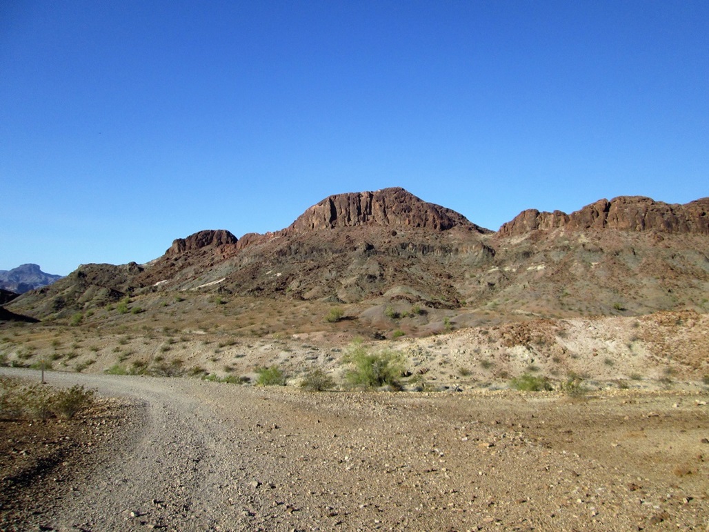
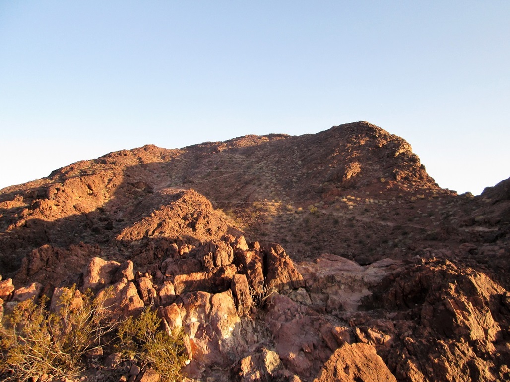
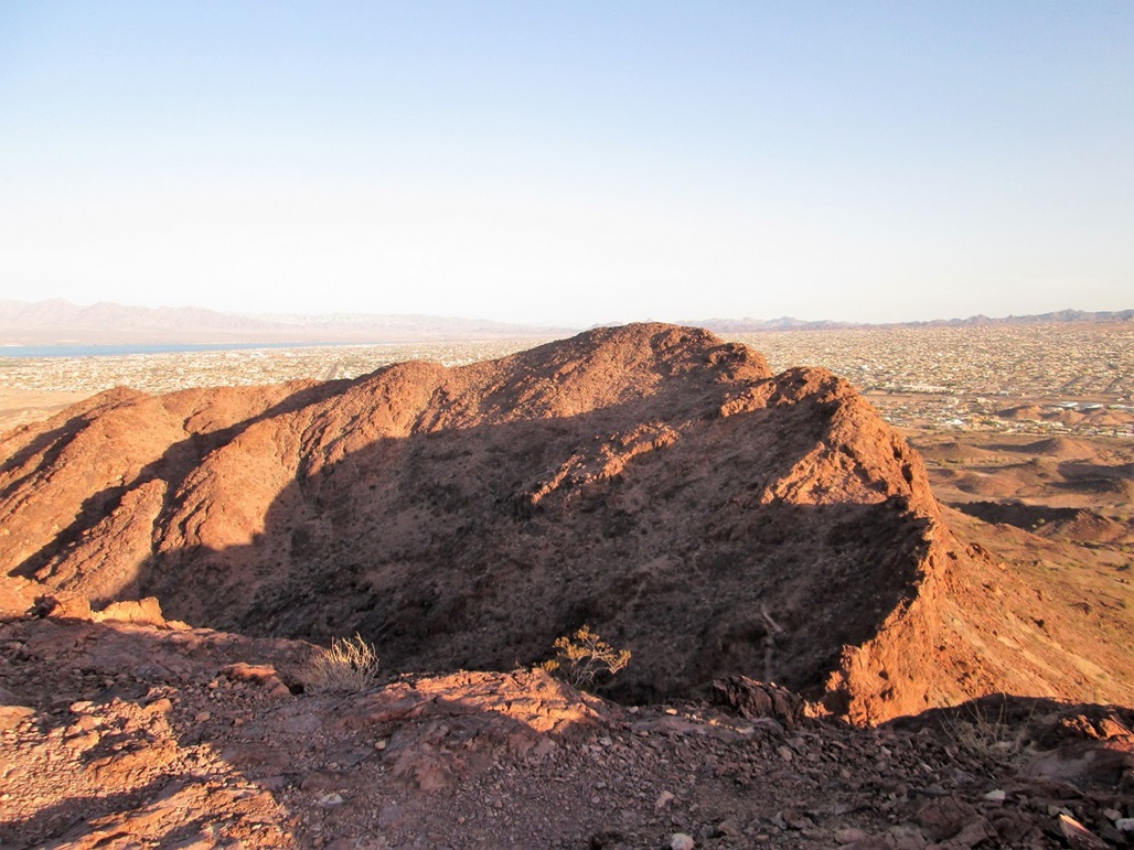
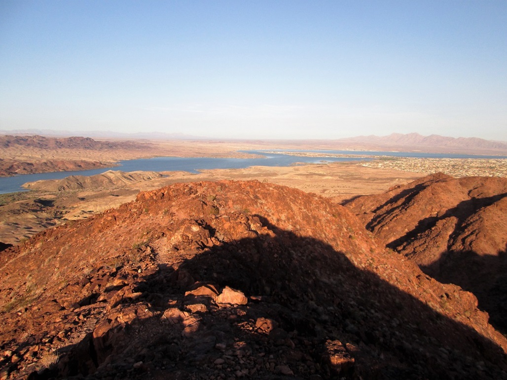
Lizard Peak is a rocky summit along the Colorado River south of Lake Havasu City. It s within a city-run park called SARA (Special Activities and Recreation Area) that features other hiking trails down to the river itself, a warren of biking trails, rodeo grounds, baseball diamonds and so on. The summit comes in at 1,380 feet above sea level. Another peak along the same ridge is close, at 1,374 feet.
I was in the area, staying at our place in Laughlin. I had maps and descriptions of this hike from various websites. I ve only been to Havasu once for fun (when Beth and I hiked Crossman Peak in 2006), so this was a good chance to come back and visit this peak, which is apparently a favorite for local-area hikers. The days were still warm, in the low 100s, but the mornings were pleasant, in the 70s, with the main heat coming in after noon. Thus, I got a very early start.
I left Laughlin at 5 a.m., and arrived in Havasu about 6, a 60-mile drive. I found the park easily, following McCulloch Road South to a small parking area about a half-mile off the main highway. There s a newer lot on the south side, and a dirt overflow lot on the north side. However, the paved lot was closed, so I parked in the overflow. Already, there were about a dozen cars here. I got my pack together and started hiking at 6:20 a.m., the air temperature about 80 degrees, going by my car s temperature-telling thing.
The peak is readily visible, about a mile away. I followed a main trail down into a sandy wash. The plan was to leave the trail at some point and hike the loop that goes counter-clockwise, achieving the summit from the north then descending south. Almost immediately, I saw a better-looking trail that seduced me. I followed it, but it was a bike path that just followed the curves of the terrain but went nowhere in particular. Thus, when I had a chance, I bailed back into the sandy wash trail. There were groups of people already hiking in it today.
I came upon a trail that leaves the wash that looked great, but the description I had said this was not the trail I wanted. It said to go another 60 feet to a big black rock, where behind that would be the trail. Well, the big black rock was more like 200 feet down range, and behind it was just a jumble of slopes and scrub. I knew I was in the right area, and I eventually found a trail. It went up and then split. So yeah, I was a little confused. I picked the turn that looked the best and hoped it would go.
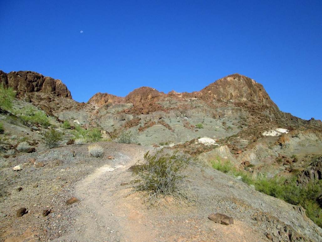
This initial stretch of trail was steep and rocky, with very little brush. In places it was weak, and I had to guess the route sometimes, but I was able to keep to it for the most part. I gained about 200 feet, now getting into some larger rock outcrops. Up ahead I could see some people way above, and occasionally see some people at the summit.
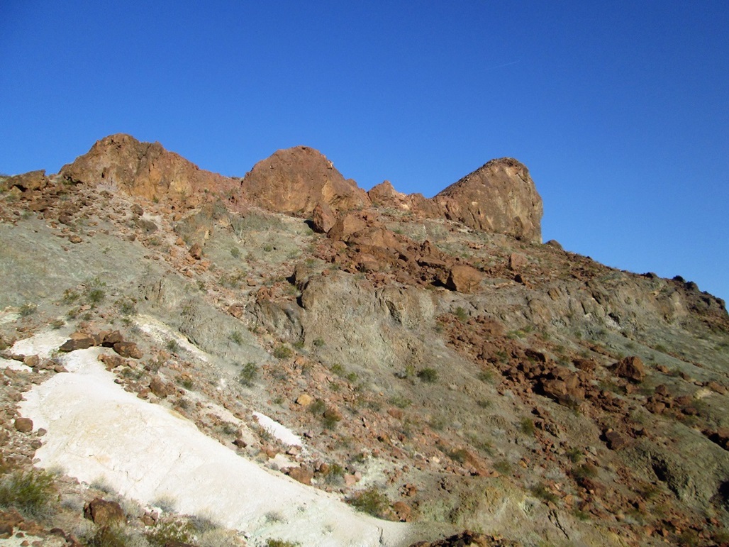
Once above these rocks, the trail becomes more distinct, but is still loose and steep. However, it is a good trail, obviously maintained and cared for. I marched up the trail to a saddle above, gaining about 450 feet from the wash below. Just below the saddle, I had to step aside for a group of about 15 young people, about ages 15-20. When I said "hi", they said something that sounded like "dog". They all had on shirts with the Norwegian flag, plus other items like caps and packs that had the Norwegian flag. I surmised they were probably from somewhere around Norway, possibly Denmark. They were friendly, and of course, the women were gorgeous. I let them all pass and walked up the final few feet to the saddle. Looking on the web later, I think they were part of a Jet Ski competition being held here.
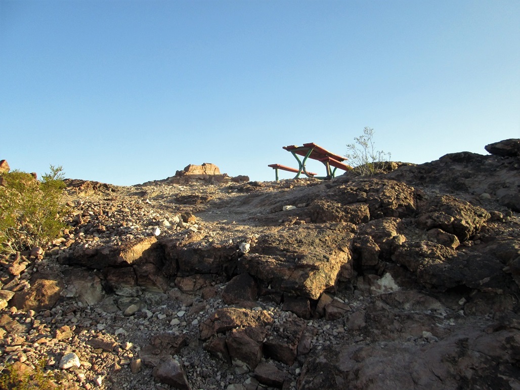
At the saddle, the summit rose to my right, and it was evident I had taken the south branch of the trail to the top, rather than the loop as I had intended. I followed the good trail all the way to the top, another 200 feet. This trail makes about five switchbacks to the summit. When I arrived, there was an older man already there. He seemed kind of out of it. He had on a pack and good shoes, so he was here by choice. But he did not respond to me. Just kind of mumbled to himself. He was starting down as I was arriving.
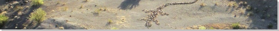
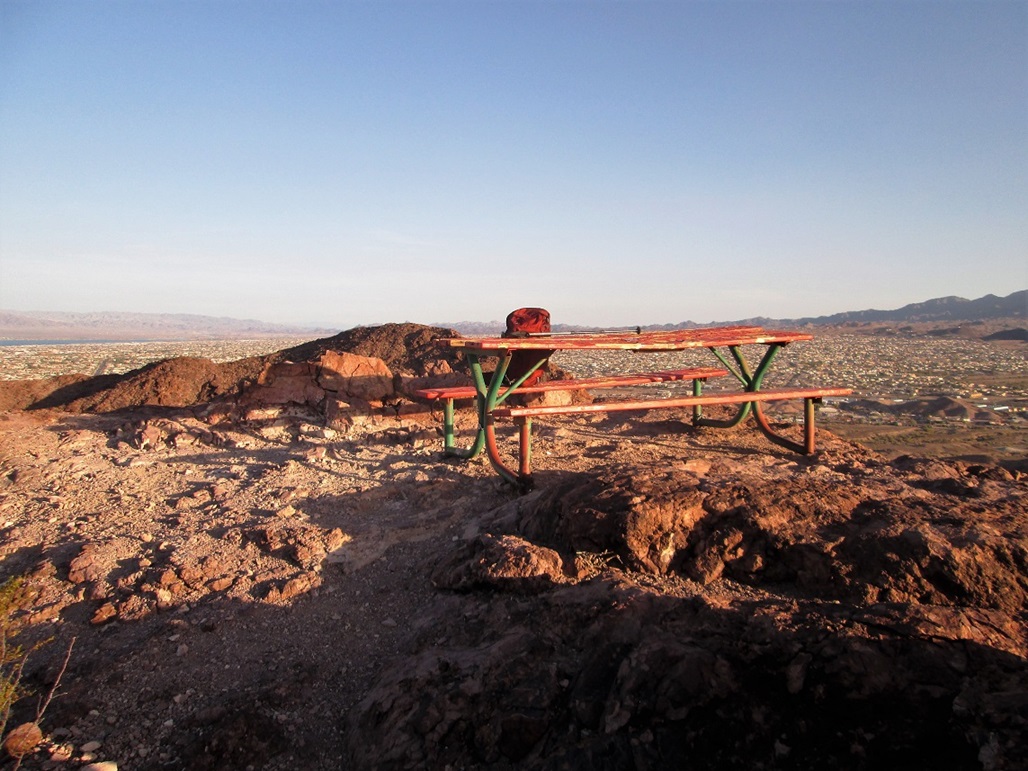
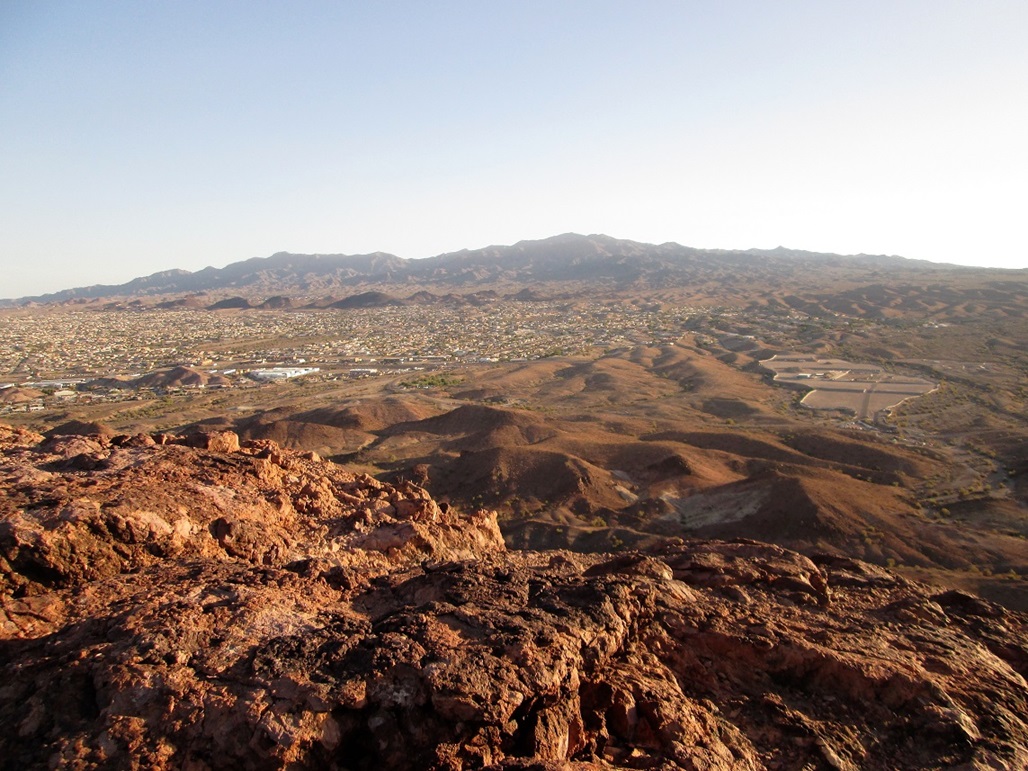
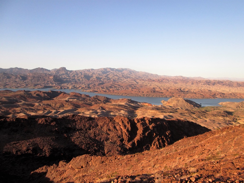
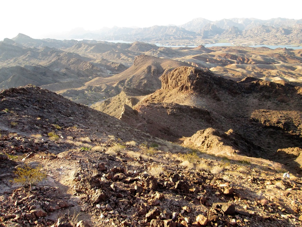
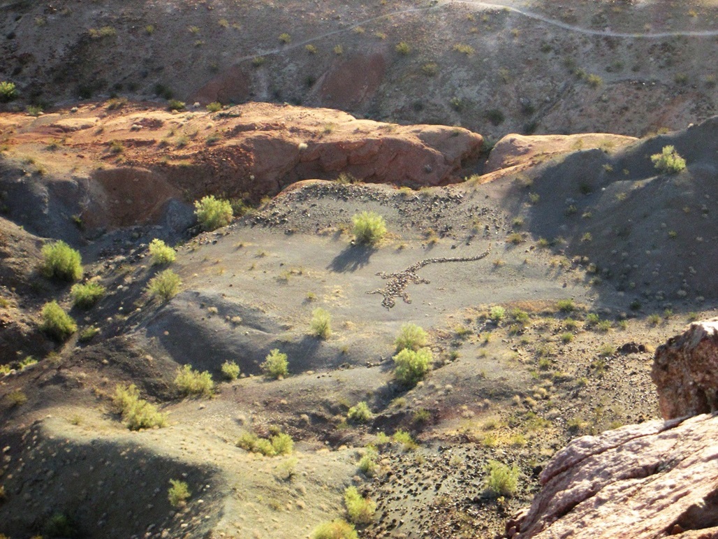
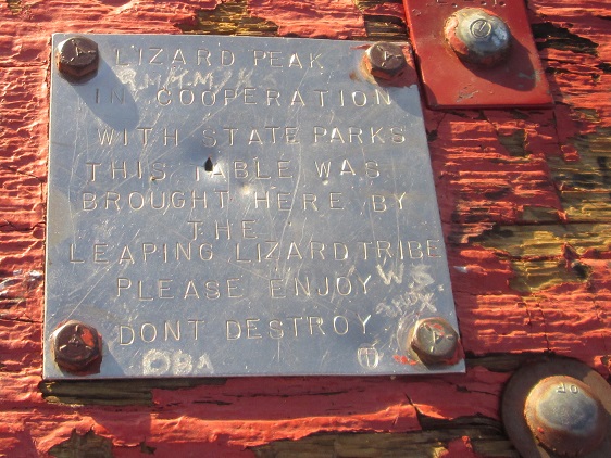
The top features a picnic table hauled up here by a group called the Leaping Lizard Tribe. According to their website, they also put in and maintain many of the trails. From the top looking straight down is a lizard geoglyph, also created by this group. They seem like an interesting crowd. I stayed up top for about 10 minutes snapping photos and enjoying the views. The views in all directions were great, with low sun making for great shadow effects on the mountains and surrounding terrain. It had taken me a little under an hour to get here, with about 750 feet of elevation gain.
I then started down, choosing to exit the same way I came up. That man was not far below me. He was moving at an extremely slow pace. Suddenly I hear scraping and a thud sound and see him sprawled out on the ground. Fortunately, it looked like he just slipped as he got back up soon thereafter. I caught up to him after a few minutes and passed him. He never even acknowledged me.
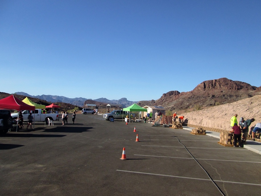
My descent back to the wash went quickly, and from there, the uphill hike (about 60 vertical feet) back to the cars went fast too. When I arrived back, I was surprised to see about a hundred people and information booths everywhere. It may have been the BLM s National Public Lands day, which was September 22 this year. This was, of course, September 29. Maybe it was a week-long celebration. I hung around and talked to some people, plus helped two women pick up items after their booth was blown over by a strong gust. I did not linger and was soon back in my car, heading home.
I enjoyed my hike up to Lizard Peak, happy to have hiked after only discovering it a few days earlier. It s a hefty little hike and I got a good work out, and the views were outstanding. I recommend the hike to anyone passing through the area. Summers get obscenely hot here, but even as I returned to my car, the air temperature was just in the low 90s, so in Fall and Winter, it s an ideal hike.
For the drive home, I followed some roads I had never been on. I went north on AZ-95 to interstate-40 (these I ve been on), then exited at the Golden Shores/Topock exit and followed the old Route-66 road, now just a small frontage, north and paralleling some railroad tracks. Here, the road wiggles along the river through the marshy shoreline, passing through homesteads with the feeling that this is the land that time forgot. It seemed like once Interstate-40 opened in the 1970s, everything here just stopped, frozen in time. I enjoyed it. This road then led to AZ-95 again from Needles. From there I just went straight back to Laughlin.
Tomorrow, I would tag four hills in and around Williams and Flagstaff, starting with Moore Hill.
|