The Mountains of Arizona
• www.surgent.net
|
| Middle Mountain |
• Ninety Six Hills • Arizona State Trust Land • Pinal County |
|
Date: December 9, 2022
• Elevation: 2,701 feet (2,707 feet per Lidar)
• Prominence: 311 feet (322 feet per Lidar)
• Distance: 4 miles
• Time: 2 hours
• Gain: 440 feet
• Conditions: Sunny and cool, no clouds
Arizona
•
Main
•
LoJ
Middle Mountain is actually a small batch of hills about twenty miles southeast of Florence, east of state route AZ-79. For purposes of this page, I call the highpoint by Middle Mountain. These hills appear to be part of a larger superset of hills called the Ninety Six Hills. The defunct 96 Ranch lies within the hills. The maps spell out "Ninety Six", the ranch uses the numerals.
The hills are low enough to hide well from the prying eyes of passing motorists on AZ-79. They lie about two miles on a straight line from the highway, but the desert flora is tall enough to obstruct any views, but in spots the hills can be seen. I was here a few weeks ago, but had not done enough homework regarding what route I would follow into the hills. That day, I had already hiked three peaks and was tired too. I come by here once every month or two. Unless the hills are going somewhere soon, I knew I'd have other opportunities.
I was on my way to visit my favorite lady friend, who lives in southern Arizona. The day was cool and sunny and this hike shouldn't take long, so I worked it into my itinerary. I drove into and through Florence, then south on AZ-79 to the 96 Ranch Road. I could see the hills when I looked hard enough and that told me to be looking out for the road. These roads come up fast with no warning and it doesn't help if someone is riding your bumper. The road is exactly at milepost 119, I discovered.
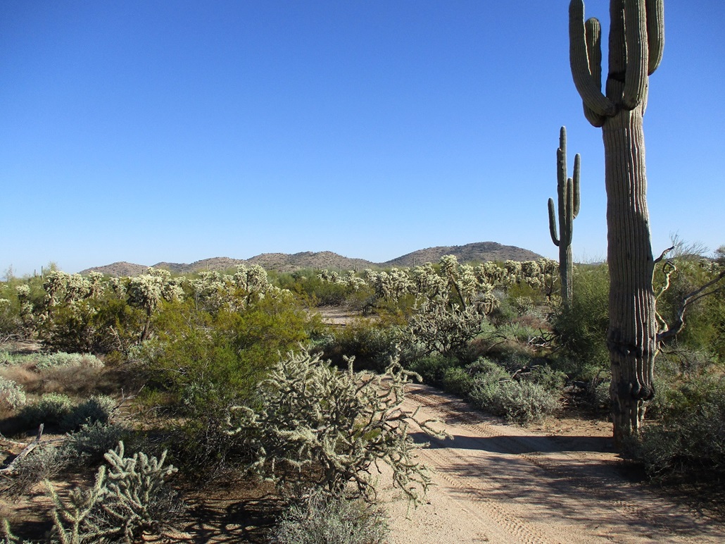
I drove in 0.9 mile to a scant track branching left (north). The satellite image shows the road goes north about 1.5 miles, then bends east and aims for the highpoint hill. I hoped to drive in some of this road, but only got in a quarter mile. A sandy arroyo crossing prompted me to stop here and park in a clearing with a fire ring. It was roughly 10 a.m. when I killed the engine, the day sunny and clear, no clouds, temperature in the 50s.
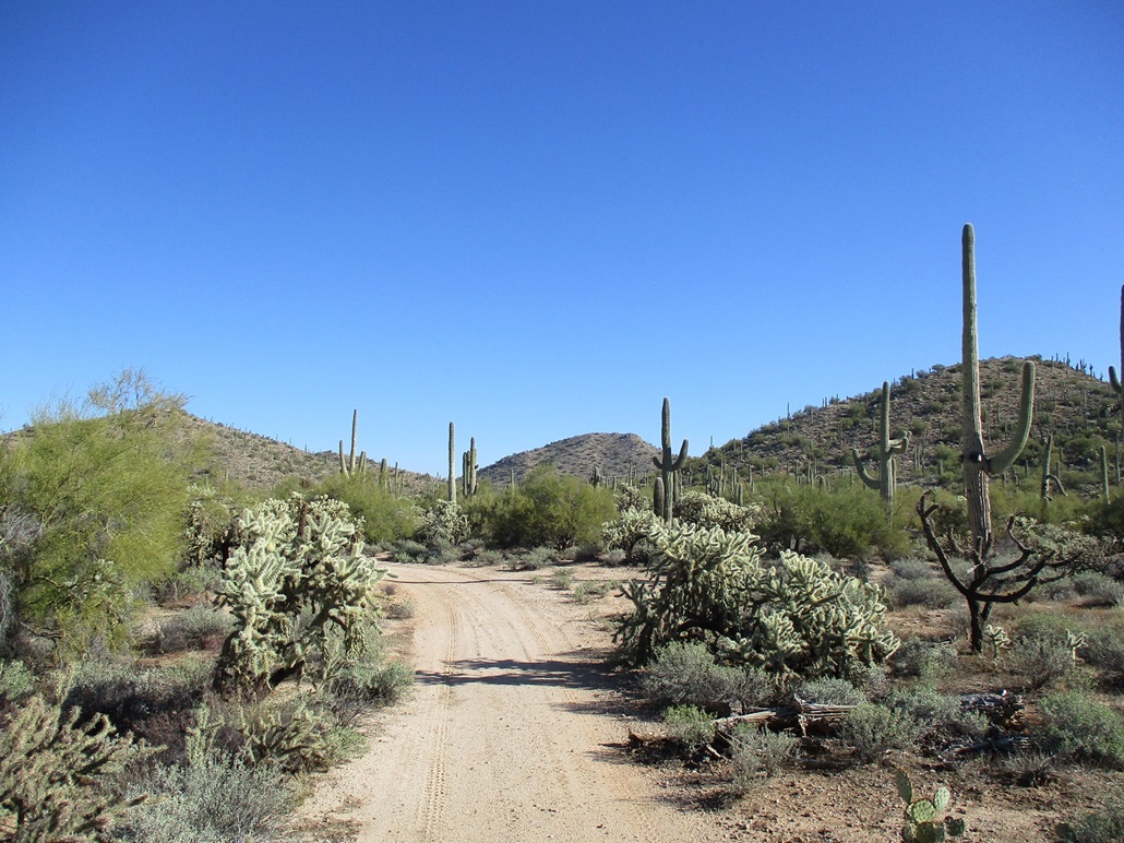
I walked the road north. A storm over last weekend dropped a good amount of rain and while it was mostly dry now, the road had about a half dozen mud pits of varying length. Every few hundred feet the road crossed through an arroyo. One would have been a show-stopper for my Subaru Forester. Otherwise, when dry, a high clearance vehicle with good tires should be adequate. There are no rocks or other ugly barriers in the road. Erosion channels are the main nuisances.
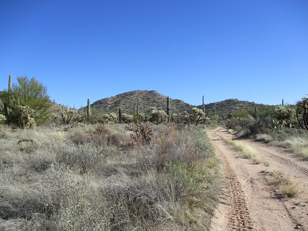
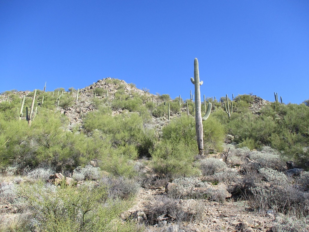
I walked the road as it bent east and finally, the highpoint hill was now in view. The road dropped into a sandy channel, a de-facto road as evidenced by recent tire tracks. I followed the channel, then easy cross country, to place myself on the hill's western slopes. The highpoint hill has a noticeable rounded rock outcrop on its apparent summit, and I aimed for that, tacking slightly right so as to meet the upper ridge a litle below this outcrop. The hillsides were steep but mostly open, the rock holding together reasonably well.
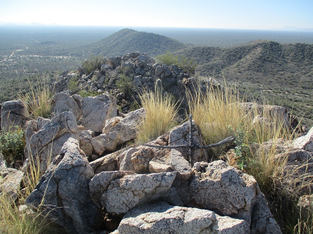
This worked well and I was now on the upper ridge and below the outcrop. I then trudged uphill, onto the lower rock apron, then easing up a jagged ledge to gain this outcrop. The scrambling was minimal. Some of the rocks were loose, which is why I took it slowly. Once on this outcrop, it is immediately evident it is not the highpoint, but the good news is that the highpoint is another rock outcrop about a hundred feet north. I downclimbed about fifteen feet, then gained the actual highest point.
The top is a jumble of rocks and a cairn holding the register. A cross made of sticks and wire lies at the summit, propped against the rocks. The register was moldy when I opened it. I made the error of looking into it to fish out the register, and breathing in the mold. All I could do is hope that my T-cells were strong enough to stave off any infections. Note to self: don't do that.
The register held a few names, some I knew, others I did not but likely locals from the area. interestingly, a monk from the nearby St. Anthony's Greek Orthodox Monastery has climbed this peak a few times, signing in each time. Other visitors have written in "hi" to this person, so I did too. He may be responsible for the wooden-wire cross.
Okay, I had no idea there would be a Greek Orthodox Monastery anywhere close to this peak. I was surprised to see this monk's entries, so afterwards, I got on the google machine and looked it up. And sure enough, there is one, not too far away, and it looks like a real nice place too. They allow day visitors. I may go check it out some day. It's pretty cool that this particular peak is a favorite of a nearby monk.
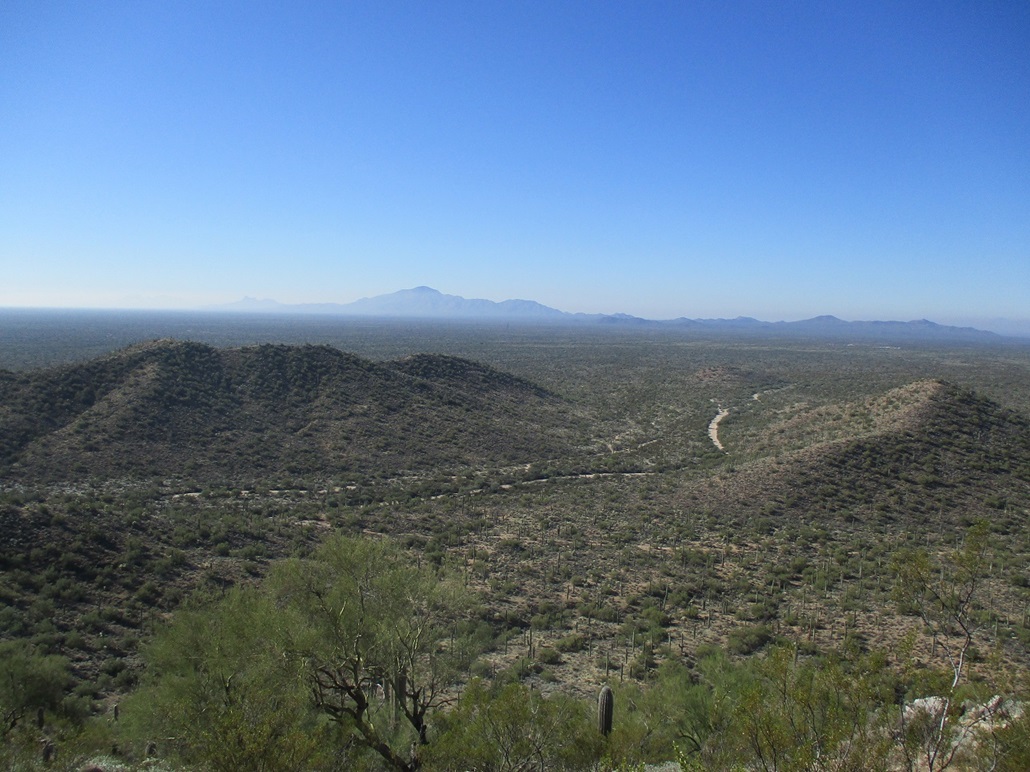
I stuck around for about five minutes snapping images and looking around. The distant peaks were bluish silhouettes, but the air was dry enough to keep their edges sharp. I also studied a slightly different route down. So for the descent, I kept to the main south-southwesterly ridge and followed it all the way down. This worked well as it was pitched very gently. Once on the road, I just followed it out to my car, a two-hour round trip.
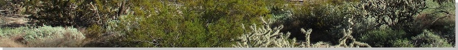
I was in no hurry so I took time to change and relax. The desert flora here is very lush and abundant, with saguaro, creosote, palo verde, brittlebush, cholla, and grasses of all kinds. It's actually quite pretty back here. This whole swath of desert between routes AZ-79 and AZ-77, between Florence and Oracle, is prettier than one would think at first. I see the usual off-roaders but they're never that many of them. What I don't see are those obscene 35-foot, $200,000 shiny poop-haulers driven by people who like to "rough it".
From here, I got back on the highway, then onto Interstate-10 through Tucson where I ran some errands, then from there, to my destination. A day later, a storm came through and dropped about three inches of snow there, which was a nice surprise.
Middle Mountain was a pleasure to hike. It's not difficult, the off-trail parts are easy, it's unlikely you'll see anyone else, and like I mentioned, it's pretty desert here. Take time to admire the cactus and bushes and how healthy it all looks. I also suggest a visit to the monastery. Look them up online. Next time I'm passing through, I may drop in too. Why not.
|

|