The Mountains of Arizona
www.surgent.net |
|
Newman Hill • Francis Crater Yesterday -- Sunday -- I intended to drive up to the Mogollon Plateau above Payson and car-camp for the night. I did not have a definitive plan except to get up on the plateau then figure things out. I got as far as Stoneman Lake Road, then followed it west past Stoneman Lake, then followed decent forest roads southwest toward Apache Maid Peak. It was about 5 p.m. and calm for the moment, although the day had been active with storms. I figured I would camp here and hike the road up Apache Maid the next morning. I tagged its summit back in 2008 but that was after driving up the road to the top. I wanted to properly climb Apache Maid this time. I got back in my car to locate a camping spot, and saw the low-tire-pressure icon lit up on the dash. I got out and took a quick look at the tires and they looked good. I assumed one had a slow leak. Not wanting to take chances, I drove back out the road to Stoneman Lake Road, got onto the paved portion and found a spot off to the side to inspect things. That's when I could hear the hissing. The driver's side rear tire was losing air fast. I had no choice but to change the tire right now. The spare was a little "bicycle" tire, suitable only for emergencies with directions that it should not be driven on for more than 50 miles or exceed 50 miles per hour. As much as we like Subaru vehicles, to supply the driver with one of these wretched spares is frustrating to say the least. A full-sized tire would not be too much to ask and certainly be safer than driving on a subpar spare. Anyway, I got it put on, got filthy in the process, and decided to bail the area altogether and head to Flagstaff. It was a Sunday evening and traffic was light. I went back up Stoneman Lake Road to Lake Mary Road, going slow with my hazards on, and slowly (40-50 m.p.h.) drove into Flagstaff. I got a hotel room for the night. The next morning, I was up early and drove to the Subaru dealership to get my car first in line. Obviously, I had no appointment. I was there early and surprisingly, a guy comes out and helps me, gets my info and takes the car in, all this a good thirty minutes before they officially opened. I sat in the waiting room and about 90 minutes later, they had patched it and I was on my way. It was about 9 a.m..
Date: August 2, 2021
• Elevation: 8,503 feet
• Prominence: 425 feet
• Distance: 2.5 miles
• Time: 75 minutes
• Gain: 805 feet
• Conditions: Sunny and warm with clouds building
Arizona
•
Main
•
PB
•
LoJ
•
Interactive map
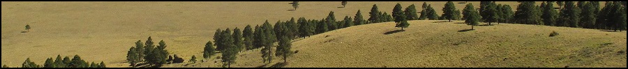
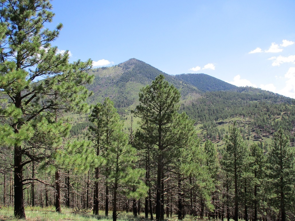
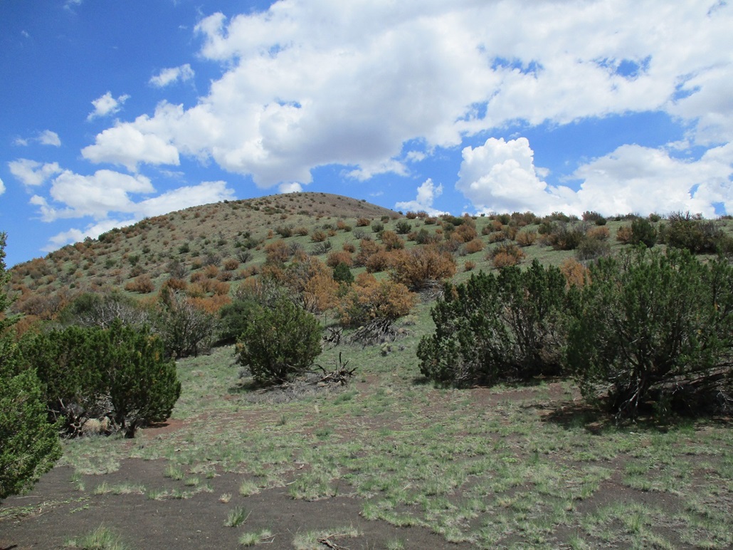
The past few weeks in Flagstaff have been very wet, with daily heavy thunderstorms and rain showers, much more than average. Yet now, the sky was clear and the air dry. I had a few hours open, so suddenly, I looked around for something to hike. I had no maps, but immediately thought of Newman Hill, which lies southwest of Kendrick Peak. I knew how to get there, where to park and what roads to follow. I could do this all from memory.
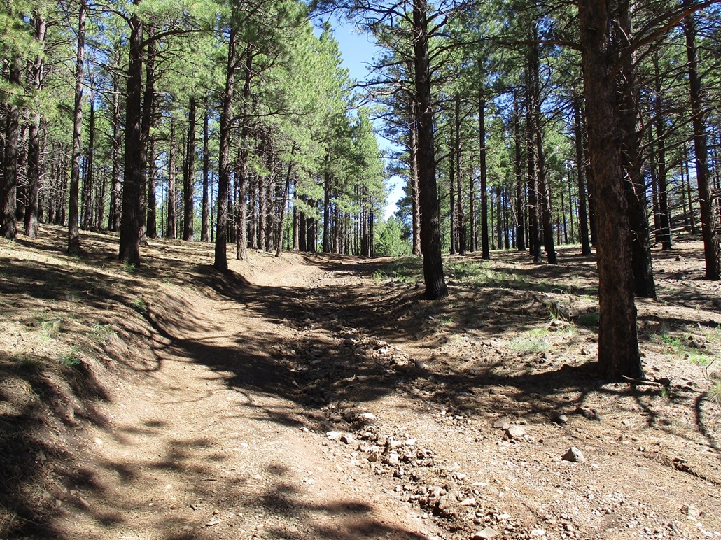
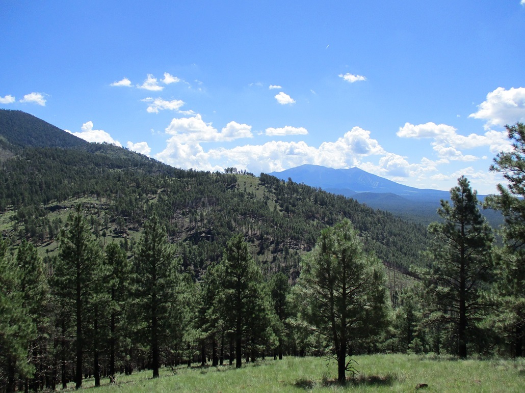
The drive took about 45 minutes. I exited off US-180 and followed Coconino Forest Road 193 west to Kaibab Forest Road 171, then that north and west to FR-190, which goes north to the parking area and trailhead for the Kendrick Peak Trail. When I pulled in, there was just one other car there. Now it was close to 10 a.m., sunny and warm but still calm above me. Some clouds were forming above the highest peaks for now.
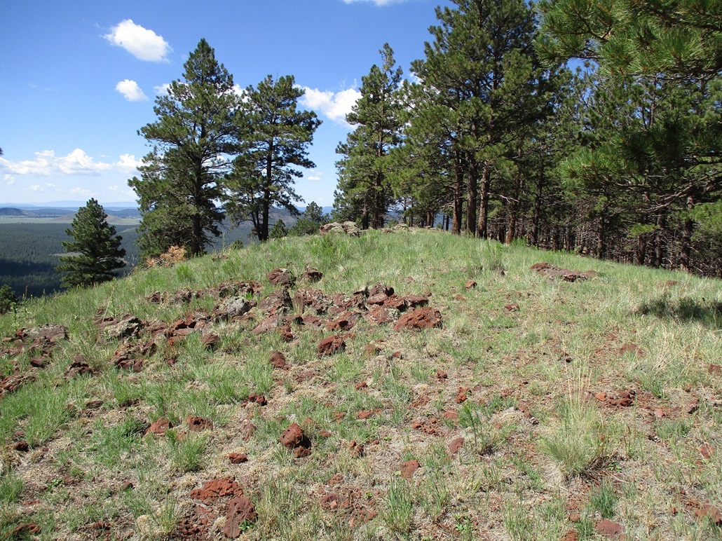
I walked north on FR-190 past Bald Hill Tank, going as far as the road's apex at the pass connecting Newman Hill to the main Kendrick Peak massif. The road walk covered about a three-quarters of a mile with about 300 feet of gain.
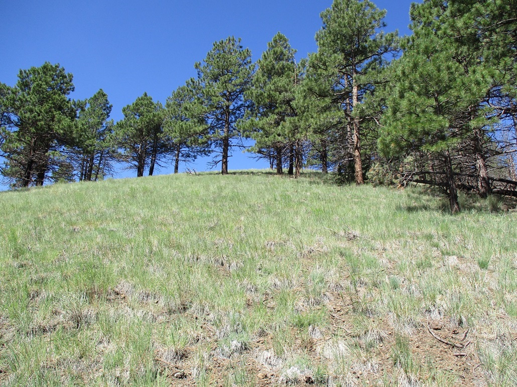
At the saddle, I expected there to be a track going west up to Newman Hill's summit, and there was, but only for about a hundred feet. It quickly petered into nothingness, but that was fine since the forest here was more open, with a couple open grass slopes, so that navigation was trivial. From the saddle, it's a 425-foot gain uphill to the grassy top. I found a cairn but no register. I didn't look that hard either. The top was open with great views all around me. Puffier clouds were forming above Humphreys Peak and nearby Kendrick Peak.
I hiked south along the summit ridge to inspect a slight rise, but the north summit was definitive. I then hiked back to the north summit, and started down hill. The hike down went well, and I took my only break in the shade of a ponderosa to text my wife and have a drink. I was soon back to the road, then back to my vehicle.
The hike took just an hour and a little extra, and I was moving fast in case the storms developed, which they can do quickly up here. But nothing ever did. I drove back to the highway and took a look at Peak 8450 near the Nordic Cross-County Ski Center. There is private property on its north which blocked access, and I did not see anything obvious for access from the highway. So I skipped it. I drove back into Flagstaff at roughly noon, and with time to waste. What to do.
I pulled into a minimart on the east end of town and stayed there for the better part of an hour. I bought some drinks, and looked up a few things on my smartphone. I decided to inspect Francis Crater, east of town. I was not super-confident I'd have any luck on it today, but the roads proved to be better than expected and the weather, while hot by now, stayed calm. With no storms developing by noon or 1 p.m., that's usually a sign they'll lay low the rest of the day. Of course, I know better than to assume that completely, but it gave me some hope things would stay calm for at least a couple more hours.
Elevation: 6,397 feet
• Prominence: 457 feet
• Distance: 1.4 miles
• Time: 45 minutes
• Gain: 557 feet
• Conditions: Hot and humid with disorganized thunderheads
PB
•
LoJ
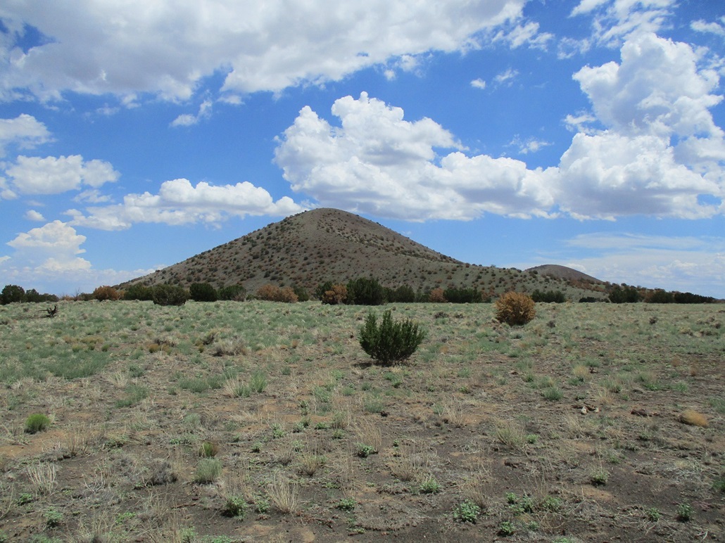
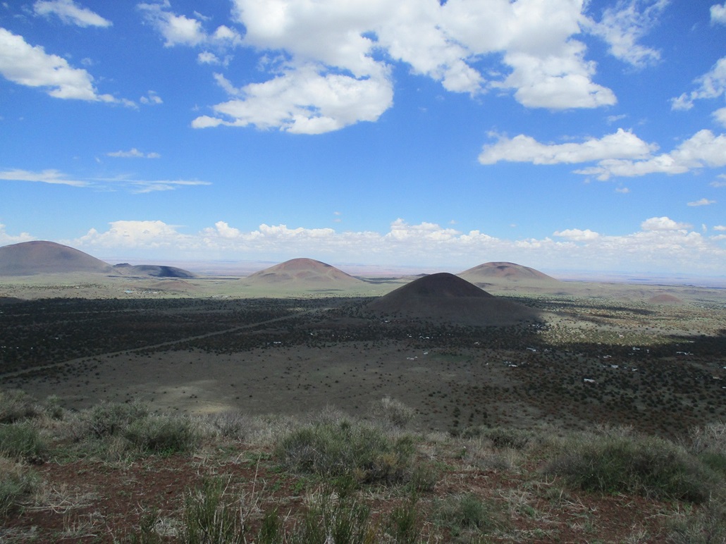
From town, I took Business-40 to the Thompson-Winona Road, then Leupp Road, about a 15-mile drive, placing me at the apex of the road south of Cochrane Hill. A gas-line access road angles right (northeast) from the main road. I followed this decent road, always following the better road at any junctions. Up ahead was Francis Crater. The road I was on was black volcanic cinder, smooth but with some washboarding. I drove until I came to a ranch property, stopping at its entrance gate. I was below Francis Crater itself, but had no intention to cross this private property to get to it.
I backed out and turned onto a scragglier road that runs underneath a major power line. This power line trends northeast, parallel to the gas-line road, and the power-line road was marginal, but passable. In about a mile or two, I was north of Francis Crater, in an area with no homes or other signs of private property. I believe I was still on the Coconino National Forest, although here the only trees were scattered pinon.
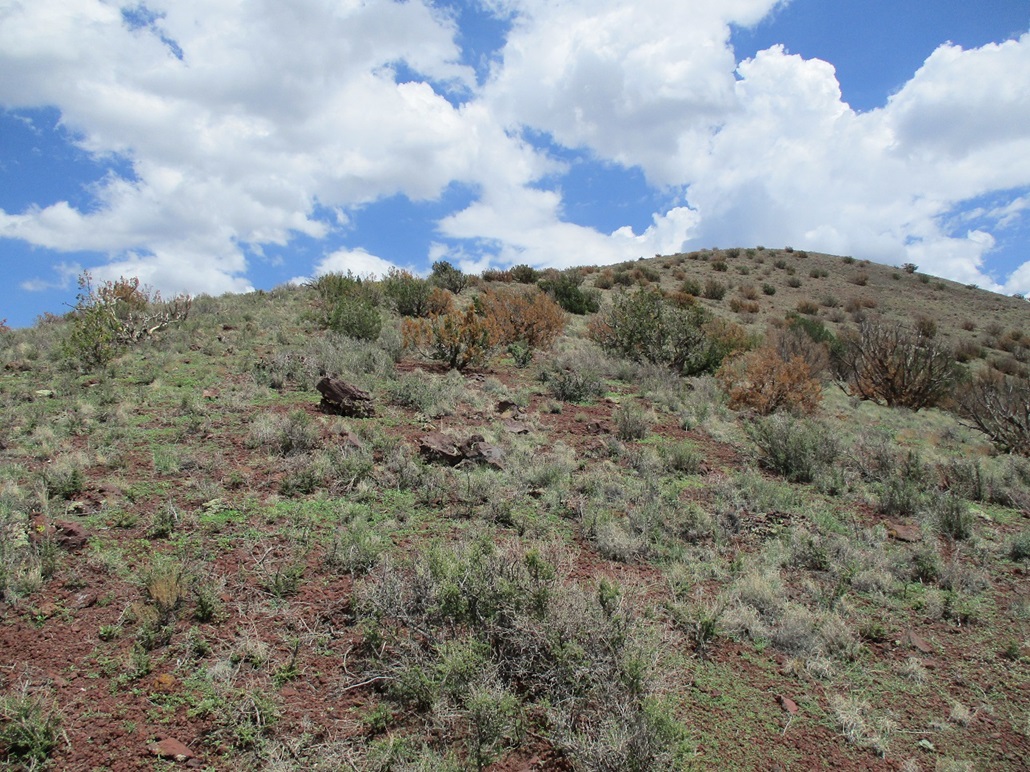
The day was quite warm, temperatures in the low 90s, and unsettled, with puffy clouds in all directions but also plenty of sunshine too. The high country had been drilled nearly every day with heavy thunderstorms for about three weeks. But it was now about 1:30 p.m. and no storms had developed, just a few weak thunderheads that seemed to collapse as fast as they formed. I was about a half-mile north of Francis Crater, so I decided to hike it now. I was pleasantly surprised to get in so close, and it looked like it would not take long.
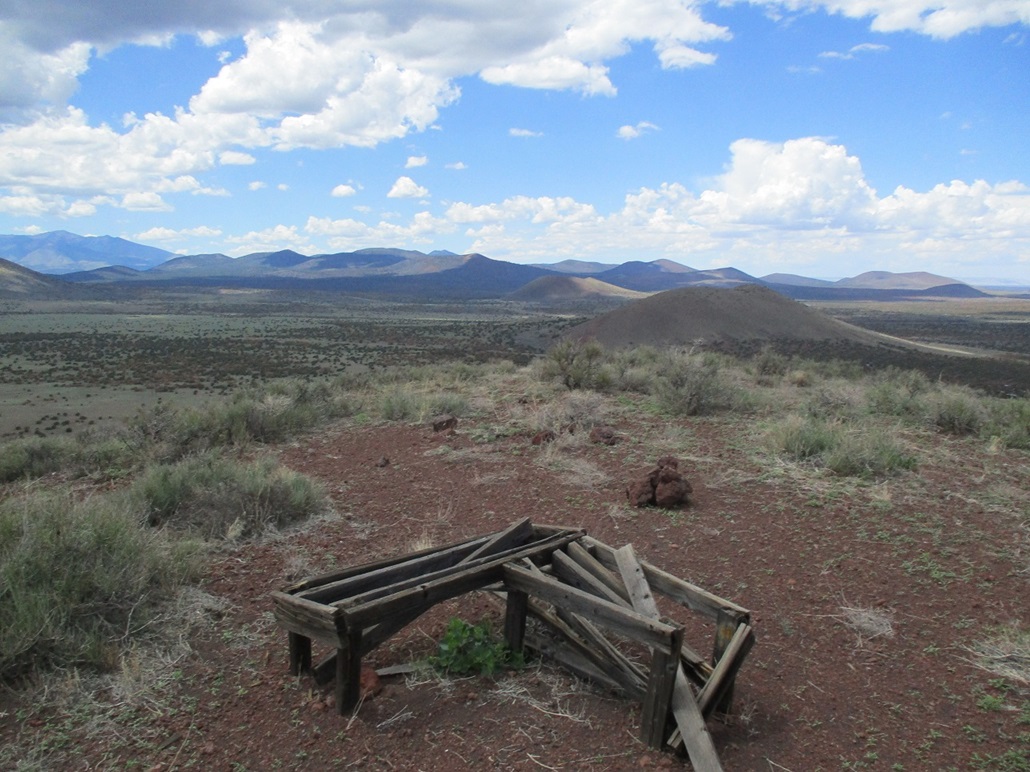
I got my pack and poles together, locked up the car and started walking, moving quickly. I walked south across the flats, then down about 40 feet into a little canyon, then up the northwest slope of Francis Crater itself. The mound is shaped like a tadpole, with a narrow ridge trending north, then west, off the summit. This is what I would follow.
I got up about a hundred feet and came upon a fence. This fence may be the forest boundary and whatever lies on the other side. There were no signs against access, but I could not tell if this was state land or private. I had my state lands permit with me just in case. I eased over a weak spot, then continued uphill, achieving the ridge quickly. (Studying a land-ownership map later on, this was a parcel of State Trust land.)
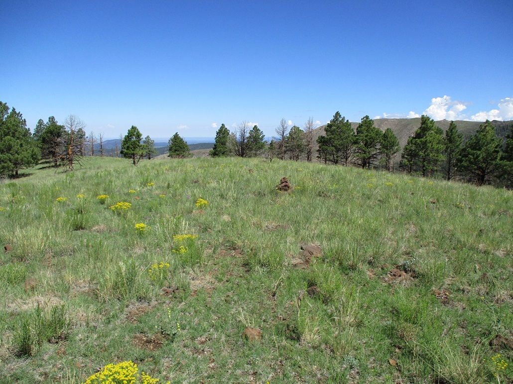
Up on this ridge I came upon a very weak path, possibly an old track. It was scant but visible against the grass and small trees, an obvious open lane up through the low brush. I moved quickly, in case the clouds started to organize. It was breezy up here too, which felt good. I was on top the hill about 25 minutes after starting. The hike had gone well and was very straightforward and easy.
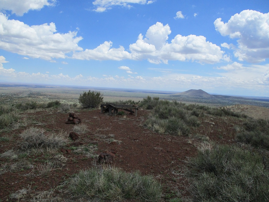
The summit features what looked like an old wooden bench, and a cairn but no register. I snapped a couple images of the surrounding countryside but did not stop once. I just tagged a few rocks and started hustling down. For the downhill hike, I jog-walked it, moving quicker than normal for me. I did not want to be up here longer than necessary in the event of a storm building. I was soon back on the Coconino Forest side of the fence, and back to my car, a round-trip of 45 minutes.
Back at the car, I gulped down a whole Gatorade all at once, got changed and started the slow drive back to pavement. It was now nearing 3 p.m. so I could go to my destination. I was pleased to hike this crater, adding it to my collection. I still have a few more ranked peaks out this way, but it was nice to tag this one especially with no real planning involved except for a lot of hope.
|


|