The Mountains of Arizona
• www.surgent.net
|
| Peak 10932 & Sunrise Peak |
• White Mountains • White Mountain Apache Nation • Apache County |
|
Date: May 26, 2023
• Elevation: 10,932 feet (Sunrise Peak: 10,682 feet)
• Prominence: 372 feet (Sunrise Peak: 202 feet)
• Distance: 3.3 miles
• Time: 2 hours, 30 minutes
• Gain: 472 feet to Peak 10932, 222 feet to Sunrise Peak
• Conditions: Beautiful clear blue skies
Arizona
•
Main
•
PB
•
LoJ
•
Interactive map
Earlier today, I had climbed Cerro Gordo Mountain a few miles to the northwest, this after driving up this morning, with a 2:20 a.m. start, from Tempe. This was the first day of what would be a three-day hiking getaway in the high country centered around Springerville, mainly tackling peaks at or above 9,000 feet in elevation.
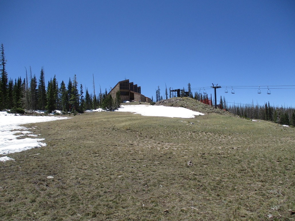
I was finished with Cerro Gordo by 9 a.m., so I drove back to highway AZ-260 in McNary, then east along the highway to where it tops out on the plateau north of White Mountain. I took the secondary highways and roads toward the Sunrise Ski Valley Area. Today was their first day of summer. They open the whole grounds to hikers and mountain bikers, many of whom take the chair-lift up to the top then hike or ride back down. That is exactly why I was here, too. I had Peak 10932 in my sights, and thought riding a chair-lift part way up would be a lot of fun.
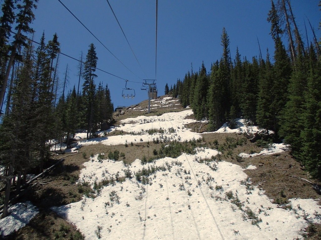
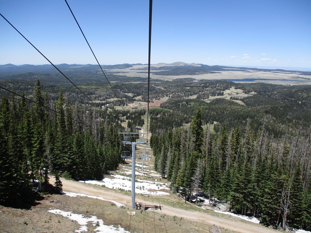
I rolled into the big parking lot and walked around until I could figure out where to go to buy tickets to ride the chair-lift. It wasn't obvious and nothing was signed. I ended up following a worker who showed me where to go. I got my ticket ($24) and I was good to go. Most people here had mountain bikes with them. The ride up the chair-lift was a blast. It starts at 9,400 feet elevation and goes up to Sunrise Peak, elevation 10,682 feet, in about a mile. At times, I was about 60 feet above the ground, just a flimsy seat and guardrail keeping me in. I took some images on the way up, and another on the way down:
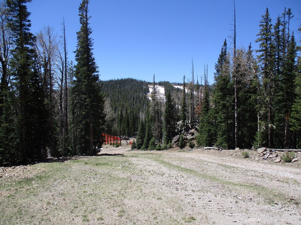
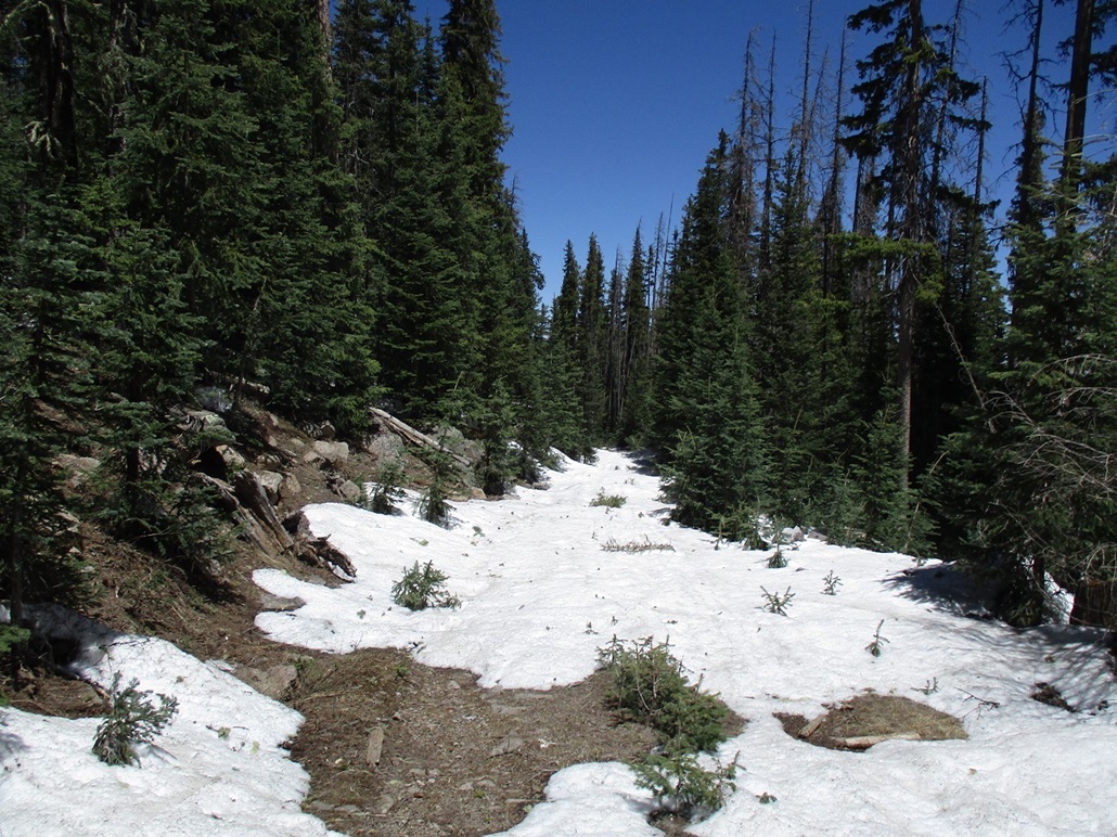
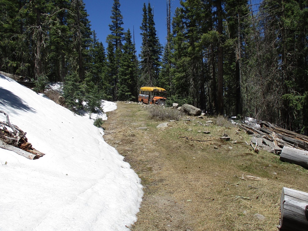
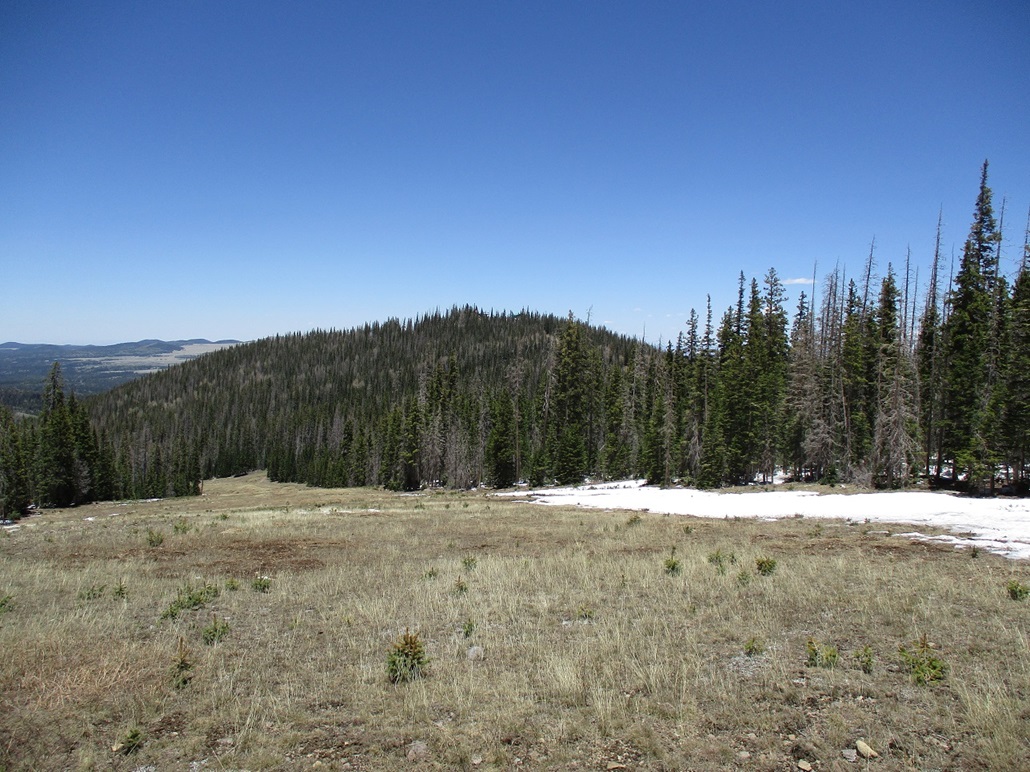
I got to the top and jumped off the chair. The guys up there were real friendly. I was told to look out for bears more than once. I mentioned I would be "hiking around". I did not want to tip my hand too much. I assumed as long as I stayed on the ski area property, I was fine. From where I stood, I could see Peak 10932 about a mile distant to the southwest. This is the state's 8th-highest ranked summit, and would otherwise be off limits, being on the White Mountain Apache Nation, were it not for it being on the ski area property. There were still significant patches of snow everywhere. I walked down a cleared area, losing about 225 feet, placing me in a saddle. I was on a service road normally off-limits to skiers. This road went behind another ridge, and still held much snow. Unfortunately, it was deep and abundant enough to make hiking a chore. It was dirty, scuzzy, late-season snow that had a chunky-icy sheen on top that either held my boot-weight, or I broke through and sometimes postholed up to my calf. It just meant I could not keep up a good pace. I had to step carefully because slipping was also a problem. And the snow would get into my boot, too, making my feets cold. At one point, I rounded a bend and there was an old school bus parked there. I would love to hear the story how and why that got there. It even shows up on the satellite images, and it looks like it's been there many many years. The service road finally topped out atop the long open ridge that encompasses Peak 10932, which the ski area people call "Apache Peak". There is a chair-lift and a very fancy building on top this peak, but the lift wasn't running and the building looked closed for the summer. I walked up to the building and around its back, to tag the summit. The last climb, so to speak, is up a small hill with about 15 feet of gain through rocks and a lot of ski-area crud. This is behind the building, and like any building, that's where they put stuff they don't need. I came upon a pile of chairs. And they looked like they've been there awhile too. It amused me. I tagged the top rock and got a warm feeling. I didn't stick around. Up this high, it was rather chilly (50s), there was a breeze, and I remembered that I had not been higher than 10,000 feet elevation since 2016 and I was lagging. The summit ridge has two more areas within a 10,920-foot contour, both small and about a quarter-mile to the west. I figured I had nothing to lose so I walked over to the area, these being within a patch of forest with deadfall and still a lot of snow. I could not sight between these areas and the presumptive summit by the building, but I am pretty sure these two smaller areas are not the highest. I don't think anyone needs to bother with these. For the hike down, I opted to hike down the actual ski-slope rather than the service road I had hiked up on. This worked better as I could find openings through the snowy patches (some of these patches ran a couple hundred feet long). I got back to the saddle I was first at about an hour earlier, then I trudged uphill to the top of Sunrise Peak. To make my ascent of Sunrise official, I scampered up the rocky knoll that lies behind a rescue hut nearby the chair-lift. I had thought about hiking down the service road but given I had hiked a lot already and wanted to rest, I rode the chair-lift back down for the enjoyment and sights. I had been on this quest for over two hours, and it pushing 1 p.m. now. I was surprised how long I had been up there and how tiring it was. I had a great time, though, and recommend a day trip up here in summer, preferably when things are calm and dry. I had time to kill before going to my hotel in Springerville, so I looked around for another peak that I hoped would not take long and was close by. I drove into Springerville and then got out my maps, and noticed Peak 7268 a few miles northwest of town. This looked like a perfect hike to take up another hour. |


|