
The Mountains of Arizona
• www.surgent.net
|
| Peak 2425 |
• Superstition Mountains • Arizona State Trust Land • Pinal County |
|
Date: December 10, 2023
• Elevation: 2,425 feet
• Prominence: 305 feet
• Distance: 2.5 miles
• Time: 90 minutes
• Gain: 345 feet
• Conditions: Blue skies, sunny, cold with a breeeze
Arizona
•
Main
•
PB
•
LoJ
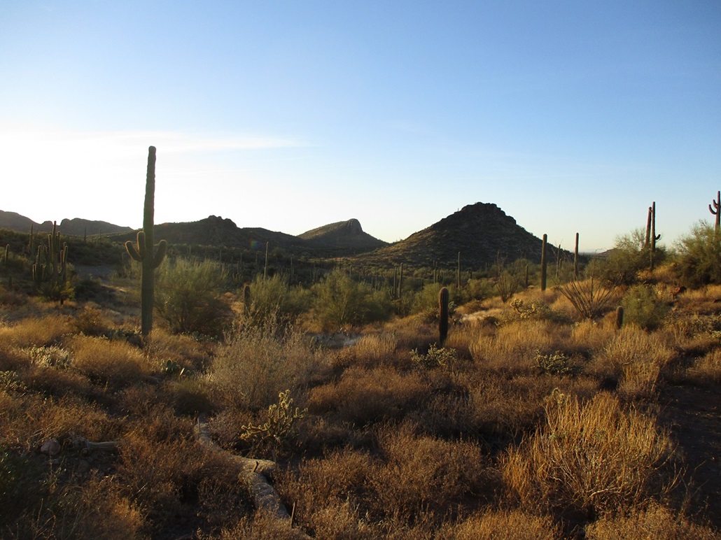
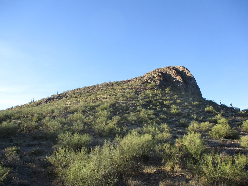
Peak 2425 is a foothill of the Superstition Mountains, located about two miles southeast of Peralta Road, but until recently, with a poor secondary road/track network that got any closer. It's a pretty peak, with a hundred-foot high cliff facing west, and gentler slopes on the east that make an ascent easy. The main challenge has been getting close to it. It's not such an awesome peak that people will want to walk through a couple miles of desert hills and arroyos to get to it. However, with the recent development of the Peralta Regional Park, a trailhead there now comes to within a mile of the peak, making access now much less cumbersome.
I was here just a couple days ago when I hiked partway up Peak 2546, stopped by tall cliffs that guarded its summit. That was a totally unplanned hike. I was perusing maps and saw that suddenly, there was a brand-new park here with roads, camping spots, ramadas and trailheads. I did not even think to consider how this peak fit in to the scheme of things. It wasn't until after I got home that I studied up on it all more and saw that the peak lies just a mile from a trailhead. This park opened in early 2023, and it's still being built out.
Yesterday and today was momentous for me. Yesterday the 9th, I was up early, rented a U-haul truck, got my big furniture items onto it, drove in 220 miles to Bisbee, off-loaded it, then drove all the way back to Tempe, a 440-mile day. The truck's brakes were real finicky. Going slow on city streets, no problem. Slowing slowly on the highway when traffic thickens, no problem. But slow down coming down an offramp to a full stop, that's when I discovered the brakes were shot. I had to put all my weight on them, then when I was stopped behind a truck, the drivetrain seemed to build so much kinetic energy that it over-rode my brakes! It made my truck lurch forward! Talk about adrenaline. I popped it into neutral to avoid further lurching.
I was in Benson when I dscovered this. I just needed to get my stuff to Bisbee and dropped off. I did not want to deal with calling for road-side help. I drove very conservatively and slowly, always keeping plenty of distance behind the car ahead of me. When I would come to a stop, I'd pop it into neutral. I was white-knuckling it all the way back to Tempe because I dreaded the heavy traffic, but fortunately, I had no issues. I spent last night at my Tempe apartment, then early today, packed my car with what remained and left. I moved out for real, the end of a 29-month stay there which was the result of a sequence of really crappy life events that forced me to move there. I did not like being there and am damn happy to be gone. The whole time I was there, everything stayed in boxes except what I needed. Nothing went up on the walls. I never even got a cable hookup and had no TV. I just used my hotspot which worked fine.
Driving away before dawn felt so good. I still have to go back one more time to clean it and check out, but I felt so light and happy as I left that place. While the wise people say you should never run away from a problem but instead run toward a solution, there is some satisfaction in leaving a setting that did nothing but remind me of this segment of my life and how much I desired for it to be over and for me to move on, in every sense of the word. I still have ties to Tempe while I am still teaching for ASU, but other than going back for specific things once in a while, leaving the apartment signified the end of my 29-month stay there, and 32 years of living in the Phoenix borg. To the best of my ability, that whole segment of my life and all that came with it slowly closes and ends. Payson was an experiment that failed. This is different. I just have a few loose ends to tie into a neat bow and can then get on with my freaking life. As always, any chance to hike a peak is always welcome.
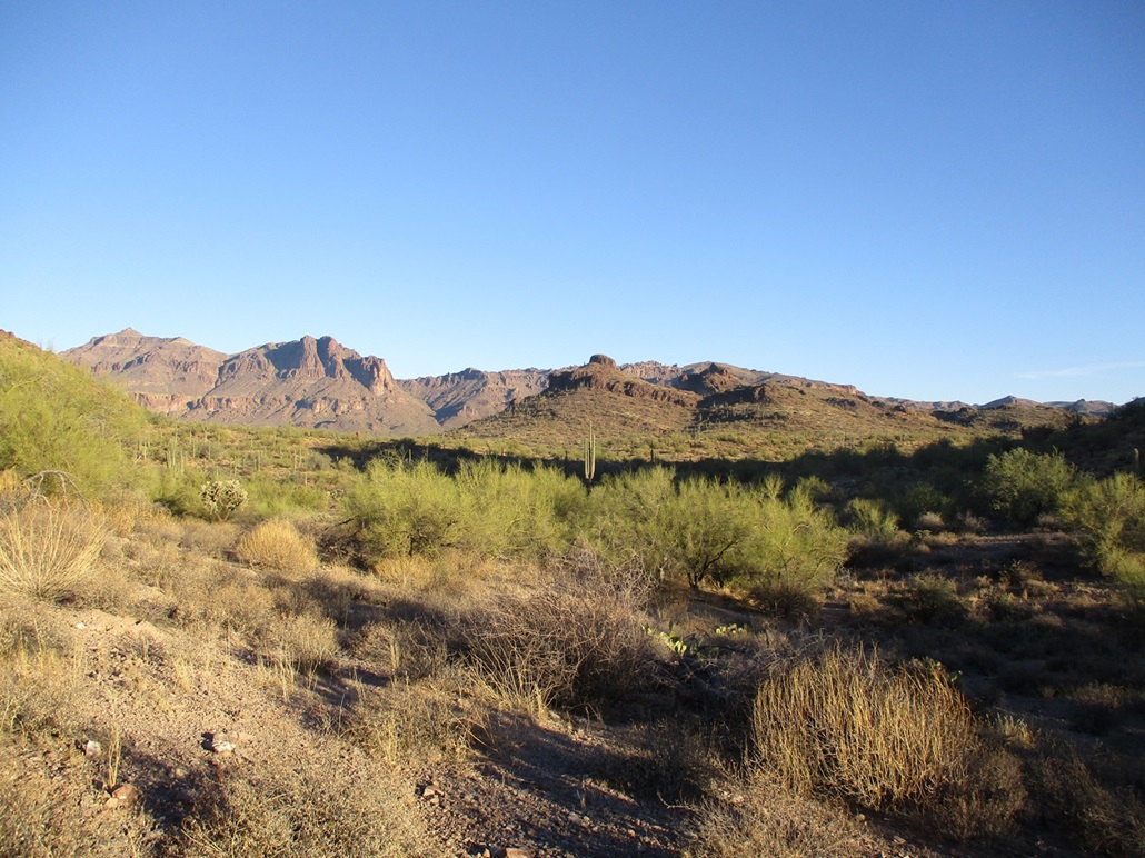
It was looking to be a fine day. It was cold for now, in the low 40s, but calm and clear. The sun created a pretty coral and lavendar sunrise, but also blinded me at times as I was driving eastbound. Being a Sunday, there was no traffic. I stopped for drinks and snacks at a Circle-K in Gold Canyon, then followed Peralta Road to the Peralta Regional Park. Now that I'm an expert, I knew what roads to follow and was at the "Backpacker's Trailhead" a little before 8 a.m.. It was just me, no Canadians (see link above for the context). I wore my buttpack and went light. I crossed immediately under the park's perimeter fence, now on State Trust land. I could not see the peak from this location yet, although I had seen it driving in.
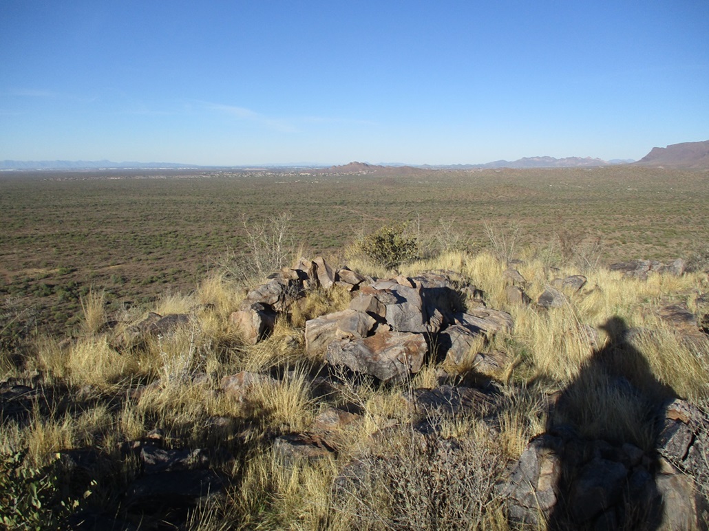
I walked south, weaving through the desert plants, and squeezing through the heavier stuff that lined the arroyos. Between me and the peak was a line of lower hills, and off them were a bunch of slopes and between them, arroyos, so I was going down and up and down and up through them, often walking in meandering patterns to find lanes. But it was easy hiking. Within minutes I could see the peak ahead of me, backlit by the rising sun.
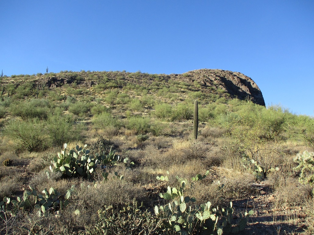
I was past the intervening hills so I angled left to gain the saddle north of the peak. Despite its impressive west-facing cliff, it's obvious that the other slopes are more gentle and without any cliffs, as far as I could tell. I even found a jeep track that I followed to gain the saddle. Tire tracks in the road suggest people come here somewhat often, maybe once a week.
I just started walking upslope and soon came upon a path, definitely a human-made path. While not critical, I always appreciate a path, so I followed it. About three-quarters of the way up, the track ends and there is a little bit of rock hopping, but the rocks laid way back and I wouldn't even call it Class-2. Maybe Class-1+. I used my hands just once on the descent to ease down one rock, that was it. I was soon on the top ridge and the home stretch, and on the summit about 40 minutes after starting.
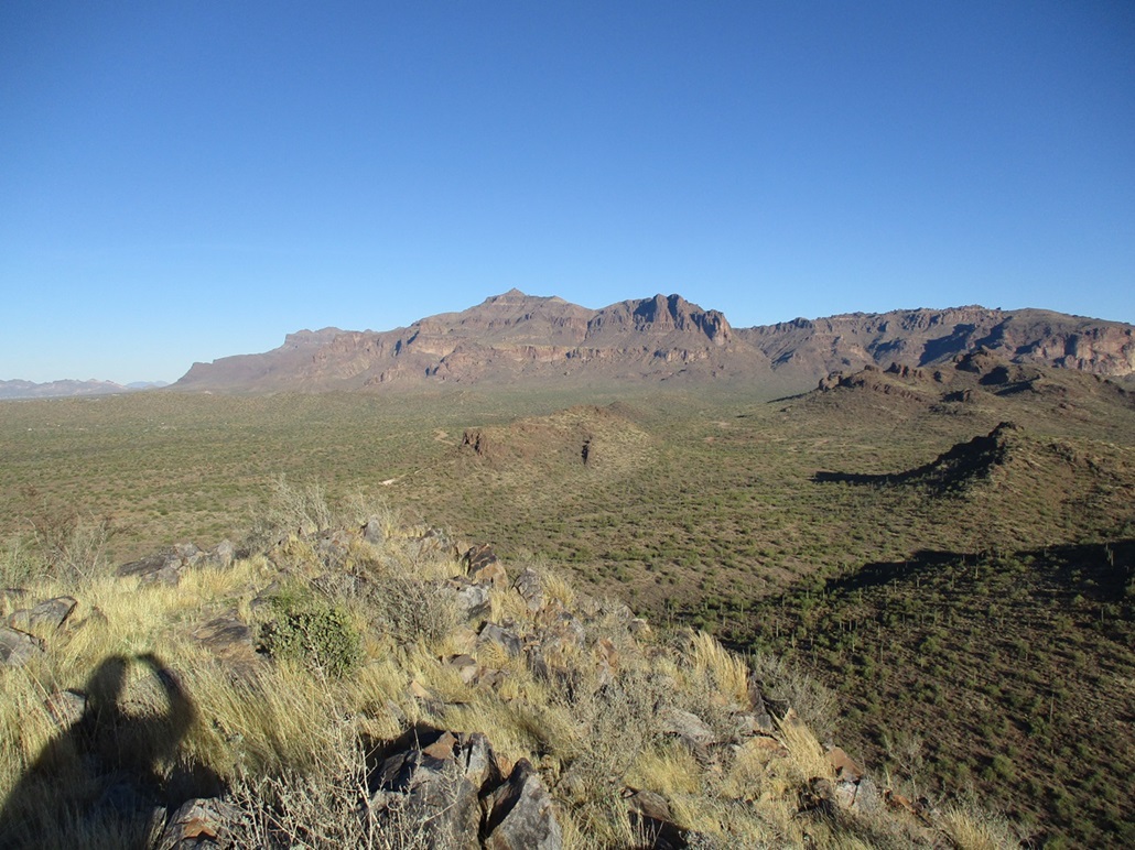
The top was bare, with low grass and a tiny rock windbreak. There was a cairn but no register. I shot images in all directions except where the sun was. Today was crystal clear, and I could see peaks as far as those by Interstate-8. It was breezier up here, though, and still cool, in the 40s. I sat briefly for a drink but got chilled fast so my stay was just a few minutes.
I hiked down the same way, following the path when I found it, then once back down onto the lower slopes and arroyos, followed a bearing back to my car. The round trip covered about 2.5 miles which includes the wandering, and took me 90 minutes. I felt great. This was an easy hike, and perfect, as I had some driving to do. I changed into my driving clothes then took the back way toward Tucson, following US-60 to AZ-89 through Florence. It's always a mellow drive this way. One of the prisons in Florence has "no trespassing" signs on its outermost fence. These fences are about 20 feet tall and topped by concertina wire. Do they have a problem with people trespassing here?
There was a marathon going on in Tucson along AZ-77 through the Oracle area. We had to go slow, but my respects to the runners. It would take me about 26 hours to run a marathon. I arrived in Bisbee in the early afternoon and got busy unpacking and putting things away. My stuff is everywhere now, in boxes, in piles, but I am happy with that. I even put something up on the wall!
|


|