The Mountains of Arizona
• www.surgent.net
|
| Peak 2753 |
• Superstition Mountains • Arizona State Trust Lands • Pinal County |
|
Date: November 16, 2022
• Elevation: 2,753 feet
• Prominence: 513 feet
• Distance: 1.8 mile
• Time: 1 hour, 15 minutes
• Gain: 593 feet
• Conditions: Clear, cool and very breezy
Arizona
•
Main
•
LoJ
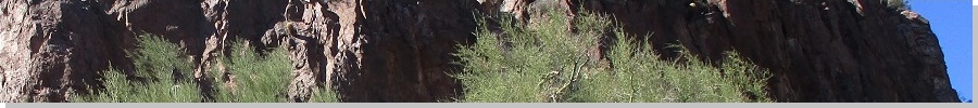
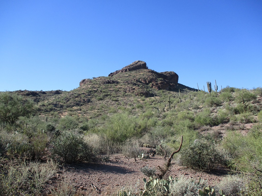
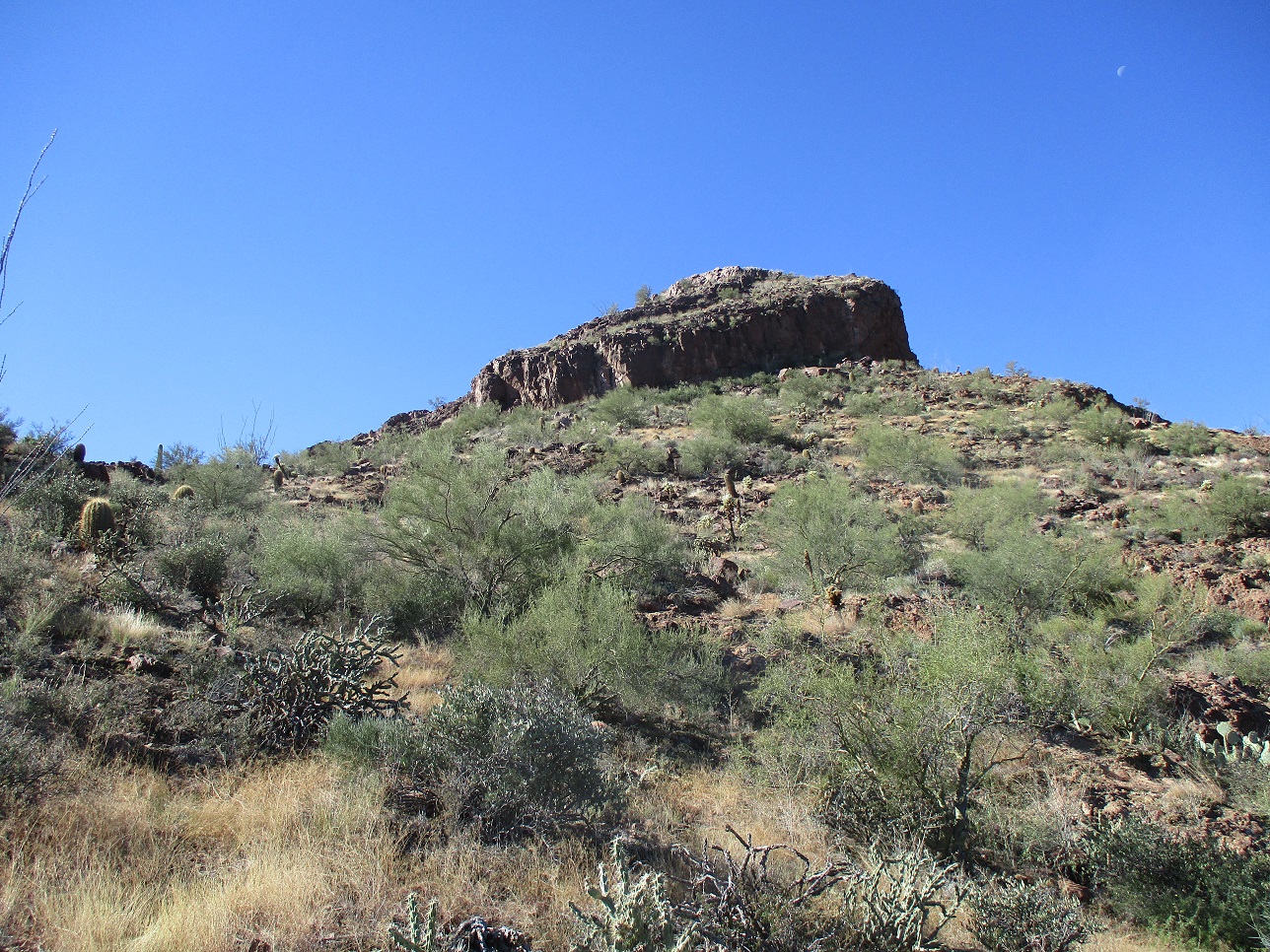
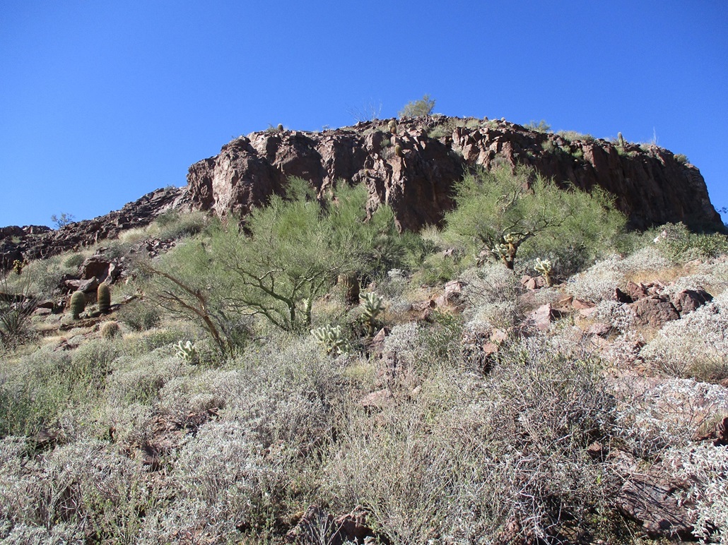
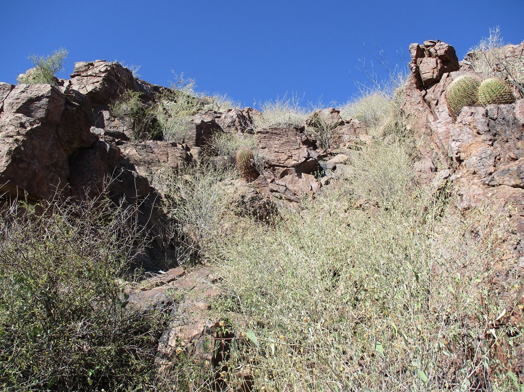
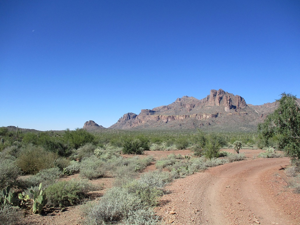
Peak 2753 is the highest of three peaks that lie south of the Peralta Trailhead parking area in the Superstition Mountains. The peak has a cliff band that nearly encircles the summit. Combined with lower cliff bands and the way the slopes tilt, it all looks like one big wedding cake ready to topple. It is a very pretty peak.
Today, I had not a whole lot going on, so by 9:30 a.m., and with the weather clear, breezy and temperatures in the low 60s, I got my stuff together and headed out the door. I've studied this peak online a few times, curious about it because it lies close to the access road to the Peralta Trail. That it has cliffs is obvious from the satellite images and from my own familiarity with the Supes. The question was, how cliffy are the cliffs? People have made it to the top, but actual information on what to expect is non-existent. There must be a ramp or chute around back, I presumed, because Scott Surgent gets up no peak unless there's an easy way up.
I followed US-60 through Gold Canyon, then Peralta Road through some new homes, then onto the dirt portion that heads to the Peralta Trailhead. Just short of the parking lots, the road splits, the left going to the parking lots. I went right for a half-mile then parked in a small clearing where a scanter track branches to the south. It was 10:30 when I killed the engine. The wind was consistent and sometimes strong. It jostled the car a little, and it was chilly too.
I walked the track a few hundred feet, then angled right at a Y, the right branch leading to a cleared turn-around with a fire ring. I hiked onto the slopes and sniffed a route through the brush. None of it was bad, but some parts, I had to plow through reedy-type grass and around the cactus. Up ahead was a lower cliff band. I aimed for it, then bypassed it to the right.
Once above the lower cliff, the upper cliff was very near. I marched up the steepening grade until I came upon the apron of rocks that lie below the cliffs. The cliffs stood about 20-30 feet high, and no obvious way up them from this vantage.
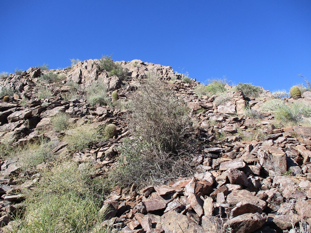
I angled left and carefully picked my way over the rocky talus, which was mostly solid but sometimes would move under my weight. That got the heart rate going. I eased past the nearest cliff wall and looked up to see a brushy, messy chute that appeared to be the magical way people get up this damn thing.
I entered into the chute, getting up about ten feet to where I had a choice. Stay straight, and it looked like a mess. I'm sure it would go, but it didn't look like much fun. Or go right, and scramble up more substantive rock which should put me on the upper slopes, and above the cliffs, faster. So I chose right.
This worked but was awkward. Directly scrambing upward was difficult because I'd hit my head on a rock outcrop above me. I had to lean to my right while placing my feet properly. It wasn't pretty. I ended up sitting on strategic rocks, then pivoting on my butt to place my feet onto higher rock, and that's what got me around this little crux.
I was now on the home stretch, another 30 or 40 vertical feet of steeply-sloping rock talus, much of it flaked off from the mother rock over the eons. I moved carefully, in a crouch, and got myself next to a higher rock band, which offered better footing and hand placement. I simply walked beside it until I found an easy breach to gain the summit itself.
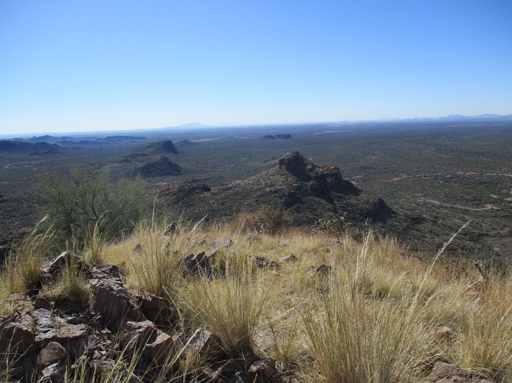
The summit was a tiny perch of grass, about twenty feet by six feet. The register held gobs of old paper scraps. Someone was here early in the year, but I spent no time trying to make sense of it. I found a blank spot and signed in, then snapped a couple images. The wind was strong up here, and I was a little skittish anyway, wanting to get back down the steepest bits before I forgot what I did and so I could let my mind relax.
Going down went very slowly. I was on my butt more often than not, by design. Back at that awkward rocky move, I found myself a little unsure what to do. It seemed I could just stretch down and get my foot placed but that wasn't possible. I tried a few things. I traded style for efficiency and essentially leaned backward in a sitting position, fulcrumed my legs around, and control-fell into some heavy brush that allowed me to get myself back into a better position. The problem here was that one wrong step or bad foot placement could have meant a fall. This was a little more sketchy than it might appear from below. I'd rate the chute class-3, that tricky bit a 3+.
Now below the cliffs, I had better footing overall and could move more efficiently, albeit slowly. I took my time and slowly walked down the slopes, essentially retracing my ascent route. I was back to my car at 11:45 a.m., a 75-minute hike.
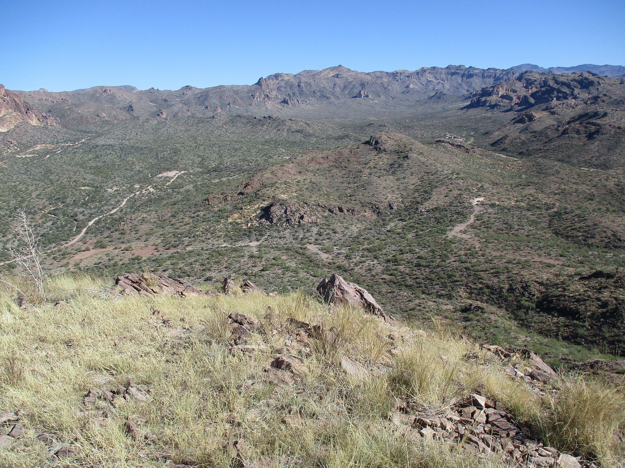
I had looked over at Peak 2562 which lies across the way and looks like just a walk up, but I was happy with this one peak as it gave me much more of a work out that I planned. A little exposed scrambling always does the body and mind a little good, especially when nobody knows your whereabouts.
|

|