The Mountains of Arizona
• www.surgent.net
|
| Peak 7100 |
• San Francisco Volcanic Field • Babbitt Ranch • Coconino County |
|
Date: August 21, 2021
• Elevation: 7,100 feet
• Prominence: 670 feet
• Distance: 3 miles
• Time: 1 hour, 55 minutes
• Gain: 1,100 feet
• Conditions: Sunny and clear
Arizona
•
Main
•
LoJ
•
Interactive map
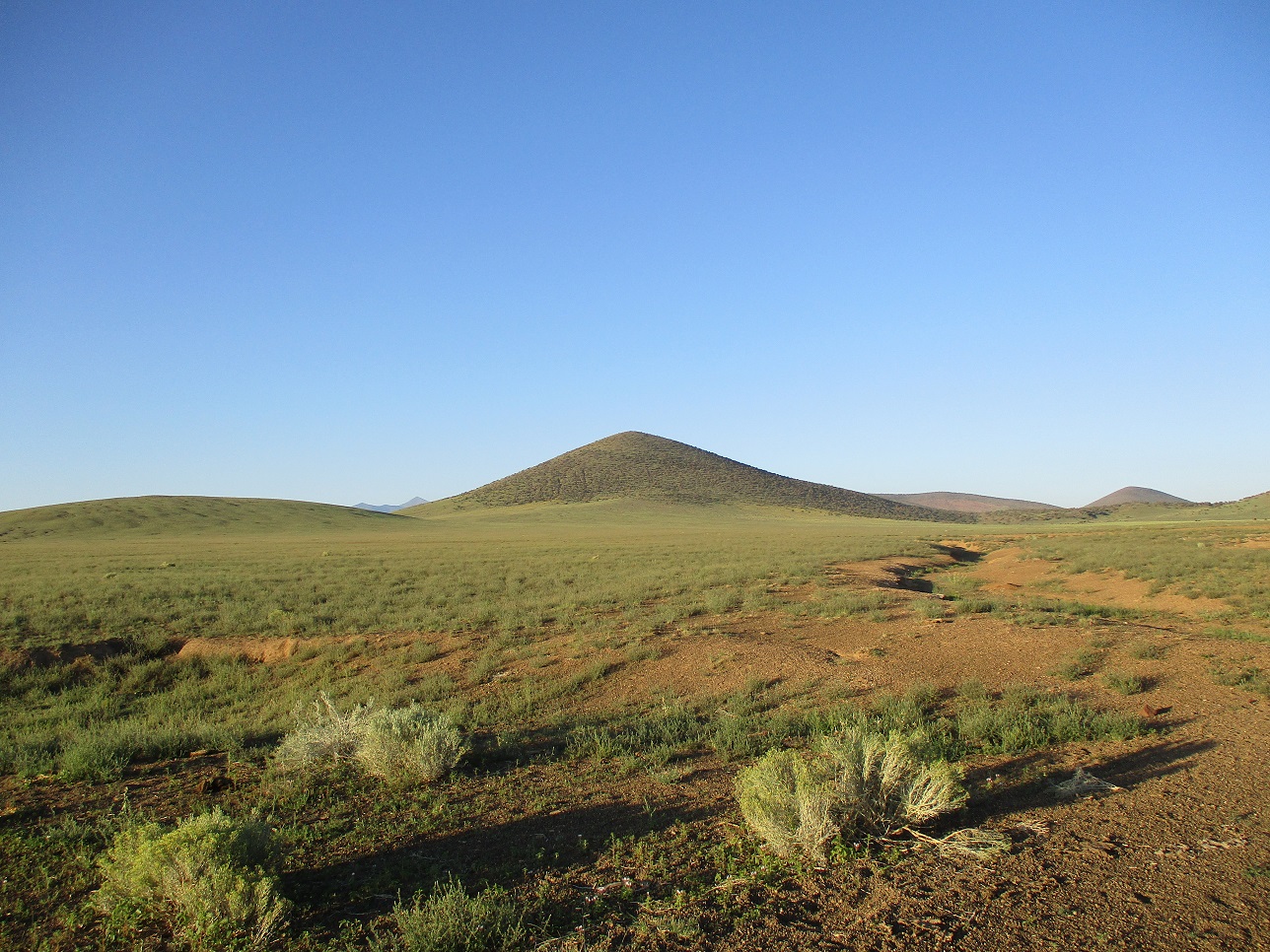
Peak 7100 lies on the northern extent of the San Francisco Volcanic Field, where the land slopes down from Humphreys Peak and flattens out, in a manner of speaking, north toward the plateaus of the Navajo Nation. The land here is part of the Babbitt Ranch holdings, a few miles south of the Navajo Nation boundary. Although private, access is allowed to the public. The most notable feature here is S P Mountain and its lava flow. I was last here in June when I climbed Peaks 6666 and 6495 and saw a mountain lion.
I arrived in the area late yesterday, after climbing Rattlesnake Crater. I originally intended to climb Colton Crater and its western neighbor. I drove to the area fairly late, the sun already setting. I drove in the main road about 7 miles, now beneath S P Mountain. The sun was directly in my eyes and I could barely see out of my smudged windshield. Once below S P Mountain, it blocked the sun. I drove southwest a couple more miles to inspect the roads toward Colton Crater and look for a place to camp for the night.
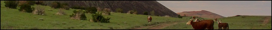
The abundance of cows kind of concerned me. There were many dozens of them, just everywhere. There was no place to pull aside and hide to camp for the night (and being private land, did not want to abuse my welcome). Even had I found a spot, the cows would moo and huff and do cow things all night. They can be loud and annoying, from past experience. I did not see any promising roads or tracks that got closer to Colton Crater, so I chose to play it safe and backed out the way I came. The sun was just about set by now, but in its last moments, provided some wonderful light to snap photos by. It highlighted the reds and pinks of the slopes of the hills against the green grasses. The clouds in the sky were still being lit. See a couple shots by clicking the links for the hikes listed above.
I backed out to the highway (US-89) then south a few miles back into the pinon-juniper woodlands, back on Coconino Forest lands. In the near-total darkness, I found a Forest Road and followed it in just a few hundred feet. I pulled into the first spot I could find, far enough from the highway so that only the loudest trucks could be heard, and only then barely. It was past 8 p.m., the sky was clear and a full-moon was rising in the east. I settled in, did a crossword puzzle, ate chips and relaxed. The temperatures were mild and conditions here very peaceful. My camp was basic: I just slept in the driver's seat laid all the way back, with a single blanket and no pillow. Kind of like what the pioneers did. I slept okay, and when I would awake, the full moon had lit the area in soft moon glow.
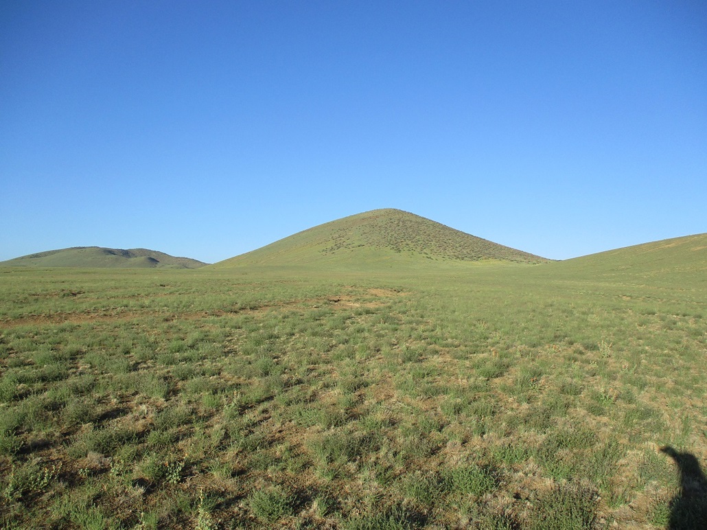
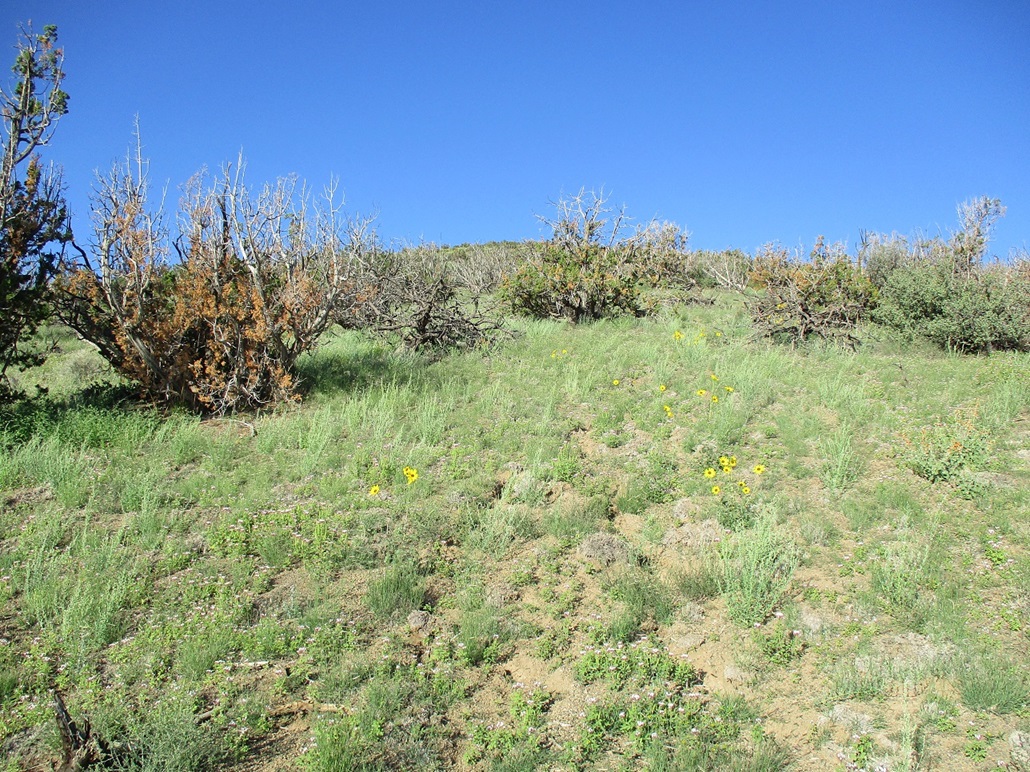
The next morning, temperatures in the low 50s, I headed back north to the Babbitt Ranch Road, and chose instead to hike Peak 7100, and save Colton for a later date when I do some more homework on the best ways to access it. I found a road that went south over a soft pass, which placed me east of the peak about a mile. I rolled in about 6:40 a.m., already sunny and warming slightly. The land here is bare of trees, just a lot of grass, shrubs and wildflowers. The recent rains have resulted in an abundance of grass and it is the greenest I've ever seen these hills. Compare the pictures here with my June visit, for example.
I suited up and got my pack in order, and started walking at 6:48 a.m.. I was at nearly exactly 6,000 feet elevation, parking just off the track in a tiny clearing. There were a few scattered cows on the slope ahead of me, spaced out nicely. I don't mind hiking amid cows, just not fifty of them all at once. They're so damn big and stupid, you never know if one will get huffy and get the others riled up.
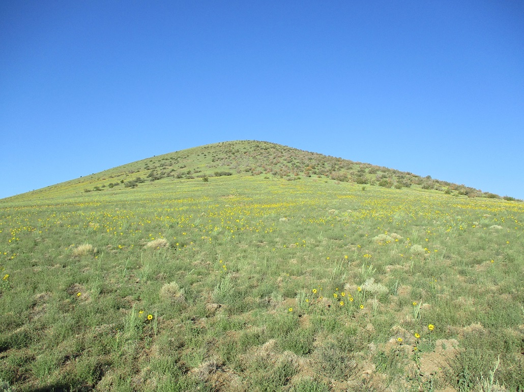
The lower slopes lay back very gently, gaining about 200 feet in a half mile. The grade steepened by degrees. Ahead of me was a patch of yellow wildflowers (sunflowers?). This was where the grade started to steepen incrementally. The grass was thick enough to force me to zig-zag through open lanes. It was warming too, and I had no shade on these slopes. The wildflower section ends just below a band of light forest, mainly pinon and juniper. The trees were spaced out as well, and I took small breaks in their shade whenever possible. By now, the grade had steepened to where I could feel it. The tread was solid but slightly loose at times. It was easy hiking, but laborious.
This band of forest lasts for about 400 vertical feet. It peters out about 300 feet below the summit, now just a lot of grass again, and small shrubby plants about waist high. By now, having gained about a thousand feet, it was a few degrees cooler and breezier, and it felt good when a wind would kick up. I was soon on the summit, a 1,100-foot gain in about a mile and a half from the car. It had taken me 80 minutes for the hike. I was moving slow and taking a lot of breaks.
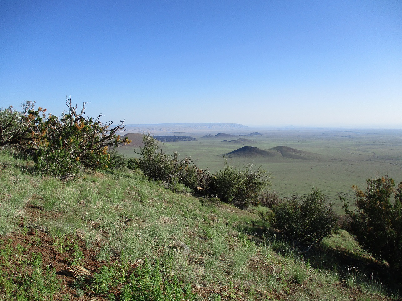
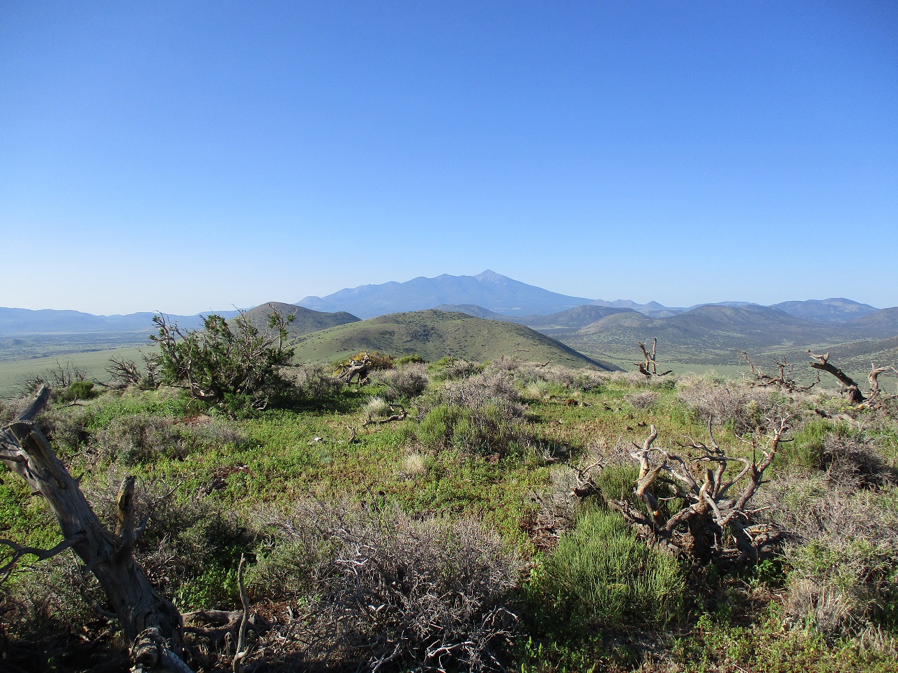
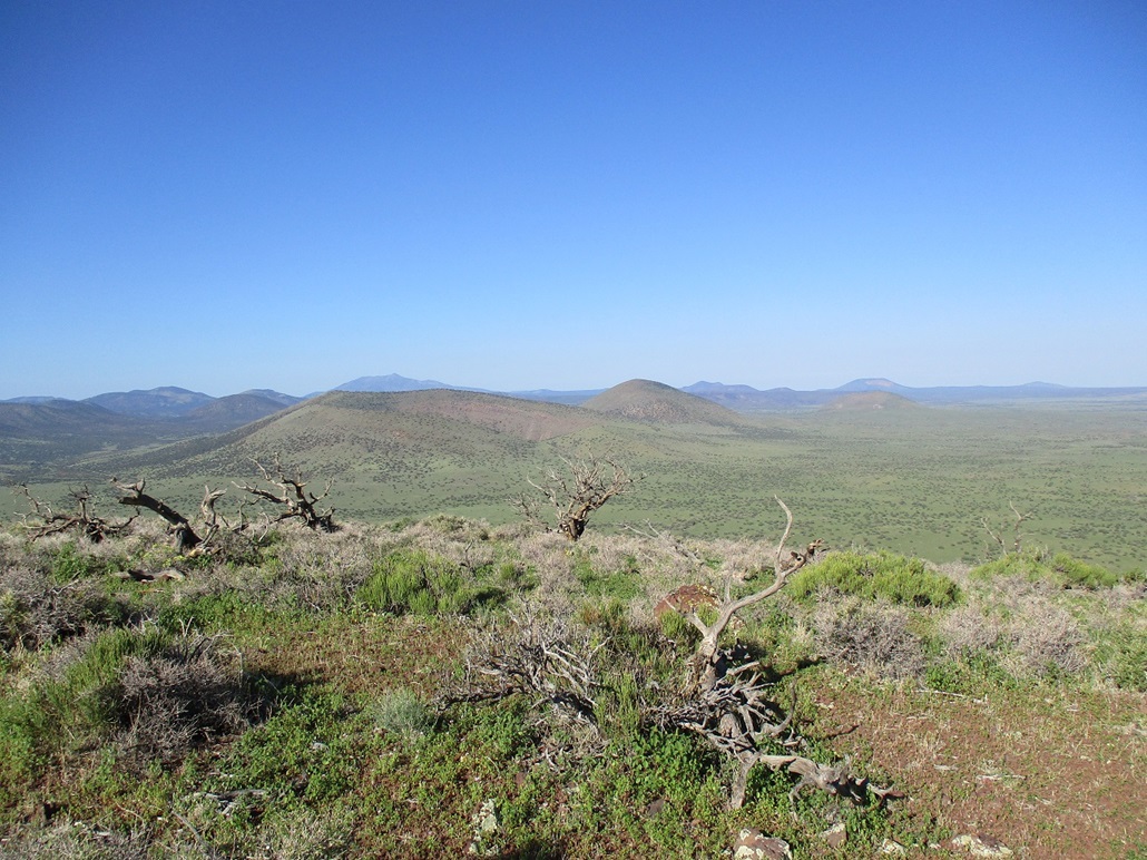
The summit was quite pretty, rocky with scrubby plants and low grass. There was no indication of a cairn or previous visitors. The views were stunning, especially with all the green grass covering the nearby hills and plains. To the south was Humphreys Peak, and to the west a myriad of peaks including Kendrick Peak. I could barely make out Red Butte way out by the Grand Canyon's south entrance. To the north were the nearby cinder cones, then long ridges and plateaus, all noticeably "pinker", this being the Navajo Nation. To the east I had intense sun, but could make out a whole lot of flat plateau country. I could probably see into New Mexico from here. I stayed up top about 15 minutes.
As laborious as the uphill hike had been, going down would be fast. The rubble held together well and I was able to speed-hike down the slopes, never stopping, covering the full distance in just under a half hour. I was back to my car at 8:42 a.m.. The hike had gone well and I was a little surprised I had gained over a thousand feet along the way. It did not feel like a thousand feet, but my lungs and legs may disagree.
I changed into more comfortable clothes, then just sat in the car for about an hour, reading, doing more of a crossword that I wasn't having any luck with, and enjoying the solitude. I had absolutely no eagerness to get back home, and a whole day to do it in. I finally got moving, drove through Flagstaff, then down Lake Mary Road. Once I got to the overlooks beside Mormon Lake, I decided to pull in and kill more time.
Moments later, a truck rolls in and four guys get out, with high-end photography and sound equipment. They set up and discuss best filming locations. Now I'm curious so I watch them. They went down the slope a little where one guy discussed Mormon Lake and how it is used to capture moisture from the San Francisco Peaks. It all looked very professional, not just some random people doing a video for Youtube. When one guy walked back to the truck, I asked him what they were up to. He said it's a piece for a PBS show called In The Americas. The man was David Yetman, presenter of the show ... and the eponym for the David Yetman Trail in Tucson! I told him I like "his" trail. I should have asked him how long it took him to build it. He was super cool and friendly. Later, they sent up a drone for some aerial footage. I stayed out of any scenes but perhaps my car will get into the show. If so, it will be the second time a vehicle of mine makes it onto the big or small screen (the first was in 1998, Point Last Seen with Linda Hamilton, look for a red Nissan pickup).
Another cool thing that happened while parked at the overlook was a procession of about 30 cars, all vintage cars from the 1940s to early 1970s, all well-kept and in fantastic shape. They were heading south. There was no theme to the cars except they were all cool old cars. I wonder where they were going. I spent nearly an hour at the overlook, then got moving again. When I got to Clints Well at the intersection of Lake Mary Road and AZ-87, there they all were. They had all parked in the lot and were having a little car show in the middle of the forest.
Soon, I was in Payson. This weekend is the big rodeo weekend, the 137th annual rodeo, supposedly the longest continuous rodeo in the world. It wasn't held last year due to Covid (so technically, it's been running continuously now for 1 year). This year, it was going on, making up for last year's non-event it seemed. The roads were jam packed. I pulled into the Mazatzal Casino lot and parked beneath a shade tree, and used up another 45 minutes, cleaned out the car, texted some of my peeps, and could hear the public-address announcer over at the rodeo grounds across the highway. Leaving southbound on AZ-87, the northbound lanes were backed up fully five miles. It would easily take an hour to get through that jam. But hey, it's good tourist dollars for Payson.
|


|