
The Mountains of Arizona
• www.surgent.net
|
| Peak 7155 |
• Dragoon Mountains • Coronado National Forest • Cochise County |
|
Date: March 3, 2024
• Elevation: 7,155 feet ✳
• Prominence: 1,292 feet ✳
• Distance: 8.1 miles
• Time: 5 hours, 40 minutes
• Gain: 1,965 feet (gross)
• Conditions: Clear, sunny, very dry and breezy
Arizona
•
Main
•
AZ P1K
•
PB
•
LoJ
•
Lidar
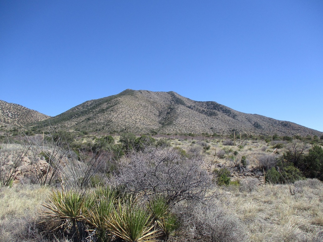
This unnamed peak is the highest point of a long ridge at the southeast end of the Dragoon Mountains. It lies south of Black Diamond Peak, which (according to the map) is just 9 feet lower than this peak. Over a century ago, there were some mines developed on the flanks of Black Diamond Peak, and a town grew on the east base of the peak, but did not last very long. It's possible that from that side, Black Diamond Peak looks higher and thus got named way back then.
This is not a peak that gets climbed often, and the two short reports (Matthias' on Peakbagger, Luther's at HikeArizona) both mentioned the steep brushy slopes at the head of Henry Canyon to the high saddle. It looked like a peak that involves a mix of brush, rocks and steep slopes. Nothing that would make an ascent impossible, but nothing to get enthusiastic about.
I found some reports on HikeArizona mentioning a route in from the north that goes to Black Diamond Peak. It involved old mine roads, bulldozer tracks and beaten paths, and it appeared that it would get close to the saddle below Peak 7161, thus a potential alternative to dealing with the bad brush in Henry Canyon. So I resolved I would try it from the north and avoid Henry Canyon.
Conditons for this weekend looked promising: clear skies, no storms, and temperatures in the 35°-65° range. All the snow from the big February 10th storm we had has melted and it's been dry since. I wasn't excited to get caught up in brushy slopes with rolling rocks, but I figured I should give this peak a try sooner than later, before it gets too warm.
I left Bisbee about 7:30 a.m., stopped in Tombstone for snacks, then drove Middlemarch Road northeast to the Coronado National Forest boundary at the southwest tip of the Dragoon Range. The road is now marked as FR-345. I stayed on it past milepost 13, to a bend that heads north to Middlemarch Pass, the trailhead for Sala Benchmark Peak. At this bend, I eased onto a lesser track, which the map calls FR-4393 but was not marked. I went in about thirty feet and parked in a clearing to my left. I got situated, and was walking about 8:20 a.m..
The road dips into a creekbed then gains out of it, aiming east then southeast. It's a rough road with uneven tread and I felt comfortable parking back where I did. About a quarter-mile in, the road forks, and the right fork is marked with a FR-4393 post. This road goes steeply uphill toward a pass between Black Diamond Peak to the left, and Peak 7091 to the right.
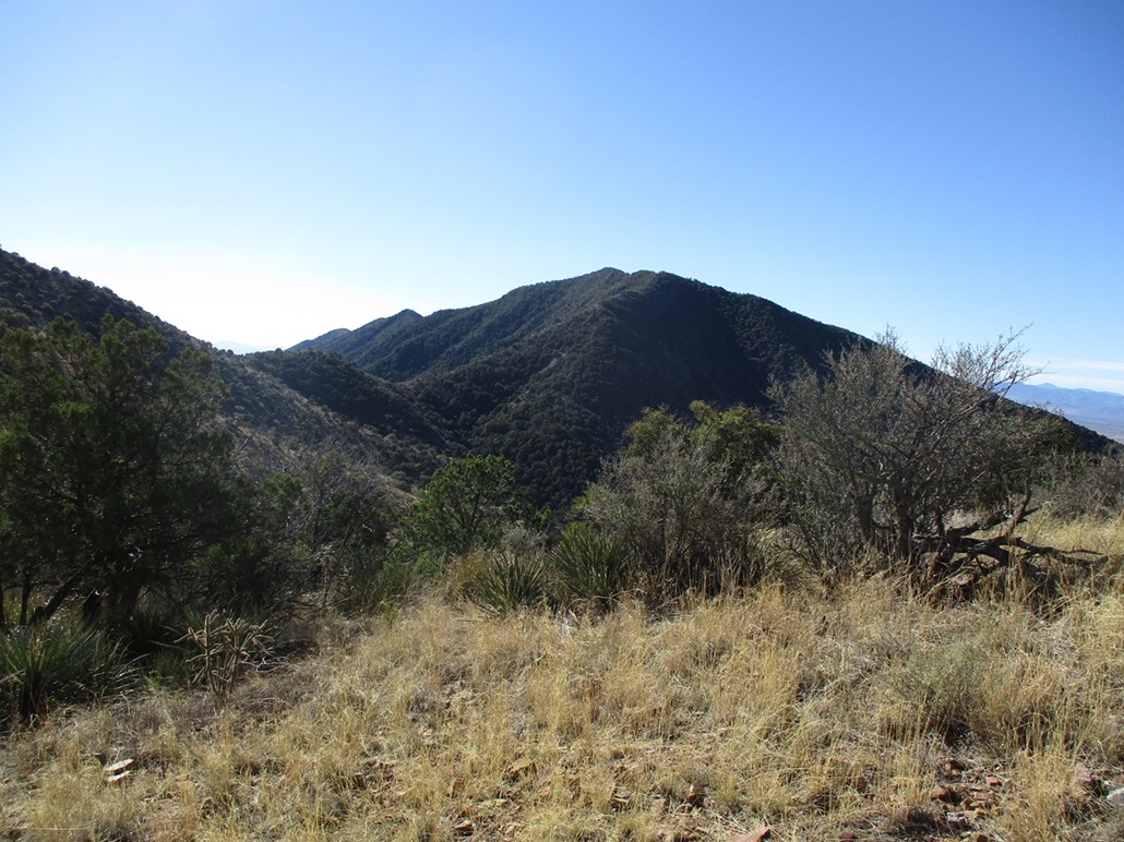
The road was steep and of marginal quality. Only a Jeep would be advisable, and there were very few spots to park or turn around. I kept to the road to its end, then followed a bulldozed clearing to gain the saddle between Black Diamond and 7091. So far, so good. At this saddle, I had a fine view of Peak 7161 about a mile to the south. It looked brushy as hell.
I then angled left and started following the clearing that traverses below the rocky ridge of Black Diamond Peak. It seems as though they were going to put in a road here then thought twice about it. At first, it was easy to follow. A well-beaten footpath runs through its center, and I thought this was going to be cake.
However, the trail weakened about a third of the way in, and started to get sketchy. It was nothing more than a dirt opening about 6 inches wide, with steep slopes below. This "path" also crossed a few rock and scree slopes with loose footing. About two-thirds of the way across, I lost the path entirely and gave up trying to find one. I just walked carefully until I was at the rocks that line the southwest ridge of Black Diamond that lead to the saddle connecting to Peak 7161. I did not like this traverse one bit and decided that unless I had no other options, I would not return this way.
I still had to drop about 200 feet to get to the saddle. Most of the descent went well, even following paths, but then I came upon some jumbled cliffs about 25 feet high. I could have probably found a walk-around but I didn't feel like it. I was able to ease down a sloping rock that formed a ledge, and my long legs helped. Were I to ascend this, I would have rated it Class-3. I then eased down more slopes and rocky piles to get to the saddle. I had been hiking now for almost 90 minutes and was feeling tired of the whole thing already.
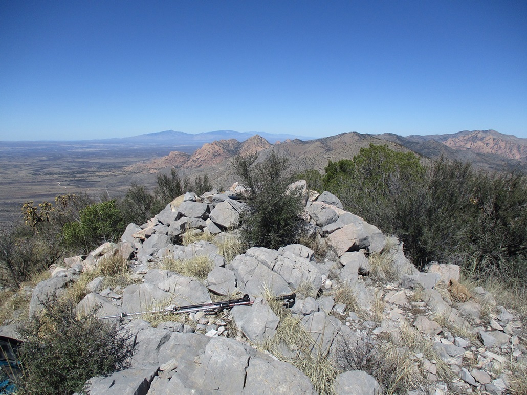
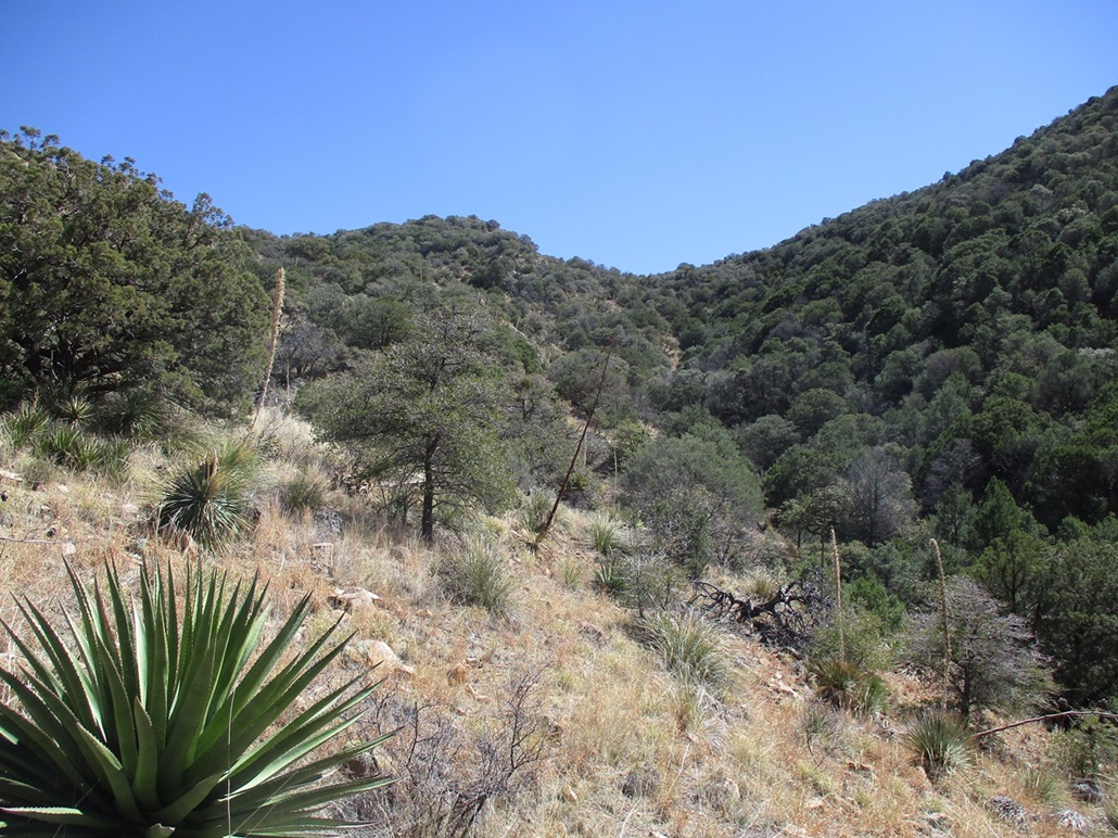
The encouraging thing was that looking up the slope toward Peak 7161, it looked manageable. It looked steep, grassy, rocky, and brushy, but not difficult. I'd come this far, I sure as heck wasn't going to stop now. I took a small break at the saddle and even looked down into Henry Canyon for a possible bail route. The summit was about a half-mile on a straight line from the saddle. The saddle elevation is 6,500 feet, and the summit about 650 feet higher.
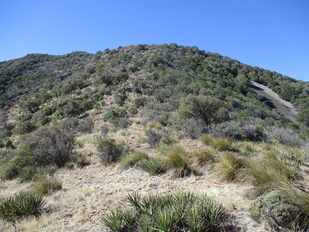
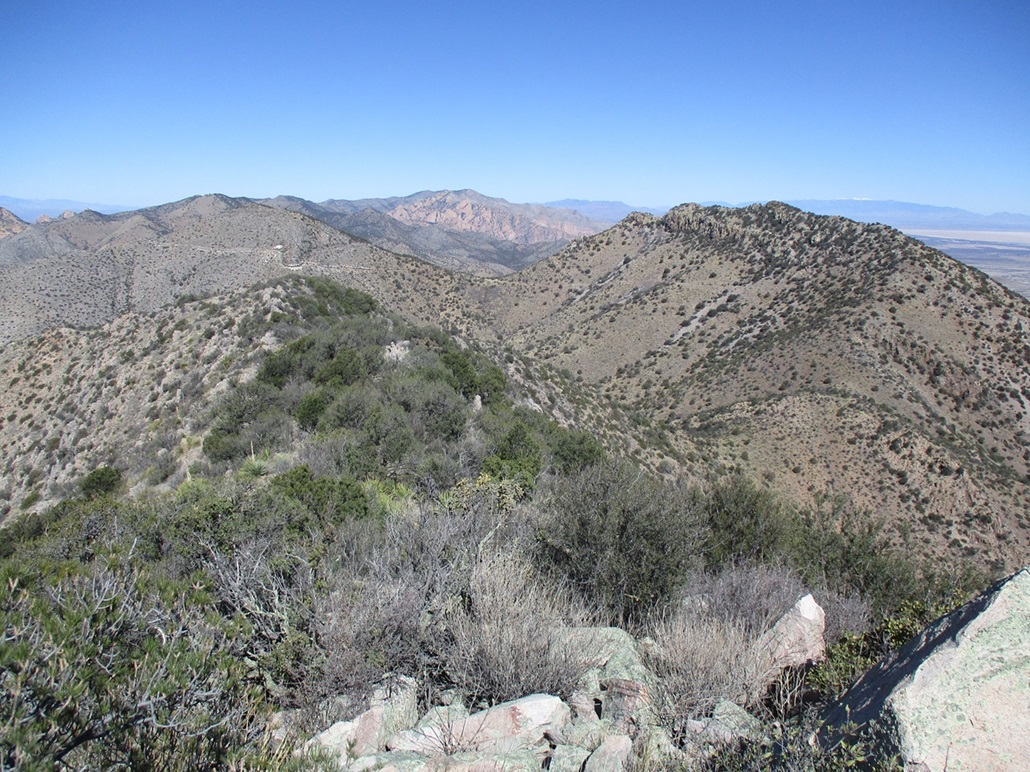
Looking up, there are three "knobs" along the skyline, of which the third one is the summit. The initial segment up to the first knob was steepest, gaining about 300 feet. This was mostly open, and I found what looked like a path for most of it, probably a people path. There were a few rocky portions but no cliffs and no scrambling necessary. This part went well, and got me to this first knob, elevation about 6,820 feet. This is south of the mine shaft shown on the map (and is visible on the slope). At no time was I ever close to this shaft.
It got brushier here and I tied a ribbon on an agave stalk to remind me to make a turn here coming down. The route angles a little more southerly but lies back more, the ridge narrower and lined with limestone rock outcrops. The next knob lies at 7,020 feet, a 200-foot gain. This stretch went okay, but it got very brushy and branchy for the last fifty feet. I had no choice but to lean in and push through it. This put me onto Point 7040, which was an open rock bald with a large boulder in its center.
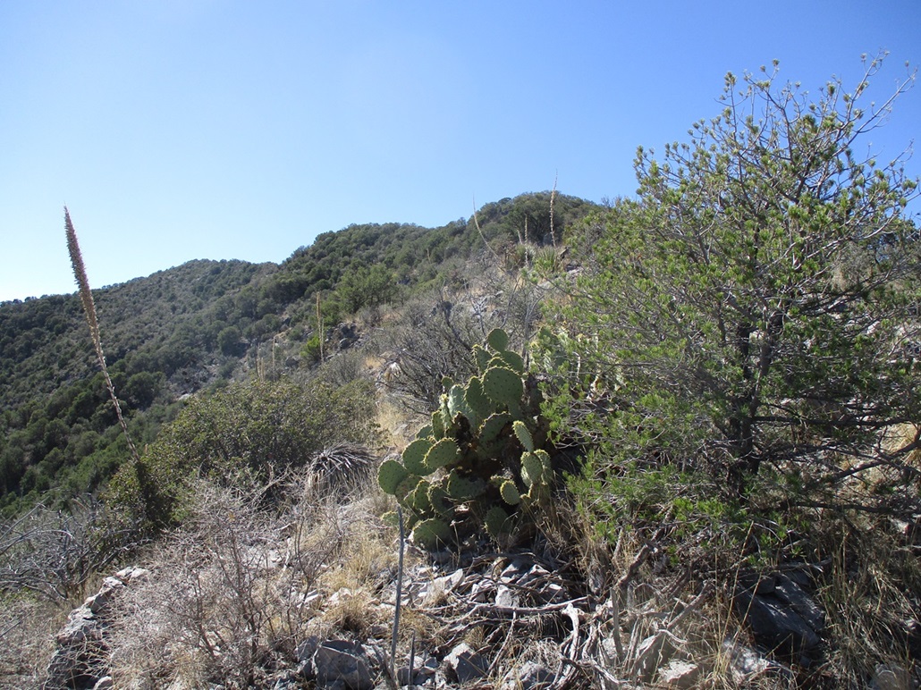
The summit was next, no more than a sixth of a mile away. The terrain was more of the same, with limestone rock outcrops lining the ridge, and plenty of brush, but I was almost always able to find an open way through. It meant going from one side of the rocks to the other, sometimes directly over them, and sometimes easing along ledges with non-trivial exposure should I fall. I actually did fall. I got my ankle around a downed agave stalk, then before I knew it I was going down. I was able to catch myself on the rocks, fortunately not banging anything seriously. Note to self: pay attention.
Finally, I gained one last slope and this put me onto the open summit of Peak 7161. It was 10:55 a.m., so I had been at this for two and a half hours. It felt more like five. I was happy and relieved to be here. The top is open with a large rock pile. I looked for a register but found nothing. Conditions were pleasant, temperatures in the 60s, with a steady breeze blowing about 15 miles per hour.
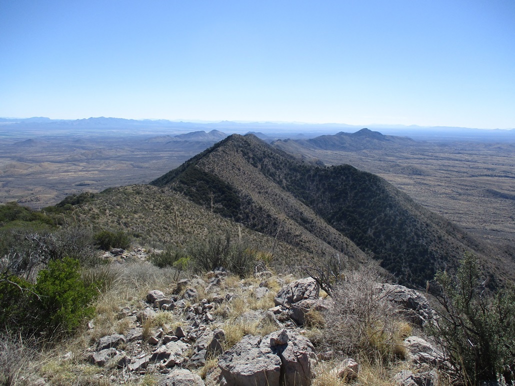
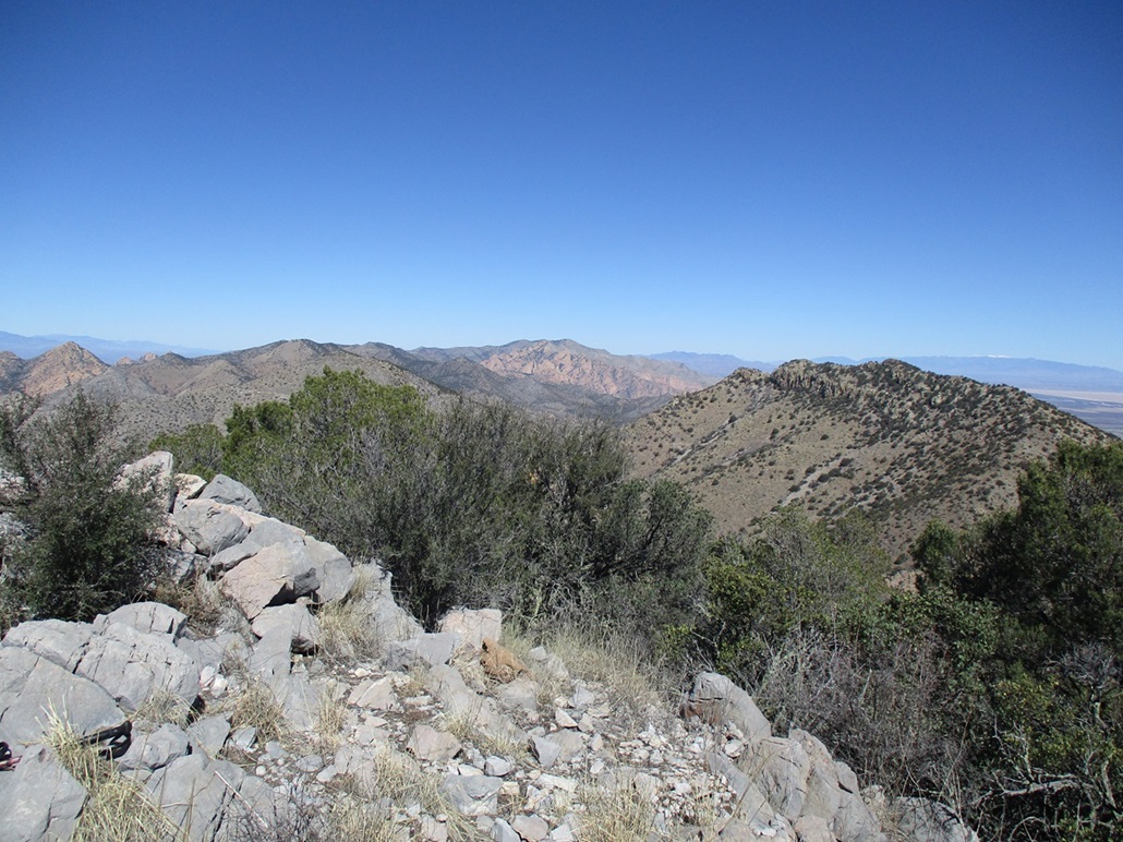
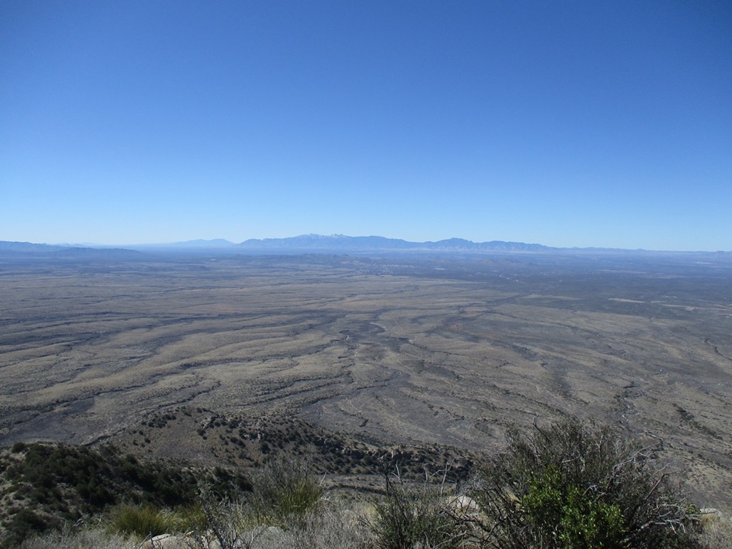
I sat for a few minutes and rested, then got up and looked around. I had fine views in all directions. The main Dragoon peaks were to the north with the Cochise Stronghold visible. There was still snow on the highest crests of the Chiricahuas and the Huachucas. Willcox Playa spread out in the valley to the east. After all this effort, the views from here were worth it. I was up here about ten minutes.
Now to get down. I eased off the summit and poked my way along the ridge pack to Point 7040. Both Matthias and Luther bailed off the ridge here, going northwest. Me, I was still considering going out the way I came in. It would be much shorter, but I was also keeping open the option to bail into Henry Canyon, too. I got all the way back down to the saddle and took a break in the shade of a tree.
I decided to take the bail route. I knew it would be nasty for a little bit, but it would be all road after awhile. It would be over two extra miles to get back to my car, but that was a reasonable price to pay. It didn't look so bad from up high.
After my rest, I started into Henry Canyon. I knew to not drop into the drainage immediately. I stayed high on some slopes closer to the canyon's headwall. These slopes were more open, and I generally descended and traversed, all the while keeping the canyon bottom to my left. I'd study it as I descended, and it looked ugly. I dropped about 300 feet and was more in the center of the canyon when I finally dropped into the canyon bottom, figuring I'd be dealing with this for awhile.
I got a little lucky. I didn't get more than fifty feet when I noticed a rock wall composed of large boulders obviously placed there by humans. This was the shoring of what must be a road above me, and sure enough, I ascended the other side ten feet and was on a narrow path. It was way overgrown but it was a path, no doubt. So I started following it out. The encroaching brush at one point forced me back into the canyon bottom, so I followed it a few more yards and got onto a slope. I played a hunch because I could see an opening up on this slope, and when I got to it, it was the better road, the one shown on the forest-service maps.
I was still deep in the canyon with heavy tree cover and encroaching brush, but this was an actual road about 8 feet wide with old ruts. It was washed out in a couple spots and looks undrivable, but for walking, it was fine. I just walked and walked until I was now out in the open, leaving the tight canyon and heavier forest behind.
I stayed on these roads, making the right choices at a couple junctions, then came to a gate, with a road branching away to the northeast. I walked up this branch, then sat and got out my map. Turns out I wanted to take the gated road. That is the road that leads back to FR-345. It just happens to pass out of the forest lands for a little bit. The gate was dummy locked. I was about a mile from FR-345, and just walked, enjoying the pleasant conditions. It was noticeably warmer by now. I passed another gate, now back on Coronado forest land.
Back on FR-345, I turned right and walked another mile-plus back to my car (1.1 miles, said my odometer as I drove it out). I passed some cattle along the way. Finally, I was back to my car, the time 1:50 p.m., a nearly three-hour descent. Later, I'd determine that my inbound hiking distace was 2.8 miles, and the outbound distance 5.3 miles, for an 8.1-mile day. I was tired and glad to be out, and despite the brush, rocks and extra drama, it wasn't a bad hike at all. I did run low on water, though, but I had plenty back at the car.
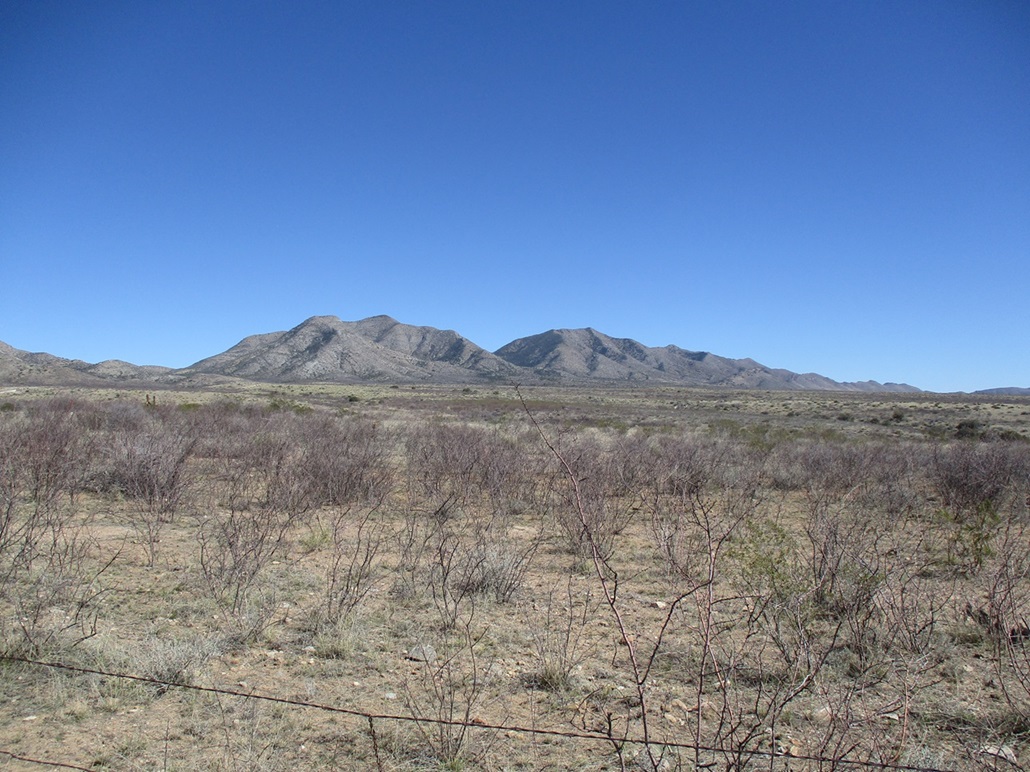
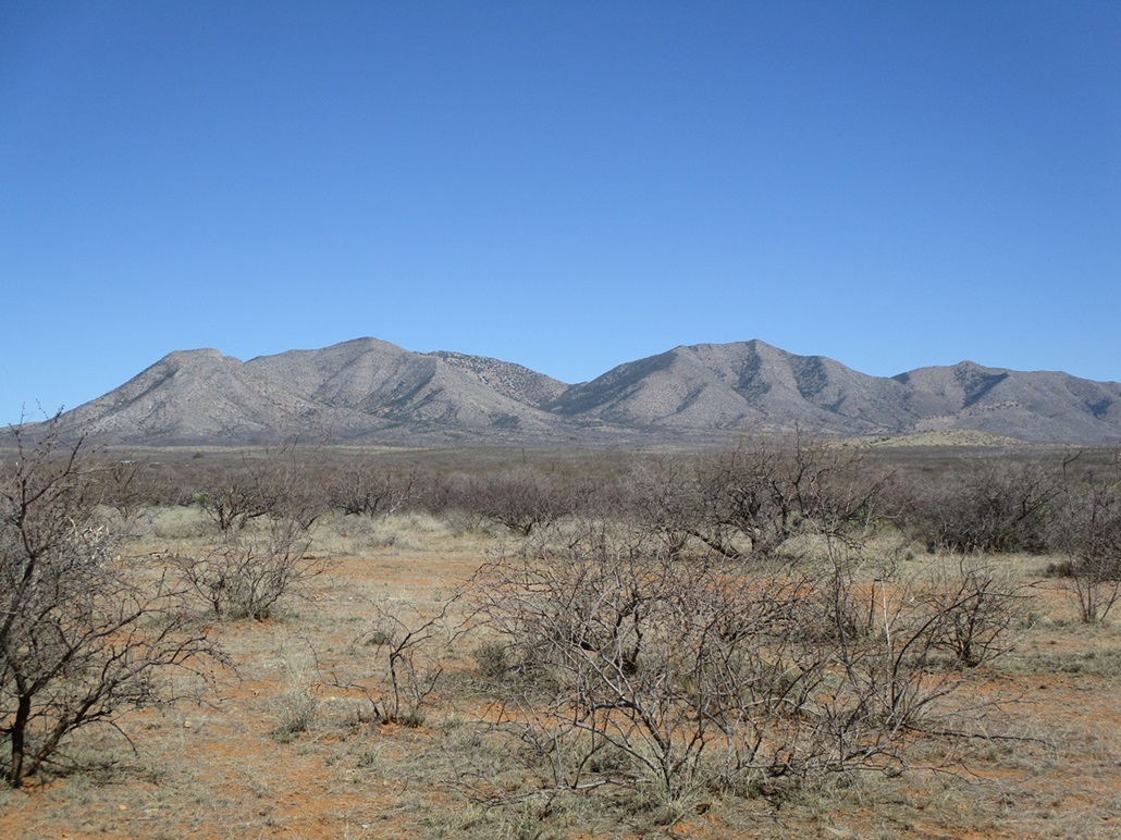
I changed and drove out, stopping a couple times for long-distance photographs. It always amused me that just a couple hours ago, I was on top that mountain. The brush also looked nastier from a distance. I won't be repeating this hike again, but I am interested to explore some of the initial road I hiked up this morning.
Thus, to summarize: once at the saddle north of the peak, the climb from there isn't that bad. It's not easy nor is it difficult. But getting to that saddle is the crux. You can either walk in the roads I walked out (which is what others seem to do), or try the higher route I did, to get to the saddle. Matthias' GPS track showed he descended that northwest ridge off Point 7040 back to the road, a drop of about 1,300 feet. When I eyeballed that ridge looking up, it looked decent. I'd recommend to follow that up. It will be 1,300 steep and tedious vertical feet, but it seems more open and without obvious cliffs. Others can explore this option, I am not going back to find out.
|


|