The Mountains of Arizona
www.surgent.net |
|
Peak 9646 • Peak 10365 Matthias proposed two peaks in the White Mountains, both unnamed and both of interest as they exceed 9,000-feet in elevation. Both he and Scott Peavy are close to finishing the big list of "9ers", while I am about 40% through the list. Both of these peaks, Peak 9646 and Peak 10365, lie slightly west of Mount Baldy, the range highpoint, within the White Mountain Apache Nation. They lie in remote, heavily forested terrain with marginal roads, in areas that appear to see maybe a half-dozen people a year pass through. While they lie "close" to one another as the bird flies (about 8 miles), they are far apart (40+ miles, all dirt road) as the car drives, and the driving would take up most of the afternoon. Still, these are worthy peaks and worth the effort. It's a safe bet that I will probably never be back in some of these areas ever again, so the opportunity was not to be missed. Prominence-wise, both peaks are "soft ranked", meaning their low-end guaranteed prominence, based off reading the map contours and interpolating between them, is below the 300-foot barrier. However, studying the maps suggest the mean prominence (the average of the low and high figures) of the first peak, Peak 9646, is probably right at 300 feet, while Peak 10365 is very strongly above 300 feet. Lidar data is marginally helpful. It is still the older 1/3-arc-second data sets. All it can do for now is affirm the "probablies". It reports a probable prominence of 301 feet for Peak 9646, and 315 feet for Peak 10365. When newer 1-meter data is released in the future, this information will be updated. The weather was spectacular. The state had seen some heavy monsoon storms, including a haboob that barrelled through Phoenix a few days prior, causing a two-hour delay of the ASU-Southern Utah football game. But today, it seemed all the storms and humid weather were gone. We had blue skies, a few puffy clouds, low humidity, and temperatures in the 60s and low 70s up this high. It felt good to hike without sweating through my clothes after ten minutes.
Date: September 4, 2023
• Elevation: 9,646 feet
• Prominence: 301 feet ✳
• Distance: 1.3 mile
• Time: 50 minutes
• Gain: 560 feet
• Conditions: Cool, blue skies and sunny
• Teammates: Mattias Stender & Scott Peavy
Arizona
•
Main
•
PB
•
LoJ
•
Interactive map
•
Lidar
We met very early, 4:45 a.m. at the Walmart on Signal Butte Road in east Mesa, and were moving at 5. This got us to the Carrizo Station at the junction of US-60 and AZ-73 right at 7 a.m. as they open. We picked up our permits for the tribal lands.
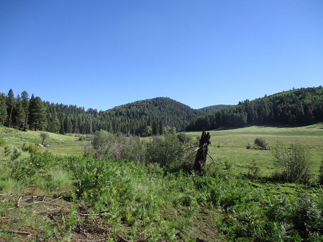
We still had a lot of driving to do, and it was nearly 8:30 when we rolled to a stop below Peak 9646, which is just north of Apache Butte, where we were not even two months ago. It was pleasantly cold outside, temperature about 60° F. After three months of 110+ degrees, 60 feels cold.
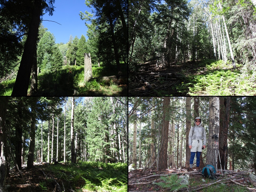
The peak rose above us. We walked the road a little ways to the saddle east of the peak, then up through ferns and downfall to the saddle. Then we angled left and grunted up the steep slope to the top. It was heavily forested but mostly open down below, there always being a lane to follow. We were on top about 25 minutes after starting.
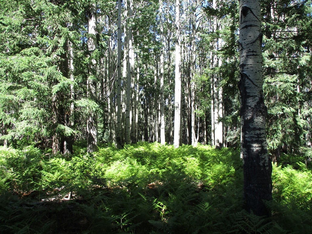
The top is forested with no views. There were pines and abundant aspen, with ferns down low. We did not find a register, but someone had etched in 8-5-52 on an aspen, which still showed that date very clearly. So we know someone was here 71 years ago.
We spent about five minutes having a break and looking around, but there were no views at all, not even bad ones. For the hike down, we mainly followed our line up, but angled slightly so as to meet the saddle slightly lower toward the road. We were back to Matthias' vehicle a little before 10 a.m..
This wasn't much of a peak but it went fast with no issues and it felt good to get one done and in the books.
Elevation: 10,365 feet
• Prominence: 315 feet ✳
• Distance: 4.4 miles
• Time: 2 hours & 20 minutes
• Gain: 755 feet
• Conditions: Still awesome, a little breezier
PB
•
LoJ
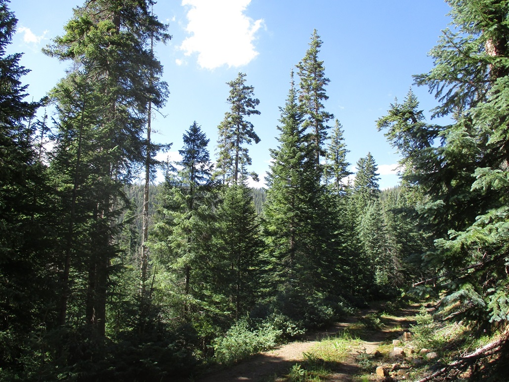
So now we had a long dirt road drive to get to the next peak, Peak 10365. We had to double back down the way we came, then get on Indian Route-55, then stay left and now on County Road 72. From where Indian Route-55 started, it was a 19-mile drive. The roads were dirt and gravel and generally good, but top speeds were generally 30 miles per hour.
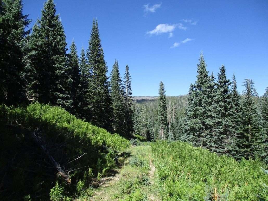
We then exited off the main road onto a scant two-track that heads north, first to Burnt Mountain, then farther on, Peak 10365. These high peaks are invisible from the roads, being hidden by the trees. This second road had grass about three feet high growing in its center, and young pines trying to grow also within this center stripe. It does not appear anyone ever comes back here. The whole place was clean — no junk, water bottles or other evidence of visitation.
I did not keep track of how far we drove. We passed Burnt Mountain, then got in about another mile, parking in a small clearing on the slope of the main ridge. The peak was a mile away but invisible. It had taken us nearly two hours to get here. Scott said we covered about 7 miles on this scanter side road. Matthias' 4-Runner handled the road well. Surprisingly, the road wasn't too bad. No big rocks or heavy erosion. Just a lot of grass, young pines and encroaching brush.
It was about 1 p.m. when we started, breezier up here, but still lovely. I was a bit sore and relaxed after the first hike so it took me a little while to get back into the flow. Plus, I could feel the effects of being close to 10,000 feet. I had to walk slow and breathe deeply.
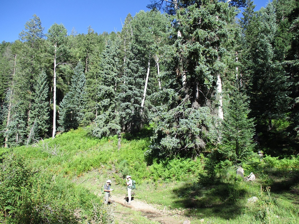
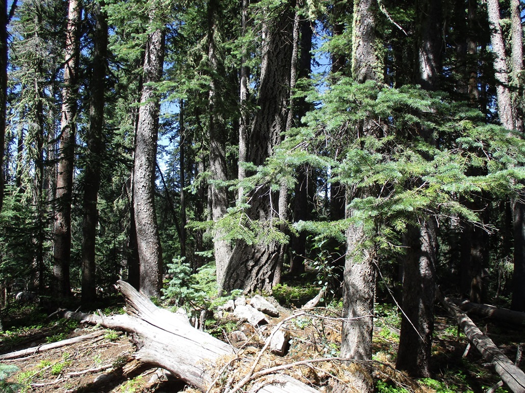
We followed a road not shown on any map but easily seen on the satellite images. There are many roads back here, logging roads we guess. Our road hugged the ridge, then swung south, away from the peak, but aiming for a saddle on a subridge ahead of us. Once there, we went right, northbound, up this ridge toward the top.
We followed what seemed to be a very old road for about a thousand feet. Once it ended, we weaved through the thick forest. Thankfully, the underbrush was light and we could keep to openings most of the time. Downed logs were everywhere. In about an hour after starting, we were atop Peak 10365, which, not surprisingly, was heavily wooded with no views.
We took a longer break up here. Conditions were perfect and there was no need to rush. The downed logs were excellent for sitting. We found no register nor hints of previous visitors. But it was a nice summit. It looked healthy and wasn't as scraggly as others I've been on.
This peak completed a short list for me: it was the tenth and final ranked peak between 10,000 and 10,999 feet (the "10ers") that I climbed. Thus, I have completed all ten 10ers. I had no idea of that until I returned home, entered it into my log at ListofJohn and saw that nifty rotating star for a list completion.
We exited the same way, and were back to Matthias' vehicle at a little after 3 p.m.. The hike covered 4.4 miles and about 800 feet of gain. We had one other peak on the agenda but chose to skip it, as we had a lot of driving to do. This was a fun peak.
The drive out went slow. It was a relief to be back on pavement after so many miles of dirt roads. We exited back to the main highways and got into some minor congestion, this being Labor Day with people heading home. But we didn't have any heavy traffic, and were able to get back into the city a few hours later. We divided up the gear and shook hands, another enjoyable day among the peaks.
(According to the usgs.gov sites, there is no plan in the near future to either map or release the 1-m Lidar data for the Apache Nation, nor that of the Navajo and Hopi Nations up north. A lot of Western Arizona also lacks the 1-m data. Thus, this may not be resolved for a long while.)
|


|