The Mountains of Arizona
• www.surgent.net
|
|
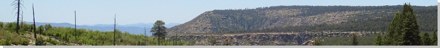
Promontory Lookout • Battle of Big Dry Wash Forest Road 300 is a classic scenic drive in Arizona, running along the lip of the Mogollon Rim, a 42-mile journey from its ends at state routes AZ-260 to the east, and AZ-87 to the west. I have driven parts of this road a few times over the years, but had never driven the full extent of the road from one end to the other. Today, we did so, taking half a day for the drive and enjoying the solitude, sights and the amazing weather. The road is jointly-managed by two forests, the Sitgreaves to the east and the Coconino to the west. It is normally shut or impassable for many months due to snow, which can collect heavily at the lip of the rim during the Fall-Winter-Spring months. The road is unpaved except for a few miles at the east end, but in dry conditions, is passable by most vehicles. However, high clearance is always advisable. There were a few short segments of uneven tread and steepness where a small passenger vehicle with narrow tires and a weak engine could have trouble. The road seemed to be in slightly better shape on the east (Sitgreaves) side.
Date: May 20, 2020
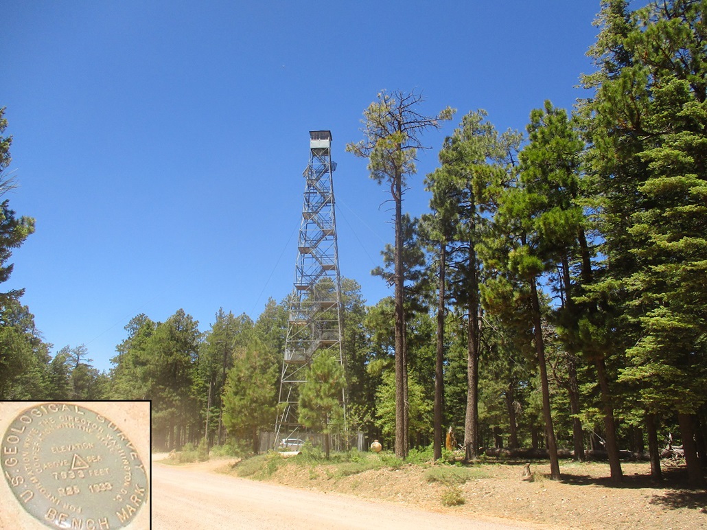
• Elevation: 7,931 feet
• Prominence: 371 feet
• Distance: Drive up
• Time: 15 minutes
• Gain: Negligible
• Conditions: Sunny, blue skies, cool and breezy
Arizona
•
Main
•
PB
•
LoJ
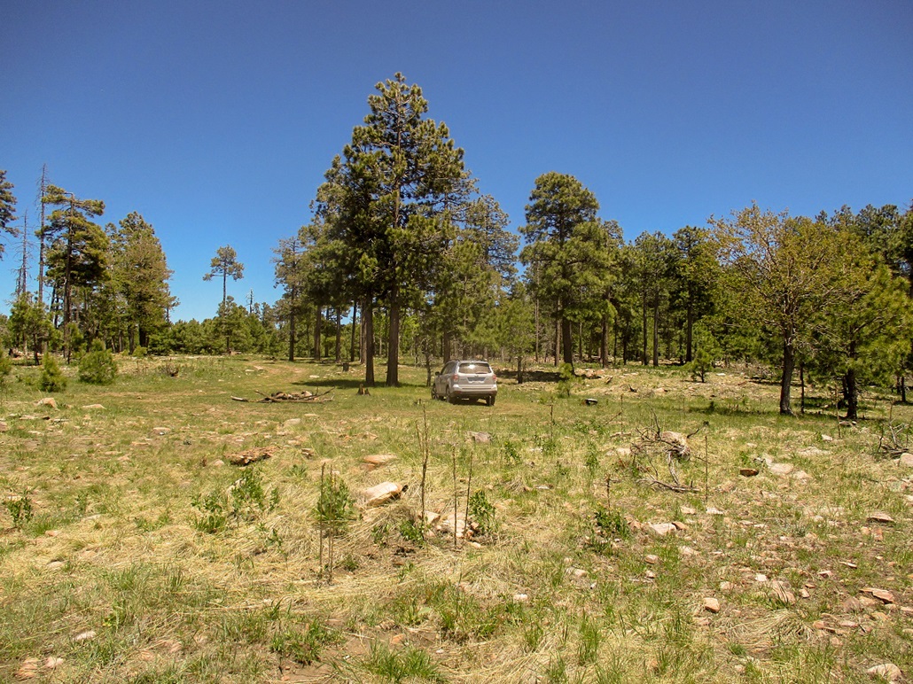
We left home about 11 a.m., heading eastbound up AZ-260 to where it surmounts the Mogollon Rim, about 30 miles from our home. The first left is FR-300, less than a half-mile from the rim's edge. We drove in and rumbled along, going slow. The first handful of miles are not too exciting, being more in the forest and away from the rim, so we mostly had views of the trees. Also, this is a popular camping area, and there were a few vehicles on the road, but the farther in we drove, the less the traffic as most of the other people would pull off to set up their campers.
Promontory Lookout comes up after about 20 minutes, a barely-noticeable rise in the heavy ponderosa forest. The lookout stands 110 feet tall and is apparently the tallest lookout in the forest, maybe one of the tallest in the state. The original wooden lookout stood almost 130 feet tall but was dismantled in the 1930s, when this one was built. The lookout has to be high to be able to peer over the ponderosa pine.
There was no one home today. We pulled in and killed the engine, walking around the area. I tried to find spots for good photographs. The high ground is somewhere around the lookout, probably to its east slightly. We spent about 15 minutes here.
I've driven by the lookout on my handful of journeys up here, mainly going to and from Promontory Butte, the (half) highpoint of Gila County. But this was the first time I got out to look. It is an impressive lookout, as most lookouts are usually just half as tall.
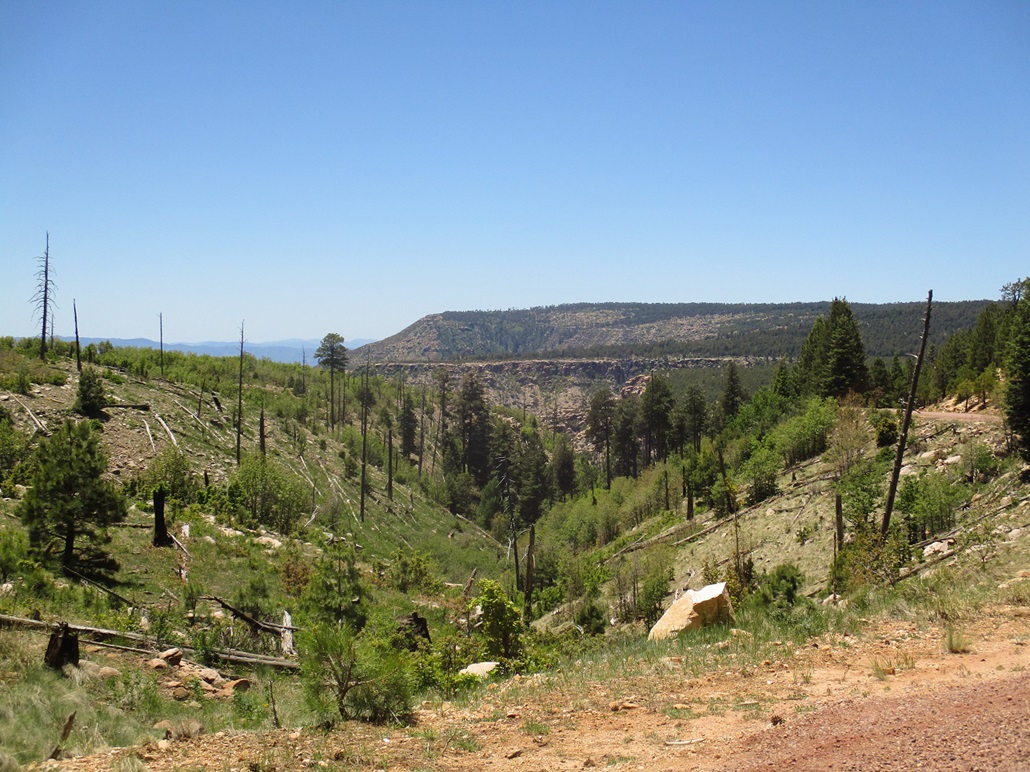
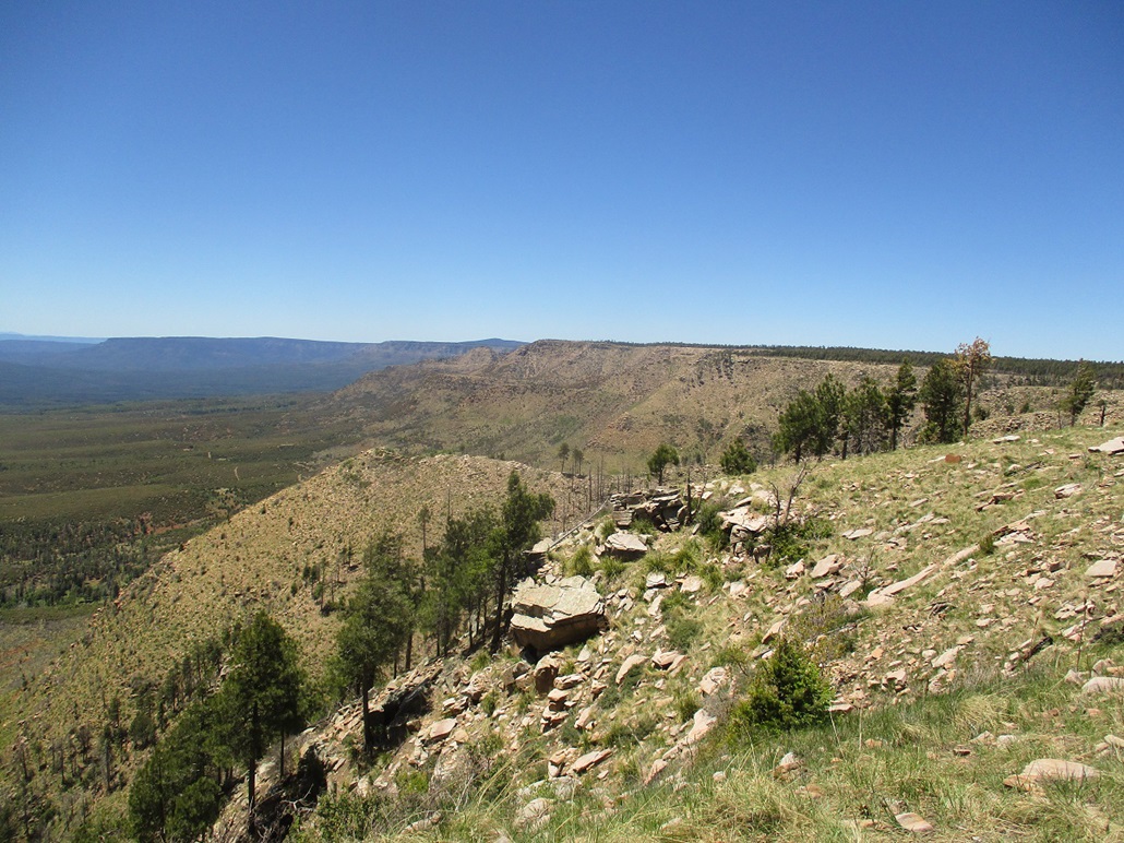
We continued westbound on FR-300. Our next stop was the Horseshoe Vista Overlook, where we had good views of Promontory Butte, and the heavy forest and hills below. We were directly on the rim's edge, and here, the wind would funnel up and gust into the 30s and 40s. The day was sunny and bright, with no clouds. It was cool, but the wind could be chilly. We stayed here about 15 minutes, too.
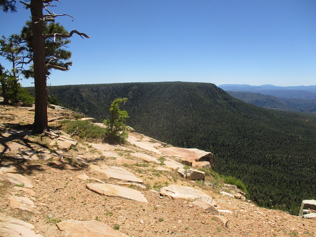
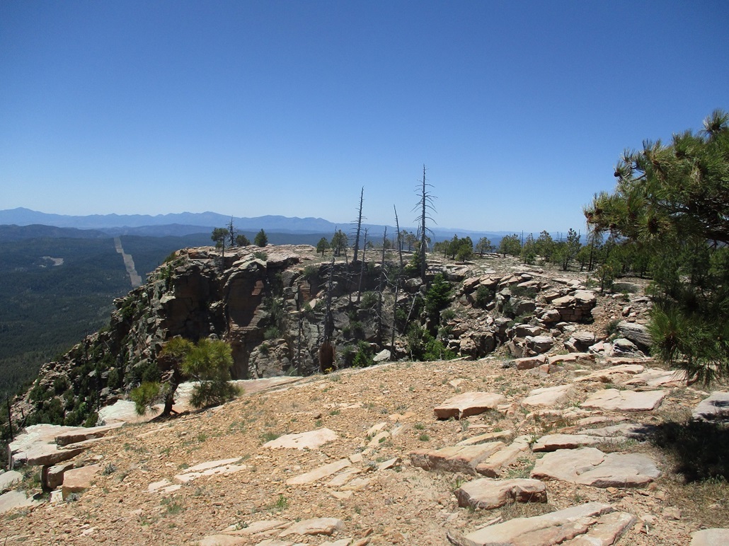
We had no agenda and would stop whenever we had a good viewpoint or just wanted a break. The road sometimes ran directly astride the rim's edge, with no shoulder and over a thousand feet of slope below us if we weren't careful. The views were stunning and we drove slowly, in no hurry and to be a little more careful for obvious reasons.
I had designs on driving the side road to Myrtle Point, the other half of the Gila County highpoints. We visited these on a sleety late-Fall day back in 2003. The weather that day was foggy and grim, and we had about 50-foot views for most of the drive. It was nice to be back on such a clear day where we could actually see things. However, when we got to the road for Myrtle Point, some guy was parked on it, blocking our way. Since this was not that important to us, we did not bother, and simply continued westbound.
Roughly half way in (I did not track mileage), the road leaves the Sitgreaves Forest and enters the Coconino Forest. The road narrowed slightly and subtly changed flavors, being a little hillier on this half. At times, the grades would get steep for a few hundred feet, and the road was a tad bumpier. We were poking along at 15-20 m.p.h., so we had no issues. It would be challenging to go much faster anyway.
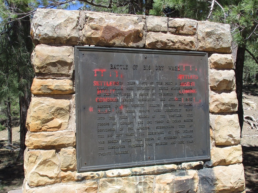
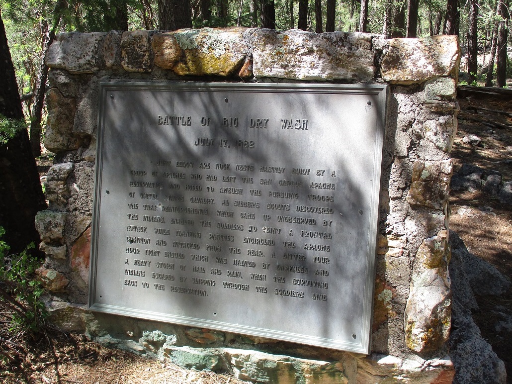
Our next goal was the Battle of Big Dry Wash Monument, commemorating a one-day battle that occured here in July, 1882. This is not a battle that gets mentioned in the history books, but it is an important battle for various reasons. The monument is hidden deep in the forest, set back about 8 miles from the rim's edge. I had heard of the battle and the monument thereof, and wanted to visit it. This was really our day's main destination.
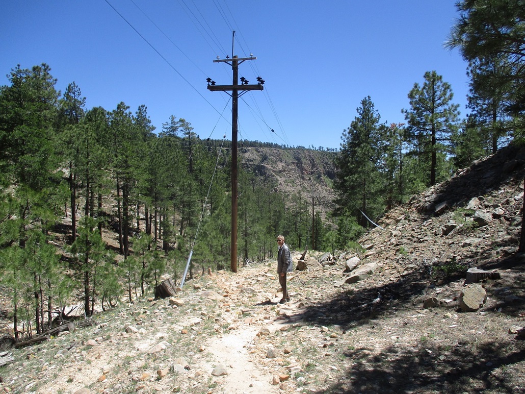
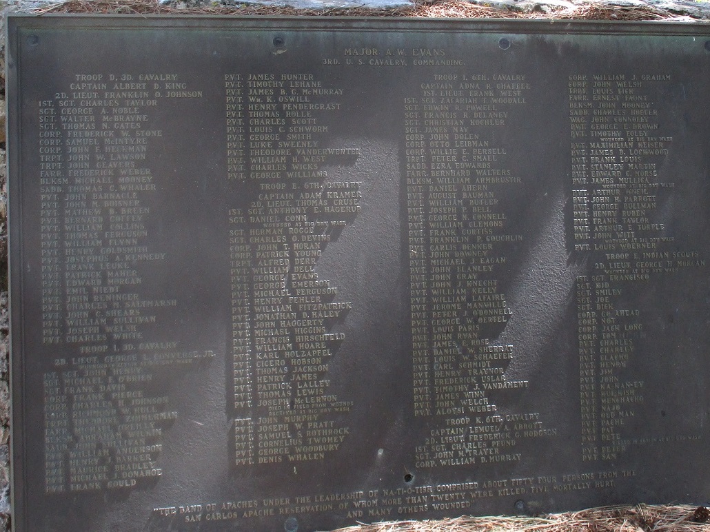
We happened upon a parking area where the Arizona Trail comes up from below the rim. Here, there is one monument, the one at the left in the images below. This is not where the battle took place. We stayed here for about twenty minutes and walked down a small segment of the Arizona Trail to where an old railrad tunnel still exists. We only hiked in a few hundred feet. This would be an ideal day hike and we decided to note this for a return trip in the future. About a mile later, we turned north onto FR-123, called the Battleground Ridge Road. This road runs about 6 miles north and is in good shape. The road splits and we went left, a sign pointing to the monument. We followed this road another 1.5 miles to a turnaround and parked. We walked the road a little more, then a trail, coming upon the monument after about a quarter-mile walk from our car. The monument lies on a downward slope above East Clear Creek. It is heavy forest here and far from everywhere. In 1882, a band of Apache warriors (and women and children) escaped the San Carlos Reservation. Some on the band were wanted for the murder of four San Carlos policemen. The band moved generally west and north, seeking higher ground due to the heat and need for water, raiding and killing settlers along the way. They were being tracked by one regiment of the Cavalry. The Apache became aware they were being tracked, so they holed up here in this canyon, intending to ambush the Cavalry. Scouts for the Cavalry learned of the intended ambush and sought reinforcements. The strengthened Cavalry moved in and aware of the Apache's location, sent troops both down and up river to flank the Apache. The battle was on. It lasted just four hours. Twenty-plus Apache and two Cavalry were killed. Typical of Arizona, the battle ended when a monsoon thunderstorm opened up and drenched the area. The Apache were beaten and the survivors escaped and headed back to the San Carlos under the cover of night, forest and heavy rain. This was the last significant battle between the United States Army and the Apache. There would be skirmishes for a few more years between the Army and Geronimo and his band, but these tended to be more guerrilla-type events, not full-scale battles. When Geronimo was captured in 1886, that essentially ended the Army's campaigns against the Apache. (My two-paragraph summary is barely adequate to explain what happened. These things don't occur in a vacuum. There was a lot of backstory and inter-twining themes going on. There are many websites that discuss this battle in detail with added context).
We stayed here about a half hour, just walking around. There is not much to see, but we both made observance there had been a bloody battle here almost 140 years ago. We walked back to our car and slowly drove out, back to FR-300. This side trip covered 15 miles and took about an hour. We still had about ten miles to drive to highway AZ-87. The road was curvier, so it seemed, with a few spots along the rim with the big drops. The road then starts a long uphill to top out near the summit of Baker Butte. Unfortunately, the spur-road was closed. We could have walked it, but not today. We were soon back to pavement at AZ-87. From here, we simply drove home, pleased with a fun and relaxed day of driving and easy hiking in the forests above the Mogollon Rim. |


|