The Mountains of Arizona
• www.surgent.net |
| Round Benchmark Hill |
• Black Hills • Cherry Ridge Development • Yavapai County |
|
Date: September 30, 2023
• Elevation: 5,674 feet
• Prominence: 634 feet
• Distance: 0.8 mile
• Time: 30 minutes hike
• Gain: 305 feet
• Conditions: Sunny, warm, very windy
Arizona
•
Main
•
PB
•
LoJ
•
USGS BM Datasheet
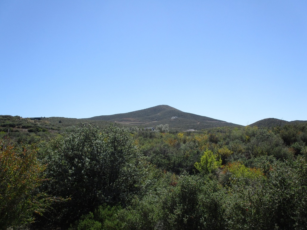
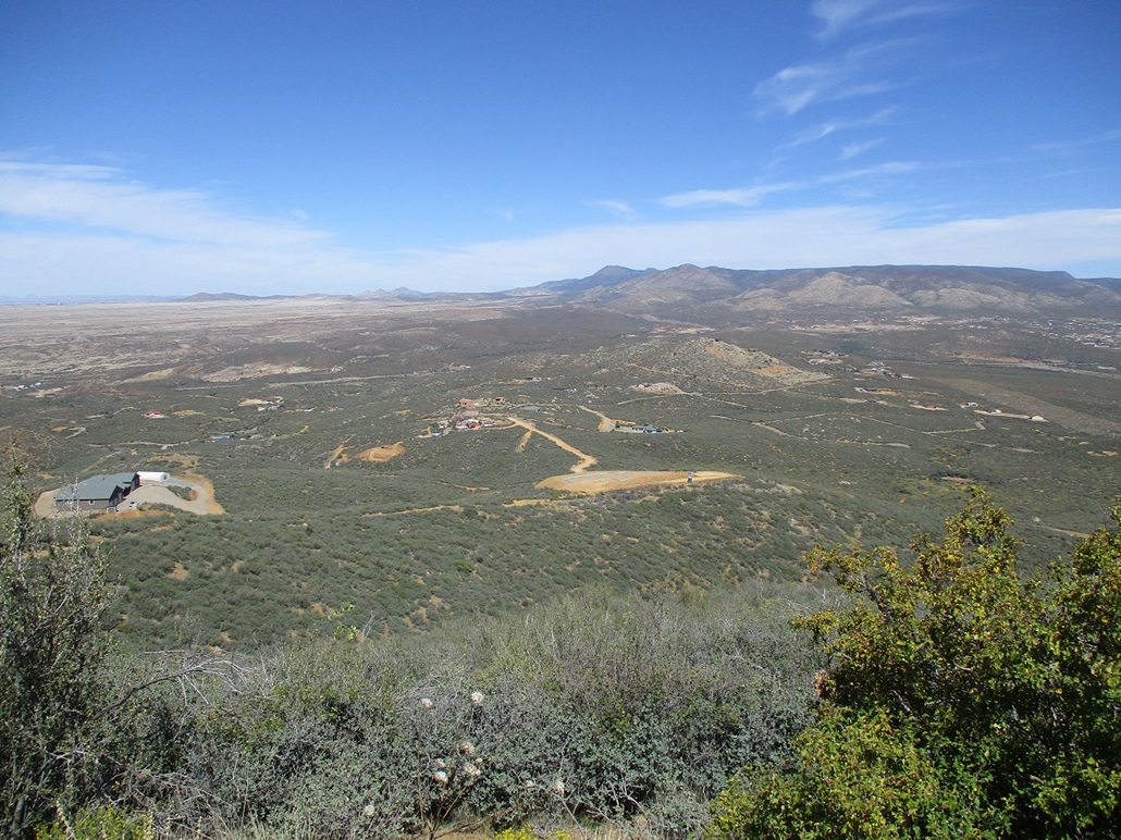
Round Benchmark Hill rises slightly east of the town of Dewey-Humboldt, about twenty minutes east of Prescott. It is the highest hill in this clump of hills, hemmed in on the north by state highway AZ-169, on the west by AZ-69, and on the east by Interstate-17. It lies in a band of private land called Cherry Ridge, which is a loose aggregate of private homes and roads. Although the signs say "no trespassing", there are no barriers like gates blocking anyone from driving the roads.
I had hiked Seven Warriors Mesa in the Village of Oak Creek by Sedona earlier today. A second hike in that area fell through when I did not like the parking/access situation, and the alternative was a seven-mile hike in 85-degree weather. So I left the area, got back on Interstate-17 and proceeded south, with a general plan to swing by the Prescott area and see what came up.
I exited the interstate onto AZ-169, heading west, signed for Dewey-Humboldt. I had no grand plan, but I remembered this hill, having studied it in the past. It's just a bland rounded hill covered in low scrub and grass. But roads get close and an ATV track goes to the top. It looked like an easy hike, assuming I could get near it.
Like I mentioned, I had no plan. I've driven by the hill a few times but never once actually drove in any of the roads. I did not know which road I needed. So I guessed. The first promising road was just a back-road track to Orme, so I got back on AZ-169 and tried again a few miles later. I exited again when I was due north of the peak, at the fancy Cherry Ridge sign.
There were a couple smaller signs about private property, no trespassing and staying on the main roads. But driving on the roads themselves is still a public right-of-way, unless gated. I drove south, now on Dewey Overlook Road said a sign. It came to a T-junction. I went left because I felt like it. A moment later, I went right, south again, the hill much closer.
The road's pavement ended at an open gate. The dirt road continuation was a good road, wide and smooth. I just kept driving as close as I could. The road I was on aimed toward a big home, but just before the home, I went sharp left onto a lesser track that switchbacked uphill and ended in a clearing where a foundation for a home has been poured, but nothing else has been built. There was no sign of any active work such as materials piled up, heavy equipment parked nearby, anything like that. Nobody was around and I was also hidden from that home. I was less than a half mile from the top. This was great news! I was not expecting to get close at all.
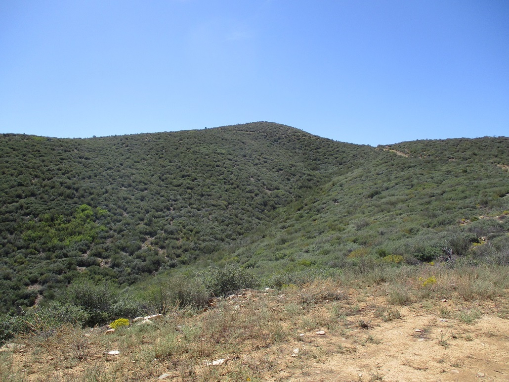
I got my boots back on and packed light. I walked up the dirt road past the foundation. This road was in terrible shape and I would not have managed it in the Subaru. For walking, it was fine. It was a little overgrown, rutted and loose, but mostly open to where I could see my feet — most of the time.
The road makes a bend left, then comes to a lip where it ends. Another road is below but I did not need to be on that road. I found the ATV path that fed to the summit. I was on top, just 15 minutes after starting my hike.
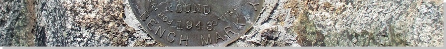
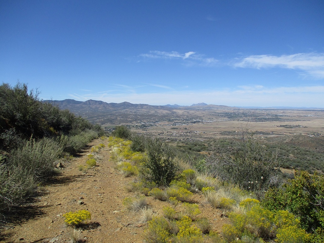
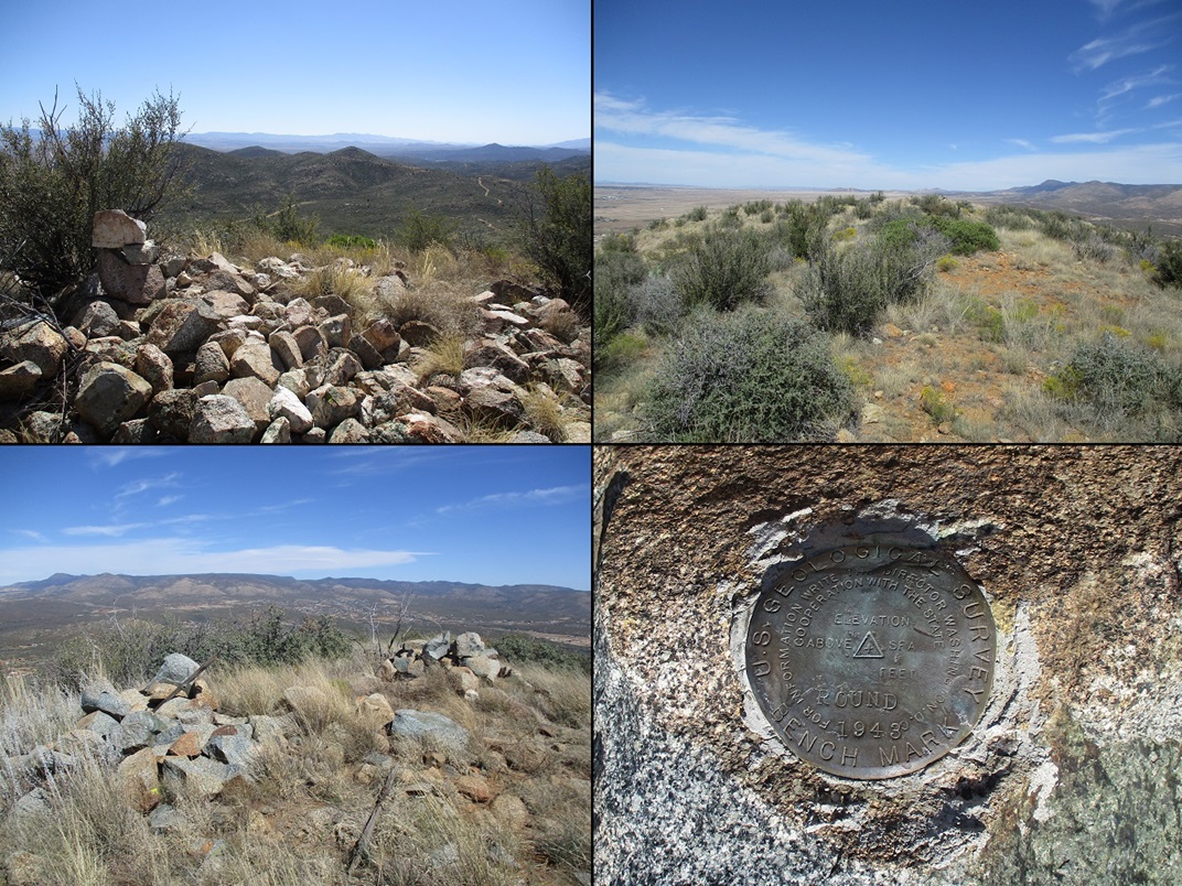
The top is flat with two rock crowns. The southern one is bigger but the northern one was higher by a foot or two. I tagged both and also shot an image of the benchmark, plus a couple images of the surrounding views. It was warm, about 80°, but pleasant, with a very stiff wind that would kick up dust from the roads.
I didn't stop. I just retreated back to my car, the total round trip coming to about 0.8 mile in thirty minutes. Although I felt comfortable being here and in the area, I was mindful that it is private and I probably shouldn't overstay my welcome. The big home nearby had one truck parked in front but otherwise looked uninhabited.
I was happy to tag this mundane peak. It was a perfect second peak for the afternoon and I was truly surprised to be successful, as I expected to be stopped by a gate early on. The homes are nice but they are spread out and I didn't see much activity. I saw just one other car on these roads while I was in here.
I got back onto AZ-169 and took that west to AZ-69, then that southeast back to the Interstate and back to Tempe.
|

|