
The Mountains of Arizona
• www.surgent.net
|
| Round Mountain |
• Mogollon Plateau • Mormon Mountain Volcanic Field • Coconono National Forest • Yavapai County |
|
Date: July 22, 2022
• Elevation: 6,344 feet
• Prominence: 464 feet
• Distance: 3 miles
• Time: 2 hours
• Gain: 364 feet
• Conditions: Cool but sultry
Arizona
•
Main
•
PB
•
LoJ
•
USGS BM Datasheet
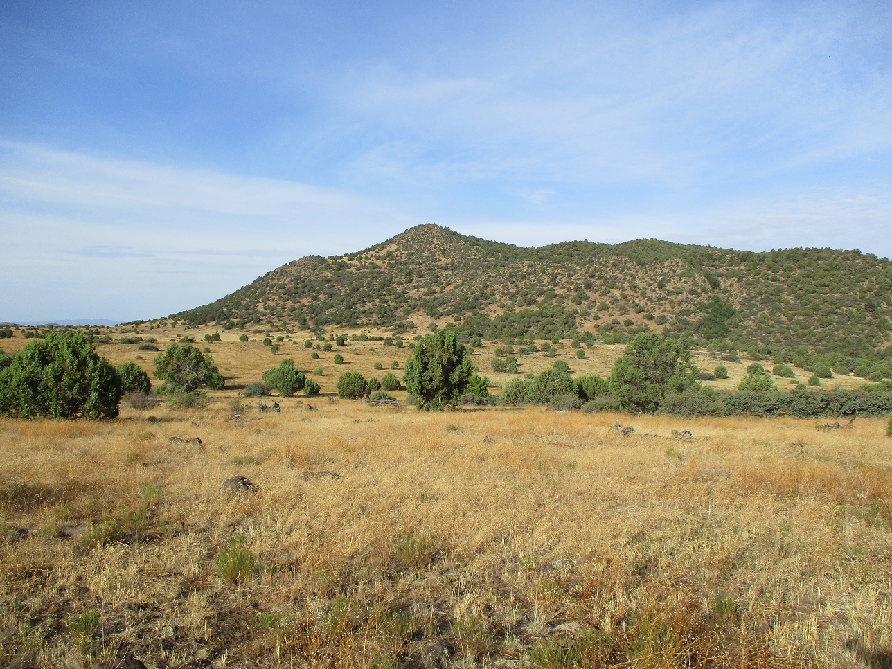
Round Mountain lies east of Interstate 17, south of Stoneman Lake Road and northeast of the town of Camp Verde. It rises at the west end of a sloping appendage of the Mogollon Plateau, about four miles west of Apache Maid Peak. Whereas Apache Maid Peak rises steeply above the plateau, Round Mountain is more spread out and not that noticeable except from the higher vantage points south of Flagstaff, but it would be hard to pick it out from among the other hills of similar shape.
I originally planned an overnight where I would hike Apache Maid Peak then nearby Hog Hill. I looked at Round Mountain as an add-on after I was done with the first two. Then Matthias suggested I hike Round and Hog in one big loop, which sounded interesting. So that was my new plan. I would save Apache Maid Peak for a future date.
So it's Thursday and I'm at my place, realizing I have no meetings for Friday. It's been searing hot the past two weeks here in Phoenix, highs in the 110-115 range every day, lows in the mid 90s. Then it cooled for a couple days, in relative terms, highs about 107. Then I looked at the weather online and saw it would be 114 on Friday. That was enough for me to bail a day early, Friday instead of Saturday.
I was on the road at 3 a.m., my car's thermometer saying it was still 98 degrees outside. There was no traffic. I followed Interstate-17 northbound about 90 miles to the Stoneman Lake exit, then up that road to Coconino FR-229, south a couple miles to FR-644, and west about 6 miles until I was northeast of Round Mountain. The roads were in fine shape, slightly rocky in some spots, but my Subaru Forester was more than adequate.
I was concerned that the temperatures were still in the high 70s and low 80s, even at this elevation and early morning hour. It was cloudy and humid, too. When I rolled in to where I parked, it was still early, just 5:30 a.m.. But it would be a warm day once the sun was higher in the sky, that was clear. I cut back the scale of the hike to just Round Mountain. I'll go back for Apache Maid Peak and Hog Hill at some later date.
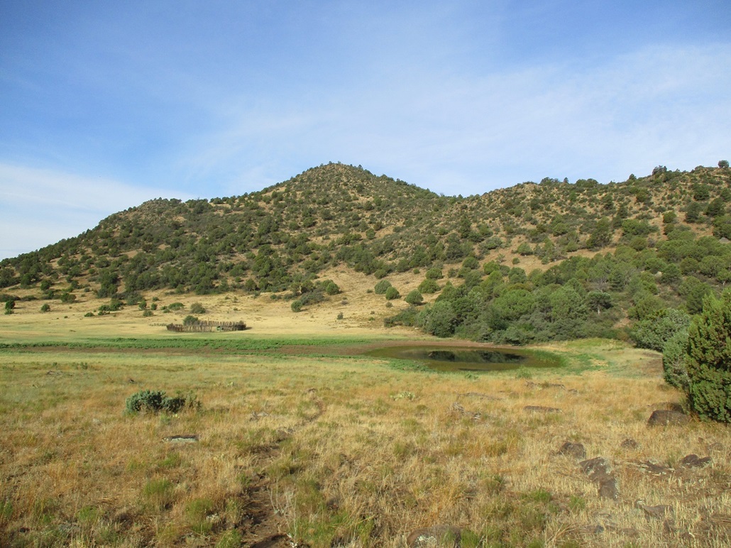
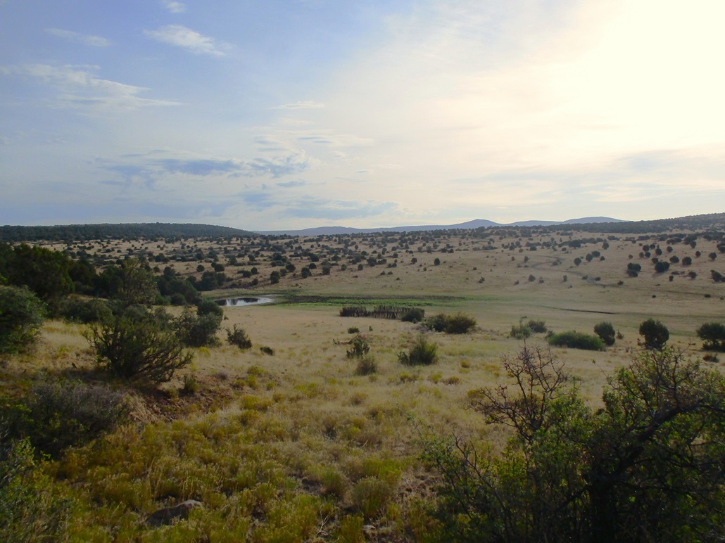
From FR-644, I was able to drive slowly in on FR-9248G, which is a much rockier road. I parked in a pull out, about a mile northeast of the highpoint. I was in an area of piñon and juniper, low cactus, lots of grass and brush, but open to where I could walk through it all without getting too scratched up. I was moving quickly, a little after 5:30. I headed on a direct line toward the peak, walking up a slight rise then down a slight decline toward Round Mountain Tank.
Past the tank, I started up the peak's lower slopes. Cows had beaten in paths, which I followed as much as I could. The brush was thick on the slopes, but the cowpaths helped. Some seemed too steep for normal cows so I suspect these paths may be human-enhanced paths, probably hunters, maybe old horse paths. In any case, I was able to efficiently climb about 250 feet to get onto a ridge with almost no brush getting in the way.
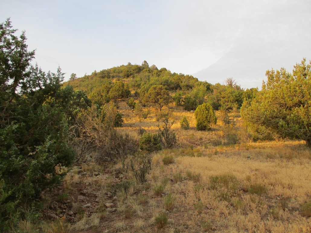
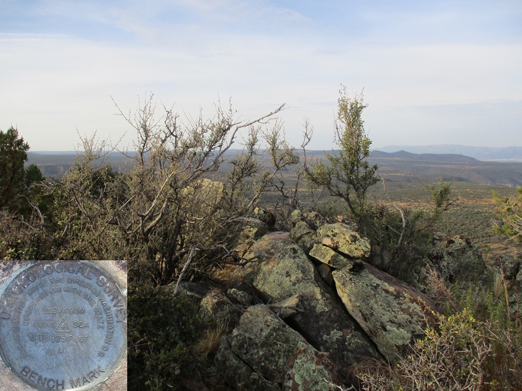
Above me was the highpoint hill, the eastern of the two main hills atop the highest ridge. To the west is the benchmark hill, the two hills separated by about a third of a mile. The eastern hill is higher by 16 feet, so says the map. Technically, I would not need to visit the benchmark hill to claim this peak. But I had extra time now since I had x'd out Hog Hill from this morning's agenda.
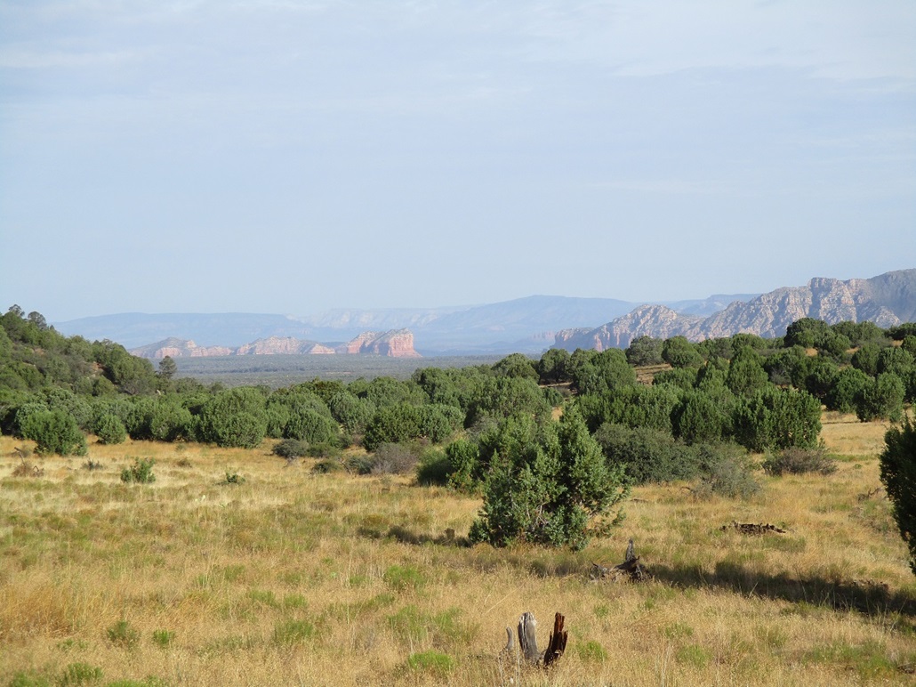
I hiked upward, following paths as I found them. It was forested but not thickly and I could always find a path or lane through the trees. I ended up going more over than up, so when I topped out on the highest ridge, I was roughly halfway between the two hills. Since I was here, I went right and walked up the benchmark hill, finding the benchmark affixed to some green-colored rocks. I looked around for the views. The highpoint hill was east, and it looked about the same elevation as where I was now. The interstate was about three miles on a direct line, and I could hear the occasional big truck engine-braking as it descended downward from the high country.
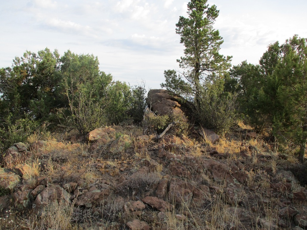
I then descended myself to the saddle between the two hills, then up to the apparent highest point of Round Mountain. I found a couple large rocks that sat atop the highest point and stood on the highest. There were no views, certainly no view toward the benchmark hill to visually compare. But I had visited both hilltops and could confidently claim I had stood on the highpoint. I found no register, and I suspect this peak sees very few people ever.
I descended generally the same route as I had coming up, the variations being I would follow paths that I hadn't seen coming up. I was soon off the mountain and on the short overland trek to my car. I got in roughly 7:30, a two-hour hike partially the result of my side trip to the benchmark hill. The sun was now up, still low in the east, but warming quickly. I felt good about skipping Hog Hill today. This is the hottest time of the year and everywhere in the state is hot, even the high country.
Now I had most of a day to fill up with activities. I had a hotel room in Williams reserved, and I was supposed to meet Matthias the next morning out that way. Had I hiked both Round and Hog together, it would have filled up most of the morning and I probably would have gone directly to the hotel afterwards. But now, suddenly, I had some free time.
After a few minutes of deep pondering, I chose to look at a couple hills north of Parks, in the area between Sitgreaves and Kendrick Peaks, about 15 miles west of Flagstaff. In past years as I have climbed virtually every ranked peak in the area, there still remained a handful not yet trodden upon by me. One was Wright Hill. I had no map but would not need one. I had scouted it in the past and knew where to go, so that's what I did.
Disclaimer: most of the distant images of the peak were taken as I hiked out, by which time the sun was out so I had better lighting.
|

|