Sawtooth Mountain is one of the major summits in the Dome Rock Mountains in western Arizona. It rises south of Interstate-10, south of Middle Camp Mountain, and north of Cunningham Mountain. The Dome Rocks are the last range in Arizona if heading west, and essentially act as a boundary of the two major desert ecosystems, the Sonoran Desert to the east, and the Mojave Desert to the west.
I've driven by the peak dozens, if not well over a hundred, times in my life, on my runs to and from California. The peak has an enticing profile, a long gentle ridge emanating north from the summit, down to the flats near the highway. It looked like an easy and fun hike, but I was always too busy getting to or from California, or it was too hot, or both. So I never climbed it.
I was in Tempe teaching my class, and had already decided I would make the long drive west to finally give this peak an honest look. Now is the best time, when temperatures are cool and the snakes in their holes. It gets warm fast along the Colorado River. Even February might be too late.
After my class, I stopped for groceries, then hit the road, aiming west. I got onto westbound Interstate-10, then just stayed on it for a couple hours until I was nearing Quartzsite. It was almost 10 p.m. and I needed a place to camp for the night.
I exited at Gold Nugget Road (exit 26) east of Quartzsite, then pulled into a big dirt clearing, me the only person there. The interstate was not far away, a few hundred yards, and I could hear the trucks and see the lights, but it was still quiet enough where I was. I curled up in my passenger seat and got some decent sleep. I was up at dawn the next morning, being today.
I drove about 15 miles, exiting at Dome Rock Road. I got onto the south side, then immediately went south onto a track that leads into a BLM campground. I stayed right at all junctions and got myself onto another track that went west, parallelling the interstate.
I was looking for a road that went south into the range, but couldn't find it at first. I found another road that was the only plausible option and followed it in. This led to another road that was parallel to the one I was just on. Then I found the southbound track I was looking for. This was a little confusing.
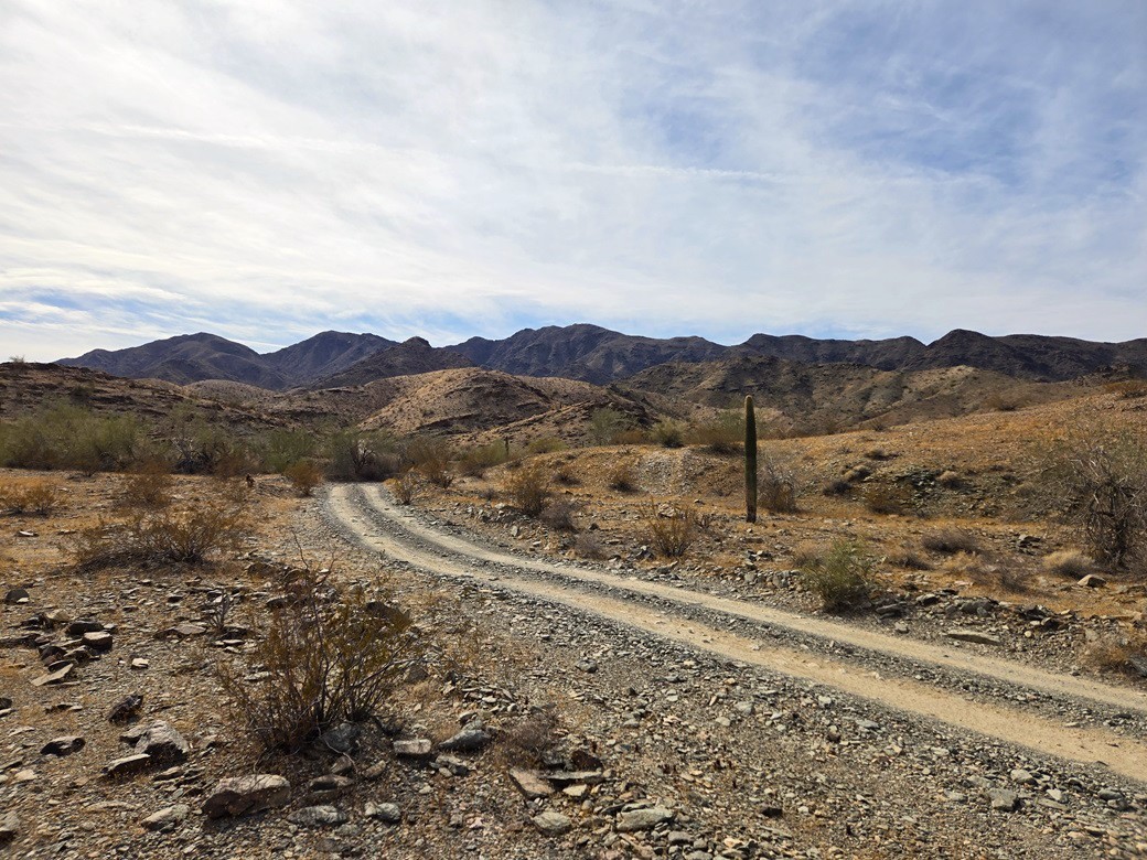
The roads were marginal but Subaru capable. I eased in slowly over the small rocks and ruts, driving in about a quarter mile on this southbound track, parking in a clearing just before the road dropped into a big arroyo. It was a little after 8 a.m. now, cold with high clouds, but calm and no chance for rain.
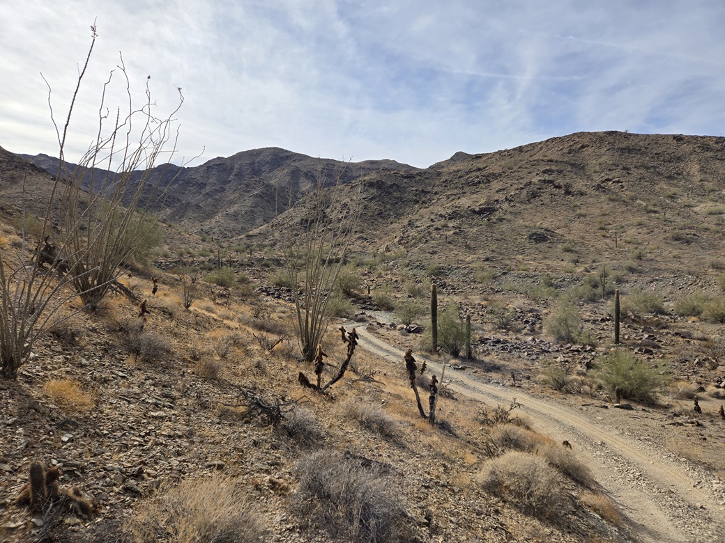
I walked the road into the hills. It curves with the terrain. Shortly, it comes to a show-stopper rocky area, where the Subaru could not have passed. It slowly gains elevation, then drops a little, coming to a T-junction. I went right, steeply up the eroded road to a pass, then down the other side, all the way to the bottom of this canyon. So far, I had hiked a little less than a mile, gained a couple hundred feet and things were going well.
At the pass, I could see the obvious route to follow. This is what Scott Peavy followed and posted to Peakbagger, and in my opinion is the best route to the top. It gains a ridge, which leads to the higher ridge, then from there to the top.
I left the road and canyon bottom when it was convenient and started up a slope, gaining its hilltop. I had a better view now of what was ahead of me. I was one ridge to the north of what Scott did, but it worked out well.
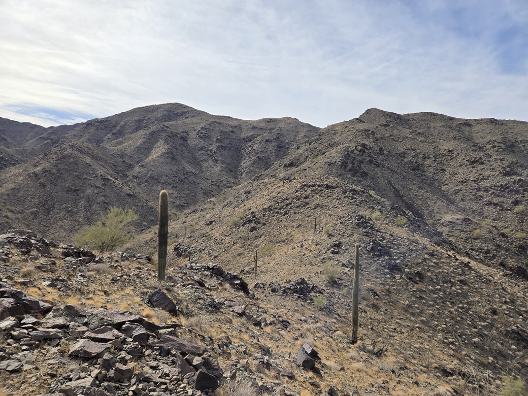
I dropped about 40 feet, then started up the slopes again. These slopes were steep and rocky, but safe. The rocks held together well and there were plenty of large embedded rocks to step on. The slopes in between were of smaller flakes of this rock, which could be loose, but never once was difficult. Brush was sparse: creosote and cholla, and ocotillo higher up, but always spread out. There was no grass cover to speak of.
This slope charged up about 400 feet, coming to a ridge. I bent left slightly, walking the ridge and passing a large miner's claim cairn. I dropped about 50 feet to a lowpoint, coming to a vertical mine shaft that was filled in.
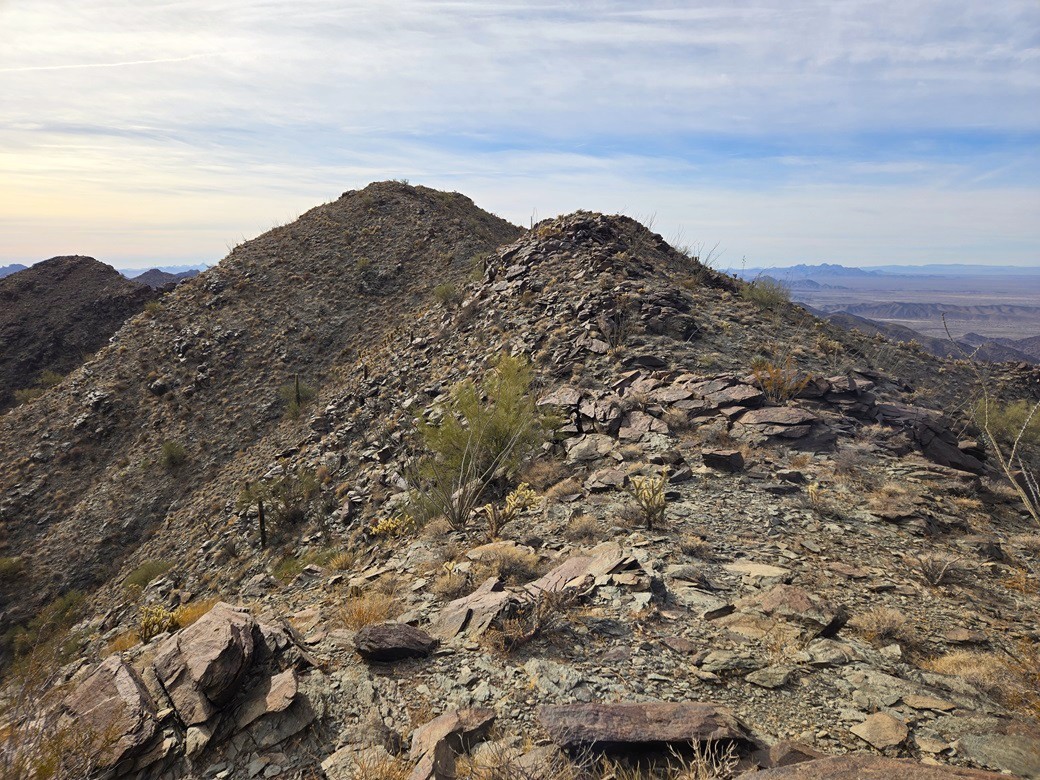
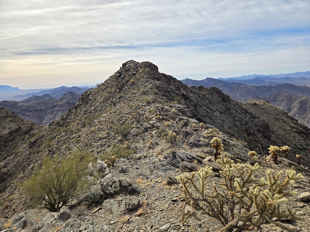
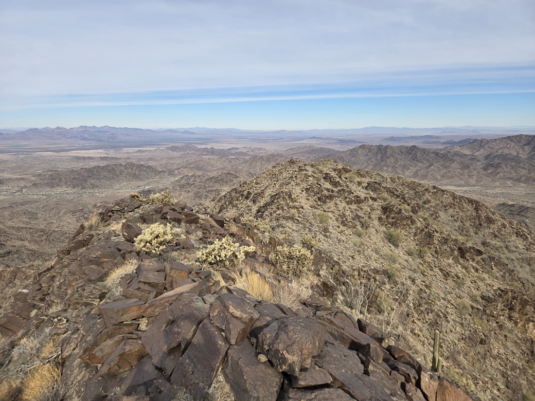
The next slope was about another 400-500 feet of gain, aiming for a point up high, marked "2346" on the map. I would bust up a slope, top out on its knob, drop about twenty feet and get a better view of what was ahead. This Point 2346 looked imposing, but once upon it, it laid back well and the footing was secure. I was on top this bump, then down its other side, now on the main north-south ridge of the range. It was breezier up here and cold, so I put back on my fleece.
The summit was another 800 feet higher in a little less than a mile. The ridge was wide and with excellent footing, even hints of a path in places. The first couple of slopes were gentle and I made good time.
The ridge does narrow and get rockier toward the top, but as before, was never exposed or felt unsafe. The clambering through the rocks was all done with just the feet and poles, never needing hands.
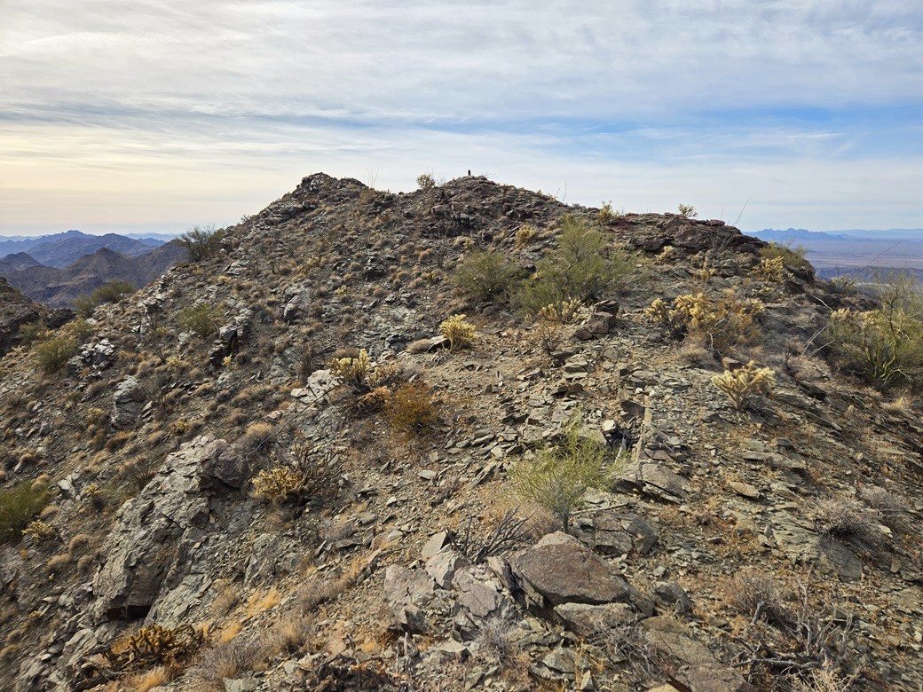
Previous reports indicate a few false summits, so I was aware that the first big bump ahead of me wasn't the highpoint and to not get too excited just yet. Once above it, I saw a couple more bumps. Neither of these were the summit either. Finally, the actual top came into view, an obvious rocky knoll and nothing higher behind it.
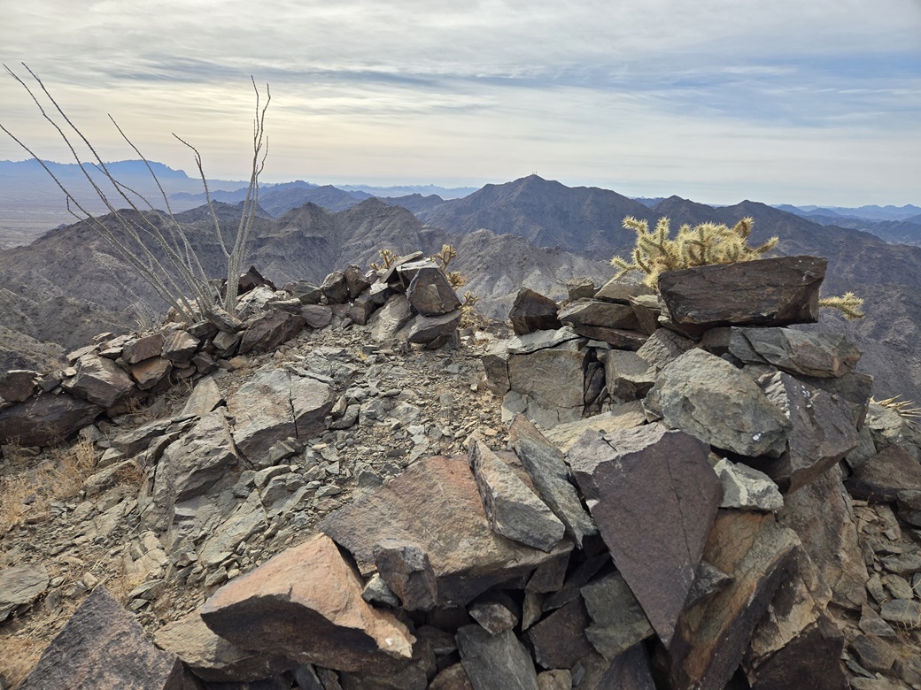
I arrived on the top about 10:15 a.m., a two-hour climb and a little extra. The weather was calm with an occasional breeze. The clouds never really moved along but sometimes would break to allow the sun to shine through. I was happy to be here and surprised how efficient this climb had been. Never once did I feel uncomfortable on a slope or rock face.
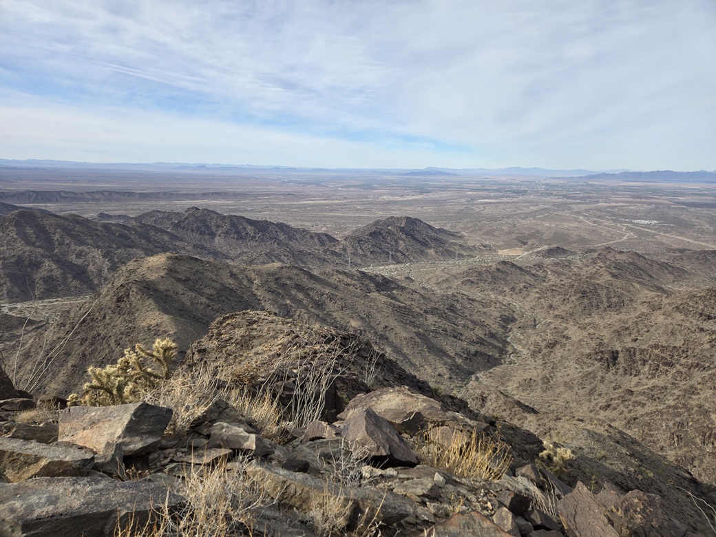
I stayed up top for about ten minutes. The towers on top of Cunningham Mountain were easily visible to the south. To the north were peaks including Middle Camp, and I could even see trucks on the interstate from up here. The top itself features a windbreak, the rocks about two feet high. I signed into the register and had a snack.
Then I had a little crisis. My wallet wasn't in the little pouch I normally stash it in. It wasn't anywhere else in my pack, and I was concerned it had fallen out, but it was in the same pouch where I kept some fig bars, and those handn't fallen out. The only plausible inference was that I never put it in the pack to begin with, but my tiny little OCD would not stop making me think of the worst.
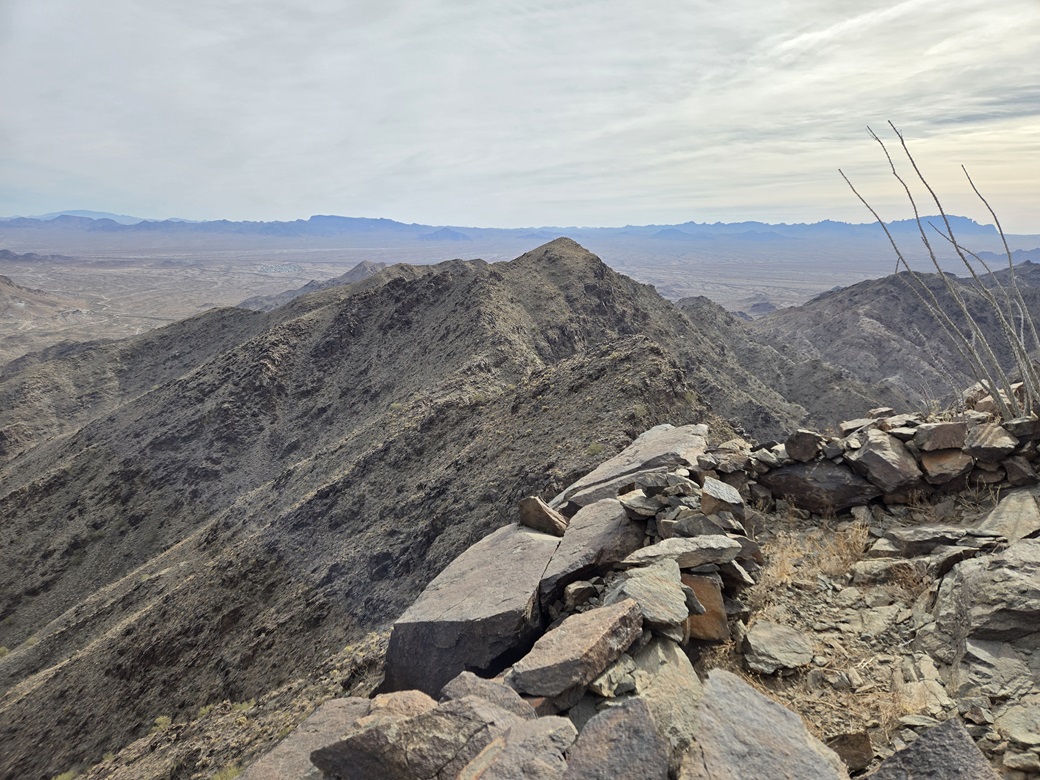
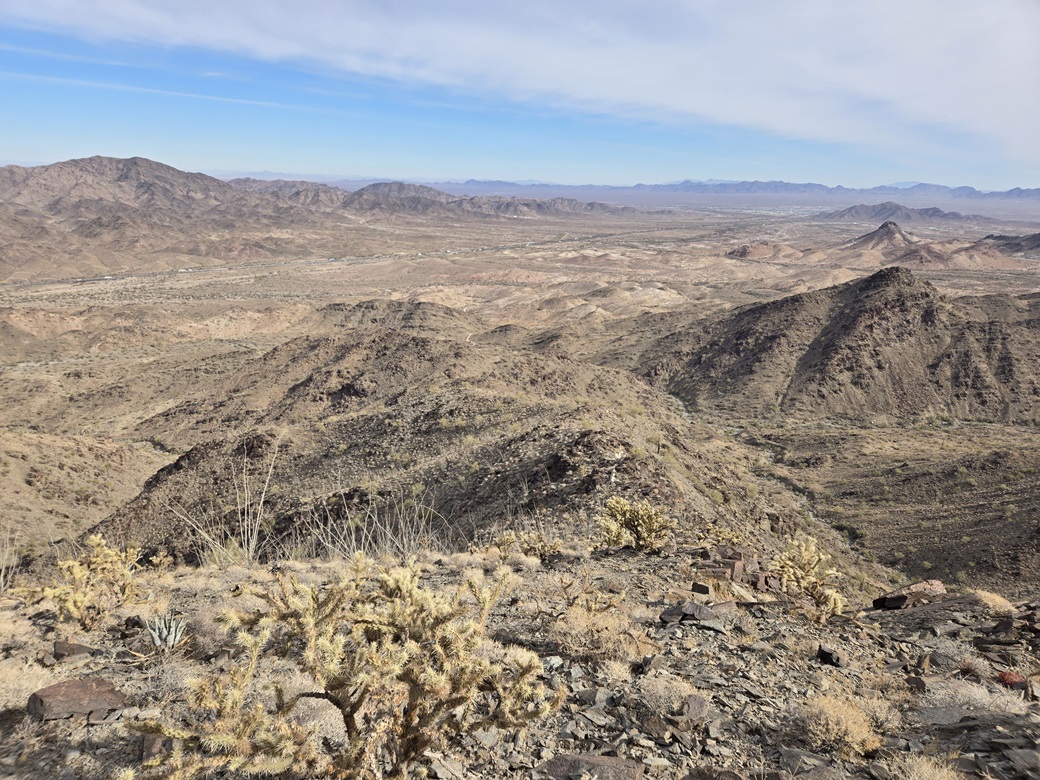
The hike down went very well, following the same ridges and slopes all the way back to my car. The outbound hike took a little under two hours. With sunnier skies, I took more images. At the bottom, a couple guys in quads were rumbling up the mine roads but they passed without seeing me.
I was back to my car just shy of noon, feeling damn pleased with this morning's effort and happy to finally tick this one off my list after so many years of driving by it. And yes, there was my wallet, sitting in the car's front seat under a jacket.
I stuck around for about fifteen minutes to relax. I had a hotel room in Wickenburg reserved and some smaller peaks planned along the way. I wanted nothing challenging. I ended up hiking Peak 2862 in the Black Hills near Wickenburg.